Saturday, February 3, 2024

Banc d'Arguin evolution

 
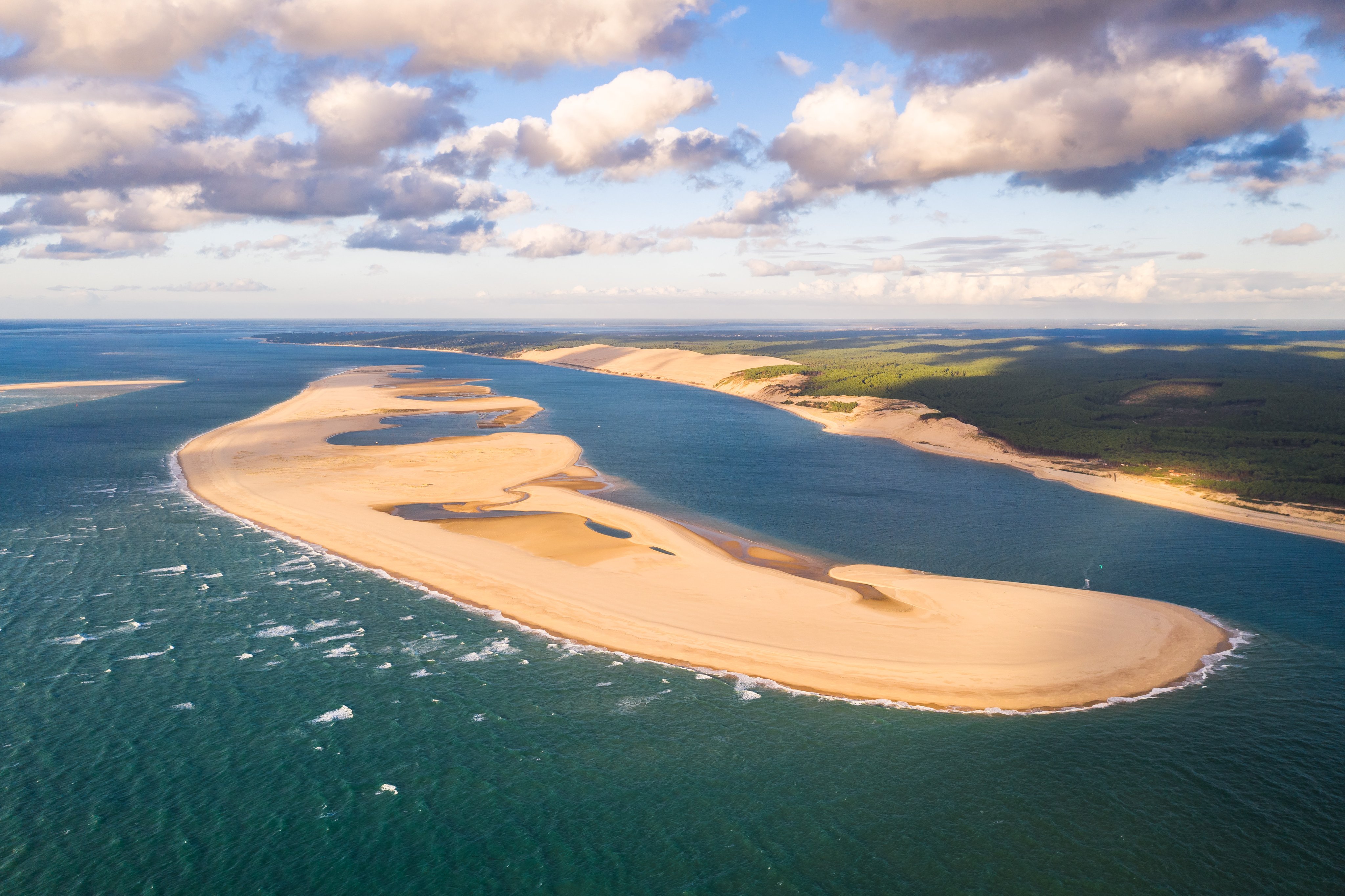
Seen from the air, the disappearance of the southern conch of the Banc d'Arguin is spectacular.
 
The Parc naturel marin du bassin d'Arcachon has just published aerial photos of the erosion that led to the disappearance of the southern conch of the Banc d'Arguin.
Spectacular...
Seen from the water, it's already impressive, but seen from the sky, it's even more so.
The Parc naturel marin du bassin d'Arcachon (PNM) has just posted images of the Banc d'Arguin from the air, following the disappearance of the site's southern conch this autumn.
 
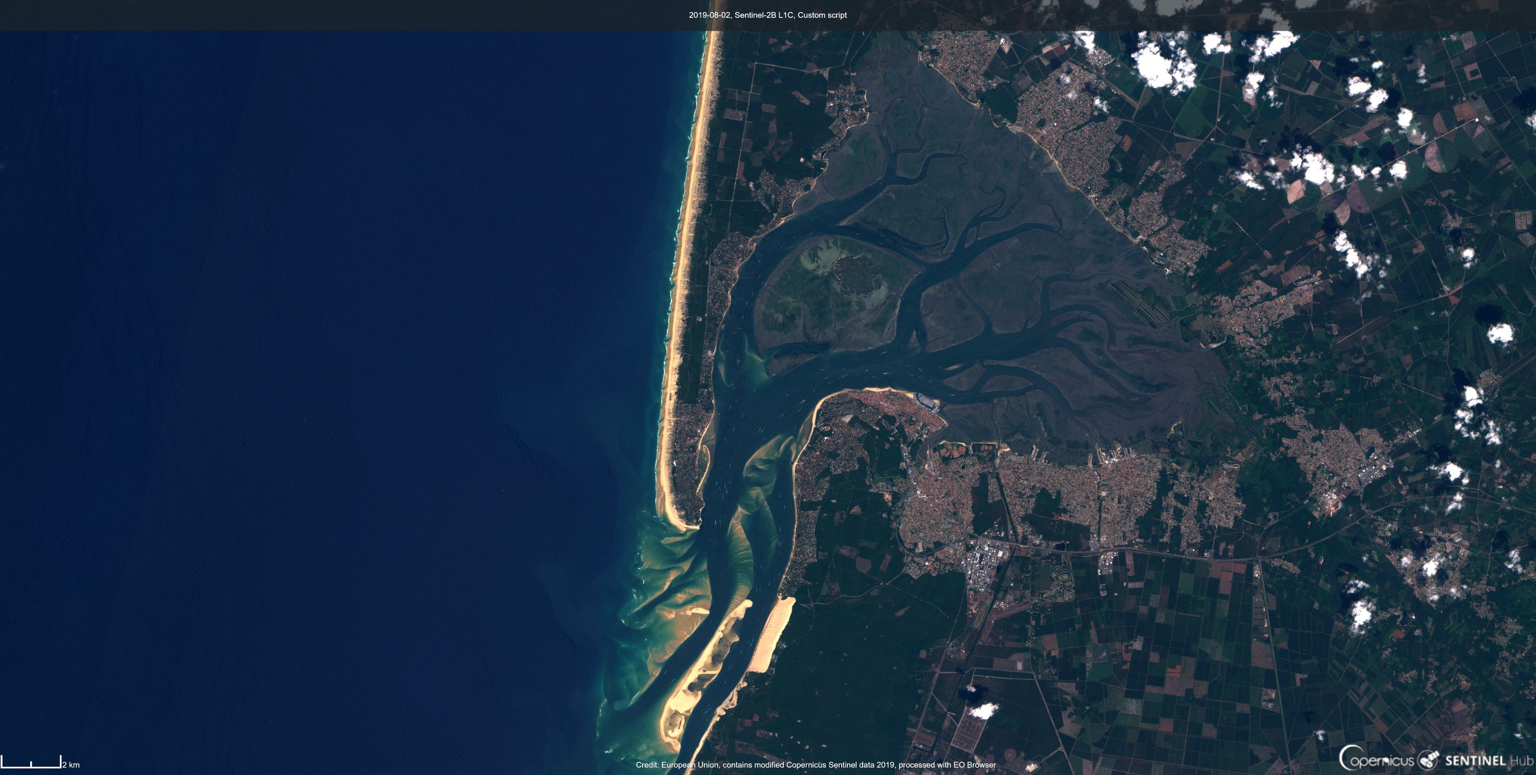
In this Sentinel2 photo from 02/08/19 we can see the Arcachon basin, the dune du Pilat, and the Banc d'Arguin.
 
Since June 2014, this area has been home to the Parc naturel marin du Bassin d'Arcachon.
 
visualization with the GeoGarage platform (SHOM nautical raster chart)

This movement has already been underway for many months, since before the passage of storm Aline in October, the southern tip of the bank had already lost more than a kilometer, and the bank had already been cut in two during high tides in September 2022.
 

In its post, PNB juxtaposes images of the bank from September 2021 up to the last photograph taken by Air Infrarouge on November 18, i.e. after the passage of the autumn storms.
This shows the extent to which the surface of Arguin has been eroded and reduced to the south, burying dozens and dozens of oyster-farming concessions under the sand.
"Compared to those acquired in September 2021 and August 2022, the evolution of the Banc d'Arguin and its southern part is impressive!" exclaims PNB.
"And echoes the results of the Arcade study (a study of the Bassin's passes, Editor's note), recently presented to the public, which shows the lagoon's inherent strong hydrodynamics and its openness." 

Links :

Friday, February 2, 2024

8 facts about Point Nemo, the most remote place on Earth

 
From History Defined by Carl Seaver 

Deep in the ocean’s depths, there is a point on the map where no land exists for thousands of kilometers in every direction.
This point is called Point Nemo, one of the most remote places on the planet.
Yet, despite its extreme remoteness, Point Nemo has become a graveyard for spacecraft, a laboratory for scientists, and a supposed refuge for mythical sea creatures.

Nemo Point : The farthest point from dry land
 
It is a unique and fascinating spot, full of secrets and surprises.
This article will explore the facts about Point Nemo and its status as one of the most mysterious places on Earth.


Point Nemo Is The Most Remote Location on Earth

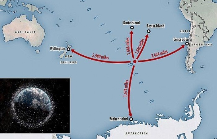
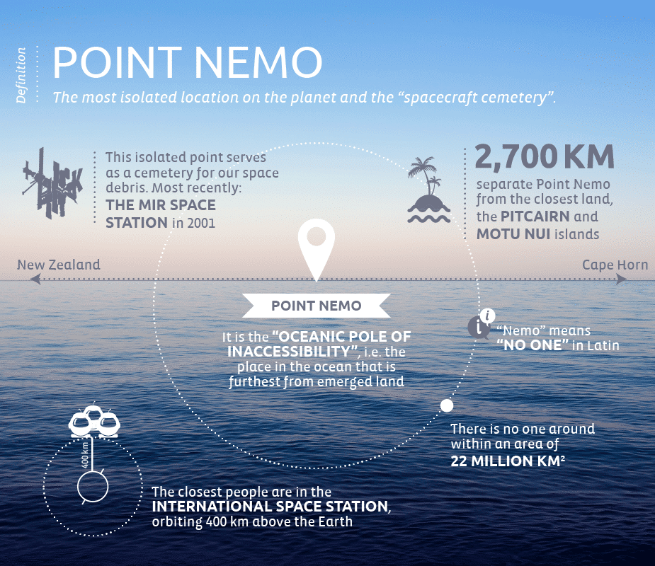
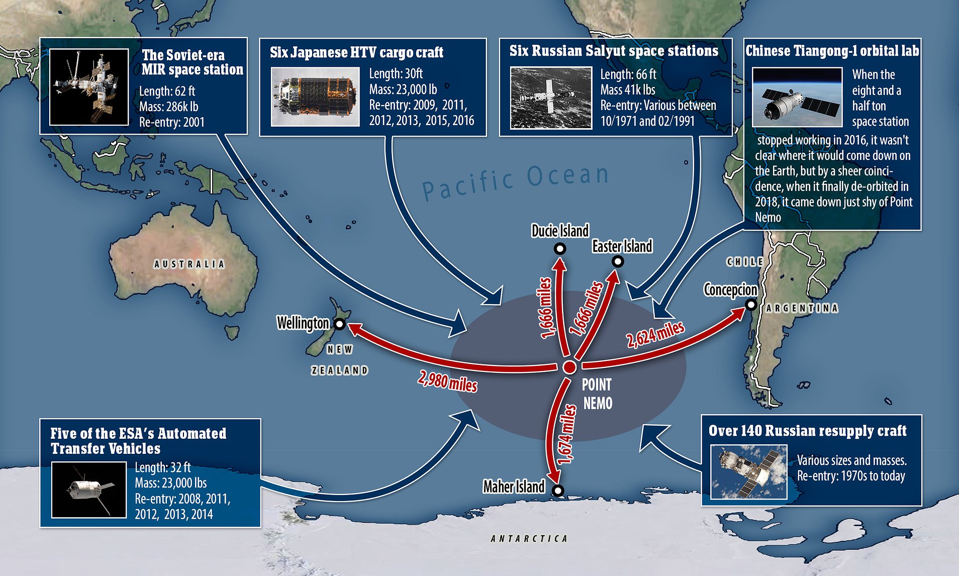
Point Nemo is located in the South Pacific Ocean, approximately 2,688 kilometers (1,670 miles) away from the nearest land.
Situated at the point of coordinates 48°52.6′S 123°23.6′W, it is the most remote location on Earth, as it is the furthest point from any landmass.
 
Localization with the GeoGarage platform (UKHO nautical raster map)

Geographically, this mystery point is located at the intersection of the equator, the International Date Line, and the 90th meridian west.

The nearest landmasses to Point Nemo are; the Pitcairn Islands’ Ducie Island to the north; Motu Nii, a small island that is part of the Easter Island chain, to the northeast, and Maher island, off the shore of Marie Byrd Land, an unclaimed territory in Antarctica, to the south.

These islands are all unpopulated.
You would have to travel to New Zealand, which is located around 2,500 miles (4,023 kilometers) away, or to one of the world’s most isolated inhabited islands, Easter Island, which is located about 2,200 miles (3,540 kilometers) to the west of Chile to find the closest hint of civilization.

This journey can only be completed by boat and could take more than two weeks.

Surprisingly, the closest people to point Nemo are astronauts on board the International Space Station (ISS) in space.
At their closest, they are about 258 miles (415 kilometers) away from the location that marks the spot.

source : Ponant
 
Point Nemo Is The Oceanic Point Of Inaccessibility 
 
Point Nemo is also known as the oceanic pole of inaccessibility.

For context, a point of inaccessibility is the point(location) on a given landmass farthest from any coastline or shoreline.
It is the geographical center of an area.

Point Nemo, as the Oceanic point of inaccessibility, is the farthest place from land.
It is the furthest point from land that you can get.

The oddity of Point Nemo as a point of inaccessibility is also seen in its equal distance from all the nearby land masses, which are Moto Nui, Ducie Island, and Maher island, each 2,688 kilometers away.
 
Point Nemo Was Discovered Just Over Three Decades Ago

While the oceanic point of inaccessibility has always existed, it was only just discovered in 1992, some three decades ago.

Hrvoje Lukatela, a Croatian-Canadian survey engineer, determined the position of point Nemo using theoretical ideas designating a point of inaccessibility.

He obtained his raw calculation parameters from the US Defense Mapping Agency’s (now National Geospatial-Intelligence Agency) “Digital Chart of the World” – a comprehensive database of satellite orbits and ground locations.

Lukatela didn’t actually visit point Nemo to confirm its existence.
Instead, using computational software, he was able to validate his calculations through realistic modeling and simulations.

Point Nemo Isn’t Named After A Fish

The etymology of Point Nemo is easily confused with Disney’s well-known protagonist — fish Nemo — in the children’s show Finding Nemo.
Although the inspiration behind both names — Nemo the fish and Nemo the geographical wonder — stems from the sea, that’s the extent of their similarities.

Point Nemo was named after the famous fictional character Captain Nemo in Jules Verne’s ‘20,000 Leagues Under The Sea.’ It translates roughly to “no man” in Latin, a name that fits a place so alone in the world.

Point Nemo Is A Confluence of Lifelessness

The Nemo point is an area of the deep ocean with no islands, reefs, or other land structures.
Instead, the ocean floor comprises abyssal plains, trenches, and mountain ranges plagued by perpetual darkness and silence.
The extreme pressure of the deep sea and cold temperatures make it uninhabitable for most life forms.

There are no fish or other marine life in the area, and the lack of sunlight and nutrients makes it difficult for even the hardiest species to survive.

Currently, only bacteria and tiny crabs have been discovered to live in the volcanic vents on the seafloor near Point Nemo.

Point Nemo Is The Home Of Cthulhu

Point Nemo’s location is coincidentally the home of Cthulhu, the fictional cosmic entity created by author H.P.
Lovecraft in his famous fictional work — The sunken city.

Cthulhu is a massive monster that is part octopus and part dragon and wields enormous power and influence.
In Lovecraft’s mythology, he supposedly has a cult of alien or extra-dimensional entities known as the “Great Old Ones” that worship him.

Point Nemo is the perfect place for Cthulhu to hide from the world.
It’s incredibly remote, and the deep waters are frigid, making it an ideal home for a creature like him.
To make matters even better, Point Nemo is considered international waters, making it a haven for Cthulhu and his followers, fiction-wise, of course.

Lovecraft puts the city in the South Pacific Ocean at 47°9′S 126°43′W, very close to Point Nemo.

The fictional submerged city was first referenced in the short story The Call of Cthulhu (1928), written 66 years before the computation and eventual mapping of Point Nemo.
 
 
Point Nemo Is A Spacecraft Cemetery

Sometime after the first man set foot on the moon, space organizations found that an extremely remote location, such as Point Nemo, is a safe “scuttling” destination for satellites and spacecraft that are deorbited for decommissioning on expiry.

As a result of this discovery, Point Nemo was designated as the ultimate space graveyard.
Space organizations eventually went on to direct defunct spacecraft and space stations to this distant area using controlled landing without fearing the disruption of humans or maritime traffic.

The cemetery — point Nemo eventually matured into its role as the ideal ultimate resting place for space technology.
It is far enough away from air and sea traffic that the spacecraft will not be disturbed, and it is located in an area of the ocean with minimal currents, so the spacecraft and its technology will not drift away.

The first spacecraft to be sent to Point Nemo was the Soviet Union’s Salyut 1 in 1971.
Since then, more than 250 spacecraft have been sent to the graveyard, including the Mir space station, the Skylab space station, and the Beagle 2 Mars lander.


When a spacecraft is sent to Point Nemo, it is deorbited before being allowed to sink to the ocean floor.
This procedure is called “geological disposal,” and it ensures that the spacecraft will not pose a threat to future space missions.

Among the space junks at Point Nemo are over 140 Russian resupply ships, a SpaceX rocket, and other spacecraft from the European Space Agency (ESA) and the Japan Aerospace Exploration Agency (JAXA).
The International Space Station (ISS) will likewise be decommissioned at Point Nemo in 2028-2030.

Ultimately, Point Nemo is a unique and fascinating place, serving an important role in space exploration.
It serves as a final resting place for spacecraft that have served humanity well and a safe refuge that decreases the likelihood of debris collisions in space.

Point Nemo Was Once Thought To Contain Life

In 1997, the US. The National Oceanic and Atmospheric Administration (NOAA) recorded a very loud sound originating from point Nemo, an otherwise Lifeless/deathly place.
However, it wasn’t only the NOAA that witnessed this phenomenon.
The mysterious sound traveled across the Pacific, echoing all the way.
Since then, it’s been known as the Bloop.

After analysis and several experimental reiterations, the Bloop was discovered to be a series of low-frequency, high-amplitude signals traveling at irregular intervals.
The sound has been compared to a whale’s call, albeit much louder and more forceful.
It was said to be so loud that it could be detected on many sensors over thousands of kilometers.

At the time, many theories were going around, all trying to explain the origins of the Bloop.
Scientists ran with the hypothesis that a large aquatic animal, such as a whale or a giant squid, could have caused the sound.
With Point Nemo’s proximity to H.P Lovecraft’s sunken city, conspiracy theories flew with wild abandon.

Eventually, several years later, in 2005, the NOAA came up with an actual scientific explanation for the Bloop.
In the end, the Bloop wasn’t caused by an unknown marine life, nor was it the site of an Alien invasion.
Instead, it was simply a phenomenon caused by large icebergs calving off an ice shelf in the depth of the dark seas.

Links :

Thursday, February 1, 2024

Has Amelia Earhart’s plane really been found? 6 key things to know

Amelia Earhart and navigator Fred Noonan disappeared over the Pacific Ocean in an attempt to circumnavigate the globe in this Lockheed Electra 10e airplane on July 2, 1937.
Experts say it's too early to know for sure whether claims that the wreckage has been found are true.
PHOTOGRAPH COURTESY PF-(AIRCRAFT), ALAMY STOCK PHOTO

From National Geographic by Rachel Hartigan


A new grainy sonar image claims to solve the mystery of the famed aviator’s disappearance, but experts say it’s too soon to tell. Here's what we do know.

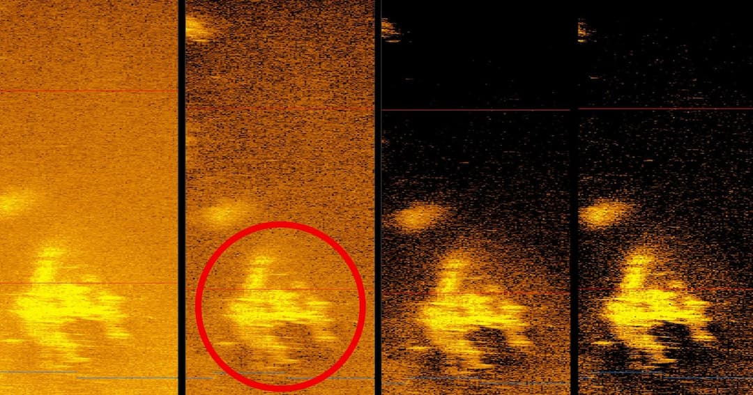
With the release of a grainy gold image, news headlines around the world are trumpeting the possible discovery of Amelia Earhart’s Lockheed Electra 10e, the plane she was flying in 1937 when she and her navigator, Fred Noonan, disappeared during the most difficult leg of their round-the-world flight.

Deep Sea Vision, a new venture founded by pilot and commercial real estate investor Tony Romeo, captured the sonar image during a hundred-day expedition in the central Pacific, the region where Earhart was lost.
 “It was definitely a surreal moment for all of us,” says Romeo, who sold his real estate holdings to purchase a cutting-edge autonomous underwater vehicle (AUV) equipped with highly advanced sonar technologies.


The remotely operated vehicle Hercules is retrieved from the waters off Nikumaroro Island onto the deck of the E/V Nautilus in 2019 after a day of searching for Amelia Earhart’s missing airplane. Explorers have long sought to solve the mystery of the famed aviator's fate.
PHOTOGRAPH BY GABRIEL SCARLETT, NAT GEO IMAGE COLLECTION

Still, it’s too soon to say whether this discovery of an object 16,000 feet deep means one of the great historical mysteries has been solved. Here’s what we do know.

1. Sonar images have limitations.


Sonar images are not photographs.
The sound waves sent by sonar are at a low frequency, which translates to low resolution.

“The sound wave, because it’s so big, can’t see fine detail,” says David Jourdan, an engineer whose company Nauticos has led three expeditions in search of Earhart. 
“It can be distorted by reflections, like taking a picture of a mirror.” 
Promising images, on a second look, sometimes turn out to be something else entirely, like a geological formation.
 

2. Deep Sea Vision didn’t confirm the object’s identity.


Romeo and his team found the image in their data storage files as they were transitioning to another expedition. 
They thought that data from one of the AUV’s earlier sorties had been corrupted. 
When they discovered it wasn’t—and that they had a potential blockbuster find—it was too late to return to the site.
“We were out of time. We were out of resources,” says Romeo. 
“And we didn’t have a camera on our [AUV]. It broke really early in the expedition.” 
Returning to go over the target again with just sonar didn’t seem worth the hundreds of thousands of dollars he estimated it would cost. 
Deep Sea Vision plans to go back to the sonar image site this year, this time with an operational camera on the AUV to confirm the finding.

3. Some experts say the plane, if it is a plane, doesn’t resemble the Electra.


“The proportions aren’t quite right,” says Jourdan, pointing to the way the wings are swept back rather than straight across, as the Electra’s were.

Others are even more skeptical. 
“For the wings of an Electra to fold rearward as shown in the sonar image, the entire center section would have to fail at the wing/fuselage junctions,” according to an email blast from The International Group for Historic Aircraft Recovery (TIGHAR), an organization that has put forward the theory that Earhart died a castaway on an island to the east of the sonar image site. 
“That’s just not possible.”


National Geographic Explorer at Large Bob Ballard, pictured here in the control room of the E/V Nautilus, led a major expedition in 2019 to find the remains of Amelia Earhart's airplane.PHOTOGRAPH BY GABRIEL SCARLETT, NAT GEO IMAGE COLLECTION

Romeo dismisses this criticism. 
Both the wings and the tail look swept back due to distortion caused by the AUV moving through the water, he says, pointing to the twin fins on the back of the plane instead. 
“That’s very distinctive of her aircraft,” he says. 
“There’s only a couple of planes that’ve ever been made like that.”

4. The object’s location is roughly on Earhart’s flight path—but beyond the range suggested by her radio signals.

Earhart and Noonan disappeared on July 2, 1937, flying from Lae, New Guinea, to Howland Island, a one-and-a-half-mile long island some 2,500 miles away. 
After flying 20 hours, Earhart thought they were close and radioed the Itasca, the Coast Guard ship awaiting them at Howland, 
“We must be on you but cannot see you.”
Her voice was so loud, the Coast Guard radiomen thought she was very near too.
She wasn’t, but the strength of the radio signals suggest that she was just beyond visual range.

Deep Sea Vision’s search area was roughly a hundred miles west; Romeo won’t reveal exactly where to avoid someone else making the crucial find.
But he does acknowledge that they were guided by a theory that Noonan had failed to account for how the International Date Line would affect his calculations.
That theory, however, doesn’t account for the strength of Earhart’s radio signals.

5. Others have claimed to solve this mystery.

Over the nearly 90 years since Earhart and Noonan vanished, many people have claimed to have proof of what happened to them.


Members of the Ballard-led expedition dive in the primary search area just off Nikumaroro Island, an isolated ring of coral and sand surrounding a turquoise lagoon where some suspect Earhart may have been landed.
PHOTOGRAPH BY GABRIEL SCARLETT, NAT GEO IMAGE COLLECTION

People who believe the Japanese captured and killed the aviators have pointed to everything from a generator retrieved in a Saipan harbor in 1960 to a photograph on a Jaluit dock revealed in 2017. TIGHAR, meanwhile, has claimed various smoking guns over the years but now argues that a preponderance of historical and archaeological evidence puts Earhart on Nikumaroro Island, 400 hundred miles south of Howland, where they believe she starved to death.

Then there’s the simplest explanation: that the aviators simply crashed into the ocean. Elgen Long, an airline pilot who with his wife Marie did the most extensive research into where that might have happened, wrote a book called Amelia Earhart: The Mystery Solved. 
Over three expeditions, Jourdan has looked where Long suggested (and elsewhere) and come up empty.

6. The mystery is still unsolved. That doesn’t mean its unsolvable.

Jourdan’s team believes they’ve narrowed down where the Electra went down based on recent radio signal testing. 
Meanwhile, when Deep Sea Vision returns to the site this year, they will bring a documentary crew to capture the moment.
“This is definitely something that we need to go back and look at,” says Romeo. 
“We’ve got to get out there before … you know, there is some urgency.”

Links :

Wednesday, January 31, 2024

Drowning Holland: how the Netherlands will survive in floating cities


In 2121, most of Holland — the most densely populated, lowest-lying part of the Netherlands — could be below the waves.
Or rather, it should be, according to Professor Jan Rotmans.
(Credit: TU Delft / KuiperCompagnons)


From BigThink by Frank Jacobs

With sea levels rising, the Dutch are pondering floating cities — while also exporting their engineering know-how to turn a tidy profit.
The Dutch are champions at defeating the sea, but even they must soon admit defeat, one expert claims.

Professor Jan Rotmans says the only sensible way to manage rising sea levels is to organize a smart retreat.

Even in a flooded Holland, the future is still bright: dealing with sea-level rise will become a highly exportable skill.


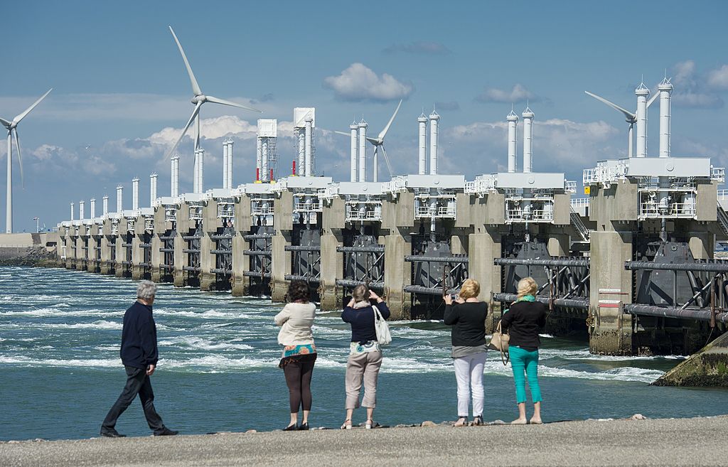
The Delta Works, keeping the Netherlands dry since the end of the 20th century.
But for how much longer? (Credit: Marco De Swart / AFP / Getty Images)


It’s the year 2121.
Due to rising seas and subsiding terrain, much of Holland has flooded.
But it’s been a managed retreat.
The country that became famous in the 20th century for taming the North Sea has used the 21st to become expert at graciously, profitably giving way to it.

Against the wiles of Neptune

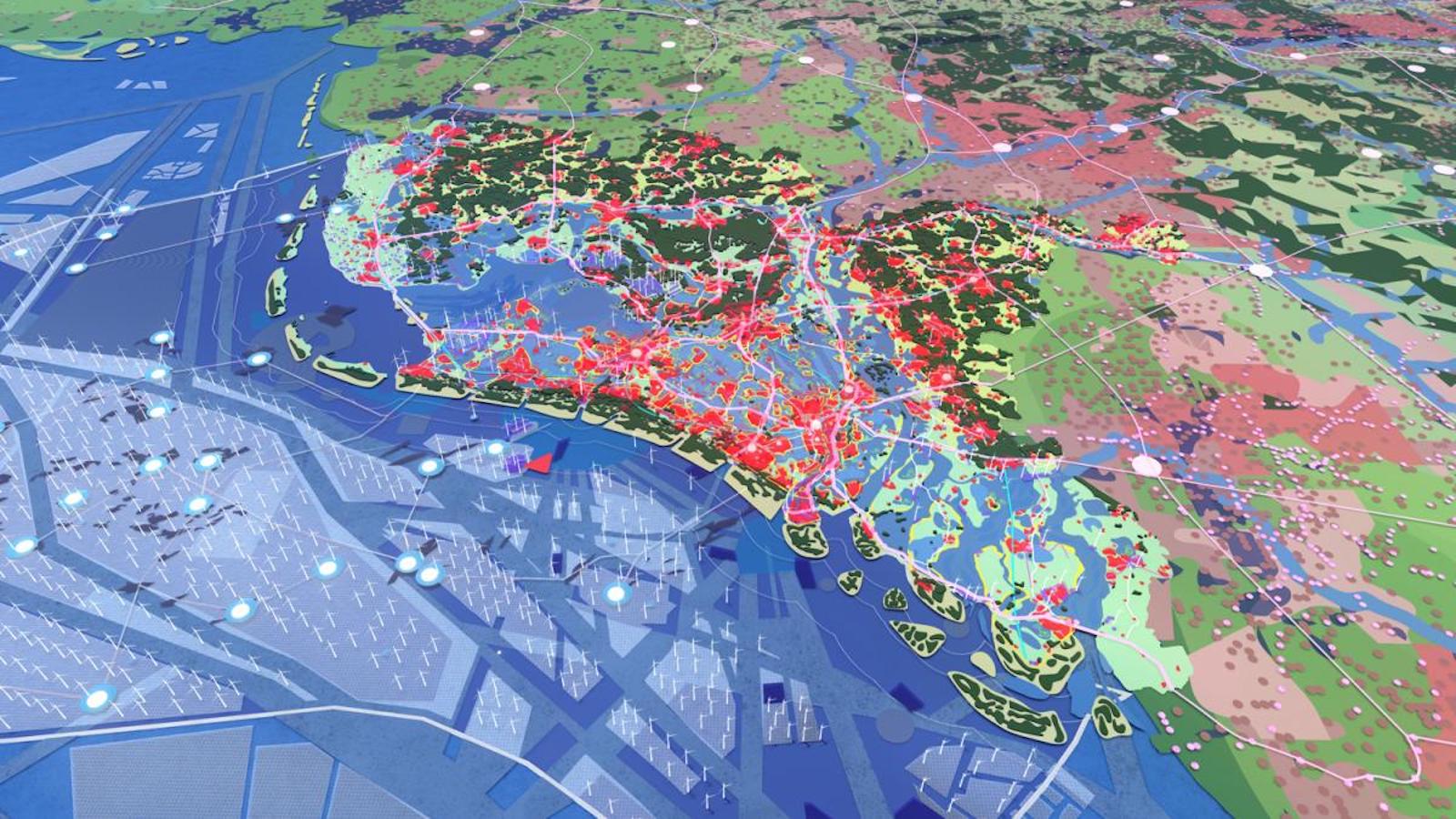
The Randstad, that massive conurbation of Amsterdam, Rotterdam, The Hague, and Utrecht, is gone.
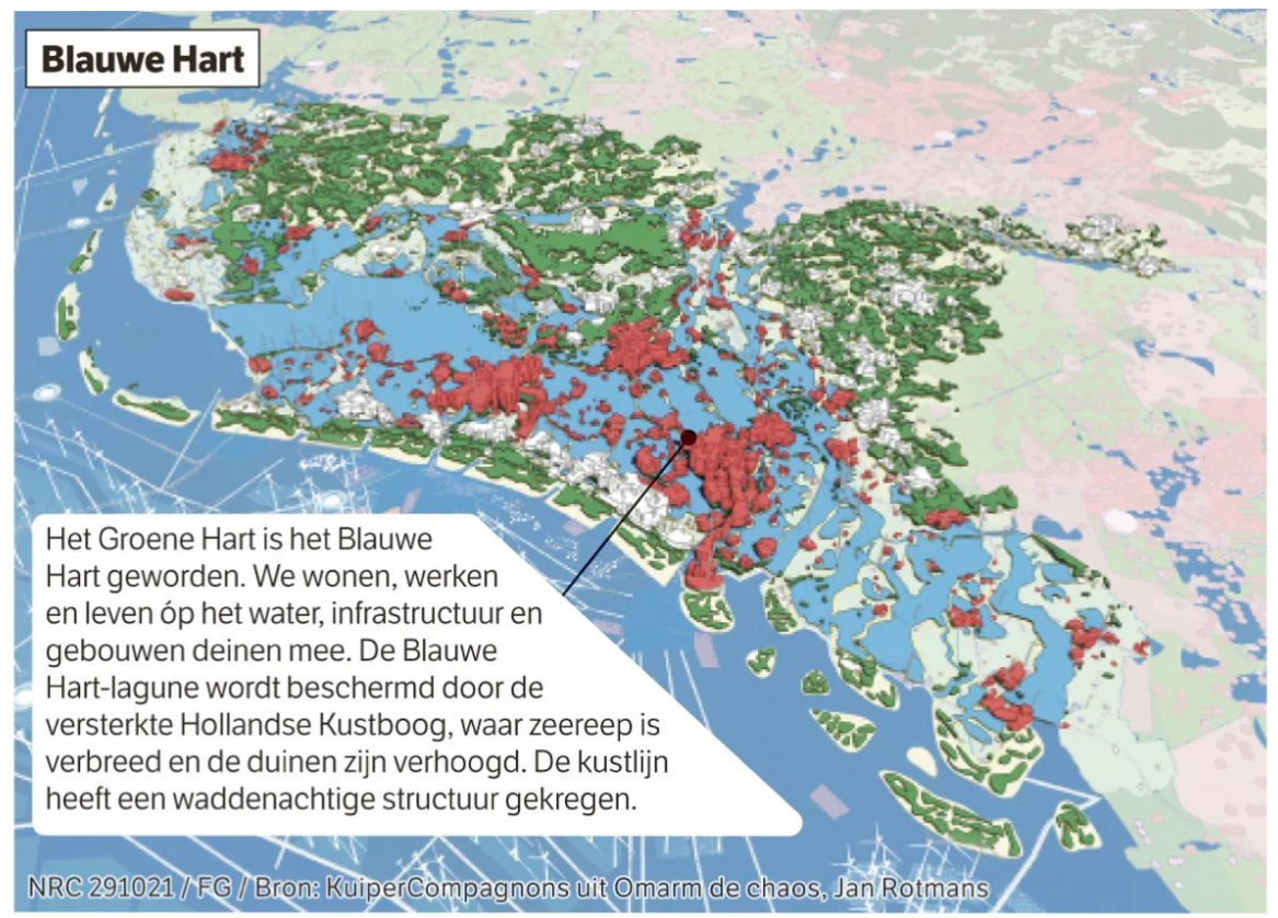
Its Green Heart has been abandoned to the waves.
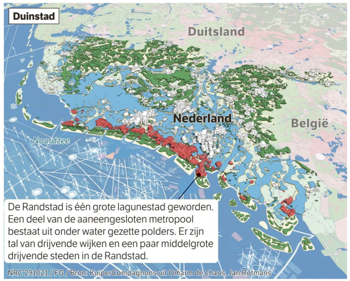
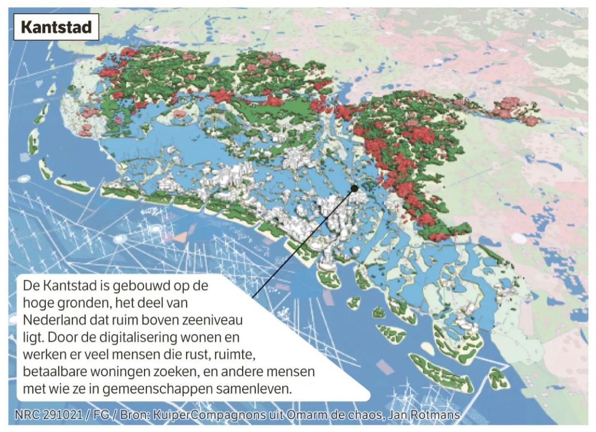
But people still thrive in this new Blue Heart, and on either side of it: in Duinstad (“Dune City”), a strip of densely populated coastal islands, fortified against the wiles of Neptune; and in Kantstad (“Edge City”), a mix of urban and rural zones in the elevated interior of the Netherlands, now its new contact zone with the sea.

This is how Jan Rotmans, professor of Transition Management at Erasmus University in Rotterdam, sees the future.
And it’s a best-case scenario, even though many of his compatriots might not agree.
 

Randstad becomes “Dune City,” an urban chain bordered on one side by the sea and by a re-created lagoon on the other.
(Credit: Jan Rotmans / KuiperCompagnons / NRC / Jaap Modder)

They would argue that retreating from the sea is anathema to Dutch identity as well as the nation’s survival.
Driving back the encroaching waves is what the Dutch have done for centuries.
So-called waterschappen (“Water Boards”), elected bodies tasked with water management in specific regions, are often claimed to be the oldest democratic institutions in the country.

Retreat from the sea, a Dutch taboo

Following the catastrophic North Sea Flood of 1953, the Delta Works, completed in 1997, secured much of the lower-lying country behind a massive system of locks and barriers.
At present, about 26% of the country is below sea level, and more than half of its 17.5 million citizens live in flood-prone areas.

Thanks to the Delta Works, and other massive engineering efforts, that risk is mainly theoretical.
But not for ever, says Professor Rotmans in Omarm de Chaos (“Embrace the Chaos”), a book on the future of large-scale water management in the Netherlands.
Its pugnacious title is meant to jumpstart a public debate on what is still largely a taboo subject in polite Dutch society: an organized retreat from the rising sea.

Based on credible scientific sources, Professor Rotmans predicts sea levels will rise 1 m (3.3 ft) over the next century.
Due to subsidence, ground levels in large parts of the country will fall by equally as much, meaning the actual sea level will be 2 m (6.6 ft) higher by 2121.
 

“Edge City” is constructed on elevated terrain deep inland.
Sustainability, innovation, and conservation go hand-in-hand.
(Credit: Jan Rotmans / KuiperCompagnons / NRC / Jaap Modder)


As a result, some of the most densely populated parts of the Netherlands, already below sea level today, will be 8 to 10 m (26 to 33 ft) below.
That will make getting and keeping the water out too expensive, Professor Rotmans argues.
Not to mention too risky — the giant floods that hit Germany in August 2021 could just as easily have struck the Netherlands.
And then there’s the fact that salinity inland is already increasing, due to the pressure of the seawater on the soil below the dykes and dams.
Floating cities will become commonplace

So, a smart, ordered retreat.
Responsible flooding.
Partially submerging Randstad.
Haarlemmermeer, now a rural area at its center, a.k.a. the Green Heart, will return to its previous aquatic incarnation (meer is Dutch for “lake”).
But people won’t entirely abandon the new Blue Heart.
The Dutch are already experimenting with floating houses.
From rarities, these will become commonplace.
People will learn to live, work, and recreate in floating cities.

Meanwhile, the historic coastal cities will not be abandoned.
They will be safeguarded as a Venice-like lagoon city on a strip of elevated and reinforced islands.
These will be a continuation of the Wadden Islands that already dot the northern coast of the Netherlands.
Like the original Wadden Islands, they will help protect areas further inland from assaults by the sea.
 

The Green Heart has turned into the Blue Heart, where people live, work, and recreate on the water itself, in floating cities.
(Credit: Jan Rotmans / KuiperCompagnons / NRC / Jaap Modder)


On those new shorelines inland we find Kantstad, a mix of urban and rural zones, focused on producing sustainable resources for a variety of industries, from clothing to construction.

Why so negative, Netherlands?


Together, these three cities are a new kind of place — no longer defined as a negative space.
Not Neder-land (“the land below (the sea)”) but Boven-water (“above water”).
These cities of the future will be powered by wind and solar energy, and its ports will do brisk trade in green hydrogen and the products of saline agriculture.

But perhaps the main export from Bovenwater will be knowledge — in water management, climate management, and sustainability.
Expertise acquired in the 21st century, for success in the 22nd.

“Today, we face many challenges in one: climate, environment, agriculture, water, and energy.
There is no other major river estuary in the world that faces so many problems all at once.
If we start now, we still have time”, says Professor Rotmans.
“The next ten years will determine whether we’ll make it or not.
Strangely, I’m optimistic — we learn most in times of crisis.”

Links :

Tuesday, January 30, 2024

South China Sea's subsea features get new Chinese names

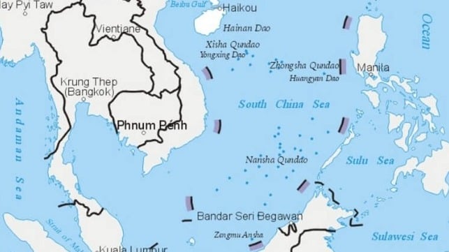
China's nine-dash line surrounds most of the South China Sea,
including the Spratly and Paracel Islands
(China Ministry of Natural Resources)

From Maritime Excutive


On Tuesday, China released the results of a new geological survey of the South China Sea, and claims to have named nearly 400 subsurface features throughout the water body.

Beijing claims sovereignty over almost all of the South China Sea, including large swathes of its neighbors' exclusive economic zones. Its sweeping maritime claims were invalidated by the Permanent Court of Arbitration in the Hague in 2016, but China has ignored the ruling.

Yang Chupeng, an official with the Guangzhou branch of the China Geological Survey, told state media that the new survey results will "provide good services for our country's marine engineering construction." The survey data will facilitate the "development and protection" of "China's blue land," the agency said. 


Ministry of Natural Resources announced in 2020 some seabed geographical entities
A territorial row between China and Japan appears to be escalating.
 
China has announced new names for some 50 underwater geological features around disputed islands in the East China Sea.
Some of the names include the term "Diaoyu" -- the Chinese name for the island group.
This comes a day after a local assembly in Japan approved plans to rename the area covering the islands.
The Japanese term for the islands -- "Senkaku" -- will be used in the new administrative name.
China has slammed the move as illegal.
The islands are currently controlled by Japan.
original data source : China govt / GEBCO seamounts / map by GeoGarage
 
The survey process found 36 new seabed features that were previously unmapped, according to state media.
The study also gave state officials the opportunity to give new names to 384 seabed landforms around the South China Sea.

The right to name seabed features is consistent with China's position on the South China Sea's ownership.
Beijing has long claimed that it has “indisputable sovereignty over the islands in the South China Sea and the adjacent waters," including legal jurisdiction over the surface, seabed and subsurface mineral rights.

Chinese Research ship described as a "dual use spy ship"
(Wang Yuan 5 ballistic missile tracking sea surveillance ship)

The data also has military applications.
Fine-scale subsea mapping is useful for submarine warfare, as seabed features must be carefully mapped to safely navigate a sub near the bottom.
(Subs can and do collide with unmapped promontories.)
Seabed features can also be used to conceal a sub from detection.

The Washington-based Center for Strategic and International Studies recently published a summary of evidence that China's research vessels serve military purposes, like the research vessels of other naval powers.
CSIS asserts that of the 64 active Chinese research vessels, over 80 percent demonstrate suspect behavior or possess links suggesting involvement in Beijing’s geopolitical agenda.

The Ministry of Natural Resources and Chinese Academy of Sciences both operate research vessels and have signed cooperation agreements with China's military. The China Geological Survey, which sponsored the large-scale mapping effort, is a division of the Ministry of Natural Resources. 

Links :