Saturday, October 5, 2019

Weekly Arctic Sea ice age with graph of ice age by area: 1984 - 2019


This visualization shows the age of the Arctic sea ice between 1984 and 2019. Younger sea ice, or first-year ice, is shown in a dark shade of blue while the ice that is four years old or older is shown as white.

A graph displayed in the upper left corner quantifies the area covered sea ice 4 or more years old in millions of square kilometers.
One significant change in the Arctic region in recent years has been the rapid decline in perennial sea ice.
Perennial sea ice, also known as multi-year ice, is the portion of the sea ice that survives the summer melt season.
Perennial ice may have a life-span of nine years or more and represents the thickest component of the sea ice; perennial ice can grow up to four meters thick.
By contrast, first year ice that grows during a single winter is generally at most two meters thick.
This animation shows the seasonal variability of the ice, growing in the Arctic winter and melting in the summer.
In addition, this also shows the changes from year to year.
A graph in the upper left corner the quantifies the change over time by showing the area covered by sea ice that is 4 years old or older in millions of square kilometers.
This graph also includes a memory bar - the vertical green bar that indicates the maximum value seen thus far in the animation for the given week being displayed.
For example, when viewing the sea ice age for the first week in September, the memory bar will display the maximum value seen for the first week of September in all prior years from the beginning of the animation (1984).
In addition, a violet bar indicates the weeks's average area covered by sea ice greater than 4 years of age during the the 20-year time period from 1984 through 2003.
Note that data for the sea ice age is not available along the coastlines.
The region where data is not available is shown in a dark lavender color.
Visualizers: Cindy Starr (lead), Horace Mitchell

Arctic sea ice likely reached its 2019 minimum extent of 1.60 million square miles (4.15 million square kilometers) on Sept. 18, tied for second lowest summertime extent in the satellite record, according to NASA and the National Snow and Ice Data Center.
The Arctic sea ice cap is an expanse of frozen seawater floating on top of the Arctic Ocean and neighboring seas.
Every year, it expands and thickens during the fall and winter and grows smaller and thinner during the spring and summer.
But in the past decades, increasing temperatures have caused marked decreases in the Arctic sea ice extents in all seasons, with particularly rapid reductions in the minimum end-of-summer ice extent.
The shrinking of the Arctic sea ice cover can ultimately affect local ecosystems, global weather patterns, and the circulation of the oceans.

Friday, October 4, 2019

Maritime navigation : France chooses EGNOS to improve services for sea users

The DGPS stations of the interregional maritime directorates, located along the French coast, provide mariners with an enhanced radionavigation service, improving GPS positioning accuracy. 
To modernise and improve the efficiency of the system, the Directorate of Maritime Affairs has chosen to use the European EGNOS service ("European complementary service for geostationary satellite navigation"), originally developed for the air transport sector and based on a set of ground stations with correlated data.
credits : MTES-Terra, Laurent Mignaux

From EGNOS

Satellite-based systems have greatly changed maritime navigation.
Most vessels, from sail boats to merchant ships or tankers, now have systems on board that rely on satellites for positioning.
In France, DGPS stations are distributed along the coastline to enhance radio navigation for seafarers.
In a context of new investment decisions, French maritime authorities chose EGNOS to upgrade their satellite-based services for radio navigation.
This is a first for the maritime sector.

For 15 years, six DGPS stations have been deployed all along the French coastline, providing sailors and merchant shippers with enhanced satellite-based radio navigation services.
The stations have made it possible to provide vessels equipped with GPS systems with precise positioning, especially in narrow waterways, as well as indications of signal quality.
But those stations have become outdated, suffering from frequent breakdowns due to ageing equipment.


Cutting-edge technology, at a low cost


To upgrade and improve the system’s efficiency, the French authorities have chosen EGNOS.
The aim was to find a solution enabling them to maintain high standards of quality while
responding to the criteria set by the International Maritime Organisation (IMO).
A cost-benefit analysis, led by the Cerema (The French centre for expertise and studies on risks, environment, mobility and urban development) showed that replacing the existing DGPS stations would have been much more expensive and less effective compared to the EGNOS solution, which appeared to be an innovative solution with limited costs.

The first station to be equipped with an EGNOS- based solution was Olonne on the Atlantic coast. Launched in June 2017, the experiment showed significant results complying with the international standards and in particular with the IMO A.1046(27) resolution.

Today, four EGNOS-based stations are in service (Olonne and Point de Buis in Brittany; Héauville on the channel coast and Porquerolles in the Mediterranean region).
Two additional stations are expected to become operational in 2020 (Béar in  the Mediterranean region and Cap- Ferret in the Atlantic region).

Operating costs total some €500,000 over three years; a service quality (in particular in terms of hardware quality), while minimising risks (jamming or cyberattacks for instance).
Further evolutions are expected with upcoming versions of EGNOS.

 "France is the first country to use ehe EGNOS technology in the maritime sector on such a scale"
"Satellite-based augmentation systems make navigation more  accurate, reliable and available, thus contributing to a safer, more efficient and sustainable maritime sector"
credits : MTES-Terra, Laurent Mignaux  

Enhanced radio navigation service with limited impact on the users 

EGNOS uses geostationary satellites and a network of ground stations to increase the accuracy of existing GPS satellite positioning signals, while providing an “integrity message” that informs users in the event of signal problems.
The constellation of these geostationary satellites provides differential correction data, which are then converted via a specific application based and centralised in Saint-Malo, Brittany.
The data are then transmitted to the users via the Medium Frequency (MF) antennas of the existing DGPS stations.

With this new service, there is no need for the ships to change their GPS receivers: the enhanced signal is received via the existing material.
Ensuring service continuity is thus crucial with total transparency for the users, while offering equivalent, if not better, performance.

Trusted precision and availability: a user- oriented service

All sea users, whether professionals or amateur sailors equipped with GPS, are targeted by this service.
They benefit from a positioning determination service that is accurate, reliable and homogeneous, based on recent technology that was historically used in the aeronautical sector, and all along the French metropolitan coastline.
The entire continental shelf included in the French economic exclusive zone should be covered, with optimal accuracy of 5 meters, thus meeting the most recent international standards (latest IMO resolution).

Today, France is the only country to use the EGNOS technology in the maritime sector on such a scale.

Links :

US (NOAA) layer update in the GeoGarage platform

8 nautical raster charts updated

From Mare Liberum to Mare Legitimum: In pursuit of safe and secure seas

For around three and a half centuries (from the early-17th to the mid-20th) the oceans of the world were dominated by the thinking of Mare Liberum, most closely associated with Hugo Grotius's 1609 publication of that name.
The legal regulation of those oceans was based on the principle of the Freedom of the Seas, which was arguably 'operationalised' through three well known bodies of law: the Law of Sea Piracy; the Laws of War and Neutrality at Sea; and that relating to the notion of Exclusive Flag State Jurisdiction.
While these bodies of law may have served well until the middle of the 20th century, there have been profound changes in the ocean environment – across seven dimension: the political; economic; social; technological; physical; military; and normative – that may require us to adopt entirely new ways of thinking about peace, good order and security at sea.
Perhaps we need to move to a new concept of Mare Legitimum – or 'lawful seas' – that may well cause us to reject entirely the idea that the seas should be 'free'.
This talk discusses whether we are moving from Mare Liberum to Mare Legitimum and whether the 'Freedom of the Seas' should be confined to history.

From Human Rights at Sea

Professor Steven Haines, Professor of Public International Law University of Greenwich and Trustee of Human Rights at Sea presented at the NATO Maritime Operational Law Conference at the Spanish Armed Forces Higher Defence College (CESEDEN), Madrid, on the 24th September 2019.

The following highlights the context and scope of his speech.


While these days I am occupying a chair in Public International Law, I am very much inter-disciplinary in my approach.
My first subject of choice was History and I also have a background in the study of Politics, both domestic and international.
I look at the law but I prefer to do so by placing it within its historical, social, economic, technological and political context.
This panel is devoted to historical developments.
They are important because they provide us with an understanding of how we got to where we are.
It is a mistake, however, to assume that history invariably provides lessons that suggest we should necessarily act in ways we acted in the past.
Far too frequently, an understanding of the history can seduce us into believing that we should do things the way we always have done.
Such intuition comes with risks, however.
Past success is very often the influence that leads us in the direction of future failure.
I am a believer in the value of a bit of counter-intuitive thinking.
It is vitally important that we understand the context, and that is ever changing, sometimes gradually but occasionally surprisingly quickly, catching us unawares.
That is what I am going to focus on this morning.

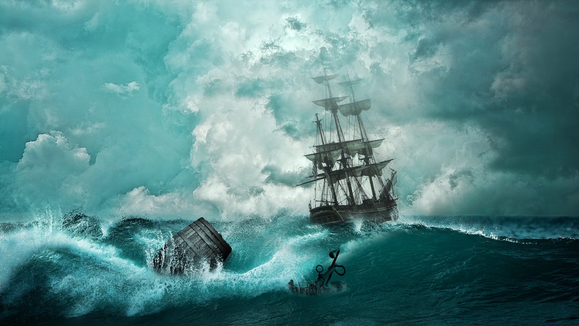
In The Free Sea (Mare Liberum, published 1609) Grotius formulated the new principle that the sea was international territory and all nations were free to use it for seafaring trade.
Grotius, by claiming 'free seas' (Freedom of the seas), provided suitable ideological justification for the Dutch breaking up of various trade monopolies through its formidable naval power (and then establishing its own monopoly). 
England, competing fiercely with the Dutch for domination of world trade, opposed this idea and claimed in John Selden's Mare clausum (The Closed Sea), "That the Dominion of the British Sea, or That Which Incompasseth the Isle of Great Britain, is, and Ever Hath Been, a Part or Appendant of the Empire of that Island 

I am working today on issues to do with ocean governance.
My study of the historical development of ocean governance and the law that provides its framework has led me to the conclusion that we are in a process of transition from a situation which prevailed for over three centuries, into something quite different.
It seems to me that this requires a fundamentally different approach if we are to arrive at an effective way of managing the future.
My starting point is a period that I refer to as the ‘Grotian Era’.
That is the period from roughly the beginning of the 17thcentury to the middle of the 20th.
If you want conveniently quotable dates, let us say from 1600 to 1950.

This was a unique period in history as far as the oceans are concerned.
It was the era of maritime imperial rivalry.
The maritime empires that were central to this rivalry were, essentially, European: Portugal, Spain, the Dutch, England (and subsequently Britain and its global empire), France and, latterly, Germany, with the extra-European powers of the United States and Japan bringing up the rear.
Their rivalries over 350 years resulted in a uniquely intense period of naval warfare, from the Anglo-Dutch Wars of the 17thcentury to the two World Wars of the 20th, including such general naval wars as the Seven Years War and the Revolutionary and Napoleonic Wars.
Naval wars throughout this period were either in progress or very much in prospect.
In other words, naval war was a constant presence.

There were, of course, naval wars prior to 1600, going back to classical times, but the three and a half centuries of the Grotian Era were especially intense in terms of naval conflict predicated on the needs and demands of imperial rivalry, with a heavy emphasis on economic warfare in both the mercantilist period into the 19thcentury and in the free trade era from the 19thonwards.

I call this period the Grotian Era because it was dominated in philosophical terms by the notion of ‘free seas’, what Grotius termed Mare Liberum.
The oceans were free for all to use for legitimate purpose, including the waging of naval conflict, regarded as a sovereign right throughout that period.
As far as the law was concerned, the foundational principle was that the seas should be subject to minimum regulation consistent with free use.
I suggest that there were three legal pillars that gave meaning to Mare Liberum: the law of sea piracy; the exclusivity of flag state jurisdiction; and the laws of naval warfare.
Piracy was a threat to free use and trade and needed to be eradicated if the seas were to be free for legitimate use.
Only flag states could exercise jurisdiction over their own ships on the high seas.
Finally, for naval warfare to be waged in a legitimate manner, some measure of normative influence was necessary to protect neutral shipping from belligerent interference while allowing the warring states to interfere with each other’s trade as a means of applying economic pressure in pursuit of victory.

The three bodies of law that emerged influenced the normative character of the oceans and they remain influential today.
And navies, especially those of the major maritime powers, base much of their thinking on what drove them during the Grotian Era – they look back on their success then and this has significant influence on their thinking today.
So much for the Grotian Era.

In 1950, the seas were still regulated to a minimum, territorial waters extended the state’s jurisdiction to a mere 3 miles from shore and there was a minimum of regulation for the high seas beyond three miles.
This was about to change, however, and in remarkable ways.
The status quo was about to be overturned and the ocean environment transformed.
It took a short while for the process of change to gain momentum but once it did the results were profound.

One of the advantages of getting older is that one develops a perspective that one did not have in one’s youth.
I first went to sea as a young naval officer while still in my teens, almost fifty years ago.
It was 1972, two years before the Third United Nations Conference on the Law of the Sea was first convened in 1974.
At that time, global maritime trade was a quarter of what it is today – and my navy had four times as many ships as it has now.
I have witnessed a considerable amount of change over the course of the past forty or fifty years.
I have no intention this morning of boring you with the detail – but it is sobering looking back from my perspective today at the profound shifts that have occurred.

In my research I am analysing the ocean environment through detailed examination of its various dimensions.
I use eight headings as an analytic framework: political; economic; technological; social; military physical; institutional; and normative.
Every single one of these has gone through – and continues to experience – substantial and often increasing rates of change.
Each of the eight dimensions has an influence on the other seven.
Let me just mention one or two pertinent facts which may help this audience to comprehend what I mean.

States have proliferated – there are four times as many as there were in 1950 – while maritime empires have all but disappeared.
Navies have similarly proliferated – and the bigger ones are, perhaps surprisingly, much smaller than they were then.
Most navies today are focused on law enforcement within their own coastal zones.
Warfighting may concentrate the minds of those serving in the US Navy and some other second and third rank navies, but the vast majority are not in the serious naval war-fighting league.
Coastal state jurisdiction has extended by a factor of over a hundred – from the former 3 mile territorial limits to the maximum 350 mile limits of the continental shelf.
Law has proliferated, with an increasing number of conventions negotiated, including important regulatory instruments negotiated under the auspices of the International Maritime Organisation.

Despite my years at sea, including in very temporary command of one of my navy’s warships, I would not now be permitted to do the job I once did because I do not have the formalised internationally recognised sea-going qualifications that are now required under STCW.
And that is probably no bad thing because I would not know how to operate given technological advances, I can probably still wield a sextant with effect but would need to be taught how to use the electronic charts and other navaids that are the norm today.
Technology continues to amaze and I am especially interested in the panels later on in the conference on autonomous shipping and the influence of artificial intelligence.
I could go on, and on, and on, believe me!

Mare Liberum

But let me get to the real point of what I am wanting to say.
These days I am very involved with the NGO Human Rights at Sea.
For those of a younger generation I perhaps ought to explain that as a young man in the 1970s and 1980s I was completely unaware and unconcerned with Human Rights Law, which only really took off to the degree we now recognise in the years after the 1990s.
Today, we most certainly should be aware of the millions of people who are at sea as I speak.
I have a provisional estimate of between 30 and 40 million actually at sea now.
They have human rights but there are serious shortcomings in the arrangements for ensuring they are recognised and complied with.
This is unfortunate because far too many seafarers are living and working under dreadful conditions, people are being trafficked and others are being used as slave labour on board fishing boats operating thousands of miles from their base ports.
Maritime crime is on the increase and people are victims of it at sea every day.
As Brian Wilson remarked to me recently, the high seas are the largest crime scene in the world.

For three hundred years and more the fundamental foundation principle was Mare Liberum.
We have heard already at this conference about the need for ‘free seas’ and freedom of navigation.
That is the received wisdom.
I used to rely on that received wisdom myself and I cannot blame others for continuing to do so.
But, as John Maynard Keynes used to say ‘When the facts change, I change my mind’.
And the facts have most certainly changed.
Today I am of the view that, while Mare Liberum was probably a very sensible foundational principle over the course of relatively recent history, today it is becoming less and less appropriate given a serious need for good order at sea.

We all need to be able to use the seas for legitimate purpose.
But what is legitimate and what is not is being redefined year on year.
Where previously there was minimum regulation consistent with free use, today there are very necessary layers of evolving regulatory systems applying at sea.
There are also plenty of people determined to breach those regulations and benefit from the proceeds of criminal activity.
They threaten the security of those who wish to use the seas for legitimate purpose.

I am convinced, indeed, that rather than ‘free seas’, we need safe and secure seas on which good people can go about their lawful business.
I like the notion of ‘lawful seas’ – and have even given it a Latin tag.
My message is that we need to shift our thinking from Mare Liberum to Mare Legitimum.

The vast majority of us here for this conference are in some way focused on navies and their roles.
We are either still serving in uniform, retired from having done so, or are in some other way concerned with the ways in which navies go about their business and have a concern with the law that regulates their operational activities.
We need to question our devotion to the old Grotian Era bodies of law seriously to assess their continuing value.


The old Law of Sea Piracy is wholly inadequate for dealing with general criminality at sea, something that has at least been recognised by the development of such instruments as the SUA Convention – though that is far from perfect.
Some older definitions of piracy included the conduct of the slave trade, with my own navy having long been proud of its record in suppressing it in the 19thcentury.
What are navies doing today to suppress the slave trade and the use of slave labour, in the fishing industry in particular?
The answer to that is ‘very little’ – indeed, I shall go further than that and say ‘nothing’..

Is the prevention and prosecution of maritime criminality helped or hindered by the old principle of exclusive flag state jurisdiction?
Just a few weeks ago, an eighteen year old Italian man was accused of sexually assaulting a seventeen year old British girl on board a Panamanian registered cruise ship in the Mediterranean.
The alleged crime was investigated here in Spain where the ship next docked, the accused was taken before a Spanish court, which then dismissed the case for lack of jurisdiction.
The accused was unable to defend himself and – arguably more important – the alleged victim had her right to justice and effective remedy denied.
I have no evidence that the flag state is doing anything at all to exercise jurisdiction.
That being the case, there is an obvious and blatant shortcoming in the law.
We should all be profoundly concerned about this and the myriad other abuses and injustices being experienced at sea on a daily basis.


My message is that we all need to consider seriously what needs to be done to render the seas well regulated, to enforce the law that does exist, and to take steps to ensure a safe and secure environment for those who rely on the oceans for their livelihoods.
That is what a modern interpretation of ‘free seas’ should mean.
Sadly, for many with criminal intent, free seas provides an evil opportunity of an anarchic character.
May I urge you all to shift thinking from the traditional notion of Mare Liberum to a new vision of Mare Legitimum.

I stress again, it is not free seas that we need, but safe and secure seas.

Thank you.


Links :

Thursday, October 3, 2019

The Ocean Cleanup is capturing plastic, prepping a larger trash-collecting system

The Great Pacific Garbage Patch is the largest accumulation of ocean plastic in the world and is located between Hawaii and California.
Scientists of The Ocean Cleanup Foundation have conducted the most extensive analysis ever of this area.

From Forbes by Jeff Kart 

Organizers of The Ocean Cleanup have spent years trying to get a system up and running to collect floating plastic from the Great Pacific Garbage Patch, the largest accumulation zone of plastic in the world’s oceans.
They now say a System 001/B is doing the job, and has been collecting a range of plastic debris using the natural forces of the ocean to catch and concentrate the garbage.

The system is the second attempt by the nonprofit, which began its journey seven years ago at a TEDx conference where the concept was presented by CEO and Founder Boyan Slat.
And that means while the group is celebrating, they’re also ready for more setbacks, or as Slat likes to call them: “unscheduled learning opportunities.”
“Something like this has never been done before,” Slat said during an Oct. 2 press conference from Rotterdam in the Netherlands.
“The path of progress wasn’t exactly a straight line.”

Slat says he and his team are proud to share that plastic is being captured, while also noting that the latest update means a System 002 is now being designed.
He and others on the team say they’re not sure when that System 002 will launch, but hope to have more details in a few months.

Plastic retained in front of an extended cork line by System 001/B.
photo : The Ocean Cleanup 

The new cork line setup.
image : The Ocean Cleanup 

The Ocean Cleanup is essentially a big rake that picks up floating plastic, with a goal to clean up 50% of the patch in five years, with a 90% reduction by 2040.

System 001 (aka Wilson) was launched from San Francisco, California, in September 2018, then later brought back when another “unscheduled learning opportunity” happened in the form of an 18-meter end section of the boom that broke off due to a fatigue fracture.

System 001/B was launched in June from Vancouver, British Columbia, and earlier reports showed promise, with tweaks that included a giant parachute anchor to create drag, slow down the system and let winds and waves push in the plastic.
The last hurdle was "overtopping," where plastic overtopped a screen meant to retain it.
That issue was addressed by using buoys to make the screen stick out higher above the water.

System 001/B, including the parachute
photo : The Ocean Cleanup 

Slat said he doesn’t have data to share on how much plastic has been captured by System 001/B so far.
“The objective of this first system wasn’t to collect as much plastic as possible,” he said, but to prove the principles of the project and using the natural forces of the ocean to collect trash.
“We collected quite a lot of plastic,” he added.

Another look at crew sorting the plastic.
photo : The Ocean Cleanup 

But he said the system is collecting all kinds and sizes of plastics, from medium-sized debris all the way down to microplastics as small as 1 millimeter.
Much larger ghost nets associated with commercial fishing also have been removed by the system.
“Now that we have these conclusions, they really have given us sufficient confidence to start the next phase of the development and work toward System 002,” Slat said, adding,
“If the journey to this point has taught us anything, it’s that this is not going to be easy.”

Ghost net being lifted onboard the support vessel during the System 001/B mission.
photo : The Ocean Cleanup

The main element to tackle in getting System 002 out on the ocean is survivability, to design a system that can stay in the water in year-round conditions and for long periods of time, so the plastic doesn’t have to be harvested too often using vessels that cost money to send.
“Right now the plastic is really able to stay in the system for days, possibly weeks,” Slat said, “but we have to go for months or even more than a year to make the economics work.”

Lonneke Holierhoek, the cleanup’s chief operating officer, said System 001/B will remain in the Great Pacific Garbage Patch through the end of November to gather more information for the next stage in the project.
It’s headed back now for a crew change and plans to concentrate near-future efforts in collecting plastic in high-density areas of the patch.
“We expect more challenges, more unscheduled learning opportunities and even more surprises, but our team has proven to be steadfast and very resilient which gives us full confidence for the future,” Holierhoek said, adding thanks to long-term partnersincluding the Dutch government and Maersk.

A bag filled with ocean plastic caught by System 001/B being lifted onboard the support vessel.
 photo : The Ocean Cleanup

Slat recalled his idea being dismissed and ridiculed by some when it was first proposed, and some remain skeptical of the project.

They include Marcus Eriksen, research director of the 5 Gyres Institute.
“All global environmental problems, like the hole in the ozone layer, smog over cities, or tar on the ocean surface, were all solved by an upstream policy solution, and that's what it will take to solve the plastic problem,” Eriksen said in response to the announcement.
“We need to use good science to see beyond the distractions.”

At the time of the announcement, Eriksen was in San Francisco with the San Francisco Bay Institute, announcing a three-year study of plastics in the San Francisco Bay “and the range of preventative solutions that will solve the problem here locally and can be replicated around the globe.
“It's upstream vs. downstream, and this is the fight we're engaged in,” he said in an email.
“We need to move the narrative to prevention.”

Crew members sort plastic into size and type classes onboard the support vessel during the System 001/B mission.
 photo : The Ocean Cleanup

Eben Schwartz, marine debris manager with the California Coastal Commission, has a similar message.
“It’s exciting to hear that The Ocean Cleanup project has made some advances in their design,” Schwartz said.
“However, my concerns remain the same as they have been since this project was first proposed.
“The Ocean Cleanup project, in both their methods and their messaging, ignores the fact that this is a 3-dimensional problem.
Plastics on the surface of the garbage patches are important to address, but they represent less than 3% of the plastic that enters the world’s oceans every single year.
“Plastics are found everywhere—throughout the water column and on the ocean floor.
Our focus needs to be on reducing and preventing the plastic that enters the ocean, while continuing to explore the possibility of long-term cleanup.”

Slat says The Ocean Cleanup still needs support to keep moving forward.
“Funding is always going to be necessary. Even though we’re in a good situation now, working toward scale-up, we’ll need more help.”
He also mentioned vacancies the nonprofit is looking to fill and encouraged people to spread the word about the work.
“The more people that know about what we do, I think the higher probability of success.”

Links :

Tuesday, October 1, 2019

315 billion-tonne iceberg breaks off Antarctica


The EU's Sentinel-1 satellite system captured these before and after images

The new D28 iceberg (~1582km²) that recently calved from Amery ice shelf is nicely shown in the latest
@CopernicusEU #sentinel1 satellite imagery @steflermitte


From BBC by Jonathan Amos

The Amery Ice Shelf in Antarctica has just produced its biggest iceberg in more than 50 years.

The calved block covers 1,636 sq km in area - a little smaller than Scotland's Isle of Skye - and is called D28.
The scale of the berg means it will have to be monitored and tracked because it could in future pose a hazard to shipping.

Not since the early 1960s has Amery calved a bigger iceberg.
That was a whopping 9,000 sq km in area.
Amery is the third largest ice shelf in Antarctica, and is a key drainage channel for the east of the continent.

 see NASA MODIS picture (30/09/2019)

 Localization with the GeoGarage platform (NGA nautical raster chart)

The shelf is essentially the floating extension of a number of glaciers that flow off the land into the sea.
Losing bergs to the ocean is how these ice streams maintain equilibrium, balancing the input of snow upstream.

So, scientists knew this calving event was coming.
What's interesting is that much attention in the area had actually been focussed just to the east of the section that's now broken away.

 The rift system was the boundary of a large piece of ice that had been referred to as the “Loose Tooth” since 2002, because it has appeared to be precariously attached for some time.
This calving happened to its west and the “Loose Tooth” is still wiggly. 
Photo by James Behrens

This is a segment of Amery that has affectionately become known as "Loose Tooth" because of its resemblance in satellite images to the dentition of a small child.
Both ice areas had shared the same rift system.

 Loose Tooth pictured in the early 2000s.
D28 is seen forming to the left
NASA 

The moment : Amery Ice Shelf's "Loose Tooth" finally calves an iceberg@NASA_ICE image
But although wobbly, Loose tooth is still attached.
It's D28 that's been extracted.
"It is the molar compared to a baby tooth," Prof Helen Fricker from the Scripps Institution of Oceanography told BBC News.

Prof Fricker had predicted back in 2002 that Loose Tooth would come off sometime between 2010 and 2015.
"I am excited to see this calving event after all these years. We knew it would happen eventually, but just to keep us all on our toes, it is not exactly where we expected it to be," she said.

The Scripps researcher stressed that there was no link between this event and climate change. Satellite data since the 1990s has shown that Amery is roughly in balance with its surroundings, despite experiencing strong surface melt in summer.
"While there is much to be concerned about in Antarctica, there is no cause for alarm yet for this particular ice shelf," Prof Fricker added.

Amery experiences a lot of summer surface melt, but the data indicates it is in equilibrium

 Amery experiences a lot of summer surface melt, but the data indicates it is in equilibrium
Richard Coleman/UTAS

The Australian Antarctic Division will however be watching Amery closely to see if it reacts at all. The division's scientists have instrumentation in the region.

It's possible the loss of such a big berg will change the stress geometry across the front of the ice shelf.
This could influence the behaviour of cracks, and even the stability of Loose Tooth.

D28 is calculated to be about 210m thick and contains some 315 billion tonnes of ice.
The name comes from a classification system run by the US National Ice Center, which divides the Antarctic into quadrants.
The D quadrant covers the longitudes 90 degrees East to zero degrees, the Prime Meridian.
This is roughly Amery to the Eastern Weddell Sea.
D28 is dwarfed by the mighty A68 berg, which broke away from the Larsen C Ice Shelf in 2017. It currently covers an area more than three times as big.
Nearshore currents and winds will carry D28 westwards.
It's likely to take several years for it to break apart and melt completely.

Links :

Building a geospatial Quant model of ocean transport


From Medium by Alex Diamond, Eduardo Franco, and John Shriver

Geospatial analysis of shipping data allows Descartes Labs to forecast freight prices months ahead of the competition.

Next time you’re perusing the internet, take a quick detour to the website MarineTraffic where you’ll encounter the ability to track more than 200,000 ships navigating the open seas each day.
From cargo vessels to tankers and tugs; fishing boats, and “pleasure crafts,” the virtual ocean looks like a swarming beehive of activity.
The sheer number of vessels displayed on the website makes it clear that seaborne transport is critical to supplying the needs of modern life.
The International Maritime Organization sums it up well with this quote:
Maritime transport is essential to the world’s economy as over 90% of the world’s trade is carried by sea and it is, by far, the most cost-effective way to move en masse goods and raw materials around the world.
Why is maritime transport so cost-effective?
It comes down to economies of scale that arise from the massive volume of goods that each ocean-going vessel can transport.
The largest modern container ships can carry more than 10,000 FEUs (forty-foot equivalent units), or over 25 million cubic feet in total!

With each container currently priced close to $1,300 USD per FEU, this allows merchants to send containerized goods across the ocean for only around 50 cents per cubic foot.
Shipping the same load by air freight could cost more than $4,000 USD and would add significant restrictions for heavier cargos.

 Shipping has been a critical component of a functioning society since ancient times (Comfreak/Pixabay).

Vessel Specialization

Much of the economies of scale described above are enabled by the specialized handling of the bulk material being transported, with containerization — in use since the 1960s — being the most well-known example.
Bulk cargo is often classified into three primary categories, each with its own unique ship design, outfitted to carry a specific type of commodity.
The three primary categories; dry bulk, liquid bulk, and containerships, are displayed below.

Bulk cargo ships are specialized according to the materials they transport
(source: MundoMaritimo.cl and phys.org).

In addition to ships designed to carry different types of materials, there are also significant variations in ship size to meet transport needs.
Ship size depends on the supply and demand of the material being transported; plus the distance covered, the route selected, and any obstacles encountered while moving from point A to point B.
The image below shows the relative size and deadweight tonnage (DWT) of each dry bulk shipping category.

The size and deadweight tonnage (DWT) of each shipping category.
Very Large Ore Carriers (VLOC) are designed to carry large quantities of ore to fast-growing economies in Asia and the Middle East.

 The size and deadweight tonnage (DWT) of each shipping category. Very Large Ore Carriers (VLOC) are designed to carry large quantities of ore to fast-growing economies in Asia and the Middle East.

Ships that are smaller than Handysize are specialized for river transport, as their reduced dimensions are necessary to pass under bridges and to navigate shallow waterways.
Handysize and Handymax ships are usually general-purpose in nature and represent the majority of bulk carriers in use today, as increased government regulations and stricter risk management resulting from the 2008 financial crisis have limited the financing of larger vessels.

Moving up in size from Handymax, Panamax ships, which traverse the Panama Canal, are functionally restricted by the berth and depth of the Panama Canal’s lock chambers, while Capesize ships cannot pass through the Panama Canal at all and must travel around Cape Horn to navigate between the Pacific and Atlantic oceans.
Only recently have some Capesize ships been able to pass through the expanded Suez Canal, which was completed in 2015.

In addition to ship type and size, the ocean transport industry typically involves four primary market participants:
  • Owner — Usually an asset-heavy company that owns a commercial ship and equips it for delivering cargo either on a per-voyage or a time-bound basis.
  • Charterer — End-users who typically own cargos that need to be moved from one location to another. These are often producers or traders.
  • Operator — Normally asset-light entities that are responsible for the end-to-end operation of a voyage. They typically buy time from ship owners and sell point-to-point services to charterers.
  • Broker — Intermediaries managing the buying or selling of shipping services between owners and charterers.
Typical bulk shipping scenario involving all four market participants.

One might imagine a typical scenario in which Company A, a charterer, wants to deliver grain from South America to the United States to be used in animal feed for Company B, a food processor.
Typically, Company A would contact a broker to arrange a quote for a voyage between two ports on a specific date.
The broker would work with an operator and potentially a shipowner to secure the proper vessel and crew to match the cargo being transported.
Assuming everything checks out, the charterer would sign off on the quote and proceed with the shipment.

But what if the cost to ship the material is higher now than it was three weeks ago when the charterer first started the conversation?
Would the charterer attempt to save money by storing the material for a period of time and waiting for shipping costs to decline?
What variables would they need to understand to move forward with that decision?

Volatility in the Baltic Dry Index
Descartes Labs is building a digital twin of our planet.
Our ocean transport price modeling process helps shipping companies optimize charter rate decisions by forecasting route-specific Baltic Dry Index price changes 1–2 months ahead.
(source: CNBC).

Systematic Fundamental Modeling

At Descartes Labs, we use our systematic fundamental modeling process and proprietary customer data to help charterers make better forecasting decisions.
Our process helps operators plan for increased price volatility and optimize Baltic Index charter rates 1–2 months ahead.
Using a “quantamental” modeling approach, we blend fundamental supply and demand factors with macroeconomic and geospatial data to predict route-specific charter rates in all market environments.
We can do this for shipping prices, or almost any financial or operating metric.

A powerful example of some of the geospatial data we work with are transponder signals from the Automatic Identification System (AIS) devices required on larger vessels.
These radio signals are generated through an onboard navigation safety device that transmits and monitors the location and characteristics of large vessels in international waters in real-time.
In its raw form, AIS data is fairly noisy, requiring cleaning and cross-referencing with outside datasets (e.g.
vessel databases) before it can be used effectively.

Over the past few years, we’ve successfully ingested multiple sources of AIS data into the Descartes Labs platform and now use it frequently for customer projects.
One of the big advantages of using AIS data from Descartes Labs is that we fuse information from different AIS sources to get the best coverage available.
The graphic below shows the incomplete coverage and variability between two AIS datasets and the more complete coverage that arises when they are combined.

Fused AIS data from multiple sources provides significantly improved coverage and completeness.

But even when AIS datasets are fused and coverage is complete, there still may be a lot of work to clean and normalize everything prior to analysis.
With billions of AIS pings in total, bad data is a frequent issue.
We define it as any vessels that have moved more than ten miles further than they should have based on a vessel’s reported speed and timestamps, anything that was moving more than ten times its reported speed, or anything that is moving more than one knot while moored.
Our process for cleaning bad data is laid out below.

A simplified process for cleaning bad AIS data

Once all the data fusion and cleaning is done, we’re left with an analytics-ready dataset like the one displayed below.
Our ability to process geospatial data at a huge scale enables customers to get answers quickly and make informed decisions.

 Color marks the status of each vessel in this cleaned AIS dataset (Descartes Labs).

Beyond AIS data, the processing pipeline for freight rate forecasting involves additional fundamental and macro data ingest and cleaning using the Descartes Labs Platform.
Once the datasets are calibrated and analysis-ready, we perform feature engineering to identify the unique variables that contribute most to model performance, such as the ratio of ballast-to-laden vessels in a specific location, or vessel counts at congested ports.
Our final models are ensembles of fundamental and macro models, that reflect the blended influence across markets changing over time.
In general, the most common factors may include:
  • Vessel supply and trade flow analysis including AIS-derived vessel patterns, potential destinations, advertised tonnage, and vessels in ballast
  • Commodity supply and demand such as imports & exports of coal, iron ore, grains, or other commodities by country and region
  • Historical prices, seasonality, bunker prices, and forward freight agreements
  • Intangibles including weather, new vessel supply, macroeconomics, port logistics and more
Using the most significant factors from feature engineering, our quantitative model selects the best combination to maximize target accuracy while rigorously avoiding overfitting.
We do this by employing robust, blind-set practices and eliminating data leaks with simulated noise series.
The end result is route-specific charter rate forecasts produced by the methodology below.
This process is a tangible example of how quantitative science can be translated into actionable forecasts that all market participants can use.


Research Area: Iron Ore Market Dislocation

As part of ongoing research and backtesting, we often evaluate how our forecasts would have performed in various macroeconomic scenarios.
One area of research is how vessel supply, routes, and prices changed across the iron ore ocean transport market before and after the Brumadinho dam failure and the resulting shutdown of multiple iron ore mines in Brazil.

The repercussions from the Brumadinho disaster are still being felt today, approximately nine months later, as Brazilian mining regulators recently announced that Vale misrepresented what it had done to shut down its riskiest dams.
The legal fallout continues even as impacts to the iron ore ocean transport market have largely returned to normal.

Looking into AIS data relating to iron ore, the graphic below depicts the major commodity-specific Capesize Dry Bulk routes.
These routes make up about half of the total Capesize contribution to the Baltic Dry Index.
Specifically, routes C2, C3, C5 are iron ore and C4 and C7 are coal.
One of the more interesting things about these routes is that they often operate on a one-way basis, shipping iron ore or coal on the “front-haul” portion of the route, and often return cargo-free and loaded down with ballast on the “back-haul” portion of the route.

Visualization of AIS data depicting the major commodity-specific Capesize Dry Bulk routes.

Most of our focus has been on the C3 route that ships iron ore from Brazil’s major export terminal in Tubarao to China’s major import terminal in Qingdao.
Looking at iron ore market data and 3rd party studies for the C3 route suggest that rates fell significantly after the Brumadinho disaster.
A quick glance below at historical Baltic Dry Index data and iron ore futures data from the CME Group tend to confirm this effect.
The chart clearly shows a divergence in prices for iron ore futures and the Baltic Dry Index shortly after the announcement that production at multiple iron ore mines in Brazil would be paused indefinitely.

Data courtesy of Investing.com. Iron ore fines 62% futures contracts available through CME Group.

This pause didn’t just impact prices but also vessel departure and destination patterns to and from Brazil.
For example, the orange line in the chart below shows Capesize and Panamax vessel departures to China dropping in early March 2019, presumably after most of the remaining iron ore inventory was cleared out of the supply chain and loaded onto ships bound for the C3 route to Qingdao.
The blue line shows vessel arrivals en route to Brazil started falling even earlier, around February 2019, or only a week after the dam failure.

Capesize and Panamax arrivals en route to Brazil and departures to China declined in early 2019

The timing difference in the decline of vessel departures and arrivals in the chart above is most likely due to the immediate negative impact on demand for ships into Brazil.
Similar effects can be seen in the drop of the Baltic Dry Index and the spike in iron ore futures that occurred at nearly the same time.

Weekly route volume information like this can be converted to features that can be used to build and test different price models.
The chart below includes several examples that could be constructed and fed into a machine learning model for iron ore.
In this case, the features being engineered include normalized weekly ratios of route volumes with a destination of either Europe or China and those with a source from Brazil or Australia.

In addition to route volumes, the relative demand between dry bulk cargos can also be represented as a feature.
These three features combined could be used to represent the primary fundamental model factors for the C3 iron ore route overall.


If you’d like to learn more about this factor model or discuss your interest in financial or operational modeling in general, feel free to get in touch with us here.
Until then, we’ll continue to expand our models of ocean transport and leave you with an appropriate sailor’s proverb:

“It is not the ship so much as the skillful sailing that assures the prosperous voyage.” — George William Curtis

Monday, September 30, 2019

The rise of cyber threats and GPS-jamming on OSVs

Cover: Guidelines on Cyber Security Onboard Ships, Third Edition.
Click on image to download PDF.

From Rivieramm by Martyn Wingrove

OSV owners need to protect DP systems from failures and the spoofing of GPS signals, while preparing crew to identify cyber threats

Offshore support vessel owners need to ensure their bridge teams, especially dynamic positioning (DP) operators, are aware of cyber threats, particularly from global positioning jamming and malware.
Although there has been no direct attack on DP vessels, they are still being impacted by jamming or spoofing of GPS in regions exposed to state players.

According to International Marine Contractors Association (IMCA), jamming signals from satellites to vessels’ position reference systems helped cause a 50% jump in DP events reported in 2018.
IMCA received 147 event reports in 2018, up from around 95 in 2017 and 80 in both 2015 and 2016.

IMCA technical adviser Capt. Andy Goldsmith said part of the jump was due to improved reporting by vessel owners, but not all of it could be explained that way.
Addressing the offshore vessel owners, operators and managers at Riviera’s Asian Offshore Support Journal Conference in Singapore on 18 September, Capt Goldsmith said: “A big part of this in 2018 was reference system signal jamming in the Middle East.”

Of the 147 events reported in 2018, 24 incidents involved a loss of automatic DP control, said Capt Goldsmith, 82 were labelled ‘undesired events’ and 41 came in under the heading ‘observations’.
He said the most frequent causes for DP events were electrical and human factors.
The electrical issues were due to “poor design, component selection and lack of maintenance and testing” he said.
Human factors included lack of knowledge, training or experience of DP functionality, operator error or insufficient processing and procedures.

Increased spoofing and jamming

In addition, DP operators should be equipped to identify any GPS signal issues, cross check with other position reference sensors and be prepared to take control of the vessel.
However, Naval Dome chief executive and cyber security expert Itai Sela thinks if there is a DP issue because of GPS spoofing and jamming, owners should not blame this on human error.
“There is an increase in spoofing and jamming of DP systems,” he tells OSJ.
“But, it is not enough to apportion blame on individuals or consider the breach of a critical system simply as a technical failure unless a cyber event has been ruled out.”

He warns owners to have greater awareness of other cyber threats to OSV bridge systems, including DP computers and controls.
This comes after an offshore drilling unit in the Gulf of Mexico lost control of its DP system due to malware incursion.
A report into the incident indicated viruses entered the system after crew members plugged in mobile devices on the bridge.
“Would this have been considered human error if the DP and associated operating technology were adequately protected and the hack thwarted,” asks Mr Sela.
“I doubt it. If cyber-crime continues to be designated a human factor event, then the industry does not fully grasp the cyber problem.”

OSV crew should be aware they can be the unwitting assistance to a cyber criminal by accidently spreading a virus on board.
“We should be careful not to attribute blame to the crews or individuals when systems malfunction due to a cyber incident,” says Mr Sela.
“After all, the hacker will always be able to penetrate systems unless a technical solution has been established to protect these systems.”

He thinks vessel systems and crew will always be vulnerable to potential cyber interference.
“Humans will always make mistakes and hackers will always find ways of circumventing them to find the weak spot,” says Mr Sela.
“We should bear in mind that a cyber incident is not a human error incident. They happen because systems are not sufficiently protected.”

Another cyber expert, SoftImpact maritime consultant Alexandros Theofilou, thinks OSV bridge systems, including DP are vulnerable to malware, viruses and hacking programs, through unauthorised use of USB memory devices.

“USB are commonly used to transfer data to port authorities and by service engineers,” he said at the Seatrade Offshore Marine & Workboats Middle East Conference in Dubai, in September.
“They can carry viruses, which can be blocked if there is antivirus. But they do not block everything, so think before plugging them in,” he warned.

Mr Theofilou demonstrated the ease by which a hacker could block usage of an onboard computer through a USB-based virus.
“When the program can damage ECDIS or change the depth alarm or jam GPS, this could cause vessels to crash, leading to damage and pollution,” he said.

Mr Theofilou thinks owners should train onshore personnel and crew to be aware of cyber threats and identify if there are issues.
“They should check passwords are not saved on laptops, that emails are not fake, set digital signatures on email, be wary of using open wifi for connectivity and use virtual private networks,” said Mr Theofilou.
“The human element is a vulnerable link, so training is important.”

To protect OSVs from the impact of a GPS jamming and spoofing, DP systems should have differential GPS with connectivity to various Global Navigation Satellite Systems (GNSS), such as Glonass, Galileo and Beidou where they are available.
DP systems should also source data from multiple position reference sensors.

Providers of differential GPS and position reference technology will present their products and services at the European Dynamic Positioning Conference and Annual Offshore Support Journal Conference, Exhibition and Awards, in London, on 4-6 February 2020.

Veripos provides Apex high-accuracy GNSS services with Precise Point Positioning (PPP), an absolute positioning technique that corrects all GNSS error sources such as: satellite orbit and clocks; tropospheric; ionospheric; and multipath errors.
PPP is not dependent on the location of reference stations and provides position accuracy regardless of location.

Veripos operates its own Orbit and Clock Determination System (OCDS) which derives real-time corrections for all available satellite constellations using proprietary algorithms.
The OCDS uses data from Veripos’ reference station network.
Apex can be complimented by Veripos’ Ultra service that provides real-time corrections using JPL’s OCDS and reference stations.

 Albwardy Damen has started construction of a DMB 8020 Multibuster vessel with DP2

Middle East oil companies tighten OSV DP requirements

In the Middle East, national oil companies and energy majors are increasingly demanding OSVs, including construction vessels, have DP2 capabilities for the next round of term contracts.

Arga Energy managing director Vivek Seth says oil companies are demanding inclusion of OSVs of less than 15 years-old and with DP2 in the latest contract tenders.
“It is only a matter of time before there is an upswing in demand for high-quality assets,” he explains.
“There would then be a two-tier system, with high quality DP2 versus low quality.” Mr Seth adds DP2 vessels will be required by the engineering, procurement and construction contractors to support inspection, maintenance and repair work.

McDermott director of maritime operations in the Middle East and North Africa Doug Korth thinks offshore construction in the Middle East will increasingly involve DP vessels compared with moored units.

McDermott operates two derrick barges with mooring spreads in the region, but it is likely to require one with DP2, he tells OSJ.

Derrick barge DB 27 is more than 40 years’ old and DB 32 is over 12 years’ old.
They operate in Saudi Arabia, Qatar and United Arab Emirates, supported by a fleet of anchor-handling tugs and shallow water multicats.

Mr Korth expects offshore work for these derrick barges and a support fleet of around 150 OSVs and tugs will increase in 2021 and be sustained at higher levels to 2025.
“There will be so much volume we will need to look at bringing in a DP derrick barge,” he says.
This could be sourced by partnering with an owner, or leasing an idle unit or one half-finished in a shipyard with DP2.

Multicats increasingly need computer-controlled positioning, which is why Damen is installing DP systems on the latest models.
The latest example is a multicat Damen Shipyards’ Hardinxveld facilities in the Netherlands is building for Van Wijngaarden Marine Services.

This vessel, to be named Kilstroom, will be built to a Multi Cat 3013 design with a DP system and bollard pull of 38 tonnes.
It will be a multi-function vessel with twin, heavy-duty cranes, rugged fendering, all-round visibility, extensive deck space and shallow draught.

Van Wijngaarden Marine Services managing director Peter van Wijngaarden said Kilstroom will support marine construction, towage, dredging and offshore windfarm operations.

Damen’s partnership in the UAE, Albwardy Damen, has started constructing a Multibuster vessel, a cross between a multicat and shoalbuster, with DP2.

Albwardy Damen managing director Lars Seistrup says this 80-m vessel will be built for shallow water pipe and cable lay, anchor handling, platform upgrades, well stimulation and decommissioning projects.
It will be built to a DMB 8020 design with 45 tonnes of bollard pull for delivery in Q1 2021, he says.
“It will be built for the Middle East market with shallow draught, Caterpillar engines and Schottel propulsion,” says Mr Seistrup.

This package includes two Schottel Rudderpropeller (SRP) 360 fixed pitch, a retractable SRP 260 RT fixed-pitch propeller and a STT 2 fixed-pitch tunnel thruster, plus steering and control systems.

Hybrid systems and energy conservation

Schottel has introduced a hybrid approach to cutting energy consumption for thrusters.
Vice president for sales Roland Schwandt says Schottel’s synchronous Y-hybrid drive enables one engine to drive two SRPs using a new gearbox.

This could be linked to SyDrive hybrid diesel-electric propulsion with energy storage, electric motors and frequency drives.
“It is adaptable and can be used in retrofit projects,” says Mr Schwandt.

Topaz Energy & Marine head of information technology Kris Vedat says fuel optimisation will be a key differentiator for OSV owners in securing contracts.
He thinks data analytics on OSV consumption will enable owners to reduce fuel costs.

“Ultimately, it will become real-time reporting to enable owners to throttle down their consumption,” he says.
“We process a lot of energy data that would benefit operators. Then we ask chief engineers to trust the data and that will then drive on board decisions, not just relying on their experience.”

Mr Seth says producing electronic logs of energy consumption will help both shore managers and onboard crew to operate propulsion more effectively.
“Crew can use smart devices for reporting and see what the office expects and then try to beat these expectations,” he says.

Links :

Sunday, September 29, 2019

Image of the week : Annual pulse of sea surface temperature

One year of sea surface data animated in the Spilhous projection view
In 1942, Athelstan Spilhaus produced a world map with a unique perspective, presenting the world's oceans as one body of water
 
Links :