Saturday, September 2, 2023

Atlas Ponant

๐—Ÿ'๐—”๐˜๐—น๐—ฎ๐˜€ ๐—ฃ๐—ผ๐—ป๐—ฎ๐—ป๐˜ ๐—ฑ๐—ฒ ๐—น'๐—”๐——๐—ฅ๐—”๐— ๐—”๐—ฅ (Association pour le Dรฉveloppement de la Recherche en Archรฉologie MARitime) provides the answer and lists underwater archaeological finds
There are shipwrecks of course but also submerged archaeological sites or war vehicles
In all, more than 1100 relics on the Channel and Atlantic coasts are documented.

Friday, September 1, 2023

Hurricane Idalia turns into a monster storm because of heat in Gulf of Mexico

 
From Scientific American by Andrea Thompson

Abundant warm ocean waters caused Hurricane Idalia to rapidly intensify into a major hurricane before striking the Gulf Coast of Florida and bringing significant impacts

Editor’s Note (8/30/23): At 7:45 A.M.
EDT on Wednesday, Hurricane Idalia made landfall near Keaton Beach in Florida’s Big Bend as a strong Category 3 storm.
It had previously reached Category 4 strength.


The ingredients are coming together for Florida to once again be hit by major hurricane less than a year after Hurricane Ian caused widespread damage across the state.
Hurricane Idalia is moving into the Gulf of Mexico, where widespread ocean warmth is expected to cause it to rapidly intensify into a major hurricane (defined as a Category 3 or higher storm) before slamming into the state’s Gulf Coast.
Idalia is predicted to bring a substantial storm surge, winds and flood-inducing rains to Florida and other parts of the Southeast.

A satellite loop captured luminous bursts of lightning within Idalia
as it gains strength in the Gulf of Mexico.
 
It is the latest storm in a hurricane season that went from quiet to busy in a matter of days: There were only four named storms for the first two and a half months of the season, but there have been five just since Tropical Storm Emily formed on August 20.
In addition to Idalia, Hurricane Franklin is currently churning over the Atlantic as a Category 4 storm, though it will not directly hit land.
(It is, however, causing dangerous surf and rip tides along the U.S.
East Coast.) And Idalia isn’t the first named storm to affect the country so far this season.
Tropical Storm Harold struck southern Texas with damaging winds and flooding last week, and Hurricane Hilary’s record-setting rain caused extensive flooding in California—a rare event for the state.

Idalia first formed as a tropical depression near the Yucatรกn Channel between Mexico and Cuba on Saturday, after which it strengthened into a tropical storm on Sunday morning and became a hurricane early on Tuesday.
Like all tropical cyclones (the generic terms for tropical storms, hurricanes and typhoons) Idalia is fueled by warm ocean waters.
The warm, moist air above these waters rises in a process known as convection; this creates a vacuum at the surface, allowing swirling winds to rush in.

Map by Ian Livingston.
 
The Gulf of Mexico’s waters are always warm in the summer.
Going swimming at its beaches can feel like stepping into a bathtub, with typical temperatures around 87 to 89 degrees Fahrenheit.
Tropical cyclones need waters of 80 degrees F to form and maintain their convection.

But this summer sea-surface temperatures in parts of the Gulf have reached much higher—including one reading of 100 degrees F.
This kind of measurement only involves the top centimeter (0.4 inch) of the ocean at most, however, says Nick Shay, a professor or meteorology and physical oceanography at the University of Miami’s Rosenstiel School of Marine, Atmospheric, and Earth Science.
Additionally, these high readings have typically occurred in very shallow areas such as those around coral reefs, which heat up much more quickly and uniformly than the deeper ocean.
Although this shallow heating can be devastating for the reefs, it has less influence on storms, which depend more on deep wells of water, Shays says.
That is because as storms swirl over the ocean, they cause it to churn, pulling up water from below.
If that water is colder, it can kill off the convection engine that powers tropical cyclones.
Yet if the deeper water is also warm, the storm has ample fuel.

And the Gulf of Mexico typically has plenty of that deep-ocean warmth.
“That’s vintage Gulf of Mexico,” Shay says.
And that deep heat is found over a widespread area, meaning a storm will hit the warmth wherever it goes.
“It’s just a lot of energy that’s out there,” says Kim Wood, a tropical meteorologist at the University of Arizona.

That is particularly the case for Idalia, which is moving over a feature called the Loop Current—an area of warm water that travels up into the Gulf from the Caribbean (essentially the same path that Idalia is on) and that doesn’t mix much with deeper, colder waters.
Hurricanes Katrina and Rita also went over the Loop Current in 2005, and it fueled their explosive development, Shay says.

The abundance of warm water, combined with a lack of the crosscutting winds that can stifle a storm, is expected to cause Idalia to rapidly intensify—a change defined as when a hurricane’s maximum sustained wind speeds jump by 35 miles per hour or more over 24 hours.
Studies have shown that rapid intensification is likely to happen more often as the climate warms because of growing ocean heat that drives the process.

Rapid intensification is particularly dangerous when it happens right before a storm makes landfall—as is predicted for Idalia—because it can surprise those in harm’s way.
Responding to that risk, the U.S. National Hurricane Center (NHC) is using a new forecast model this season to help better predict rapid intensification.

“Our ability to capture the potential for this kind of evolution has definitely improved,” Wood says.
And the fact that the NHC is explicitly calling for rapid intensification “is a very big deal.”

Forecasters who are following Idalia are watching closely to see how soon the storm’s rapid intensification process will begin and how quickly it will progress, Wood says, because this can influence how strong and large it will be when it makes landfall.
One way meteorologists are doing so is by utilizing frequent flights on hurricane-hunter aircraft to take direct measurements of the storm to chart its development.

The NHC is warning a broad swath of Florida to be prepared, particularly because very small deviations in a storm’s track can make a big difference in terms of the impacts particular areas might experience.
Idalia is expected to cause a significant storm surge near its core, but affects will extend far out from that.
Rain could bring flooding inland across northern Florida.

 
Links :

Thursday, August 31, 2023

How the latest advances in machine learning are enabling forecasters to make predictions in seconds


Credit: Sean Rodwell

From Meteorological Technology Int. by Helen Norman


The meteorological sector has been using artificial intelligence (AI) for nearly half a century, according to Dr Peter Neilley, director of weather science and technologies at The Weather Company, an IBM Business.
“AI is not a ‘Johnny-come-lately’ to the atmospheric sciences,” he says.
“It has been ingrained in how we do our business since before the term AI was even invented.”

Neilley recalls a professor called Harry Glahn, who back in the 1970s came up with the model output statistics (MOS) system, which took numerical weather prediction (NWP) outputs and used machine learning (ML) – a subset of AI – to make the data better.


“That technique has been integral to how weather forecasting has been carried out for years,” explains Neilley.
“The foundational concept of taking output from physical NWP models and improving on them is still arguably the number-one use of ML and AI in our sciences today.”

What has changed, however, is the sophistication of the process, Neilley notes: “The statistical and mathematical tools that we have available to work with today, and the computing tech that we use to apply it, have been improved greatly over many generations.”

The Weather Company uses AI in almost everything it does today.
“It’s foundational to optimized weather forecasting and to the translation of that information into the products and services we put out,” explains Neilley.

Its use of AI has enabled The Weather Company to be rated “the overall most accurate provider globally” in 2023 by ForecastWatch, an organization that evaluates the accuracy of weather forecasts.
In fact, The Weather Company has been the world’s most accurate forecaster overall every year since the study began in 2017.

The Weather Company uses AI as a critical tool for meteorologists to make sense of billions of unstructured weather datapoints produced by satellites, ground sensors, radars, models and more.
With advanced ML algorithms and computing power from IBM, meteorologists at The Weather Company can use this data to simulate atmospheric conditions and better forecast the weather, in real time.
“This is basically the MOS process, but on steroids,” Neilley comments.

Emerging uses for AI

The accuracy of forecasts within IBM’s weather products is critical not only for keeping consumers informed, but also for delivering AI-based insights and decision capabilities across industries.
This will be a big area of growth for AI and weather in the future, according to Neilley.

“This approach turns the weather forecast into information that matters to you and your business,” he explains.
“For example, using AI to analyze weather data and create insights on things such as what you should wear, what time you should leave for work, or how successful a specific event will be.
Weather impacts all these things and many more.
I believe we will see explosive growth in this area.
We are just on the cusp of understanding the possibilities of this and there really are billions of possibilities.
AI is going to help us touch many more of those intersections between weather and optimized societal decisions.”

Another emerging use for AI in meteorology is using the technology to replace physical NWP models, such as the ones used by ECMWF or the Global Forecast System (GFS).
“These models use physics to predict what the forecast will be, and then AI is often applied on top to make the forecast better and to create insights,” explains Neilley.
“But now we are seeing an emerging science that could replace those physics-based NWP models with AI-based NWP models.
This would bring AI all the way back to the beginning of the forecast process.”

Neilley notes that The Weather Company is “very excited” by this capability, but stresses that the approach is still “immature” and is currently “not as good as the physical models”.
He adds, “AI-based NWP models are not ready for prime time yet, except maybe in some exceptional use cases such as long-term climate simulations, but the pace at which they have improved over the past few years is remarkable.”

The Weather Company is paying close attention to developments in this area, including developing partnerships with some of the key players in the space, such as Nvidia’s Earth-2 digital twin of Earth’s climate.

The next big thing?

One of the newest entrants in the AI-based NWP model space is GraphCast, which has been developed by Google DeepMind, an AI research lab.
“GraphCast is a weather simulator based on ML and graphical neural networks, using a novel high-resolution multiscale mesh representation.
It forecasts five surface variables and six atmospheric variables, at 0.25° resolution and 37 vertical pressure levels, and can produce a 10-day forecast in less than a minute on a single Tensor Processing Unit (TPU),” explains Matthew Wilson (right), senior research engineer from the Google DeepMind GraphCast team.

GraphCast has been trained on and verified against reanalysis data from ECMWF’s ERA5 data set.
ERA5 is the fifth-generation ECMWF atmospheric reanalysis of the global climate, covering the period from January 1950 right up to the present day.

“We found GraphCast to be more accurate than ECMWF’s deterministic operational forecasting system, HRES, on 90% of the thousands of variables and lead time combinations we evaluated,” says Wilson.

A further comprehensive verification of GraphCast’s forecasts is currently under journal review.
The team is also exploring a range of deployment scenarios.

According to Wilson, GraphCast addresses the challenge of medium-range forecasting at high vertical and horizontal resolution “with greater accuracy than NWP forecasts and with significantly less computational cost”.

He continues, “Its improved accuracy is a result of learning from observations – via reanalysis data – rather than relying on hand-tuned parameterization schemes, together with the strong predictive capacity of a neural network architecture that has been tailored for the geospatial domain.”

The team’s focus in the development of GraphCast has been on deterministic forecasts of medium-range weather, however, it believes the model architecture will generalize well to other geospatial forecasting problems.
“We’re excited to apply the GraphCast architecture to a wider range of problem settings.
Watch this space,” he adds.

Cost implications

As Wilson mentioned, a key benefit of the GraphCast solution is reduced cost compared to traditional NWP forecast models.
Nvidia, which has a strong presence in the use of AI for meteorology, also believes that cost is a big benefit of AI weather prediction.

Dion Harris, lead product manager of accelerated computing at Nvidia, explains, “Traditional numerical simulations on supercomputers can be computationally intensive and expensive, requiring significant resources and infrastructure.
In contrast, AI techniques such as ML can leverage existing computational resources more efficiently, reducing costs.
AI can provide accurate and fast predictions at a lower computational cost, making it an attractive alternative for certain applications in meteorology.”

Nvidia’s Fourier ForeCasting Neural Network (FourCastNet) is a physics-ML model that emulates the dynamics of global weather patterns and predicts extremes with “unprecedented” speed and accuracy.
FourCastNet is GPU-accelerated, powered by the Fourier Neural Operator, and trained on 10TB of Earth system data.

“Each seven-day forecast requires only a fraction of a second on a single Nvidia GPU to generate potential impacts based on thousands of scenarios.
That’s five orders of magnitude faster than numerical weather predictions,” explains Harris.

He also notes how the model can compute a 100-member ensemble forecast using vastly fewer nodes, at a speed that is between 45,000 times faster (at 18km resolution) and 145,000 times faster (at 30km resolution) on a node-to-node comparison.
By the same estimates, FourCastNet has an energy consumption that is between 12,000 (18km) and 24,000 (30km) times lower than that of the Integrated Forecasting System model.

“However, it’s important to note that the development and training of AI models also require significant computational resources, expertise and data, which can incur costs,” Harris continues.
“The affordability of AI versus supercomputers depends on the specific use, the scale of the problem, the available resources and the required accuracy and precision.”
 
 
Pic: Nvidia

Digital twins

Nvidia is currently eight months into the two-year NOAA Earth Observations Digital Twin (EODT) project, which seeks to build an AI-driven digital twin for Earth observations.
The prototype system will ingest, analyze and display terabytes of satellite and ground-based observation data from five Earth system domains: atmosphere (temperature and moisture profiles), ocean (sea surface temperature), cryosphere (sea ice concentration), land and hydrology (fire products) and space weather (solar wind bulk plasma).

Nvidia is working closely with Lockheed Martin Space on the EODT project, which will essentially showcase how NOAA could use AI/ML and digital twin technology to optimize the vast amount of data the agency receives from multiple ground and space data sources.
It will provide an extremely accurate, high-resolution depiction of current global weather conditions.

As part of the project, Lockheed Martin’s OpenRosetta3D platform uses AI/ML to ingest, format and fuse observations from multiple sources into a gridded data product to detect anomalies.
The platform also converts this data into a USD (universal scene description) format.

Nvidia’s Omniverse Nucleus platform will connect multiple applications to a real-time 3D environment and serve as a data store and distribution channel, enabling data sharing across multiple tools and between researchers.

Meanwhile, Agatha, a Lockheed Martin-developed visualization platform, ingests this incoming data from Omniverse Nucleus and allows users to interact with it in an Earth-centric 4D environment.

Speaking about progress so far, Lynn Montgomery, Lockheed Martin science researcher for EODT, says, “In December 2022, the project began ingesting data from the Geostationary Operational Environmental Satellite-R (GOES-R) series, and the Suomi National Polar-orbiting Partnership (NPP) Satellite.
We have been able to format, grid and tile the data as well as pass it into an Omniverse Nucleus instance where it can be fed into our front-end user interface and visualized.”

As of May 2023, the EODT team has been working on developing custom AI/ML algorithms for data fusion and anomaly detection, as well as working to make sure it has a scalable and stable framework.
By September 2023, one year into the two-year contract, Lockheed Martin and Nvidia expect to fully integrate and demonstrate one of the variable data pipelines – sea surface temperature.

“This alone is an incredible amount of data,” Montgomery continues.
“The EODT team is well on its way to demonstrating how AI/ML can seriously help humans deal with and use the increased amount of data at our fingertips.
For NOAA, this prototype will show a more efficient and centralized approach for monitoring current global weather conditions.”

Besides the ability to fuse data from multiple diverse sources, AI/ML can play an important role in detecting anomalies.
“That’s a good thing,” Montgomery notes.
“Anomalies represent instances in data where something is unusual or unexpected.
In NOAA’s case it might be a spike in ocean temperature on a sensor, revealing a calibration error or an actual physical anomaly.
The AI/ML can sort through all the data and call attention to something like that, which would warrant further human examination."

Links :

Wednesday, August 30, 2023

Tightening the net: new age of maritime domain awareness

image Spire

From GeospatialWorld by Sachin Awana

EO and satellite imagery are playing a key role in tracking sea piracy, dark vessels and other illicit activities that cause ecological imbalances, posing a threat to oceanic sustainability.

Waterways have always played a crucial role in boosting trade and commerce, securing national borders, and expanding political heft.
Dominance of oceans across the globe has always been a point of contestation.
Historically, seafaring powers were the first to explore and conquer vast swathes.

With the advent of globalization and spiralling trade, there has been a rise in sea piracy and other illicit activities.
Population explosion globally has coincided with changing consumption patterns and other social and behavioural shifts, leading to a massive increase in demand for fishes, especially in China.
This has led to illicit fishing by dark vessels across the globe, endangering oceanic biodiversity.
Another issue has been the increase in the smuggling of narcotics and other contraband.

This brings the need for a system that can monitor the ships.
Spanning hundreds of miles, sea territory can be intimidating and out of bounds for manual monitoring.
Thus, giving an opportunity for a space-based arrangement that can scan the surface area of the sea to detect any illegal sailings.

Maritime Domain Awareness (MDA) is an umbrella term for monitoring sea-related activities.

It is defined as all areas and things of, on, under, relating to, adjacent to, or bordering on a sea, ocean, or other navigable waterways, including all maritime-related activities, infrastructure, people, cargo, and vessels and other conveyances, as explained by Dr Christian Bueger Professor of International Relations, University of Copenhagen in his paper ‘From Dusk to Dawn: Maritime Domain Awareness in Southeast Asia’.

“Space-based earth observation does not replace terrestrial systems but does make them substantially more effective and is a significant start to fulfilling the core need of knowing who is where on the world’s waterways,” said Guy Thomas, Co-founder, C-SIGMA.
“The potential contributions of space-based Earth observation systems to maritime awareness is of growing interest to the world’s naval and law enforcement forces, as well as to environmental preservationists, and commerce, maritime, environmental protection, and disaster preparedness governmental ministries,” he added.

Shipbrokers, and others with an interest in the marine domain, are also interested in it, however, there is a lack of coordination for maximizing the capabilities.

EO imagery has been useful in classifying the type of vessels involved, but it is not a feasible means of surveillance in cloud-covered areas.
Similarly, synthetic aperture radar (SAR) has had limited use due to the times of imaging (6AM and 6PM) and its relatively small coverage area.
The latest tool for satellite surveillance, radio frequency (RF) detection from marine radars, is already much more effective in detecting commercial fishing vessels conducting IUU fishing.

With a single coverage area spanning up to 700km, monitoring restricted zones have become much easier.
This allows maritime authorities to not only interdict, but also discourage national fleets from attempting to engage in IUU activities.
 
Overview of the Automatic Identification System (AIS).
(Photo by: Government of Canada)
The AIS


Since its inception, the Automatic Identification System (AIS) has been used as a public broadcast system to identify collisions at sea.
However, while expanding its capabilities, many organisations stepped forward and added features that would help track dubious activities.

A technology sophisticated enough to give respite to marine security around the world, the AIS proved to be the flagship data procurer for maritime domain awareness agencies.
However, there are different technologies within the sub-group of AIS.

Companies such as ORBCOMM, HawkEye 360, and UnseenLabs are innovating these technologies, especially the AIS to make it more efficient and accurate.
Organisations like the Global Fishing Watch are furthering the cause of maritime safety by intervening through pre-existing technologies.

“Utilizing an RF-first approach in addition to standard AIS signal monitoring offers improved maritime domain awareness.
National maritime authorities can rely on these results for strategic response and remediation tactics,” said Adam Bennett, Senior Director of Product Marketing at HawkEye 360.

There are a number of ways in which AIS can be made more efficient and accessible, yet, the complexity of the entire system trumps the efforts driven by many corporations
Spoofing AIS

There is still a lot to be done in making AIS more reliable as it has been easy to spoof it and create a proxy location for illicit exercises.
This is witnessed as many sanctioned countries barred from trading oil or fishing in Economic Exclusive Zones (EEZs) are using AIS to project their initial locations, only to turn off the system and enter forbidden zones.
These vessels are known as ‘Dark Ships’.

They have been on the rise throughout the world, with China leading the way in collecting hundreds of ships that sail around the world.
Since the Russia- Ukraine war, Moscow has also assembled a fleet of over 100 ships that will carry out trade and fishing around the world, as per the Financial Times.
 
Example of AIS information displayed for a vessel carrying a Class A AIS device.
(Photo by: Government of Canada)

Recently, Russia’s Kapitan Schemilkin was found spoofing its AIS and creating a proxy location.
It was sailing off to Greece with barrels of oil but was later seen at Northern Cyprus and Malta.

There are a number of ways in which AIS can be made more efficient and accessible, yet, the complexity of the entire system trumps the efforts driven by many corporations.

Explaining the methods that can be incorporated to make AIS more accessible and relegate spoofing, ORBCOMM’s Business Development Manager, Art Ramirez said, “While cost is often cited as a concern, there are a number of low-cost AIS devices now available for both commercial and artisanal fishers.
However, a comprehensive national program, backed by government leadership, is required to ensure compliance with an AIS mandate and succeed with this type of effort.”

“Spoofing AIS is, in fact, a significant indicator of unsanctioned behaviour.
Many maritime authorities analyse AIS historical data to identify vessels of interest.
The list of such vessels is subsequently monitored with both AIS and remote surveillance to interdict or prosecute offending vessels,” he added.

Art further explained that ORBCOMM is trialling a low-cost, battery-powered, dual-mode vessel tracking device while using both AIS and satellite IoT connectivity services with some marine authorities around the world.

“There is also an obligation to develop very low-cost trackers for small boats which do not venture very far into the sea and link them to a shore-based monitoring system”, said Rear Admiral Dr.
S Kulshrestha.

“There is a need to subsidise AIS for fishing fleets which sail out together, the smaller boats could be equipped with a tracker linked to the mother boat which could be equipped with a low-cost AIS.
In this manner the fishing fleet along with its boats could be located at all times,” he added.
 
Ayungin (Second Thomas) Shoal, West Philippine Sea.
02 August 2022 — The Philippine Coast Guard’s BRP Teresa Magbanua (MRRV-9701) together with BRP Malapascua (MRRV 4403) safely escorts the reprovisioning boat M/V Unaiza Mae 2 as the latter replenished supplies, medicine and other essential welfare-sustaining support to BRP Sierra Madre LS57.
Due to security reasons, only the Philippine Coast Guard vessels transmitted their AIS positions.
However, all three vessels were detected using their marine radar RF emissions, as shown on the image above.
(©2022 ORBCOMM Inc.)


Recently, China has been relentlessly gauging across the South Asian sea zone with its newly found naval strength.
Reports have shown Chinese vessels entering exclusive zones in unauthorised manners, taking advantage of the loopholes in the MDA system.
HawkEye 360, a satellite monitoring company has come out with multiple studies that track the movement of Chinese vessels, which then turn into dark ships.

China’s Oceanic Adventurism

An increasingly assertive China looks to tighten its hold on territories across the globe.
The perks of having control over oceans are endless, and all major economies recognize it.
Perhaps, China recognizes it more than any other at the moment.

The job of expanding sea boundaries is easier said than done, and often many countries retort to breaking international laws and treaties set in place by mutual agreement of multiple nations.
In a similar unruly fashion, China is using all its power to dominate the important sea territories across the world.

From fishing illegally to exploring restricted water zones, Chinese vessels are roaming around the world.
Currently, China is responsible for 85% of the Illegal, Unreported, and Unregulated (IUU) fishing across the world.
 
Image and analysis courtesy: HawkEye 360

“IUU fishing is a growing concern not only because of the impact that depleted fish stocks can have on the local population’s food resources, but also because of the economic losses to the country and higher likelihood of modern-slavery labour conditions,” Art Ramirez said.

What is enabling them to do so? The Dark Ships.
As per the mandate by International Maritime Organization, 2004, all the ships around the world are required to carry the AIS and send data periodically to other ships and coastal guard authorities.

According to a report by Financial Transparency Coalition, among the top 10 countries involved in IUU fishing, 8 belonged to China with a total of 233 vessels.
The data was collected from 2010 to 2022.

“Of the 972 identified vessels suspected or reported to be involved in IUU fishing, flag information was available for 696 of them, representing 72 percent of the total,” the report said.
 
Containment Efforts

In the Indian Ocean alone, more than 200 Chinese fishing Vessels have been monitored in the first half of 2022, according to the Indian Navy.
Most of the illegal vessel activities were found to be in the Northern Indian Ocean Region (IOR) and were fishing in the Indian Exclusive Economic Zone (EEZ).

An Exclusive Economic Zone or EEZ is an area on the sea where adjacent countries have special rights to explore and use marine resources that span approximately 137 million square kilometres across the world.
The need to protect these areas come naturally, as resources as scarce and the demand is inevitably high. 
The Galapagos Islands are 900km away from the coast of Ecuador.
This gives the extent of China’s dire need for fishing.
(Photo by: HawkEye 360)


To curb the illegal Chinese efforts, the Quad group, consisting of Japan, Australia, India, and the US announced the Indo-Pacific Maritime Domain Awareness (IPMDA), in May 2022.
It aims to provide near real-time imagery of the activities happening in the region.
All the movements are currently monitored at the Indian Navy’s IMAC and the Information Fusion Centre-Indian Ocean Region (IFC-IOR), both located in Gurugram.

As of now, there are two main regulations on IUU that operate globally; The Cape Town Agreement and the Agreement on Ports State Measures.
India has not signed either of these agreements.

“The mitigation of risks associated with supply chains across the oceans may need a constant uninterrupted flow of reliable information.
This would have to be managed between the state and private enterprises since the benefits would accrue to both”, said Admiral Kulshrestha (Retd), Indian Navy.

“This in turn would need a whole range of sensors which would be based upon platforms like satellites, aircrafts manned and unmanned, surface installations or those located undersea.
The need to process this flow of information into actionable data would require special purpose vehicles,” he added.
 
Where Does the Future Lie?

The history of Maritime Domain Awareness dates back decades, but a technological advancement in recent years has catapulted its reach and efficiency like never before.
This gives a positive outlook to marine security and organisation.
With innovations coming in every year, it is a matter of time before oceans would be as secure as some countries’ borders.
However, it won’t come easily.

With the addition of future technologies such as Artificial Intelligence (AI), Machine Learning (ML), and 5G, an ambitious lineup of innovations can be seen on the cards.
The amalgamation of these different technologies with each other is yet to be seen, though.

“We see a future where 5G, LoRa and low-cost satellite connectivity makes all points on the planet connected all the time.
This means very low-cost tracking devices and continuous coverage is possible, along with collecting rich data from vessels at sea” said Tony Long, CEO of Global Fishing Watch.

“This means that compliant vessels will be increasingly visible in maritime monitoring systems, causing non-compliant vessels to stand out more readily when they are in areas where they can be directly observed”, he added.
 
 Links :

Tuesday, August 29, 2023

Strange ecosystem found thriving below seafloor hydrothermal vents

A large cluster of tubeworms at Fava Flow Suburbs, a site on the East Pacific Rise 2,500 meters deep.
Experiments testing the theory of species dispersal through cracks in Earth's crust were performed in this area.
Credit: ROV SuBastian/Schmidt Ocean Institute (CC BY-NC-SA 4.0)

From Scientific America by Jack Tamisiea

An expedition using a deep-sea remotely operated vehicle has uncovered a hidden underground ecosystem below hydrothermal vents on the seafloor

There may be no ecosystem on Earth that seems less hospitable than hydrothermal vents.
In the perpetual darkness, cold and relentless pressures of the deep sea, these volcanic seeps spew piping hot water so loaded with particles and metals that it looks like black smoke billowing from a chimney.
But even these hellish habitats are crawling with life, ranging from giant clams and ravenous crabs to spindly octopuses and ghostly eelpout fish.

Schmidt Ocean Institute's research vessel Falkor (too) sets sail on 3rd March, on a 40-day mission to uncover unknown vents and lifeforms along the mid-Atlantic ridge.
Using state-of-the-art laboratories, the team hope to capture images of undiscovered life at the depths of the ocean.
 
And those are just the creatures lurking above the vents.
Using a deep-sea remotely operated vehicle (ROV), researchers recently flipped over slabs of seafloor to uncover a hidden ecosystem teeming with tiny life beneath the vents themselves.
According to Monika Bright, a zoologist at the University of Vienna, who led the expedition, the assortment of worms, snails and microscopic larvae and bacteria that reside down here adds a new layer of complexity to hydrothermal vent ecosystems, which scientists have studied since 1977.

“We’ve known about the vents above for a long time, but this is basically a completely new ecosystem below,” Bright says.
“It’s especially strange that we found it in a place that is very well studied.”

Last month Bright and an international team of collaborators boarded the nonprofit Schmidt Ocean Institute’s research vessel Falkor (too) in Panama.
The scientists plumbed the depths off Central America’s Pacific coast to study species ranging from symbiotic bacteria in deep-sea clams to the temperature limits of tiny copepod crustaceans.
 
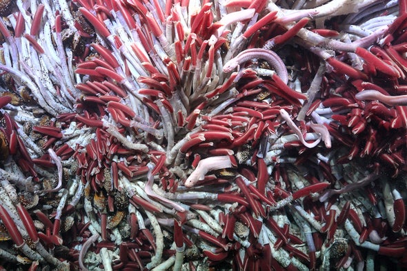
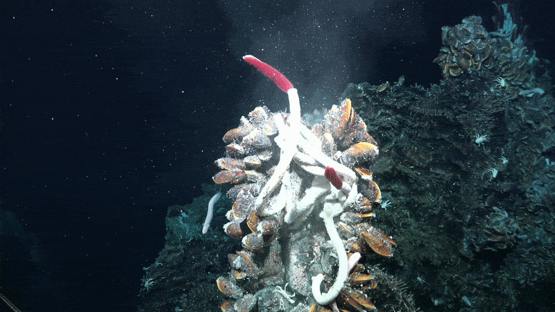
Superheated fluid streams past tubeworms and other creatures that dwell around hydrothermal vents on the East Pacific Rise.
Credit: ROV SuBastian/Schmidt Ocean Institute (CC BY-NC-SA 4.0)

The team focused its ROV dives on an area where diverging tectonic plates create a string of deep-sea volcanoes known as the East Pacific Rise.
As the plates drift apart, magma bubbles up from the rift and cools to create new oceanic floor.

These volatile conditions fuel hydrothermal vents.
Frigid water percolates through fissures in the splintering oceanic crust and meets the scalding magma below.
When the seawater is heated to temperatures of more than 400 degrees Celsius, chemical reactions create a supercharged fluid that is rich in chemicals such as sulfur, and it spews out of openings in the ocean floor.

These geyserlike vents are hotspots of deep-sea diversity that can thrive in the dark, thanks to bacteria that convert chemicals into energy-providing sugars.
Some of these bacteria reside inside the elongated bodies of giant tubeworms (Riftia pachyptila).
These worms, whose exposed bright-red, feathery gills make them look like six-foot-long lipstick tubes, grow in dense patches around the vents and provide habitats for other vent dwellers.

When eruptions or earthquakes alter the area’s volcanic activity, these strongholds of hardy worms are wiped out.
But when new hydrothermal vents pop up dozens or even hundreds of kilometers away, they are quickly colonized by towering thickets of giant tubeworms within a few years.

Just how these worms arrive and anchor themselves at new vents remains unknown, Bright says.
Scientists have found few tubeworm larvae in the water column surrounding vents, and constant stream of supercharged fluid would also make it difficult for the larvae to attach themselves from above.
This led the researchers to hypothesize that tubeworm larvae were squirming through crevices below the seafloor to reach new vents.

"We do not fully understand how the animals who live on hydrothermal vents find them and come to the vents." 
The #VentUnderworld team has embarked on an expedition to determine how animals are transported to hydrothermal vents and build communities.
The team suspects that the answer does not solely lie in the waters above the vents but also in the hydrothermal fluid circulating in the earth's crust.
They have created a new piece of equipment, called a Mesh Box Staining Gadget, to determine if life is traveling through earth's crevices to form ecosystems on hydrothermal vents.
"We need to know the connectivity between the different habitats, the different environments. The more we know about everything, the more we can also protect it."
Expedition: FKt230628 - The Underworld of Hydrothermal Vents - Week 1
 

Working as part of a team on Research Vessel Falkor (too) creates a situation ripe for the spreading of knowledge and cross-collaboration. 
Scientists are close to - and may work on - projects that are not in their precise field of expertise. "Through doing that, you learn a lot about sort of different methods that people use and learn from: not only the hard skills of science, but also the soft skills of the creativity, the precision, the attention to detail." 
The team has been conducting experiments, gathering samples, and measuring data around hydrothermal vents, making tremendous strides in gaining knowledge about these areas. 
The teamwork happening on board is key to success: "I think this is something special about going on expeditions [at sea], because everyone is interested in different aspects of the deep sea, and then you get to know a lot about the whole ecosystem, not only your specific subject."
 
While conducting their seafloor experiments, the #VentUnderworld team encountered fantastical creatures from the Ocean's surface down the seafloor.
Pelagic rays, thresher sharks, oceanic white tip sharks, phantom jellyfish, larvaceans, and the charismatic glass octopus are just some examples.
On the seafloor, SOI's stellar ROV pilots aided the scientists in deploying and adhering new scientific equipment known as "Mesh Box Staining Gadgets."
These experiments were intended to collect data on whether or not hydrothermal vent animals are traveling through the vent systems below Earth's surface.
Expedition: FKt230729 - The Underworld of Hydrothermal Vents - 4K ROV Highlight Reel
 
To test this idea, the scientists sent the ROV down to the Tica Vent, a well-studied hydrothermal vent located 2,500 meters below the ocean’s surface.
Initially, the team glued mesh boxes over cracks in the seafloor to collect animals that moved between the rocky floor itself and the subsurface below.
But when the boxes proved cumbersome, the team employed a more direct method: flipping over heavy chunks of seafloor with the ROV’s robotic arm to collect what lay beneath.

This uncovered an underworld labyrinth.
In a network of caves and crevices carved through the rock, the water was a balmy 25 degrees C.
This provided the perfect conditions for a thriving microbial community of protists, bacteria, viruses and even some larger creatures such as snails and worms.

While the team is the first to peer below the seafloor around these hydrothermal events, its discovery is not entirely surprising to Julie Huber, a geochemist at the Woods Hole Oceanographic Institution, who was not involved in the expedition.
She notes that the oceanic crust along mid-ocean ridges is porous, offering plenty of real estate for fluids, nutrients and microbes.
“Given most of the animals at hydrothermal vents require all three of these things to thrive, I suppose it makes sense that animals are carving out another niche to attach themselves to and make a living,” Huber says.
She also thinks residing below the seafloor may help keep these tiny critters safe from prowling deep-sea crabs.
 
 
A rock crust sample, flipped upside down, reveals Oasisia and Riftia tubeworms, as well as other organisms.
Credit: ROV SuBastian/Schmidt Ocean Institute (CC BY-NC-SA 4.0)


Below the vents, the researchers also discovered a lot of tiny tubes, which revealed that these subsurface chambers serve as tubeworm nurseries.
The scientists posit that tubeworm larvae traverse this subsurface maze, which Huber refers to as the “subseafloor conveyor belt,” to travel from vent to vent.
The tubeworms initially live down there before moving up toward the vents as they grow as much as 85 centimeters per year.

Many mysteries remain about the realm below hydrothermal vents, however.
Bright and her colleagues plan to sequence the genetics of animals and microbes collected both above and below the seafloor to examine how these two ecosystems are connected.
“As a scientist, you find out something, and then there [are] 10 more questions you have,” Bright says.

Bright and her colleagues hope that shedding more light on the inner workings of hydrothermal vent ecosystems will help shield them from development.
These areas are of potential interest to deep-sea mining companies because of the minerals that leach out of the magma-heated water as it gushes out of the vents.

That economic incentive could endanger one of the planet’s most unique environments, a realm that Bright says scientists still struggle to comprehend.
“From our view these vents are very extreme and exotic,” she says.
“But for the animals, it’s not extreme to live at these pressures with fluctuating temperatures and fluctuating chemistry—it’s normal.”
 
Links :

Monday, August 28, 2023

World's strangest research vessel heads for scrapyard after 60 years

FLIP in 2016 (Scripps)
From Maritime Executive

The Scripps Instition of Oceanography's innovative Floating Instrument Platform (FLIP) has been towed off into the sunset for the last time.
It may well have been the strangest, most recognizable research vessel ever built - and its users remember that it was exceptionally effective.

For more than 50 years, FLIP provided a stable research station at sea for Scripps' scientists and their colleagues from around the world.
The one-of-a-kind vessel (technically a platform) could be partially flooded to sink the stern and change the orientation of its buoyancy.
In less than an hour, it could transition seamlessly from a horizontal barge for transit into a vertical spar platform for stationary operation.
To refloat from vertical to horizontal mode, the crew would pump out the ballast tanks with compressed air, and the vessel's stern would rise back up to the surface.

By design, FLIP was minimally affected by ocean swells, and it provided scientists an extra-stable, extra-quiet platform for sensitive experiments.
Physical oceanographic research conducted aboard FLIP produced "exquisite" data, according to ONR Ocean Sensing Battlespace Department director Dr.
Tom Drake, and established a "gold standard" for ocean modeling to support U.S. Navy research objectives.


Watch Scripps "sink" one of it's most famous science tools.
 
“It was like being on land except in the middle of the ocean. It was just glorious,” remembered Scripps oceanographer John Hildebrand, who used the platform's stability and relative silence to study marine mammal sounds.
“There were things you could do with it that you couldn’t do any other way.”

Planning for FLIP's creation began at the National Research Council Committee on Oceanography in the late 1950s, according to Scripps scientist and longtime FLIP researcher Rob Pinkel.
The committee's list of top priorities included a deep-diving submersible - the famous Alvin - and FLIP.

The unique spar platform was designed and built by Scripps, and it launched in 1962.
Most of its core mission systems were designed to rotate through 90 degrees, from the air compressors to the galley cabinets.
The diesel generators were mounted on gimbals and connected to their fuel and exhaust piping using flexible hoses.


“FLIP set the stage for thinking big about what could be done with technology to enable new scientific discoveries,” said Scripps’ Marine Physical Laboratory (MPL) Director Eric Terrill.
“It was built in an era of risk-taking; a spirit that we try to embrace to this day and encourage in the next generation of seagoing scientists.”

The venerable spar vessel has been towed off for the last time, but a piece of it remains at Scripps.
The institution has arranged for one of FLIP's booms to be removed and mounted onto a pier, where it will continue to be used to deploy instruments into the water.

Links :