Saturday, June 4, 2022

This Open Ocean robot is designed to stop the maritime mafia


It does not matter where it happens - very close to the coast or in the most remote areas of the planet. Illegal, unreported, and unregulated fishing is one of the main drivers of the deterioration of the world's oceans condition.
At the same time, this issue often remains out of sight, against the backdrop of problems with pollution. Given that this is a black market controlled by the maritime mafia, it is difficult to estimate its volume. Experts voice the annual volume of 11 or even 26 million tons.
This is at least 14 percent of the total legal catch in the world. And perhaps the crime syndicates are responsible for the catch of every third fish in the world's oceans. 
n money, this market is estimated at 20-30 billion dollars.
Why is this scary?
Poachers completely ignore the established norms for catching fish.
It gets smaller, becomes petty, its qualities deteriorate, and then it dies out.
But that is not all. Crime maritime syndicates use inhumane methods of catching fish.
For instance, trawling, which destroys the natural ecosystem.
They also use modern, high-tech ships that allow them to identify large schools of fish and catch them completely.
If everything is left as it is, then the ocean ecosystem will be destroyed irreversibly. And it is impossible to imagine all the consequences for the world.
Therefore, the problem needs to be addressed now.

Friday, June 3, 2022

Fishing industry still ‘bulldozing’ seabed in 90% of UK marine protected areas

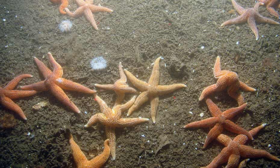
Starfish and anemones at Dogger Bank in the North Sea, where a ban on bottom-trawling will shortly take effect. The harmful practice continues at 58 other sites. Photograph: JNCC/PA

From The Guardian by Karen McVeigh

New data shows ‘mystifying’ lack of progress in post-Brexit pledge to curb bottom-trawling, two years after landmark legislation

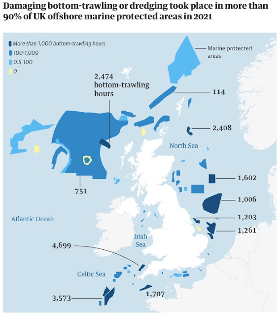
More than 90% of Britain’s offshore marine protected areas are still being bottom-trawled and dredged, two years after analysis of the extent of destructive fishing exposed them as “paper parks”, according to data shared with the Guardian.

The UK’s network of marine parks, set up to safeguard vulnerable areas of the seabed and marine life, is a cornerstone of the government’s target to protect 30% of ocean biodiversity by 2030.

But analysis of fishing vessel tracking data from Global Fishing Watch (GFW) and Oceana, a conservation NGO, found that fishing with bottom-towed gear took place last year on 58 out of 64 offshore “benthic” MPAs, which aim to protect species that live on the seabed.
A total of 1,604 vessels, including industrial boats, spent 132,267 fishing hours in these MPAs in the UK, it found.

Vessels with bottom-towed gear – the most destructive type of fishing, involving dragging weighted nets across sea floor habitats – spent at least 31,854 hours in MPAs in 2021.
This is likely to be an underestimate, Oceana said, as it could only identify gear type for 837 boats, just over half of those detected, due to a lack of publicly available data.
The vast majority were industrial vessels, it said.
 
Guardian graphic. Source: Oceana.
Note: Fishing hours is for bottom-towed fishing gears only, having analysed Global Fishing Watch figures and cross-referenced with Marine Management Organisation data

When vessels with bottom-towed gear fish in marine parks, it prevents the recovery of ecosystems already lost to decades of exploitation, and limits the seabed’s ability to store carbon and combat the effects of the climate crisis.
Greenpeace has described this type of fishing in MPAs as akin to “bulldozing national parks”.

Bottom-trawling is banned in just two MPAs, to date, with another four to be protected in June.

Melissa Moore, head of UK policy at Oceana in Europe, said that Oceana’s analysis “is further proof that this damaging activity is pervasive.
Yet still the UK and devolved governments have licensed this to occur throughout 2022 as well, contravening nature laws. They are destroying habitats for the future.”

Post-Brexit, the UK has granted licences for thousands of vessels to fish in all UK waters, including in all but two offshore MPAs. 
“No other activities, not houses, roads or ports, are licensed first and assessed later,” Moore said. 
“Yet this is what happens with fishing, despite the law being clear that you must not license activities until it has been proven they do not have an adverse effect on the site.”

The offshore habitats regulations say no activities can be licensed on special areas of conservation unless an assessment confirms they will not adversely affect site “integrity”.
In April, after Oceana and other groups raised legal concerns, the government committed to adopting fisheries management for all its MPAs by 2024.

The UK has had powers to ban bottom-trawling in MPAs since Brexit, via the 2020 Fisheries Act.
Two years later, no bans are in place, although on 13 June, new laws to outlaw the practice in four MPAs come into effect.

These include Dogger Bank, a vital North Sea breeding ground for commercial species including cod and whiting, as well as sand eels – eaten by kittiwakes, puffins and porpoises.
It is also an important site for blue carbon, the CO2 sequestered and stored in coastal and marine ecosystems.

The four MPAs represent a tenth of offshore MPAs, leaving 90% unprotected.
Last month, the government announced that a further 13 are being examined, as part of its “post Brexit freedoms to protect rare and valuable marine habitats and species”.

But NGOs damned the government’s plans as “too slow”, “unambitious” and unlikely to deliver its 2030 target to protect 30% of the ocean.
They say introducing licence conditions to all industrial vessels, banning them from fishing in MPAs, would allow faster and better protection.

Charles Clover, executive director of the Blue Marine Foundation, said: “The government was under an obligation to protect these areas on day one of Brexit. They are so far behind in compliance [with] their own laws, it is mystifying. And it makes them vulnerable to legal challenges.”

Will McCallum, of Greenpeace, said: “It’s taken two years for the government to introduce trawling bans on four MPAs. The whole thing is taking too long and at the end, you have a ban on a single gear type – bottom-towed gear. But, in theory, a supertrawler could go straight though it.”

A spokesperson for the Department for the Environment, Food and Rural Affairs (Defra) said: “It is untrue to say that little has changed. We have passed our landmark Fisheries Act 2020, we are consulting on the joint fisheries statement, we are stopping damaging trawling and dredging in four marine protected areas, and we have asked for evidence to support the management of 13 further MPA sites. Our £100m UK seafood fund is supporting innovation and sustainability, to ensure that our fishing sector is the most sustainable in the world.”

Defra is expected to consult soon on highly protected marine areas – defined as areas which allow for the protection and recovery of marine habitats by banning destructive fishing methods.

A Scottish government spokesperson said: “The Scottish government is committed to designating highly protected marine areas (HPMAs) covering at least 10% of Scotland’s inshore and offshore waters by 2026 – before the end of the current Scottish parliamentary term.
This is a world-leading commitment – it meets the EU 10% target but in a shorter timeframe.

“HPMAs will prohibit all extractive, destructive, depositional activities and allow other activities only at non-damaging levels. We have committed to delivering fisheries management measures for existing MPAs, where these are not already in place, by March 2024 at the latest.”
 
Links :

Thursday, June 2, 2022

How to rehabilitate old oil supertankers

(Image credit: Getty Images)

From: BBC by Richard Gray

The enormous ships that ferry crude oil around the world embody the fossil fuel era and its legacy of pollution.
But can they be transformed to be good for the environment?


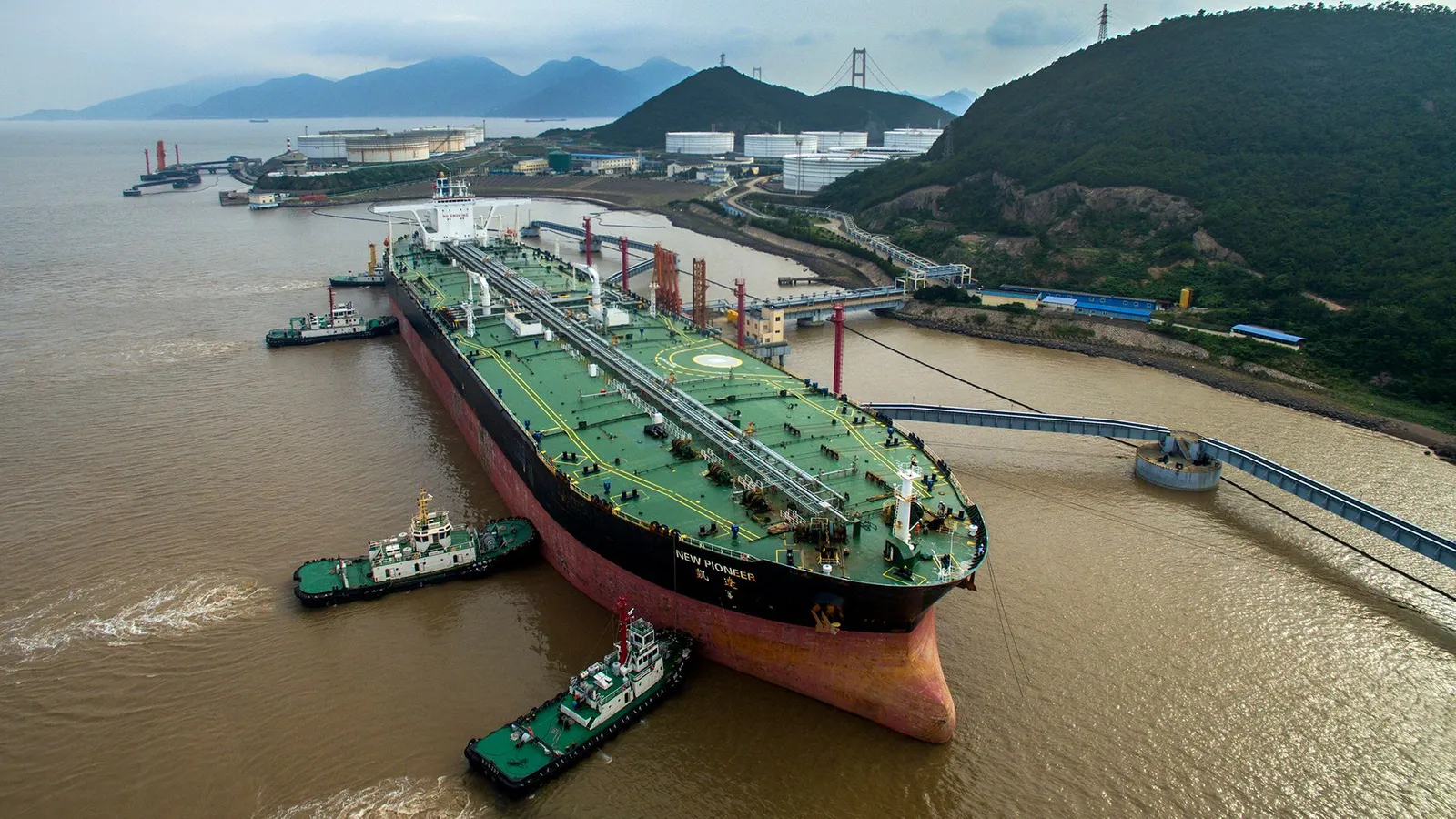
As you read this, around 10,420 giants are heaving their way across the world’s oceans.
Their enormous metal bodies lumber onwards in spite of inclement weather and rough seas.

In their bowels, these beasts are carrying 3.8 billion barrels of crude oil among them, enough to fuel around 418,000 transatlantic flights and for the world’s cars to cover around 3 billion miles between them.
Their sticky cargo is the raw material for billions of plastic bags, combs, trainers, drinking straws, synthetic clothing, toys, water bottles and hundreds of other plastic-based goods that we use in our daily lives.

There are few vessels that better symbolise the achievements and the problems of our thirst for fossil fuels than the oil tanker.
Their number include some of the largest moving human-made objects on the planet – vessels of intimidating scale.
Without them, our modern lives would grind to a halt.
But as they chug relentlessly across the oceans, these supertankers release their own thick plumes of pollution into the atmosphere and, on occasion, into the water.

 
As the world moves towards more renewable energy sources and non-fossil fuel based products, there are some looking to find new jobs for oil tankers to do
(Credit: Getty Images)

In a world where climate change poses a very real threat – one that could force us to wean ourselves off our fossil fuel habit – the diminishing demand for oil tankers could produce new problems.
As renewable energy, bio-based plastics and other sustainable materials reduce our reliance on oil, what will we do with the gigantic vessels that currently carry it around the world?

There are some who believe these dirty monoliths of the oil age can be rehabilitated by transforming them into sources of clean, renewable energy

Like most sea-going ships, they could be sent to the scrapheap, their bodies cannibalised for valuable metal that can be melted down and reused.
But disposing of them is a dirty, dangerous and poorly paid business for those who undertake this work in some of the most deprived parts of the world.

There are some, however, who believe that these dirty monoliths of the oil age can instead be rehabilitated – they want to transform them into sources of clean, renewable energy.
Engineers believe it is possible to use the vast hull of oil tankers to create floating power stations that can convert the ocean swell into electricity.
This is the ambitious plan to create the world’s first “waveships”.

“The current problem with most wave energy projects is that they are fixed in place, close to the shore so they can be connected to the electricity grid,” says Andrew Deaner, managing director of ShipEco Marine, the company behind the waveship project.
“This isn’t necessarily where the best waves are.
With a ship you are mobile, so you can move to the edge of low-pressure weather systems where the waves are bigger and there is more energy.”

Transforming a supertanker into an environmentally friendly mobile power station draws on other areas of the oil industry for its inspiration.
Growing up, Deaner spent a great deal of time on diving support vessels built by his father for installing and repairing oil wells and pipelines on the sea bed.
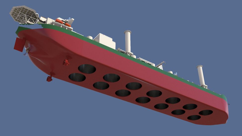
These vessels have special chambers cut through their hulls, known as moon pools, which allow divers and submersible vehicles to be lowered safely into the ocean.


Oil supertankers are among the largest vessels to be built by humans but disposing of these giants at the end of their life is problematic
(Credit: Getty Images)

On choppy seas, the water levels in these moon pools can move up and down as waves pass along the length of the ship.
This in turn can change the air pressure inside the chamber above the pool of seawater as it rises and falls.

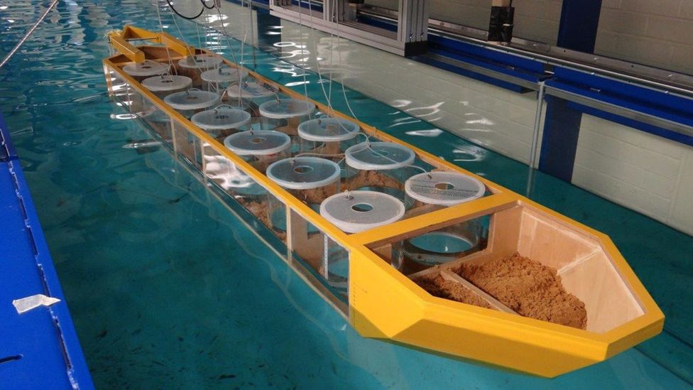
“It works like a giant piston,” says Florent Trarieux, a renewable energy engineer who led tests on the waveship concept in scale models at Cranfield University.
“We would put a turbine at the top of the chamber that is driven by the air as it is pulled back and forth by the water.
We could put these in columns all down the length of a ship like an oil tanker.”

While cutting holes in the bottom of a ship might not seem like the smartest move, tests by Trarieux have shown the huge displacement that oil tankers generate would help to ensure they remain buoyant.
Depending on the hull size, the team believe a tanker could have a capacity to produce between 10 and 30 megawatts of electricity.
A very large tanker could have up to 35 moon pools, each 20m in diameter, they say.


Laboratory tests have shown that the waveship concept is at least feasible, according to the company
(Credit: ShipEco Marine)

The technology needed to do this is far from pie-in-the-sky.
In the 1970s the Japan Marine Science and Technology Center built a boat shaped buoy that used air turbines at the top of 22 bottomless chambers cut into the hull.
But tests of the vessel, which was anchored in the Sea of Japan, showed its ability to absorb energy from the waves was “disappointing”.

More recently, however, engineering giants Siemens have developed a more efficient “hydroair” turbine that can turn the oscillating flow of air inside a water filled chamber into electricity.
Another firm, called Ocean Energy, has also built buoys that use a similar principle that are being tested in the Atlantic Ocean.

Like many other wave energy devices, these systems are mounted on platforms that are moored in place and so rely upon the weather at a single spot in the ocean to generate sufficient waves.
Wave energy generators also need to be able to transmit the electricity they produce back to shore, and so need to be close to the coast so they can be connected through cables.

Putting oscillating air flow turbines above moon pools on board ships could allow them to chase storms around the oceans to get the best waves

Deaner and Trarieux, however, believe this is limiting the potential of wave power.
They say that putting oscillating air flow turbines above moon pools on board ships could allow them to chase storms around the oceans to get the best waves.

“Effectively we would be going ‘fishing for energy’,” says Trarieux.
Out on the open ocean where unimpeded winds can generate larger waves, the amount of energy that can be generated is many times greater than can be produced in
 coastal areas.
“It is a completely different approach to wave energy.”


Dozens of moon pools could be cut into the hull of a repurposed oil tanker to turn it into a mobile power station
(Credit: ShipEco Marine)

The project has already received the backing of the UK government, which funded some of the feasibility studies and scale model tests.
These have shown that the tankers can be modified to create moon pools without compromising their strength and stability, according to Trarieux.

The next challenge is getting hold of a suitable ship.
Second-hand oil tankers are not cheap and even an ageing, relatively small ship can cost millions of dollars on the open market.
But the team believe the prevailing wind could work in their favour as the world moves away from using fossil fuels.

All that steel could be cut up and reused, or we could repurpose them to make wave energy – Florent Trarieux

“There are thousands of oil tankers currently in operation and hundreds reaching the end of their service lives every year,” says Trarieux.
“All that steel could be cut up and reused, or we could repurpose them to make wave energy.”

The number of large oil tankers being scrapped reached record levels in 2018, with more than 100 vessels being sent for demolition.
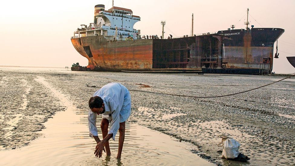
The majority ended up on beaches in Bangladesh, India and Pakistan where they are taken apart by unskilled workers, often with little or no safety equipment.
The life expectancy of those doing this dangerous work at these enormous shipbreaking yards has been estimated to be 20 years lower than the general population in these countries and the industry has faced accusations of human rights abuses.
Environmental campaigners have also raised concerns about the hazardous substances and pollutants that leach out from the ships as they are dismantled, which has led to calls for stricter environmental regulations around ship breaking.


Oil tankers sent for scrapping are often run aground on beaches in Bangladesh where they are dismantled by hand by poorly paid unskilled workers
(Credit: Getty Images)

Converting these vessels into waveships could be a tempting alternative to scrapping them.
“Transforming old oil tankers, used to ship millions of gallons of oil around the world, into a potential clean energy source is yet another example of the UK leading the global shift to clean growth,” says Claire Perry, energy and clean growth minister in the UK.

If someone wanted to put a chocolate factory on the deck of our waveship we could actually be manufacturing products as it is being shipped to markets around the world – Andrew Deaner

But Deaner’s vision goes beyond simply turning them into power stations where the energy will be stored on board in expensive, heavy batteries.
Instead, he sees these giant ships becoming floating, self-sustainable factories by putting the electricity they produce to immediate use.

“We are looking at making products onboard so we are not tied to any electricity grid connection,” he says.
“We are looking at producing fresh water – we think we could make somewhere between 18,000 and 36,000 tonnes a day before bringing it ashore.
We could also make hydrogen or liquid nitrogen, which we could sell to industry.

“But if someone wanted to put a chocolate factory on the deck of our waveship we could actually be manufacturing products as it is being shipped to markets around the world.”


Their vast size could allow supertankers to be turned into iconic shoreside public buildings
(Credit: Chris Collaris Design)

But not everyone is convinced by the idea.
Stephen Salter, a leading wave energy expert at the University of Edinburgh who invented one of the early wave energy devices commonly known as Salter’s Duck, says air turbines may struggle to cope with the wide range of flow speeds caused by natural waves on the ocean.
He also worries about how resilient an oil tanker would be on the high seas with holes cut in its hull.

“Cutting a round hole raises stress by a factor of three,” he says.
“If the tanker designer did a good job, then a great deal of modification will be needed.
Any sharp corners will also dissipate lots of energy.”

But there could be some alternative uses for the world’s discarded oil tankers.
One New York-based artist recently proposed tipping a 300-metre-long supertanker on its end and anchoring it vertically in a harbour as a visual reminder of the need for mankind to end the fossil fuel era.

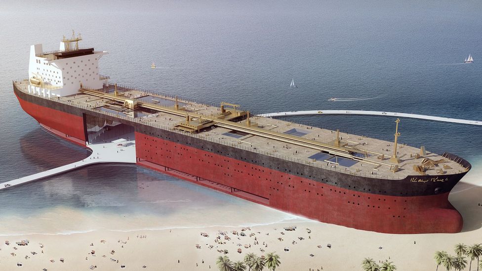
A group of Dutch architects have also proposed turning old supertankers into floating public villages that contain shopping malls, concert venues, museums, swimming pools and a public park on the top deck.
But the firm behind the concept, Chris Collaris Design, say they have yet to find anyone brave enough to take the concept further.


Thousands of tankers are responsible for transporting crude oil around the world so it can be refined into fuel and hundreds of other products
(Credit: Getty Images)

But anchoring an oil tanker in such a way that it can be safely boarded and used by thousands of people is a tricky problem.
Others believe it may be better to turn these enormous steel beasts into something that provides services to people rather than being somewhere they can meet and gather.

A Norwegian company called EnviroNor is developing technology it hopes can be used to convert oil tankers into mobile waste water treatment plants.
These offshore treatment plants could then be sent to cities around the world that are struggling with water shortages.
EnviroNor say a single tanker could treat the waste water from a city of 250,000 inhabitants.
Mooring these converted tankers alongside wind farms, they could also use renewable energy to desalinate water for coastal cities.

Since 1985, 39 tankers of various sorts have been sunk off the coast of the US and one off the coast of Malta

But one of the most common current uses for old oil tankers after scrapping is perhaps also the most surprising – turning them into wildlife havens.
Oil tankers are more commonly associated with harming marine life due to spills after accidents, but at least 40 of these vessels have been deliberately sunk to create artificial underwater reefs.

“If they are cleaned properly, oil tankers have a very big surface for things to attach to underwater and they will have a long lifespan,” says Dalia Conde, director of science at Species360, an international conservation research organisation, who recently created a global database of ships that have been deliberately wrecked to create artificial reefs.
“There is the potential to attract a lot of fish, molluscs, different seaweeds.”


Underwater wrecks of oil supertankers like the Amoco Milford Haven that sank off the coast of Italy in 1991 can become havens for marine life
(Credit: Alamy)

Cleaning up an oil tanker is an expensive business, though – it can cost several million dollars to mop up all the toxic mess that accumulates in these vessels.
But since 1985, 39 tankers of various sorts have been sunk off the coast of the US and one off the coast of Malta.
Unfortunately, little work has been done to monitor the impact these vessels have had on the ocean environments where they were sunk.

Anecdotal reports from divers who have visited some of these tankers, however, suggests they host a rich diversity of life including lobsters, shellfish, barracuda and sharks.
The wreck of the supertanker MT Haven, which sank off the coast of Genoa, Italy after an explosion on board in 1991 has also become a popular diver site.
Although 40,000 tons of oil poured into the sea in the accident, it has since become home to a wide array of marine animals.

“It is surprising that so many of these ships have been deliberately sunk to provide habitats for fish,” says Conde.
“But we need to start monitoring these sites properly.
With the crisis we are facing in our oceans and climate, it would be good if there was a way of using ships like oil tankers to do some good.”

Wednesday, June 1, 2022

Arctic shipping routes are expanding faster than predicted

Observations of sea ice show that large stretches of the Arctic Ocean are remaining ice-free long enough for ships to reliably transit through—something that wasn’t expected to happen to this degree for decades.
Photo by Jean Landry/Alamy Stock Photo
 
From Hakai Mag by Michaƫl Allen

As ice melts, navigable routes have opened in ways that were not expected until the middle of this century.

As the climate warms and sea ice melts, trans-Arctic shipping routes are becoming easier to navigate, a prospect that is enticing to freight companies.
These routes can cut up to 9,000 kilometers off a one-way trip between East Asia and Europe compared with shipping through the Suez or Panama Canals—shortcuts that clip roughly 40 percent off the voyage.

According to a new study, the reality of routine trans-Arctic trade could come sooner than expected. Using satellite data on daily sea ice between 1979 and 2019, the researchers found that the safe navigation season for open-water vessels in the Arctic—trips that could be embarked upon without the help of icebreakers—is already significantly longer than climate models anticipated.

With a few exceptions, most shippers avoid the hostile Arctic Ocean.
But according to Kuishuang Feng, an ecological economist at the University of Maryland who worked on the new study, observational data shows that rather than being commercially navigable by the middle of the century, as many climate models predict, several trans-Arctic routes are already navigable for large chunks of the year—and they have been for a while.

The team found that open-water ships could have been traveling through the Canadian Arctic Archipelago along the fabled Northwest Passage for more than two months of the year during the 2010s.
Captains wanting to travel between the Atlantic and Pacific Oceans along the Norwegian and Russian coasts could have done so for even longer.
This Northeast Passage was open for around three months of each year—long enough for freight carriers to make at least two round trips between ports in East Asia and Europe without any assistance from icebreakers.

According to the researchers, these routes would have only been occasionally navigable in the 1980s, and depending on the climate projections used, they were open for around two to four times longer than expected in the 2010s.


Over the past several decades, the navigability of the Arctic Ocean for open-water ships—that is, ships without any icebreaking ability—has increased considerably.
Researchers assessed a number of variables, including the prevalence of sea ice, to determine the risk to different kinds of ships. Illustration courtesy of Feng et al.

Since 1979, the area of the Arctic that is safe for open-water vessels for 90 days of the year has increased by 35 percent, the researchers claim.
With this, the routes these ships can take have changed. For instance, the best path along the Northwest Passage has shifted northward from the Amundsen Gulf to a shorter route through the Parry Channel, one that was predicted to be unnavigable until the mid-21st century.

Siri Veland, a human geographer at Norce, a Norwegian research center, says that while the finding that trans-Arctic shipping routes can be used now is not new—limited commercial trips operated over the past decade by Russian, Chinese, and Danish shipping companies, among others, is proof enough of that—“it does seem that [the researchers] have picked up a few windows for navigability that maybe have been off people’s radar.”

Veland cautions, however, that “when you have the benefit of hindsight [the Arctic] looks a lot more navigable than when you are trying to forecast.”
The problem that navigators face is interannual sea ice variability.
Year to year, there is a high variability in the exact number of days with low sea ice, particularly at either end of the summer.
This makes sending ships through the Arctic very risky, and Veland does not expect this variability to decrease for another decade or two.

But Feng did find that since 2004 open-water vessels have been able to travel through the Arctic for the whole of September.
And one of his collaborators in China who has been talking to commercial shipping companies discovered that they are already going out with ships and icebreakers and testing the routes.
“They just try to explore the possibilities,” Feng says.

Links :

Tuesday, May 31, 2022

NOAA predicts above-normal 2022 Atlantic Hurricane Season


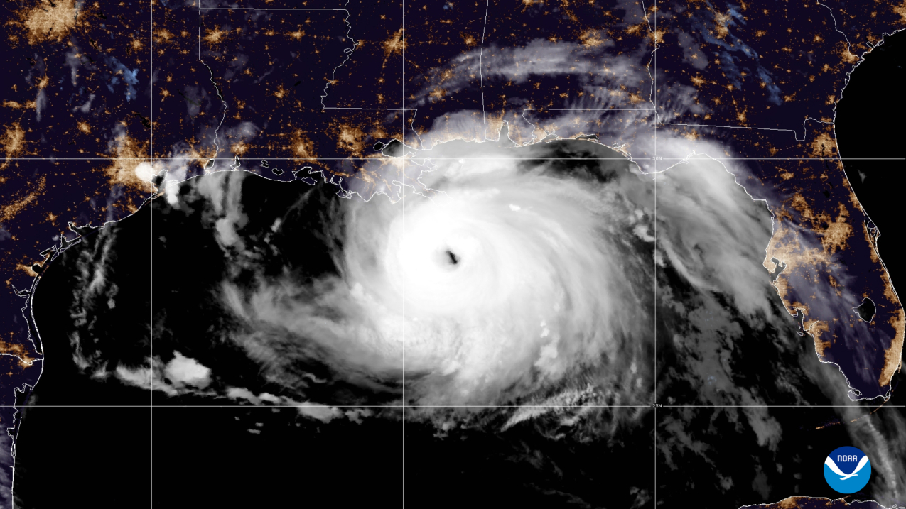
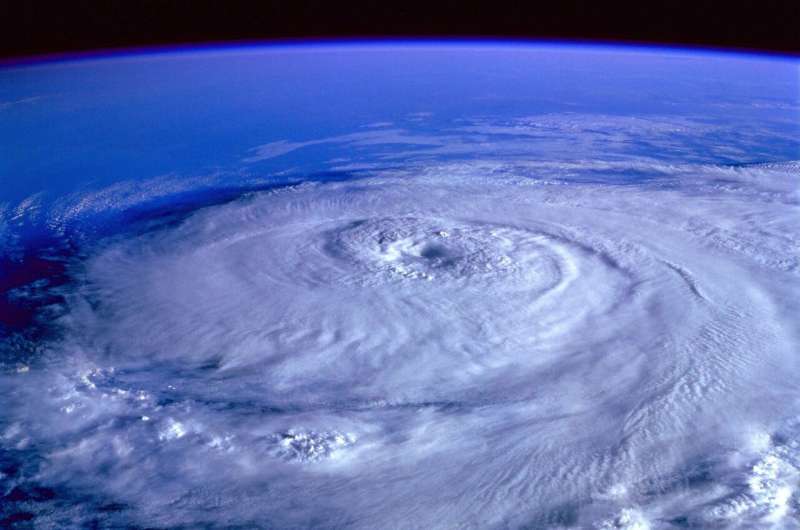
A visible satellite image of Hurricane Ida approaching land in the Gulf of Mexico taken by NOAA's GOES-16 (GOES East) satellite at 4:10 am (EDT) on August 29, 2021. (NOAA)

From NOAA by Jasmine Blackwell
 
Ongoing La NiƱa, above-average Atlantic temperatures set the stage for busy season ahead

Forecasters at NOAA’s Climate Prediction Center, a division of the National Weather Service, are predicting above-average hurricane activity this year — which would make it the seventh consecutive above-average hurricane season.

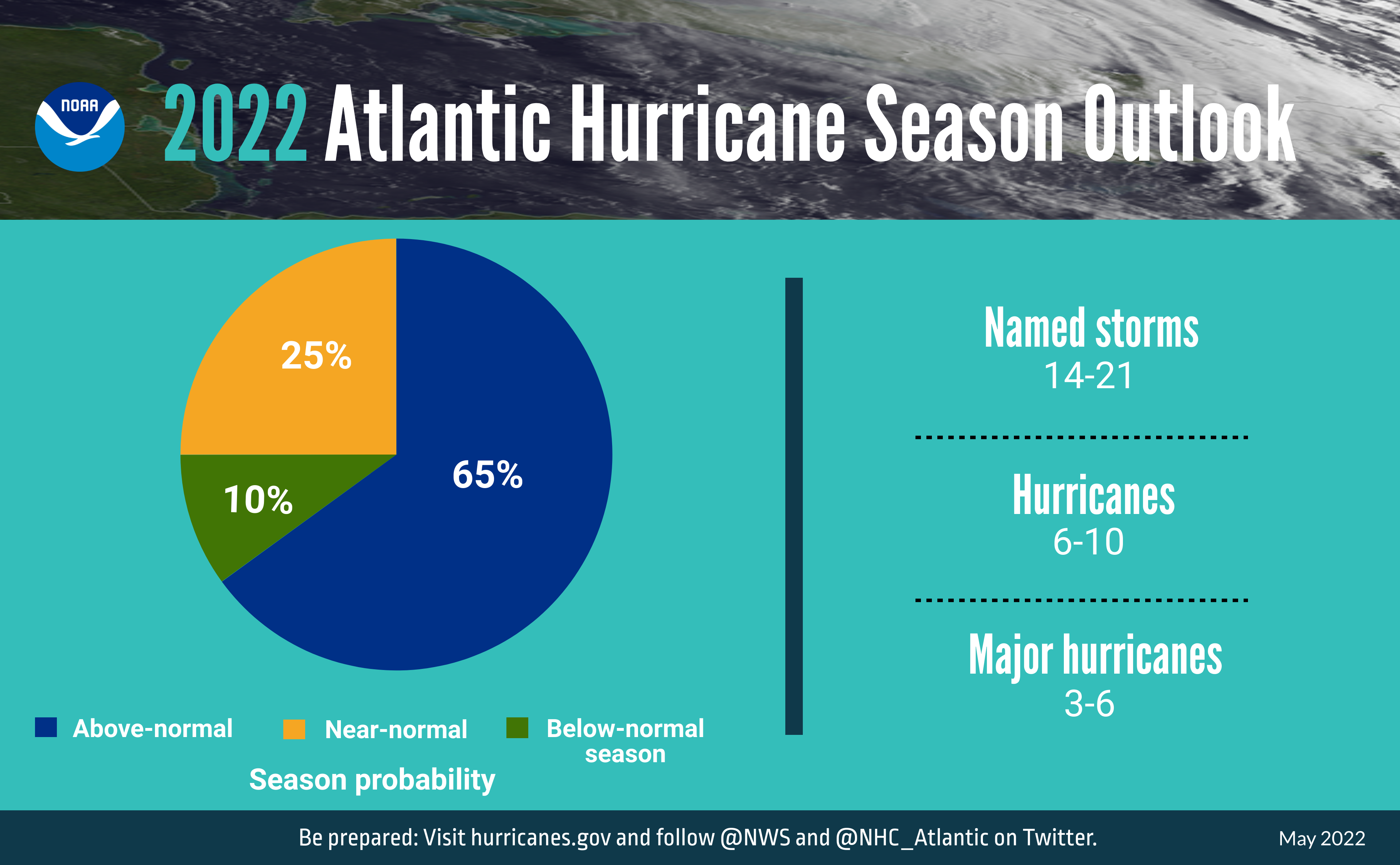
NOAA’s outlook for the 2022 Atlantic hurricane season, which extends from June 1 to November 30, predicts a 65% chance of an above-normal season, a 25% chance of a near-normal season and a 10% chance of a below-normal season.

For the 2022 hurricane season, NOAA is forecasting a likely range of 14 to 21 named storms (winds of 39 mph or higher), of which 6 to 10 could become hurricanes (winds of 74 mph or higher), including 3 to 6 major hurricanes (category 3, 4 or 5; with winds of 111 mph or higher). NOAA provides these ranges with a 70% confidence.
 
A summary infographic showing hurricane season probability and numbers of named storms predicted from NOAA's 2022 Atlantic Hurricane Season Outlook. (NOAA)

“Early preparation and understanding your risk is key to being hurricane resilient and climate-ready,” said Secretary of Commerce Gina M. Raimondo. 
“Throughout the hurricane season, NOAA experts will work around-the-clock to provide early and accurate forecasts and warnings that communities in the path of storms can depend on to stay informed.”

The increased activity anticipated this hurricane season is attributed to several climate factors, including the ongoing La NiƱa that is likely to persist throughout the hurricane season, warmer-than-average sea surface temperatures in the Atlantic Ocean and Caribbean Sea, weaker tropical Atlantic trade winds and an enhanced west African monsoon.
An enhanced west African monsoon supports stronger African Easterly Waves, which seed many of the strongest and longest lived hurricanes during most seasons.
The way in which climate change impacts the strength and frequency of tropical cyclones is a continuous area of study for NOAA scientists.
 
A summary graphic showing an alphabetical list of the 2022 Atlantic tropical cyclone names as selected by the World Meteorological Organization. The official start of the Atlantic hurricane season is June 1 and runs through November 30. (NOAA)

“As we reflect on another potentially busy hurricane season, past storms — such as Superstorm Sandy, which devastated the New York metro area ten years ago — remind us that the impact of one storm can be felt for years,” said NOAA Administrator Rick Spinrad, Ph.D. “Since Sandy, NOAA’s forecasting accuracy has continued to improve, allowing us to better predict the impacts of major hurricanes to lives and livelihoods.”

Additionally, NOAA has enhanced the following products and services this hurricane season:To improve the understanding and prediction of how hurricanes intensify, NOAA’s Atlantic Oceanographic and Meteorological Lab and Pacific Marine Environmental Lab will operate five Saildrone uncrewed surface vehicles during the peak of the 2022 hurricane season and coordinate for the first time with uncrewed ocean gliders, small aircraft drone systems, and NOAA Hurricane Hunter aircraft to measure the ocean, atmosphere and areas where they meet.
The Hurricane Weather Research and Forecast Modeling System and Hurricanes in a Multi-scale Ocean-coupled Non-hydrostatic model, which have shown significant skill improvements in terms of storm track and intensity forecasts, have been successfully transitioned to the newest version of the Weather and Climate Operational Supercomputing System, allowing for uninterrupted operational forecasts.
The Excessive Rainfall Outlook (ERO) has been experimentally extended from three to five days of lead time, giving more notice of rainfall-related flash flooding risks from tropical storms and hurricanes.
The ERO forecasts and maps the probability of intense rainfall that could lead to flash flooding within 25 miles of a given point.
In June, NOAA will enhance an experimental graphic that depicts the Peak Storm Surge Forecast when storm surge watches or warnings are in effect.
Upgrades include an updated disclaimer and color coding that illustrates the peak storm surge inundation forecast at the coast.
This tool is currently only available in the Atlantic basin.
 
Credit: CC0 Public Domain
 
“Hurricane Ida spanned nine states, demonstrating that anyone can be in the direct path of a hurricane and in danger from the remnants of a storm system,” said FEMA Administrator Deanne Criswell. 
“It’s important for everyone to understand their risk and take proactive steps to get ready now by visiting Ready.gov and Listo.gov for preparedness tips, and by downloading the FEMA App to make sure you are receiving emergency alerts in real-time.”

NOAA’s outlook is for overall seasonal activity and is not a landfall forecast. In addition to the Atlantic seasonal outlook, NOAA has also issued seasonal hurricane outlooks for the eastern Pacific and central Pacific hurricane basins.
NOAA’s Climate Prediction Center will update the 2022 Atlantic seasonal outlook in early August, just prior to the historical peak of the season.

Links :

Monday, May 30, 2022

Letting the sea have its way


Near the community of Selsey, England, saltwater marsh and other coastal ecosystems have been allowed to reclaim what was farmland and is now known as the Medmerry Nature Reserve.
Photo by Gillian Pullinger/Alamy Stock Photo

From HakaiMagazine by Erica Gies

Welcome to Selsey, a community that welcomed back the marsh.

As climate-fueled floods and droughts wreak havoc around the world, a hard truth is emerging: sooner or later, water always wins.
But these devastating water extremes are not just due to climate change.
They are made much worse by our poor development choices aimed at controlling water.
The following excerpt is from the book Water Always Wins, in which Hakai contributor Erica Gies follows innovators in what she calls the Slow Water movement who are instead asking a revolutionary question: what does water want?

 
What water wants is to reclaim its slow phases—wetlands, floodplains, mangrove forests—that we’ve erased with development.
The Slow Water movement has parallels to Slow Food, drawing attention to water’s relationships with rocks, microbes, beavers, humans, and how our actions affect them.
Projects work with local geology, life, climate, and cultures rather than trying to control them.

On May 10, a four-bedroom house perched on the beach of a North Carolina barrier island in the town of Rodanthe collapsed into the ocean.
It was not the victim of a violent hurricane strike or storm surge.
Rather, a low-pressure system coupled with a high tide drew ocean waves onto the shoreline, leaving heaps of sand on the prophetically named Ocean Drive.
Then—in that viral video moment—the water gently pulled the house loose and set it to bob upon the sea.
It was not the first house—this year! that day!—nor will it be the last.

This is reality in the 21st century.
By 2100, high tides will likely inundate land that’s home to between 190 and 630 million people worldwide.
The range depends on whether humanity slashes carbon emissions by midcentury or, instead, continues to fail.
There is no longer any question that water is moving in and people must begin to move out.
For that homeowner in Rodanthe, water has dictated immediate retreat from the coastline.
Elsewhere around the world, people are beginning to leave coasts, usually on the heels of disasters or when they can no longer afford routine flooding or salt intrusion that fouls drinking water, kills plants, and spreads sewage.
But now scientists and government agencies are calling for a more deliberate, organized—and, in the long run, much cheaper—pullback.
It’s called strategic or managed retreat because it’s planned, as opposed to crisis driven.
It relinquishes the idea of control, of “holding the line,” in favor of accepting nature’s power and giving those protective ecosystems space to absorb wave energy and tides.


A home in Rodanthe, North Carolina, succumbs to the sea on May 10, 2022.
Photo by Cape Hatteras National Seashore


After decades of resistance to the idea, which detractors characterized as “giving up,” some communities are embracing it.
Today, managed retreat driven by pragmatism is an increasingly accepted component of government policies.
One of the most ambitious programs is in the United Kingdom, which is planning a countrywide step back from the sea.
With its thousands of kilometers of coastline exposed to the rough North Atlantic Ocean, the United Kingdom is mapping out where it will cease trying to hold back the sea within a decade or two.
And in other places around the world, new amphibious designs embrace a way to live with water without courting regular disaster.
Both managed retreat and amphibious housing are the ultimate expression of Slow Water thinking, of accepting and working within what water wants.

The UK program, called coastal realignment, has large stretches of coast in its sights.
In England alone, the government has identified 1.8 million properties at risk of coastal flooding and erosion by 2080, along with £120–£150-billion (US $169–$212-billion) worth of infrastructure such as roads, schools, and railways.

The UK Environment Agency is acknowledging that it cannot win a war against the sea, even if it could afford to wall off the whole coast—which it can’t.
Accepting that reality includes strategies such as abandoning or removing hard-barrier coastal protections—generally, sea walls or embankments of big rocks—in places where they must be maintained constantly and still sometimes fail.
Instead, the agency is suggesting that people move back from threatened coastlines.
One strategy is to build new barriers against the sea farther inland and allow marshes, estuaries, and other coastal habitats to migrate into the breach.
Because the new barriers are buffered by natural ecosystems that dissipate wave energy and reduce erosion and flooding, they are less expensive to maintain and less likely to be undermined.

Most planned projects are in areas of low human density, such as marginal farmland, rather than urban zones.
But depending on the location, the scale, and the physics, these areas can reduce impacts on nearby urban areas.
Several such projects have already been built in the United Kingdom.

On a cold, bright day in early March 2020, I drive to the sea.
I want to see the Medmerry Managed Realignment Scheme, the largest planned retreat on an open coast in Europe at the time it was completed in 2013.
Now it is a nature reserve administered by the Royal Society for the Protection of Birds.
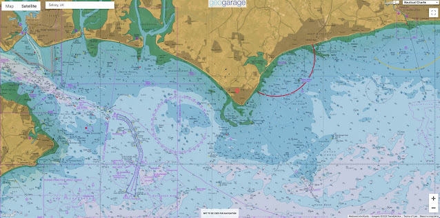
 
Selsey localization with the GeoGarage platform (UKHO nautical chart)

Two hours southwest of London is Selsey, a town of about 10,000 people in south Sussex that lies on a peninsula called Manhood.
(Yes, really, but it derives from Man wode—“wood”—and refers to a long-gone communal forest.) Selsey lies at the tip of the peninsula, poking its nose out into the English Channel.
The west side of the nose is home to the post-realignment Medmerry Nature Reserve.
Selsey is a typical English seaside town with pubs, charity shops, and grocery stores lining the quiet high street.
Low lying and historically riven by estuaries and rifes (a local word for creeks), Selsey was, in fact, an island prior to about 1750.

Residents accepted the town’s tidal separations until about 200 years ago, when the lord of the manor decided he didn’t like getting a ferry across the marshes and wanted greater profits.
So he drained the land, reclaimed it from the sea, and turned it into farmland.
Now there’s just one road in and out of town, via a bridge over an inlet called “the ferry channel,” where the boat used to take people across at flood tide.


The town of Selsey, on a peninsula called Manhood in England, was an island or peninsula at various times in history, and has often contended with flooding.
In the far distance, behind the town, lies Medmerry Nature Reserve.
Photo by Geoffrey Deadman/Alamy Stock Photo


Although Selsey lies within the uneasy embrace of the sea, humans have lived here as far back as the Stone Age.
The town was once the capital of the Kingdom of the South Saxons, and its name, meaning “seal’s eye,” or “isle,” is derived from the Saxon language.
Pete Hughes, an ecologist with the nearby Chichester Harbour Conservancy and a consultant on the Medmerry project, tells me that “a huge amount of archaeology was discovered” during the managed realignment project.

The range of findings speaks to how the geography here has changed over the centuries, illustrating how many of the landscapes we think of as fixed are ever in motion.
Archaeologists found a submerged oak forest from Neolithic times (2455–2290 BCE), now visible at low tide.
They also discovered an Iron Age (760–410 BCE) human skull held by a rock, its spinal column trailing out in the water behind.
More recent artifacts from about 500 years ago show how fundamental the sea has been to human life: fish traps, an eel basket, shrimp and prawn traps.
Archaeologists also found two water wells—signs that fresh water was once available where the sea now pulses.

The name Medmerry comes from a small village that disappeared into the sea a few hundred years ago.
“It was built on marshes,” explains David Rusbridge, whose family farmed on the Manhood Peninsula for 400 years.
Medmerry means “middle eye (isle)” because it too was once an island, as revealed on a 1752 map.
A neighboring hamlet, East Thorney, was also lost to the sea, possibly done in by 19th-century drainage ditches to move water out of the marshes.
Without those marshes as protection, the sea moved in around 1900.
Now the coast is where the marshes once lay.

In modern times, before the Medmerry Managed Realignment Scheme, this stretch of shore was the most threatened by coastal flooding in southeast England.
It was rated a one in one risk, meaning it was likely to flood every year.
During a severe flood, if Selsey’s one access road were inundated, people could be trapped there, with no electricity, sewage treatment, or emergency services.
Other nearby communities were also at risk: a settlement of small prefab, portable vacation homes to the west of Selsey called West Sands caravan park, and Bracklesham Bay, a village to the northwest.
These communities were protected by a “shingle embankment”—essentially, a low barrier made of rocks—erected where East Thorney once lay.

Every winter, workers would go out to the shore with bulldozers and push up the rocks afresh, a job that cost £300,000 (about US $413,000) annually.
In 2008, these efforts failed, and 30 people had to evacuate when the sea came in.
Damages cost £5-million (US $7-million).
Pippa Lewis, an environmental project manager with the UK Environment Agency, tells me, “Work during winter storms to maintain the embankment was dangerous, expensive—and wasn’t really working, to be honest.”

The goals of the Medmerry realignment were to make the local communities safer and to re-create lost coastal habitat that would benefit endangered species.
The Environment Agency bought land from farmers just behind the shingle bank so the marshes could reclaim space that was once theirs.
“From an historic perspective, a lot of what we are realigning is just land that we have claimed from the sea,” Hughes explains.
“There’s a sense of … we stole it from salt marsh 200 years ago; we should be putting it back.”

To see some of the almost 300 hectares of habitat, I decide to rent a bike.
At a small Selsey shop called Peddle Wise, I opt for a cruiser over a mountain bike because it has fenders.
A drenching rain the day and night before has left ponded water scattered across the flat terrain.


The Medmerry Managed Realignment Scheme allowed the sea to have its way with roughly 300 hectares of habitat.
Photo by Erica Gies


I set out past an old windmill, then cruise through West Sands caravan park, which seems mostly empty at this time of year.
At the edge of West Sands, I come to the southern end of the realignment project.
Here, workers removed the shingle bank barrier to the sea and built a new almost seven-kilometer-long, U-shaped levee that juts inland for close to two kilometers.
The new levee is made of local clay, already held strong with grass and other plants, and fortified on the sea edge by large rocks.
Standing atop the levee, I can look down into what was farmland in 2012 and is now a young marsh that floods with the tides.

The length of coastline that allows the sea to come in, more than 110 meters, is vast enough that the homes and buildings on the other side appear tiny on the horizon.
Now prone to sudden inundation, the intertidal area is not accessible to the public.
Instead, a winding inland path tracks the new slither of levee.
The hard-packed dirt of the path is pocked with puddles this morning, and some segments are fully flooded.
Reflecting the sky, their depth is impossible to gauge, so traversing them is a leap of faith.
I plow through at a steady pace, water shooting up in rooster tails from my tires, feet carefully balanced on pedals skimming just above the surface.

As I pedal, I pass through a variety of lowland habitats.
In the intertidal zone, the sandbars and rocks scattered across mudflats offer chunks of land for birds that make their living here, including dunlin, curlew, gray and ringed plovers, oystercatcher, redshank.
They hunt 13 species of marine mollusks that have moved in.
Just a short distance inland, saline plants are already established.
Still farther from the sea, reed beds give way to grassland and low shrubs.

David Rusbridge, the man whose family farmed in the area for 400 years, was asked by the UK Environment Agency to sell his 140 hectares so it could be returned to marsh.
His cousins, who owned 160 neighboring hectares, were also asked to sell.
“Me and my cousins, we sat down and talked about it,” he tells me.
“We were in no position to argue” with the government.
“They would have got their way one way or another. So our view was work with them, not work against them.”

He believes it was the right decision.
Rusbridge had been on the local flood defense committee, so he knows the challenges—and costs—of keeping out the sea.
When the national Environment Agency decides that it will no longer protect a stretch of coast, such as the annual bulldozing once required at Selsey, then it’s down to local districts to decide whether to pay to protect it.
The prospect of shouldering that financial burden locally changes the calculus, in his experience.

When the Medmerry Managed Realignment Scheme came along, Rusbridge decided he was ready to quit farming.
“If I’m entirely honest, conventional farming was quite difficult to make much money on it,” he says.
Consolidation of family farms like his by industrial companies created stiff competition.
And his children weren’t interested in farming.
The government paid him market price for his land, and given the tough economics of farming, “it seemed a reasonable way out.”

Still, after 400 years of family history here, “it marked the end of an era,” he adds a bit wistfully.
“But we were happy that it was going to go to a good environmental cause.” Both of his adult children work on environmental issues.
Since selling his land, Rusbridge has started a self-storage business in Bracklesham Bay.
“Self-storage pays a hell of a lot better than farming,” he laughs.
He still has friends who farm, and “when they’re struggling in the harvest, when it’s raining every day, I’m glad I’m not doing it.”

Part of Rusbridge’s former farm is now a section of the 183 hectares of intertidal area I gaze across from the path atop the levee.
Creating this habitat was a key goal of the project, and mitigation funds to compensate for similar habitat lost elsewhere to development helped pay for it.
Salt marshes are not just great buffers against wave energy, they are also vital nurseries for fish and serve as home and pantry for other wildlife.


Medmerry Nature Reserve encompasses freshwater areas, grasslands, saline lagoons, intertidal mudflats, and various other habitat types, which support a variety of birds, water voles, butterflies, dragonflies, and other animals.
Photo by Gillian Pullinger/Alamy Stock Photo

In addition to the intertidal areas (mudflat, salt marsh, and transitional grassland), Medmerry has freshwater and terrestrial habitats that are helping the United Kingdom to meet various national and international targets for biodiversity protection.
Already the Royal Society for the Protection of Birds has seen breeding populations of avocet and little ringed plovers.
Ducks such as teal and widgeon are prevalent.
Voles moved into new freshwater areas.
Creatures have even more room to find what they need thanks to physical connections between Medmerry and the older Pagham Harbour Local Nature Reserve—a tidal estuary on the east side of the Manhood Peninsula that was formed about 100 years ago when another barrier wall gave in to the sea.

Although other people around Selsey were less affected than the farmers who sold their land, public sentiment can be challenging on a project like this.
“People are understandably anxious about something that is going to alter their neighborhood,” Hughes, the ecologist, tells me.
The human instinct to build a fortress—such as the shingle barrier—is strong.
People tend to assume this will provide the best protection, so proposing its removal raises community concern and conflict, he warns.

Explaining the project to the community and engaging them in decisions can help.
“As they realized the benefits and protection they’d be afforded, people gradually became much more positive,” Hughes says.
The return of wildlife and more than 10 kilometers of new paths for walking, biking, or riding horses has brought economic benefit via a four-fold increase in visitors.
The intertidal habitat has also created fish-spawning and nursery areas that are helping to sustain local fishers.

Meanwhile, the salt marsh is doing its job protecting human habitat.
Flood risk to the area, once rated one in one year, has been revised to one in 100.
The main road to Selsey, a sewage treatment plant, and 348 homes benefit from that increased level of protection.
Now, several years later, the salt marsh continues to buffer the community, according to Lewis with the Environment Agency, despite “some big, big storms.”

While it’s hard to give up one’s land, the Medmerry project seems to have provided a happy ending for Rusbridge and his family.
But it’s not clear whether other landowners in the path of coastal realignment will do as well.
Medmerry was a flagship site, and the Environment Agency invested £28-million (US $38.5-million).
But the agency likely can’t afford the same for every coastal spot at risk.
While it will continue to look for opportunities to “manage realignment” in places that can create habitat for wildlife while reducing risks for people, some sites may be allowed to breach naturally, relinquishing control to nature without investing millions to micromanage it.

Rusbridge has moved into the hills, but he still goes down to the Manhood Peninsula often.
“I walk along the trail bank, the bund, and try to recognize which fields were which,” he says.
“It becomes harder as time goes on.” Day after month after year, water reclaims its space, obscuring human patterns.

In North Carolina, beach homes on the barrier islands are generally not multigenerational family affairs going back centuries, as in Medmerry.
Still, accepting retreat goes against the dominant culture’s belief that we can control water.
But proponents of managed retreat emphasize its inherent opportunity not just to save money in the long run, but to reduce trauma—such as watching one’s house float off into the sea.
Insecurity around the behavior and availability of water is destabilizing.
So admitting that water always wins is not weakness; rather, it’s the foundation for strength because it allows us to begin a conversation about what comes next.
By planning ahead, we can move toward something better—say, a more sustainable, equitable neighborhood—with less upheaval.
In letting go, in providing space for coastal ecosystems, we acknowledge the power of waterlands—to hold water, to hold carbon, to hold life, including us.
Sunday, May 29, 2022

The fascinating ancient origins of the World Map

 
What did people used to think the world looked like?
From the beginning of human history to right before the age of exploration, how were world maps created?
This goes from Anaximander to the Catalan Atlas in 1375.

From LaughingSquid by Lori Dorn
 
Video producer Jeremy Shuback looks at the ancient origins behind the first world maps, pondering how they were so accurate despite the lack of world travel at the time.
How did they make accurate maps before the Age of Exploration?
It traces maps from the beginning of human history to 1375 with the Catalan Atlas, showing the way the world was seen for each generation, and how the maps continued to improve.
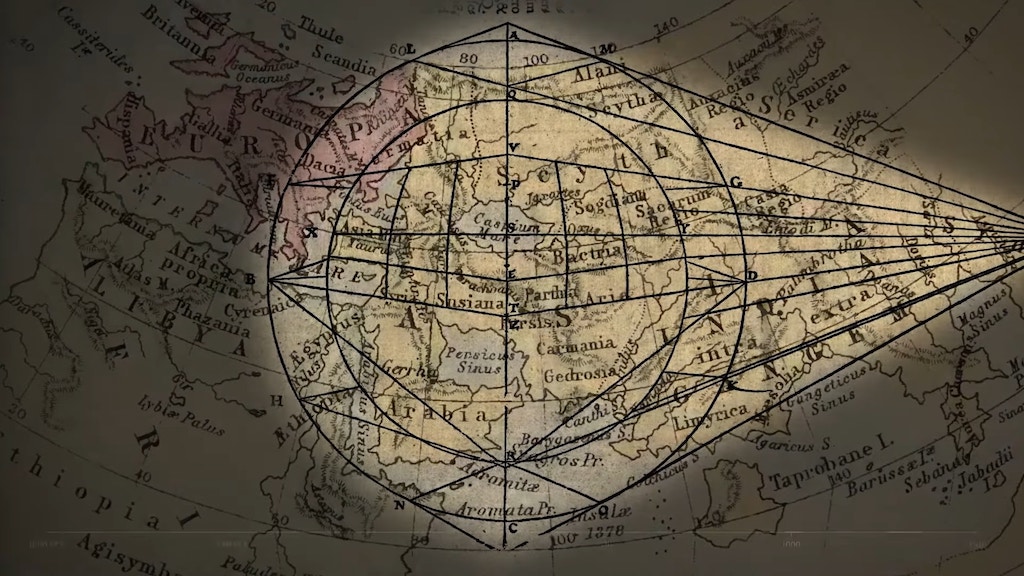
Shuback first looks at the ancient map developed by Anaximander in the early third century.
While rough, the map was astoundingly accurate for someone who didn’t travel very much.

The Greek, Anaximander was the first person to publish a measured detailed description of the layout of the world….
It was believed that an ocean circled the world.
But even this was an incredible accomplishment, roughed out by who knows how many explorers.

In time, others built upon this map.
This includes Marinus of Tyre, who invented the concepts of longitude and latitude, and Ptolemy, who defined both East and North.
A version of these updated maps was used by Christopher Columbus.
Unfortunately, this map miscalculated the size of Earth.
This error led Columbus to the Bahamas rather than India.
Ptolemy did make plenty of mistakes, like miscalculating the size of the globe, something that didn’t bode well years later for Columbus, when he used a variation on Ptolemy’s measurements as his motivation to sail across the ocean, in an effort to reach India.

Muhammad al-Idrisi, an 11th Century Muslim cartographer, was also improving upon this map and his version became widely used around Europe until the Catalan Atlas was developed in 1375.
This highly decorative map filled in the gaps between the Anaximander map and the notable improvements made to the original.
In 1375 Abraham Cresques and his son made the Catalan Atlas.
They were commissioned to make a set of nautical charts that would build on everything created so far, and also incorporate new knowledge like working in areas Marco Polo had recently explored.
What makes it particularly notable is it was both accurate for the time, and towards the end of an era when little elements, gorgeous illustrations, were still woven in – like Kubla Kahn, Alexander the Great, the Tower of Babel, Mansa Musa (the Starbucks Mermaid), Noah’s Ark, the Crossing of the Red Sea, and so, so many other flourishes.

The Catalan Atlas - A Medieval Marvel
 
Links :