Tuesday, September 26, 2023

Who owns the most satellites?

-


From Visual Capitalist by Bruno Venditti

Nearly 7,000 satellites orbit the Earth, serving vital functions such as communication, navigation, and scientific research.

In 2022 alone, more than 150 launches took place, sending new instruments into space, with many more expected over the next decade.

But who owns these objects? In this graphic, we utilize data from the Union of Concerned Scientists to highlight the leaders in satellite technology.
 
SpaceX’s Dominance in Space

SpaceX, led by Elon Musk, is unquestionably the industry leader, currently operating the largest fleet of satellites in orbit—about 50% of the global total.

The company has already completed 62 missions this year, surpassing any other company or nation, and operates thousands of internet-beaming Starlink spacecraft that provide global internet connectivity.

Starlink customers receive a small satellite dish that self-orients itself to align with Starlink’s low-Earth-orbit satellites.


In second place is a lesser-known company, British OneWeb Satellites. 
The company, headquartered in London, counts the UK government among its investors and provides high-speed internet services to governments, businesses, and communities.

Like many other satellite operators, OneWeb relies on SpaceX to launch its satellites.

Despite Starlink’s dominance in the industry, the company is set to face intense competition in the coming years. Amazon’s Project Kuiper plans to deploy 3,236 satellites by 2029 to compete with SpaceX’s network. The first of the fleet could launch as early as 2024.
 
The Rise of China’s Space Program

After the top private companies, governments also own a significant portion of satellites orbiting the Earth. The U.S. remains the leader in total satellites, when adding those owned by both companies and government agencies together.

American expenditures on space programs reached $62 billion in 2022, five times more than the second one, China.

China, however, has sped up its space program over the last 20 years and currently has the highest number of satellites in orbit belonging directly to government agencies.
Most of these are used for Earth observation, communications, defense, and technology development.

 
Satellite Demand to Rise Over the Decade

Despite the internet being taken for granted in major metropolitan areas and developed countries, one out of every three people worldwide has never used the web.

Furthermore, the increasing demand for data and the emergence of new, more cost-effective satellite technologies are expected to present significant opportunities for private space companies.

In this context, satellite demand is projected to quadruple over the next decade.
 
Links :

Monday, September 25, 2023

Satellite radar imagery helps reveal the true scale of hidden fishing

Global Fishing Watch uses machine learning to analyze millions of gigabytes of satellite radar imagery to determine the location of vessels that remain hidden in public monitoring systems.
 © 2022 Global Fishing Watch


From GFW

Synthetic aperture radar brings new layer of transparency to ocean monitoring, illuminating previously unseen vessels

The Issue

Over the last several years, Global Fishing Watch has provided unprecedented insights into fishing activity worldwide.
Our flagship map is built on data from automatic identification systems (AIS)—a satellite tracking technology that large vessels are required to use to broadcast their position—and supplemented by vessel monitoring system data, which a number of progressive governments have shared with us.

But our map is only as good as the data we receive—so while revolutionary, it’s not perfect. Some vessels switch off their AIS signals, others don’t publicly broadcast their location and some simply fail to appear in public monitoring systems at all. There are a number of legitimate reasons why a vessel might not appear in a public monitoring system—or broadcasting their location at all—but all too often these so-called “dark vessels” have been engaged in unscrupulous behavior such as illegal, unreported and unregulated fishing.

And so we needed to find another way to detect these vessels and bring the dark fleet to light.

Our Work

To get a more comprehensive picture of global fishing, we started combining vessel tracking data with other satellite data, including optical imagery and synthetic aperture radar (SAR). 
SAR, a powerful tool for remote sensing technology, works day and night in all types of weather, so vessels can be detected even through thick cloud cover.

This technique for producing fine-resolution images proved essential in our 2020 study, “Illuminating Dark Fishing Fleets in North Korea,” which drew on four different data sources to reveal around 900 vessels of Chinese origin fishing illegally in North Korea.
SAR was also extremely valuable in studying previously unseen fishing activity in the Mediterranean and off the African coast, opening our eyes to activities we had never seen before.
It was clear that our ocean was a lot busier than existing monitoring systems had shown.

In 2022, we made even further progress on this front by adding a new data layer to our map which shows previously undetected dark vessels..
We developed this by analyzing millions of gigabytes of SAR data from the European Space Agency’s Sentinel-1 satellites.
Using some clever machine learning, we were able to identify vessels that weren’t publicly broadcasting their position and gain a better understanding of the true global footprint of fishing activity.

We are continually adding new data to our map, helping build an even more comprehensive picture of what is taking place at sea.
 

These efforts received a major boost when Canadian space-tech company MDA provided us with access to its entire archive of SAR data—a record stretching back 14 years and including nearly a million images.

Thanks to the combination of satellite radar imagery and science based analytics, we have the ability to catalyze research and equip policymakers with insights that can reveal what was once unknown and more effectively fight illegal fishing practices.

“By seeing and characterizing the activity of these expansive dark fleets, we can begin to better understand and quantify not just illegal fishing but a great deal of human activity that is impacting our marine environment. These are exciting times when it comes to open, accessible data that anyone can use for free to understand and advocate for the fragile marine areas they care about most.”
Paul Woods,chief innovation officer, Global Fishing Watch
 
Links :

Sunday, September 24, 2023

Here's the 3-step Navy Seal trick to turning your pants into a makeshift life preserver


From Business Insider by Sam Fellman

A German sailor who spent three hours lost at sea was rescued after employing a lifesaving trick used by Navy SEALs.
Here's how to turn your pants into a makeshift life preserver in three fairly easy steps.

Falling overboard is one of the most disorienting and terrifying experiences you can have.

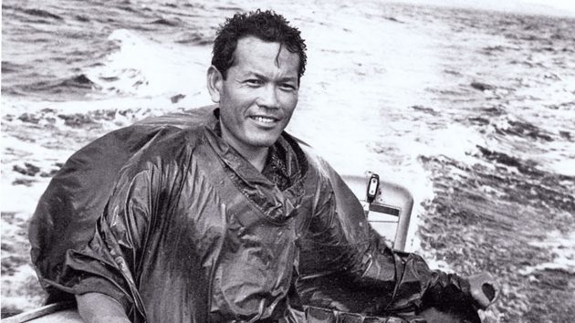
A German sailor named Arne Murke had this happen when he was knocked off a sailboat in 9-foot waves and without a life preserver. Fortunately, Murke had the wherewithal to employ a trusted lifesaving trick used by Navy SEALs — which starts by taking off your pants — and was rescued off New Zealand after over three hours in the water.

The method uses your pants to assist with flotation to stay on the surface and conserve your energy. And unlike a dead-man float, in which your face is in the water, this tactic allows you to rest with your face up so rescuers can more easily find you.

Read more: A man survived hours lost at sea by turning his jeans into a floatation device, a trick used by Navy SEALs

Here's how to perform this tried-and-true "drown proofing" technique, which is taught to troops from all the military branches.

  • Step 1: Take off your pants. While you tread water or lie on your back, tie a knot in the ends of the pant legs. The US Navy recommends you tie the two pant legs together and tight enough to trap air, as seen in a 2015 video. Oh, remember to zip up the fly.
  • Step 2: Inflate. Put the waist opening over your shoulder, then in one motion raise the open waist high over your head to scoop in air and then slam it into the water. Close the waist underneath the water to hold in the air. A US soldier after inflating his pants and putting his head through the legs.Visual Information Specialist Pascal Demeuldre/US Army
  • Step 2.5: If your air pocket isn't filled enough, repeat Step 2. Or you can try to fill the pants by going underwater and breathing air into the open waist.
  • Step 3: Put your head through the inflated pant legs and hold the waist closed and underwater. Wait for help and stay calm. If and when the pants deflate, just repeat the steps.
These moves are fairly straightforward, but it's hard to get the pants to inflate by swinging them over your head. It may take a few tries. Best to practice this in a pool first.

Links :

Saturday, September 23, 2023

Why meteorological and astronomical fall start on 2 different dates

 
Tomorrow at 2:50 am ET, astronomical autumn officially begins in the Northern Hemisphere
time-lapse from NOAA's GOESEast - showing the change in the angle of the sun from last year’s equinox through today.
On this equinox day, the length of day and night is the same all over the world.
For half of the year, as the earth is tilted in its orbit, the sun shines brighter on one hemisphere than the other.
From today onwards, the southern hemisphere will be brighter.
 
From AccuWeather by Brian Lada
 
Many people consider the September equinox to be the official start of autumn, but for meteorologists, the new season kicks off weeks before the astronomical event.

The autumnal equinox marks the start of fall across the Northern Hemisphere, but meteorologists commonly consider a different date to mark the start of the new season.

Equinox comes from the Latin words aequi, which means equal, and nox, which means night. On the day of the equinox, the sun’s rays are most direct over the equator. No matter the location around the globe, the sun will rise exactly due east and set exactly due west. 


Astronomical fall starts on the autumnal equinox, between Sept. 21 and Sept. 23, and ends on the winter solstice, between Dec. 20 and Dec. 22.

These dates vary from year to year due to leap years and the elliptical shape of Earth's orbit around the Sun, with the autumnal equinox in 2023 falling on Saturday, Sept. 23 at 2:50 a.m. EDT.

While this equinox signals the start of astronomical fall across the Northern Hemisphere, those in the Southern Hemisphere recognize it as the first day of spring.

Traditionally, astronomical seasons last between 89 and 93 days due to the elliptical shape of the Earth’s orbit around the sun, according to the National Centers for Environmental Information (NCEI).
 
This variability can make it difficult for experts to compare statistics from one year to another.

Meanwhile, meteorological seasons are more consistent, with the four seasons being broken into groups of three months.

Meteorological fall lasts for 91 days every year, starting on Sept. 1 and lasting through Nov. 30.
Meteorological spring is March, April and May.
Meteorological summer is June, July and August.
Meteorological fall is September, October and November.
Meteorological winter is December, January and February.

“By following the civil calendar and having less variation in season length and season start, it becomes much easier to calculate seasonal statistics from the monthly statistics, both of which are very useful for agriculture, commerce and a variety of other purposes,” NCEI said.

One common misconception is that the equinox is the only time of the year that it is possible to balance an egg on its end.

"The origins of this myth are attributed to stories that the ancient Chinese would create displays of eggs standing on end during the first day of spring," John Millis, assistant professor of physics and astronomy at Anderson University said.

Although it is possible to stand an egg on end on the equinox, the trick is also able to be accomplished every other day of the year.

While autumn is known for its shorter days and cooler conditions, it also brings a heightened risk of severe weather.

The renewed severe weather risk is caused by a southern shift in the jet stream that directs powerful storm systems across the central and eastern United States.
The severe weather is not typically as widespread as it is during the spring months, but storms in autumn can still spawn damaging wind, hail and tornadoes.

The frequency of severe thunderstorms gradually decreases near the end of the season as the Northern Hemisphere begins to transition to winter.
 
Links :

Friday, September 22, 2023

Deep and dangerous: Is AI the future of ocean exploration?

[Nataliia Shulga/Al Jazeera]
 
From Aljazeera by Tom Cassauwers

The Titan implosion has cast focus on autonomous, unmanned submersibles as the way to uncovering the ocean’s secrets.


When the Titan submersible, carrying five sightseers to the wreck of the Titanic, blew up thousands of metres under the ocean surface in June, it underscored why humanity knows more about the surface of some other planets than about the depths of the Earth’s oceans.

Oceans cover more than 70 percent of the earth’s surface.
Yet, this underwater world is a challenging place to explore, as the Titan disaster showed.
It’s a vast space.
The deepest point under water, the Challenger Deep in the Pacific Ocean, is 11,000 metres deep, more than the height of Mount Everest.

The light doesn’t penetrate to such depths.
Still, that little-known world is crucial for the future of the planet.
The oceans interact heavily with the earth’s climate and understanding them better could offer potential solutions to climate change.
New animal and plant species are also constantly being discovered in the great deep.

The ocean bed is also home to battery metals such as cobalt, copper and manganese which are critical for the planet’s clean energy transition.
And a race to the deep sea is on, with companies and countries eyeing resource deposits on the seabed to mine, even as environmentalists have warned of damage to vulnerable ocean ecosystems.

Norway’s government wants to open up an area of the ocean floor larger than Germany for mining.
India, which in August became the first nation to land a spacecraft near the moon’s South Pole, has announced a mission called Samudrayaan – sea vehicle in Sanskrit – for a submersible with three people to travel to a depth of 6,000 metres by 2026.
China is building an icebreaker with a submersible that aims to reach and explore the Arctic seabed.

Is it too dangerous to explore these depths?
Where does the technology stand?
And what’s next for submersibles?

The short answer: Underwater exploration will most likely continue, even after the Titan debacle.
However, small submersibles, often uncrewed and driven by artificial intelligence (AI), might be the future, using novel technology to recharge under water and operate for months – even years – on end.
Before we accomplish that, though, some technological hurdles still remain.
 
 
A view of OceanGate equipment within the boatyard near the headquarters at the Port of Everett complex in Everett, Washington, US, June 22, 2023.
OceanGate owned and operated the Titan submersible that imploded in June 2023 [File: Matt Mills McKnight/Reuters]

Unmapped depths

While decades of scientific and technological advances have allowed humans to send exploratory missions to distant planets, only about 25 percent of the Earth’s ocean floors have been mapped to date.

Still, that too represents a major shift: By 2017, only 6 percent of the ocean floor had been charted.

“So, the last few years we have seen a huge acceleration.
Nevertheless, there’s still a long way to go,” said Jamie McMichael-Phillips, director of Seabed 2030, an initiative that aims to map the entire seabed by 2030.

Seabed 2030 doesn’t usually do this mapping itself.
It scours archives of governments, research institutes and companies looking for seabed maps that haven’t been published yet.
Besides that, it tries to convince other ships to use their sonar systems to map the seafloor and share that data with them.

Sonar is an old technology, first invented in the 1910s.
It uses sound waves to determine what is under water and what the seabed looks like.
With this technology, a surface vessel can roughly map even the deepest points of the ocean.
Seabed 2030 turns data like this into a map and makes it public.

“There are a range of ocean processes that depend on the shape of the ocean floor,” said McMichael-Phillips.
“We need this information to better understand climate change and issues of biodiversity.”

What is challenging about the process is that it is slow and time-consuming.
Fully crewed ships need to sail across the world and use their sonar to scan the ocean floor.

“It’s a slow, slow process”, said McMichael-Phillips.
“The game changer will be uncrewed technology, where you can operate a vessel almost 24/7, without any people on board.”
 
RoboSea’s Robo-Shark, a multi-joint bionic robot fish for underwater exploration, is displayed during the 2020 Consumer Electronics Show in Las Vegas, Nevada, US, January 8, 2020 [File: Steve Marcus/Reuters]

AI is ‘the future’

This is why ocean researchers have big hopes for artificial intelligence.
Seacraft, such as submersibles, that operate autonomously by themselves, could take away a lot of the manpower needed to explore the vast reaches of our oceans.

“A remotely operated underwater vehicle, controlled from a distance by a human pilot, works well when you need to inspect a specific object, like the base of an offshore wind turbine,” said Helge Renkewitz, a researcher at the German research institute Fraunhofer working on underwater robotics.
“But if you want to explore large stretches of the seafloor, autonomous vehicles are the future.”

Autonomous, AI-powered submersibles would minimise the risks to human lives from deep-sea exploration and would allow faster mapping of ocean floors.
But what researchers ideally want is to go one step further: build submersibles that can explore for indefinite stretches of time, thereby speeding up the process of scanning the planet’s deepest spots.

That, according to Renkewitz, is difficult because the deep sea comes with several engineering challenges.

First, there’s the corrosiveness of salt water, which makes it hard for submersibles to survive undamaged for long unless they are made of high-tech materials like titanium steel.
Then there’s the pressure.
The deeper you go under water, the more pressure is directed at an object.
This proved fatal for the Titan submersible.

“At the depth of the Titanic wreck, almost 4,000 metres deep, a craft experiences 5,689 pounds [2,580kg] of pressure per square inch,” said Renkewitz.
That’s 400 times the average pressure we experience at sea level.

And then there are the challenges that autonomous vehicles face in navigating the terrain deep under water.

On the surface, a self-driving car can use sensors to look around and recognise things.
It can also rely on precise satellite positioning systems like GPS.
An autonomous submersible doesn’t have these luxuries.

Because of negligible light deep in the ocean, it can only see very close to itself.
Sonar can help it see further, but it can only detect objects in a very specific direction.
On top of that, finding its own position is very difficult for a submersible because of the lack of satellite connections under water.
Researchers use complex calculations to keep track of where a craft is, but those aren’t always accurate.

“There’s always an error rate in these position estimation algorithms,” said Renkewitz.
“And the longer you spend under water, the worse the error gets.
After only a few hours, you can be hundreds of metres away from where you think you are depending on the quality of your sensors.”
 
 
This May 4, 2022, photo shows an underwater glider bobbing in the Gulf of Alaska.
Gliders can steer themselves under water using their wings and can bob up and down across the ocean for months.
But eventually, they too run up against a major challenge that confronts submersibles: sourcing energy to power them [File: Mark Thiessen/AP Photo]

Perpetual exploration

Another challenge for long-term submersibles is energy.
These craft need electricity to operate, yet under water, there’s no obvious source of power to use.
According to Paul Koola, professor of ocean engineering at Texas A&M University, solving this issue will be one of the keys to exploring the deep sea more intensely.

“The dream would be to have a perpetually operating vehicle that uses renewable energy to monitor the ocean and continuously inform us of any changes,” he said.

Some submersibles have taken steps towards this vision.
Underwater gliders absorb water to make them glide downwards and release it again to go up, steering themselves with wings.
In this way, they can bob up and down across the ocean for months.
But even they are eventually limited by their battery life.

To move past this, several options are available.
Even though the sun doesn’t penetrate far under the surface, an autonomous submersible could surface regularly to stock up on energy before it goes down again.
But the small size of a submersible would limit the amount of solar power it can gather, according to Koola.

Floating charging stations across the ocean, where submersibles could dock and recharge, are another scenario researchers are considering.
The problem? This would need a high start-up investment.

“The initial ramp-up is very slow,” said Koola.
“You need an Elon Musk-type character to make this happen and standardise power charging connectors at sea.”

Another option could be to use ocean currents or hydrothermal vents on the seabed, although these are not always available everywhere.
Koola is also working on a system to generate energy from the heat differences between water at different depths.
A craft could, in this way, go down and up in the water and generate the power needed to sustain itself.

Making any such mechanism work in the harsh conditions of the ocean won’t be easy.
Nevertheless, Koola is optimistic.

“The time seems to be right,” he said.
“Interest and funding is increasing, and technology is advancing.
That being said, if we would fund deep-sea exploration like we fund space, we would be much farther already.”
 
 
A blue whale swims in the deep blue sea off the coast of Mirissa, in southern Sri Lanka, April 5, 2013.
Scientists are studying whether sea creatures, including shrimp and krill, can teach them how to build submersibles that can successfully manoeuvre, accelerate and brake undersea
[File: Joshua Barton/Reuters]

Shrimp saviour?


What these future, autonomous submersibles might look like is changing as well.
At Brown University, a team is now looking at how some sea animals, such as shrimp and krill, might serve as an inspiration for future swarms of underwater craft.

“We want to understand why krill and shrimp are so good at manoeuvring, accelerating and braking,” said Sara Oliveira Pedro Dos Santos, a PhD student who is part of the team.
“These are all qualities we want in a submersible to explore the ocean, but so far we don’t know how these animals move like this.”

Brown is bringing together a team to make new, shrimp-like prototypes of submersibles, moved around by gears for now, but maybe utilising pulleys in the future.
The craft could reach up to the size of a large lobster.

“Even though the mechanisms are simple, we don’t know how to reproduce the movement of these little animals,” said Nils Tack, a postdoctoral research candidate at Brown University.
“That is the main challenge for us now.”

The shrimp submersibles will face some of the problems all underwater craft deal with – from finding enough energy to communicating with the surface.
Since these machines are particularly small, they will need even smaller batteries than other submersibles.

Still, the team at Brown hopes to find answers to these questions in the next five years.
And their dreams are bigger than just this research project.

“We haven’t explored much of the ocean,” said Oliveira Pedro Dos Santos.
“There’s so much for us to learn from it if we managed to explore it more.

“We don’t fully understand yet what the ocean can offer us.”
 
Links :