Saturday, July 21, 2012

Alex Gray chasing giants


This is a fresh look at Alex Gray and his exploits from the last year.
Putting Alex Gray into words is a difficult thing because words can’t even describe who Alex is.
Alex Gray is one of the most unique people on the planet.
He is a pro surfer, world traveler, comedian, ladies man, nudist, lobster diver, yoga god, paddler, and inspiration to many.
He grew up in the South Bay of Los Angeles and still loves to come home and spend time with his family after long trips around the world.
He is one of the stars of The Drop Zone and has even co hosted the Surfer Poll Awards.
He has a heart of gold, balls of steel and the summer of 2011 was the Summer of Alex Gray scoring some of the biggest, heaviest and best waves on the planet.

Friday, July 20, 2012

Glaciers calving : cause for worry ?


The Petermann Glacier in northern Greenland has calved an iceberg twice the size of Manhattan, scientists say.
Images from a
NASA satellite show the island breaking off a tongue of ice that extends at the end of the glacier.

From BBC

The increasingly detailed and immediate pictures that we get of vast movements of ice at the Earth's poles make for a dramatic sight.

 Polar explorer Eric Philips looks down into one of the 'cracks' in the Petermann Glacier last year

But whether that drama is cause for worry is an open question.

Floating "tongues" of ice, like the one that has broken off the Petermann glacier reported on Thursday, extend beyond the glaciers, and are constantly fed by ice pouring off the ice sheet.
Eventually parts of these tongues break off under the forces surrounding them and become free-floating icebergs.

 >>> geolocalization with the Marine GeoGarage <<<

Thousands of these "calving events" happen in Greenland each year, ranging from the unremarkable to the striking.

On August 5, 2010, an enormous chunk of ice, roughly 97 square miles in size, broke off the Petermann Glacier, along the northwestern coast of Greenland. The glacier lost about one-quarter of its 40-mile long floating ice shelf, the Northern Hemisphere's largest. It's not unusual for large icebergs to calve off the Petermann Glacier, but this new one is the largest to form in the Arctic since 1962. 

This most recent calving is neither of the two in terms of size; with an area of roughly 120 sq km (46 sq mi), it is about half the size of the iceberg that broke off the same glacier in 2010.
Looming larger in the future is the breakup of the Pine Island Glacier in Antarctica - which already shows a 30km-long crack - which could happen any day.
And they get far, far bigger than that.

Northern exposure

It is important to keep in mind that this is a natural and periodic process that has been going on since long before we were here to snap satellite photos.
What is at issue is whether or not the frequency of the events is changing, and why.

In the debate surrounding those questions, there are facts, educated guesses, and worrying trends.
The truth is that the questions are devilishly difficult to answer - the stability of ice sheets at both the Earth's poles depends on a wide range of factors: atmospheric temperatures, the temperatures of the surface of the sea, and the degree of sea ice cover, to name just a few.

The Pine Island glacier will eventually cut loose an 800sq km iceberg

One fact is that the Petermann glacier's margins have now retreated to a point not seen in the last 150 years.

Another is that Greenland has over the last two decades experienced a significantly higher atmospheric warming than the global average.
Yet another is that over that same period, the south of Greenland has seen "mass loss" - both the kind of calving seen at Petermann and simple melting of surface ice - increasing year on year.
And levels of Arctic sea ice cover - which can literally shore up some of Greenland's ice sheet - are on track to be among the lowest ever recorded.

But from there, it becomes educated guesses.

Estimates of the speed of mass loss, for example, have gone back and forth among groups of scientists (and the 2011 edition of the revered Times Atlas got it wrong altogether).

And it remains guesswork to determine whether that worrying mass-loss trend is making its way northward.
"To date, we've not really seen such a strong signal in northern Greenland - and Petermann is right at the northern limit of the ice sheet," said Jonathan Bamber, director of the Bristol Glaciology Centre at the University of Bristol.
"I think it's too early to say that this is the start of increased mass loss from northern Greenland - but it's certainly not good news," Prof Bamber told BBC News.
"Whether it's news that we should be particularly concerned about I think is difficult to answer at this stage."

'Not surprising'

In truth, the buildup and breakup of glaciers can change over timescales ranging from months to millennia, and scientists simply haven't been watching this closely for very long.

As is so often the case in science, what is needed are more observations.
"If we start seeing patterns of the calving front retreating over a range of quite a few glaciers in northern Greenland in the same sector, then we would be quite concerned - and that would be a strong indicator that there's a change taking place, related to either atmospheric warming or ocean warming," Prof Bamber said.

For now, glaciologists - working with Earth and climate scientists of every stripe - are loath to make an explicit connection between iceberg formation and the broader debate around climate change, and this is where worrying trends come in again.
"I can't say that yes, this calving event is a consequence of the marked atmospheric warming that's been taking place over Greenland in the recent decades, but it is certainly more likely to take place as a consequence of that warming," Prof Bamber said.
"You don't have to be a rocket scientist to realise that in a warming world, ice is going to melt - so it's not surprising that Greenland is responding."

Links :
  • TheGuardian : Greenland glacier calves iceberg twice the size of Manhattan
  • ESA : Earth from Space: Pine Island cracked
  • UDEL : Greenland glacier loses ice
  • Icy Seas :  New Petermann Ice Island forming July-16, 2012

Thursday, July 19, 2012

Rip currents: the ocean's deadliest trick


From LiveScience

Year after year, the ocean's most successful killer is not the great white shark.
It's not the deadly jellyfish.
Not even monster waves or hurricane-force winds.
Your worst ocean nightmare during a day at the beach is more likely to be a rip current, experts say.

Every year more than 100 beachgoers drown in these strong rushes of water that pull swimmers away from the shore.
And that's just in the United States.
Nearly half of all rescues made by lifeguards at ocean beaches are related to rip currents, according to the United States Lifesaving Association.
Sharks typically kill about 6 people a year globally.

A common perception is that rip currents pull you underwater, but in reality they're roughly horizontal currents that gradually suck you further and further from the beach.


A rip current near Melbourne, Fla., after Hurricane Jeanne (NOAA)

Here's how they originate: Waves break differently at different parts of a shore — in some places the waves are strong and in others they are weak.
These differing conditions carve out channels in sand bars that lie just off the beach.
When water returns to the ocean, it follows the path of least resistance, which is typically through these channels.

This creates a strong and often very localized current capable of sweeping unsuspecting swimmers out to sea.
The currents usually move at one to two feet per second but stronger ones can pull at up to eight feet per second. (On a track, Olympic sprinters cover about 34 feet per second.)

Heavy breaking waves can trigger a sudden rip current, but rip currents are most hazardous around low tide, when water is already pulling away from the beach.

Hurricanes, widely spaced swells, and long periods of onshore wind flow can also drum up stronger than normal currents.
These conditions also create larger waves, which sometimes draw more people into the water.

What to do

It is easy to be caught in a rip current.
Most often it happens in waist deep water, experts say.
A person will dive under a wave, but when they resurface they find they are much further from the beach and still being pulled away.


What they do next can decide their fate.

Those who understand the dynamics of rip currents advise remaining calm.
Conserve energy.
A rip current is like a giant water treadmill that you can't turn off, so it does no good to try and swim against it.

The National Oceanic and Atmospheric Administration (NOAA) and the United States Lifesaving Association (USLA) suggest trying to swim parallel to the shore and out of the current. Once you've gotten out of the current, you can begin swimming back to shore.

However, if it is too difficult to swim sideways out of the current, try floating or treading water and let nature do its thing.
You'll wash out of the current at some point and can then make your way back to shore.


If neither of these options seems to be working for you, continue treading water and try to get the attention of someone on shore, hopefully a lifeguard.

The NOAA also emphasizes anyone planning to swim in the ocean should learn to swim well and never swim alone.
Pick a beach with a lifeguard if you don't feel comfortable with your swimming abilities but still want to enjoy the surf.
And finally, take a look at the water -- if it looks dangerous, don't even try it.

Wednesday, July 18, 2012

News from Google Maps

Ferry routes display improved for Europe in Google Maps (from Google blog)


Calais/Dunkerque to Dover on the Marine GeoGarage (with SHOM overlay)


Calais harbour (France) with Google Earth
 
Ferry routes are also more clearly labelled than before, and Google Maps will estimate a ferry time  based on its timetables if users try planning a route for their journey.
(example in Italy with the Marine GeoGarage)

We’ve also added better and more clearly labelled ferry routes in many places, such as the area below surrounding Naples, Italy.
Traveling by ferry is one of my favorite ways to explore a city—I love looking back from the water at the cityscapes—and this improvement will help you find the ferry routes you need to do the same. You can even use Google Maps to get transit-based directions for ferries.
We take into account ferry timetables to route you over water just easily as you might follow our driving directions over land.


Become an Antarctic explorer with panoramic imagery (from Google LatLong)

In the winter of 1913, a British newspaper ran an advertisement to promote the latest imperial expedition to Antarctica, apparently placed by polar explorer Ernest Shackleton.
It read, "Men wanted for hazardous journey. Low wages, bitter cold, long hours of complete darkness. Safe return doubtful. Honour and recognition in event of success."
While the ad appears apocryphal, the dangerous nature of the journey to the South Pole is certainly not—as explorers like Roald Amundsen, Robert Falcon Scott and Shackleton himself discovered as they tried to become the first men to reach it.

Back in September 2010, we launched the first Street View imagery of the Antarctic, enabling people from more habitable lands to see penguins in Antarctica for the first time.
Today we’re bringing you additional panoramic imagery of historic Antarctic locations that you can view from the comfort of your homes.
We’ll be posting this special collection to our World Wonders site, where you can learn more about the history of South Pole exploration.


With the help of the Polar Geospatial Center at the University of Minnesota and the New Zealand Antarctic Heritage Trust, we’ve added 360-imagery of many important spots, inside and out, such as the South Pole Telescope, Shackleton's hut, Scott’s hutCape Royds Adélie Penguin Rookery and the Ceremonial South Pole.

The ceremonial South Pole - View Larger Map

Garbage-eating drone destroys ocean pollution


From EarthTechling

Drones have been a hot topic in the media lately.
Whether they’re for surveillance or combat, the idea of drones patrolling our airspace is one that’s not taken lightly by the public.
As we struggle to work out the ethics and legalities of military drones, it’s important to remember that not all autonomous robots are designed for violence or espionage.


Many of us enjoy the work of drones in our daily lives, like the Roomba vacuum, BUFO pool cleaner, or Bosch Indego autonomous lawn mower.
These self-sufficient robots perform routine tasks that normally take a lot of time away from our daily lives.
They also make it possible to conduct tasks that would be costly or dangerous if carried out by a human.
The Marine Drone concept created by Elie Ahovi and his team of collaborators, is a perfect example of a way drone technology can have a positive impact on our world.


Unlike the drones that have been causing so much controversy, this robot is designed to operate underwater, and instead of seeking out enemy targets, it will search for and destroy something equally sinister–ocean garbage.
Horrified by the size of the Great Pacific Garbage Patch, and its identical twins forming in oceans all over the world, Ahovi and his classmates from the French International School of Design decided to come up with a simple-yet-sophisticated solution.

As this review points out, the Marine Drone would patrol the oceans autonomously, sucking plastic bottles and garbage into its maw like a butterfly net.
Powered by water-proof batteries, the Drone would employ an electric motor to move silently through the water.


Like these pollution-seeking robot fish, the Drone’s sonic emitter would send out an irritating signal to deter aquatic life, ensuring that only trash goes into the net.
When it’s collection area is full of junk, the Drone would dock with a nearby mothership, where a crew would crane the garbage up for disposal.

Tuesday, July 17, 2012

Royal Navy finds uncharted Red Sea mount‎

Multi-beam echo sounder imagery of the uncharted sea mount discovered by HMS Echo in the Red Sea
[Picture: Crown Copyright/MOD 2012]

From MOD

Royal Navy survey ship HMS Echo has discovered a previously uncharted underwater 'mountain' on the bed of the Red Sea the size of the rock of Gibraltar.

The hi-tech sonar suites of the Devonport-based survey ship mapped the huge feature for the first time, and it will now be marked on charts to prevent other seafarers running into it.

Echo was sent east of Suez at the beginning of last year to help improve charts of the region's waters and gather key hydrographic data.
The enormous mound – the correct term is 'sea mount' is quite literally the biggest success of Echo's deployment.

Yemeni fishermen at anchor on the sea mount
[Picture: Crown Copyright/MOD 2012]

Yemeni fishermen evidently knew the mount existed – Echo found a dhow anchored on its summit as she carried out her survey of the area.

Existing charts of the area suggested the sea was 385m (1,263 feet) deep, but over an eight-hour period Echo collected reams of information with her sounders to prove otherwise.

24 hours later, after processing all that information, the survey ship's powerful computers produced stunning 3D imagery which revealed the true extent of the mount.

It rises to just 40m (131ft) below the surface of the Red Sea – deeper than the deepest draught of any civilian or military surface ship, but a definite danger to submarines passing between the Mediterranean and the Middle East.

"We were actually looking for volcanoes – the southern Red Sea region has seen a significant amount of recent tectonic and volcanic activity with several volcanoes emerging from the sea close to the Yemeni coast line," said Commander Matt Syrett, Echo's Commanding Officer.

"We didn't find any. But we did find this. It is absolutely massive, and finding it is something which really makes everybody on board feel good.
"So often it's difficult to show that what the Navy does has a tangible effect. This is visible proof. We found it and, as it's a danger to other seafarers, it's been reported to the United Kingdom Hydrographic Office and is expected to appear on new charts of the region in the near future."

Now in the Mediterranean, Echo's finds have continued with the possible wreck of a Second World War 'Liberty Ship' a dozen or so miles off Tripoli. Standing 22m (72ft) proud of the seafloor, 105m (344ft) long and 22m wide; the object is the length of 11 double decker buses parked in nine rows and stacked five deep.

Once again the UK Hydrographic Office, which provides charts for the Royal Navy and many of the world's merchant mariners, has been informed so other sea users can be warned of Echo's discovery.

"From the shape of the hull and location of the superstructure it is likely to be an old Liberty Ship, and was most likely another casualty of World War 2," said Cdr Syrett.

In the 18 months since Echo left UK waters, she has carried out a wide range of essential survey tasking, from supporting assault ship HMS Albion during amphibious exercises in the Gulf last summer, to improving navigational safety for merchant shipping in the Gulf and Red Sea and carrying out oceanographic research off the Horn of Africa.

Links :
  • RoyalNavy :  Survey ship echo finds 'underxwater Gibraltar' in the Red Sea

Shark attacks prompt calls to review the great white's protected status


From TheGuardian

The government of Western Australia has called for the national protected status of the great white shark to be reviewed after the state suffered its fifth fatality from the ocean predator in the past 10 months.

Ben Linden, a 24-year-old musician from Perth, was killed in a shark attack while surfing near Wedge Island, 160kn north of the state capital.
A jetski rider who attempted to retrieve Linden's body was knocked off his vehicle by the shark.
Police and volunteers are searching nearby beaches for the surfer's remains, although a hunt for four- to five-metre long sharks in the vicinity was unsuccessful and has been called off.

Phantom camera capturing amazing slow motion shark attack footage

Western Australia's fisheries minister, Norman Moore, said he was "very distressed" by the latest fatality and said he would lift the great white's protected status if the federal government – which has ultimate jurisdiction over protected species – did the same.

Citing concerns over the impact on tourism to the state, Moore said he would push Canberra to allow commercial and recreational fishing of great whites, although he stopped short of calling for a concerted shark hunt or the setting up of protective nets.
"They have been protected by the Commonwealth and by the state for about 20 years because they were considered to be a threatened species," he told reporters.
"But there seems to be a view that there's an increase in the number of great whites within our waters in recent times.
"Regrettably, people are being taken by sharks in numbers which we have never seen before.
"We need to try to work out to the best of our capacity what is causing this to happen. I'm totally perplexed."


Conservationists have cited an increase in extreme sports and surfing as contributing to the attacks, with environmental group The Wilderness Society calling the hunt for culprit sharks a "Neanderthal" reaction by authorities.

However, Western Australia has seen an unusual number of attacks, with five deaths since September last year.
Globally, there have been four fatalities from shark attacks so far this year.
In 2011, there were 12 deaths from "unprovoked" shark attacks.

This number is dwarfed by the number of sharks killed by humans, with tens of millions slaughtered each year just for shark fin soup.

Links :
  • BBC : Australia shark attacks: Would cull work?

Monday, July 16, 2012

Dark secret of the Lusitania


From DailyMail

Was the Lusitania Britain's war crime?
1,198 passengers died in 1915 when the liner sank - but was a German torpedo really to blame?


Within seconds of the initial shock, the great passenger liner listed and began to sink, her four funnels belching smoke.
Women and children shrieked in panic, and lifeboats half-full of people swung drunkenly from their davits, some crashing on to the deck, crushing other passengers.
A familiar picture – yet this is not the Titanic going down, but her lookalike, rival trans-Atlantic liner, Cunard’s RMS Lusitania, which sank off the Irish coast with the loss of 1,198 lives on 7 May 1915, three years after the Titanic went down.

And while the Titanic’s end had a natural cause – a collision with an iceberg – the Lusitania was sunk by a German U-boat torpedo. Or was it?
In the century since the catastrophe, debate has raged about what exactly caused the liner, among the largest in the world, to sink in just 18 minutes – the Titanic took almost three hours to go down.
Although the Lusitania was certainly struck by a German torpedo, survivors reported hearing a second explosion, which caused the fatal damage.
Now, as part of a TV documentary, a diving team has visited the wreck to find out what caused this mysterious second blast.

Multibeam Sonar image of the wreck of the Lusitania (GSI)
(Olex 3D seabed mapping display from Wreck Hunter)
>>> geolocalization with the Marine GeoGarage <<<

The Lusitania, which had left New York bound for Liverpool six days earlier with almost 2,000 passengers and crew on board, had been known to be carrying small-arms ammunition to supply the British Army, then grappling with the Germans in Flanders in the midst of World War I.
But soon after the sinking, rumours circulated that the ship had also been carrying explosives destined for the front.
Endangering innocent civilians in such a way – if proved – could constitute a war crime almost as serious as the U-boat’s targeting of the passenger liner, an atrocity that helped bring the US into the war against Germany in revenge for the many Americans who died.
In its time, the sinking of the Lusitania had all the shock impact of 9/11.
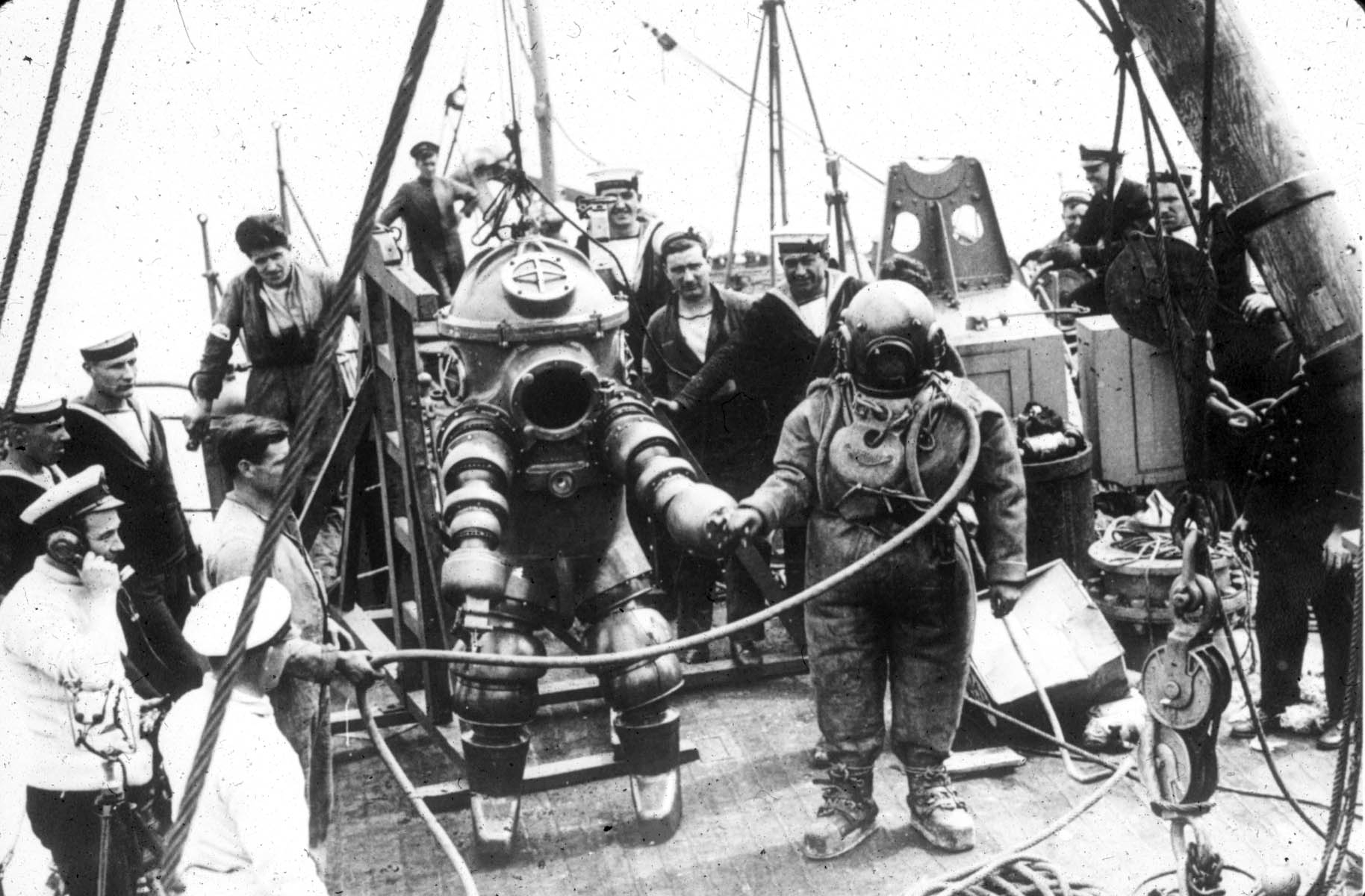
Today, the ship lies 300ft down, 12 miles off the south coast of Ireland near the port of Cobh.

 First underwater visit in 1935 by James Jarret English diver who located the wreck with ASDIC

In 1968 American businessman Gregg Bemis became a co-owner of the wreck, which had been bought the previous year by a US diver for £1,000.
Bemis, who subsequently became sole owner, fought a long battle in the courts for the right to dive and explore the ship, which still contains the remains of hundreds of victims.
It also holds valuable items, but Bemis, now 83, says, ‘When I was younger it was the monetary value that most interested me. But today it’s the history – all the people on board had lives like you and me that were brutally cut off on that May day.’
Bemis is certain that the Lusitania was carrying an illicit cargo of high-explosive gun-cotton which, he believes, caused the blast that sank her so quickly.
The expedition he joins for the documentary aims to prove whether he is right.


The diving team plan to cut out a section of the liner’s hull, locate where any explosive was stored and find evidence of what caused the second explosion.
But just getting down to the Lusitania is hard.
‘The water is incredibly murky,’ says Eoin McGarry, one of the dive team.
‘Although the Lusitania lies in much shallower water than the Titanic, which is 12,000ft down, it’s still difficult to see your hand in front of your face.’
There is also an emotional aspect to diving to the wreck, which McGarry describes as ‘like travelling back in time to visit a graveyard’.

In August of 1993, Dr. Robert Ballard, the discoverer of the Titanic and the Bismarck, led an expedition to the wreck of the Lusitania, off the coast of Ireland.
Using a small submarine and remotely controlled camera vehicles, Ballard and his team studied the wreck like a team of underwater detectives trying to solve a murder mystery. (book/video)

To add to their problems, the divers have only a narrow window of opportunity before worsening weather forces their ship back to port.
First, they have to pinpoint the position of the liner’s magazine, the room set aside for explosive material (the ship had been built on the understanding she might be converted for military use, but never was), then clean off the sediment on the exterior and cut their way into the wreck…
They manage it with just minutes to spare, and crawl deeper into the liner’s interior than anyone before.

RMS Lusitania Celtic Sea Ireland wreck lies approximately 7 miles (11 km) off the Old Head of Kinsale Lighthouse in 300 feet (93 m) of water.
The image shows one of the starboard forward deck mooring bollards still intact
with their original rope lashed into position.
British Technical diver Mark Jones was expedition leader of 3 successful expeditions to the wreck from 1999-2001.

They find the small-arms ammunition the Lusitania had been known to be carrying – and gather enough photographic data for experts at a California lab to make an informed guess about what caused the blast that sent the ship to the bottom.

 Track chart showing the position of RMS Lusitania from 1 May to the day of its sinking 1915.

‘There are only three possibilities,’ says Bemis.
‘Either the torpedo ruptured one or more of the ship’s 25 boilers, causing an explosion; or it set off a coal dust explosion in the coal bunkers; or it triggered a gun-cotton or aluminium-powder explosion – which would mean the Lusitania was carrying dangerous high-explosives, unknown to the passengers who died. And that would have been a war crime on a par with the action of the U-boat that fired the fatal torpedo.’
So what did the scientists at the laboratory decide?

Links :

Sunday, July 15, 2012

This is our planet

Time-lapse with images courtesy of the Image Science & Analysis Laboratory, NASA Johnson Space Center (video)

The ISS orbits Earth at an average altitude of about 250 miles and travels at around 17,500 miles per hour.
It makes roughly 16 trips around the planet every day.