Saturday, August 14, 2021

Panje : Drowning prevention

PANJE | #DrowningPrevention from Steve Won

With free swim classes, three brave women of three different generations are fighting to change the old cultural picture of the women in Zanzibar.
Many women on the island still don´t know how to swim even when some of them working in the sea. Or traveling the sea by boat.
The last decades many boat incidents happened where only men was able to safe themselves.
The project PANJE by a local charity foundation in Zanzibar wants to educate and inspire women to take action.
With free swim classes for young and old, they learn to feel safe and connected to the sea.
The picture of the women floating in the water symbolizes their empowerment.
World Drowning Prevention Day, declared through the April 2021 UN General Assembly resolution A/75/L.76 “Global drowning prevention”, is held annually on 25 July.
This global advocacy event serves as an opportunity to highlight the tragic and profound impact of drowning on families and communities and offer life-saving solutions to prevent it.
An estimated 235,600 people drown every year, and drowning is among the ten leading causes of death for children aged 5-14 years.
More than 90% of drowning deaths occur in rivers, lakes, wells, domestic water storage vessels and swimming pools in low- and middle-income countries, with children and adolescents in rural areas disproportionately affected. 

Friday, August 13, 2021

Giant iceberg A74 kisses the Antarctic coast


COPERNICUS/SENTINEL-1image
Strong easterly winds picked up the berg and pushed it past the Antarctic coast

From BBC by Jonathan Amos

It was the briefest and gentlest of icy kisses.

A massive iceberg that's nearly the size of Greater London was pictured by satellite this week squeezing past the coast of Antarctica.

Germany's Polarstern research vessel sailed between A74 and the Brunt in March
 
The block, known as A74, made only the faintest of contacts.
Had it been any firmer, it would probably have knocked off a similarly sized iceberg.

UK scientists were watching the icy liaison with keen interest because one of their bases is close by.

The Halley research station is currently mothballed as there is uncertainty about the way all the ice in the region might behave in the near future.
"We've been monitoring the situation very closely for the past six months because A74 has been drifting around in the same kind of area," explained Dr Ollie Marsh from the British Antarctic Survey.
"But then there were some really strong easterly winds and these seemed to trigger a rapid movement in A74 that saw it scrape along the edge of the western Brunt," he told BBC News.
media captionGermany's Polarstern research vessel sailed between A74 and the Brunt in March

The Brunt is what's called an ice shelf.
It's an amalgam of glacier ice that has flowed off the land and floated out to sea.

It's still attached to the train of ice behind - but only just. An enormous crack, called Chasm 1, has opened up in recent years in the shelf's far-western sector. An area measuring some 1,700 sq km is on the verge of breaking free.

Many thought a big nudge from the passing A74 iceberg might be the event that made it all happen. But it didn't; or at least, it hasn't happened yet.


BAS has GPS sensors positioned on the ice shelf and on A74. These instruments report back to the survey HQ in Cambridge on an hourly and daily basis.

Their data catches any sudden movements in the ice.

And although this week's contact did produce a very small rotation in the Brunt, it clearly wasn't enough to break the last 2km of ice at the tip of Chasm 1 that keeps the western shelf in place.

"So there does appear to have been a bump, and it does seem to have had a bit of an effect on the western Brunt, but not enough to cause a calving," Dr Marsh said.

BASimage The UK has had a research station on the Brunt Ice Shelf since 1957

It would be helpful to BAS if the Brunt could break soon.
This would end the uncertainty surrounding the status of Halley, which sits atop the floating shelf's eastern sector.

The station is just under 20km away from Chasm 1 and scientists don't think it will be perturbed by a big calving, but they need to be sure before once again permitting year-round operations.

Currently, Halley is closed every winter as a precaution, because should the worst happen it would be very difficult and risky to try to evacuate personnel at a time of year when the weather can be awful and there is 24-hour darkness.
Links :

Thursday, August 12, 2021

Nautical chart smarts

In fair weather, Mount Baker looms over the San Juan Islands. 
That’s when those navigating the deepwater ­channels and granite-clad coastline have it easy.
Courtesy Ralph Naranjo
 
From CruisingWorld by Ralph Narajo
 
Ralph Naranjo is a ­circumnavigator, technical writer, former Vanderstar Chair at the US Naval Academy, and author of The Art of Seamanship, among other books.
 
By studying cartography, cruising guides and weather patterns ahead of time, a skipper can enter unfamiliar waters with a good idea of what lies ahead.

As with most popular chartering destinations, sailing the San Juan Islands tests the navigation skills of a visiting sailor, while at the same time providing for a memorable getaway with family and friends.

The trick is to arrive in new cruising grounds with a fair understanding of what you’ll find when you get there.

Using the Pacific Northwest as an example, it’s easy, with chart in hand or called up on a tablet screen, to recognize the spectacular features of the area.
And the best way to put Puget Sound and the Salish Sea in perspective and begin planning a trip there is with a wide-angle (small-scale) view of the entire region.
Use the chart in combination with detailed descriptions in the Coast Pilot and numerous cruising guides to develop an overall perspective.
So, regardless of whether you sail or fly to this remote destination, you’ll arrive with an awareness of its cruising bounty.

While doing this pre-­charter planning—or when preparing to sail your own boat to a new destination, for that matter—factor in the time of the year and look closely at how the seasons change.
Check the percentage of gales and calms called out on traditional pilot charts and in contemporary climate-­model data.
Download weather maps produced and archived by the Ocean Prediction Center (ocean.weather.gov).
Note the similarities and differences between your local sailing conditions and what you’ll find in the San Juans.
Details such as an awareness of the tidal range, its impact on currents and the local aids to navigation are important.
You’ll know you’ve done enough homework if your first cruise in the Pacific Northwest makes you feel as though you’ve been there before.
This level of situational awareness helps to minimize surprises.

For example, each ­meteorological mood shift results in a change in sea state, especially in the tight passes between islands and in semiprotected anchorages.
Be ready for the effect that spring tides have on surface currents, especially when bolstered by winds in sync with the set and drift of the current.
It pays to refer to a current table or a digital current display when planning each day’s route.
The bottom line when you’re sailing unfamiliar waters and approaching a new anchorage or marina is to envision the challenges, mentally rehearse your approach, and don’t let strong currents and a large tidal range go unnoticed.

Both of these large-scale charts show excellent detail of the Echo Bay anchorage, enclosed in the horseshoe-shaped Sucia Island. 
Note that the chart to the left is a digital raster version of a NOAA paper chart. 
To the right is an S-57 Vector ENC. 
The North and South finger islands, called out on the raster chart, show different soundings than the vector chart, which relies on a more recent survey, and some variation in symbology. 
But switching from one to the other is not difficult.Courtesy Ralph Naranjo

I prefer to have alternate anchorages in the game plan, and the one finally chosen usually has as much to do with tomorrow morning’s weather as it does with the conditions of the moment.
For example, in the charts depicting Sucia Islands and the Echo Bay anchorage (above), I liked the mud bottom and ample swinging room, but I would have gone elsewhere if the forecast had indicated SE winds of 15 to 20 knots or more.
It’s no fun having to bail out of a good anchorage gone bad.
It’s even worse when it happens in the middle of the night in unfamiliar waters.
So make the choice on where to drop the hook with tomorrow’s weather in mind, not just current conditions.

Chartering out of Anacortes or Bellingham puts you in the heart of the San Juan Islands.
Arrival at a charter company’s home base usually mixes boat familiarization with resortlike excitement.
Make sure you don’t miss out on the valuable local knowledge conveyed during the briefing.
Whenever an experienced local sailor starts pointing to destinations on a chart and detailing the local cruising grounds, I pay close attention.
His or her overview and recommendations about local highlights and places to avoid should be noted.
If you’ve done the right homework, it probably sounds familiar.
Jot down what comes as a big surprise, and later on determine how and why you missed it in your pre-arrival charter planning.

 This vector chart reveals a survey-accuracy overlay that ranks six different levels of reliability.
In this case, they range from six stars (accurate to within 16 feet) to the letter U, which stands for “unassessed.”
It’s important to keep track of this Zone of Confidence, because no matter how accurate a GPS signal might be, when the cartography ­displayed is flawed, your location will not be where the chart plotter or tablet indicates.
Courtesy Ralph Naranjo

I prefer to show up with a tentative itinerary compiled ahead of time.
It’s based on crew input and individual sailing interests overlaid on the destination’s features.
Often, the same charter region holds appeal to cruising bird-­watchers as well as bar-­hoppers.
If you’re into both, it’s all good; if not, you’ll want to ­fine-tune your route according to preferred activities.
The easiest alternative is the migration from one mooring area or slip to another, where one good restaurant leads to the next—not a bad fate for those out to relax and saunter among the islands.
But, the more you want to stray from the pack, the more decision-making about anchorage appropriateness and route planning you shoulder.
Detailed charts become more and more vital.
That’s another reason to show up with all the digital charts for the area embedded in a nav program on a laptop, tablet or smartphone that’s as familiar to you as the deck layout of your own boat.

It’s important to keep in mind that these detailed, large-scale charts have some internal variations in accuracy.
And every navigator should have the answer to two key questions: What’s the indicated Zone of Confidence ascribed to my location on the chart? And what does the “satellites” page on my GPS receiver indicate about the Horizontal Dilution of Precision? These two factors have a major influence on the GPS/digital chart’s accuracy, and are most often the culprit when the cursor on your multifunction display screen and your location aren’t one in the same.

HDOP is used to describe the relative position of navigation satellites, which ­affects a plotter’s accuracy.
A low HDOP value represents more accuracy; a high number, less.

Both ENC and RNC rely on accurate, detailed surveys.
Notice the “Source” block from a recent raster chart (left) ­depicting the waters around Sucia Island (the horseshoe-shaped landmass in the lower middle).
This insert shows the channel waters to the north have been well-surveyed and have an “A” rating.
However, those interested in exploring Tumbo Island (right) will venture into B5 survey-accuracy waters, which rely on pre-1900 lead line and sextant survey work.Courtesy Ralph Naranjo

One of the benefits of NOAA’s new electronic navigational charts is a switch from their old Source Diagram descriptions of survey accuracy to a more user friendly, internationally used ZOC reference block.
These inserts on large-scale charts tell chart users when certain parts of a given chart were last surveyed and what anomalies might be encountered.
This lack of recent survey data comes as a big surprise to many mariners.
For example, detailed charts of many coastal water bodies include large areas labeled in the Source Diagram as B3 and B5 (equivalent to ZOC “C” and “D” designations on an ENC).
This indicates that the most recent survey data was pre-1949 and pre-1900, respectively, with position inaccuracy of up to plus or minus 1,600 feet for C and worse than that for D.
This means that even with excellent GPS signal strength, an abundance of available satellites and minimal HDOP, your boat could be over a quarter-mile away from where it appears on the digital chart.
(On the other hand, ZOC category A1 designates an accuracy of plus or minus 16 feet.)

 At night or in overcast conditions, digital charts take much of the anxiety out of sailing.
The bigger the screen, the better.
Courtesy Ralph Naranjo

These incongruencies in chart accuracy are explained by NOAA and all other national cartography sources as a manifestation of their primary mission.
They provide charts for commercial maritime navigation.
Most major, well-marked channels and waters leading to larger port facilities have an A1 or A2 ZOC designation, based on both depth and positional accuracy.
Cruisers often favor more off-the-beaten-path parts of a waterway, where surveys have not been a priority and greater variations in chart accuracy exist. 


Spring and fall gales are predicted well in advance by the NWS Ocean Prediction Center, which offers a wide range of useful offshore, nearshore and coastal forecast info, such as this May 2021 48-hour surface forecast depicting stormy conditions approaching the coast.
Their Nowcast ­downloads easily, and the area’s great cell coverage completes the picture.
Courtesy Ralph Najaro

NOAA’s Coastal Survey is putting new technology to work, and in 2025, the new ENCs will show another leap forward in accuracy and detail.
Third-party chart development by companies such as Navionics, C-Map, etc., are making great inroads by ­adding detail to those uncharted waters, and their collaboration with NOAA holds promise for sailors cruising among the shoals and exploring skinny waters.
 

Late summers in the Olympic rain shadow that shields the San Juan Islands can be hot and dry, with light airs.
Courtesy Ralph Naranjo

In the meantime, put your fathometer and radar to use when navigating in regions such as among the San Juan Islands.
Their steep, rocky slopes and abundance of beacons, towers, and other charted land-based structures send a crisp return signal that can create an effective radar overlay.
Comparing the relationship between the cartography and the radar signals helps confirm location accuracy.
It’s also helpful to confirm chart soundings with your depth sounder.
Make sure to factor in the tidal range’s influence on the depth readings.

 When you see islands converge and the passes narrow on the chart (left), expect that tidal currents will accelerate there.
In places such as the San Juan Islands’ straits, spring tides and strong winds exacerbate the tumult (right).
Check the chart for mention of tide rips, eddies, currents and overfalls.Courtesy Ralph Naranjo

Still, even with the ­challenges, it’s hard to top the rewards of a sailing vacation.
As with the landfalls in the Caribbean, the Med and the vast Pacific, the islands of the Pacific Northwest provide a challenging navigation ­curriculum, and the campus for that training can’t be beat.

The Charts, They Are A-Changin’


Sailors from Capt. Cook to Capt. Ron have extolled the value of cartography—and today we have better options than ever before.
Most nautical charts, whether digital or paper, are Mercator projections that show latitude and longitude in a perpendicular, girded relationship.
This simplifies plotting, handling headings, bearings and distance measurements.

Digital vector charts—designated as electronic navigational charts by NOAA and other third-party sources—are taking precedence over the venerable old standby: the raster navigational chart.
The latter is a pixelated rendition of NOAA’s paper charts, and many sailors favor its familiar look and symbology.
But raster-based NOAA charts are headed to the locker labeled “lead lines, RDFs and Loran-C units.” Fortunately, much of the symbology remains consistent between RNCs and ENCs.
They might look a bit different, but the latter’s seamless zooming ability involves adding layers of detail, not simply magnifying a fixed picture.

The missing continent it took 375 years to find


Getty Image

 From BBC by Zaria Gorvett 

It took scientists 375 years to discover the eighth continent of the world, which has been hiding in plain sight all along.
But mysteries still remain.

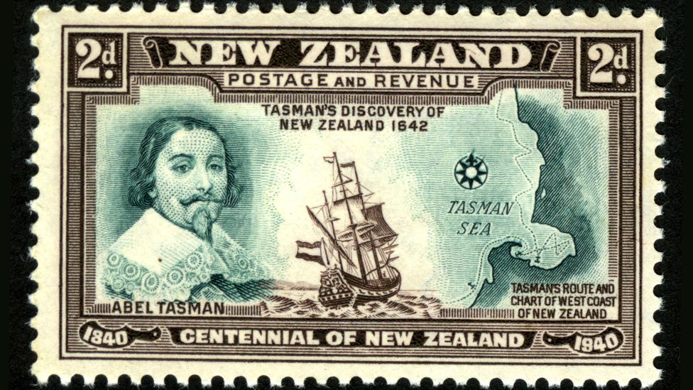
It was 1642 and Abel Tasman was on a mission.
The experienced Dutch sailor, who sported a flamboyant moustache, bushy goatee and penchant for rough justice – he later tried to hang some of his crew on a drunken whim – was confident of the existence of a vast continent in the southern hemisphere, and determined to find it.

At the time, this portion of the globe was still largely mysterious to Europeans, but they had an unshakeable belief that there must be a large land mass there – pre-emptively named Terra Australis – to balance out their own continent in the North.
The fixation dated back to Ancient Roman times, but only now was it going to be tested.

And so, on 14 August, Tasman set sail from his company's base in Jakarta, Indonesia, with two small ships and headed west, then south, then east, eventually ending up at the South Island of New Zealand.

His first encounter with the local Māori people did not go well: on day two, several paddled out on a canoe, and rammed a small boat that was passing messages between the Dutch ships.

Four Europeans died.

Later, the Europeans fired a cannon at 11 more canoes – it’s not known what happened to their targets.

And that was the end of his mission – Tasman named the fateful location Moordenaers(Murderers) Bay, with little sense of irony, and sailed home several weeks later without even having set foot on this new land.
While he believed that he had indeed discovered the great southern continent, evidently, it was hardly the commercial utopia he had envisaged.
He did not return.

(By this time, Australia was already known about, but the Europeans thought it was not the legendary continent they were looking for. Later, it was named after Terra Australis when they changed their minds).

Little did Tasman know, he was right all along.
There was a missing continent.


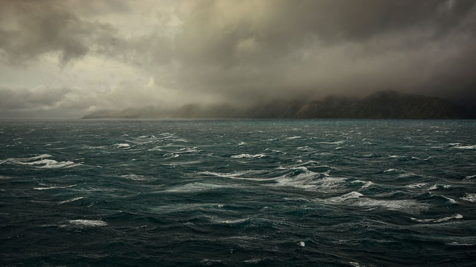
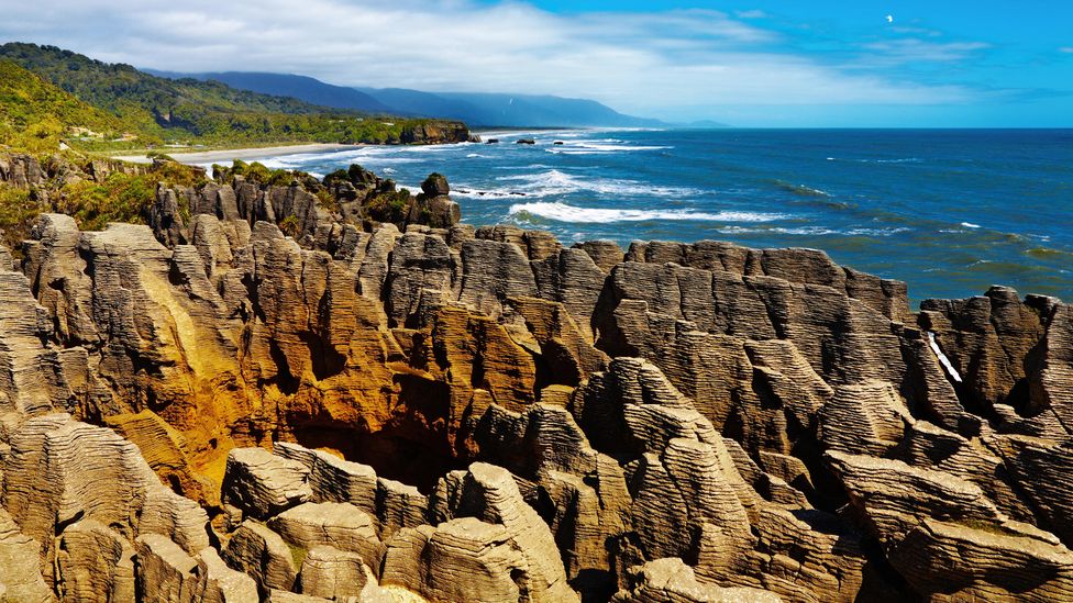
Abel Tasman arguably did find the great southern continent, though he didn’t realise 94% of it is underwater (Credit: Alamy)

In 2017, a group of geologists hit the headlines when they announced their discovery of Zealandia –Te Riu-a-Māui in the Māori language.

A vast continent of 1.89 million sq miles (4.9 million sq km) it is around six times the size of Madagascar.

Though the world's encyclopaedias, maps and search engines had been adamant that there are just seven continents for some time, the team confidently informed the world that this was wrong.

There are eight after all – and the latest addition breaks all the records, as the smallest, thinnest, and youngest in the world. 
The catch is that 94% of it is underwater, with just a handful of islands, such as New Zealand, thrusting out from its oceanic depths. It had been hiding in plain sight all along.

"This is an example of how something very obvious can take a while to uncover," says Andy Tulloch, a geologist at the New Zealand Crown Research Institute GNS Science, who was part of the team that discovered Zealandia.

But this is just the beginning.
Four years on and the continent is as enigmatic as ever, its secrets jealously guarded beneath 6,560 ft (2km) of water.
How was it formed?
What used to live there?
And how long has it been underwater?

A laborious discovery


In fact, Zealandia has always been difficult to study.

More than a century after Tasman discovered New Zealand in 1642, the British map-maker James Cook was sent on a scientific voyage to the southern hemisphere.
His official instructions were to observe the passing of Venus between the Earth and the Sun, in order to calculate how far away the Sun is.

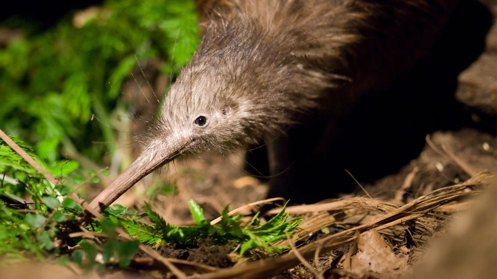
Possibly due to a quirk of geology, the enigmatic kiwi bird’s closest relative hails from Madagascar (Credit: Alamy)
 
But he also carried with him a sealed envelope, which he was instructed to open when he had completed the first task.
This contained a top-secret mission to discover the southern continent – which he arguably sailed straight over, before reaching New Zealand.

The first real clues of Zealandia's existence were gathered by the Scottish naturalist Sir James Hector, who attended a voyage to survey a series of islands off the southern coast of New Zealand in 1895. After studying their geology, he concluded that New Zealand is "the remnant of a mountain-chain that formed the crest of a great continental area that stretched far to the south and east, and which is now submerged…".

Despite this early breakthrough, the knowledge of a possible Zealandia remained obscure, and very little happened until the 1960s. 
"Things happen pretty slowly in this field," says Nick Mortimer, a geologist at GNS Science who led the 2017 study.

Then in the 1960s, geologists finally agreed on a definition of what a continent is – broadly, a geological area with a high elevation, wide variety of rocks, and a thick crust. It also has to be big. 
"You just can't be a tiny piece," says Mortimer. 
This gave geologists something to work with – if they could collect the evidence, they could prove that the eighth continent was real.

Still, the mission stalled – discovering a continent is tricky and expensive, and Mortimer points out that there was no urgency.
Then in 1995, the American geophysicist Bruce Luyendyk again described the region as a continent and suggested calling it Zealandia.
From there, Tulloch describes its discovery as an exponential curve.


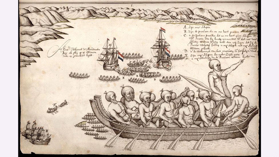
Tasman’s ships left New Zealand after a bloody encounter with the Māori people – but he believed that he had found the legendary southern continent (Credit: Alamy)
 
Around the same time, the "United Nations Convention on the Law of the Sea" came into force, and finally provided some serious motivation. 
It states that countries can extend their legal territories beyond their Exclusive Economic Zone, which reaches 200 nautical miles (370km) out from their coastlines, to claim their "extended continental shelf" – with all the mineral riches and oil this encompasses.

If New Zealand could prove that it was part of a larger continent, it could increase its territory by six times.
Suddenly there was an abundance of funding for trips to survey the area, and the evidence gradually built up.
With every rock sample that was collected, the case for Zealandia improved.

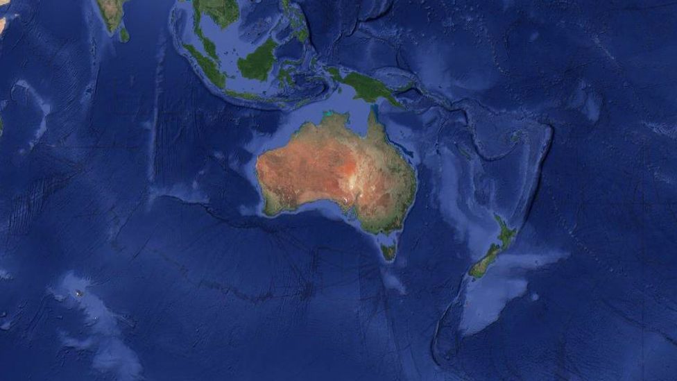
The final flourish came from satellite data, which can be used to track tiny variations in the Earth's gravity across different parts of the crust to map the seafloor.
With this technology, Zealandia is clearly visible as a misshapen mass almost as large as Australia.


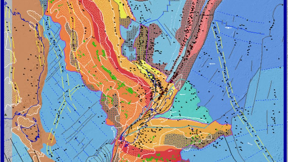
Satellite data can be used to visualise the continent of Zealandia, which appears as a pale blue upside-down triangle to the east of Australia (Credit: GNS Science)

When the continent was finally unveiled to the world, it unlocked one of the most sizeable maritime territories in the world.
"It is kind of cool," says Mortimer, "If you think about it, every continent on the planet has different countries on it, [but] there are only three territories on Zealandia."

In addition to New Zealand, the continent encompasses the island of New Caledonia – a French colony famous for its dazzling lagoons – and the tiny Australian territories of Lord Howe Island and Ball's Pyramid. The latter was described by one 18th-Century explorer as appearing "not to be larger than a boat."

A mysterious stretching

Zealandia was originally part of the ancient supercontinent of Gondwana, which was formed about 550 million years ago and essentially lumped together all the land in the southern hemisphere.

It occupied a corner on the eastern side, where it bordered several others, including half of West Antarctica and all of eastern Australia.

Then around 105 million years ago, "due to a process which we don't completely understand yet, Zealandia started to be pulled away", says Tulloch.

Continental crust is usually around 40km deep – significantly thicker than oceanic crust, which tends to be around 10km.
As it was strained, Zealandia ended up being stretched so much that its crust now only extends 20km (12.4 miles) down.

Eventually, the wafter-thin continent sank – though not quite to the level of normal oceanic crust – and disappeared under the sea.
Despite being thin and submerged, geologists know that Zealandia is a continent because of the kinds of rocks found there.

Continental crust tends to be made up of igneous, metamorphic and sedimentary rocks – like granite, schist and limestone, while the ocean floor is usually just made of igneous ones such as basalt.

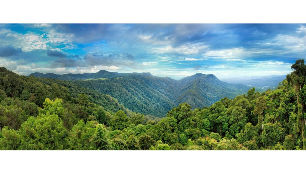
When the supercontinent of Gondwana broke up, fragments drifted all across the globe. Many of its ancient plants still live in the Australian Dorrigo forest (Credit: Getty Images)

But there are still many unknowns.
The unusual origins of the eighth continent make it particularly intriguing to geologists, and more than a little baffling.
For example, it's still not clear how Zealandia managed to stay together when it's so thin and not disintegrate into tiny micro-continents.

Another mystery is exactly when Zealandia ended up underwater – and whether it has ever, in fact, consisted of dry land. The parts that are currently above sea level are ridges that formed as the Pacific and Australian tectonic plates crumpled together.Tulloch says opinion is split as to whether it was always submerged apart from a few small islands, or once entirely dry land.
 
This also raises the question of what lived there.

With its mild climate and 39 million-sq-mile (101 million-sq-km) range, Gondwana itself was home to a vast array of flora and fauna, including the first four-limbed land animals and later, an abundance of the largest to ever live – the titanosaurs. 
So, could the rocks of Zealandia be studded with their preserved remains?

A debate about dinosaurs

Fossilised land animals are rare in the southern hemisphere, but the remains of several were found in New Zealand in the 1990s, including the rib bone of a giant, long-tailed, long-necked dinosaur (a sauropod), a beaky herbivorous dinosaur (a hypsilophodont) and an armoured dinosaur (an ankylosaur). Then in 2006, the foot bone of a large carnivore, possibly a kind of allosaur, was discovered in the Chatham Islands, about 500 miles (800km) east of the South Island.
Crucially, the fossils all date to after the continent of Zealandia split from Gondwana.

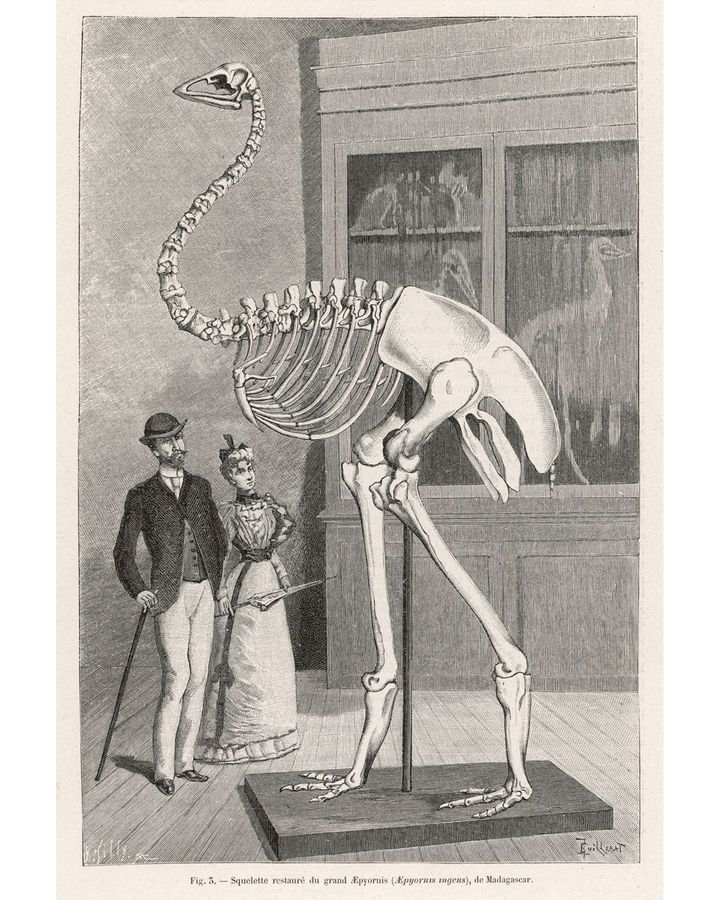
The elephant bird stood 3 m (9.8 ft) tall and fragments of its eggshells still litter beaches to this day (Credit: Alamy)
 
However, this doesn't necessarily mean there were dinosaurs roaming over the majority of Zealandia – these islands may have been sanctuaries while the rest was drowned, as it is now. 
"There's a long debate about this, about whether it's possible to have land animals without continuous land – and whether without it, they would have been snuffed out," says Sutherland.
The plot thickens with one of New Zealand's weirdest and most beloved inhabitants, the kiwi – a dumpy, flightless bird with whiskers and hair-like feathers.
Oddly, its closest relative is not thought to be the Moa, which is part of the same group – the ratites – and lived on the same island until its extinction 500 years ago, but the even-more giant elephant bird, which stalked the forests of Madagascar until as recently as 800 years ago.

The finding has led scientists to believe that both birds evolved from a common ancestor that lived on Gondwana.
It took 130 million years to fully break up, but when it did, it left behind fragments which have since been scattered all across the globe, forming South America, Africa, Madagascar, Antarctica, Australia, the Arabian Peninsula, the Indian Subcontinent, and Zealandia.

This, in turn, suggests that at least part of now-submerged Zealandia has remained above sea level the whole time.
Except around 25 million years ago the entire continent – even possibly the entirety of New Zealand – is thought to have been plunged underwater
"It was thought that all the plants and animals must have colonised afterwards," says Sutherland. So what happened?
 
 
New Zealand is one of the highest points of Zealandia, after being pushed up by the movement of tectonic plates (Credit: Alamy)
 
Though it's not possible to collect fossils from the seafloor of Zealandia directly, scientists have been plumbing its depths by drilling. 
"Actually the most helpful and distinctive fossils are the ones which form in the very shallow seas," says Sutherland. 
"Because they leave a record – there are zillions and zillions of tiny, tiny little fossils that are very distinctive."

In 2017, a team undertook the most extensive surveys of the region so far, and drilled more than 4,101ft (1,250m) into the seabed at six different sites.
The cores that they collected contained pollen from land plants, as well as spores and the shells of organisms that lived in warm, shallow seas.

"If you have water, which is only you know, 10m (33ft) deep or something like this, then there's a good chance that there was land around as well," says Sutherland, who explains that the pollen and spores also hint at the possibility that Zealandia was not quite as submerged as was thought.

A (literal) twist

Another lingering mystery can be found in Zealandia's shape.

"If you look at a geological map of New Zealand, there are two things that really stand out," says Sutherland.
One of these is Alpine Fault, a plate boundary that runs along the South Island and is so significant, it can be seen from space.


The red band of rock – the Median Batholith – should travel all the way down Zealandia in a diagonal line, but instead it has been twisted out of shape (Credit: GNS Science)
 
The second is that the geology of New Zealand – as well as that of the wider continent – is oddly bent. Both are split in two by a horizontal line, which is where the Pacific and Australian tectonic plates meet.
At this exact point, it looks like someone has taken the lower half and twisted it away, so that not only do the previously-continuous ribbons of rock no longer line up, but they are almost at right angles.

An easy explanation for this is that the tectonic plates moved, and somehow deformed them out of shape.
But exactly how or when this happened is still totally unresolved.
"There are various interpretations, but this is quite a large unknown thing," says Tulloch.

Sutherland explains that the continent is unlikely to give up all its secrets anytime soon.
"It's quite hard to make discoveries, when everything is 2km (1.2 miles) underwater, and the layers that you need to sample are 500m (1,640ft) beneath the seabed as well," he says.
"It's really challenging to go out and explore a continent like that. So, it just takes a lot of time, money and effort to go out and ships and survey regions."

If nothing else, the world's eighth continent surely shows that – nearly 400 years after Tasman's quest – there is still plenty to be discovered.
 
Links :

Wednesday, August 11, 2021

Allianz: "Shipping losses remain at historic lows, but Covid, mega-ship, supply chain and climate challenges loom large"


Allianz is raising the red flag over growing risks associated with larger vessels, ranging from navigational challenges at ports, fires, loss of containers at sea to unprecedented complex and expensive salvage processes in case of incidents.

From Allianz

Safety & Shipping Review 2021: 49 large ships lost worldwide last year.
Total losses down 50% over 10 years.
Number of shipping incidents (2,703) declines year-on-year.
Shipping industry resilient through pandemic, but crew change crisis has long-term consequences.
Covid-19 delays and surge in demand for shipping increasing cost of claims.
Inadequate ship maintenance could bring future claims.
Suez Canal incident shows ever-increasing vessel sizes continue to pose a disproportionately large risk with costly groundings and salvage operations.
High number of fires and containers lost at sea.
South China, Indochina, Indonesia and Philippines maritime region is the global loss hotspot.

The international shipping industry continued its long-term positive safety trend over the past year but has to master Covid challenges, apply the learnings from the Ever Given Suez Canal incident and prepare for cyber and climate change challenges ahead.
The number of large vessels lost remained at record low levels in 2020, while reported incidents declined year-on-year, according to marine insurer Allianz Global Corporate & Specialty SE’s (AGCS) Safety & Shipping Review 2021.

“The shipping sector has shown great resilience through the coronavirus pandemic, as evidenced by strong trade volumes and the recovery we are seeing in several parts of the industry today,” says Captain Rahul Khanna, Global Head of Marine Risk Consulting at AGCS.
“Total losses are at historic low levels for the third year running.
However, it is not all smooth sailing.
The ongoing crew crisis, the increasing number of issues posed by larger vessels, growing concerns around supply chain delays and disruptions, as well as complying with environmental targets, bring significant risk management challenges for ship owners and their crews.”
 

The shipping sector has shown great resilience through the coronavirus pandemic

The annual AGCS study analyzes reported shipping losses and casualties (incidents) over 100 gross tons.
During 2020, 49 total losses of vessels were reported globally, similar to a year earlier (48) and the second lowest total this century.
This represents a 50% decline over 10 years (98 in 2011).
The number of shipping incidents declined from 2,818 to 2,703 in 2020 (by 4%).
There have been more than 870 shipping losses over the past decade.

The South China, Indochina, Indonesia and Philippines maritime region remains the global loss hotspot, accounting for one in every three losses in 2020 (16) with incidents up year-on-year.
Cargo ships (18) account for more than a third of vessels lost in the past year and 40% of total losses over the past decade.
Foundered (sunk/submerged) was the main cause of total losses over the past year, accounting for one in two vessels.
Machinery damage/failure was the top cause of shipping incidents globally, accounting for 40%.

Total losses by year 50% drop over a decade (876 total losses from 2011-2020)
Source: Lloyd’s List Intelligence Casualty Statistics.
Data Analysis & Graphic: Allianz Global Corporate & Specialty

 
Covid-19 factors

Despite the devastating economic impact of Covid-19, the effect on maritime trade has been less than first feared.
Global seaborne trade volumes are on course to surpass 2019 levels this year after declining slightly in 2020.
However, the recovery remains volatile.
Covid-19-related delays at ports and shipping capacity management problems have led to congestion at peak times and a shortage of empty containers.
In June 2021, it was estimated there was a record 300 freighters waiting to enter overcrowded ports.
The time container ships are spending waiting for port berths has more than doubled since 2019.

The crew change situation on vessels is a humanitarian crisis which continues to affect the health and wellbeing of seafarers.
In March 2021, it was estimated some 200,000 seafarers remained on board vessels unable to be repatriated due to Covid-19 restrictions.
Extended periods at sea can lead to mental fatigue and poor decision-making, which ultimately impact safety.
There have already been shipping incidents which have featured crews who have been on board for longer than they should have.
Seafarer training is suffering, while attracting new talent is problematic given working conditions.
Future crew shortages could impact the surge in demand for shipping as international trade rebounds.

Although Covid-19 has resulted in limited direct marine claims to date, the sector has not been spared significant loss activity.
“Overall, the frequency of marine claims has not reduced.
We are also seeing an increased cost of hull and machinery claims due to delays in the manufacture and delivery of spare parts, as well as a squeeze on available shipyard space,” says Justus Heinrich, Global Product Leader, Marine Hull, at AGCS.
“Costs associated with salvage and repairs have also increased.” In future, insurers could potentially see an uptick in machinery breakdown claims if Covid-19 has affected crews’ ability to carry out maintenance or follow manufacturers’ protocols.

Larger vessels, larger exposures

The blocking of the Suez Canal by the Ever Given container ship in March 2021 is the latest in a growing list of incidents involving large vessels or mega-ships.
Ships have become ever-larger as shipping companies seek economies of scale and fuel efficiency.
The largest container ships break the 20,000 teu mark, with vessels over 24,000 teu on order – capacity of container ships vessels alone has increased by 1,500% over 50 years and has more than doubled over the past 15 years.
“Larger vessels present unique risks.
Responding to incidents is more complex and expensive.
Approach channels to existing ports may have been dredged deeper and berths and wharfs extended to accommodate large vessels but the overall size of ports has remained the same.
As a result, a ‘miss’ can turn into a ‘hit’ more often for the ultra-large container vessels,” says Captain Nitin Chopra, Senior Marine Risk Consultant at AGCS.
If the Ever Given had not been freed, salvage would have required the lengthy process of unloading some 18,000 containers, requiring specialist cranes.
The wreck removal of the large car carrier, Golden Ray, which capsized in US waters in 2019 with more than 4,000 vehicles on it has taken over a year and a half and cost several hundreds of millions of dollars.

 
The number of fires on board large vessels has increased significantly in recent years.
There was a record 40 cargo-related fires alone in 2019.
Across all vessel types, the number of fires/explosions resulting in total losses increased again in 2020, hitting a four-year high of 10.
Fires often start in containers, which can be the result of non-/mis-declaration of hazardous cargo, such as chemicals and batteries.
When mis-declared, these might be improperly packed and stowed on board, which can result in ignition and/or complicate detection and firefighting.
Major incidents have shown container fires can easily get out of control and result in the crew abandoning the vessel on safety grounds, thus increasing the size of loss.

Loss of containers at sea also spiked last year (over 3,000) and have continued at a high level in 2021, disrupting supply chains and posing a potential pollution and navigation risk.
The number lost is the worst in seven years.
Larger vessels, more extreme weather, a surge in freight rates and mis-declared cargo weights (leading to container stack collapse), as well as the surge in demand for consumer goods may all be contributing to this increase.
There are growing questions about how containers are secured on board ships.

Delay and supply chain issues

Maritime supply chain resilience is in the spotlight after a series of recent events.
The Ever Given incident sent shockwaves through global supply chains dependent on seaborne transport.
It compounded delays and disruption already caused by trade disputes, extreme weather, the pandemic and surges in demand for containerized goods and commodities.
“Such events expose the weak links in supply chains and have magnified them,” says Captain Andrew Kinsey, Senior Marine Risk Consultant at AGCS.
“Developing more robust and diversified supply chains will become increasingly important, as will understanding pinch points and supply chain nodes.”

Piracy and cyber concerns

The world’s piracy hotspot, the Gulf of Guinea, accounted for over 95% of crew numbers kidnapped worldwide in 2020.
Last year, 130 crew were kidnapped in 22 incidents in the region – the highest number ever – and the problem has continued.
Vessels are being targeted further away from the shore – over 200 nautical miles (nm) in some cases.
The Covid-19 pandemic could exacerbate piracy as it is tied to underlying social, political and economic problems, which could deteriorate further.
Former hotspots like Somalia could re-emerge.

The report also notes that all four of the world’s largest shipping companies have already been hit by cyber attacks, and with geopolitical conflict increasingly played out in cyber space, concerns are growing about a potential strike on critical maritime infrastructure, such as a major port or shipping route.
Increased awareness of – and regulation around – cyber risk is translating into an uptake of cyber insurance by shipping companies, although mostly for shore-based operations to date.

The environmental picture

With momentum gathering behind international efforts to tackle climate change, the shipping industry is likely to come under increasing pressure to accelerate its efforts.
“A huge investment in research and development is required if the industry is to meet the challenging targets being set.
Today’s existing fleet and technology will not get the shipping industry to the International Maritime Organization’s target of a 50% cut in emissions by 2050, let alone the more ambitious targets being discussed by national governments,” says Khanna.

Last year, the cap on the sulphur content of ships’ fuel was cut.
Known as IMO 2020, the cut is expected to reduce emissions of harmful sulphur oxide (SOx) from shipping by 77%.
Insurers have seen a number of machinery damage claims related to scrubbers, which remove SOx from exhaust gases for vessels using heavy marine fuel.

Most frequent loss and incident locations

According to the report, the South China, Indochina, Indonesia and Philippines maritime region is also the major loss location of the past decade (224 vessels), driven by high levels of local and international trade, congested ports and busy shipping lanes, older fleets and extreme weather exposure.
Together, the South China, Indochina, Indonesia and Philippines, East Mediterranean and Black Sea, and Japan, Korea and North China maritime regions account for half of the 876 shipping losses of the past 10 years (437).The British Isles, North Sea, English Channel and Bay of Biscay region saw the highest number of reported incidents (579) in 2020, although this was down year-on-year.
And finally, the most accident-prone vessels of the last year were a Greek Island ferry and a RoRo ferry in Canadian waters, both involved in six different incidents.

Links :

Tuesday, August 10, 2021

Climate crisis: scientists spot warning signs of Gulf Stream collapse

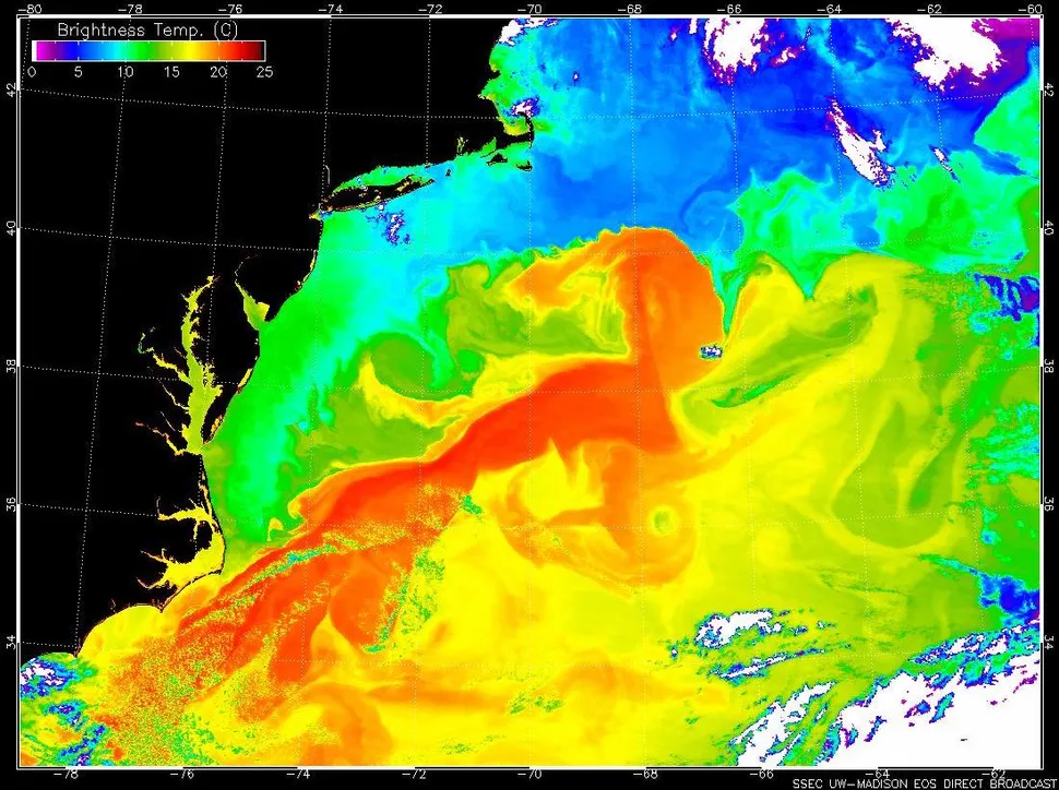
Melting freshwater from Greenland’s ice sheet is slowing down the AMOC earlier than climate models suggested.
Photograph: Ulrik Pedersen/NurPhoto/REX/Shutterstock

From The Guardian by Damian Carrington

A shutdown would have devastating global impacts and must not be allowed to happen, researchers say

Climate scientists have detected warning signs of the collapse of the Gulf Stream, one of the planet’s main potential tipping points.

The research found “an almost complete loss of stability over the last century” of the currents that researchers call the Atlantic meridional overturning circulation (AMOC).
The currents are already at their slowest point in at least 1,600 years, but the new analysis shows they may be nearing a shutdown.

Such an event would have catastrophic consequences around the world, severely disrupting the rains that billions of people depend on for food in India, South America and West Africa; increasing storms and lowering temperatures in Europe; and pushing up the sea level off eastern North America.
It would also further endanger the Amazon rainforest and Antarctic ice sheets.

 
The complexity of the AMOC system and uncertainty over levels of future global heating make it impossible to forecast the date of any collapse for now.
It could be within a decade or two, or several centuries away.
But the colossal impact it would have means it must never be allowed to happen, the scientists said.

“The signs of destabilisation being visible already is something that I wouldn’t have expected and that I find scary,” said Niklas Boers, from the Potsdam Institute for Climate Impact Research in Germany, who did the research.
“It’s something you just can’t [allow to] happen.”

It is not known what level of CO2 would trigger an AMOC collapse, he said.
“So the only thing to do is keep emissions as low as possible.
The likelihood of this extremely high-impact event happening increases with every gram of CO2 that we put into the atmosphere”.

Science Photo Library / Schneider, Karsten

Scientists are increasingly concerned about tippingpoints – large, fast and irreversible changes to the climate.
Boers and his colleagues reported in May that a significant part of the Greenland ice sheet is on the brink, threatening a big rise in global sea level.
Others have shown recently that the Amazon rainforest is now emitting more CO2 than it absorbs, and that the 2020 Siberian heatwave led to worrying releases of methane.

The world may already have crossed a series of tipping points, according to a 2019 analysis, resulting in “an existential threat to civilisation”.
A major report from the Intergovernmental Panel on Climate Change, due on Monday, is expected to set out the worsening state of the climate crisis.

Boer’s research, published in the journal Nature Climate Change, is titled “Observation-based early-warning signals for a collapse of the AMOC”.
Ice-core and other data from the last 100,000 years show the AMOC has two states: a fast, strong one, as seen over recent millennia, and a slow, weak one.
The data shows rising temperatures can make the AMOC switch abruptly between states over one to five decades.
 
The Gulf Stream current (red) speeds warm water up the eastern coast of the United States, where it clashes with cold water in the North Atlantic.

The AMOC is driven by dense, salty seawater sinking into the Arctic ocean, but the melting of freshwater from Greenland’s ice sheet is slowing the process down earlier than climate models suggested.

Boers used the analogy of a chair to explain how changes in ocean temperature and salinity can reveal the AMOC’s instability.
Pushing a chair alters its position, but does not affect its stability if all four legs remain on the floor.
Tilting the chair changes both its position and stability.

Eight independently measured datasets of temperature and salinity going back as far as 150 years enabled Boers to show that global heating is indeed increasing the instability of the currents, not just changing their flow pattern.

The analysis concluded: “This decline [of the AMOC in recent decades] may be associated with an almost complete loss of stability over the course of the last century, and the AMOC could be close to a critical transition to its weak circulation mode.”

Levke Caesar, at Maynooth University in Ireland, who was not involved in the research, said: “The study method cannot give us an exact timing of a possible collapse, but the analysis presents evidence that the AMOC has already lost stability, which I take as a warning that we might be closer to an AMOC tipping than we think.”

David Thornalley, at University College London in the UK, whose work showed the AMOC is at its weakest point in 1,600 years, said: “These signs of decreasing stability are concerning.
But we still don’t know if a collapse will occur, or how close we might be to it.”
 
Links :

Monday, August 9, 2021

ENC worldwide catalogue & distributors

ENCs Primar catalogue with Google Earth
(download weekly updated kmz)

Last week, Primar (Regional ENC Coordinating Center -RENC- managed by NHS Norway) has published more than 18,000 ENCs in its catalogue (18,003 ENCs including cancelled ENC cells)
In this list, 17,493 ENCs are active (510 ENCs withdrawn for use -edition 0- replaced or not by new references) and includes ENCs from IC-ENC the other European RENC.

ENC cells cancelled or replaced in the Primar catalogue (kmz)

IC-ENC managed by UKHO provides 9,591 worldwide ENCs today.


AVCS the other commercial service from Admiralty/UKHO proposes 17,740 ENCs in its catalogue (including ENCs from Non RENC such as C China, LK Sri Lanka, MM Myanmar, TH Thailand and VN Vietnam North, so not in the Primar catalogue)
Note : more, some ENCs in the AVCS portfolio are dual-badge ENCs so restricted by UKHO for its AVCS catalogue, so not available for Primar : ID Indonesia, CA Canada & GB for example.
 
790 ENCs (kmz) are only available with AVCS (x494 C, x118 GB, x58 ID, x4 LK, x4 MM, x36 TH, x77 V)
543 ENCs (kmz) are only available with Primar (x1 1U, x486 CN, x1 EA, x15 ID, x26 IN, x1 RU, x13 VN)
 
Note : by the way, some charts originally from C and CN have the same geographical coverage but different ENC cell references, categories and edition date...
ex : CN502301 & C1616162  / CN502201 & C1616164 ... (see below)

ENC cells in IHO but not in the Primar catalogue (kmz)
 
Note : the IHO catalogue displays a total of 18,218 ENCs whose x16 ENCs from CA not available at AVCS or Primar
Note : by the way, AVCS or Primar for some CA charts propose folios numbers references for some individual CHS ENC references :
for example, id CA3892 contains 3 ENCs: CA471012, CA571010, CA571011
 
By the way, x80 ENC (1U Taiwan) at AVCS and x1 ENC (also 1U Taiwan) at Primar are not listed in the IHO catalogue.

Finally, not so easy for any ENC user to find the right cells...

‘I’d never seen a boat come in with so many bodies’: the mortal cost of the Atlantic migrant route

A crowded boat arrives at Arguineguín, Gran Canaria.
Photograph: Eduardo Robaina
 
From The Guardian by Sam Jones
 
Every year thousands of refugees from conflict, climate and instability in Africa board vessels in search of a new life in Europe but hundreds never arrive

At 6.30am on Friday 28 May, three fishermen at work four miles off the southern coast of Tobago spotted a large white boat adrift on the dawn waters of the Caribbean.

As they drew closer, the trio saw the boat’s shape was far from local, and noticed a strong smell coming from inside it.
The body the fishermen glimpsed at the bow was enough to confirm their suspicions.
They called the coastguard who, unable to dispatch a vessel, asked them to tow the boat ashore at Belle Garden beach.

The sun was bright and the tide still low when William Nurse, an assistant commissioner with the Trinidad and Tobago police, arrived on the scene 90 minutes later.
What Nurse saw on the calm, sheltered beach at Belle Garden that morning was unlike anything he had witnessed in nearly four decades as a police officer.

“I’d never seen a boat come in with so many bodies.
I’d never seen anything like it,” says Nurse.
“Most of the bodies were concentrated in the middle of the boat.
There were two bodies to the rear of the boat and there were a few towards the bow.
I think one of those ones towards the bow was the last to die because there was still hair on the head.”

 
The migrant boat that was found floating off Tobago at the end of May, containing the bodies of 15 people.
Photograph: Courtesy of the Trinidad and Tobago Police Service

Thirteen badly decomposed corpses were recovered from the boat at first.
Then, after the water was drained from the bottom, officers found another body and some skeletal remains.

There were no lifejackets, no trace of food, and evidence that only a scant amount of fuel had been brought to run a 40hp outboard engine that was far too small to properly power the 42ft-long boat, which was registered in Mauritania.
Police found 1,000 Swiss francs, €50 and a number of mobile phones.
Those that weren’t irretrievably corroded were traced to Mauritania and Mali.

Even before postmortem examinations determined that 13 of the 15 bodies were those of African men, Nurse and his colleagues had begun to suspect that those aboard had not been trying to reach the Caribbean.
“We know that people from other African countries stop in Mauritania to get a boat with the hope of getting to Europe,” he said.
But those aboard the boat registered as AG231 – 15 people who died of hunger, thirst and exposure – appear to have overshot the continent by almost the entire width of the north Atlantic.

Six weeks later, Nurse got a phone call from Deputy Commissioner Rodney Adams of the Turks and Caicos police.
A boat carrying 15 bodies had been discovered drifting in the waters off Grand Turk.

“We suspect the same thing may have happened as it did with Tobago,” said Adams.
“We’ve had small boats coming across to us here in the Turks and Caicos from our neighbours 80 or 90 miles to the south in Haiti, but not from the other side of the Atlantic.”
 

The two boats and their 30 bodies are the exceptions to a deadly rule: most of those who die on the increasingly perilous Atlantic route from Africa to the Canary Islands are never found, their small boats, or pateras, swallowed by the waves.

In the midst of continuing instability and conflict, the climate crisis, border closures forced by the Covid pandemic and increased controls in some north African countries, the gangs that ferry migrants and refugees between Africa and Europe are making more and more use of the Atlantic route.

According to the International Organisation for Migration (IOM), 7,418 migrants and refugees have arrived by sea in the Canaries so far this year, while 250 have died in the attempt.
The fatalities are up on the same period last year – when 237 people died – and well above the total number of deaths in 2019, when 210 people lost their lives.

The IOM, however, believes that the true number of deaths is far higher because of the number of “invisible shipwrecks” – boats that vanish without trace.
A recent report from the Spanish migration NGO Caminando Fronteras(Walking Borders) suggested the true number could be almost eight times the IOM’s estimates.
Caminando Fronteras, which has spent 14 years tracking and helping to co-ordinate the rescues of people who come to grief en route to Spain from Africa, estimates that 1,922 people died or disappeared while trying to reach the Canaries by sea between January and the end of June this year.
By their calculations, the Atlantic route claimed 1,851 lives last year.

 
A rescued child is carried ashore at Arguineguín, on Gran Canaria, in March.
Photograph: Eduardo Robaina


The port of Arinaga, half an hour’s drive south of Las Palmas, the capital of Gran Canaria, offers its own mute summary of what it going on across the Spanish archipelago and on the waves that lead to it.
Across its grey volcanic sands, under giant wind turbines and beneath the passenger planes descending towards the airport, lie the scores of pateras that have arrived on Gran Canaria over the past year and a half.
Ropes twist and snap in the fierce winds that whip across the port, and the names of the boats – Salma, Fatima, Nafai, Hayat among many others – are inscribed across the prows like the names on tombstones.

In their sandy, bleaching timbers lie glimpses of their voyages: empty water bottles; rusty tins of tuna and sardines; milk cartons with Arabic script; a single wellington boot; a pair of knock-off Adidas; spent batteries; a solitary sparkplug; and a very occasional lifejacket.

One of the pateras seems newly arrived, its hull still slicked with green, floor speckled with chickpeas and dates bloating in the sun, and the pungent smell of human faeces.

No part of the archipelago, however, speaks of all this quite as plainly as a small corner of San Lázaro cemetery.
Past the labyrinths of flower-decked niches and beyond the palms, the cactuses and the stones where Gran Canaria’s giant lizards charge up in the late afternoon sun, is a small grave ringed with stones.
The gold letters on a thick piece of white ribbon read: “Eléne Habiba Traore, forever in our hearts.”

Eléne, an 18-month-old old girl from Mali, had just reached the Gran Canaria port of Arguineguín with her mother and sister on the evening of 16 March this year when her heart stopped and she lost consciousness.
Red Cross workers managed to resuscitate her, but she died in hospital five days laterand was buried in the small Muslim section of San Lázaro, thanks to the efforts of the Federation of African Associations in the Canary Islands (FAAC), which helped arrange a plot and find an imam to officiate at her funeral.

Teodoro Bondyale, the secretary of the FAAC, refers to Eléne and countless others as murder victims because, he says, the conditions they face on the Atlantic route represent an almost certain death.

“What blame can that little girl from Mali possibly have?” he asks.
“She just had the bad luck to be born in this century, may she rest in peace.” If a decent burial is a basic right, adds Bondyale, “then so is the right not to have to flee from your country.
Where is the right to not have to migrate? That’s the basic question we have to ask ourselves: Why would a mother put her little girl into a small boat?”

 
The grave of 18-month old Eléne from Mali in San Lázaro cemetery on Gran Canaria.
Photograph: Courtesy, Federation of African Associations of the Canary Islands


The high numbers of deaths and arrivals are stirring up a painful sense of deja vu on the archipelago.
Over the course of 2020 – but overwhelmingly in its final three months – 23,023 men, women and children arrived in the Canaries, pushing its unprepared and under-resourced reception infrastructure to the point of collapse.

If last year didn’t quite reach the levels of 2006 – the year of the “cayuco crisis”, when 36,000 people reached the Spanish archipelago in small and dangerous fishing boats - it dwarfed those of 2019, when arrivals stood at just 2,698.

Last autumn’s squalid images from the dock at Arguineguín, not to mention the Spanish government’s refusal to move people to the mainland, called into question the humanitarian credentials of the Socialist administration that won so many plaudits for taking in the 630 people aboard the rescue ship Aquarius in the early summer of 2018.
After visits from Human Rights Watch, Spain’s public ombudsman and others, the makeshift Arguineguín camp was dismantled and its occupants moved to hastily constructed facilities elsewhere on the island, where many reported similarly awful conditions.

Amnesty International has warned there is still time to avoid similarly “horrific scenes” in the Canaries this year, but says the Spanish government must act now to ensure that the most vulnerable arrivals are protected and transferred to the mainland.

Both Spain’s interior ministry and its migration ministry insist resources are in place to prevent a repetition of the failings of 2020.
On a recent visit to the Canaries the interior minister, Fernando Grande-Marlaska, said the archipelago now had “[reception] infrastructure that’s worthy of the strong and solid country that Spain is”, adding that arrivals to the Canaries were “moved elsewhere when necessary, and according to their vulnerability and to our analysis”.

The migration ministry, meanwhile, says the current situation bears little comparison with last year’s, not least because it has provided 7,000 reception places in six camps across the islands – of which 1,800 are currently occupied.

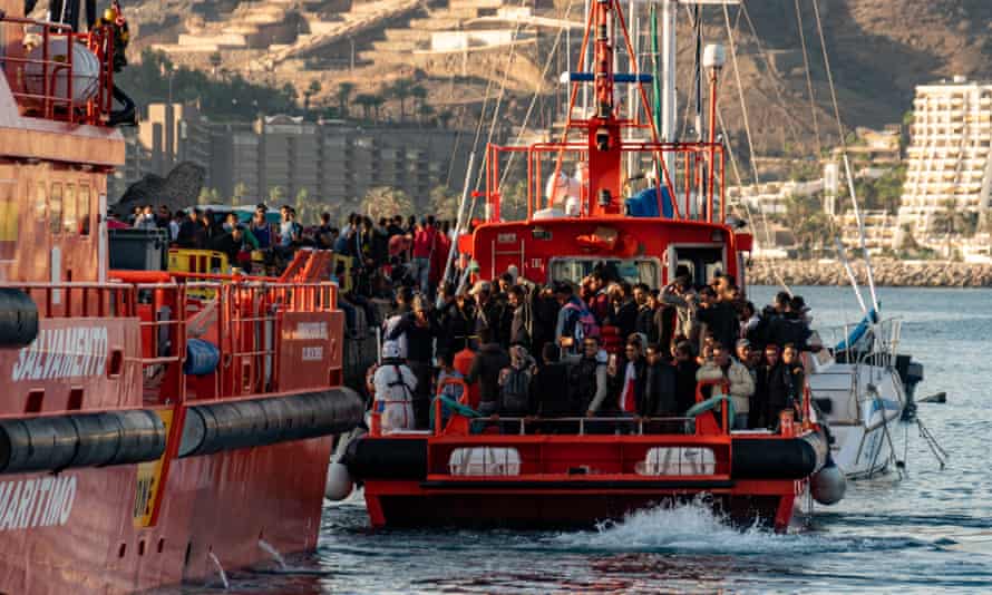
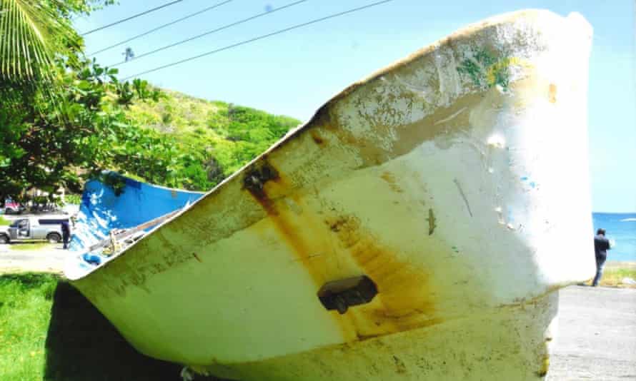
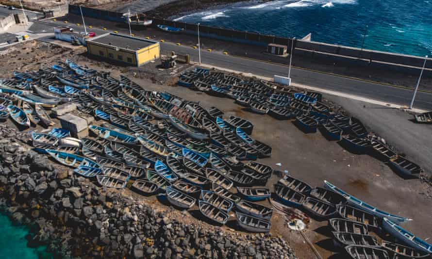
Recovered small boats on Gran Canaria.
Photograph: Eduardo Robaina/The Guardian


José Javier Sánchez Espinosa, director for social inclusion at the Spanish Red Cross, is also cautiously optimistic.
“Between January and 28 July las
t year, we helped 3,100 people,” he said.
“Over the same period this year, we’ve attended to 7,621 people.
So we’ve more than doubled the number we’re helping.
But the provision of reception and humanitarian assistance is much easier this year because there are more a lot more resources.”

Much, however, will depend on what happens after the summer.
The surge in last year’s numbers, driven mainly by people leaving Morocco amid the economic devastation wrought by coronavirus, only began in September.

Txema Santana, a migration adviser to the regional government of the Canaries, sees no reason why this year should be any better.
“The pandemic is the same – or worse – in both health and economic terms, and none of the situations people are leaving behind show symptoms of improving: you still have war in Mali; the conflicts in the Sahel are becoming more drawn out; things aren’t getting any better in Senegal; and you have the same repression in Guinea Conakry.” he said.
“And then we’ll see what happens with Moroccans, because they’re the ones who will determine the intensity of the rise.”

 
A migrant helper at the church in Las Reyohas, Gran Canaria.
Photograph: Eduardo Robaina/The Guardian

Santana and others say there must be no repeat of the interior ministry’s airport blockade, which stopped new arrivals with valid passports from flying to mainland Spain and was only overturned by the courts in mid-April.

“If people can’t be moved to other parts of Spain, then, yes, there could be more problems here in the Canaries,” said Santana.
“But even [the transfers] don’t mean there aren’t people who are having to live on the street because they’ve got nowhere to go.
There are still people in camps who’ve been here for six months.”

José Antonio Benítez, a Claretian missionary and the parish priest of Our Lady of Peace in Las Rehoyas, one of Gran Canaria’s most deprived neighbourhoods, knows all too well what happens when the system begins to buckle and small NGOs and community groups have to step in.

Last year, he witnessed the toll the crisis was taking on both locals and the new arrivals.
“People didn’t stop arriving and the response from the authorities was silence, inaction and closing the borders,” he said.
“There was no way to get out and people ended up staying here.
That led to a lot of unease within the Canaries.
People were tired of the situation, and there were the fears being whipped up by certain political groups.
Then you had the pandemic, which left the islands’ economic, employment and health situation in an awful state.”

Rumours and fake news – much of it spread by the far right – led to protests and outbreaks of xenophobic violence.
Towards the end of 2020, stories that migrants were raping women brought people on to the streets of Las Rehoyas with sticks and knives.
Today, the neighbourhood is quieter.
A handful of young migrants sit in a room off the parish centre kitchen and chat in their newly acquired Spanish as they make sandwiches for the church’s soup kitchen, which feeds up to 60 each day – most of them native Canary islanders.

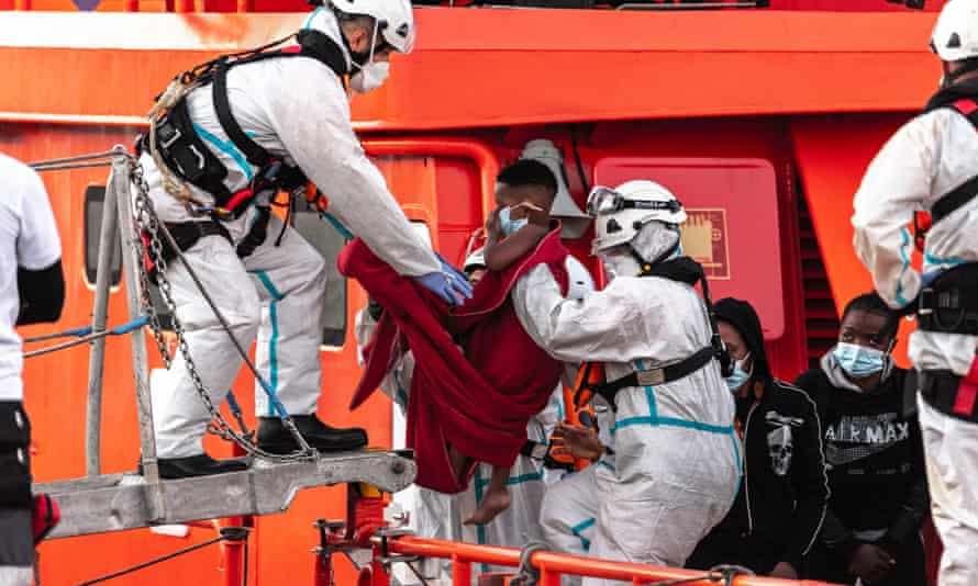
Three men recover in Arrieta on Lanzarote last month after being rescued from a small boat.
Photograph: Javier Fuentes/EPA


Babacar Ndiaye left his home in Senegal in October last year and endured a seven-day voyage in a small boat with 50 others.
After arriving at Arguineguín, where he spent 10 days on the dock, he was put in a hotel for four months and wound up on the streets until a woman from a local NGO brought him to the church.

“I was a fisherman back in Senegal but the fishing just isn’t what is once was – you work a lot and earn very little,” said the 30-year-old.
“So I decided to leave my wife and two daughters behind and come to Spain.
It was pure chance that we made it.”

Ndiaye is desperate to work – “maybe in a restaurant or as a driver; anything” – but can’t until his papers come through.
For now, he bides his time, watches his two young daughters grow up in video calls, and shrugs off the hatred he sometimes receives.

“There’s one woman who just can’t bear seeing black people and who calls us trash and other horrible things, but that doesn’t bother me,” he said.
“Anyway, I wouldn’t answer her back because she’s an older woman like my mother.
And there are also some really good people here.”

Hassan Hadda, another sandwich maker, has been in the Canaries since April 2017 and is still waiting to be regularised.
Like Ndiaye, the 25-year-old Moroccan wants to find work so he can send money home to his parents and six younger siblings.
And, like Ndiaye, he will never forget his journey to the archipelago from Dakhla in Western Sahara.

“People who’ve never made that journey will never understand it,” he says.
“It took three days and there were 28 people in a 5 metre-long boat that was a metre-and-a-half wide.
We were packed liked sardines.
I’d always dreamed of getting to Europe since I was a kid.
It didn’t matter where it was – France, Spain or anywhere else – I felt I’d never have a future if I stayed where there’s no work and no human rights.
That is why I risked my life.”

 
The interior of the migrant boat that was found floating off Tobago.
Photograph: Courtesy of the Trinidad and Tobago Police Service


Across the Atlantic, William Nurse is hopeful that fingerprints taken from three of the bodies will help identify at least some of those who drifted to the coast of Tobago.
For now, though, they lie, unnamed, but probably not unmourned, in a morgue in Port of Spain.

The ugly historical echoes of their fatal, 3,500-mile voyage are not lost on the assistant commissioner of police.
“I never thought that a region from which my foreparents were brought would produce a boat with dead people trying to reach Europe but which ended up in the Caribbean,” he said.
“They were trying to flee something – I don’t know what it was – but everybody’s looking for a better life.”

Links :