Saturday, March 14, 2015

High speed yacht racing

Ragamuffin 100 hitting 38 knots in 2014 Sydney Hobart Race 

 Ragamuffin 100 (photo Carlo Borlenghi)


Dramatic fixed camera footage of Derry~Londonderry~Doire knock-down in hurricane force gusts heading to Southern Ocean from South Africa in November 2013

Links :

Friday, March 13, 2015

WoRMS catalogue downsizes ocean life


Deep Sea ID, is an iOS app field guide interface to the World Register of Deep-Sea Species (WoRDSS), which is a thematic database of the World Register of Marine Species (WoRMS).
The App currently stores on your device (for offline access) the taxonomic information for over 24,000 deep-sea species, over 450 high-resolution photographs of deep-sea specimens as well as links to online taxonomic tools, sources and important references.

From BBC by Jonathan Amos (& LifeWatch)

A mammoth effort to catalogue all known ocean life is nearly complete.
It has taken taxonomic experts eight years to pull together all existing databases and compile one super-definitive list, known as the World Register of Marine Species (WoRMS).
Of the 419,000 species names recorded in the scientific literature, nearly half (190,400) have been shown to be duplicate entries.

The app is designed to improve access to taxonomic information for researchers and contractors working at sea, in the field or in the laboratory as well as educators and science communicators who wish to learn more about the remarkable diversity of deep-sea life.

One species of sea snail even had 113 different names.
The WoRMS editors have now put the number of species known to science at 228,450.
The vast majority - 86% or about 195,000 species - are animals.
These include just over 18,000 species of fish described since the mid-1700s, more than 1,800 sea stars, 816 squids, 93 whales and dolphins and 8,900 clams and other bivalves.

The remainder of the register is made up of kelp, seaweeds and other plants, bacteria, viruses, fungi and single-cell organisms.
Although the definitive list has shrunk in the process of compiling WoRMS, the catalogue continues to grow rapidly.
In 2014, 1,451 new-to-science marine creatures were added to the register. It is estimated another 10,000 or more new species are held in laboratories around the world just waiting to be described.

Dr Jan Mees is from the Flanders Marine Institute (VLIZ) in Belgium, and a co-chair of WoRMS.
He told BBC News: "The purpose of WoRMS was to create a master list of all organisms that have ever been observed and described in the world oceans.
"This task is now near completion. All the historical data have been entered in the database; all the names that have become redundant over time have also been identified and documented.
“And now we have a system in place that can be used as a backbone for data management activities and for marine biodiversity research; and that can be updated by a consortium of taxonomists."

A 'star-gazing' shrimp in South Africa, so-called because its eyes are fixed in an upward direction

Asked to name his favourite species in the list, Dr Mees pointed to the “stargazing” shrimp (Mysidopsis zsilaveczi) in South Africa.
It is so called because its eyes appear to be fixed in an upward-looking direction.
“The pigment pattern of the eyes gives the impression that animal is constantly gazing skywards. It’s not; it’s just an effect. But it’s beautiful.
"But then I would say that, because as well as being a member of the scientific steering committee for WoRMS, I’m also the taxonomic editor for the mysid shrimps.”

A 3-D scan of the newly discovered Ruby Seadragon

Added just last month, for example: A new species of sea dragon, the ruby red Phyllopteryx dewysea from southern Australia, distinguished via DNA analysis from two other sea dragon species.

The Gobiidae family of goby fish boasts the most new species added since 2008 with 131, followed by the Liparidae family of snailfish with 52.
Other new fish curiosities since 2008 include:
Sphyraena intermedia: A new third species of barracuda found in the Mediterranean
  • Protanguillidae: A new basal eel-like family discovered in Palau (species: Protanguilla palau)
Histiophryne psychedelica: An Indonesian frogfish with “psychedelic” colouring


Chlamydoselachus africana A particularly homely

New to science ocean species in 2014 include two dolphins, 139 sponges

Other forms of ocean life described in 2014 include two dolphins and 139 new-to-science sponges. Some previously-discovered sponges have yielded valuable cancer-fighting agents.
Studies foresee more than 200 oncology drugs derived from marine life compounds passing clinical trials - pharmaceuticals with an estimated value of at least US$560 billion.

The two new-to-science dolphins:

Sousa sahulensis: Australian humpback dolphin


  • Inia araguaiaensis: a long-snouted river dolphin from Brazil, a rare river mammal included in the WoRMS marine species database as an exception

  •  Scientists last year also described  12 new marine life families and 141 new genera (family and genus ranking higher than species on the eight-rung ladder of life’s scientific classification).

    A new genus of animal (Dendrogramma, with two associated species (Dendrogramma enigmaticaDengrogramma discoides) does not readily fit into an existing phylum - the top classification in the animal kingdom.
    Further research will resolve the issue but could lead to the historic addition of a new life classification.

    Other curiosities among the class of 2014:
    • Areospora rohanae: A new genus and species of parasite, first noticed by Chilean fisheries workers, that invades and causes lesions on the valuable King Crab. The taxonomist dubbed the little critter after his daughter.
     Keesingia gigas: A new genus and species of giant jellyfish - venomous and tentacle-free - named in honour of renowned Australian biologist John Keesing

    Thursday, March 12, 2015

    Canada CHS update in the Marine GeoGarage

    As our public viewer is not yet available
    (currently under construction, upgrading to a new viewer
    as Google Maps API v2 is officially no more supported),
    this info is primarily intended to our universal mobile application users
    (Weather 4D Android -App-in- on the PlayStore)
    and also to our B2B customers which use our nautical charts layers
    in their own webmapping applications through our GeoGarage API


    CHS raster charts coverage

    99 charts have been updated & 4 charts have been added  (March 5, 2015)
      • 1201 SAINT-FULGENCE À / TO SAGUENAY
      • 1203 TADOUSSAC À/TO CAP ÉTERNITÉ
      • 1209 SAINT-FULGENCE À / TO RIVIÈRE SHIPSHAW
      • 1230 PLANS PÉNINSULE DE LA GASPÉSIE
      • 1235 POINTE AU BOISVERT À/TO CAP DE LA TÊTE AU CHIEN
      • 1236 POINTE DES MONTS AUX/TO ESCOUMINS
      • 1310 PORT DE MONTRÉAL - COMPARTMENT B-C
      • 1311 SOREL-TRACY À / TO VARENNES
      • 1312 LAC SAINT-PIERRE
      • 1313 BATISCAN AU/TO LAC SAINT-PIERRE
      • 1315 QUÉBEC À/TO DONNACONA
      • 1316 PORT DE QUÉBEC
      • 1317 SAULT-AU-COCHON À/TO QUÉBEC
      • 1320 ÎLE DU BIC AU/TO CAP DE LA TÊTE AU CHIEN
      • 1350A SOREL - TRACY AU/TO RUISSEAU LAHAISE
      • 1350B RUISSEAU LAHAISE À/TO SAINT-ANTOINE-SUR-RICHELIEU
      • 1351A BASSIN DE CHAMBLY À/TO ÎLE SAINTE-THÉRÈSE
      • 1351B ÎLE SAINTE-THÉRÈSE À/TO POINTE À LA MEULE
      • 1351C POINTE À LA MEUILE À/TO POINTE NAYLOR
      • 1351D POINTE NAYLOR AU LAC/TO LAKE CHAMPLAIN
      • 1430 LAC SAINT-LOUIS
      • 1512A OTTAWA TO / À LONG ISLAND
      • 1512B LONG ISLAND TO / À BECKETTS LANDING
      • 1512C BECKETTS LANDING TO / À SMITHS FALLS
      • 1514A CARILLON À/TO L'ORIGNAL
      • 1514B L'ORIGNAL À/TO PAPINEAUVILLE
      • 1515A PAPINEAUVILLE À/TO OTTAWA
      • 1515B BECKETTS CREEK
      • 2259 JOHN ISLAND TO / À BLIND RIVER
      • 2299 CLAPPERTON ISLAND TO/À MELDRUM BAY
      • 3001 Vancouver Island Île De Vancouver Juan De Fuca Strait To/À Queen Charlot
      • 3052A OKANAGAN LAKE - PENTICTON TO/À KELOWNA A - B
      • 3052B OKANAGAN LAKE - KELOWNA TO/À VERNON B - C
      • 3419 ESQUIMALT HARBOUR
      • 3441 HARO STRAIT BOUNDARY PASS AND/ET SATELLITE CHANNEL
      • 3456 HALIBUT BANK TO/À BALLENAS CHANNEL
      • 3459 APPROACHES TO/APPROCHES À NANOOSE HARBOUR
      • 3475 PLANS - STUART CHANNEL
      • 3493 VANCOUVER HARBOUR WESTERN PORTION/PARTIE OUEST
      • 3512 STRAIT OF GEORGIA CENTRAL PORTION/PARTIE CENTRALE
      • 3534 PLANS - HOWE SOUND
      • 3538 DESOLATION SOUND AND/ET SUTIL CHANNEL
      • 3546 BROUGHTON STRAIT
      • 3548 QUEEN CHARLOTTE STRAIT (CENTRAL PORTION/PARTIE CENTRALE)
      • 3549 QUEEN CHARLOTTE STRAIT WESTERN PORTION/PARTIE QUEST
      • 3555 BEAVER INLET
      • 3598 CAPE SCOTT TO CAPE CALVERT
      • 3602 APPROACHES TO/APPROCHES À JUAN DE FUCA STRAIT
      • 3605 QUATSINO SOUND TO / À QUEEN CHARLOTTE STRAIT
      • 3675 NOOTKA SOUND
      • 3710 CHANNELS EAST OF CHENAUX À L'EST DE MILBANKE SOUND
      • 3711 PLANS VICINITY OF/PROXIMITÉ DE PRINCESS ROYAL ISLAND
      • 3719 INLETS IN CAMPANIA AND PRINCESS ROYAL ISLANDS
      • 3723 BORROWMAN BAY
      • 3729 DEAN CHANNEL SOUTHERN PORTION/PARTIE SUD AND /ET BURKE CHANNEL
      • 3730 DEAN CHANNEL (NORTHERN PORTION) AND NORTH AND SOUTH BENTINCK ARMS
      • 3736 KITIMAT AND / ET KEMANO BAY
      • 3744 QUEEN CHARLOTTE SOUND
      • 3802 DIXON ENTRANCE
      • 3808 JUAN PEREZ SOUND
      • 3921 FISH EGG INLET AND/ET ALLISON HARBOUR
      • 3935 HAKAI PASSAGE AND VICINITY/ET ENVIRONS
      • 3956 MALACCA PASSAGE TO/À BELL PASSAGE
      • 3957 APPROACHES TO/APPROCHES À PRINCE RUPERT HARBOUR
      • 3958 PRINCE RUPERT HARBOUR
      • 4001 GULF OF MAINE TO STRAIT OF BELLE ISLE / AU DÉTROIT DE BELLE ISLE
      • 4002 GOLFE DU SAINT-LAURENT GULF OF ST. LAWRENCE
      • 4003 CAPE BRETON TO / À CAPE COD
      • 4011 APPROACHES TO/APPROCHES À BAY OF FUNDY/BAIE DE FUNDY
      • 4013 HALIFAX TO / À SYDNEY
      • 4015 SYDNEY TO/À SAINT-PIERRE
      • 4016 SAINT-PIERRE TO/À ST JOHN'S
      • 4022 CABOT STRAIT AND APPROACHES / DÉTROIT DE CABOT ET LES APPROCHES
      • 4025 CAP WHITTLE À/TO HAVRE SAINT PIERRE ET/AND ÎLE D'ANTICOSTI
      • 4045 SABLE ISLAND BANK/BANC DE L'ÎLE DE SABLE TO/AU ST. PIERRE BANK/BANC DE S
      • 4098 SABLE ISLAND / ÎLE DE SABLE
      • 4116 APPROACHES TO/APPROCHES À SAINT JOHN
      • 4241 LOCKEPORT TO / À CAPE SABLE
      • 4277 GREAT BRAS D'OR / ST. ANDREWS AND / ET ST. ANNS BAY
      • 4306 STRAIT OF CANSO AND/ET SOUTHERN APPROACHES/LES APPROCHES SUD
      • 4328 LUNENBURG BAY
      • 4367 FLINT ISLAND TO/À CAPE SMOKEY
      • 4375 GUYON ISLAND TO/À FLINT ISLAND
      • 4384 PEARL ISLAND TO/À CAPE LA HAVE
      • 4396 ANNAPOLIS BASIN
      • 4403 EAST POINT TO/À CAPE BEAR
      • 4421 BOUGHTON RIVER
      • 4448 PORT HOOD
      • 4469 ÎLE PLATE À/TO ÎLE DU PETIT MÉCATINA
      • 4474 ÎLES BUN À/TO BAIE DES MOUTONS
      • 4617 RED ISLAND TO/À PINCHGUT POINT
      • 4641 PORT AUX BASQUES
      • 4679 HAWKES BAY \ PORT SAUNDERS\ BACK ARM
      • 4827 HARE BAY TO / À FORTUNE HEAD
      • 4839 HEAD OF/FOND DE PLACENTIA BAY
      • 4845 RENEWS HARBOUR TO/À MOTION BAY
      • 4865 APPROACHES TO/ APPROCHES À LEWISPORTE AND/ET LOON BAY
      • 4921 PLANS-BAIE DES CHALEURS / CHALEUR BAY - CÔTE NORD / NORTH SHORE
      • 4957 HAVRE-AUBERT
      • 5351 PAYNE BAY AND APPROACHES   NEW
      • 5457 DECEPTION BAY   NEW (2 charts)
      • 7181  DURBAN HARBOR   NEW
        So 796 charts (1685 including sub-charts) are available in the Canada CHS layer. (see coverage)

        Note : don't forget to visit 'Notices to Mariners' published monthly and available from the Canadian Coast Guard both online or through a free hardcopy subscription service.
        This essential publication provides the latest information on changes to the aids to navigation system, as well as updates from CHS regarding CHS charts and publications.
        See also written Notices to Shipping and Navarea warnings : NOTSHIP

        Tepco's Fukushima Daiichi disaster: four years of an ongoing nuclear crisis


        From Greenpeace by Kendra Ulrich

        Yesterday, March 11th 2015, is a somber anniversary for the people of Japan: four years since the Great East Japan Earthquake struck, sparking a tsunami, claiming tens of thousands of lives, and beginning the worst nuclear disaster in a generation: the triple reactor core meltdowns and destroyed containment buildings at TEPCO's Fukushima Daiichi nuclear power plant.
        And, four years later, the nuclear crisis continues to unfold: both the environmental contamination and the ongoing human suffering caused by the disaster.

         A team of IAEA experts check out water storage tanks TEPCO's Fukushima Daiichi Nuclear Power Station on 27 November 2013. The expert team is assessing Japanese efforts to decommission the stricken nuclear power plant. Photo Credit: Greg Webb / IAEA
         
        Even Japan's Prime Minister Abe – an unabashed nuclear supporter who has been pushing for the restart of Japan's nuclear fleet – has taken a step back from his position of 2013 that the radioactive water crisis was "under control."
        In January 2015, he admitted that, "There [are] a mountain of issues, including contaminated water, decommissioning, compensation and contamination...
        When I think of the victims still living in difficult evacuation conditions, I don't think we can use the word 'settled', to describe the Fukushima plant".
        One of the plagues of the Fukushima site has been – and continues to be – a crisis of that most fundamental of elements, the very foundation for life on this planet: water.
        Water, contaminated with some of the most dangerous and long-lived man-made toxins ever created: radioactive elements like cesium, bone and brain-seeking, carcinogenic strontium-90, and 61 other radionuclides.
        As recently as 25 February, TEPCO admitted that highly radioactive water – 50 to 70 times more radioactive than the already high radioactivity levels previously seen onsite – had been leaking into the ocean for nearly a year. TEPCO chose not to disclose the leak until now.
        The fishermen's union declared this latest news a complete breach of trust between the utility and the local fisherman.
        And this, at a time when TEPCO has been seeking approval from the local fishermen's union to start dumping some 297,000 tons of "treated," radioactive tritium-contaminated water into the ocean.
        Just how big is TEPCO’s radioactive water problem?

         Arakawa River in Sekikawa. A Greenpeace monitoring team found radiation levels high enough to require evacuation in several locations to the northwest of the crisis-stricken Fukushima Daiichi nuclear plant, including Iitate village, 40km from the plant and 20km beyond the official evacuation zone. 03/27/2011 © Christian Åslund / Greenpeace

        Well, let's get down to the numbers:
        • 320,000 tons – the amount of highly contaminated water as of December 2014 waiting in about 1000 massive tanks onsite for "treatment" to remove the 62 radioactive elements contaminating it – except for the radioactive hydrogen isotope, tritium.
        • 300 tons – water per day sprayed into the reactor vessels to cool the molten reactor cores in Units 1-3: cores that no one actually knows the exact location of.
        • 800 tons – the amount of groundwater migrating onsite every day. Of which, 300-400 tons becomes radioactively contaminated.
        • 400 tons – the amount of highly radioactive water flowing into the Pacific Ocean every day – a figure that does not include this latest leak announced in February.
        • 11,000 tons – the estimated amount of highly contaminated water sitting in trenches – which TEPCO has attempted to pump up for treatment with limited success.

        The crux of this is that, not only does the contamination continue to flow from the reactor site and into the environment, but the locating of the reactor cores and decommissioning of the site are themselves contingent upon controlling this onsite watery onslaught.
        In an attempt to get a grip on the natural hydrology of the site, TEPCO has focused on two major projects: building a sea wall to control the massive radioactive leaks into the ocean and building an ice wall to reduce the amount of water flowing onsite every day.
        The efficacy of both projects raise significant doubts.
        Both projects are based on the assumption that 30 meters below the surface, the soil layers become impermeable rock, which would serve as a sort of natural floor, preventing water from moving beneath the walls.
        Unfortunately, independent geological surveys show that reactor site is built on the soil equivalent of a sponge – highly permeable sand and pumice stone – to a depth of 200 meters.
        Offsite, the situation in surrounding communities is tragically surreal.

         Bags of Contaminated Soil in Fukushima. Piles of bags containing contaminated soil, mud and grass at a site in Iitate village, three and a half years after the nuclear accident. 10/27/2014 © Noriko Hayashi / Greenpeace
         
        Decontamination efforts are generating a massive amount of radioactive waste.
        This waste is packed into huge cubic meter black bags and moved to temporary sites. 54,000 thousand such open-air, temporary, rad waste storage sites lie scattered throughout the surrounding areas, including in the backyards of homes, parking lots, and parks. (Reference)
        Official estimates of the storage volume required to house this mountain of radwaste are between 15 and 28 million cubic meters of waste, enough to fill 12 to 23 Tokyo Domes.

        In short, the decontamination efforts are not getting "rid" of the radioactive problem – they are simply moving it, and sometimes not very far.
        In places like the heavily contaminated city of Iitate, thousands of decontamination workers swarm over the site – many bent over a bit of curb or sidewalk scrubbing with a toothbrush – a poignant reminder of both the enormity of the problem and the deep losses for the community members who once lived here.
        Now, four years on, these are still nuclear ghost towns.
        And in spite of such valiant efforts on the part of the decontamination workers, the sheer magnitude of the problem seems to prevent real success.

        Greenpeace radiation experts have visited Fukushima 23 times – the first in the weeks immediately following the start of the disaster. In October 2014, Greenpeace monitoring results from Iitate (40km from Fukushima Daiichi), Fukushima city (60km), Miyakoji of Tamura city (20km) and Kawauchi village (20km) showed that efforts at decontamination were still failing to reduce contamination in many areas to meet the Japanese government’s long-term decontamination target level of 0.23micro Sv/h.
        In Kawauchi, part of which had its evacuation order lifted in October 2014,  Greenpeace monitoring found 59% of our radiation measurements were over the target level and, again, with higher levels found away from the roads.
        But people cannot be expected to live full, meaningful lives in their former communities by being confined to clean "corridors" along the roads and walkways.
        This was once a heavily agricultural region. The loss of the land means the loss of an entire way of life and many former residents' entire livelihoods.
        Approximately 120,000 nuclear refugees are still living in temporary housing, their lives left in limbo: not enough compensation to establish a life somewhere else, and either not able to, or choosing not to return to their former homes.

        "Why would people come back here permanently to live?" asks Masami Yoshizawa, a farmer who refused to leave his cattle herd in Namie.
        "There is no infrastructure any more; no schools, shops or transport."
        And that is a question no one should ever have to ask – particularly not when the disaster is man-made.
        On this day, as we do every day, we remember the victims – many of whom are still suffering from this nuclear disaster.
        And we will continue to fight, with the majority of the people of Japan who oppose any nuclear restart, to ensure that the future is one which is safe, clean, and nuclear-free.
        Add your name to the petition today, to show the Japanese policy-makers and their industry allies, that we believe a #ZeroNuclear future is possible, for Japan and the world.
        www.greenpeace.org/zeronuclear2015

        Links :

        Wednesday, March 11, 2015

        Why the National Geospatial Intelligence Agency has eyes on the Arctic

         The Arctic regions (nautical chart #80 NGA)
           
        From NextGov

        National Geospatial Intelligence Agency director Robert Cardillo sees the North Pole as the future nexus of geopolitical tensions.

        Almost by definition, the North Pole is not thought of as a global hot spot.
        It's an area typically only recognized come holiday time.
        But as the polar ice melts, the Arctic is becoming a nexus of geopolitical tensions, over subjects as diverse as penguins and Ukraine.
        The National Geospatial Intelligence Agency, a Pentagon division that provides maps to the spy community, is closely monitoring the situation.
        New transportation routes and energy reserves are rising to the surface.

        North Magnetic Pole (NGA chart) with the Marine GeoGarage

        And because all the commotion has economic and not just military ramifications, NGA Director Robert Cardillo sees the Arctic as a place that could bring his agency out into the open.
        Again.
        Since taking office last fall, the lifelong intelligence analyst has garnered attention for pulling the curtain off certain geospatial data, such as maps of the Ebola spread.
        "To me, I think the Arctic is a wonderful place where we should be thinking about our next piece of open code," Cardillo said in a recent interview with Nextgov. "
        A great deal of what’s known about the Arctic is unclassified. We don’t have a rich history of classified intelligence collection in the Arctic, because -- guess what? -- it wasn’t a priority.


        Now it is.
        President Barack Obama in a May 2013 Arctic National Strategy outlined "strategic priorities" for the Arctic region, that call for, among other things, a greater awareness of activity in the region as well as charts and scientific research to better understand the landscape.
        That would include NGA’s geospatial intelligence -- insights derived from pairing satellite imagery with historical data sets.
        "I’m not going to dive into the, ‘Why is the Arctic warmer than it used to be?' but I know it is," Cardillo said. "And I know there’s less ice up there now, and I know there’s more ship traffic now. I know there’s more potential for natural resource exploitation then there ever has been before. Those facts have driven state actions. Russia, as one of the claimants for the resources and maritime navigation and control, etc., has made decisions based upon those changing facts. Some of those decisions are military based."

         The Arctic is now a frozen conflict

        Some observers compare the situation up North to the 1980s Cold War, no pun intended.
        "Although Moscow isn’t threatening the West with anything near the number of warplanes deployed by the Soviet Union during the Cold War, its air sorties around Norway have increased dramatically each year since 2007," Jeff Stein wrote in Newsweek last month.
        Late last year, "military construction crews began refurbishing a string of Cold War-era bases on islands in the Arctic."
        The United States seems to be preparing for more aggression from Russian President Vladimir Putin.
        Last year, the Army’s Northern Warfare Training Center in Black Rapids trained 1,300 personnel to maneuver on the frozen ground, Stars and Stripes reported last week.

         North of Greenland (NGA chart) with the Marine GeoGarage

        Polar Bears vs. Polar Drilling

        Aside from the potential for tactical clashes, there are disagreements pitting U.S. industrial operators, who are pursuing the Arctic's fossil fuels and new shipping waterways, against U.S. environmentalists, who worry about the ecological risks of drilling.
        "Underneath all of that is an economic decision," said Cardillo, speaking from inside NGA’s Springfield, Virginia-based headquarters, which is shaped like a giant eyeball lens.
        It's estimated the Arctic region holds 13 percent of the world’s oil reserves and 30 percent of its natural gas.
        Venues for hosting public geospatial intelligence on the Arctic might include Apple's app store, the code-sharing site GitHub and NGA.mil, where interactive viewing tools are powered by Esri mapping software.
        The site currently serves up unclassified data sets to aid Ebola relief efforts.
        NGA’s first app, Anti-Shipping Activity Messages, or ASAM, details incidents of hijacking on the high seas all over the world.
        The underlying code for the app, which was released last fall, also is available on GitHub.
        "We’re all in on GitHub. We’re very proud of our page," Cardillo said.
        "Not that we want to introduce piracy into the Arctic -- but there’s a certain appetite for general situational awareness that I would think we could and should play."

         Barents Sea with the Marine GeoGarage

        While NGA has unique access to panoramas of Russian military construction up north, it remains to be seen whether site locations would be made public.
        "I’m encouraging our team to create conditions and the context so that our policymakers and decision-makers can have a better footing to think about employment of resources, deployment of diplomatic engagement, potentially, security-related actions, whether it’s just to protect or it’s to project, in some cases we project force throughout the world to ensure safety of navigation, for example," Cardillo said.

        Sailors clear ice outside the USS Connecticut (SSN 22) during Ice Exercise 2011

        I Can See Russia from My House

        The Arctic is where allies Canada, the United States, Greenland, Iceland and Norway come in closest proximity to Russia, Military and Aerospace Electronics pointed out earlier this month, in describing several international efforts underway to surveil the region.

        Among the cutting-edge explorations is the Arctic Earth Observation and Surveillance Technologies program, run by the Research Council of Norway. The Norwegians are trying out new satellite and drone surveillance equipment to better understand environmental changes at the pole.
        "As the ice retreats, new fishing zones are opening up, and -- most importantly -- so are shipping routes that trim thousands of miles off voyages, saving enormous amounts of time and money" for transporting all kinds of resources, Foreign Policy In Focus researcher Conn Hallinan said this past November.
        Moscow and Beijing have negotiated a $400 billion oil and gas deal, which China expects will generate Arctic energy development profits and Moscow anticipates will relieve the pangs of Western sanctions over Ukraine fighting.


        Yes, China and Ukraine have a stake in the land grab, even if they aren't visible on an Arctic map.
        Cardillo said he likes to show people polar projection maps “because it’s very disconcerting, it destabilizes your mind. When you look at the North Pole at the center of a projection, it looks very unfamiliar,” he said.

        At first, gazers say, “’Wait a minute, the United States isn't that tiny. It doesn’t sit on the edge on the Earth like that. We’re at the center of the world.' You get those reactions,” Cardillo said. But they also “clearly see Alaska and Canada and Norway and Russia  -- what I like about it is the way it changes your thinking about it."

        Links :
        • NGA : Agency hemps US, DOD execute Arctic strategy at 'top of the world' 
        • Marine Technology : US Navy drones to fight Russia in Arctic 
        • Canadia sailing : Russia’s new cool war?

        Tuesday, March 10, 2015

        Brazil DHN update with the Marine GeoGarage

        As our public viewer is not yet available
        (currently under construction, upgrading to a new webmapping technology
        as Google Maps v2 is officially no more supported),
        this info is primarily intended to our universal mobile application users

        (Marine Brazil iPhone-iPad on the Apple Store / Weather 4D Android -App-in- on the PlayStore)
        and also to our B2B customers which use our nautical charts layers 
        in their own webmapping applications through our GeoGarage API.

         DHN coverage

        2 charts added & 34 charts has been updated since the last update

        DHN update February 2015

        • 2  DO RIO DE JANEIRO PENÍNSULA ANTÁRTICA   NEW
        • 20  COSTA LESTE DA AMÉRICA DO SUL
        • 52  ARQUIPÉLAGO DE FERNANDO DE NORONHA
        • 703  PORTO DE AREIA BRANCA
        • 710  PROXIMIDADES DO TERMINAL DO PECÉM E DO PORTO DE MUCURIPE
        • 720  DE AREIA BRANCA A GUAMARÉ
        • 1104  BAÍA DE TODOS OS SANTOS PARTE NORDESTE
        • 1107  BAÍA DE TODOS OS SANTOS PARTE OESTE
        • 1110  BAÍA DE TODOS OS SANTOS
        • 1401  PORTOS DE VITORIA E TUBARÃO
        • 1407  CANAL DE SÃO THOMÉ
        • 1504  ENSEADA DE BÚZIOS
        • 1506  PROXIMIDADE DA BAÍA DE GUANABARA
        • 1620  DA BARRA DO RIO DE JANEIRO À ILHA GRANDE
        • 1633  BAÍA DA ILHA GRANDE - PARTE OESTE
        • 1637  BAÍA DA RIBEIRA
        • 1641  DA ENSEADA DO MAR VIRADO AO PORTO DE SÃO SEBASTIÂO
        • 1645  CANAL DE SÃO SEBASTIÃO
        • 1821  BARRA DE PARANAGUÁ
        • 1822  PORTOS DE PARANAGUÁ E ANTONINA
        • 1904  CANAL SUL DE SANTA CATARINA
        • 1905  PoRTO DE FLORIANÓPOLIS
        • 1907  DA ILHA DO CORAL À ILHA DAS ARARAS
        • 2010  PROXIMIDADES DE TRAMANDAÍ
        • 2101  PORTO DO RIO GRANDE
        • 19001 (INT.20)  COSTA DA AMÉRICA DO SUL   NEW
        • 21900 (INT.2112)  DA PONTA MACEIÓ AO CABO CALCANHAR
        • 23600 (INT.2129)  DO RIO GRANDE AO ARROIO CHUÍ
        • 2109  DA PONTA GROSSA A PORTO ALEGRE
        • 2112  DE RIO GRANDE A FEITORIA
        • 303  DO CABO MAGUARI À MOSQUEIRO
        • 304  DE MOSQUEIRO À ABAETETUBA
        • 305  DA ILHA DO CAPIM À ILHA DA CONCEIÇÃO
        • 316  DE MOSQUEIRO A BELÉM
        • 320  PORTO DE BELÉM
        • 321  PORTO DE VILA DO CONDE

        Today 444 charts (510 including sub-charts) from DHN are displayed in the Marine GeoGarage
        Don't forget to visit the NtM Notices to Mariners (Avisos aos Navegantes)

        The fisherman’s dilemma


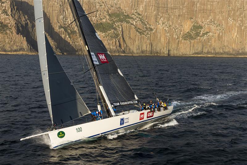
        From California Sunday by Paul Greenberg (New York Times bestselling author of Four Fish and American Catch)

        Off the coast of California, a radical experiment has closed hundreds of miles of ocean to fishing.
        Will it lead to better catches for years to come?

        “So, a little orientation,” my scuba guide told me on the beach at Monterey Bay.
        “First thing, don’t mess with the sea otters.”
        “I don’t want to mess with the sea otters.”
        “Exactly,” said the guide, “because the sea otter is basically a 60-pound weasel. Mess with the sea otter and the sea otter could tear your wet suit to shreds.”
        OK, point taken on the sea otters.
        “Second thing you’re going to have to deal with is the kelp. If you get snagged in the kelp, don’t pull. What you want to do is kind of roll … like this.”
        Here the dive master pantomimed an underwater pirouette.
        I tried and failed to imagine myself, a middle-aged New Yorker who’d never dived the California Pacific, doing the same.
        But, again, point taken.

        What had drawn me to peek under California’s waves was not a great love of scuba, but something radical that California was trying to do with its ocean.
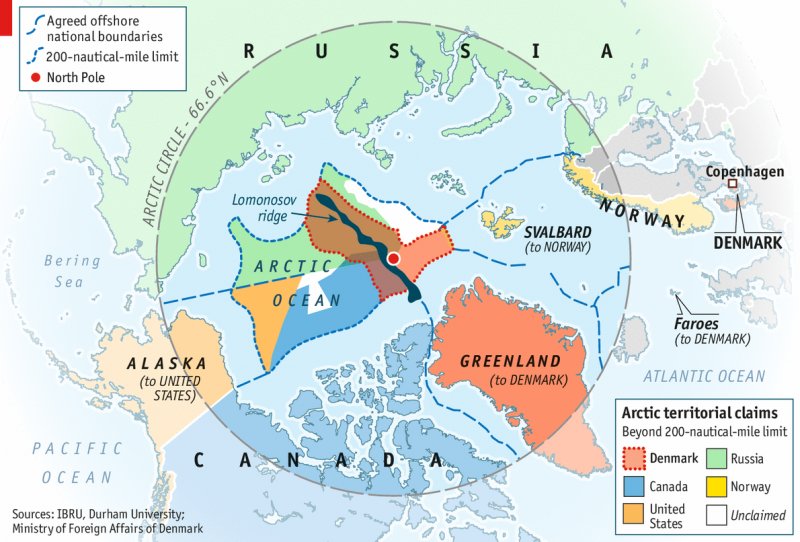
        Over the past 15 years the state has upended nearly every aspect of its fisheries management.
        At the center of that effort is the creation of 124 marine protected areas, covering more than 850 square miles, where fishing is banned or severely curtailed.
        At a little more than 16 percent of California’s ocean holdings, this represents more protected water than that of any other state in the continental United States.
        What makes California’s experiment unique as well as controversial is more than its size, though: It’s the “network effect” its proponents think they can achieve.
        By creating an interconnected stretch of no-fishing and restricted-fishing areas up and down the coast, scientists and conservationists theorize they can weave back together the elements of an ecosystem that two centuries of exploitation has blown apart.
        My interest was personal as well.
        Since childhood, fishing has been my greatest passion.
        Whenever I’ve discovered a new piece of good-looking water, my default instinct has been to find out where the fish are living and go and get them.
        I have with hook and line killed many hundreds of fish.
        The problem is, this same base instinct guides much of the way humans behave toward marine life.
        Since the 1970s, the annual global catch has doubled to around 80 million metric tons — the equivalent of the weight of the human population of China. Now, as I started to explore a state that was taking a wholly new approach, I wondered whether California’s plans for its sea might affect my own relationship to fish.

        MONTEREY BAY IS the site of Lovers Point–Julia Platt Marine Reserve, formerly the Hopkins Marine Life Refuge, one of the places where California’s ocean-conservation movement began.
        The reserve came into being back when ocean ecology was a quaint idea and restricting fishing an absurdity.
        But when you dip below Monterey’s waves, fish aren’t the first thing to enter your head.
        Rather it’s the crushing cold water, which courses under your diving hood and floods downward. Struggling against the wet suit’s buoyancy, I slipped beneath the surface and caught up with the dive master.
        I dropped down another ten feet, and the temperature dropped another ten degrees.

        Cold coastal water is the defining characteristic of much of California’s seaside — in part the result of prevailing northern winds and the eastward turning of the earth.
        These forces drive warm surface water offshore, allowing an upwelling of nutrient-rich deep water in its place.
        This frigid, fertile stream, known as the California Current, once supported an integrated system of kelp forests, invertebrates, fish, and sea otters stretching from southern British Columbia to the southern tip of Baja California.
        But over the years, piece by piece, that system has been dismantled.

        It was the sea otters with all their wet-suit-shredding ferocity that were the first piece to be removed.
        The otter’s dense fur made it the state’s first export product, cloaking Chinese royalty for nearly a century.
        By 1850, the otters were all but exterminated.
        With the otters gone, the urchin and abalone population exploded and started devouring the kelp forest.
        This caused another California fishing boom and bust.
        Chinese émigrés discovered abalone all along the coast and began drying and shipping it back to their homeland until the abalone, too, declined.

        Other immigrant communities found their place in California by fishing, in particular Croatians, Italians, and other southern Europeans.
        Although demand grew for California fish through the 20th century, halibut, rockfish, lingcod, and other bottom-dwelling “groundfish” remained primarily local staples.
        This small-scale dynamic was upset in 1983 when the federal government extended its ocean sovereignty out to 200 nautical miles and began an effort to expand the country’s commercial fishing fleet.
        Between 1976 and 1996 the number of large vessels in the U.S. increased by more than 70 percent to 28,870 boats.

        Making matters worse, fishing expanded without managers properly taking into account the natural fluctuations of the California Current.
        The eastern Pacific is governed by something called the Pacific Decadal Oscillation — a sun-driven cycle where ocean temperatures shift periodically from cold to extreme-cold regimes every few decades.
        These subtle changes affect the composition of ocean life. During the colder phases, plankton species shift and some fish struggle.
        Monterey’s sardine-dependent Cannery Row appears to have collapsed in part because of the end of a warmer regime in the mid-1940s.
        In the late 1990s, when the oscillation wobbled in the cold direction again, nine species of rockfish suffered particularly steep declines.
        In 2000, the federal government declared the West Coast groundfish fishery an economic disaster.
        Soon after, the Monterey Bay Aquarium Seafood Watch program — perhaps the nation’s most influential arbiter on sustainable fish — placed many California species on its red “Avoid” list.

        But now in Monterey Bay, as I pushed my way into the kelp in a zone where fishing had been severely curtailed, I got a glimpse of what primeval California might once have looked like.
        This was not only because fishing had been limited, but also because the system’s missing pieces have started to slot themselves back in.
        In 1938, just after the completion of the Pacific Coast Highway, a remnant population of sea otters was discovered off Big Sur.
        That small group of animals was protected and gradually began working its way up the coast.
        When in 1962 the otters entered into Monterey Bay, they were welcomed by a new concept in ocean management: the Hopkins Marine Life Refuge, one of only two no-fishing areas in the country at the time.
        The otters cropped down the sea urchins and the abalone, and something of an intact ecosystem started to reemerge.

        Now as I parted the curtain of kelp, the full breadth of the system came at me with all its diversity.
        To my left a field of flower-like anemone waved and blossomed.
        Several copper rockfish came into view, their eyes twitching from side to side.
        Here and there lingcod skulked along the bottom, and little flutters of ocean perch slipped by and lingered around the kelp fronds.
        Up until now, I had only ever seen these fish on the end of a line.
        In various trips I’d made over the years out of San Pedro or Oxnard I’d hauled in dozens of them, pulling them up from extreme depth, fighting them hard until the fish hit the ten-fathom mark.
        At that point the pressure shifts caused their eyes to pop out of their sockets and their innards to swell into their mouths.
        The suffering creatures floated beatifically to the surface without resistance.
        Here, though, they swam and intermingled, coming together and bursting apart.

         To ensure that a sport-fishing boat doesn't exceed its limit, a tally of the days catch is kept.

        To ensure that a sport-fishing boat doesn’t exceed its limit, a tally of the day’s catch is kept.
        “ARE WE DOWN YET?”
        Tim Maricich called from the bridge of his boat, Donna Kathleen.
        “Yeah, we’re down,” one of the conservation biologists from the environmental-nonprofit Nature Conservancy answered back from the cabin below.

        Maricich put his engines to idle, hunched his lanky frame forward, and looked into a video monitor. The scientists stared intently into their own set of monitors.
        On the screen a part of the seafloor came into view that many had fished but few had seen.
        A remotely operated vehicle, or rov, was settling onto Portuguese Ledge, a marine protected area 3 miles west of the town of Monterey, on the edge of a Grand Canyon–deep ravine. The vehicle’s camera began a slow pan.
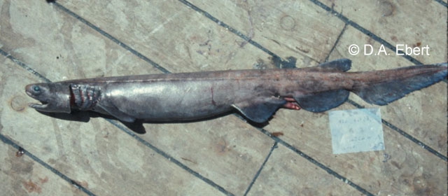
        Out of the miasma, several faces emerged, most of them belonging to different varieties of rockfish.
        Some of them were the kinds of protected species that had led to the closure of fishing grounds and put Tim Maricich out of business.
        There was enough light to make out differences of color and shape, but only barely.
        “Is that a yelloweye?” a graduate student named Christian Denney wondered half to himself and half to his Cal State supervisor Rick Starr.
        “Yelloweye!” Maricich called from above.
        “Tim’s taking Christian to school,” Starr said, and then checked the box on his research spreadsheet marked “yelloweye rockfish.”

        There is probably no better candidate for someone who should not want to collaborate with conservationists than the man who was in the wheelhouse.
        Hailing from three generations of Croatian fishermen, Maricich has fished up and down the California coast for more than 47 years.
        But when more than 150 square miles in the Channel Islands were closed as part of the state’s first marine reserve network, Maricich lost a swath of fishing grounds.
        He then retreated north to the edges of the Monterey Canyon, where he worked for a number of years until planners began identifying areas that might form part of a Central Coast network.
        “I told them at the time,” Maricich said, “ ‘You can take one area or the other, but not both.’ ”
        They took both.

        To fishermen like Maricich, conservationists can be susceptible at times to a Manichaean view of the seas, something I’ve witnessed in my interactions with foundation-funded ocean-conservation organizations.
        (Full disclosure: Since 2014, I have been a Pew Fellow in Marine Conservation.)
        Close fishing grounds, and the ocean will recover. Stop bottom trawling, and seafloor life will rebuild itself.
        But ocean ecosystems are a continually changing matrix of interlocking parts, one of which is commercial fishing.
        Fishermen who spend far more working hours on the water than scientists and who by nature are solitary and not always effective communicators often find themselves struck dumb in the face of the negotiations that stand to take away their livelihoods.

        “I said to myself, ‘I’m dead. I’m out of the fishery,’ ” Maricich recalled.
        He thought it might be time to get out of fishing altogether.
        The year before, the Nature Conservancy had initiated a program in Morro Bay to reduce the size of the fishing fleet in federal waters and was buying vessels.
        He approached the nonprofit Natural Resources Defense Council to see if they’d do the same for fishermen displaced by state closures.
        “Just buy me out,” Maricich said.
        “Put me out of business.”
        No offer came.

         The deck of a bottom trawler off Monterey.

        It was a particularly painful time for Maricich and for many other commercial fishermen, largely because they felt that they had already complied with so much regulatory upheaval.
        Just as California was carving out no-fishing reserves, federal fisheries managers, under pressure from nonprofits, were instituting a slew of restrictions in the nationally controlled waters.
        In 2001, the environmental group Oceana and several other organizations successfully sued to close “essential fish habitat” in federal waters up and down the coast.
        In 2002, the federal government instituted a coastwide Rockfish Conservation Area to the 40-fathom mark, which closed still more ocean.
        In 2004, the state significantly restricted the practice of bottom trawling, probably the most productive form of fishing, in which boats drag nets along the seafloor.
        Together, all of these different rules helped shrink the number of boats registered in California from a high of 8,427 vessels in 1981 to 2,818 in 2011.
        Nearing what for many would be retirement age, Maricich realized he had to find a place for himself within the new order.
        “I thought, Who is going to do the research around all this? If the science community is saying spot prawn are primary feed for rockfish, and we’re doing bottom degradation by fishing spot prawn, you can’t have those same scientists doing the monitoring. Let’s have transparency, and let’s have fishermen involved.”

        Maricich’s decision to throw in his lot with fish counters rather than catchers is in part economic, but it also stems from one truth that in a backdoor kind of way unites fishermen and conservationists: After all the closures and commissions, all the surveys and reappraisals, the ocean is still deeply mysterious.
        In the 1970s and 1980s, a profound knowledge deficit led to a policy of killing fish first and asking questions later.
        In the 2000s, the corrective — to close fishing grounds first and ask questions later — has been equally burdened by the problem of the vastness of the ocean.
        Which was why the research Tim Maricich has been doing with the Nature Conservancy over the past three years is so important.
        It suggests that the regulatory overhaul and the federal and state closures are working.
        “We’re pretty consistently finding species like the yelloweye rockfish, which are deemed overfished,” the Nature Conservancy’s Mary Gleason told me.
        “That suggests that the formal stock assessments are probably underestimating their abundance and that the Rockfish Conservation Areas are probably contributing to their rebuilding. We’re seeing big schools of fish — widow rockfish, chilipepper rockfish. It’s gotten the fishermen pretty excited. They’re hoping some of this data might support opening up some of the closed areas.”

        Down below, the monitoring droned on as the researchers’ attention flagged.
        “When there aren’t many fish and there’s just this stuff in the water,” Christian Denney said, “my brain starts to see things. Is that a fish or just a bunch of gunk?”
        “That’s why sensory deprivation is so effective as a torture method,” the senior scientist Rick Starr noted.
        “Wait, was that a copper rockfish head-on?” Christian asked.
        “Copper, head-on!” Maricich called out.
        “Tim, you must be listening to Christian.”
        “Hey,” Maricich called down. “That was a big fish.”
          
         A haul of mostly chilipepper rockfish caught outside of Monterey

        WHEN I TAKE stock of my life as a fisherman, the particular species that torments me is Atlantic cod.
        Back in the early 2000s, I began making an annual winter cod trip to Gloucester, Massachusetts.
        In spite of all I’d read about codfish heading toward extirpation, I nearly always ended up with good-size brown-and-yellow-speckled cod whenever I’d drop a line to the bottom.
        But as the years went by I began to notice that the codfish started getting progressively smaller and that the sport-fishing fleet was converging on an ever-diminishing area.
        The oceans still seemed full of fish, but in fact the codfish range was shrinking and the population was making something of a last stand.
        This, it turns out, is a phenomenon that the marine ecologist Daniel Pauly has identified as “the shifting baseline syndrome.”
        Simply put, when we possess no absolute measure of natural abundance, our minds use a sliding scale and incorporate what can be enormous declines within a redefinition of “normal.”
        This continual forgetting and recalibration compels fishermen to forever move on to new grounds.
        As Pauly put it to me, “Even when fisheries seem to be stable, they are slowly expanding.”
        Marine protected areas are the flip side of this constant expansion.
        By closing areas to fishing, we establish a baseline against which all our deductions can be finally measured.

        As I started thinking more and more about the possibility of not fishing, I decided to visit the Channel Islands marine reserve network.
        It comprises the first group of no-fish areas created in California and has the most data available for analysis in the post-sanctuary era.
        Since 2003, around a quarter of the water around the Channels has been closed to fishing.
        Now, more than a decade later, I wanted to see if shutting down that much ocean could have the effect that scientists hoped it would.

        Just before dawn, I boarded the Cobra in the town of Oxnard. In former times I might have fished off Laguna Beach or Marina del Rey.
        But now with reserves blocking much of the grounds to the south, Oxnard was my port of last resort. Other fishermen had the same idea.
        A small armada took shape in the penumbra when we reached the fringe of a kelp forest a little ways outside of a marine reserve near Anacapa Island.

        As the Cobra slowed to prepare for a first drift, I grabbed a live squid in the bait well.
        After hooking it through, I flipped it out and cringed as it almost dropped into the cockpit of a sleek private yacht cutting us off stern-side.
        “Hey,” one angler on our boat yelled. “Get outta the way!”

        Closing areas to fishing doesn’t necessarily reduce the amount of fishing that goes on. In fact, it may crowd more and more fishermen into a smaller space.
        This displacement effect, some theorize, could possibly cause a net loss of fish if you were to take into account areas both inside and outside the reserves.
        Amid the crowding of boats off Anacapa, it was easy to think that something like that was happening.

        When the networks were designed, the long-term growth of the fish population was of greater concern than the crowding of fishermen.
        Steve Gaines, dean of the Bren School of Environmental Science & Management at the University of California at Santa Barbara and one of the driving forces behind the Channel Islands reserve, explains the theory of the networks this way:
        “Imagine if human babies when they were born were tied to helium balloons and then we let them float for three or four days until the balloons deflated. Wherever those babies ended up would be where they would spend the rest of their lives. That’s the way it is with fish. Because larvae drift, one reserve can enrich other reserves even though they’re widely separated.”

        A decade later, the first comprehensive results are starting to emerge from scuba surveys. Jenn Caselle, a research biologist also from the University of California at Santa Barbara, has logged thousands of dive hours in the same cold water and kelp I experienced in Monterey.
        She’s found a noticeable change there, particularly around Anacapa Island, where I was now fishing. “The important message from the Channel Islands over ten years,” she says, “is that the fish inside the reserves are increasing. But here’s the key point. The populations of many fished species outside the reserves are also increasing — not as fast, but they’re increasing. This is really important because it was feared that the redistribution of fishing effort could cause scorched earth outside the reserves. That’s not happening.”

        All those extra boats that were wedged against the Cobra were apparently not doing as much damage as one would expect. Indeed, the fishing I experienced off Anacapa showed no sign of diminished returns.
        Once we’d cleared the stern of the private yacht and I flipped my squid through a pile of kelp, line started peeling off my reel.
        I leaned back and set the hook.
        Five minutes later, what I thought of as an impressive fish — a nearly 3-foot-long lilac-and-silver white sea bass — came to the gaff and hit the deck with a thud.
        I was certain my fish was going to win the jackpot, the pool of money anglers contribute to at the beginning of the day that is awarded for the biggest catch.

        Evidence like Caselle’s isn’t good enough for some critics. Ray Hilborn, a professor of aquatic and fisheries science at the University of Washington who’s frequently cited by fishermen as a counterweight to the “enviros,” claims there’s no evidence that the sanctuaries are having a comprehensive effect.
        Hilborn had taken part in the establishment of California marine reserves and found the science guidelines lacking in academic rigor.
        “If they had done it correctly,” he says, “there would have been adequate control groups, like with any experiment. They would have set up three reserves and three non-reserves and then compared the fish in each after five and then ten years.”
        But Caselle argues that a control for an experiment the size of the Channel Islands network is an impossibility.
        “The hypothesis is that the total effect of a network is greater than the sum of its parts,” she says.
        “But that is very difficult to measure. That would require having another region that is similar in all ways to Southern California but without marine protected areas. Essentially, there are no controls for entire networks.”
        In other words, the entire California approach to linking its fragmented coast is a leap of faith.
        A leap of faith where the default is not fishing instead of fishing.

        My “big” 30-inch white sea bass was soon trumped by another white sea bass a good 6 inches longer.
        Then came a bigger one.
        And an even bigger one.
        And finally a fish so big that my posing for a group photo with the other anglers and their fish at day’s end was an embarrassment.
        For good measure, just as we were gearing up to head home, the captain eased the Cobra right up to the edge of the reserve, which caused an angler in the stern to shriek.
        She had hooked a halibut the size of a radial tire.

        Perched on equipment that provides a live feed from an underwater rover, Elsa watches over Tim Maricich's wheelhouse.

        Were all these fish the result of the reserve?
        Or was it just a good day, as can happen, even when there aren’t that many fish around?
        It cannot yet be scientifically documented.
        Since many fish that are specifically protected by the reserves, like rockfish, can live many dozens of years, it may be a long time until we know the extent to which reserves populate other fishing grounds.
        By the end of the day, when the mate cleaned our catch and the dozen-odd fishermen aboard the Cobra all had a bag or two of fillets to show, there seemed to be a grudging feeling that the Channel Islands experiment had shifted something.
        As we motored back to port, a retired chef who’d been fishing next to me muttered, “I’ll tell you what, if it wasn’t for these closures, there wouldn’t be any fish at all.”
        This thought stayed with me as I made my way to the airport.
        After boarding a plane I checked my phone before shutting it down for the trip back east.
        Atop the headlines was the news that the National Oceanic and Atmospheric Administration had closed the entirety of the East Coast from Provincetown, Massachusetts, to the Canadian border to both commercial and sport cod fishing —  at least until May, in an effort to reverse declining fish populations in the Gulf of Maine.
        These were grounds I’d helped deplete over the past decade.
        After the latest stock assessment it was revealed that cod had dipped to an even lower level than had previously been assumed.
        The remaining stocks from Cape Cod to the Gulf of Maine, a population upon which colonial New England built its economy, were now reported to be between 3 and 4 percent of what would be required to have a sustainable fishery.

        As I considered this news, I thought how the fishermen of California might have avoided a similar fate.
        The Monterey Bay Aquarium’s Seafood Watch program recently surveyed the range of fisheries off California and moved many of the state’s groundfish species off its red “Avoid” list.
        In the decades ahead, commercial fishermen might enjoy rebuilt runs of rockfish and lingcod, surging runs of white sea bass and squid, all of them dashing through the regrown kelp in pursuit of sardines and anchovies that are also, apparently, on the rebound.

        With the spring migrations coming on, the usual time I’d head to Gloucester for cod, I thought about what I might do instead.
        Was there something else I could fish?
        Maybe mackerel would swing through our waters as they once did in my youth but now only do on occasion.
        Maybe the blackfish would make an appearance if they hadn’t been hit too hard by lobstermen whose Long Island Sound lobster had grown scarce.
        Or maybe I’ll just hang it up and not fish at all this season.

        Monday, March 9, 2015

        NZ Linz update with the Marine GeoGarage

        Coverage NZ Linz Marine GeoGarage layer

        As our public viewer is not yet available
        (currently under construction, upgrading to a new webmapping technology as Google Maps v2 is officially no more supported),
        this info is primarily intended to
        our universal mobile application users
        (Marine NZ iPhone-iPad on the Apple Store/ Weather 4D Android -App-in- on the PlayStore)
        and our B2B customers which use our nautical charts layers
        in their own webmapping applications through our GeoGarage API.  


        4 charts has been updated in the Marine GeoGarage
        (Linz February update published March 6, 2015 (Updated to NTM Edition 4, 20 February 2015)

        • NZ62 Cape Palliser to Kaikoura Peninsula
        • NZ63 Kaikoura Peninsula to Banks Peninsula
        • NZ86 Samoa Islands
        • NZ822 T 822 Vava’u Group
        Today NZ Linz charts (183 charts / 323 including sub-charts) are displayed in the Marine GeoGarage.

        Note :  LINZ produces official nautical charts to aid safe navigation in New Zealand waters and certain areas of Antarctica and the South-West Pacific.


        Using charts safely involves keeping them up-to-date using Notices to Mariners
        Reporting a Hazard to Navigation - H Note :
        Mariners are requested to advise the New Zealand Hydrographic Authority at LINZ of the discovery of new or suspected dangers to navigation, or shortcomings in charts or publications.