This is the first confirmed live observation of the colossal squid, Mesonychoteuthis hamiltoni, at depth in its natural habitat.
Pilots filmed the young 30-centimeter-long (one-foot) cephalopod at about 600m near the South Sandwich Islands as the Schmidt Ocean Institute’s remotely operated vehicle SuBastian descended through the water column on a dive aiming to discover new marine species, in partnership with Ocean Census during the South Sandwich Islands expedition.
Mesonychoteuthis hamiltoni was formally described and named 100 years ago, in 1925, based on two partial specimens found in the stomach of a sperm whale near the South Shetland Islands.
However, no one has ever captured footage of a living colossal squid until now.
Seabirds, marine mammals, and fishes prey on juvenile colossal squid.
At full size, their only known predators are sperm whales and sleeper sharks, although remains of large adults have also been found in toothfish stomachs, likely scavenged.
Experts believe colossal squid may reach total lengths of 6 to 7 meters and weigh about as much as a small Italian Fiat at more than 500 kilograms, making them the heaviest known invertebrate.
Dr Kat Bolstad, associate professor and lab leader of the Auckland University of Technology Lab, NZ, worked with glass squid expert Dr. Aaron Evans to help confirm this observation, and she narrated this video.
From CBS news by Emily MaeCzachor
A colossal squid — the world's largest squid species — was filmed and photographed in its natural habitat for the first time since scientists discovered it about a century ago.
Crew members on board a research vessel in the South Atlantic Ocean recorded the video March 9, said the nonprofit organization Schmidt Ocean Institute, which owns the ship.
The crew's remotely operated vehicle technically facilitated the sighting, which occurred about 2,000 feet below the surface of waters around the South Sandwich Islands, a volcanic archipelago located between the tip of South America and Antarctica.
The crew's remotely operated vehicle technically facilitated the sighting, which occurred about 2,000 feet below the surface of waters around the South Sandwich Islands, a volcanic archipelago located between the tip of South America and Antarctica.
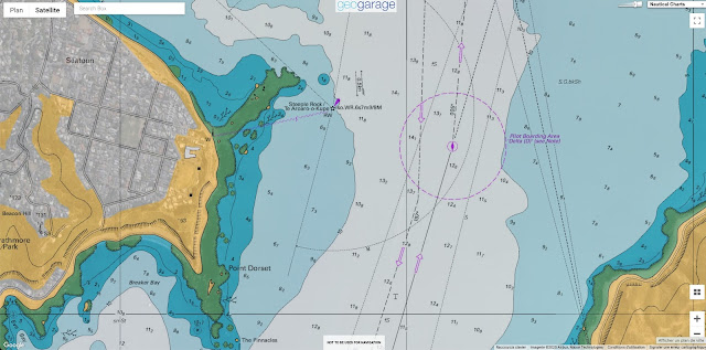
 South Sandwich Islands with the GeoGarage platform (UKHO nautical raster chart)
The unprecedented footage of the elusive deep-sea creature came 100 years after it was initially identified and given a name, according to the institute.
As their moniker suggests, colossal squid can grow to be enormous, with some ultimately weighing as much as 1,100 pounds and measuring more than 20 feet, according to Schmidt Ocean Institute.
As their moniker suggests, colossal squid can grow to be enormous, with some ultimately weighing as much as 1,100 pounds and measuring more than 20 feet, according to Schmidt Ocean Institute.
That's the height of a multi-story building.
The squid caught on video in the South Atlantic was a juvenile and much smaller than a full-grown adult, with the research team placing its size at around 11 inches long.
It's exciting to see the first in situ footage of a juvenile colossal and humbling to think that they have no idea that humans exist," said Kat Bolstad, a professor and researcher at the Auckland University of Technology in New Zealand, who the crew consulted to verify their squid footage after the expedition.
It's exciting to see the first in situ footage of a juvenile colossal and humbling to think that they have no idea that humans exist," said Kat Bolstad, a professor and researcher at the Auckland University of Technology in New Zealand, who the crew consulted to verify their squid footage after the expedition.
"For 100 years, we have mainly encountered them as prey remains in whale and seabird stomachs and as predators of harvested toothfish."
The expedition occurred during a 35-day voyage where researchers sought to find new marine life, according to the Schmidt Ocean Institute.
Colossal squid belong to the "glass squid" family, a group of about 60 squid species that earned that label because of their transparent bodies.
The expedition occurred during a 35-day voyage where researchers sought to find new marine life, according to the Schmidt Ocean Institute.
Colossal squid belong to the "glass squid" family, a group of about 60 squid species that earned that label because of their transparent bodies.
 Searching for new species in the South Sandwich Islands (Schmidt Ocean Institute)
Scientists said that while colossal squid have this appearance as juveniles, their bodies become more opaque over time.
Although not much is known about the life cycle of the massive squid, this change has been documented by fishermen who have encountered colossal squid as they die.
The Schmidt Ocean Institute's research trips have so far led to the first sightings of four species of squid, including the latest colossal squid sighting, the organization said.
The Schmidt Ocean Institute's research trips have so far led to the first sightings of four species of squid, including the latest colossal squid sighting, the organization said.
The institute's executive director Jyotika Virmani described the encounters as "unforgettable moments," which "continue to remind us that the Ocean is brimming with mysteries yet to be solved.
Links :
- New Scientist : First ever confirmed image of a colossal squid in the deep ocean


.png)


 Small island, big fuss


