Saturday, September 30, 2017

Ouessant, au souffle du vent


 from Arte
The last stopover before America, Ouessant is nicknamed "the end of the world".
A documentary with a poetic breath of breath on this island of Finistère eternally submitted to the whims of the wind.
Raising anchor for Ouessant is taking to the sea.
The island is regularly swept by spectacular storms.
The unreal light varies there at any moment and gives these few arpents of land an atmosphere out of time.
Ouessant has never changed its face: no tall buildings but simple and rustic houses.
Its nine hundred inhabitants are deeply attached to their environment.
Their word is sober and straightforward.
They all live to the rhythm of the wind, an omnipresent element.
The stroll of director Raphaëlle Aellig Régnier follows this red thread and reveals to us the powerful, violent and poetic nature of this small stone on the ocean.


Friday, September 29, 2017

The Coast Guard is detecting a new trend among high-seas narco smugglers

Suspected trafficking routes detected during 2016. Adam Isacson/US Southern Command

From Business Insider by Christopher Woody


Since June, Coast Guard vessels patrolling the US's southern approaches have stopped seven low-profile smuggling vessels — stealthy ships that ride low in the water to spirit illicit cargos from South America to Mexico and the US.


US authorities sit on a "narco-submarine" found off the coast of El Salvador, July 18, 2015. US Customs and Border Patrol

Akin to self-propelled semi-submersibles used by smugglers for the same purpose, low-profile vessels are boats designed to run near or at surface level to present the smallest possible radar signature.

Low-profile vessels usually have a sharp bow to cut through the water and an elongated body to transport cargo — typically high-value drugs like cocaine.
Some only have masts or conning towers that stick out above water, and they are often outfitted with multiple outboard engines and painted to blend in with the water.

The Coast Guard said the last time a low-profile vessel was stopped prior to the current fiscal year was in late May 2016.
Six narco subs were caught during that fiscal year (and one was intercepted in September, the first month of fiscal year 2017).
The seven interdictions since June occurred in drug-transit areas in the eastern Pacific, off the coasts of South and Central America.


US Coast Guardsmen sit atop a narco sub stopped in the Pacific Ocean in early September 2016.
US Coast Guard

In mid-August, Coast Guard cutter Steadfast intercepted a suspected low-profile vessel several hundred miles off the coast of Central America, seizing more than 6,000 pounds of cocaine and arresting four suspected traffickers.

Another low-profile vessel — six feet wide and 54 feet long — was stopped by Coast Guard cutter Waesche off the Central American coast in early June, after the cutter tracked the vessel for almost 100 miles. The Waesche's crew arrested four suspected smugglers and seized 2.79 tons of cocaine.

The US and partner forces have stepped up their activity in the eastern Pacific, and cocaine production has risen considerably in Colombia, the world's biggest producer of the drug.

The result has been "a significant increase in narcotics removal" in drug-transit areas off South and Central America, the Coast Guard said.

During fiscal year 2016, the Coast Guard set a record by seizing more than 443,000 pounds of cocaine bound for the US.
The service says it is on pace for another record-setting amount of seizures this fiscal year, though officials have warned that it doesn't have the resources to fully address the trafficking activity it detects.

Take a look inside what Colombian drug smugglers use to carry tons of cocaine across the sea.
And how arm forces hunts them down.

The ocean area from Colombia to the Galapagos and up to the Mexican and US coasts is about the size of the continental US, Vice Adm. Charles Ray, the Coast Guard's deputy commandant for operations, said at a hearing earlier this month.
"On any given day we'll have between six to 10 Coast Guard cutters down here," Ray added.

"If you imagine placing that on [an area the size of] the United States ... it's a capacity challenge."

US officials believe about 90% of the cocaine shipped to the US traverses the sea at some point, typically arriving somewhere in Central America or Mexico and being smuggled over the US-Mexico land border.

The Drug Enforcement Administration says about 93% of the cocaine sent to the US comes through the Mexico/Central America corridor.
US anti-narcotics officials also think they intercept about one of every four tons of cocaine headed for the US, with about 69% of it stopped in the eastern Pacific Ocean.

Narco subs — a category that includes fully submersible vessels, semi-submersible vessels, or towed containers — appeared in the 1990s, as Colombian smugglers sought to stay ahead of law-enforcement's detection abilities.

Fully submersible and semi-submersible vessels are hard to detect and expensive to build (though their cargos are valuable enough that a single trip can cover the price), so interceptions of them are not that common.


A Coast Guard cutter Stratton boarding team investigates a self-propelled semi-submersible off the coast of Central America, July 19, 2015.
US Coast Guard/Petty Officer 2nd Class LaNola Stone

Low-profile vessels, which are not technically semi-submersible, are the majority of seized drug-smuggling vessels, according to a 2014 report.

Low-profile vessels can come in various forms, often balancing speed and stealth in different ways.
A more recent variation appears to be what naval expert HI Sutton called "very slender vessels" — elongated vessels that go through waves rather than over them.

In April, Guatemalan forces found an abandoned vessel that appeared to be a VSV, as did the crew of the Waesche in June.

VSVs sacrifice cargo size for stealthiness and speed, and their appearance suggests a maturation in the designs of Colombian traffickers — in particular Los Urabeños, the country's most powerful criminal group — Sutton notes.


A abandoned low-profile vessel found by the Guatemalan coast guard on April 22, 2017.
Guatemalan army/US Southern Command

Narco subs are typically constructed near Colombia's Pacific coast, assembled under cover of jungle canopy.

They're moved through rivers and mangroves to the coast once completed, and their smuggling routes typically take them out into the Pacific — sometimes around the Galapagos Islands — before turning north.

"In recent years, 'narco-sub' vessels (mostly LPVs) have been built with upper lead shielding which helps to minimize their heat signature and hence they can evade infrared sensors," according to a 2014 paper in Small Wars Journal.
"Some of the newer models have piping along the bottom to allow the water to cool the exhaust as the ship moves, making it even less susceptible to infrared detection."

In addition to the Coast Guard air and sea assets deployed to stop traffickers, US Customs and Border Patrol have eight P-3 Orion maritime patrol aircraft converted into Long Range Trackers.
The former Navy aircraft have been upgraded with radars originally designed for the F-16 fighter jet, as well as optical sensors.

Links :

Thursday, September 28, 2017

Mapping the menacing sea monsters in medieval and renaissance cartography

Orcas attacking a whale, from Carta Marina (1539)

From Ancient Origins by April Holloway

Until a few years ago, no serious consideration had been made of the many and varied representations of monsters found on world maps from the 10th century through to medieval and Renaissance times.
Yet they made so many appearances for a reason.
These monsters of the deep had caused concern – indeed struck fear into – sailors around the globe.
Although some of the images seem fantastic to the modern world, most of the creatures had some basis on true encounters, and their depiction on maps are a great example of how mythology and folklore can evolve from real events.

Merian, Matthaeus, "America nouiter delineata," [1634]
Like many cartographers of the era, Matthaeus Merian filled his maps' blank spaces with frightening creatures, like this sinister seamonster.
During the Age of Exploration, sailors provided natural philosophers and cartographers with firsthand accounts of the unfamiliar animals and people beyond the horizon.
Their experiences in this “New World” were informed by folk tales, biblical lore, and racial and cultural biases (not to mention the anxiety of sailing into unknown waters), and as a result, many of the creatures they encountered were interpreted as terrifying monsters.
Merian took this theme a step further, and surrounded his title cartouche with ominous skulls and bones to underscore the mysteries and dangers he and Europeans of his time associated with the New World and its surrounding oceans.
His message can be loosely interpreted as, “Beware, explorers and sailors, or these skulls might be yours!”

In 2013, the British Library released a book which took the study of these creatures seriously and offered a full and detailed account of the menacing artwork appearing on these maps.
Chet Van Duzer's " Sea Monsters on Medieval and Renaissance Maps" (British Library, 2013) catalogues a variety of examples of ‘sea monsters’ which cartographers had seen fit to include in previously unchartered areas of the world, issuing possible warnings of the creatures that had been or might be encountered in certain ocean territories.
Although it has been thought that the inclusion of these mythical creatures were simply the results of illustrators’ over-zealous artistic license and overactive imagination, many of the ocean’s creatures, such as whales, sharks, walruses and squid would have rarely been seen, and would have been viewed as monsters in medieval and Renaissance times.


Taken from the vignettes on Olaus Magnus's Carta marina, Basel c.1544 (Public Domain)

"The creatures look purely fantastic.
They all look like they were just made up," Van Duzer, a map historian at the Library of Congress, said in an interview concerning his book.
"But, in fact, a lot of them come from what were considered, at the time, scientific sources." For example, it was quite usual for the encyclopedias of the time to contain reference to strange looking terrestrial-aquatic-hybrid animals and mapmakers just took some poetic license in depicting them.

In his book, Van Duzer, who was a 2012 Kluge fellow at the Library of Congress, charts the origins of sea monsters from "mappa mundi," medieval European maps of the world; nautical maps; and Ptolemy's Geography, a treatise by the Greco-Roman mathematician and scientist Claudius Ptolemy, which contained an atlas of the known world during the second century.

The Kraken is but one example of a real sea creature being transformed into a beast of legend.
It is first mentioned in the Örvar-Oddr, a 13th century Icelandic saga.
In Scandinavian mythology, this gigantic sea creature was said to be 1 mile long.
It was depicted as great beast that would attack ships and was so huge that its body could be mistaken for an island.

St.Brendan's ship on the back of a whale.
From by Chet Van Duzer and published by the British Library:
'Sea Monsters on Medieval and Renaissance Maps' (CC BY 2.0)

The Kraken was also made it into the first edition of Systema Naturae [1735], a taxonomic classification of living organisms by the Swedish botanist, physician, and zoologist Carolus Linnaeus.
Here the Kraken was classified as a cephalopod, designating the scientific name Microcosmus marinus.

The myth of the Kraken is believed by historians and scientists to relate to the real world giant squid, which can reach 18 meters in length and has been rarely seen due to its normal habitat being deep in the ocean.

Iceland is burning and attacked by sea monsters.
Map by Abraham Ortelius Flemmish Cartographer (Public Domain)

By tracing the depictions of sea monsters throughout the centuries, Van Duzer presented an evolution from a world full of dangers lurking in distant oceans where gigantic octopuses and whales drag ships and sailors into the sea, to 17 th century maps showing ships exerting dominion over the beasts of the ocean.
Eventually, the beasts disappeared from maps altogether.

The take away from Van Duzer’s fascinating depiction of sea monsters is that mythological stories and legends of the past, however fanciful they seem, often stem from real life events or experiences.
Many of the stories from our ancient ancestors evolved from real events that were portrayed according to the understanding and knowledge of the time.
They may have become exaggerated and stray far from reality (any creature 1 mile long is stretching it) but the origin often hails from a seed of truth.

Links :

Wednesday, September 27, 2017

US NOAA update in the GeoGarage platform

5 nautical raster charts updated

New scans reveal what lies beneath Venice's canals

Bathymetry of the famous Piazza San Marco (St Mark's Square) with the Campanile.
Source and Credit: Ismar-Cnr/Google Earth.

From Forbes by David Bressan

The Italian harbor city of Venice is famous for its many canals and bridges.
Built along the shores of the Adriatic Sea, the canals were used for protection, sheltering the city from the mainland, and transportation within the city.
For the first time, research by the Italian Institute for Marine Research (Ismar-Cnr) and the Italian Navy has revealed what lies beneath the water's surface.

 Venezia in the GeoGarage platform (Navimap/IIM nautical chart)

The depth of the canals was measured in high details using echolocation technology.
Using the time needed by the signals to be reflected from the ground, not only can the depth be calculated, but also the density and type of encountered substrates.

 The light pink polygon depicts the area surveyed by the Istituto Idrografico della Marina (IIM) (Italian Hydrographic Institute), whereas the coloured ones the CNR-ISMAR weekly covered areas. Pseudo-true-colour LANDSAT 8 OLI imagery as background.

The scans show areas of sediment accumulation and sediment erosion, which is especially important for the maintenance of the canals.
Yellow and red colors in the published data show shallow water - in some cases just three feet deep.
Green and blue colors are deep water, thirty to sixty feet deep at least.
The maximum depth found in the Venetian Lagoon is 164 feet below sea level.

 Bathymetry of the main channel to the seaport of Venice (eastern part).
Source and Credit: Ismar-Cnr/Google Earth.

Main channel (western part) and seaport of Venice,
note the large cruise ships anchored along the piers in the port.
Source and Credit: Ismar-Cnr/Google Earth.
The artificial channels significantly changed the currents in the lagoon of Venice.
Marine lifeforms living here have to deal with strong seasonal variations of salinity and oxygen, as the exchange of water with the open sea is limited.
Tides transport sediments into the lagoon.
Because the Venetian Lagoon is now separated from the open sea by dams, the sediments tend to accumulate and fill the canals and the lagoon.
The scans also revealed another type of anthropogenic impact.
In some pictures strange round features are recognizable on the ground of the canals, disposed tires and other trash.

 Tires, parts of smaller boats and possibly house utensils disposed in one of the many smaller canals. Maximum depth in this image is twenty feet.
Source and Credit: Ismar-Cnr/Google Earth.

The research and data were published in the online journal  Scientific Data (Nature), the article with the title 'High resolution multibeam and hydrodynamic datasets of tidal channels and inlets of the Venice Lagoon' is freely accessible online.

Links :

Tuesday, September 26, 2017

David Attenborough on the scourge of the oceans: 'I remember being told plastic doesn't decay, it's wonderful'


Sir David Attenborough:
‘People say, How did you first become interested in animals?,
and I say: Was there a time when you were not interested in animals?’
"All we have to do is keep declaring the facts as we see the facts, and producing the evidence whenever we can"

From The Guardian by Fiona Harvey

His sequel to The Blue Planet will focus not only on the marvels of sea life but also the threats to it.
The naturalist explains why plastic pollution, climate change and overpopulation are problems too urgent to be left to ecologists

David Attenborough vividly remembers, nearly 80 years on, his first encounter with one of the worst scourges of the planet.
He was a schoolboy.
“I remember my headmaster, who was also my science master, saying: ‘Boys, we’ve entered a new era! We’ve entered, we’ll be proud to say, the plastic era.
And what is so wonderful about this is we’ve used all our scientific ingenuity to make sure that it’s virtually indestructible.
It doesn’t decay, you know, it’s wonderful.’”

Attenborough lets the last word hang in the air, eyebrows and hands raised.
Then the hands fall.
Now we dump thousands of tonnes of it, every year, into the sea, and it has catastrophic effects.”


United Nations - Plastic - both a wonderful invention and a scourge on our planet.
Over 300 million tons will be produced this year.
Most is never recycled and remains on our land and in our seas for ever.
Our story shows the damage to all creatures who depend on the ocean for their food –
from birds… to us.

Pieces of plastic in the ocean will soon outnumber fish.
They have, in the past few years, been recognised as one of the most pressing problems we face.
Fish eat the plastic debris, mistaking it for food, and can choke or starve to death.
The long-term effects are not yet understood, but we do know that plastic microparticles are now found in drinking water across the world, as well as throughout our oceans.

Plastics are the latest in a long line of concerns for the 91-year-old naturalist.
They are a key theme of his latest work for television, the new series of The Blue Planet, which he will return to writing after our interview.
Premiering at the BFI Imax in London this Wednesday – with Prince William as a special guest – the series will focus not only on the marvels of ocean life, but the threats to it, of which plastic is one of the worst.
It will also deal with what people can do to help.

Plastic Oceans

The arc by which plastics started off as a wonder of technology and ended up as a calamity is familiar to the veteran conservationist.
It seems to be repeated endlessly: CFC aerosols and refrigerants destroying the ozone layer; pesticides killing wildlife; the fossil energies that fuelled a career based around television and exotic international travel resulting in climate change; the advances in medicine prolonging life and bringing good health, but giving us a population explosion that Attenborough fears will endanger further species, including our own.

For Attenborough, however, there must always be a message of optimism running above and beyond any warnings of doom.
While he admits to sadness at the disappearances he has witnessed – “Overall, without any question, the world is not going to be as varied and as rich as it was a hundred years ago” – he insists on practical solutions.
“It’s within our power, because most of the problems are created by us, and we can solve them or should be able to solve them,” he says, slapping his knee emphatically.
“There are solutions, and there is cause for hope, and there’s cause for encouragement, and it isn’t all disasters.”

Take plastics.
That problem could be solved “if we got together, within a decade, if not less”.
It could be dealt with technically, through potential breakthroughs such as degradable plastic.
“And disposing of it could be dealt with technically,” he adds.
This could involve ways to collect and filter plastics from the sea, and to absorb or break down the plastics that are already there.
And “stop putting plastic in the sea”.


A career spanning seven decades has earned him a loyal following of tens if not hundreds of millions of viewers, who are entranced by his delight in the beauties and savageries he witnesses.
It has also given him a unique authority.
When Attenborough speaks, viewers tend to trust him.

For years, he kept this trust to himself.
He was associated with several conservation groups, from Flora and Fauna International to the Dragonfly Society, but did not use his public platform to make prescriptions for the planet’s future.
For this, he was sometimes criticized by green activists, who wanted him to take a public lead on issues such as climate change.

It is evidently a criticism he feels a need to address, and, without prompting, he offers that in his earlier career he felt inhibited by his association with the BBC, where he was a channel controller as well as presenter, and the need to be strictly impartial.
“I joined the BBC after [national service in] the navy, and there was a monopoly and it was like a civil service.
So you had to be guarding against propaganda or guarding against grinding axes.
And so the moment had to be judged as to when it was you suddenly started talking about conservation and when it was that you were behind the Greenpeaces of this world.
They were the cutting edge and you, as a broadcaster, had to make sure that both sides of the argument were ventilated until such time as you, in your professional capacity, thought it was absolutely justified to say: ‘This is incontrovertible, this is what we’re doing to the natural world.’”

As he has felt more free to speak out, one of the more controversial areas Attenborough has addressed is population growth.
Of all the world’s problems, this is the one he sees as central and most difficult to solve, although it is a tricky and unpopular cause to take up.
Many high-profile environmentalists will privately agree that the rapid growth in the world’s population – now at more than 7 billion, a tripling since Attenborough was born – creates further problems, because feeding 9 billion by 2050 will be hard, and raising people out of poverty even harder, and it makes a real conundrum of giving people decent lives, opportunities and governance, while protecting dwindling natural resources and halting climate change.
For a start, it sounds offensive, even patronising – particularly coming from anyone who lives a relatively privileged life in a developed country.
For another, it crosses religious and other taboos.
And – for many the clincher – it can look like blaming the more numerous poor of the developing world for problems emphatically not of their making.

Attenborough chooses his words slowly.
“I sometimes question whether I should be more positive or more outgoing on the question.
The trouble is that we don’t know the answer.
What we all say is that if women are given political freedom and education and medical facilities and all the rest of it, the birth rate falls.
That’s actually not the whole question.
It’s more complicated than that.
But it’s all I can say in response.
One should be very cautious about imposing, from where I sit, regulations where other people have got the problems.”

But he will draw the links between population growth and ecological destruction.
“The whole question of migration out of Africa across the Mediterranean has multiple causes and part of it is the political systems, but part of it is undoubtedly ecological systems and sociological problems.
I mean the changing of the climate in Africa, the spread of the desert in Africa, the rise of political systems which oppress – all those things mount up.
That’s why conservation is not any more just the affair of ecologists.”


Viewing conservation as part of the whole future of humanity, rather than a thing apart, is one of Attenborough’s great legacies.
He is spearheading an effort at Cambridge University to bring all academic disciplines – “not just other botanists, not just ecologists, but law, international lawyers, psychologists, geographers, political scientists and so on” – to bear on the pressing problems of the planet.
“Break down those walls and get people talking about it who wouldn’t otherwise meet,” he says.

The Cambridge Conservation Initiative is a collaboration among 10 institutions, housed in the new Sir David Attenborough building in Cambridge.
Its future has just been assured by a $10m (£7.4m) endowment from Arcadia, the charitable fund of Lisbet Rausing, one of the heirs to the Tetra Pak fortune, and her husband, Peter Baldwin.
It will work across all conservation and environmental issues, and its ethos mirrors Attenborough’s own polymathic approach: the idea is that people will congregate in the building, from all over the world as well as across disciplines, for the cross-fertilisation of knowledge.

Attenborough spent two years at Clare College, Cambridge, from 1945, taking a degree truncated by the war.
“It was two years of unalloyed bliss,” he says.
“It’s a sudden great opening of windows, if you’re a provincial grammar school boy like me.
And you were with these people who had been fighter pilots and so on and you realised that the sun had come out over Europe and over you.
You were just looking through intellectual windows and singing, yes, madrigals – never heard of madrigals before.
Gosh, how marvellous.”

It was here, while ostensibly studying X-ray crystallography (“it was ghastly – I couldn’t understand a bar of it”) that he embarked on turning his interest in nature into the beginnings of a career.
“A guest lecturer came in and talked for an hour about frogs.
And all the extraordinary varieties, the beauties of frogs, how the frog’s life was dominated by how on earth they were going to rear their young, who needed water.
Some did it by spinning foam and hanging it above a pond.
Some by taking their eggs into their mouths.
Some even did it by putting eggs in their stomachs – extraordinary.
And so you sat there with your jaw slacking, just the amazement and splendours and wonders of the world.”

Keeping that sense of wonder will be what keeps us alive, he believes, if we do choose to save the planet.
“If you want a comfortable life, what you do is you turn your mind, your face away from problems, of course.”
He sees his responsibility as reminding people that they can and must turn towards the problems, and find solutions – in day-to-day life and in collective efforts.
To do that, he believes, the most important thing is to remind people of what they have forgotten, and what is sometimes hard to remember – why we are in love with the world we live in.

Can a Minke whale escape a dramatic attack by Orcas?

“People say to me, ‘How did you first become interested in animals?’, and I look at them and I say: ‘Was there a time when you were not interested in animals?’ It’s the first sort of pleasure, delight and joy you get as a child.
As a child grows, he becomes aware of all sorts of things, sex or computers and the internet and so on.
But if he loses the first treasure, he’s lost something that will give him joy and delight for the rest of his life.”

Links :


Monday, September 25, 2017

Superaccurate GPS chips coming to smartphones in 2018


From IEEE by Samuel K. Moore

We’ve all been there.

You’re driving down the highway, just as Google Maps instructed, when Siri tells you to “proceed east for one-half mile, then merge onto the highway.”
But you’re already on the highway.
After a moment of confusion and perhaps some rude words about Siri and her extended AI family, you realize the problem: Your GPS isn’t accurate enough for your navigation app to tell if you’re on the highway or on the road beside it.

Those days are nearly at an end. At the ION GNSS+ conference in Portland, Ore., today Broadcom announced that it is sampling the first mass-market chip that can take advantage of a new breed of global navigation satellite signals and will give the next generation of smartphones 30-centimeter accuracy instead of today’s 5 meters.


Even better, the chip works in a city’s concrete canyons, and it consumes half the power of today’s generation of chips.
The chip, the BCM47755, has been included in the design of some smartphones slated for release in 2018, but Broadcom would not reveal which.

GPS and other global navigation satellite systems (GNSSs), such as Europe’s Galileo, Japan’s QZSS, and Russia’s Glonass, allow a receiver to determine its position by calculating its distance from three or more satellites.

All GNSS satellites—even the oldest generation still in use—broadcast a message called the L1 signal, which includes the satellite’s location, the time, and an identifying signature pattern.
A newer generation broadcasts a more complex signal called L5 at a different frequency in addition to the legacy L1 signal.
The receiver essentially uses these signals to fix its distance from each satellite based on how long it takes the signal to go from satellite to receiver.
Broadcom’s receiver first locks onto the satellite with the L1 signal and then refines its calculated position with L5.
The latter is superior, especially in cities, because it is much less prone to distortions from multipath reflections than L1.

In a city, the satellite’s signals reach the receiver both directly and by bouncing off of one or more buildings.
The direct signal and any reflections arrive at slightly different times, and if they overlap, they add up to form a sort of signal blob.
The receiver is looking for the peak of that blob to fix the time of arrival. But the messier the blob, the less accurate that fix, and the less accurate the final calculated position will be.
However, L5 signals are so brief that the reflections are unlikely to overlap with the direct signal.
The receiver chip can simply ignore any signal after the first one it receives, which is the direct path. The Broadcom chip also uses information in the phase of the carrier signal to further improve accuracy.

Though there are advanced systems that use L5 on the market now, these are generally for industrial purposes, such as oil and gas exploration.
Broadcom’s BCM47755 is the first mass-market chip that uses both L1 and L5.

Why is this only happening now?
“Up to now there haven’t been enough L5 satellites in orbit,” says Manuel del Castillo, associate director of GNSS product marketing at Broadcom.
At this point, there are about 30 such satellites in orbit, counting a set that only flies over Japan and Australia.
Even in a city’s “narrow window of sky you can see six or seven, which is pretty good,” Del Castillo says.
“So now is the right moment to launch.”


Broadcom had to get the improved accuracy to work within a smartphone’s limited power budget. Fundamentally, that came down to three things: moving to a more power-efficient 28-nanometer-chip manufacturing process, adopting a new radio architecture (which Broadcom would not disclose the details of), and designing a power-saving dual-core sensor hub.
In total, they add up to a 50 percent power savings over Broadcom’s previous, less accurate chip.

In smartphones, sensor hubs take the raw data from the system’s sensors and process it to provide only the information the phone’s applications processor needs, thereby taking the computational burden and its accompanying power draw off of the applications processor.
For instance, a sensor hub might monitor the accelerometer looking for signs that you had flipped your phone’s orientation from vertical to horizontal.
It would then just send the applications processor the equivalent of the word “horizontal” instead of a stream of complex accelerations.

The sensor hub in the BCM47755 takes advantage of the ARM’s “big.LITTLE”design—a dual-core architecture in which a simple low-power processor core is paired with a more complex core.
The low-power core, in this case an ARM Cortex M-0, handles simple, continuous tasks.
The more powerful but power-hungry core, a Cortex M-4, comes in only when it’s needed.

The BCM4775 is just the latest development in a global push for centimeter-level navigation accuracy.
Bosch, Geo++, Mitsubishi Electric, and U-blox established a joint venture called Sapcorda Services in August, to provide centimeter-level accuracy.
Sapcorda seems to depend on using ground stations to measure errors in GPS and Galileo satellite signals due to atmospheric distortions.
Those measurements would then be sent to receivers in handsets and other systems to improve accuracy.

Japan’s US $1.9 billion Quasi-Zenith Satellite System (QZSS) also relies on error correction, but it additionally improves on urban navigation by adding a set of satellites that guarantees one is visible directly overhead even in the densest part of Tokyo.
The third of those four satellites launched in August.
A fourth is planned for October, and the system is to come online in 2018.

Links :

Today in technology: raising a ladder to the moon, under the sea


From Pulse by Brad Smith & Carol Ann Browne

Today, September 22, 2017, business and government leaders from around the world gather in Virginia Beach to unveil a modern-day marvel on the ocean floor: a 4,000-mile-long cable stretched between North America and Spain that can transmit eight times the volume of the U.S. Library of Congress, in one second.
Marea – named for the Spanish word “tide” – is the first subsea cable connecting the United States and Spain.
Completed by Microsoft, Facebook, and Telxius, Marea establishes a faster and stronger telecommunications link not only to Europe, but to the next billion internet users that will come from Asia, Africa, and the Middle East.


It took more than five months for engineers and the crew aboard the CS Dependable to load and lay Marea along the seabed, which in spots plunges to depths of more than 17,000 feet.
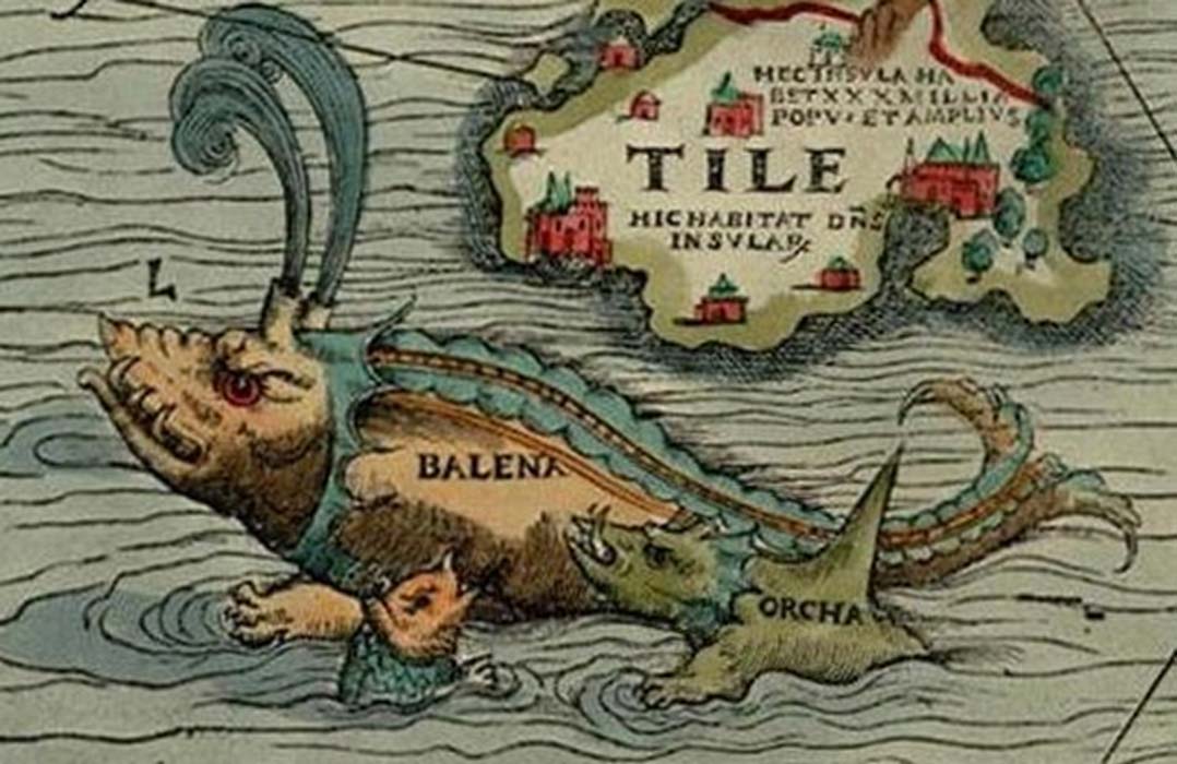
A daunting feat today, but downright unthinkable 150 years ago when American financier Cyrus Field first set out to connect the New World with the old via an undersea wire.
News stories at the time deemed his ambitious attempts “only one degree, in the scale of absurdity, below that of raising a ladder to the moon.”


It’s a fitting day to recall not just the enormous engineering innovation that went into this first subsea cable, but the continuing innovations that help make cables like Marea part of the critical infrastructure of our own time.

Few people before Field’s day understood the profound impact that creating a communications link between the world’s continents would have.
The War of 1812 between Great Britain and the United States, for instance, would have ended two weeks earlier – preventing 2,792 casualties at the bloody Battle of New Orleans – if news of a truce had reached troops before that battle began.

The dream of connecting Europe and the United States with a cable was born with electricity, which made possible the invention of telegraphy, the process of transmitting text or symbols through an electric current.
While inventors across Europe and the U.S. experimented with battery-powered telegraphs, American inventor Samuel Morse was inspired to develop a binary code of pulses to transmit natural language.
He demonstrated his invention in 1837, catching the eye of investor and machinist Alfred Vail, who worked with Morse to patent an electromagnetic telegraph machine that printed messages on a strip of paper.


In 1844, with the help of a $30,000 grant from the U.S.
Congress, long-distance telegraphy became a commercial reality when Morse and Vail dispatched the first Morse Code message from the Supreme Court chamber in Washington, D.C. to the B & O Railroad Depot in Baltimore, Maryland: “What hath God wrought?”
The Information Age had arrived.

 Korff Brothers - Map of the submarine telegraph between America and Europe,
with its various communications on the two continents (1857)

Less than a decade later, countries around the world were laced with extensive telegraph networks.
Communications that had taken weeks by horse and carriage now occurred instantaneously.
Telegraphy transformed how people communicated and spread news, changing forever how journalists, politicians, bankers and even military leaders conducted their business.
By the 1850s, the United States alone had 23,000 thousand miles of land-based cable, Prussia had 1,400 miles, Great Britain 2,200 miles, and France 700 miles.
By 1861, the United States was connected coast to coast by cable, bringing the fabled run of the Pony Express to an end.

Creator: Van Hoven, C.

After conquering overland communications, telecommunications pioneers set their sights on bridging the seas.
But underwater telegraphy was plagued by technical barriers, particularly by the inability to protect the wire from water.
While inventors in London and New Jersey experimented with methods to keep the cable dry, a solution was found half way across the globe, in the Malaysian archipelago, where the sap from the gutta tree proved an effective thermoplastic insulator.
When warmed, the substance, known as gutta-percha, became pliable and molded around a copper wire.
In the deep ocean, the cold water hardened it into a firm shell.
By 1851 gutta-percha was imported to the British Isles and used on a 25-mile telegraphic line connecting London to France across the English Channel.

But the experiment failed.
The insulation proved too thin, and water seeped into the cable, garbling signals before they reached the end of the line.
And within a few hours, the malfunctioning cable was snagged and severed by a curious fisherman off the coast of France.

The following year, in 1852, European engineers tried again, this time protecting the copper cable with a sheath of gutta-percha covered in hemp and incased in an iron fiber skirt.
This second cross-channel cable worked, and within five years cables connected England with France, and the Netherlands.
Soon Ireland, Corsica, Sardinia, and Italy were connected, and a line ran across the Black Sea speeding up British contact with Crimea during the Crimean War.


Back in North America, an attempt to wire Newfoundland, Canada to New York was on the verge of bankruptcy.
Desperate for an investor to save the project, the designer approached Field, who declined to invest.
But the offer got him thinking.
What if Newfoundland could be a key junction point in a new transatlantic telegraph? In 1856, he purchased the failing Newfoundland cable company, founded the Atlantic Telegraph Company and staked his fortune and reputation to bring his “outlandish” plan to life.

In 1857, two of Field’s ships set sail in the Atlantic with enough cable to wrap the globe 13 times.
Just five miles out to sea, the cable snapped.
The ship and crew returned, collected the cable and set out again.
This time, they got farther, about 335 miles out to sea, but again the cable snapped, dropping 12,000 feet to the ocean floor.
Despite the loss, Field was pleased.
The cable had maintained a continuous signal to the point where it had snapped.


Finally, on August 16, 1858, a telegraphic line of seven copper wires weighing one ton per nautical mile was successfully laid between the west coast of Ireland and Newfoundland.
It was a huge event for people on both sides of the Atlantic.
The cable officially opened when Queen Victoria sent U.S. President James Buchanan a message in Morse Code “fervently hoping that the electric cable, which now connects Great Britain with the United States, will prove an additional link between the two places whose friendship is founded upon their common interests and reciprocal esteem."

Fireworks lit up the New York skyline, accidentally setting city hall on fire.
The English response was more officious but nonetheless celebratory, as the chief British engineer on the project, Charles Bright, was given an immediate knighthood, at the age of 26.
And Field became an instant hero across the United States, regarded by many as one of the most famous and accomplished individuals of his age.

But the jubilation between the two countries was short-lived when the cable stopped functioning just a few weeks later.
Engineers soon learned that they had not yet mastered the science needed to keep a subsea cable of such length functioning properly.
Their biggest problem was the degradation or loss of the signal as it traveled such a long distance over a copper wire in deep, cold water.
This was a challenge that could be mastered only through the hard experience gained once the first trans-Atlantic cable was successfully laid.

The public, however, was less understanding.
Celebration turned to condemnation of the venture and Field’s leadership of it, and Congressional investigations and legal threats soon followed.
Some thought that the entire venture had been a fraud or a hoax.
Field found that where well-wishers previously had stopped him on the sidewalk to congratulate him, now even his friends crossed the street to avoid saying hello.
The U.S. Civil War intervened, efforts to repair the line were put on hold for several years, and the public understandably turned its attention elsewhere.


Once the Civil War ended, however, engineering efforts resumed.
Field had never given up on his dream, and the necessary technology had advanced considerably in the intervening years.
While initial efforts in 1865 failed when a ship lost the end of a cable, the following summer, in 1866, Field’s crew returned to the sea and met with success.
When the ship returned, it came “gliding calmly in as if she had done nothing remarkable, dropped her anchor in front of the telegraph house, having trailed behind her a chain of two thousand miles, to bind the old world to the new."

From the telegraph house of Heart’s Content, Newfoundland, Field sent a telegram to New York, “We arrived here at 9 o’clock this morning.
All well.
Thank God, the cable is laid and in perfect working order.”
Immediately the ship returned to sea, and four weeks later it restored the lost wire of the 1865 trip.
In one month the Atlantic secured two transoceanic cables, and a decade’s worth of effort finally paid off.

 
Hailed as the “eighth wonder of the world,” the cables created a network of almost instantaneous communications and proved to be an early catalyst of globalization.
News that previously took weeks or months to reach its destination could be relayed within hours.
As technology and cable-laying techniques continued to advance, the submarine cable network expanded, and by the early 20th century much of the world was connected by a network of cables.

In 2017, people might look back at Field and conclude that subsea cables are “old” technologies whose advances ended long ago.
They might even think that, in an age of ubiquitous wireless communication, the role of such cables is a vestige of the past.
But both views would be mistaken.

The technology of subsea cables has continued to advance in new and important ways.
One of the big leaps came in 1988, as the internet was in its infancy.
A new generation of engineers laid the first transoceanic fiber-optic cable, linking the United States, the United Kingdom, and France.
These new cables transmit information by light over glass or plastic strands that have the same diameter as human hair.
They enable data transmissions at higher bandwidths than copper cables, and signals suffer less loss over distance.

Marea cable headed towards the ocean

A cable with fiber optic strands bundled together represented a huge advance in the ability to move information around the planet.
This became a critical ingredient of what made the internet as we now know it possible.
Today more than 99 percent of international communications is routed through fiber optic cables, with much of it at the bottom of the world’s oceans.

All of this points in part to the human elements of technology, both in terms of its use and its continuing advances.
Cloud computing and artificial intelligence are reshaping not only the usage of the internet, but its role in society.

Take something like video content on the internet.
What some thought was mostly about YouTube videos a few years ago is now about a whole lot more.
The future of healthcare involves telemedicine and high-quality video connections.
The future of education often now involves high-quality distance learning, either with real-time video connections or on-demand streaming.
The future of business and job growth often involves companies based in one state or country opening an office or factory in another – and communicating in real time.
The MAREA cable itself will play a role, for example, in enabling Sanjo, a tools company headquartered in Barcelona, to open a factory and employ people in Virginia Beach.

Marea colled on a ship

Given all of this, it’s perhaps no surprise that Cisco estimates that by next year one million minutes of video content will move across the internet every sixty seconds.
Broadband connectivity has become a necessity of life.
It helps explain why Microsoft has invested to build one of the largest data center campuses in the world in Boydton, Virginia, where we meet the increasing cloud needs of businesses and consumers alike with services that range from enterprises using Azure and Office 365 to consumers connecting on Skype, Xbox Live, and so much more.
It also explains why we feel so strongly about causes like closing the broadband gap for the 23.4 million Americans who live in rural counties that lack this connectivity.

This also helps explain why Marea’s added subsea cable capacity across the Atlantic comes at a critical time.
Submarine cables already carry 55 percent more data across the Atlantic than trans-Pacific routes and 40 percent more data than between the U.S.
and Latin America.
Without question the demand for even more data flows across the Atlantic will keep growing.

The human dimension is not only important in the need for more subsea cables, but in the work needed to put them in place.
A venture like Marea takes more than a village, with work required in multiple countries.


This work started with great engineering.
Marea builds on many prior advances and takes them farther than ever before.
For example, it takes a new step in addressing the technology challenge that has plagued every subsea cable since the time of Cyrus Field, namely the degradation of a signal over a long distance under deep and cold water.
With Marea, engineers at Microsoft, Facebook, and Telxius, working with experts at cable suppliers, redesigned the workings of underwater repeater stations to reduce this decibel loss even more for the light traveling through fiber optic cables.
And the three companies invested in innovative on-shore electrical supplies that will power the repeater stations across the Atlantic, enabling the use of eight fiber optic pairs rather than the usual six.
In short, it added two more lanes to the information super highway.

Like so many infrastructure investments, Marea required important collaboration between the private and public sectors.
Authorities in the Spanish Government played an important role in facilitating the application for the installation permit for the cable landing in the Bilbao region, which was issued after approval by multiple ministries of the national government with strong support from the region.
Similarly, the U.S.
landing required approval by four distinct parts of the federal government in Washington, D.C., with the active involvement of local and state authorities in Virginia itself.
These steps easily could have required many years.
Thanks to strong communication and collaboration, government processes that began in 2015 have led to a finished cable just two years later.


This strong partnership made it possible for the CS Dependable to start laying the cable this year.
At an average depth of 5,000 meters, the ship had to lower Marea’s cable to a greater depth than Mount Rainier, near Seattle, is tall.
After taking 90 days to load the massive cable on deck, the ship completed its work after 62 days at sea.

While all this involved a feat of modern engineering, some things never change, even over 150 years.
As in Field’s day, every good ship needs a great crew.
The Dependable had a crew of 60, representing five countries.
And, a good crew needs to eat well.
It’s therefore perhaps not a surprise that the laying of the Marea cable involved not only the latest in fiber optic cable and repeater stations, but also 11,000 meals.

This too required a variety of supplies – including 632 jars of peanut butter.

As today illustrates, subsea innovation and technology have marched forward with continuing advances over a century-and-a-half.
Usually on a full stomach.

Links :

Sunday, September 24, 2017