 Remote control centre for USV.
(Image courtesy: Exail)
From Hydro by y Huibert-Jan Lekkerkerk
How past and current developments may impact the surveyor
The world is ever changing.
So is the profession of the hydrographic surveyor.
But how will current technological and societal changes impact hydrographic surveying? Will this be a matter of historical recurrence or are we on the brink of something completely new? Let us look at some past developments, taking a line from George Santayana (1905): “Those who cannot remember the past are condemned to repeat it.”
This article will therefore first consider some historical developments to see what may happen in the future to our profession.
Please note that this overview is neither complete nor can developments be pinned to an exact time period.
Until 1720: the age of discovery
Before the 18th century, hydrographic surveying was a very imprecise business with data unsystematically gathered from a great number of sources.
Bathymetry was mostly absent in early charts and positioning relied on relatively crude latitude measurements and dead reckoning.
Charts were either state or company secrets or were created and distributed by commercial printing houses.
Very often, information was not only inaccurate but also outdated.
New charts often copied old charts with a new look and name on them.
Hydrographic surveyors as we know them today were virtually non-existent, and chart information came from sea captains and explorers who wrote down what they witnessed.
They collected their data using whichever sailing ship they happened to be on, were often away for years on end and had to rely on navigators onboard, the education of whom was mostly in the hands of individuals.
Knowledge was transferred orally using hands-on experience or a select number of standard works on navigation that often were kept in print for decades.
 Frontispiece of 'De groote lichtende ofte vyerighe colom' showing the state of the art of navigator education in the 17th century.
(Image courtesy: Allard Pierson Museum)
1720–1920: hydrography becomes scientific
From the 18th century onwards, hydrography for the safety of navigation became more state-institutionalized, starting with the French Depot des Cartes et Plans de la Marine in 1720.
It was not until the second half of the 18th century that systematic chart updates based on proper hydrographic surveys were performed.
This was also the start of hydrography as we know it today.
First, land survey work was performed to set the geodetic network.
The development of the sextant and chronometer allowed relatively accurate determinations of latitude and longitude, which greatly improved the accuracy of data.
The hydrographic data was then systematically collected using resection from two sextant angles combined with depths from the lead and line along survey lines.
The charting itself relied, depending on the preference of the hydrographic service, on instruments such as the station pointer or on newly developed formulas.
Navigational charts were issued by governments rather than commercial companies.
 Late 19th-century survey sextant.
(Image source: collection author)
As exploration became more systematic and institutional, specialized tools and training appeared.
Ships for exploration and surveys required their own outlay and specialized crew.
Engine power was adopted relatively quickly.
Hydrographic training was still ‘on the job’ and most hydrographic surveyors started their career as navigators.
Surveyors would be away for long periods but could often rely to some extent on existing infrastructure to support them.
As most surveying was government business, hydrographic surveyors became part of navies and were trained at navy institutes.
In the field they were supported by a survey crew that was trained on the job by the same surveyors who would oversee their work.
Books specifically devoted to hydrographic survey started to appear, such as those of Murdoch Mackenzie and Beautemps-Beaupre.
Illustration from Beautemps-Beaupre’s ‘Introduction to the practice of nautical surveying’ showing the resulting chart of a ‘modern’ survey.
(Image source: archive.org)
1920–1970: hydrography goes electronic
The methods described were further refined during this period but essentially remained unchanged.
With the development of underwater acoustics, the single-beam echosounder made its introduction into hydrography and was quickly adopted as a standard tool.
In the United States, radio acoustic ranging was developed, a system that can be seen as a predecessor of long baseline positioning.
During WWII, electronic positioning systems were conceived which, after the war, were transformed into a multitude of high-accuracy hyperbolic and range-range positioning systems.
Photogrammetry for topography became mainstream, which also saw the introduction of aircraft into hydrography.
These new technologies were used side by side with the ‘old’ technologies.
Chart plotting did not change much and still required manual labour but chart printing was modernized.
Near the end of this period, the first of the ‘modern’ survey technologies such as multibeam echosounders, sidescan sonar, underwater acoustic positioning and sub-bottom profilers saw the light of day.
The establishment of the International Hydrographic Bureau (IHB, now IHO) in 1921 can be seen as the formal start of international cooperation which lasts until today.
With respect to hydrographic training, not much changed.
The publication of the International Hydrographic Review by the IHB and the hydrographic conferences held by the same did much to spread knowledge across the field.
Surveyors were now away for periods of a few months to maybe a year or so and could rely on existing infrastructure with relatively quick communications.
 Radio acoustic ranging principle.
 (Image courtesy: NOAA)
1970–1990: hydrography is automated
With the more systematic exploration and production of oil and gas, hydrographic surveying became a private, commercial, enterprise.
Though initially navies supported exploration, it became quickly clear that more capacity was required.
What also became clear was that project requirements were different although survey technologies were essentially the same.
Hydrographers were quick to adopt computers into the work process, allowing for faster data collection and processing.
As computer capacity increased, software became more elaborate and complete.
With the greater need for capacity, the training of surveyors could no longer be handled by just the navies, although many of the early commercial surveyors obtained their knowledge through the respective hydrographic services.
Specialized, civil training emerged with the IHO setting the standards for training programmes, which led to the Cat-A and Cat-B recognized courses we still see today.
This period also saw the establishment of hydrographic societies and new periodicals and congresses to continuously educate a much wider hydrographic audience and allow them to network and cooperate.
The surveyor from this period had to be skilled in both the ‘old’ manual techniques but also in the ‘new’ digital and electronic technologies.
The commercial environment also required faster turnaround times, and the surveyor could no longer afford a few months delay between surveying and delivering the final product.
Teams became smaller as automation did not require as many people.
The surveyor would generally be away for no longer than a few months and could rely on structured organizations and immediate communications with experts to help solve issues.
 Crew at work on a survey launch in 1969.
(Image source: De Hollandse Cirkel)
1990–2015: data revolution
GNSS and specifically dGPS were quickly embraced by the hydrographic world and almost fully replaced electronic positioning as they were about as accurate but much faster and cheaper to use.
At the same time, systems such as the multibeam echosounder and bathymetric Lidar became commercially available.
This changed the sparse data from single-beam to full bottom coverage, high-density datasets.
This period also saw the development of the geographic information system and of modern survey software to support the new data streams.
Charting became part of survey software supporting relatively quick turnaround of data to final product.
At the same time, the electronic navigational chart and electronic chart display system were defined and developed, allowing safety of navigation data to be distributed in digital form.
New platforms became more elaborate, with the ROV becoming the standard offshore tool.
The first autonomous underwater vehicles were developed but the main tool remained the survey vessel / launch and aircraft / helicopter for photogrammetry and airborne Lidar (bathymetry).
New technologies require new standards and commercial and civil institutes started to develop these standards, notably the European Petroleum Surveying Group (EPSG, now IOGP) and the International Marine Contractors Association (IMCA).
The new surveyor had to be able to handle the high data volumes and increased accuracy with tools that were still being developed and improved.
Survey crews became even smaller, but knowledge was easily disseminated through the internet and digital publications.
Hydrographic surveyors would be away for weeks to months now.
The hydrographic surveyor was responsible for a wide variety of systems using technology that was still under development.
As a result, training also became wider in subjects and more detailed in content with a focus on specific techniques and applications.
2015–today: remote, autonomous and artificial
Most of the technologies we use today are still the same as in the previous era.
Systems have become easier to use if set up correctly.
However, clients also keep asking for more and higher quality data while setting stricter tolerances for construction.
Further miniaturization of electronics and the improvement of computing power have allowed the development of smaller and faster electronics.
Additionally, communications have become significantly faster and less expensive.
This has allowed the development of autonomous, uncrewed and remote systems.
The uncrewed aerial vehicle equipped with Lidar and photogrammetric cameras is standard on many construction projects.
The next step with remote control and remote processing of survey data with lightly or uncrewed and sometimes autonomous survey vessels is in full swing.
This has also changed the work environment; remote working does not require the remote surveyor to be away and, for the first time, some surveyors can work from behind their desk in the office and be home in time for supper.
With the increase in computing power, data processing has also become more automated.
Machine learning and artificial intelligence are out of the research phase and are slowly becoming mainstream in data processing.
Compiling data in databases and integrating it with other datasets is now standard for many clients for whom bathymetric data is just one aspect of their daily operations.

Cat-A students at work with a USV.
(Image courtesy: Maritiem Instituut Willem Barentsz / NHL Stenden)
Towards the future What will hydrography look like in the next 10 to 20 years? No one can say for sure, but it is clear from history that new technologies will keep emerging.
Historically, hydrographic surveyors have shown themselves to be technocratic and flexible enough to be the early adopters and absorb new technologies quickly.
On the other hand, society has changed.
We can see this in the job rotation duration, which has gradually been reduced from years to weeks and for some no longer than a working day.
As the industrial revolution changed the way we propelled our survey vessels, the age of automation changes the way we collect our data.
Looking towards the future, we can see two types of surveyors emerge.
The first is very skilled in the higher theoretical and technological details of mobilization, data acquisition and processing.
This type of surveyor will possibly travel from site to site, mobilizing systems and troubleshooting them in the field.
Once the system has been set up and running, we will see another type of surveyor, more of an operator, taking over the operation.
These operators will most probably work increasingly remotely, and their main function will be overseeing the operation of highly automated systems.
When they detect an issue, they will involve a troubleshooting surveyor to analyse and resolve the issue, either through a change in the system or through corrective action with the automation.
Looking at data processing and products, we have seen a gradual change from pure safety of navigation products on paper to electronic products / data for a much wider use with integration into other datasets.
At the same time, the processing of data without major issues is becoming increasingly automated.
This will possibly create a similar division for data processing / charting as described for data acquisition.
The above translates to a potential paradigm shift in our industry that we have not seen for decades.
We will (again) require survey operators who can be trained relatively quickly and without all the theoretical details as well as more technical surveyors who can oversee the operations and can analyse and troubleshoot the system based on in-depth knowledge.
At the same time, there are so many systems around that it is impossible to be trained in detail on each system and method.
Education will need to give a basic understanding of all technologies and techniques with specialization occurring through additional formal training geared towards the application.
The above may be seen as a bad thing, but considering that it is becoming harder to obtain and retain personnel for many companies, it may also provide a way out.
The big challenge will be to sustain training programmes for the specialized surveyors if the volume drops even lower than it is today.


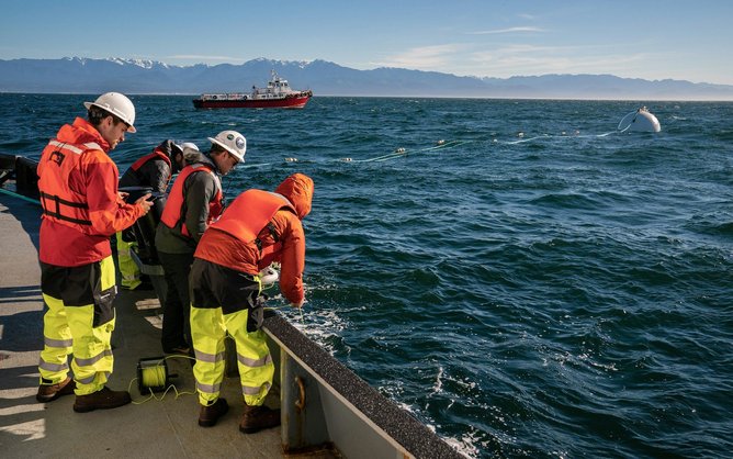

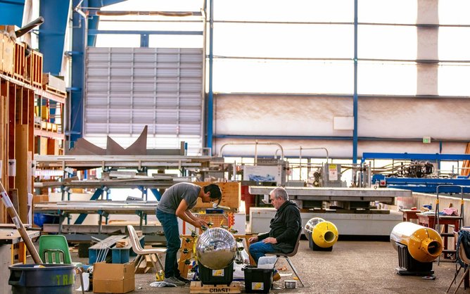 Manufacturing the Panthalassa nodes. Credit: Panthalassa
 Panthalassa's wave-powered data centres do not require any connection to land. Credit: Panthalassa
 Panthalassa's motto is "go where the energy is". Credit: Panthalassa
 Panthalassa says its technology only relies on abundant materials and minerals. Credit: Panthalassa

 Dead heart urchins at St. Michel-en-Greve on 2 April 1978 / Credit: NOAA / EPA