Saturday, September 22, 2018

Gypsea stories : Wylo II

Gypseas live on the water.
Afloat and free they roam all over the world.
At 70, the infamous Nick Skeates has sailed around the world 4 times.
Many have wondered how he does it and the changes he has seen over the years.
This film reveals a unique insight into his life onboard his equally famous boat Wylo II. 

Friday, September 21, 2018

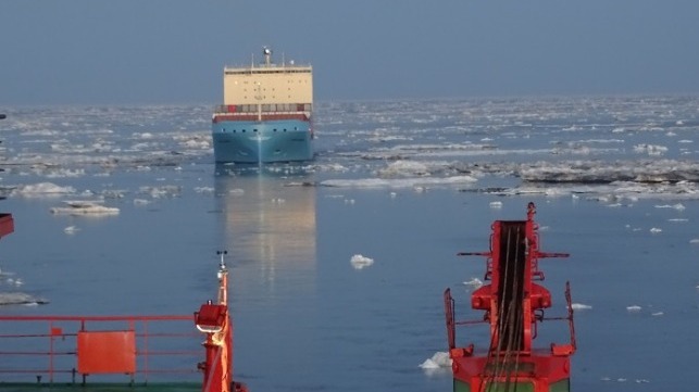
Container ship crosses Arctic route for first time in history due to melting sea ice

Venta Maersk Escorted Through Sannikov Strait

From The Independant by Tom Embury-Dennis

Ice-class 42,000 ton vessel carries Russian fish and South Korean electronics to Europe

A commercial container ship has for the first time successfully navigated the Northern Sea Route of the Arctic Ocean, a route made possible by melting sea ice caused by global warming.


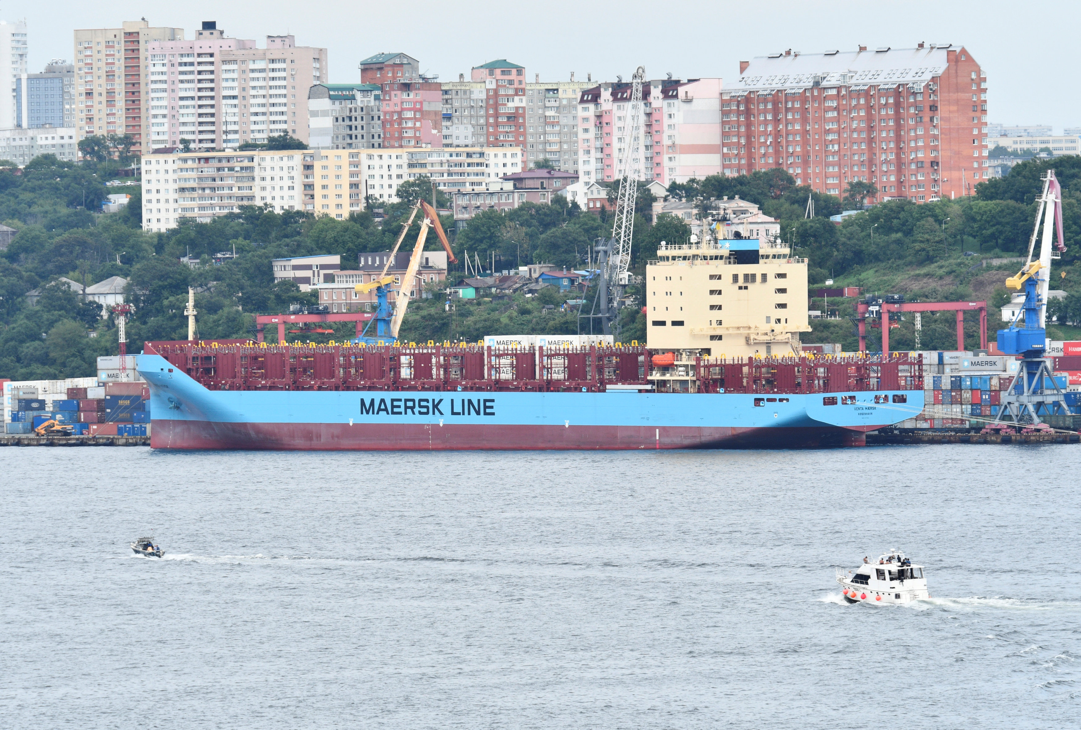
The Venta Maersk in the Russian port of Vladivostok as it prepares to set off on its Arctic voyage, Russia August 22, 2018.
(Yuri Maltsev / Reuters)

Maersk Line, the world’s biggest container shipping company, told The Independent its ship, Venta Maersk, was expected to reach its final destination of St Petersburg next week.
The new ice-class 42,000 ton vessel, carrying Russian fish and South Korea electronics, left Vladivostok, in the far east of Russia, on the 23 August.

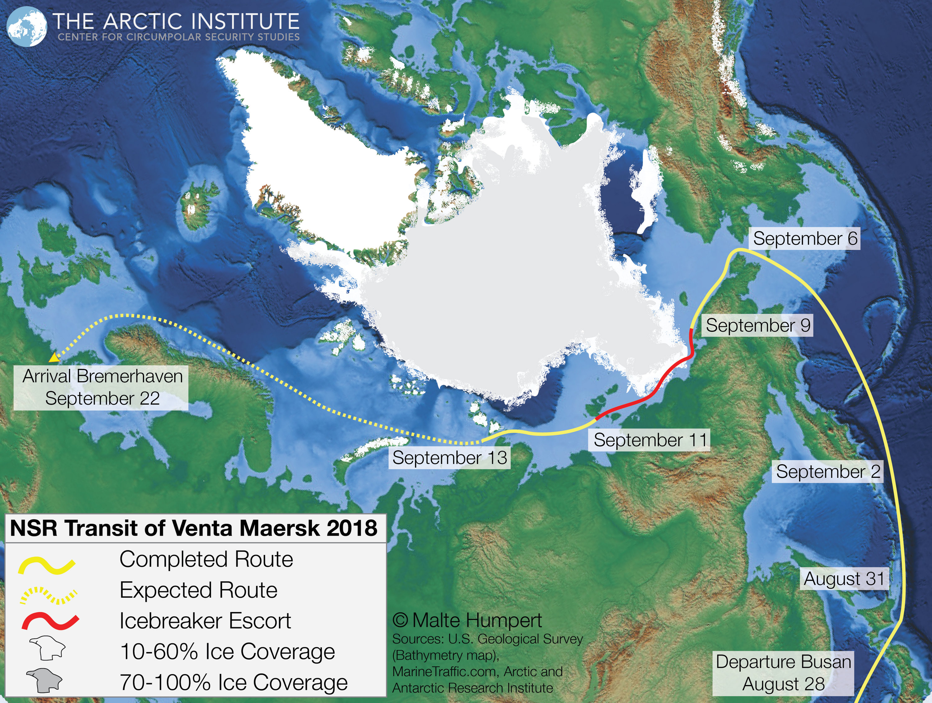
 The voyage of the Venta Maersk from Asia to Europe and ice conditions along the route.
(courtesy of Malte Humpert)


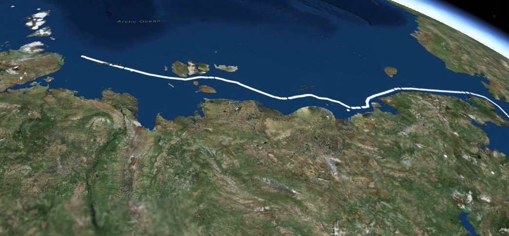
With help from Russia's most powerful nuclear icebreaker, it followed the Northern Sea Route up through the Bering Strait between Russia and Alaska, before travelling along Russia’s north coast and into the Norwegian Sea.

 Venta Maersk route captures by Lemur satellites from Spire

The route has seen growing traffic during summer months already, with cargos of oil and gas regularly making the journey.

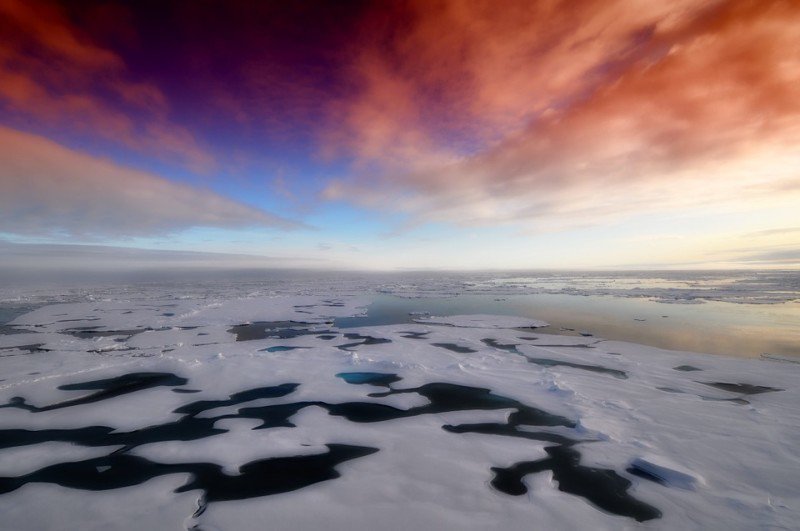
Arctic sea ice hit a record low for January this year, and an “extreme event” was declared in March as the Bering Sea’s ice levels reached the lowest level in recorded history as temperatures soared to 30C above average.

Arctic sea ice extent for September 17, 2018 was 4.60 million square kilometers (1.78 million square miles). The orange line shows the 1981 to 2010 average extent for that day.

Data released by the National Snow and Ice Data Centre in Colorado showed this winter’s sea ice cover was less than a third of what it was just five years ago.

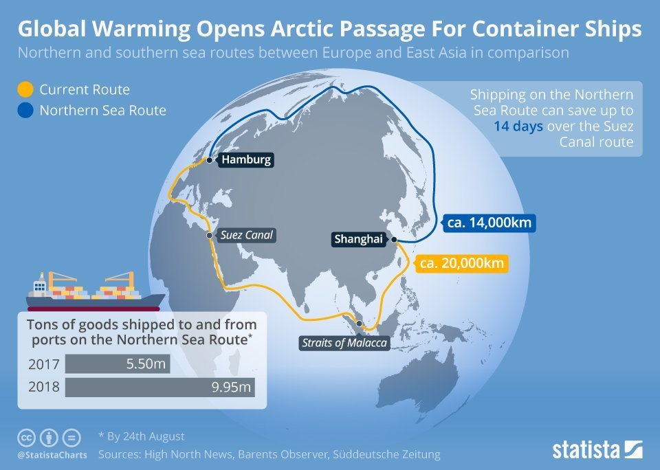
The Northern Sea Route can cut journey times between Asia and Europe by up to two weeks by allowing ships to avoid travelling through the Suez Canal or past the Cape of Good Hope in South Africa.
The Arctic Ocean route does, however, remain more costly as icebreakers are still required to accompany ships.

On the Northern Sea route heading for Yurp.

In an email to The Independent, Maersk confirmed the success of the “one-off trial passage”, with icebreaker ships providing assistance “as required”.
“The trial passage will enable us to explore the operational feasibility of container shipping through the Northern Sea Route and to collect data,” a spokesperson said.
“Currently, we do not see the Northern Sea Route as a commercial alternative to our existing network.”


Sune Scheller, project leader of Greenpeace Nordic, told The Independent any regular shipping route in the Arctic Ocean ultimately risked an "environmental catastrophe".
"The most immediate threat comes from some of the problems with the fuel," he said.
“Maersk hasn’t spoken about which kind of fuel this [ship] is using, but in general container ships are using heavy fuel oil, which is basically what’s left in the barrel.”

Mr Scheller said the "dirty fuel" had "consequences" for the environment, including adding to particulate matter in the atmosphere.
Also known as black carbon, particulate matter rests on white surfaces like ice and snow and absorbs heat instead of reflecting it, which contributes to climate change.
According to The Economist, “just 15 of the biggest ships emit more of the noxious oxides of nitrogen and sulphur than all the world’s cars put together”.
"It’s also of a concern in case of an accident," Mr Scheller continued.
"It is more toxic and it is more difficult to get out of the environment again, especially an Arctic environment where the water is cold."
A combination of the use of heavy fuel oil, the shallow water of the Arctic Ocean, and the ice makes the Northern Sea Route one of "increased risk" of a catastrophe, he added.


Even though the Northern Sea Route (NSR) is only feasible for three months of the year, globalwarming is making it increasingly viable for major shipping companies. 

However, no expert has ever predicted that the NSR would become a "maritime highway" in the decade 2010.
The majority of global shipowners are indeed convinced by the Arctic, but from the 2030s onwards.
(courtesy of Statista)

But as global warming increases ice loss, Mr Scheller said banning commercial shipping in the area was unlikely to be a realistic possibility.
“What’s important now is that you make sure that when this becomes available, you have the necessary regulation in place in the area," he said.
"So that means you have vessels that are capable of charting this area, But it’s also about putting bans on the most dirty types of fuels that exist."

Global estimates suggest ships are responsible for 15 per cent of nitrogen oxides and 8 per cent of sulphur gas worldwide.
These gases have been linked with a range of health problems including asthma, heart disease and cancer.

Links :

Thursday, September 20, 2018

Shell and Exxon's secret 1980s climate change warnings

(2014) Exxon published a deeply cynical rebuke in a report to investors.
The oil company argued that, because it was “highly unlikely” that governments would address climate change, it was going to carry on drilling for oil and gas regardless.

From The Guardian by Benjamin Franta

Newly found documents from the 1980s show that fossil fuel companies privately predicted the global damage that would be caused by their products.

One day in 1961, an American economist named Daniel Ellsberg stumbled across a piece of paper with apocalyptic implications.
Ellsberg, who was advising the US government on its secret nuclear war plans, had discovered a document that contained an official estimate of the death toll in a preemptive “first strike” on China and the Soviet Union: 300 million in those countries, and double that globally.

Ellsberg was troubled that such a plan existed; years later, he tried to leak the details of nuclear annihilation to the public.
Although his attempt failed, Ellsberg would become famous instead for leaking what came to be known as the Pentagon Papers – the US government’s secret history of its military intervention in Vietnam.

America’s amoral military planning during the Cold War echoes the hubris exhibited by another cast of characters gambling with the fate of humanity.
Recently, secret documents have been unearthed detailing what the energy industry knew about the links between their products and global warming.
But, unlike the government’s nuclear plans, what the industry detailed was put into action.


In the 1980s, oil companies like Exxon and Shell carried out internal assessments of the carbon dioxide released by fossil fuels, and forecast the planetary consequences of these emissions.
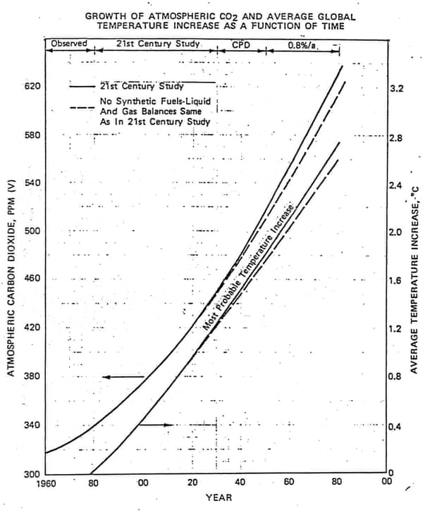
In 1982, for example, Exxon predicted that by about 2060, CO2 levels would reach around 560 parts per million – double the preindustrial level – and that this would push the planet’s average temperatures up by about 2°C over then-current levels (and even more compared to pre-industrial levels).

Exxon’s private prediction of the future growth of carbon dioxide levels (left axis) and global temperature relative to 1982 (right axis).
Elsewhere in its report, Exxon noted that the most widely accepted science at the time indicated that doubling carbon dioxide levels would cause a global warming of 3°C.
Illustration: 1982 Exxon internal briefing document

Later that decade, in 1988, an internal report by Shell projected similar effects but also found that CO2 could double even earlier, by 2030.
Privately, these companies did not dispute the links between their products, global warming, and ecological calamity.
On the contrary, their research confirmed the connections.


Shell’s assessment foresaw a one-meter sea-level rise, and noted that warming could also fuel disintegration of the West Antarctic Ice Sheet, resulting in a worldwide rise in sea level of “five to six meters.”
That would be enough to inundate entire low-lying countries.

Shell’s analysts also warned of the “disappearance of specific ecosystems or habitat destruction,” predicted an increase in “runoff, destructive floods, and inundation of low-lying farmland,” and said that “new sources of freshwater would be required” to compensate for changes in precipitation.
Global changes in air temperature would also “drastically change the way people live and work.”
All told, Shell concluded, “the changes may be the greatest in recorded history.”

 source : Pullitzer prizes

For its part, Exxon warned of “potentially catastrophic events that must be considered.” Like Shell’s experts, Exxon’s scientists predicted devastating sea-level rise, and warned that the American Midwest and other parts of the world could become desert-like.
Looking on the bright side, the company expressed its confidence that “this problem is not as significant to mankind as a nuclear holocaust or world famine.”

The documents make for frightening reading.
And the effect is all the more chilling in view of the oil giants’ refusal to warn the public about the damage that their own researchers predicted.
Shell’s report, marked “confidential,” was first disclosed by a Dutch news organization earlier this year.
Exxon’s study was not intended for external distribution, either; it was leaked in 2015.

 A combination of file photos shows the logos of five of the largest publicly traded oil companies - BP, Chevron, ExxonMobil, Royal Dutch Shell, and Total.
Photo: Reuters

Nor did the companies ever take responsibility for their products.
In Shell’s study, the firm argued that the “main burden” of addressing climate change rests not with the energy industry, but with governments and consumers.
That argument might have made sense if oil executives, including those from Exxon and Shell, had not later lied about climate change and actively prevented governments from enacting clean-energy policies.

Although the details of global warming were foreign to most people in the 1980s, among the few who had a better idea than most were the companies contributing the most to it.
Despite scientific uncertainties, the bottom line was this: oil firms recognized that their products added CO2 to the atmosphere, understood that this would lead to warming, and calculated the likely consequences.
And then they chose to accept those risks on our behalf, at our expense, and without our knowledge.


In 1991, Shell produced a public documentary on global warming called Climate of Concern.
It warned that trends in global temperatures raised serious risks of famines, floods and climate refugees.
But in the quarter century since, Shell has continued to invest heavily in fossil fuels.

The catastrophic nuclear war plans that Ellsberg saw in the 1960s were a Sword of Damocles that fortunately never fell.
But the oil industry’s secret climate change predictions are becoming reality, and not by accident.
Fossil-fuel producers willfully drove us toward the grim future they feared by promoting their products, lying about the effects, and aggressively defending their share of the energy market.

As the world warms, the building blocks of our planet – its ice sheets, forests, and atmospheric and ocean currents – are being altered beyond repair.
Who has the right to foresee such damage and then choose to fulfill the prophecy?
Although war planners and fossil-fuel companies had the arrogance to decide what level of devastation was appropriate for humanity, only Big Oil had the temerity to follow through.
That, of course, is one time too many.

Links :

Wednesday, September 19, 2018

Unmanned technology unveils the mystery of Antarctica : USV fills data gap for polar expedition

China is building its fifth research station in Antarctica as it looks to expand research on the Earth’s southernmost continent and gain greater global influence on how it is governed.

From Hydro by Chris Yan, OceanAlpha

Not long ago, China’s fifth Antarctic scientific research station – the Ross Sea Station – officially laid its foundation stone on Inexpressible Island (74°54’S 163°39’E).
While preparation and research already began a few years ago, the construction work will take another four years to fully complete.
In November 2017, four unmanned surface vessels (USVs) from Oceanalpha Co., Ltd teamed up with the Antarctica expedition ship ‘Snow Dragon’ all the way south to the Ross Sea to assist the construction project.
The USVs worked for nearly 40 hours, completing a multibeam full-cover seabed topographic survey of five square kilometres.
This not only fills the data gap in the region but also provides spatial geographic data support for marine navigation and the construction of the new station.

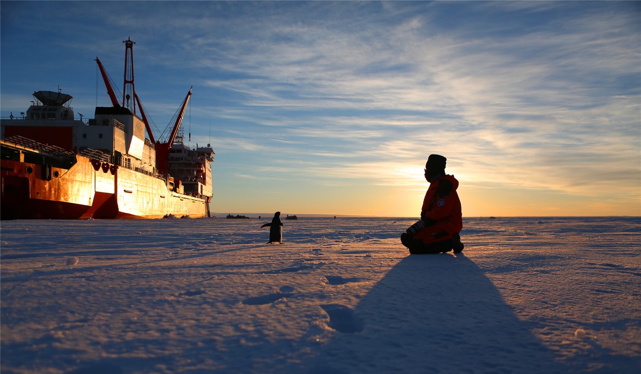
Chinese icebreaker Xuelong, or Snow Dragon, seen returning from a three-month expedition in Antarctica.
Photo: Xinhua

This is China’s 34th Antarctic expedition and is aimed at building the nation’s fifth Antarctic station, following on from the Great Wall Station, Zhongshan Station, Kunlun Station and Taishan Station.

The expedition team consists of 334 members from more than 80 companies and organisations.
During the expedition, the team made full use of the ship-based, ice-based and sea-based platforms to conduct joint observations on land, ocean, atmosphere, ice shelf and organisms.
Their investigations will also help to establish the national Antarctic Observation Network, protect the marine environment and control pollution around the station.

 China's Antarctica stations

Oceanalpha’s USVs visit Antarctica for the first time

Changxin Liang, an engineer from Oceanalpha, was selected by the national expedition team last July.
He boarded the mother ship, Snow Dragon, with two M80 USVs and two SE40 USVs to carry out the autonomous hydrographic survey mission.

In the past, hydrographic surveys relied mainly on manned vessels which would alert surveyors on board to safety hazards but could only explore within channels.
The application of unmanned vessels greatly enlarges the survey area and reduces labour costs and fuel costs since they run on electricity or diesel.

The specific tasks of the USVs in this expedition include bathymetric survey, seabed topography survey, water flow and tide survey.
Detecting the direction of water flow will provide a reference to the design of the water circulation system in the station; observing tides and finding the highest point of sea level will determine the altitude position of the station so as to avoid it being inundated by seawater.

M80 was launched into the sea by the crane.

It’s all about time, time and time

The application of USVs is highly subject to weather conditions.
When the weather is poor, the team can only find two hours of undisrupted time to get the USV working.
“The weather in Antarctica is unpredictable.
When we were hanging down the USV, everything was fine, the weather was peaceful, but as soon as the USV touched the sea surface, snow suddenly started falling and the temperature dropped instantly.
It’s like the weather was challenging our resolution to continue, but we never gave up,” comments Liang.

With the mother ship supporting more than 200 missions, it is never easy to find an overlapping interval.
Liang continues: “We had to race against the weather, as well as coordinate with other 200 project teams that were waiting in line to get their missions done with the mother ship within strictly limited time.”

Every project has a tight restriction on members and equipment.
Each team can only be equipped with two to three staff members.
Equipment should be highly integrated; on-site assembly which would take too much time and energy is unacceptable.

In an interview, Dr JinJing Pu, the marine application technology director of Oceanalpha as well as the leading R&D engineer of the M80 USV, claimed: “When developing the Antarctica expedition USV, the M80, we bear in mind all the limitations but never compromise in its multi-functionality and humanisation”.

 M80 during testing at the Chinese Polar Expedition Base

Dr Pu was originally a teacher at Qingdao Ocean University and once spent more than 800 days at sea for research.
In 2016 he decided to leave the university and join Oceanalpha in order to participate in the development of marine USVs which in the future can help peers and juniors to conduct ocean expeditions that involve higher work intensity and bigger risks.

According to Dr Pu, M80 is modular-designed so it can be assembled conveniently and gives large capacity to survey instruments.
With the crane and hooking devices, the USV can be launched and retrieved easily.
Its autonomous system requires only two to three operators to conduct multiple surveys at a time.

During the whole expedition, the team worked for five days while the Snow Dragon was unloading materials in the new station.
It then had to stop for ten days because the Snow Dragon was leaving for Zhongshan Station for other projects.
The expedition could then continue for another three days when the Snow Dragon went back to the Ross Sea.
In the first five days, the team surveyed 3.6 square kilometres of sea area, and a total of nearly five square kilometres over two periods.

 M80 working near Inexpressible Island

 Inexpressive island with the GeoGarage platform (NGA nautical raster chart)

Surveying in Antarctica: Why can USVs shoulder such a task?

Strong winds and water flows in Antarctica could bring a lot of ice floes which might bump a survey vessel off its planned path or even cause a crash.
According to Dr Pu, drawing a precise survey line on water is an unparalleled advantage of a USV, which means it can sail in high accordance with the planned route enabling the mounted sensors to scan the seabed evenly, forming an accurate seabed topographic map.
Although the M80 was constantly hit by randomly drifting ice, its working pattern never got affected.

Dr Pu revealed the secret that qualified the M80 USV for the polar expedition: “The adoption of artificial intelligence and advanced algorithms ensures the accuracy of the USV’s sailing route.
When combining the autonomous obstacle avoidance system with the manual remote control mode, most emergencies can be resolved.
The uniquely designed bulbous nose can also cushion the impact of waves and ice floes.
The second generation of M80 USV has improved in material from composite to aluminium.
Aluminium alloy is more flexible so when a crash happens the USV will be deformed at most; its hull won’t stop functioning.
If the damage is serious, it can easily be repaired by cutting and welding.
Due to the low temperature, the lifetime of electric vessels is shortened sharply in Antarctica, making them unqualified for Antarctica expeditions.
The M80 is powered by diesel which only freezes at -35° C.”

Links :

Tuesday, September 18, 2018

Robots ahoy! Mapping Earth's surface

Introducing SEA-KIT™ the world's first truly Long-range, Long Endurance, Ocean Capable Autonomous Surface Vessel. 
SEA-KIT and its submersible work in tandem to map the sea floor

From BBC by Johnathan Amos

One of the big favourites to win the ocean-mapping XPRIZE has formally confirmed its presence in the final.

The GEBCO-Nippon Foundation Alumni Team has just completed 24-hour trials of its technology and is ready for the competition's ultimate challenge.

This requires a mapping system inside a day to survey a section of seabed that is 500-sq-km in area and 4,000m-deep.

GEBCO-NF will use a state-of-the-art underwater vehicle launched from the back of a robotic boat.

The uncrewed surface vessel, known as SEA-KIT, will be of particular interest to British readers.
It has been designed by Hushcraft of Essex, which believes its 12m-long XPRIZE concept is the forerunner for a new class of autonomous, ocean-going boats.

The location of the final, due to take place in the next three months, is currently being kept a secret, but GEBCO-NF team lead Yulia Zarayskaya says her group will be well prepared wherever it is sent.
"We're pretty much there," she told BBC News.
"We still have some things to work out in terms of how best to operate our system in 24 hours and to manage the data and data processing.
Obviously, we've had some ups and down, but at this stage I'd say we know now how to bring it all together."

Ocean Discovery XPRIZE rules for final

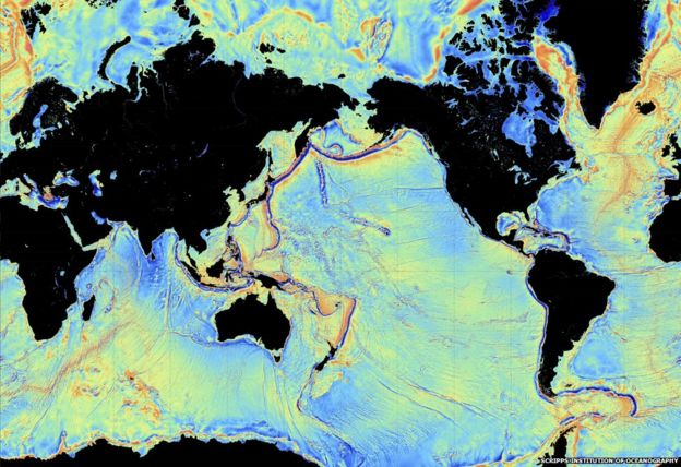
Image copyright Scripps Institution of Oceanography
Image caption Most of what we know is the result of low-resolution satellite mapping

  •     Map an area of 500 sq km at 4,000m depth
  •     Time limit of 24hrs from entering map zone
  •     Teams must map at least 50% of this area
  •     Resolution: 5.0m horizontal, 0.5m vertical
  •     Image 10 features, eg archaeological/geological
  •     Top prize of $5m; $1m for second place

Today's maps of the ocean floor are woeful.
Less than 15% of its bathymetry (depth) has been measured in a meaningfully accurate way.
Most of what we know about the shape of the global seabed comes from gravity observations made by satellite and this method cannot see anything smaller than a kilometre in size.

The $7m Shell Ocean Discovery XPRIZE was launched to find new technologies and new strategies to try to close the knowledge gap.

Eight teams from around the world are expected to take on the year's-end challenge.
They will be using all manner of robotic systems that operate above, on and below the water's surface.

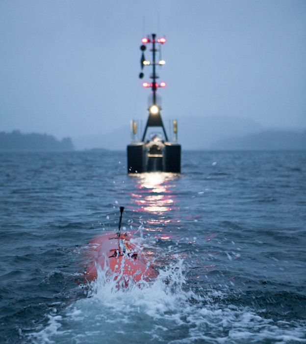
Image copyright GEBCO-NF/HUSHCRAFT
Image caption The SEA-KIT boat lines up ready to retrieve the Kongsberg Hugin AUV

GEBCO-NF is a natural candidate.
GEBCO stands for General Bathymetric Chart of the Oceans - it is the official keeper, if you like, for maps of the sea-floor.
And many of its XPRIZE team-members have gone through the organisation's postgraduate training course at the Center for Coastal and Ocean Mapping at the University of New Hampshire, US.

In the group's solution, a top-of-the-range autonomous underwater vehicle (AUV) from the Norwegian Kongsberg Maritime company will make the sea-floor map using an echosounder.
The submersible will be deployed and recovered by SEA-KIT.

The rules of the competition demand that team-members cannot themselves be in the survey zone at the time and so that means the surface vessel also requires very efficient remote control and/or autonomy to get itself into the right place to release the Kongsberg sub - and get it back again after the mapping exercise.

Key to this, says Hushcraft's Ben Simpson, is a communications and control system called Global Situational Awareness via Internet, or G-SAVI.

"We are now not only able to view CCTV, thermal imaging and radar, but remotely control these from anywhere in the world," he explained.
"Other features include listening live to things going on onboard and repeat VHF to speak to other vessels in the vicinity of SEA-KIT - all from a remote office anywhere you have internet.
"It's a great step towards safely operating a vessel over the horizon anywhere in the world."

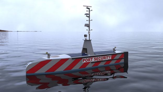
SEA-KIT Uncrewed Surface Vessel (USV)
Image copyright SEA-KIT INTERNATIONAL/Hushcraft
Future concepts: Many different applications are being considered for the boat
  •     Dimensions: 11.75m long and 2.2m wide
  •     Propulsion: Hybrid diesel-electric system
  •     Range & speed: Up to 22,000km at 4 knots
  •     Can fit inside a shipping container
  •     But scalable. Larger versions being considered

The 12-tonne, aluminium-hulled SEA-KIT uses a conveyor belt mechanism in its aft section to launch the AUV.
An acoustic connection ensures the pair always know each other's position.
When the time comes for recovery, SEA-KIT manoeuvres itself in front of the sub, which then drives on to the rising ramp.

Hushcraft envisions multiple roles for the uncrewed boat.
Its remote-controlled and autonomous capabilities mean it could be sent into dangerous situations, for example to spread dispersants on an oil spill or to take scientific measurements in front of an ice shelf.

The present design can carry a payload of up 2.5 tonnes.
"The key driver for me is it's universal platform," said Mr Simpson.
"You don't have to keep tweaking the design. SEA-KIT is agnostic with regards to the equipment you want to put on it. It's got lots of bolting on points."

The ocean community - scientific and industrial - has set itself a target to map the entire ocean floor to a reasonable standard by 2030.
That will require higher investment, but likely also a few of the new approaches to be demonstrated in the XPRIZE final, says GEBCO-NF project coordinator Rochelle Wigley.

"It can be done; it's possible, although it might cost the same as a Mars mission," she told BBC News.
"That funding is not immediately available. Ocean science hasn't been seen as sexy.
That's changing and I think projects like XRPIZE and 2030 are raising awareness, and that's got to be good."

The XPRIZE Foundation will announce the location of the mapping zone in the next few weeks.

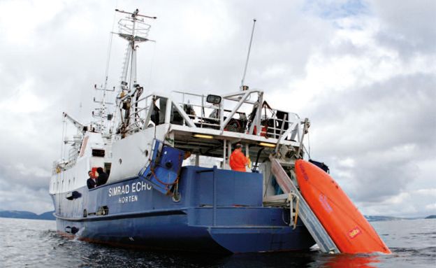
Image copyright Kongsberg Maritime
Image caption Using large, crewed vessels is expensive.

Monday, September 17, 2018

Merchant Adventurers: the voyage that launched modern England

In the spring of 1553 three ships sailed north-east from London into uncharted waters.
The scale of their ambition was breathtaking.
Drawing on the latest navigational science and the new spirit of enterprise and discovery sweeping the Tudor capital, they sought a northern passage to Asia and its riches.
The success of the expedition depended on its two leaders: Sir Hugh Willoughby, a brave gentleman soldier, and Richard Chancellor, a brilliant young scientist and practical man of the sea.
When their ships became separated in a storm, each had to fend for himself.
Their fates were sharply divided.
One returned to England, to recount extraordinary tales of the imperial court of Tsar Ivan the Terrible.
The tragic, mysterious story of the other two ships has to be pieced together through the surviving captain's log book, after he and his crew became lost and trapped by the advancing Arctic winter.
This long neglected endeavour was one of the boldest in British history, and its impact was profound. Although the 'merchant adventurers' failed to reach China as they had hoped, their achievements would lay the foundations for England's expansion on a global stage.
As James Evans' vivid account shows, their voyage also makes for a gripping story of daring, discovery, tragedy and adventure.
-From the dust jacket

From HistoryExtra

The 1553 expedition, undertaken in an attempt to find a new, shorter route to China and its riches, saw Sir Hugh Willoughby and his crew skirt through the icy seas around the top of Norway and along Asia’s northern rim.

The pioneering voyage ultimately led to the discovery of the White Sea and a new trade route to Russia, and helped to build cultural and diplomatic relations between England and the court of Ivan the Terrible in Russia.

In Merchant Adventurers: The Voyage That Launched Modern England, Evans explores the first major advances in maritime navigation, and the Tudor masters of cartography.
Here, writing for History Extra, he reveals eight things a Tudor crew would have needed to do if they hoped to survive the journey…


1) Know the wind

Mid-Tudor ships were evolving, and becoming better suited to long distance navigation.
But unlike modern sailing ships, most had square sails.
While these had advantages, sailing into the wind was not one of them.
Tacking was laborious, and there was much less flexibility in the direction travelled.

Often ships were stuck at port, ‘tarrying for the wind’, or they switched destination.
For the men of 1553 it was a huge frustration: they knew the window of the Arctic summer was narrow, and they desperately wanted to head north.
But for weeks they were pinned to the east coast of England, fretting over ‘great loss and consuming of time’.

When crossing large oceans such as the Atlantic, winds were governed by seasonal patterns, and familiarity with these helped sailors enormously because routes could be designed accordingly.

2) Don’t fall ill or get injured

Illness was little understood in Tudor England, and medical help could be as dangerous as the condition that necessitated it.

A ‘surgeon’ formed part of the crew only on a large ship.
He wasn’t bad at removing foreign objects, like splinters.
He could stitch open wounds, or ‘debride’ (remove dead tissue).
And he could amputate using a tourniquet to reduce blood loss (without anaesthetic).

Some suspected that cleanliness aided recovery – through observation rather than understanding of infection.
Nevertheless, painless surgery this was not.

Faced with other illnesses, surgeons were helpless.
Infectious diseases could play havoc with a crew, and there was little option other than to deposit affected men on shore and hope the malady did not spread.

3) Eat your greens

Diet in Tudor England was terrible for plenty of people, but life on board was worse.
Much food was simply unpleasant.
Supplies included staples like butter, cheese, beans, oatmeal and biscuit, or barrelled beef (“of a most loathsome and filthy taste and savour”, according to one sailor).

There was a reason crews chased wildlife when they could: people were less fastidious than we are today about which animals to eat.
So, in 1553 it was seabirds – puffins, or cormorants – that were stuffed hungrily into the hold.
But it could be anything: seals, whales, turtles, or even penguins.

Few expected what we today call a ‘balanced diet’.
Months at sea meant deficiencies, and scurvy was a notorious problem.
Lack of vitamin C caused lethargy, joint pain and gum disease, then fever, convulsions and death.
It was vital to eat fruit and vegetables when possible, as a few unusually caring captains – like James Lancaster on the first East India voyage – gleaned from intelligent guesswork before the link was understood.

Sailing ship, 1445.
Copy of one of the illuminations of the Shrewsbury Book (1445).
Illustration from Dresses and Decorations of the Middle Ages from the Seventh to the Seventeenth Centuries, by Henry Shaw, (London, 1843).
(The Print Collector/Print Collector/Getty Images)

4) Behave well

Discipline was harsh on a Tudor ship.
Rules and punishment were still based on the old ‘Laws of Oléron’ – written on parchment, and nailed to the mast.
A murderer was strapped to his victim and flung overboard.
For theft, dishonourable discharge was followed by traditional punishment.

In the case of Thomas Nash, accused in 1553 of petty theft, this involved being ‘ducked at the yard arm’ – bound then hoisted and plunged into the sea until almost drowned.
Offenders might also be ‘keel-hauled’: dragged under the ship from one side to the other.

Efforts were made to keep order.
Sebastian Cabot forbade “blasphemy of God, or detestable swearing”; “ribaldry, filthy tales, or ungodly talk”, as well as “dicing, carding, tabling” and other “devilish games”.
These could lead to strife, brawling and even murder, and cause disaster by provoking “God’s most just wrath, and sword of vengeance”.

5) Take precautions against pirates

The boundary between piracy and ‘normal’ seafaring was hazier in 16th-century Europe than it is today.
The same men might trade on one voyage, then attack a tempting target on another.

‘Privateering’, as this was called when authorised against ships of an enemy nation, was simply permitted piracy.
Pirate captains were the people a country needed in time of war – brave, remorseless, good sailors – so they were unlikely to be treated too harshly.
And corrupt officials would always turn a blind eye in return for a slice of the loot.

The best means of avoiding risk was to sail well armed, well manned and in convoy (a lone target was more vulnerable).
The reduction of crew to save money was regarded as “a perilous and foolish thrift”.

6) Learn to navigate

We might think the country has always been home to natural sailors, but it isn’t true.
Navigation by celestial bodies was slow to catch on in England.

In England ‘ancient masters of ships’ were usually illiterate.
They stuck to short routes, and tried to keep the coast in view.
They were contemptuous of foreign sailors, with their new-fangled instruments, and of them “that busied themselves with charts”.

Richard Chancellor, chief pilot in 1553, was the first of a new breed: an English sailor who was practical and intellectual.
Not only was he literate, he studied maths and astronomy, and he built instruments to measure the sun and the stars.
Although he died young, his influence lived on, not least in the persons of men like Stephen and William Borough, who sailed with him.

Knowing how to navigate was no guarantee of safety.
And while men could calculate their latitude, no one could measure longitude, but it helped.
It was no coincidence that of three ships that sailed in 1553, it was Chancellor’s that returned to tell the tale.

c1557, Portuguese sailors navigate by astrolabe [an elaborate inclinometer, historically used by astronomers, navigators, and astrologers].
(Hulton Archive/Getty Images)

7) Don’t fall in

Surprisingly few Tudor-era sailors knew how to swim.
It wasn’t an unknown skill, but nor was it common.
In some cases there was a strong superstition against learning: to fall in and survive was felt to deprive sea gods of a body to which they were entitled, and for which retribution would be exacted from the entire crew.

Contact with the New World had increased awareness of men who could swim, though Cabot still warned his crews against attacks by people who did.

8) Be lucky

Perhaps most of all, those on board a Tudor ship needed to be lucky.
Sailing was a desperately dangerous business, even when not many, in any walk of life, could expect to live long by modern standards.
Few sailors, wrote the Tudor historian Richard Hakluyt, lived to ‘grey hairs’.
It could easily happen that, as with Chancellor’s own son, shipwreck could mean curtains at the outset of one’s career – as a young teenager, before there was any chance to progress.

Links :
Sunday, September 16, 2018

From multihull to kite with foils : glide and speed


 The Maxi Edmond de Rothschild is the first flying trimaran of the new generation to have emerged in July 2017.
On 17 July 2017, the day of her launch in Vannes, south-west Brittany, the Maxi Edmond de Rothschild joined the legendary Gitana line, a quite unique family maritime saga initiated by the Rothschild clan in 1876 on the shores of Lake Geneva.
see GeoGarage blog
Indeed, she is leading the way in a new generation of large flying offshore trimarans and, needless to say, her debut flights were eagerly anticipated...
His skipper Sébastien Josse is also a touch to everything, keen on gliding and speed.
In this video, he embarks us for a kite navigation foil in the paradisaical archipelago Glénans!

Links :