Have you ever wanted to simply walk away and find a way to live life off the grid?
Canadian artists Catherine King and Wayne Adams of Vancouver Island did just that.
They've lived in Freedom Cove on a floating island of their own making, some 45 minutes by boat from the nearest town. for 24 years, making subsistence living look like a true adventure.
All plastic waste, regardless of size, is detrimental to the environment, but microplastics pose a special challenge given their minuscule size (some are 150 times smaller than a human hair) and ability to enter the food chain.
The result is that chemical additives and all end up in the flesh and organs of fishand humans.
While the World Health Organization’s stance is that ingesting microplastics poses no known threat to human health, not everyone agrees.
“I think we know enough today to worry about it,” says Dr Douglas Rader, chief oceans scientist at the Environmental Defense Fund, pointing out that many microplastics contain chemicals linked to reproductive and hormonal disruption and cancer.
But it’s not all bad news.
Some are now innovating in microplastic extraction, providing the basis for a touch of cautious optimism.
Here is a look at several examples.
A microplastics magnet
Fionn Ferreira, a 20-year-old Irish inventor, found a way to successfully remove 88% of microplastics from water samples. Photograph: Fionn Ferreria
One way to remove microplastics from water is to encourage them to clump together into compounds that can be filtered – or, in the context of the 20-year-old Irish inventor Fionn Ferreira’s work, magnetized – out.
Ferreira created a homemade ferrofluid – a magnetic mixture of oil and powdered rust – and successfully used it to remove 88% of microplastics from water samples.
Ferreira’s efforts won him the top prize at the 2019 Google Science Fair.
He hopes to incorporate his findings into a device compatible with existing filtration systems, such as those in wastewater treatment plants (most of which are unable to sufficiently filter out microplastics).
In the future, he plans to test out whether he could use the device to make a self-cleaning filter for ocean engines.
“It could be built into the already existing water intake and outlets of the ships used to cool the engines, so as they’re taking in the water and as they’re driving around the oceans, they could be cleaning the water that passes through those engines,” he says.
(In autumn 2020, Suzuki Motor Corporation announced plans to introduce a microplastic filter into its watercraft outboard motors using similar logic.) Using bottom feeders as ‘living vacuum cleaners’
A Japanese spiky sea cucumber in the Sea of Japan. Photograph: Yuri Smityuk/TASS
Dr Juan José Alava, an expert in marine eco-toxicology and conservation, believes the answer to the microplastics problem could already be in the environment.
Alava studies organisms he calls “living vacuum cleaners”, including bottom feeders such as sea cucumbers, as well as the much smaller organisms that make up “epiplastic microbial communities”: strains of bacteria able to break down synthetic material, some of which originally evolved to metabolize naturally occurring polymers such as lignin and wax, and others which evolved to eat plastic garbage specifically.
“The idea is to identify communities of bacteria and try to enhance them – not by incorporating a new mix of genes created by humans, but by stimulating them to break down plastic,” he says.
When an organism can eliminate more plastic than it accumulates in its body or waste, it becomes “our best ally” in the fight against microplastics, says Alava.
A screen that can catch ‘plastic dust’
Marc Ward’s static-charged screen can capture plastic particles as small as 50 microns.
Photograph: Marc Ward
Marc Ward first became concerned about microplastics over 15 years ago while studying threats to wild marine turtle populations in Costa Rica.
Not only were turtles swallowing toxic microplastics, but the secluded beaches on which they nested were choked with plastic particulates.
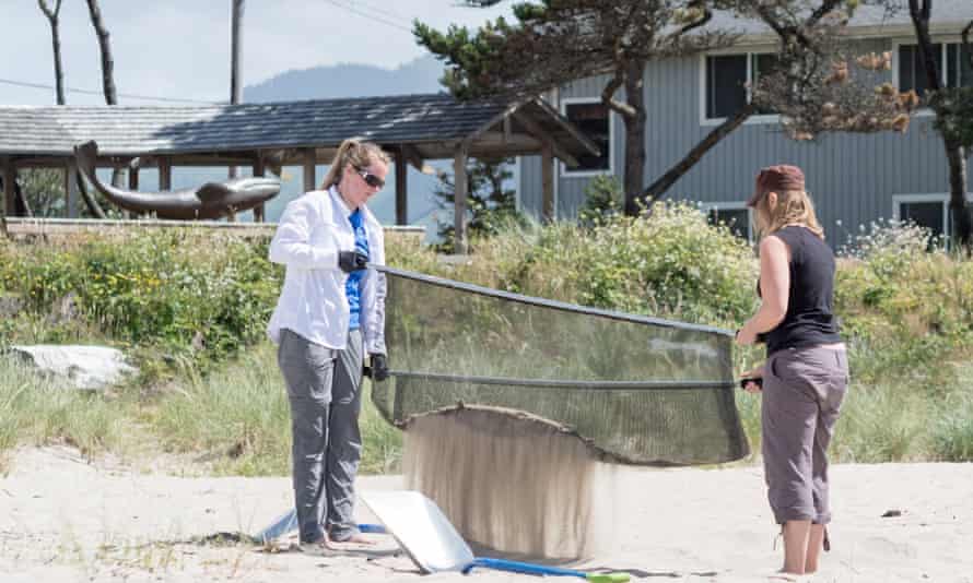
Ward began surveying beaches in both South America and near his home of coastal Oregon, sifting through sand with a static-charged screen able to capture plastic particles as small as 50 microns – essentially plastic dust.
In some areas, he found 10 pounds of microplastic in each square meter of beach.
The last straw for Ward came when, shortly after co-authoring a paper on marine plastic toxicity, he brought his two-year-old to their favorite beach in Oregon only to watch the child immediately try to put a piece of plastic garbage in his mouth.
Now, Ward works with a team to filter thousands of pounds of plastic out of Oregon’s beaches every year as part of his non-profit, Sea Turtles Forever’s Blue Wave initiative.
It may be that filter-cleaning sand at the beach is akin to chipping away at a mountain, and that ocean currents can undo such work in one fell swoop, yet Ward retains a positive outlook.
“I know we are not the solution to ocean plastics,” he admits.
But he is extracting vast amounts of plastic from beaches nonetheless. Plant-based nets than can collect even the tiniest particles
Scientists have created a new kind of water filter made from plant-derived nanocellulose mesh. Photograph: VTT Technical Research Centre of Finland
A new kind of water filter made from plant-derived nanocellulose mesh has been created by scientists at the VTT Technical Research Centre of Finland.
Nanoplastics – as tiny as 0.1 micrometers in diameter – have long proven particularly difficult to remove from drinking and wastewater given their minute size, and they have been found to accumulate in the tissues of humans and other organisms.
Hopefully, they have finally met their match.
The
porous, colloidal structure of cellulose allows the material to bind to
nanoplastics without using any chemical or mechanical interaction, says
Tekla Tammelin, a research professor.
The gist (which this short video on the technology captures) is that cellulose filters can help researchers study nanoplastics, as well as keep them out of our water when integrated into wastewater filtration systems, or even laundry machines, where they could catch the tiny microfibers from synthetic clothing that comprise a subset of microplastics.
And while these findings are in their early days yet, the nanocellulose product has already garnered industry interest.
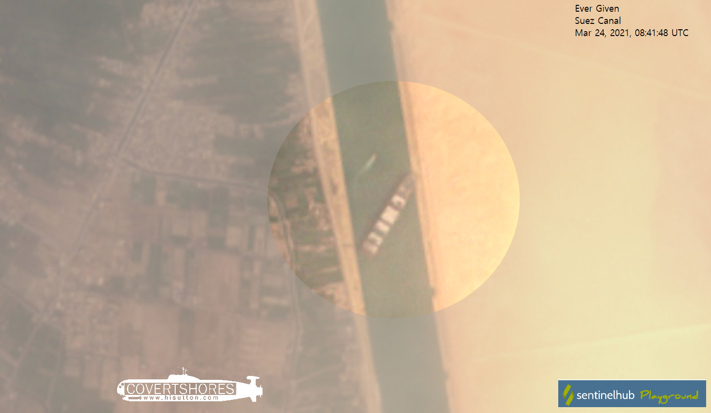
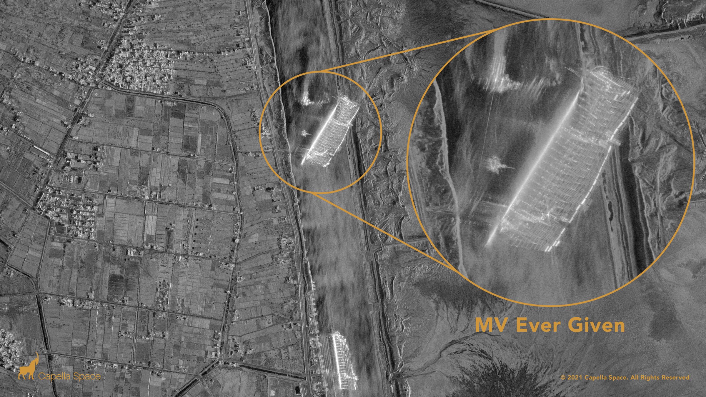
Capella’s #SAR constellation captures the Ever Given container ship blocking the Suez Canal with very high resolution 50 cm imagery as of 9:36am local Egyptian time.
From The Guardian by Martin Farrer and Michaél Safi
One of the largest container ships in the world has run aground in the Suez canal after being blown off course by a “gust of wind”, causing a huge jam of vessels at either end of the vital international trade artery.
The 220,000-ton, 400-metre-long Ever Given – a so-called “megaship” – became stuck near the southern end of the canal on Tuesday.
Eight tugboats were working to free the vessel, blocking a lane through which about 50 ships a day passed in 2019, according to Egyptian government statistics.
Bernhard Schulte Shipmanagement (BSM), the ship’s technical manager, said it ran aground in the canal at about 05.40 GMT on Tuesday.
It said an investigation was under way.
Early reports speculated the vessel suffered a loss of power, but the ship’s operator, Evergreen Marine Corp, told Agence France-Presse it ran aground after being hit by a gust of wind.
A part of the Taiwan-owned MV Ever Given (Evergreen), lodged sideways and impeding all traffic across the waterway of Egypt’s Suez canal.
Impaled the canal shore with its bulbous bow.
Photograph: Suez canal/AFP/Getty Images
Egyptian forecasters said high winds and a sandstorm hit the area on Tuesday, with winds gusting as much as 31 mph.
BSM said all crew were safe and accounted for, and there had been no reports of injuries or pollution.
A growing number of tankers were gathering near the entrance to the canal on Wednesday morning waiting to pass through. An extended blockage would have severe consequences for trade.
Asia-Europe container flows were picking up again after China’s lunar new year and the alternative route via the Cape was a week slower, Tan Hua Joo, a consultant with Liner Research, told Reuters.
Lars Jensen, the chief executive at SeaIntelligence Consulting, said delays increased the risk of congestion at European ports.
“When the canal reopens, this will mean that the delayed cargo will now arrive at the same time as cargo behind it which is still on track,” he said.
As of Wednesday, five laden liquefied natural gas (LNG) tankers were unable to pass through the canal due to the grounded container ship, according to the data intelligence firm Kpler.
Of the five, three were bound for Asia and two for Europe, said Kpler analyst Rebecca Chia.
She said that if the congestion persisted until the end of this week, it would affect the transit of 15 LNG tankers.
This video shows that the obvious is not always true.
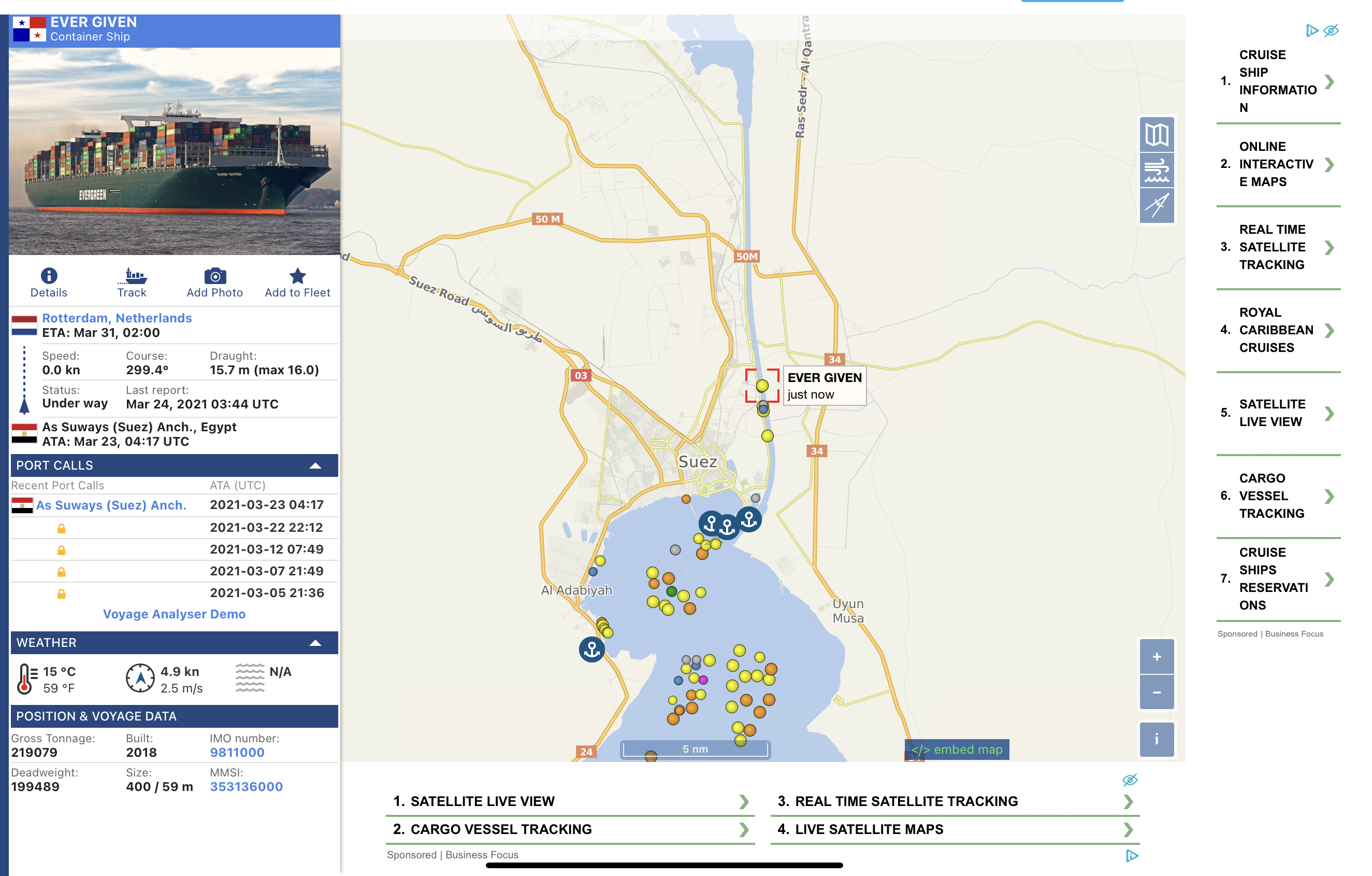
On the occasion of the disputed incident of the ultra-large container ship Ever Given blocking the Suez Canal, the VesselFinder team made a video simulation of the movements of the ship in more detail, for some time before it got stuck in the canal and blocked the main artery of cargo flow between Asia and Europe.
"Suspected gust of wind’ sends 400m-long vessel into bank, sparking several failed attempts to refloat it."
A cargo container ship that’s among the largest in the world has turned sideways and blocked all traffic in Egypt’s Suez Canal, officials said Wednesday, threatening to disrupt a global shipping system already strained by the coronavirus pandemic.
The Ever Given is one of a new category of ships called ultra-large container ships (ULCS), some of which are even too big for the Panama canal, which links the Atlantic and Pacific.
It is carrying hundreds of containers bound for Rotterdam from China.
Pictures taken from another ship in the canal, the Maersk Denver, show the Ever Given lodged at an angle across the waterway.
It dwarfs the tugs sent in by the Egyptian authorities to try to free it, and also a mechanised digger that appeared to be trying to excavate ground in order to free the bow.
Julianne Cona, who posted the picture from the Maersk Denver on Instagram, watched the drama unfold as her ship waited at anchor. “Hopefully it won’t be too long but from the looks of it that ship is super stuck,” she wrote.
“They had a bunch of tugs trying to pull and push it earlier but it was going nowhere … there is a little excavator trying to dig out the bow.”
Photograph: Suez CANAL/AFP/Getty Images
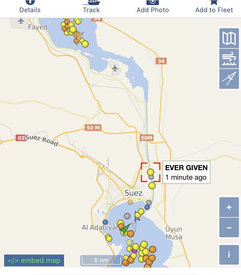
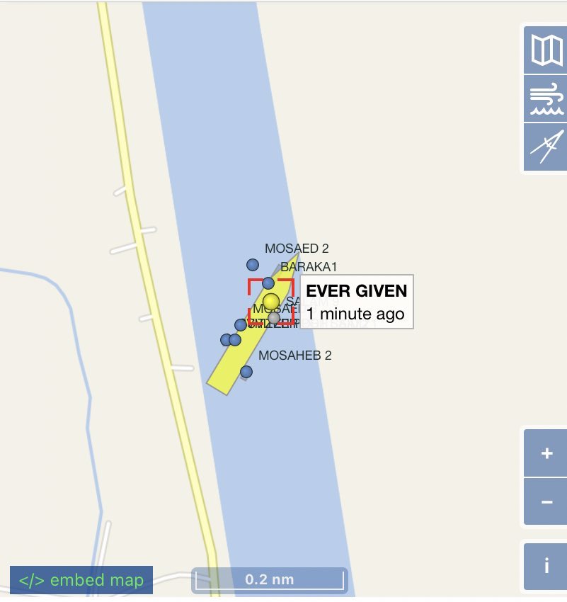
The shipping monitoring site Vesselfinder.com showed the stricken ship surrounded by smaller tugs trying to free it from the banks.
The site also shows the traffic jam of other vessels at either end of the canal.
The trade monitor TankerTrackers.com tweeted that there were “a lot of fully laden” tankers stuck at either end of the canal carrying Saudi, Russian, Omani and US oil.
Normally ships form convoys to traverse the Suez north and south up and down the canal.
The Ever Given was part of a northbound convoy when the incident occurred, according to the shipping agent GAC.
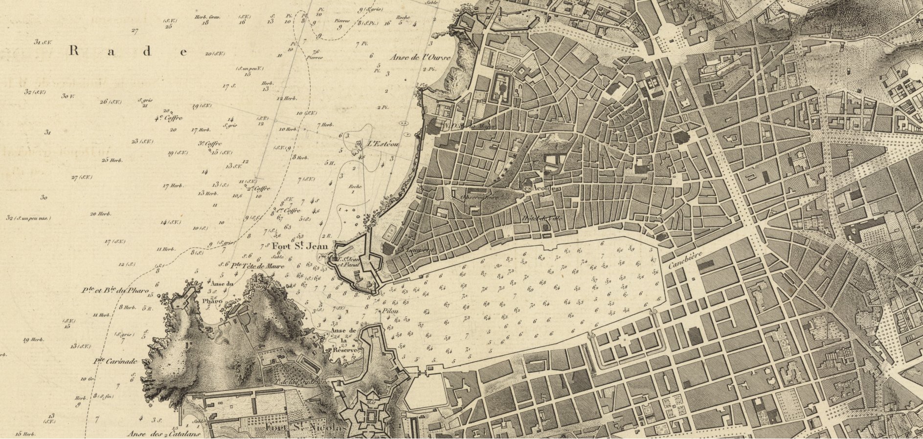
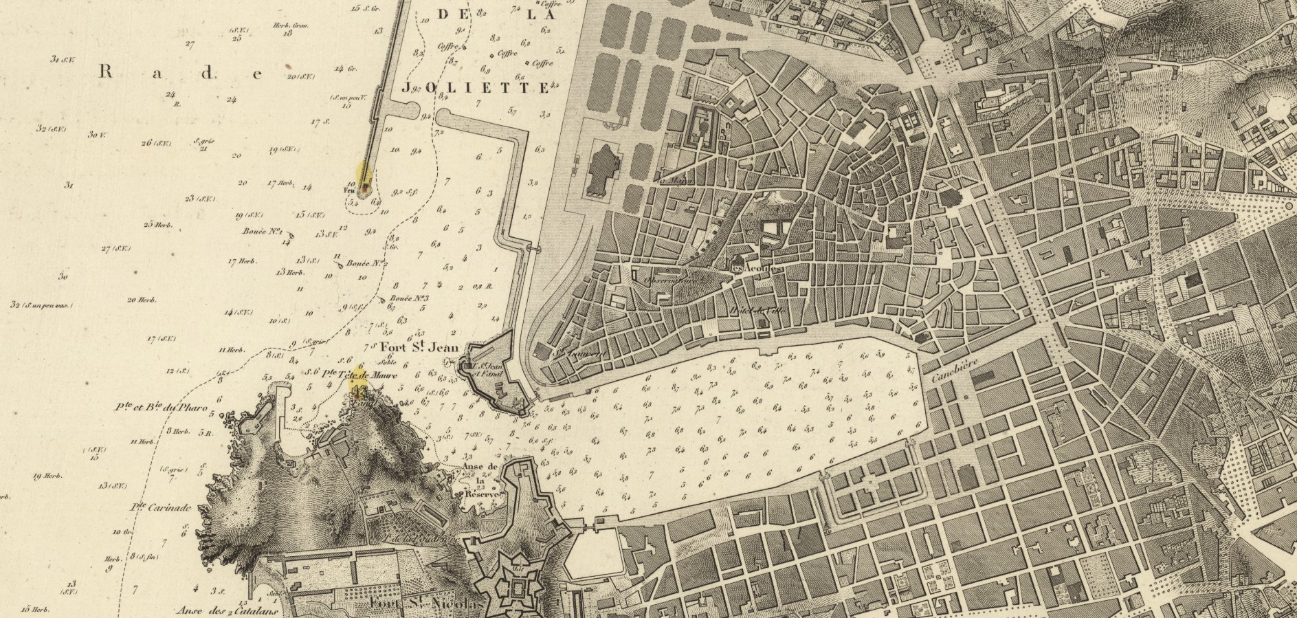
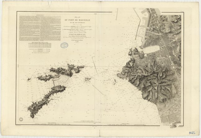
The Suez canal is one of the most important waterways in the world and links the Mediterranean with the Red Sea and shipping lanes to Asia. It is 120 miles (190km) long, 24 metres (79ft) deep and 205 metres wide and can handle dozens of giant container ships a day.
It was expanded in 2015 to enable ships to transit in both directions simultaneously, but only in part of the waterway.
Gen Ossama Rabei, head of the Suez Canal Authority, second right, speaks to other staff onboard a boat near the stuck cargo ship.
Photograph: AP
Ships have been grounded in the canal before. In 2017, a Japanese ship became stuck but was refloated within hours.
Away from the canal, a more serious incident occurred near the German port of Hamburg in 2016 when the massive CSCL Indian Ocean ran aground and needed 12 tugs to set it free after five days.
But Flavio Macau, a senior lecturer in supply chain management at Edith Cowan University in Western Australia, said one problem was that container ships had become much bigger in recent years. He added: “Moving about 50 ships a day, the impacts of a stranded ship are negligible unless it takes weeks to float it. But that is very unlikely and it should be over in a couple of days, tops.”
Copernicus -Sentinel1
The canal’s role as a cornerstone of international trade, particularly in oil, led the Egyptian president, Abdel Fatah al-Sisi, to announce an expansion of the vital waterway in 2014, a project promised as “a gift to the world”.
It cost $8bn (£5.2bn at that time), after the Egyptian dictator demanded the project be completed within a year, promising Egyptian citizens that it would prove to be an “artery of prosperity”.
Egypt welcomed world leaders to a grand ceremony marking the reopening of the new canal channel in 2015, amid a wave of nationalist fervour about the project.
Egypt’s Suez Canal Authority pledged that the expansion would double revenues from increased traffic, declaring that the canal would afford Egypt $13.23bn annually by 2023.
Last year, revenues fell to $5.61bn, according to the canal authority’s own figures.
American model forecast on Christmas Eve, showing snow and mixed precipitation in the Washington region and to the north after an earlier period of rain as an Arctic front passes. (Pivotal Weather)
The National Oceanic and Atmospheric Administration announced Monday that a major upgrade has been applied to the American Global Forecast System model, one of the main computer models used to predict weather across North America and the world.
.@NOAA’s flagship weather model is undergoing a major #upgrade today to improve weather forecasts for hurricanes, snowfall, and heavy rain. (1 of 2) pic.twitter.com/SjLfxV3rz8
The newly minted upgrade, which went live at 8 a.m. Eastern time, is the latest in improvements designed to make for more accurate forecasts as far out as about two weeks into the future.
NOAA says it will lead to better predictions of hurricanes and other extreme events, ocean waves and weather systems high in the atmosphere.
The upgrade focuses on addressing the underlying physics of the model and how it handles various features of the atmosphere. It’s known as version 16.0 of the model frequently referred to by forecasters as simply the GFS or the “American” model.
The upgraded GFS model now has double the vertical resolution and for the first time is coupled with a global wave model to extend wave forecasts out from 10 to 16 days.
The upgrade piggybacks off the launch of the GFS FV3 model, or Finite-Volume Cubed-Sphere Dynamical Core, a souped-up version of the previous GFS model that debuted in summer of 2019. Its release was delayed while model biases were addressed, including a tendency for model depictions to skew too cold and snowy. After changes, the FV3 was released, fully replacing the legacy GFS model in September.
The latest upgrade focuses on addressing some additional biases. The upgrade also adjusts how initial conditions, or current weather information, are ingested into and processed by the model, while integrating more sources of data from weather satellites and ordinary aircraft.
Furthermore, the model’s resolution in the vertical will nearly double. The atmosphere will now be simulated as having 127 vertical slices, rather than just 64.
“When we announced our upgrade to the GFS in 2019, we described it as replacing the engine of a car,” Louis Uccellini, director of NOAA’s National Weather Service, said in a phone conference Monday. “With today’s upgrade, we’re adding more horsepower and more upgrades to the entire car as we move forward.”
The American GFS model simulates temperature anomalies in the stratospheric polar vortex in late December. (WeatherBell)
The upgrade “brings together the day-to-day reliability and speed required” in an operational weather model, Uccellini said.
Software engineers reconfigured existing NOAA infrastructure to allow for more computationally demanding model simulations to be run.
The physical computers themselves are located in Reston, Va., and Orlando.
Version 16.0 of the GFS also absorbs a global ocean wave model known as Wavewatch III, which should allow for better marine forecasts, particularly with regard to water waves driven by wind.
Wave forecasts will now stretch to 16 days out rather than just over one week into the future.
“This implementation is the first time it allowed us to couple the GFS to the global wave model,” said Vijay Tallapragada, chief of the Modeling and Data Assimilation Branch at NOAA’s Environmental Modeling Center.
Tallapragada explained that the highest altitude simulated by the new GFS will jump to 80 kilometers (50 miles) up from 55 kilometers (34 miles), effectively raising the ceiling of the model. The additional layers added to the model will allow for improvement in two key areas — the near-surface “boundary layer,” and the stratosphere, the second layer of earth’s atmosphere.
Most weather occurs in the troposphere, or the part of the atmosphere in contact with the ground. In the stratosphere, temperature increases with height due to the absorption of ultraviolet solar radiation.
Increased resolution in the stratosphere will allow for better prediction of sudden stratospheric warming events, which are known to have major implications on weather systems closer to the surface. In early January, a sudden stratospheric warming event spurred the disruption of the polar vortex, which, through a chain reaction of events, unleashed an outbreak of bitter Arctic air that wrought havoc in Texas in mid-February.
A look at the American model's simulation for how much snow was expected to fall in the Rockies during mid-March. (WeatherBell)
Tallapragada said that users can expect significant improvements in forecasting high-end events such as heavy precipitation or tropical cyclones.
He said that Version 16, when run in parallel with the previous iteration of the GFS model, resulted in “more well-accurate timing and magnitude of the snow in Colorado” that struck early last week.
NOAA has been experimenting with aspects of Version 16, running it internally since 2018. When it comes to tropical storms and hurricanes, they say the results are promising.
“We found about a 10 to 15 percent improvement in the track and intensity forecasts in the Atlantic Basin, especially at longer lead times,” Tallapragada said.
American (GFS) model shows a wintry mix from the D.C. south during a mid-February event.
(Pivotal Weather)
Programmers and meteorologists also noted that the tweaked GFS can signal trouble areas at risk for brewing a tropical storm or hurricane about 36 hours further in advance.
Despite what NOAA touts as an impressive step in the future of weather forecasting, some meteorologists still believe the United States lags behind Europe in its ability to produce a good model.
The European Center for Medium Range Weather Forecasting, or ECMWF, has a model that is generally considered better than the GFS.
“We have been running the GFS v16 maps in parallel on our models page for the past few months, and I’ve honestly not seen much to impress me,” wrote Matt Rogers, a meteorologist at Commodity Weather Group.
“The model is still quite volatile from run-to-run with significant changes that lack consistency.
While it may have a decimal improvement in skill score, it will likely continue to verify as a weaker model against the European and all the various ensemble guidance.”
Roughly two weeks ago, a massive iceberg calved from the Antarctic Ice Sheet.
As the only research vessel nearby, the Polarstern took the opportunity to enter the area between the iceberg and the Brunt Ice Shelf.
The first images from the seafloor reveal an amazing level of biodiversity in a region that was covered by thick ice for decades. The sediment samples gathered are expected to provide more detailed insights into the ecosystem, while a geochemical analysis of the water samples collected will allow conclusions to be drawn regarding the nutrient content and ocean currents.
Polarstern in the gap between iceberg A74 (right) and Brunt Ice Shelf (left). Scientists named the smallest part between the two ice masses "foxhole" - its entrance is located directly behind Polarstern. (Photo: Alfred-Wegener-Institut / Ralph Timmermann)
People around the world are fascinated by satellite images of the massive iceberg dubbed A74, which calved from the Brunt Ice Shelf in the Antarctic on 26 February 2021; with an area of 1270 square kilometres, the iceberg is twice the size of Berlin.
Helicopter flight along the ice edge of A74 (Photo: Alfred-Wegener-Institut / Tim Kalvelage)
View of the gap between iceberg A74 (on the right) and the Brunt Ice Shelf, where new ice has formed. (Photo: Alfred-Wegener-Institut / Tim Kalvelage)
Brunt Ice Shelf (Photo: Alfred-Wegener-Institut / Tim Kalvelage)
RV Polarstern in front of A74 (Photo: Alfred-Wegener-Institut / Tim Kalvelage)
The German research icebreaker Polarstern is the only research vessel on site, and has succeeded in penetrating the gap between the iceberg and the shelf edge, to explore the seafloor that has been covered by hundreds of metres of ice for decades. Experts from the Alfred Wegener Institute, Helmholtz Centre for Polar and Marine Research (AWI) and their international partners arrived on scene shortly after the calving event. The scientists on board are thrilled with the once-in-a-lifetime photographs and sediment samples from the seafloor, not to mention the geochemical measurements of the water column above it. Gale-force winds had initially kept the Polarstern from reaching the region, but on the weekend (13/14 March 2021), more favourable weather conditions led the captain to give a green light for making a circuit of the iceberg and exploring the surrounding area.
Polarstern in the smallest gap called "foxhole" between iceberg A74 (right) and Brunt Ice Shelf (left). Look to direction out of the foxhole, in which Polarstern manoevered after station work.
(Photo: Alfred-Wegener-Institut / Ralph Timmermann)
German Federal Research Minister Anja Karliczek underlines the importance of this mission, which is made possible through the institutional funding of the AWI by the Federal Ministry of Education and Research, as follows: “It is a unique opportunity offered to researchers on board Polarstern to explore the Antarctic Ice Sheet. I am grateful to the crew of the Polarstern for taking on the associated hardships and also risks. Polar research makes a decisive contribution to better understanding and foreseeing climate change and its consequences for our earth.
Giant iceberg A74 calved from Brunt ice shelf (eastern Weddell Sea) two weeks before scientists from the Alfred Wegener Institute and international colleagues arrived in the area with RV Polarstern. (Photo: Alfred-Wegener-Institut / Christian R. Rohleder, DWD)
We need this knowledge in order to be able to take effective countermeasures against climate change. The effects of climate change in Antarctica, among others, are worrying. "
This on-site research is essential to understanding the processes that massive calving events set in motion.
The sun came out behind the ice shelf and illuminated the eastern break-off edge of the iceberg.
(Photo: Alfred-Wegener-Institut / Ralph Timmermann)
Though doing so offers vital snapshots, it’s rarely possible to be nearby when a region becomes ice-free and first comes in contact with sunlight. Icebergs of this size only calve roughly once every 10 years in the Antarctic. Their smaller counterparts break free more frequently: snow falls and is compressed into thick layers of ice, which slowly slide along the continent toward the sea.
TerraSAR-X satellite image: Polarstern in the gap between Brunt Ice Shelf and Iceberg A74, Weddell Sea, Antarctica.
Localization with the GeoGarage platform (NGA nautical chart)
Tongues of ice, referred to as ice shelves, float on the ocean instead of resting on dry land, and finally calve when the force of inland ice makes their connection to the glaciers unstable.
Life on Antactic seafloor (Photo: Alfred-Wegener-Institut / OFOBS-Team PS124)
To date, climate change has especially warmed West Antarctica; the global temperature rise hasn’t yet affected East Antarctica, i.e., the Polarstern’s current research region.
Life on Antactic seafloor, where giant iceberg A74 calved from Brunt ice shelf (eastern Weddell Sea) two weeks before scientists from the Alfred Wegener Institute and international colleagues arrived in the area with RV Polarstern.
Pictures taken with OFOBS (Ocean Floor Observation and Bathymetry System).
A 10 cm diameter sea anemone uses a small stone as a substrate.
Various shrimp and small fish may form part of the diet of this under ice animal.
A sponge of almost 30 cm diameter is affixed to a small seafloor stone. Soft corals and other filter feeders are also using the stones as substrates on which to grow.
However, climate models predict that, in the course of this century, the air temperature will also rise over the East Antarctic Weddell Sea, negatively affecting the sea ice. In turn, such changes could produce fundamental transformations of the hydrography: to date, a stable front has kept comparatively warm water from reaching the ice shelf. If there is less and thinner sea ice, and therefore less salt is released into the water column, that front could become unstable, and the warmer water it lets through could melt the shelf from below. In addition, a warmer atmosphere could mean that icebergs calve more frequently. The Antarctic is currently losing ice mass at a higher rate than before 2000, as the AWI experts have observed.
In order to create simulations, researchers need data from the regions in question – and gathered not just once, but consistently over extended timeframes.
Accordingly, the Alfred Wegener Institute has conducted regular Polarstern expeditions to the Antarctic Weddell Sea since the 1980s. In this regard, the seafloor, ocean, ice and atmosphere are investigated – with different focus areas, depending on the respective expedition. “It’s extremely fortunate that we were able to respond flexibly and explore the calving event at the Brunt Ice Shelf in such detail,” says Dr Hartmut Hellmer, a physical oceanographer at the AWI and head of the expedition. The planned region lies in the southeast Weddell Sea, so it was already close by. “That being said, I’m even happier that we successfully replaced a number of moorings, which will continue to record elementary data on temperature, salinity, and ocean current directions and speeds once we’ve left. This data forms the basis for our simulations of how the ice sheet will respond to climate change. As a result, we can say with a higher degree of certainty how quickly the sea level will rise in the future – and provide the political community and society at large with sound data for making decisions on necessary climate change adaptation measures,” Hellmer explains.
The experts found that, despite being permanently covered with ice for decades, the seafloor is home to impressive biodiversity. The deep-sea research team observed numerous organisms that had settled on stones of various sizes, surrounded by a silty landscape. The stones hail from the Antarctic continent and are transported to the ocean by glaciers. The majority of the organisms on them are filterers. Whether they chiefly feed on algal remains, or on organic particles transported with the ice, remains unclear. The experts also found a number of non-sessile species like sea cucumbers, sea stars, various molluscs, at least five fish species and two squid species.
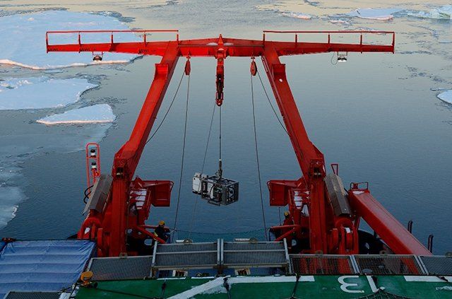
The OFOBS (Ocean Floor Observation and Bathymetry System) shortly before deployment on board RV Polarstern.
(Photo: Alfred-Wegener-Institut / Tim Kalvelage)
The OFOBS is lowered over the stern of the ship
The deep-sea team photographed and filmed this surprisingly species-rich ecosystem for the first time using the OFOBS (Ocean Floor Observation and Bathymetry System). Since the camera platform is towed below the ship on a long cable, the researchers had to wait for the calving event before they could explore the previously unreachable seafloor. In the future, new technologies like autonomous underwater robots will be used to investigate such habitats.
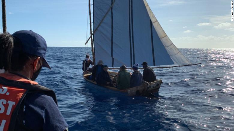
When Beatriz Jimenez closes her eyes, she sees her daughter and two young grandchildren and they are alive. Jimenez's family left the small seaside town of Cabarién, on Cuba's north coast, on March 4, aboard a packed smuggler's boat.
The boat had come from Florida and picked up a group of Cubans desperate to reach the US, according to a statement from the Cuban foreign ministry. The smuggling run violated both US and Cuban laws and put the passengers' lives at risk. Although the communist-run island is only 90 nautical miles from the US, the weather in the Florida Straits is treacherous, particularly in the spring when "Easter winds," as Cubans call seasonal abrupt shifts in weather, can transform the sea into a frothing monster. Jimenez said her daughter Lisbethy took the trip because she had been apart from her husband in Florida for more than a year, after the pandemic forced Cuba to cut most international flights. Lisbethy had been afraid to leave her daughter Kenna Mariana, 6 years old, and Luis Nesto, 4, behind in Cuba and risk a lengthy separation. "My daughter is a good mother. She wouldn't have done this if everything wasn't safe. She wouldn't have put them through this. Her children are everything to her," Jimenez told CNN from the small room full of toys that her daughter had shared with the children
Jimenez holds a picture of her grandchildren Kenna Mariana, 6, and Luis Nesto, 4.
According to the Cuban foreign ministry statement, the smugglers made the migrants switch boats once they reached Bahamian waters, likely to try and confuse any Coast Guard ships that could be in pursuit. As the second boat sped north, it lost control and capsized. It is not clear how many people were aboard. Some 14 hours later, a Royal Bahamian Defence ship found 12 survivors and one dead body, according to a Bahamian government statement. Lisbethy and her children were not among them. Jimenez said relatives in Florida, who had contacted survivors in the Bahamas, later told her the smugglers had not brought life vests for any of the passengers. As Cuba's economic crisis worsens, US Coast Guard officials say they are seeing more Cubans attempting the dangerous journey by boat.
Since October 1, the Coast Guard has intercepted 90 Cubans at sea, according to spokesman Brandon Murray. That number already surpasses the 49 Cuban migrants the previous fiscal year and does not account for many migrants who may arrive in third countries like the Bahamas or who successfully reach the US. In February, a small boat carrying eight Cubans, including two pregnant women, capsized as it reached the Florida coast after 16 days at sea. The same month, the US Coast guard rescued three Cubans who had been living mostly off coconuts after being stranded on a deserted island in the Bahamas for 33 days.
While so far the numbers of Cuban migrants taking to the seas are far less than the rafters crisis of the 1990's, when thousands of people attempted the dangerous crossing by boat, the increase is raising alarms. "The Coast Guard does not recommend anyone taking to the seas in vessels that are not seaworthy. The vessels are often overloaded, the seas are unpredictable and the risk of loss of life is too great," the US Coast Guard said in a statement provided to CNN. Most Cubans caught entering the US now are returned to the island, after President Obama, in his final days in office in 2017, canceled the "Wet Foot, Dry Foot' policy that allowed those who reached the country to remain. According to figures released by the Coast Guard. 5,396 Cubans were interdicted in the fiscal year of 2016. That number dropped to 1,468 the next fiscal year, following Obama's policy change, and since then has stayed in the hundreds.
But a worsening economic climate could push more Cubans to make the desperate voyage, despite having lost their preferential status. In 2020, the economy shrank by 11%, according to Cuban government figures, as the island's tourism industry was almost entirely shut down by the pandemic. That followed a series of punishing sanctions by the Trump administration -- the toughest in decades -- that included returning Cuba to the list of countries that support terrorism, limiting US citizens' ability to travel to the island and cutting off channels for Cuban-Americans to send remittances to relatives there. "Remittances basically determine who can eat and who can't," said Ernesto Gonzalez, whose remittances company Vacuba was impacted by the Trump sanctions. Gonzalez said he is urging the Biden administration to restore the money transfer services before Cubans face a humanitarian crisis.
Desperate circumstances
Coast Guard Station Islamorada law enforcement crew interdicts a migrant boat with 7 migrants, Islamorada, Florida, March 2, 2021.
The migrants were repatriated to Cuba. Increasingly Cubans wait in hours-long lines to buy food, which they must pay for in US dollars at many Cuban government-run stores. Without tourists, restaurants and home rentals opened by Cuban entrepreneurs sit empty. Many Cubans compare the ongoing crisis to the dark years the island experienced following the collapse of their ally the Soviet Union in 1991, when tens of thousands of Cubans fled to the US by boat and raft. The Biden administration has said it is studying potential changes to its Cuba policy, including determining how scores of US diplomats working at the US Embassy became ill. The mysterious health incidents led the State Department in 2017 to pull most of their diplomats from the island and shut down embassy services through which Cubans could receive US visas. According to a State Department report, as of November 2020, more than 78,000 Cubans were on a waiting list for immigrant visas. Beatriz Jimenez said her daughter had hoped to apply for a visa to reunite with her husband in the US but as the embassy closure and disruption caused by the pandemic dragged on, she could not wait any longer. As Jimenez held a vigil with neighbors and relatives for her missing family, she prayed for word of their rescue. "They are alive. I know it because I believe in God. I know it will be a miracle," she said. "I am desperate but clinging to the idea that we will have an answer." But ten days after their disappearance, the Cuban government announced it was suspending the search operation. Jimenez still does not know what became of her daughter and grandchildren. The children and their mother had vanished into the sea.

 Fionn Ferreira, a 20-year-old Irish inventor, found a way to successfully remove 88% of microplastics from water samples. Photograph: Fionn Ferreria
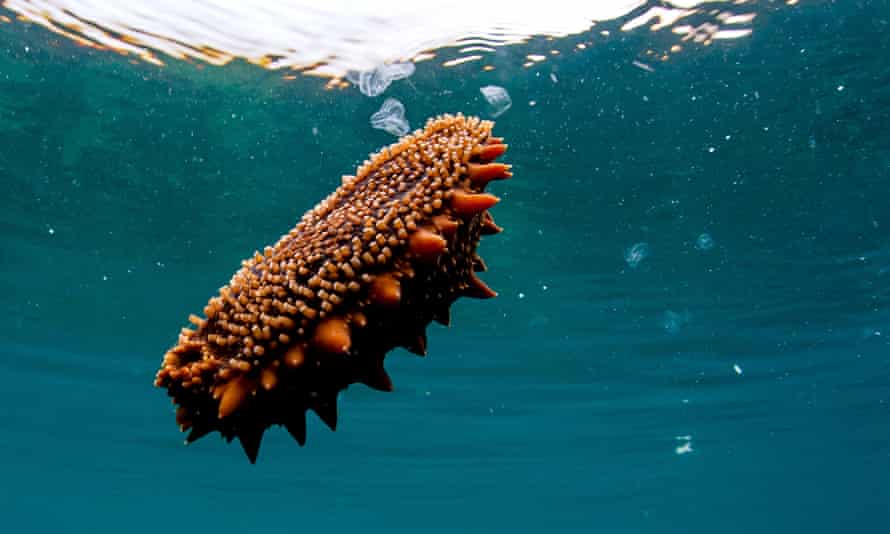
 Marc Ward’s static-charged screen can capture plastic particles as small as 50 microns.
 Scientists have created a new kind of water filter made from plant-derived nanocellulose mesh. Photograph: VTT Technical Research Centre of Finland
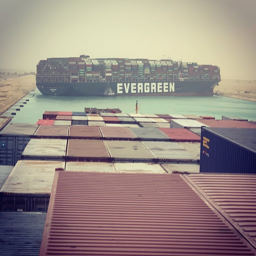
 A part of the Taiwan-owned MV Ever Given (Evergreen), lodged sideways and impeding all traffic across the waterway of Egypt’s Suez canal.
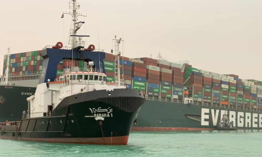 Photograph: Suez CANAL/AFP/Getty Images
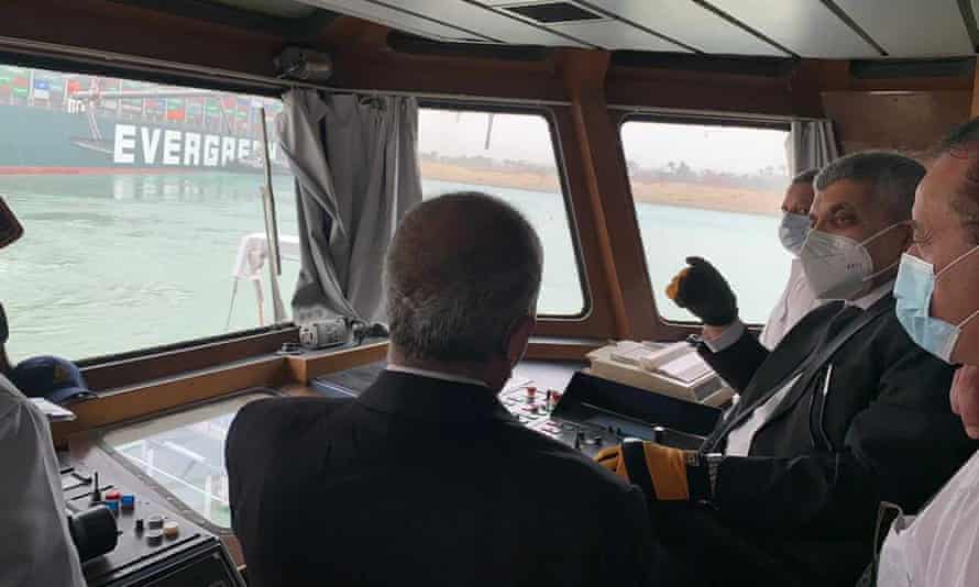 Gen Ossama Rabei, head of the Suez Canal Authority, second right, speaks to other staff onboard a boat near the stuck cargo ship.
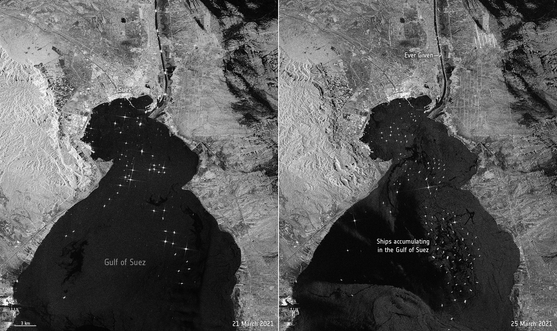


