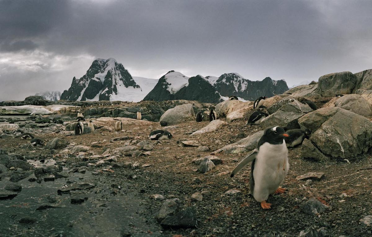
The gentoo penguin colony at Petermann Island.
Credit: Macduff Everton
Antarctica is the coldest, driest, and windiest continent on earth.
It’s like no other place on earth—a devastatingly beautiful, beguiling, enchanting and dangerous landscape.
Perhaps I’m using too many adjectives, but Antarctica deserves them all.
The Greek word arktos, meaning bear, is the source of our word Arctic; a dictionary definition is, “Pertaining to, or situated under, the northern constellation called the Bear.” While Ursa Major (Great Bear) is dazzling in the northern sky and the logical choice, Ursa Minor (Little Bear) contains Polaris, the North, or Pole Star, designating the celestial north pole.
There is no comparable star in the southern hemisphere.
Antarctica literally is the anti-Arctic, with no bears, real or celestial.
It is located under a permanent ice cap averaging 1.9 kilometers thick, twice the average elevation of any continent.
The ice cap locks up at least eighty per cent of the world’s fresh water.
But today, with little annual precipitation, it is basically a barren icy desert.
The strait off Antarctica between Kiev Peninsula and Booth Island
Credit: Macduff Everton
Antarctica’s shores are ringed in ice, and the surrounding poorly charted waters are a navigational hazard dangerously chock full of sea ice and icebergs.
Even though the ancient Greeks and Romans hypothesized that it should exist if only to balance the continents in the northern hemisphere, it wasn’t until the nineteenth century that sealers, whalers, and explorers discovered this strange world at the bottom of the world.
In geological terms it arrived rather recently.
It was part of the ancient supercontinent of Gondwana that broke up in the late Mesozoic era into the bits and pieces that became continents, islands, and land masses we know today: Australia, New Zealand, South America, Africa, Madagascar, India, and Antarctica.
Only 25 million years ago Antarctica detached itself from South America to drift slowly to the South Pole.
Fossil records show a once-temperate land covered first in snow, then ice, before becoming the benumbed landscape we know today.
The frozen continent has no indigenous culture and belongs to no nation.
Since 1961 the Antarctic Treaty System administers it under an international agreement that sets aside the continent as a scientific preserve, while establishing freedom of scientific investigation, banning military activity, and providing environmental protection.
One needs no visa to visit and there are no passport controls.
The problem is how to reach it.
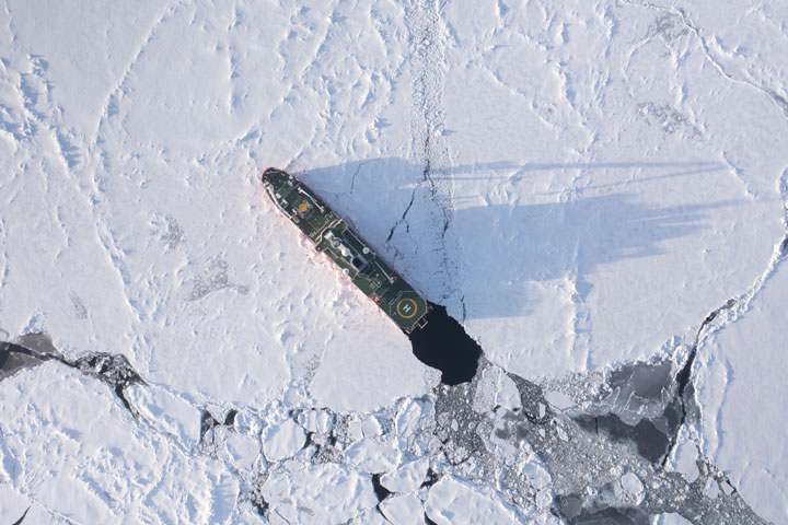
In December and January, I made two back-to-back voyages to Antarctica, on MV National Geographic Explorer, a fully stabilized expedition ship, an ice-class vessel with a strengthened hull strong enough to push through the Antarctic sea ice.
With a fleet of Zodiacs and side doors, it gave us the flexibility, depending on conditions, to sail and land anywhere we were allowed to visit.
The Lindblad/National Geographic Expeditions staff included naturalists, historians, undersea specialists, and something no other tour company offers, a National Geographic photographer on board for each trip.
That was my role; I gave lectures, answered questions, guided, joined guests in the lounge and at meals.
For several years I’ve made pilgrimages to Antarctica.
My wife Mary Heebner joined me on two of the trips.
Cuverville Island, Antarctica | Credit: Macduff Everton
I brought my Noblex panoramic film camera and scads of rolls of film.
Guests would watch me shoot and then ask to see the photograph, thinking there would be a button I could push to show them the digital file.
It would be a month before I developed my film and see any of my images.
More than 90 percent of ships visiting Antarctica leave from Ushuaia, the cold and rainy Argentinian frontier town on the island of Tierra del Fuego, the terminus of the Pan American Highway.
It is on the northern side of the Beagle Channel.
The southern bank is Chilean, as is Cape Horn at the tip of South America.
Between Cape Horn and the Antarctic Peninsula is Drake Passage, the dreaded and often stormy open ocean spanning a thousand kilometers.
The seas are infamous for the strong westerly winds delineated by latitudes—the Roaring Forties, the Furious Fifties, the Screaming Sixties—that generate great force and strength, unimpeded by large land masses.
A stormy sea crossing is hard to forget.
The weather can change so quickly it’s hard to forecast whether you are going to experience the “Drake Lake” or the ‘Drake Shake.”
Soon after 6 p.m.
on the summer evening of December 19, we sailed from Ushuaia with 148 guests.
Dinner, after a safety drill, began at eight.
On the reception counter was a basket full of seasickness pills.
When we left the protected Beagle Channel and the ship rose and fell as we met the deep swells of the open sea, many of the guests who hadn’t put on a patch or taken a pill headed for the basket at reception.
But we were lucky.
A low-pressure system sitting over Antarctica prevented the usual storms, allowing us a rare and relatively calm passage.
The staff shared cabins on the B deck, just above the waterline.
To get to the bridge we had to climb up four levels.
The lounge and chart room were up three levels, the restaurant two.
It was as if we were on a Stairmaster all day long.
The only communal room on the staff level was the mudroom, from which we would embark on explorations, with benches and open lockers where we hung our survival jackets and Wellies, and side doors we opened for boarding Zodiacs.
An icemaster is a ship captain experienced in sailing polar waters.
Captain Leif Skog was arguably the most experienced ice expedition captain in the industry.
When he first sailed these waters the nautical charts for Antarctica were incomplete.
Good maps rely on expensive hydrographic surveys and no government among the Antarctic Treaty system, was volunteering to undertake the expense.
If Captain Skog wanted something more, he needed to create his own charts, so when his staff landed passengers for their excursions, he sent crewmembers in a Zodiac to crisscross the water with a GPS and a sonar device to map every expedition destination, the more remote and uncharted the better.
He shared and distributed his seafloor depth information with others navigating these waters.
 Credit: Mary Heebner
A Norwegian company developed Olex, a seafloor database for mapping and navigation around the world.
It provides a three-dimensional chart system to use in conjunction with standard navigational charts.
Antarctica isn’t a location I would first think of for crowdsourcing, but each ship, depending on weather, tides, season, and ice, uses a different route, however slight, and adds to the mapping of the sea floor.
Thousands of contributing users are constantly updating billions of bathymetric soundings worldwide.
In addition to scientific expeditions, tourism in Antarctica is increasing, as are the risks and safety issues, especially now when even mega-cruise ships with thousands of passengers are navigating freezing waters strewn with icebergs and where weather can suddenly deteriorate to blizzard conditions.
Captain Skog developed the safety and emergency procedures for International Association Antarctica Tour Operators (IAATO), ensuring every commercial vessel operating in Antarctica remain in daily contact to respond to any emergency.
There is no local Coast Guard in Antarctica to help.
When there is a maritime incident, it is often another expedition cruise ship that comes to the rescue.
The weather was brisk but not freezing.
Pelagic birds rode the air currents.
Climbing, dropping, swooping, banking, plucking something from the sea, or hanging motionless just off the deck, we saw wandering albatross, black-browed albatross, Cape petrel, greater shearwater, Antarctic prion, giant petrel, gray-headed albatross, royal albatross, Wilson’s storm petrel and blue petrel.
It was an impressive list of birds for our first day at sea.
The wandering albatross, the world’s largest flying bird, is a master glider.
With long wings with black tips, they come ashore only to breed on windswept and remote islands.
They hold their wings rigid, using only slight shifts to maneuver, soaring, or skimming the ocean surface.
My favorite was the Cape petrel, or pintado, a name I like better.
It is not colorful; indeed, it is piebald, but its markings make me think of an artist flicking a brush of white paint on a black bird—a delightful and unexpectedly blotchy pattern.
While others looked for wandering albatross, I sought out the pintados, which like following ships, hoping for galley wastes and scraps.
 Icebergs at Devil Island | Credit: Macduff Everton
I celebrated two Summer Solstices this year, first in the northern hemisphere, now at sea, steaming towards Antarctica.
Sunrise was at 3:22 a.m.
I awoke an hour later and climbed to the bridge, greeting Arnie Carrera, the Filipino night navigator, who was listening to a mix of the Beatles and James Taylor while scanning the horizon and monitoring the radar and navigation screens.
Beams of sunlight escaped a cloudy sky to splash brilliantly on a calm pewter sea.
With only a breath of wind, there were no whitecaps.
We were making excellent time.
Drake Passage was as calm as a placid lake.
The ship had an open-bridge policy.
Guests were welcome and could join the captain and crew and ask where we were and where we were going or consult the navigational charts and the array of monitors to discover for themselves.
Beneath the windows giving an unobstructed view was a shelf with the ship’s controls, computer monitors and navigational maps.
There were two chairs, one in front of the wheel.
With a dozen binoculars at hand, and out of the wind, spray, and cold, this was an excellent platform for spotting wildlife.
On both ends were glassed-in porches leading to stairs and lower decks.
Double doors guarded against the cold, and stormy and windy conditions.
Our course was set for the South Shetland Islands.
The horizon rose and fell in a steady rhythm.
I checked our position and ETA to landfall on a monitor.
We had passed latitude 60˚ south during the night and entered the Antarctic Convergence—the fluid boundary between the warmer waters of the subantarctic region, the southern reaches of the Pacific, Atlantic, and Indian Ocean.
We were now in the political and ecological realm of Antarctica, with its own distinctive political jurisdiction, marine life, and climate.
The seawater temperature had dropped 2.8˚ C., from 42 ºF to 36 ºF.
Without any wind, sea smoke appeared, a phenomena of low fog created by colder air over warmer water.
It was so low on the water we seemed to glide across it until it broke into wisps and disappeared.
Other staff members began to show up with their first cup of coffee for the day.
One on the naturalists wiped a white board clean, where we kept a daily log of sightings.
He asked what we’d seen so far, and I mentioned I’d already seen wandering and royal albatrosses, usually as far south as the birds came.
Moments later a wandering albatross flew by, as if on cue to corroborate my sighting.
 Adélie penguin rookery on the Tabarin Peninsula of the Antarctic Peninsula | Credit: Macduff Everton
On the horizon I saw two tall sea stacks, but when I looked at the nautical charts, I couldn’t find them.
When I asked Arnie, he told me they were icebergs.
Yes!!!
I grabbed a pair of binoculars and indeed the rock stacks were gigantic floating mountains of ice, some larger than our ship.
I’d seen icebergs before, in Alaska and Patagonia, and kayaked through fields of them in Glacier Bay National Park, but nothing prepared me for this scale.
Like snowflakes, no two were alike.
Agents of erosion—sun, wind, and waves—had sculpted them into ice islands, with their own distinct valleys, peaks, cliffs, and beaches.
Whatever showed above the water—the tip of the iceberg—was often only one-eighth of what lay beneath.
Icebergs are inherently unstable; they calve, split, roll, or even turtle—flip over—without warning.
Even beneath the waterline, icebergs were changing shape.
As they slowly melted, it released air bubbles trapped for hundreds or thousands of years.
Billions of these tiny bubbles abraded the ice, creating distinctive fluted columnar patterns we saw when they flipped.
Gentoo penguin rookery at Neko Harbour in Andvord Bay | Credit: Macduff Everton
What appeared to be whitecaps on the sea were not wind-whipped waves at all but bits of floating ice.
I learned that while all floating ice, typically detached from a glacier or ice sheet, is technically an iceberg, there is a hierarchical nomenclature to distinguish them by size, beginning with iceberg.
At any one time an estimated 300,000 icebergs are in the Southern Ocean.
An iceberg is a massive piece of ice drifting in the sea.
It needs to float more than 5 meters (16 feet) above sea level and cover at least 500 square meters.
Anything smaller is either a bergy bit, a large chunk of ice but smaller than an iceberg, or a growler, an even smaller chunk, pretty much awash with less than one meter showing above water.
As we crossed the continental shelf, we began looking for whales attracted to this nutrient-rich water.
Aaron Wood, the chief officer, arrived on the bridge at 6 a.m.
As soon as he mentioned we should soon see penguins, one porpoised across the bow.
Icebergs showed on our radar screens as yellow-orange blips, so many they looked like schools of fish.
As we passed the first large one, I could see huge plumes of spray where waves broke against an ice cliff.
A smaller iceberg with a sloping side passed us.
The first officer looked at the radar and told me the iceberg was a kilometer away, but it appeared as if it was right off our starboard.
In the clear, dry, dust-free air—clear as gin—it was hard to judge distances.
It was only when I saw the penguins on the iceberg that I got a sense of scale.
They looked like poppy seeds on a bread roll.
With binoculars I saw they were staining the ice red with guano.
Approaching Baily Head at the eastern end of Deception Island we sailed between Snow and Smith Islands.
Baily Head has an important breeding colony of some 60,000 pairs of chinstrap penguins.
Very few ships attempt a visit, as the beach is so steep it makes landing difficult, and impossible in large swells.
Captain Leif Skog said we would try as the sea was so calm.
Many of the crew had never landed here before.
As we approached, we saw pods of orcas cruising the water among scads of penguins porpoising.
Both were black-and-white blurs in the water, but the larger blurs ate the smaller blurs.
I was excited to step onto Antarctica on a sunny summer day under a blue sky.
Even so, the other guides and I put on our insulated Wellies, our waterproof pants and a safety jacket that inflated on immersion.
We found our gloves, hats, balaclavas, and gaiters, and strapped on our radios.
I jumped in the first Zodiac heading for shore.
Even with a light swell the landing at Baily Head was delicate.
It was one thing for the guides to accomplish this, but it had to be safe enough for everyone.
The beach of black basalt pebbles and sand fell off so abruptly our driver backed the Zodiac in, so a wave wouldn’t wash over the transom and swamp the boat.
The boatman cut the engine as we drifted in, then one of the guides jumped out to hold it.
One by one we exited from the stern.
If anyone had tried exiting anywhere else, they would be in water over their head.
The beach was so steep it was hard to carry all the gear.
The landing was in the shadow of a cliff.
We moved off to set up hampers where guests would leave their life jackets and a couple of folding chairs in case someone needed to sit.
When guests arrived, we warned them to keep away from the unstable cliff—proof of it were the heavy slabs of stone lying in ruin where they’d broken loose and fallen.

Port Lockroy, Antarctica | Credit: Macduff Everton
It felt good to work with professionals who you could trust your life with.
Working inland, we marked a path with orange traffic cones along the black sand beach that wouldn’t interrupt the steady parade of penguins entering and exiting the sea from a valley formed by successive rocky ridges.
They were porpoising through the water, scrambling up the beach, shaking the saltwater off, and taking off for their mate, while as many more headed out sea to fish.
We used a crossing at a shallow lagoon created by a berm of beach sand damming the stream of snowmelt flowing in multiple channels to the sea.
Penguins are sea birds, spending most of their lives in the ocean except when breeding or molting.
They are so comfortable swimming around that the first explorers classified them as fish.
The penguins we would see on this trip were all the archetypal black and white birds that look like little men in tuxedos, walking upright on land with the peerless rolling gait of a sailor, their stubby paddle wings held out for balance.
Markings around the head and neck distinguished the differences between the brush-tailed penguin species.
The chinstrap has white cheeks, and a thin black line running from the nape to under the chin, and a dark bill.
They are noisy and sociable and their nests, unlined bowls of pebbles they cobble together, were everywhere, bunched close to each other.
The first pairs to breed built their nests more than a kilometer back from the sea on exposed rock high on a ridge where the snow melted first.
We’d hoped to reach at least the first ridge, where the valley opened into an amphitheater where most of the nests were, but the colony was spilling over the edges.
Chinstraps were pouring over the ridges from all directions with thousands of tracks and guano marking their trails in the sand and snow.
If the guano was white, it indicated a diet of fish, if red they were eating krill, green indicated they were starving and not healthy.
Concentric circles of guano marked their nests.
You could smell rookeries on the seas even before sighting land.
Ammonia punctuated the air.
An early explorer wrote it was the most intolerable stench he had ever smelled, a sentiment echoed by successive visitors.
Mary would describe it as the odor of a diaper pail left unattended for a week.
Once set up, we radioed the ship that the first group could come ashore.
This was the guests’ first landfall.
Unlike the first explorers and exploiters who killed anything edible, of value, or in their way, the International Association of Antarctica Tour Operators (IAATO) rules were very explicit.
Animals have the right of way, and we couldn’t block their access to and from the sea.
We must not feed them, nor step on fragile mosses and lichen that might only grow ten millimeters in diameter per century.
Visitors should walk slowly and carefully around penguins and seals, keeping noise to a minimum, while maintaining at least five-meters distance apart.
We were supposed to be courteous and respectful visitors.
Everyone knew the guidelines, but once ashore, they grew giddy at finding themselves surrounded by penguins.
The rookery was a complex drama of perpetual movement and cacophonous chatter.
When a penguin returned from the sea, waddling into the colony among tens of thousands of nests, it found its mate using a distinctive antiphonal call that the parents passed on to their chicks.
The returning penguin, once back to their nest, conducted a ritual of head waving and squawking, quite an exotic dance really.
Because its call is so loud and harsh, chinstraps are also known as ‘stonebreaker’ or ‘stonecracker penguins.’
 Adélie penguin rookery on Pualet Island | Credit: Macduff Everton
It was hard not to anthropomorphize the animals because it was a way of connecting.
They looked like urban commuters waddling to and from work.
Back on its nest at last, it was at this point most people stopped anthropomorphizing when the penguin regurgitated a meal of predigested krill into the mouth of its waiting chick.
“Yuck,” one guest said, turning away.
But everywhere you looked it was the same.
A constant in this tableau was a parent always on the nest with their egg or chick to keep it warm and protected while the other was fishing.
Each penguin couple, on their stone pebble nest, was just beyond pecking distance from the next nest and then the next.
There was safety in proximity as the rookeries attracted skuas, fierce birds of prey dogging the nesting areas.
They looked like oversized juvenile gulls, large and powerful, brown with patches of white on their wings at the base of their primary feathers.
They are intelligent birds with personalities.
They would land in the colony and stalk insouciantly between the nests, like an intent shopper walking down a grocery aisle looking for a tasty morsel, watching for the slightest lapse of attention to pluck an egg or chick for its meal.
The penguins would scream and peck at them to leave, but the skuas were fearless, seemingly immune to their protestations.
Sometimes they worked in tandem to trick a parent from their nest.
For several hours I stood at the far end where we had to stop and couldn’t go any further, offering help, answering questions, and reminding people who forgot the wildlife rules that we couldn’t approach the penguins, but the penguins could approach us.
I suggested if anyone wanted to sit down and be patient, there was a good chance a curious penguin would walk up to them, and within minutes they would.
 Detail of iceberg on Booth Island | Credit: Macduff Everton
I’d dressed for the warm sunny 2˚ C on landing and left my parka on the beach in a hamper.
In the afternoon the sky clouded over, got colder until it began snowing.
I was bone cold.
I had stood around too long.
When the last of the guests were back on the ship, we gathered our cones, hampers, and folding chairs and filled the Zodiac.
After putting things away, I took a long hot shower, never even bothering to turn on the cold, my body tingling as it thawed.
We sailed the short distance from the eastern end of Deception Island to the narrow break in the volcanic cone leading into the collapsed flooded caldera of this active volcanic island.
The narrow channel, called Neptune’s Bellows for the fierce winds that blow through, is also treacherous, with Ravn Rock, ready to rip the hull of any careless ship captain, lying just a few meters below the surface in the center of the strait.
The entrance was easy to miss, but once American sealer Nathaniel Palmer discovered the secret harbor in 1820, and gave Deception Island its name, Port Foster proved to be one of the safest and most protected harbors in all of Antarctica once a ship was safely inside.
First serving as a fur seal base, it became a haven for whalers in the 20th century.
On deck it was snowing hard, visibility reduced to half a kilometer.
Snowflakes were as big and wet as a sloppy, drunken winter kiss.
The wind swirled them around us wildly, creating a murmuration of snowflakes.
Inside the caldera, Captain Skog maneuvered the bow of the Explorer to just meters from the black volcanic sand beach, the drop off so precipitous ship instruments showed we had more than six meters of depth.
Abandoned buildings and fuel tanks were remnants of a whaling station and a British scientific base damaged by volcanic eruptions in the 1960s.
Conditions were deteriorating so rapidly, Captain Skog decided that instead of landing, we would immediately head for Antarctic Sound and the Weddell Sea.
We sailed through the night enveloped in a storm-induced darkness.
It was still snowing when I went on deck at 5 a.m.
A white veil covered the ship.
The railings wore a mantle as if icing on a cake.
There were no footprints leading to the bow.
I went inside to warm up and prepare for an early landing at Brown Bluff, on the east side of the tip of Antarctica Peninsula.
Snowflakes flecked the windows, obscuring the view.
 Gentoo penguin colony with algae on snow on Petermann Island | Credit: Macduff Everton
Guests in the first group had a 5:30 a.m.
wake-up call.
A half-hour later the guides jumped into Zodiacs, dusted in snow, to prepare for their landing.
I ducked my head whenever we hit a swell to avoid the spray.
Our drivers wove between the icebergs that even in this light radiated an intense blue—the ice so dense and the air bubbles so compressed, it absorbed the longer wavelengths of reds and yellows, only reflecting the shorter wavelengths of blues and greens.
They seemed to glow as if lit from inside.
We landed at a rocky beach with a wide terrace above the high-tide line.
In the snowstorm our world was monochromatic save for the tall cliffs of reddish-brown volcanic rock that gave Brown Bluff its name.
An extinct volcano a million years old, the now flat top of the mountain was ice covered.
Both Adélie and gentoo penguins had adjoining rookeries here.
Gentoos have black heads with a distinctive white patch above their eyes like a narrow head scarf, and a bright reddish-orange bill, while the Adélie has a black head with a white ring around its eyes, and a black bill with a hint of red.
Both species crowded the pebble beach in their peregrinations to and from their nests so close together there was just enough room for the constant flow.
Watching a rookery long enough reveals all manner of drama and skullduggery.
Not all the Adélies immediately headed to sea to hunt once their mate returned.
They might stick around long enough to steal a pebble from a neighbor’s nest to add to their own.
Once a penguin embarked on larceny, they found it hard to stop.
They seemed to derive tremendous satisfaction in it.
After pinching a stone from a neighbor’s nest, carrying it proudly in its beak back to its mate, showing it off before carefully placing the stone on their nest.
It waited a moment to deserved admiration of its mate, then trundled off to steal again.
The penguins seemed delighted with their thievery.
Of course, their neighbors screamed and pecked at them, trying to defend their nests while also guarding against the omnipresent lurking skuas.
The listing of animal sightings for a typical day.
On 23 December, from Devil Island to Antarctic Sound in the Erebus & Terror Gulf and Weddell Sea, included Antarctic tern, Wilson’s storm-petrel, Southern Giant Petrel, Snow petrel, Cape petrel, Adélie and Gentoo penguins, Blue-eyed shag, Kelp gull, Snowy sheathbill, Brown skua, Crabeater seal, Leopard seal, Weddell seal, Minke whale, and Humpback whale.
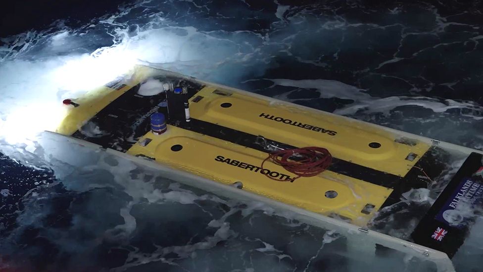
Each evening, before dinner, the staff did a recap for an hour, with short presentations by the naturalists, historians, and photographers, as well as the undersea crew who dived nearly every day and brought back video footage of what they found beneath the frigid surface.
Topics could include how penguins stay warm, how penguins cool themselves off on a warm day, how glaciers are created, tips on how to photograph birds in the air or compensate for exposure when shooting snow and ice, or tributes to the great Australian polar photographer Frank Hurley and explorers such as Ernest Shackleton, Robert Scott, and Roald Amundsen.
It was a bit like foreplay as it stimulated conversations around the dinner table.
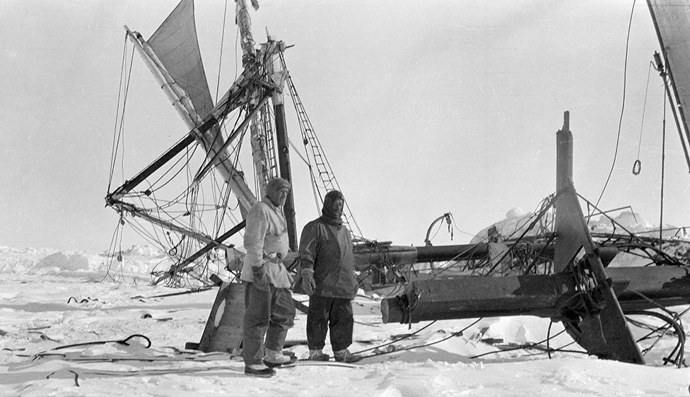
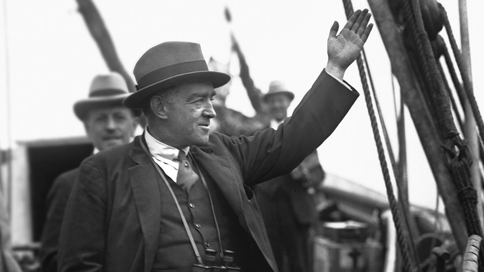
Sir Ernest Shackleton is linked to Antarctica as surely as Joshua is to Jericho.
He led three British expeditions to the Antarctic during a period known as the Heroic Age of Antarctic Exploration.
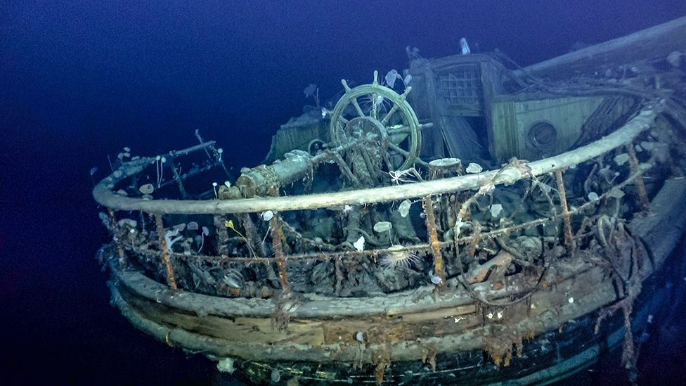
In 1915 he attempted a transcontinental crossing of the Antarctic ice sheet via the South Pole but drifting pack ice sunk his ship Endurance in the Weddell Sea.
Expedition photographer Frank Hurley’s shots of the Endurance rising out of the ice as it is being squeezed to death have become iconic images.
Shackleton’s legendary rescue of his crew of 27 men is an epic tale of survival.
Abandoning the 144-foot-long Endurance in what Shackleton described as “the worst portion of the worst sea in the world,” he and his crew first camped on a drifting ice floe for six months until breaking ice allowed them to sail in lifeboats to the cold and desolate Elephant Island north of the Antarctic Peninsula.
Leaving all but five of his crew there, it took 16 nerve-wracking days, using only a sextant for navigation, to sail 800 miles in a 22-foot boat across heaving seas in gale-force winds to reach South Georgia, the nearest inhabited island.
They rarely had clear skies to get a fix on the sun to locate a mere speck in the South Atlantic.
It was an amazing feat of sailing, followed by an equally extraordinary feat of mountaineering.
Landing on the eastern shore, Shackleton and two crew members completed the first crossing of the island’s treacherous glaciers and snow-covered mountains.
After 36 hours they reached a Norwegian whaling station where they got their first hot bath in two years.
Shackleton then organized the rescue of all of his men.
 Credit: Mary Heebner
England, at war with Germany, could not spare a vessel.
It was the Chilean navy that saved the day, providing the Yelcho, a steel-built tug.
Setting sail from Punta Arenas on the Straits of Magellan, it was Shackleton’s last hope to rescue his men.
Even though the tug was ill-suited for the endeavor, they successfully reached his stranded crew on Elephant Island, and found them all still alive, living on seals and penguins.
Returning to Punta Arenas, at the bottom on the American continent, he wrote his wife, “I have done it… Not a life lost, and we have been through Hell.”
As Sir Raymond Priestly, an Antarctic explorer and scientist said, “For scientific leadership, give me Scott.
For swift and efficient travel, Amundsen.
But when you are in a hopeless situation, when there seems no way out, get on your knees and pray for Shackleton.”
Before leaving for Antarctica Mary and I visited our daughter who teaches medical anthropology at Dartmouth.
The Rauner Special Collections Library, which includes several of Mary’s artist books, is a beautiful neoclassic brick building on campus.
Mary was meeting with Jay Satterfield, the special collections librarian, when she texted me to come over immediately.
She’d noticed a stuffed Adélie penguin in a bell jar on a shelf behind his desk.
Mentioning we were going to see its descendants, Jay explained the library had the Stefansson Collection on Polar Exploration, including a rare original copy of Aurora Australis, the first book written, edited, illustrated, printed, and bound on the continent of Antarctica.
Shackleton conceived the project for his Nimrod expedition (1907-09) as something to occupy his men during the icy winter void of four months without sunlight.
It’s a fascinating side of his character few people know about.
On an expedition with the purpose of being the first to reach the South Pole, where cargo space was precious, Shackleton brought a printing press, an etching press, along with type, papers, inks, and plates.
He chose four members of his polar crew to take a three-week long crash course to learn typesetting and printing before leaving.
 Tabular icebergs in Crystal Sound, in the early summer morning below Antarctic Circle when the sun never sets | Credit: Macduff Everton
Shackleton had edited South Polar Times, a monthly typed paper during Scott’s Discovery Expedition, but he envisioned something more exciting.
Aurora Australis is a singular book; printing only a hundred copies, and even fewer bound, they fashioned the covers from the thin wood sides of the packing crates carrying the expedition’s supplies.
It contains stories, poems, and an account of the ascent of Mount Erebus—the southernmost active volcano on earth—written by Shackleton’s men and illustrated with lithographs and etchings by the expedition artist, George Marston.
We excavated the pages one by one from an acid-free library box and spread them out on the broad library table.
For preservation, each page of the book was unbound and protected.
To see Ernest Shackleton’s signature written across his editor’s page was unexpected and thrilling.
“Since writing the preface for this book,” he wrote, describing the madness behind this epic undertaking, “I have again looked over its pages, and though I can see but little not up to usual standard in bookmaking, the printers are not satisfied that it is everything that it ought to be.
But the reader will understand better the difficulty of producing such a book quite up to the mark when he is told that, owing to the low temperature in the hut, the only way to keep the printing ink in a fit state to use was to have a candle burning under the inking plate; and so, if some pages are printed more lightly than others it is due to the difficulty of regulating the heat, and consequently the thinning or thickening of the ink.
Again the printing office was only six feet by seven and had to accommodate a large sewing machine and bunks for two men, so the lack of room was a disadvantage; but I feel sure that those who see this book will not be captious critics.
The printing was entirely done by Joyce and Wild, the lithography and etchings by Marston, and the covers made of provision cases were manufactured by Day.
It is therefore to these four that the carrying out of the Aurora Australis is due; most of us have contributed an article of some sort, and I as Editor feel an interest in the work, as it was a pleasure to see it progressing; and I trust that all who have a copy will think kindly of the first attempt to print a book and illustrate it in the depth of an Antarctic Winter.”
 Largest chinstrap rookery on the Antarctic Peninsula | Credit: Macduff Everton
Almost as unexpected was the 15˚F we experienced that December morning in Hanover, New Hampshire.
Because of global warming, it was colder than any day we encountered in Antarctica.
The frozen continent used to be colder when whalers and explorers first sailed here.
Pack ice and ice shelves are receding or disappearing—10,000 square kilometers of ice shelf were gone from the Weddell Sea by 2002.
When conservators in 2010 were restoring Shackleton’s hut at Cape Royds on Ross Island, where fifteen of his men had stayed, they found three buried crates of Mackinlay’s malt whisky, the popular spirit much enjoyed and personally selected by Shackleton to fortify his expeditioners.
Three of the bottles were flown back to the Scottish Highlands to Whyte & Mackay, owners of the Mackinlay’s brand.
Through exhaustive scientific analysis and expert tasting they recreated an exact replica of the original.
After our shipboard presentation on Shackleton, waiters circulated among the passengers with trays of shot glasses giving each a wee dram.
Together we raised our glasses and toasted Shackleton and his men.
We were sailing where a century before pack ice crushed Shackleton’s ship Endurance.
Today more than 90 percent of the icebergs from ice shelves end up in “Iceberg Alley” in the Weddell Sea, near the narrow passage between the tip of the Antarctic Peninsula and a group of offshore islands.
The Antarctic Coastal Current, a counter-clockwise whorl of currents and winds—a counter-current to the largest ocean current in the world, the Antarctic Circumpolar Current—carry many of the icebergs thousands of kilometers from where they were born.
As huge sections of the ice shelf break off, they create tabular icebergs, with steep clifflike sides and flat tops.
Even Cubism couldn’t do justice to these massive, angular forms that are stark, raw, and dramatic.
Cezanne, Braque, or Picasso were fussy in comparison.
Gentoo penguin rookery in Dorian Bay | Credit: Macduff Everton
It took us more than an hour to pass a single iceberg 18 kilometers long and 3.5 kilometers wide.
It even had a name, B-15Y, provided by the U.S.
National Ice Center.
Established in 1995, USNIC is the only organization that names and tracks all Antarctic icebergs, primarily using satellite data.
This iceberg was once part of the massive B-15 iceberg that calved off the Ross Ice Shelf in March 2000, approximately 295 kilometers long by 37 kilometers wide at birth.
Covering 11,000 square kilometers, B-15 was larger than the island of Jamaica.
As it broke up over the years, USNIC designated the bigger chunks with a letter, beginning with B-15A.
B-15Y was the twenty-fifth large chunk to break off.
In 2016 NASA scientists tracking the melting ice sheets published a study in the journal Science Advancesdescribing how global warming is changing the way the earth wobbles on its polar axis.
Scientists and navigators have measured the true pole and polar motion since 1899.
The earth’s spin axis drifts slowly around the poles and needs to be taken into account for GPS, Earth-observing satellites, and observations on the ground to be accurate.
Until the 21st century the wobble was heading west towards Canada, in part due to the Earth’s mantle readjusting to the loss of ice on North America after the last ice age.
It was pulling the spin axis a few inches a year towards Hudson Bay.
But abruptly at the turn of the twenty-first century the motion dramatically moved eastward towards Britain, drifting almost twice as fast as before.
Scientists calculate melting ice sheets are altering the distribution of water mass on earth and causing this massive swing.
Greenland was losing more than 272 trillion kilograms of ice annually and West Antarctica 124 trillion kilograms, while at the same time East Antarctica is gaining about 74 trillion kilograms annually.
That is exerting a push-pull on the Earth’s spin axis.
This in itself wouldn’t generate the gigantic amount of energy needed to alter the Earth’s spin so dramatically, which introduces one more wobbly equation.
Scientists found an answer in the combination of depleted aquifers and drought in the area of the Caspian Sea and the Indian subcontinent.
Even though the lost water mass in Eurasia isn’t as large, the spin axis is extremely sensitive to changes occurring around 45 degrees latitude, and combined with the melting ice sheets, it provides the additional pull to change the Earth’s wobble.
In the Weddell Sea we looked for emperor penguins on the pack ice.
They are the largest penguin and breed on the ice, so we kept close to the ice.
Along one section we kept abreast of a leopard seal prowling the ice’s edge, lined with Adélie penguins.
Instead of backing off, the curious penguins seemed to lean even closer, the difference between viewer and victual nearly disappearing.
One penguin did fall into the water and immediately popped back out.
Most of the guests were rooting for him, having heard from the naturalists that leopard seals will grab a penguin and shake it so violently the birds turn inside out, all the easier to eat.
 Credit: Mary Heebner
The National Oceanic and Atmospheric Administration scientists working on the Antarctic Peninsula discovered a pod of orcas using a collective technique to hunt seals resting on pack ice.
Working together, the whales swim quickly abreast toward the ice.
They create a bow wave, and then pump their tails as they dive, generating an even larger wave washing over the ice knocking the seals into the water.
The waves are powerful enough to even break up large ice floes into smaller pieces.
The scientists also found these whales were very selective, preferring Weddell to more aggressive crabeater and leopard seals.
Research also uncovered four orca ecotypes in Antarctica, which might be separate subspecies or even species—those hunting penguins, those hunting minke whales in open water, those hunting fish, and those hunting seals.
They had overlapping territories but didn’t seem to interbreed.
While Antarctica appears to be a vast empty wilderness, we kept spotting penguins, seals, orca, humpback, minke and fin whales.
Nearly everyone came out on deck or rushed to a window at an announcement of a pod of whales.
Whale watching was sometimes like trying to remember dreams.
You saw a spout, and then the whale disappears.
Did it sound? Where would it reappear? It might resurface and become familiar or drift away, a fragmentary memory we try to recall before forgetting.
We had days when whales swam alongside the ship.
Late on Christmas Eve in Dallmann Bay a pod of humpback whales was bubble feeding off the bow.
The whales worked together as they swam underwater in small circles, releasing a wall of bubbles that acted like nets, corralling the krill.
Then up though the center a whale rose to the surface with its mouth stretched wide, capturing tons of them.
As we watched, beams of the setting sun touched the mountains as if erupting in flames, and icebergs most coruscant.
Adélie penguin rookery on the Tabarin Peninsula of the Antarctic Peninsula | Credit: Macduff Everton
When the absence of distractions frees them to notice their surroundings, people pay attention to the light in Antarctica.
On an ineffable windless day, when the water mirrored the world, light bathed and caressed the frozen polar landscape.
You begin to see the subtle pastel sky mixed with sea fog and clouds as if painted by Turner or Constable or reminded of canvases painted primarily of night by James McNeill Whistler, who took a musical term popularized by Chopin, and applied it to a series of masterful paintings he called Nocturnes, evocations of subtle tonal changes and luminous monochromatic light.
It was another painter I thought of one day, one night in the wee hours of breathless light.
We were in Crystal Sound below the Antarctic Circle, among bergy bits and tabular icebergs, where the muted hues of sea and sky became tonal blocks of color floating in the atmosphere.
A block of reddish orange at the horizon hummed with a vibrance I usually associated with a light in a stormy sky that stands in juxtaposition to the roiling bruised purples, blacks, and Payne’s grey of the clouds around it.
This seemed less a definition of space than another block of color, with such a soothing balance it made me feel calm even as the freezing temperature reminded me where I was.
I had on a Hebridean tweed woolen jacket, a Patagonia gaiter around my neck, but I wore no gloves—I needed my fingers free to continue photographing.
I warmed my fingers in my coat pockets in between shots as I didn’t want a distraction stealing valuable time if I fumbled taking my gloves on and off.
I didn’t know how long this glorious world of color and form surrounding me would last.
We were moving along a coast of a continent where weather changed as quickly as a sneeze.
I remained transfixed, simply in awe that we’d seemingly sailed into one of Rothko’s iconic and emotionally transformative Color Field paintings.
Mark Rothko was born Marcus Rothkowitz in Dvinsk, part of Tsarist Russia.
It is now the Latvian city of Daugavpils.
All his life he remembered the glorious sunsets he saw before he left at the age of ten.
He associated heaven with a light shining through mist.
Daugavpils is far enough north Rothko would have known the long days of summer, the long nights of winter, and the wide horizons above the Daugava River that travels 352 kilometers across Latvia before emptying into the Gulf of Riga in the Baltic Sea.
My mother, when I would show her a new collection of landscape photographs, would separate them into two piles.
When she handed me her favorites, she explained, “When I look at these, I hear music.”
 Neko Harbour, Antarctica | Credit: Macduff Everton
I thought of this while looking through Geographic Names of the Antarctic and discovered there was a Beethoven Peninsula.
Intrigued, I made a list of classical composers and looked them up.
I was amazed to find Bach Ice Shelf, Bartók Glacier, Beethoven Peninsula, Berlioz Point, Boccherini Inlet, Mount Borodin, Brahms Inlet, Britten Inlet, Chopin Hill, Copland Peak, Debussy Heights, Dvorák Ice Rise, Elgar Uplands, Fauré Inlet, Franck Nunataks, Gilbert Glacier, Sullivan Glacier, Gluck Peak, Mount Grieg, Handel Ice Piedmont, Haydn Inlet, Ives Ice Rise, Mount Liszt, Mahler Spur, Mendelssohn Inlet, Monteverdi Peninsula, Mozart Ice Piedmont, Mussorgsky Peaks, Puccini Spur, Rameau Ice Shelf, Ravel Peak, Rossini Point, Scarlatti Peak, Schubert Inlet, Mount Schumann, Shostakovich Peninsula, Sibelius Glacier, Mount Strauss, Stravinsky Inlet, Mount Tchaikovsky, Verdi Inlet, Wagner Ice Piedmont, Weber Inlet and Vivaldi Glacier.
There was probably a more prosaic reason why the UK Antarctic Place-Names Committee gave areas around Alexander Island, the largest island of Antarctica such musical names, but as I discovered more and more geographic places featuring their names, I surmised the committee had a blank topographic map (from air photos taken by the Ronne Antarctic Research Expedition in 1947-48) and a wonderful list of classical music composers.
But I hoped at least one of the committee members had gazed upon the area and heard music, too.
Alex Ross, music critic of The New Yorker, wrote that a chamber ensemble from the Orquestra Sinfónica del Sodre, the Uruguayan orchestra, performed in Antarctica in 2011.
“Antarctica may seem a silent continent, but it has other musical resonances.” He mentioned many of the landmarks I’d also stumbled on, and spoke with David Searle, son of Derek Searle, a leader of the Falkland Islands Dependencies Survey in the 1950s.
He explained: “[My father] was responsible for the names with Dr.
Brian Roberts of the Foreign Office and the Scott Polar Research Institute… He was base commander at Horseshoe Island in Marguerite Bay (north of Alexander Island) from 1956 to 1957 and surveyed that island.
Because there were so many unnamed features on Alexander Island, they chose to have the theme of classical music for consistency and because much of the landscape was very grand.”
On that musical note I think my mother and I would have agreed.
 Barrientos, South Shetland Islands, Antarctica; skua close to nests at Gentoo penguin rookery on one of the Aitcho Islands | Credit: Macduff Everton
Almost every landing was on an uninhabitable piece of land, at least for humans.
Using our Zodiacs, we could land on an island covered in ice and snow to climb to the top to discover what we could see.
On beaches we found penguin footprints and trails.
On some trails the birds had worn the snow so far down only their heads were visible.
At Danco Island gentoo penguin colonies covered all the exposed rock areas.
After finding a landing spot between the growlers and bergy bits washing up on the rocky shoreline, we made a switchback trail up a steep hillside through the snow to the top, marking it with orange traffic cones, keeping our distance from penguin nests.
But we ran into an unexpected problem.
We’d had several days of warm weather so as we walked, we broke through the snow’s crust only to sink up to our knees.
It made slogging through the snow slow and tedious, but worse, each footprint, deep as a posthole, was a death trap if a penguin fell in.
A vertical casket.
They wouldn’t be able to hop out and escape.
The guides followed behind, shuffling, cleaning up the danger, creating a rut the penguins could navigate.
This was the dichotomy between guide and passenger.
You would hope we would both have an overarching desire to do the right thing, but there were always passengers who couldn’t see the whole picture and consequences and left it to the guides to clean up after themselves.
At the top of Danco Island I turned in slow circles, like a record on a turntable, to take in the unobstructed view.
The snow hid any hint of our hilltop’s features, smoothed by the flow of wind.
Mountains rose from the sea along the west coast of Graham Land off on the Antarctic Peninsula.
Glaciers slipped off the mountains on their bellies, scraping, and grinding until they reached the sea and calved, creating the icebergs filling the Errera Channel.
This was a landscape reduced to the basics—geology, topography, land, sea, snow, and ice sculpted by the elements.
Another day we explored Orne Harbour at Spigot Peak.
Skirting a glacier, we hiked to the ridgeline, more than 300 meters above.
A chinstrap penguin colony nested among the exposed rock, with snow and ice dropping precipitously to the sea on either side.
Steep mountains and glaciers spilled into the sea edged the harbor.
Because it was warm, we saw where cornices had fallen; others were only a vibration away.
If we could have fired a cannon, we would have had a spectacular show.
Icebergs circled with the current.
We saw a crabeater seal hauled out on one, and then humpback whales bubble feeding.
The view off the other side of the ridge was similar, but with more sea, a maze of islands, sounds, and fjords all covered in ice.

Sunset near Gerlache Strait | Credit: Macduff Everton
We’d brought up a large group of guests.
After most had left, only five of us remained on top in case others wanted to join us.
We’d marked with orange cones a crevasse running across the glacier we had to cross.
It wasn’t wide, but there was a risk of disappearing into a bottomless void.
Our time on the ridgetop was a gift.
For more than two hours we observed the penguins, watching the light slowly change the landscape.
To be relatively alone in a reverie of silence was precious, something I treasure.
Antarctica is a stark landscape, a geologic tumble of rock, ice and snow with seas choked with pack ice and icebergs, punctuated with penguins like so many little exclamation marks waddling across a page.
This was how I had pictured Antarctica, cold, bleak, and achingly beautiful.
Mary described it as a land of pure shape and form.
So much of what we saw was ice.
She said she saw an iceberg in the fog and didn’t know where it ended, and where her memories began.
In the evening, through the windows of the lounge, I watched icebergs float past as the wind ripped the top off waves, sheets of spray scattering across the black stormy sea.
There was fresh snowfall on the Antarctic Peninsula.
It was cold and hostile outside, but I was sitting in an armchair in a cocoon of warmth and comfort.
There was a fully stocked bar with more than a dozen single malt whiskies only a few steps away.
We had it easy compared to the early explorers who wore the same wet wool sweater and pants for months or even years at a time.
I would spend a day in the cold and then return to the ship and have a hot shower.
Our cabin was cleaned every day.
We had fresh sheets and towels.
We were in a state of perpetual light, a long, long, never-ending day.
Sunset on Christmas Day in Antarctic Sound, just a few days past summer solstice, was at 12:08 a.m.
After a prolonged gloaming, sunrise was at 02:14.
Lemaire Channel, Antarctica | Credit: Macduff Everton
David Campbell, author of The Crystal Desert, emailed me before I left, “The antipodal light is so shifting, so unexpectedly strange and dream-like, that I’ve been unwilling to sleep lest I miss even one evanescent moment.
So many of my most vivid memories of the place were acquired while I was exhausted, bleary and sleep-deprived… Relish every minute down there Macduff.
I hope that you return wracked by fatigue.”
Despite the cozy comforts of the ship, I followed David Campbell’s advice.
I was indeed wracked by fatigue, going to bed late, rising early.
The vistas were stunning.
I shot 90 rolls of film.
My fourth crossing of the Drake Passage was finally the bumpy, rocking, windy trip I had dreaded, with heaving seas and gale-force winds.
The Explorerstuttered and groaned with every arrhythmic swell.
A curtain of spray covered the bow each time we rose dramatically before dropping into a trough.
The captain had all the lower portholes covered to prevent waves smashing them in.
At 2 a.m.
we changed course, heading directly for the Beagle Channel rather than going first to Cape Horn.
The seas were so rough the captain wanted to reduce any chance a passenger might be injured.
Snuggled in our cabin, Mary confided the movement was as comforting as a rocking chair or a hammock.
Neither of us was seasick.
Sailors are superstitious and consider whistling anywhere on board will bring bad luck—the person whistling is calling up a wind, a storm, a gale.
The crew had complained about a couple of guests who whistled, and here in the Drake Passage we were bucking a gale.
Yet the winds ensured we would see pelagic birds, especially petrels and albatrosses.
I spent hours on the sundeck at the rear of the ship watching them disappear behind the swells and then come swooping up and over the waves, gliding just above the sea.
Perhaps the purpose of these trips is to change people’s lives, and I know for myself it was successful.
Antarctica was an orgy for the senses.


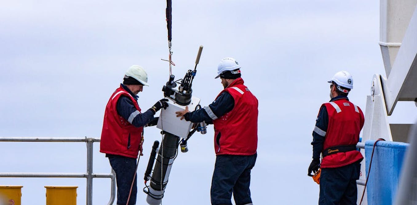
 Global distribution of Argo floats.