Saturday, May 17, 2025

Our Planet | Coastal Seas

Experience our planet's natural beauty and examine how climate change impacts all living creatures in this ambitious documentary of spectacular scope.
In this episode: From fearsome sharks to lowly urchins, 90 percent of marine creatures live in coastal waters.
Protecting these habitats is a battle humanity must win.

Friday, May 16, 2025

Norway (NHS) layer update in the GeoGarage platform

 92 nautical raster charts updated

Antarctic glacier caught stealing ice from neighbour

Dotson Ice Shelf from Sentinel-1 pillars

From ESA

Thanks largely to Copernicus Sentinel-1, scientists have discovered that a glacier in Antarctica is rapidly siphoning ice from neighbouring flows – at a pace never before seen.
Until now, researchers believed that this process of ‘ice piracy’ in Antarctica took hundreds or even thousands of years, but these latest findings clearly demonstrate that this isn’t always the case.

Published today in The Cryosphere, the research, partly funded by the Science for Society element of ESA’s FutureEO programme, reveals that the fast-flowing Kohler East Glacier in West Antarctica has been stealing ice from a slower-moving neighbour.

Kohler Glacier, as well as the Pope and Smith Glaciers, are among the fastest-changing in West Antarctica, with some moving and thinning faster than others.
These glaciers are situated upstream of the Dotson and Crosson Ice Shelves.

Ice from the Pope, Smith and Kohler Glaciers flows into the Dotson and Crosson Ice Shelves, which float on the Amundsen Sea.
The rate at which the ice flows and eventual melts into the sea has implications for sea-level rise.

 
Localization with the GeoGarage platform (NGA nautical raster chart)

A group of scientists, led by the University of Leeds in the UK, examined high-resolution images from satellites such as Sentinel-1 along with other satellite data spanning 2005 to 2022 to understand the rates of flow from eight ice streams in the Pope-Smith-Kohler region.

They calculated ice velocity using a tracking technique that measures the displacement of visible features, such as crevasses or rifts, on or near the ice surface.
Data on ice-thinning rates from ESA’s CryoSat mission were also used in the study.

In doing so, they found that seven of the streams had sped up, one almost doubling its speed, but, in stark contrast, one had actually slowed down.

It turns out that the fastest-flowing glacier, Kohler East, is right next to a slower-flowing glacier, Kohler West.


However, the difference in speed of ice flow isn’t the only intriguing aspect of this vulnerable region.
The research team also discovered a significant shift in flow direction, which is resulting in the faster Kohler East stream rapidly drawing ice from its slower neighbour, Kohler West.

The researchers found that, on average, the glaciers in the Pope-Smith-Kohler region have sped up by 51% since 2005.
However, hidden within this average are some big differences.
Four glaciers sped up by between 60% and 87% over the 17 years, and, remarkably, six of the streams reached average speeds of over 700 m per year in 2022 alone.

The fastest were Kohler East and Smith West Glacier, where ice speeds increased by an average of 32 m a year over 17-year the study period.

Given the impacts climate change is having, this doesn’t really come as a surprise.
However, what is surprising is the fact that the speed of the Kohler West glacier actually slowed by 10% over the study period.


Lead author Dr Heather Selley, from the University of Leeds, explained “We think that this slowdown is because Kohler West also seems to have changed direction and flowed towards its neighbour, Kohler East.
“This change in direction is likely caused by the vastly different thinning rates on the neighbouring glaciers.
“Because Kohler East’s ice stream is flowing and thinning faster as it travels, it absorbs, or ‘steals’ ice from the slower-moving Kohler West.
“This is effectively an act of ‘ice piracy’, where ice flow is redirected from one glacier into another, and the accelerating glacier is essentially thieving ice from its slowing neighbour.
“Astonishingly, thanks to satellite data, we can see that this is happening in less than 18 years, whereas we’ve always thought it was this extremely long, slow process.”


These results show that there is substantial speed-up in this region of Antarctica, which has the highest recorded rates of thinning and grounding-line retreat.

The grounding line is the point at which glaciers on land transition to ice shelves and start to float.
If the grounding line retreats, this can cause instability and even faster flow of the ice sheet towards the ocean.

Prof. Anna Hogg, also from the University of Leeds, added, “Our results suggest that ice flow redirection is an important new process in contemporary ice-sheet dynamics, which is required to understand present-day structural change in glaciers and the future evolution of these systems.


“The data reveal previously unobserved interactions between floating ice shelves and grounded ice sheets, which will affect future sea-level rise, and may influence changes in the mass of ice sheets and ice shelves during the 21st century.”

Dr Martin Wearing, ESA Polar Science Cluster Coordinator, said, “This new study highlights the unique ability of satellites to provide both the temporal and spatial coverage required to assess change in the polar regions.
“Using data from Copernicus Sentinel-1, as well as data on ice thinning from ESA’s CryoSat mission, the team has revealed the complex evolution of ice flow in part of West Antarctica over the past few decades.
“Understanding these changing dynamics and what drives them is crucial for improved projections of future ice-sheet change and contributions to sea-level rise.”
 
Links :

Thursday, May 15, 2025

The woman unlocking the mysteries of the deep sea in Fiji

Nicknamed ‘Moana’, Charlene Erasito is the only female Pacific Islander on the expedition to document unexplored parts of the ocean

From The Guardian by Sera Sefeti


On the island of Rotuma in Fiji, Christmas is a time of joy, a celebration bursting with song, dance and laughter.
Charlene Erasito remembers watching the festivities there when she was a child, captivated as people paraded through the village for “fara,” a local Christmas celebration.

Erasito never imagined that decades later, she would return to the same shores, no longer as a spectator but as a scientist.
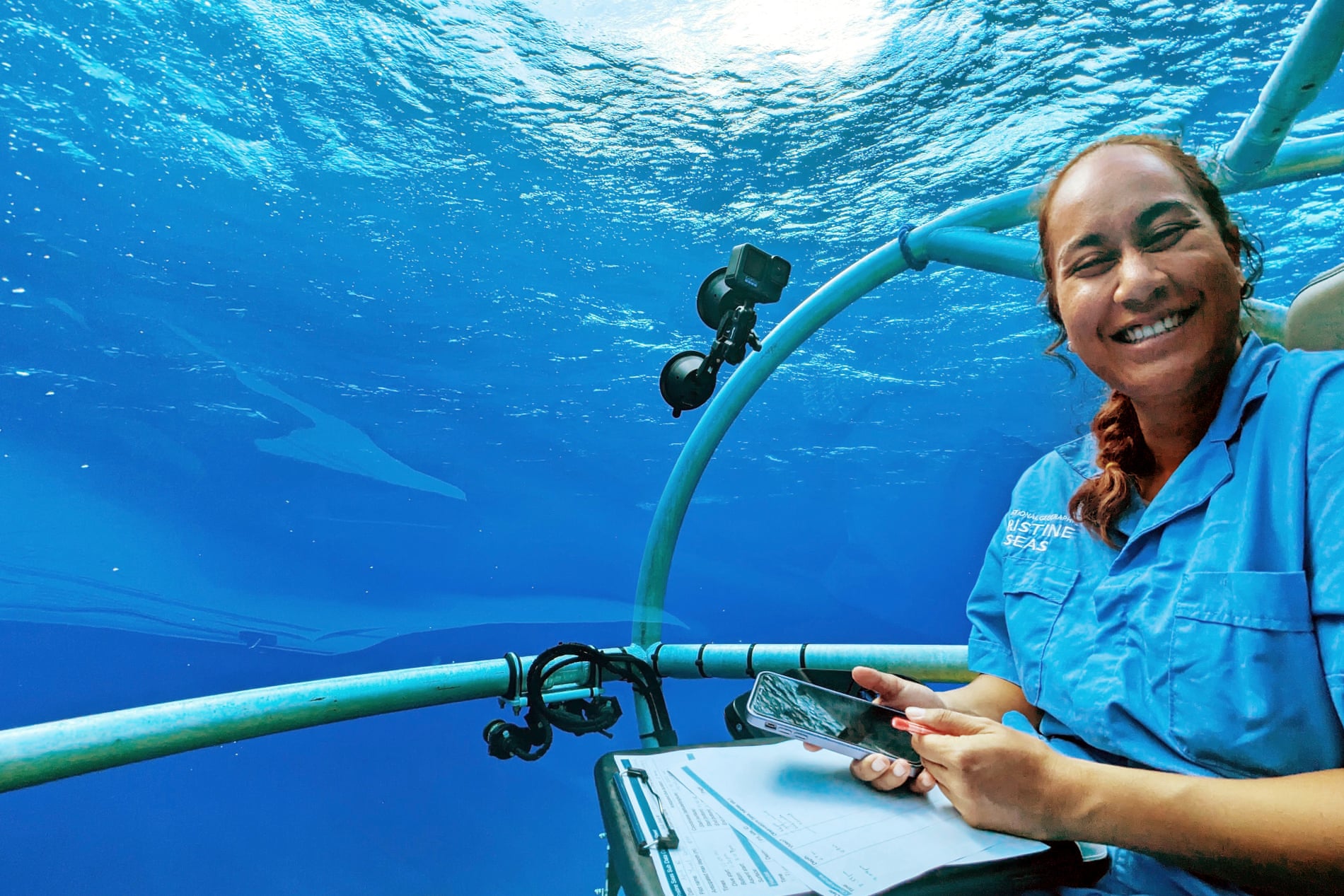
Erasito, now 30 years old, is the only female Pacific Islander aboard an ambitious expedition seeking to document unexplored ocean ecosystems in Fijian waters.

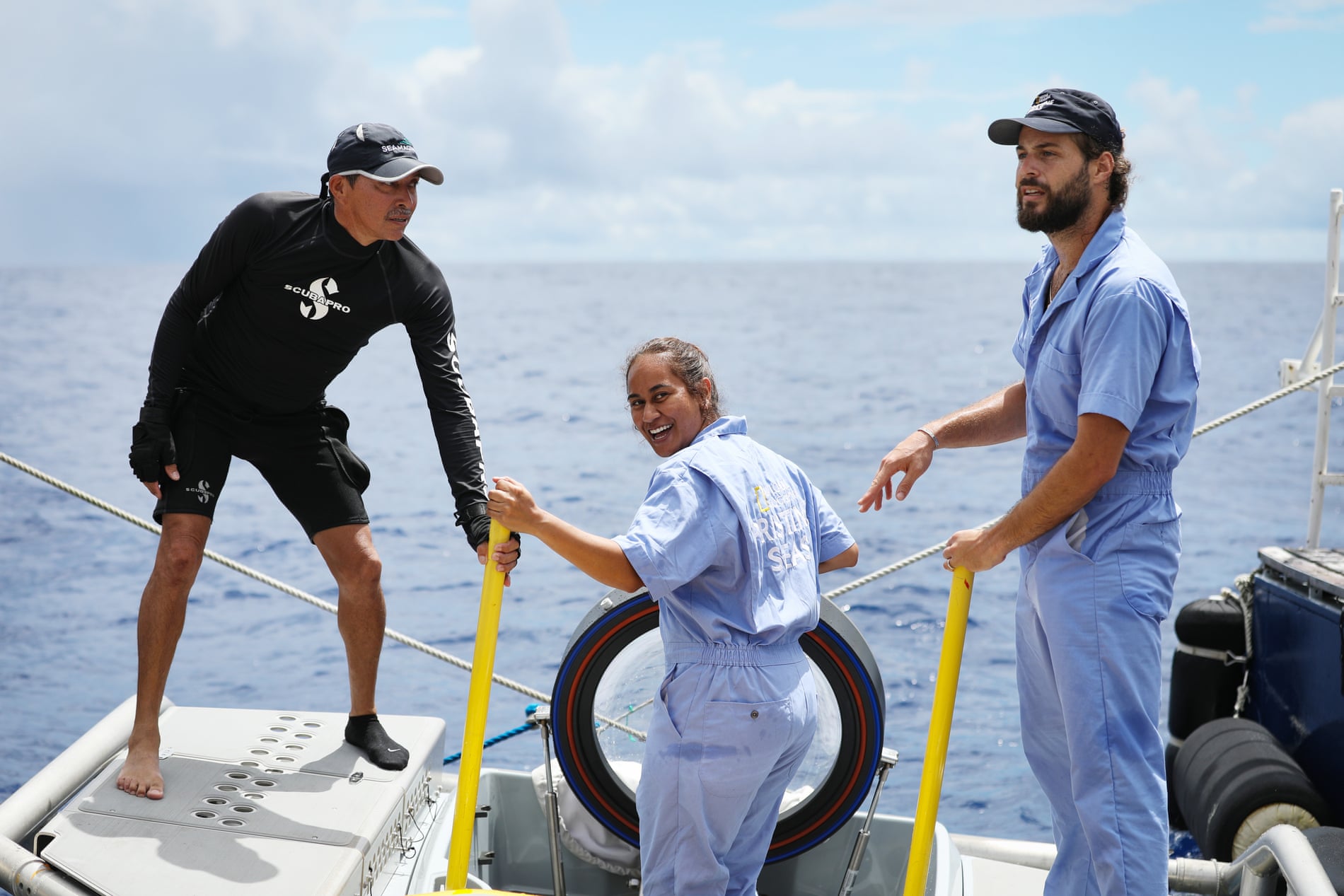
The months-long project, led by National Geographic Pristine Seas, began in April with a crew of local and international experts.
It starts with deep sea exploration and will later examine shallower parts of the ocean.
The expedition began in Fiji and will also travel to Tuvalu and Tonga.

Stepping on the deck of the research vessel last month, Erasito was affectionately nicknamed “Moana” by her crew mates – a title she accepts with a laugh.
“It was funny because, as a child, I actually had a pet pig and chicken,” Erasito says, referencing the popular animated Disney film. 
“Except I named them ‘Pig’ and ‘Chicken’. Zero creativity there.”

Erasito is studying for her PhD at the French national institute for ocean science and technology.
The invitation to join the expedition came after her research on seamounts – underwater mountains that rise from the sea floor- and biodiversity in New Caledonia impressed the Pristine Seas team.
In that project, she used remote-operated vehicles, imagery and acoustic data to explore deep-sea life.
 
 Charlene Erasito onboard the submersible during the Fiji expedition.
Photograph: Beth Pezzoni/National Geographic Pristine Seas

She has family links to Rotuma and was “speechless” when asked to join the Fijian project.
“I was at work in France when the invitation came. It took me days to process and respond. It was surreal,” she says.
“I was thrilled to be going back to sea, but this expedition would be different. We would be exploring deep-sea ecosystems around my home island of Rotuma – something I never imagined I’d have the chance to do” she says.

Erasito says it “felt like a duty” to return to the Rotuma, where she remembers travelling as a child for her late father’s work.
She had fond memories of swimming, fishing and the beach.
 
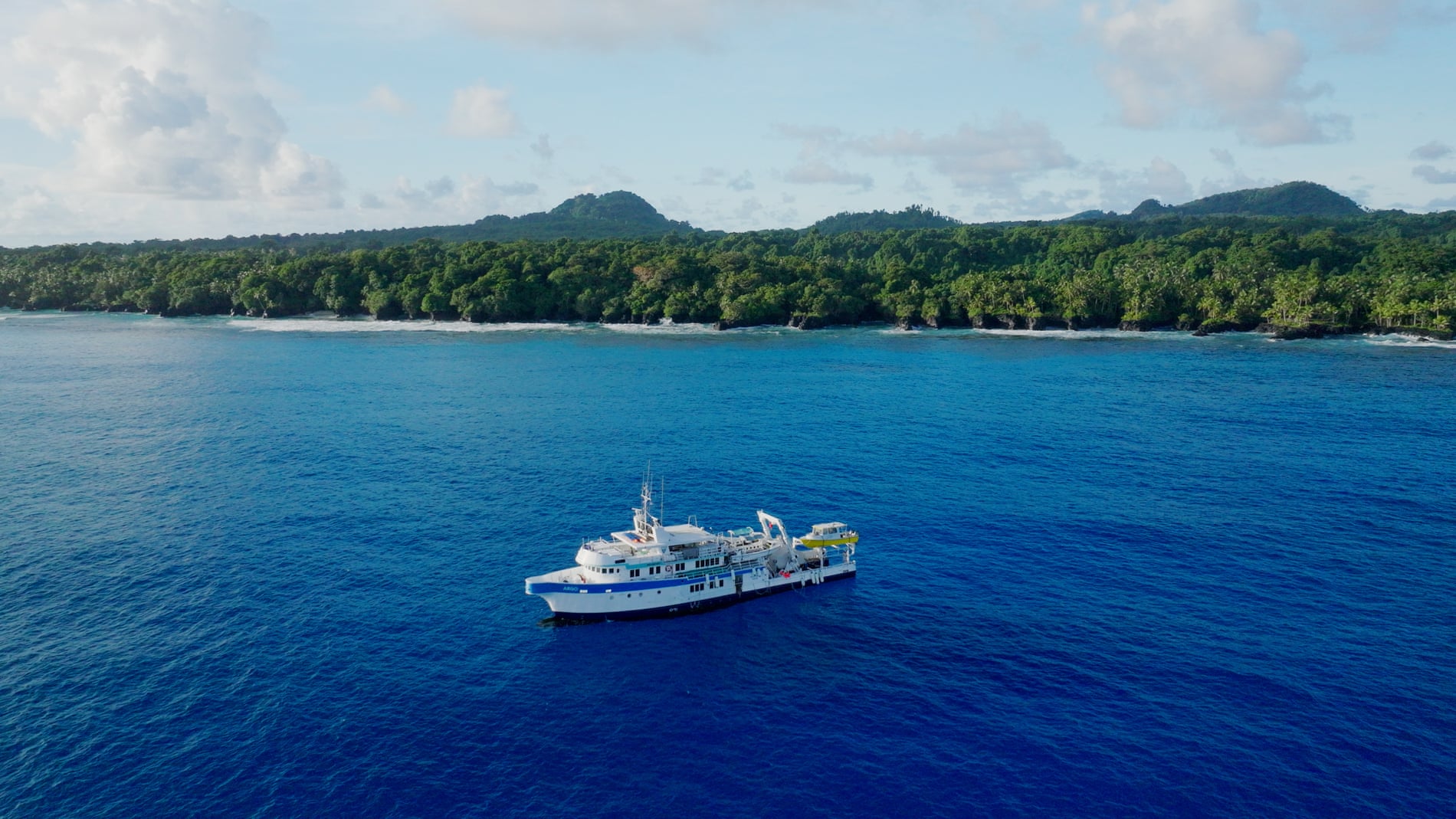
The Pacific expedition will travel to Fiji, Tuvalu and Tonga.
Photograph: Brett Kuxhausen/National Geographic Pristine Seas

“I used to listen to stories of night fishing that my dad would share or different aspects of Rotuma … but mostly the significance of the ocean to Rotuma and her people.”
“Every person we met on the island felt like family – whether or not we were actually related. That’s the magic of home.”

The expedition has given Erasito experience with new technologies including types of underwater cameras and video tools.
“Seeing the deep-sea footage – the fish, the corals, and the life hidden beneath the surface – was incredible. And to know we’re exploring with minimal disruption to these fragile habitats was important to me.”

The deep-sea part of the Rotuma exploration has wrapped up, and the vessel is on its way to Tuvalu.
So far, scientists have documented diverse and healthy ecosystems, and have begun sharing their knowledge with village chiefs.
At the end of the journey, they will report the full findings to government and other partners.

Dr Keiron Fraser, expedition leader for Pristine Seas, said Fiji and Rotuma are home to “an awe-inspiring array of marine life”
“Guided by our local partners, this team will help unlock the mysteries of the ocean so we can learn how to best protect it,” he said.

The Pacific Ocean is home to many, but due to its sheer size, there are areas that are yet to be fully explored.
“For many of our islands, the ocean isn’t just our back yard. It’s our lifeline. Protecting it starts with knowledge – and that starts with expeditions like this,” Erasito says.

Fraser says Erasito’s involvement has been “inspiring for the young people in Rotuma”.
“We’ve been unbelievably lucky to have Charlene with us. The children loved her… a real example of what’s possible.”

Erasito hopes other young Pacific women will follow her path.
“The ocean is in our blood, our stories, and our responsibilities. You belong – in science, on ships, in submarines, and in rooms where ocean decisions are made. Follow your heart.”

Links :

Wednesday, May 14, 2025

Russia needs more resources to handle emergencies on the Northern Sea Route


From ArcticToday by Ekaterina Blokova

Last winter was marked by several maritime accidents in Russian waters.
These events raised doubts about the ability of the country’s emergency services to respond promptly and effectively.

The latest incident occurred on February 9, when the Chinese bulk carrier An Yang 2 ran aground off the coast of Sakhalin due to a hull breach.
Two weeks earlier, the Russian nuclear icebreaker 50 Let Pobedy collided with the cargo ship Yamal Krechet while breaking ice in the Kara Sea.
Both vessels managed to continue operations and reached their ports independently.The most serious environmental damage among these was caused by a series of oil tanker accidents with the Volgoneftfleet in the Kerch Strait.
On December 15, in bad weather, two tankers carrying fuel oil crashed, spilling approximately 4,000 tons of oil products into the sea.
On December 17, another tanker issued a distress signal due to a crack in its hull and was towed to safety, preventing a spill.

According to official assessments by the Russian Academy of Sciences, it may take 10 to 15 years for the ecosystems affected by Kerch to recover.
If an accident like this was to occur in the Arctic, with its harsh climate, fragile environment and vast distances, the consequence could be much more severe.

The 1989 Exxon Valdez oil spill off the coast of Alaska demonstrated that oil persisted in the Arctic environment even after 20 years, and a full ecological recovery could take more than 50 years.
In financial terms, Rosatom estimates that within the first 24 hours, damage to water bodies from an oil spill on the Northern Sea Route (NSR) would exceed100 billion rubles.

During the fall of 2024 alone, there were three incidents along the NSR:

Alternative:On September 5, the research vessel Akademik Nikolay Strakhov suffered a main engine failure and lost propulsion in the Kara Sea.
Assistance arrived only two weeks later and towing to Murmansk was completed on September 27.
On October 6, the dredging vessel Nordic Giant ran aground near Teriberka in the Murmansk region.
The rescue operation to refloat the boat only started 41 days later, on November 16.
On October 30, the tanker Ammolite lost control in Ugolnaya Bay (Chukotka) when fishing nets became entangled in its propeller, forcing the engine to shut down.
The tanker awaited assistance for 12 days, causing media concern due to stormy weather and temperatures as low as 32°C, with 4,000 tons of oil products onboard.
The expected icebreaker rescue vessel Spravedlivy was unavailable because it was assisting other ships.

Earlier, on June 4, another accident occurred.
In the Yenisei Gulf of the Kara Sea, the ice pressure capsized and sank the tugboat Baikal.
With the assistance of the icebreaker Vladivostok it was trying to approach the drifting barge Dikson, which had broken free from its moorings due to ice drift.
One of the nine crew members of Baikal went missing, while the others were rescued.
An investigation by Russian transport authority Rostransnadzor revealed that the accident was caused by the absence of a towing operation plan for ice conditions, a failure to maintain a safe distance between the icebreaker and the tug, and a failure to provide information in a timely manner.

Just a month after this accident, on August 1, 2024, Rosatom – which manages the NSR – reported that no emergencies had occurred on the route in the two years since Northern Sea Route administration came under its control on August 1, 2022.

These accidents have not caused significant environmental damage, but they raise concerns that if a more serious accident happens, rescue ships might take too long to arrive, and the available resources may not be enough to handle the situation.
 
Emergency Response Infrastructure on the NSR

Currently, emergency response infrastructure along the NSR is underdeveloped, a fact acknowledged even by Russian officials.

Several agencies are involved in handling emergencies in the Arctic, but the key players are the Ministry of Transport, the Ministry of Emergency Situations (EMERCOM), and Rosatomflot.

The Marine Rescue Service, under the Ministry of Transport, is responsible for search-and-rescue operations and oil spill cleanup when tanker owners or extraction companies cannot handle their spills themselves (despite the fact that by law says they must do so).
In the Arctic, its units operate in the ports of Murmansk and Dikson, with rescue sub-centers in Arkhangelsk, Pevek, and Tiksi.
However, the Pevek and Tiksi sub-centers operate only during the summer navigation season, leaving the entire area from Novaya Zemlya to Chukotka under the responsibility of the center in Dikson during the rest of the year.

In emergencies, both natural and man-made, EMERCOM assists with rescue operations.
If an operation takes place at sea, EMERCOM is responsible for aviation support.
However, search-and-rescue helicopter coverage only extends to a small portion of the NSR’s navigable waters.

There are also EMERCOM emergency rescue centers in Arkhangelsk, Murmansk, Vorkuta, Naryan-Mar, and Pevek, with search-and-rescue teams in Dudinka, Nizhneyansk (Yakutia), and Chersky (Yakutia).
Additionally, plans are underway to establish three new centers along the NSR in Sabetta, Dikson, and Tiksi.
On November 19, 2024, news emerged that another center would be built in Khatanga on the Taymyr Peninsula.

However, the creation of these centers has been delayed.
Initially, 10 emergency response centers were planned along the NSR by 2015, but only three were completed on time.
Deadlines were repeatedly put back, and most of the centers remain unfinished.

In addition to land-based response centers, a search-and-rescue fleet, including vessels with the appropriate ice class, is essential for ensuring the safety of both ships and their crews -as well as the environment.
However, along the more than 5,000 km stretch from Murmansk to the Bering Strait, there is only one Marine Rescue Service vessel of Icebreaker 6th class and two Arc5-class vessels assigned to Arctic ports.
The remaining ships have an ice class of Arc4 or lower.
Even Icebreaker 6 and Arc5-class vessels cannot navigate the Northern Sea Route during winter without icebreaker support.

The NSR Development Plan until 2035 envisions the construction of 46 emergency rescue vessels by 2030.
Initially, 16 of them were scheduled for delivery in 2024, but only two were completed, while the construction of the remaining vessels has been delayed due to shortages of imported components caused by international sanctions.
As a result, it is unlikely that all 46 vessels will be ready by 2030.
 
The Venta Maersk on the Northern Sea Route during September 2018.
(Source: Courtesy of Maersk)
 
Key Risk Factors

Between 2009 and 2020, a total of 520 maritime accidents and incidents were recorded in Arctic waters, mostly due to equipment failure, ice compression, storm damage, grounding, or collisions.

The likelihood of future accidents and associated environmental risks continues to rise with increasing shipping activity.
An EMERCOM report highlights key risk factors in the Russian Arctic, including growing cargo traffic on the NSR, new investment projects, aging icebreaker fleets, and climate change.

These risks are further exacerbated by the emergence of so-called “shadow fleets,” consisting of older vessels (15 to 20-plus years old) lacking proper insurance.
Such ships often disable identification systems and conduct risky oil transfers at sea, increasing the likelihood of spills.

However, spills can occur from any vessels that use petroleum products as fuel.
Most ships operating along the Northern Sea Route still use the dirtiest fuel—marine fuel oil (heavy fuel oil, HFO).
Tellingly, Russia is the only Arctic nation that has not joined the International Maritime Organization’s ban on the use and transportation of HFO in the Arctic.

At the same time, there are currently no effective methods of collecting petroleum products in Arctic seas, and their natural decomposition in cold water occurs very slowly.

Mechanical collection is extremely difficult in the presence of ice and loses its effectiveness with each passing hour after a spill.
If petroleum products become embedded in the ice, their removal becomesalmost impossible due to the vast volumes of contaminated ice and the challenges of transportation.
Because of the great distances, rescue vessels may take several days or even weeks to reach the site of an accident.
Additionally, the lack of infrastructure and the limited number of emergency response centers hinder rapid assistance and complicate logistics in Arctic regions.

With environmental protection taking a backseat to industrial development in Russia’s Arctic policy, the risk of severe environmental disasters continues to grow.

Links :

Tuesday, May 13, 2025

Putting Portugal on the (seabed) map with the SEAMAP 2030 program

Illustration showcasing the mapping scope of the Portuguese seabed, encompassing territorial waters and the envisioned extension of the continental shelf.
(Image source: EMEPC – Mission Structure for the Extension of the Continental Shelf)

From Hydro 

Undertaking an unprecedented endeavor, Portugal's SEAMAP 2030 program leads the mission to meticulously chart its maritime depths.
As a vital piece of the global puzzle, this initiative aims to map the seabed with advanced technology, unveiling mysteries and contributing to the monumental GEBCO bathymetric grid.
Guided by the Hydrographic Institute of Portugal (IHPT), this ambitious undertaking seeks to uncover the secrets of Portugal's oceanic realm by 2030.

If there were a metaphor for building the GEBCO bathymetric grid, surely a jigsaw puzzle would be most appropriate.
“You have these little individual pieces that you put together to build the puzzle,” says Dr Vicki Ferrini, Senior Research Scientist at Columbia University’s Lamont-Doherty Earth Observatory and head of The Nippon Foundation–GEBCO Seabed 2030 Project’s Atlantic and Indian Oceans Regional Center.

There is, however, a big difference.
When you buy a jigsaw puzzle, you have all of the pieces at hand.
For the GEBCO grid, not all the pieces have been created yet.
Fortunately, efforts are underway to build those pieces.
When nations commit to mapping the seabed in their waters, they aren’t just creating individual pieces but larger, preassembled sections.
“It accelerates what we’re trying to do at the global scale,” says Ferrini.

Portugal is among the countries engaged in crafting a preassembled section.
Putting Portugal on the (seabed) map with the SEAMAP 2030 program

Led by Portugal’s Hydrographic Institute of Portugal (IHPT), the SEAMAP 2030 program has set out to map all the seabed within Portugal’s maritime space by 2030, using multibeam echosounders.

“In the beginning, we started collecting data for the proposal for the extension of the continental shelf beyond 200 nautical miles,” says Rear-Admiral João Paulo Ramalho Marreiros, Director General of the IHPT.
If granted under the United Nations Convention on the Law of the Sea, the extension of the continental shelf would see Portugal gain sovereign rights over the proposed area, which is the size of Europe, for exploitation of the seabed.

In January 2004, Marreiros was the Commander of the Portuguese Navy vessel NRP “D. Carlos I”, one of the two hydrographic vessels fitted with multibeam echosounders to map the seabed.
It was the official start of this survey campaign.
To gather the data for the proposal, “we sailed about 200 to 300 days a year for about six years,” says Marreiros.
After capturing the data needed for the proposal, “we continued doing the surveys to complement the data for some specific areas where more detail was required.”
The IHPT collects and processes almost all of the seabed data, with a small proportion coming from scientific cruises and companies operating within Portugal’s maritime areas and who are willing to share their data.

Approximately 56% of the seabed in Portugal’s maritime areas, including the exclusive economic zone and the proposed extension of the continental shelf, has now been mapped with multibeam echosounders.
To reach their goal of completely mapping this area by 2030, “we need to spend 100 to 150 days surveying, every year until 2030,” Marreiros says.
Deep challenges to be resolved

The advent of multibeam echosounders brought the potential to map the seabed in unprecedented resolution.
Just how fine or coarse the resolution is depends on the distance between the multibeam transducer to the seabed.
The shorter the distance, the higher the resolution that can be achieved.
Almost all seabed mapping is done from vessels.
When those boats pass over deeper waters – over a trough or off the continental shelf, for example, the resolution will become coarser than when that boat is in shallow water.
This is why Seabed 2030 has different target resolutions for different depth ranges.
The SEAMAP 2030 program also has resolution targets that vary by depth.

Although IHPT SEAMAP 2030’s targets are finer scale than Seabed 2030’s targets, Marreiros would like to map deeper waters at an even higher resolution, particularly in areas of special interest.
To do that, you need to bring the multibeam closer to the seabed, “and for that, we need autonomous vehicles that go near the ocean bottom.” 
Using autonomous vehicles to map the seabed is the next challenge of SEAMAP 2030, to be explored in the near future.
Speaking about seabed mapping in general, Marreiros says, “To go from ships to underwater vehicles, we must invest in the development of reliable underwater autonomous vehicles.”

Alongside seabed mapping, Marreiros sees an increasing need for a “more detailed physical, chemical, and biological survey” in areas of special interest, such as hydrothermal sources near the Azores Islands discovered by SEAMAP 2030.
“If you don’t know what is in the ocean bottom, how can we explore in a reliable and sustainable way?” he says.

Sharing to reach a common goal


Collecting multibeam data is only part of the work involved in seabed mapping.
Afterwards, there is the need for data processing, quality control, and making the results accessible and usable.
Alongside a higher resolution product, the IHPT prepares the data in grid format compliant with GEBCO.

“We [the IHPT] exist to serve the maritime community – everyone that uses the sea,” says Marreiros.
“The principle is to collect data once and use it many times, it will enhance a safe and sustainable use of the sea,” he adds.
The data collected will support research, sustainable use of the ocean and conservation efforts and navigation safety, “from which all may benefit,” Marreiros says.

“The SEAMAP 2030 is a wonderful initiative,” says Ferrini.
“Part of the joy of the Seabed 2030 project is getting to meet and work with and build relationships with folks around the world.
It’s been a pleasure to do that with colleagues in Portugal and to see this great product they’ve put out there for the world as they’ve become part of our global movement.”

For those countries who may not yet be fully committed to mapping the seabed in their respective exclusive economic zones, Marreiros encourages them to start moving forward now and share their data with an appropriate grid scale.
“If we don’t know what is in the sea, we cannot make good decisions [about ocean uses].
It takes a lot of time, and effort to map the seabed.
Nobody can do it in one or two years,” he says.
“It might be expensive and demanding in the short term, but the benefits will clearly emerge in the future.” 


Portugal (IHPT) nautical chart layer update in the GeoGarage platform

1 new rasterized chart based on ENC material added
 
Terceira ENC with the GeoGarage platform
 
Terceira (1744) surveyed by Captn Vidal

Monday, May 12, 2025

Croatia (HHI) nautical chart layer update in the GeoGarage platform

 
7 new rasterized nautical charts based on ENC material added and 100 charts updated

Hurricane forecasts are more accurate than ever – NOAA funding cuts could change that, with a busy storm season coming

Radar shows a NOAA Hurricane Hunter flying through Tropical Storm Idalia during a mission in 2023. Nick Underwood/NOAA

From The Conversation by Chris Vagasky, Meteorologist and Research Program Manager, University of Wisconsin-Madison
 
Hurricane forecasts are more accurate than ever – NOAA funding cuts could change that, with a busy storm season coming

The National Hurricane Center’s forecasts in 2024 were its most accurate on record, from its one-day forecasts, as tropical cyclones neared the coast, to its forecasts five days into the future, when storms were only beginning to come together.

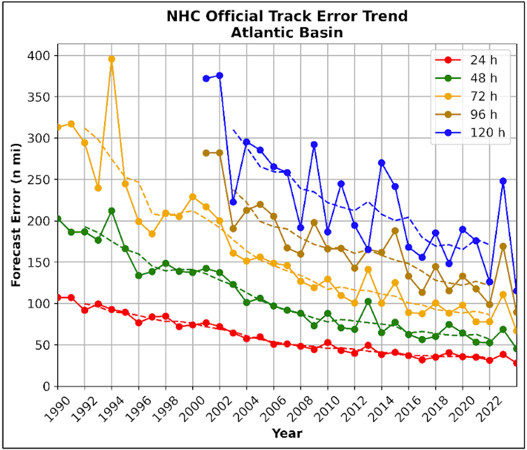
Thanks to federally funded research, forecasts of tropical cyclone tracks today are up to 75% more accurate than they were in 1990.
A National Hurricane Center forecast three days out today is about as accurate as a one-day forecast in 2002, giving people in the storm’s path more time to prepare and reducing the size of evacuations.

Accuracy will be crucial again in 2025, as meteorologists predict another active Atlantic hurricane season, which runs from June 1 to Nov. 30.

Yet, cuts in staffing and threats to funding at the National Oceanic and Atmospheric Administration – which includes the National Hurricane Center and National Weather Service – are diminishing operations that forecasters rely on.

 
National Hurricane Center Official Track Error Trend for the Atlantic Basin between 1990 and 2024. via National Hurricane Center

I am a meteorologist who studies lightning in hurricanes and helps train other meteorologists to monitor and forecast tropical cyclones.
Here are three of the essential components of weather forecasting that have been targeted for cuts to funding and staff at NOAA.
 
Tracking the wind

To understand how a hurricane is likely to behave, forecasters need to know what’s going on in the atmosphere far from the Atlantic and Gulf coasts.

Hurricanes are steered by the winds around them.
Wind patterns detected today over the Rocky Mountains and Great Plains – places like Colorado, Wyoming, Nebraska and South Dakota – give forecasters clues to the winds that will be likely along the Gulf and Atlantic coasts in the days ahead.

Satellites can’t take direct measurements, so to measure these winds, scientists rely on weather balloons. That data is essential both for forecasts and to calibrate the complicated formulas forecasters use to make estimates from satellite data.
 

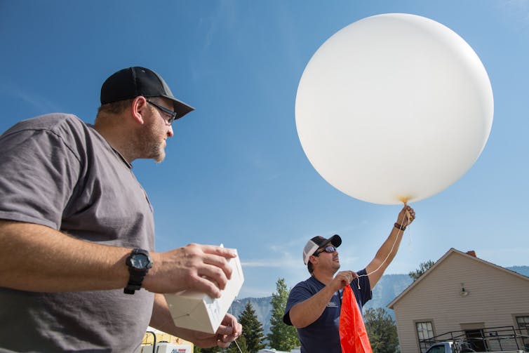
A meteorologist prepares to launch a weather balloon at Mammoth Hot Springs, Wyo.
Data collected by the balloon’s radiosonde will help predict local weather that can influence fire behavior.  

However, in early 2025, the Trump administration terminated or suspendedweather balloon launches at more than a dozen locations.

That move and other cuts and threatened cuts at NOAA have raised red flags for forecasters across the country and around the world.

Forecasters everywhere, from TV to private companies, rely on NOAA’s data to do their jobs. Much of that data would be extremely expensive if not impossible to replicate.

Under normal circumstances, weather balloons are released from around 900 locations around the world at 8 a.m. and 8 p.m. Eastern time every day. 
While the loss of just 12 of these profiles may not seem significant, small amounts of missing data can lead to big forecast errors. 
This is an example of chaos theory, more popularly known as the butterfly effect.

 
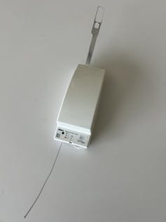
A radiosonde is a small instrument package that measures temperature, relative humidity, wind speed and direction, and air pressure every second as it rises through the atmosphere.
Author provided

The balloons carry a small instrument called a radiosonde, which records data as it rises from the surface of the Earth to around 120,000 feet above ground.
The radiosonde acts like an all-in-one weather station, beaming back details of the temperature, relative humidity, wind speed and direction, and air pressure every 15 feet through its flight.

Together, all these measurements help meteorologists interpret the atmosphere overhead and feed into computer models used to help forecast weather around the country, including hurricanes.
Hurricane Hunters

For more than 80 years, scientists have been flying planes into hurricanes to measure each storm’s strength and help forecast its path and potential for damage.

Known as “Hurricane Hunters,” these crews from the U.S. Air Force Reserve and NOAA routinely conduct reconnaissance missions throughout hurricane season using a variety of instruments.
Similar to weather balloons, these flights are making measurements that satellites can’t.

Hurricane Hunters use Doppler radar to gauge how the wind is blowing and LiDAR to measure temperature and humidity changes.
They drop probes to measure the ocean temperature down several hundred feet to tell how much warm water might be there to fuel the storm.
 

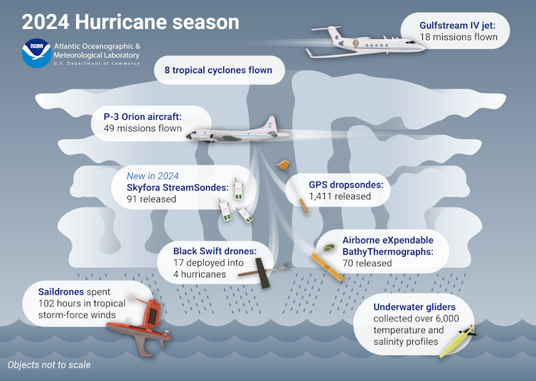
A summary of 2024 Atlantic hurricane season missions flown by NOAA Hurricane Hunters shows the types of equipment used.
Atlantic Oceanographic and Meteorological Laboratory

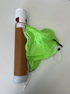
They also release 20 to 30 dropsondes, measuring devices with parachutes.
As the dropsondes fall through the storm, they transmit data about the temperature, humidity, wind speed and direction and air pressure every 15 feet or so from the plane to the ocean.

Dropsondes from Hurricane Hunter flights are the only way to directly measure what is occurring inside the storm.
Although satellites and radars can see inside hurricanes, these are indirect measurements that do not have the fine-scale resolution of dropsonde data.

 
A GPS dropsonde designed by the National Center for Atmospheric Research. Author provided

That data tells National Hurricane Center forecasters how intense the storm is and whether the atmosphere around the storm is favorable for strengthening.
Dropsonde data also helps computer models forecast the track and intensity of storms days into the future.

Two NOAA Hurricane Hunter flight directors were laid off in February 2025, leaving only six when 10 are preferred.
Directors are the flight meteorologists aboard each flight who oversee operations and ensure the planes stay away from the most dangerous conditions.

Having fewer directors limits the number of flights that can be sent out during busy times when Hurricane Hunters are monitoring multiple storms.
And that would limit the accurate data the National Hurricane Center would have for forecasting storms.
 
Eyes in the sky

Weather satellites that monitor tropical storms from space provide continuous views of each storm’s track and intensity changes.
The equipment on these satellites and software used to analyze it make increasingly accurate hurricane forecasts possible.
Much of that equipment is developed by federally funded researchers.

For example, the Cooperative Institutes in Wisconsin and Colorado have developed software and methods that help meteorologists better understand the current state of tropical cyclones and forecast future intensity when aircraft reconnaissance isn’t immediately available.

 
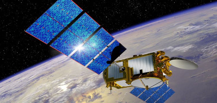
The Jason 3 satellite, illustrated here, is one of several satellites NOAA uses during hurricane season. The satellite is a partnership among NOAA, NASA and their European counterparts. NOAA

Forecasting rapid intensification is one of the great challenges for hurricane scientists.
It’s the dangerous shift when a tropical cyclone’s wind speeds jump by at least 35 mph (56 kilometers per hour) in 24 hours.

For example, in 2018, Hurricane Michael’s rapid intensification caught the Florida Panhandle by surprise.
The Category 5 storm caused billions of dollars in damage across the region, including at Tyndall Air Force Base, where several F-22 Stealth Fighters were still in hangars.
 

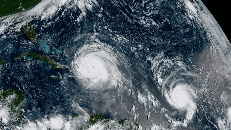
NOAA’s GOES-16 satellite shows Hurricanes Irma, left, and Jose in the Atlantic Ocean on Sept. 7, 2017. 

Under the federal budget proposal details released so far, including a draft of agencies’ budget plans marked up by Trump’s Office of Management and Budget, known as the passback, there is no funding for Cooperative Institutes.
There is also no funding for aircraft recapitalization.
A 2022 NOAA plan sought to purchase up to six new aircraft that would be used by Hurricane Hunters.

The passback budget also cut funding for some technology from future satellites, including lightning mappers that are used in hurricane intensity forecasting and to warn airplanes of risks.
 
It only takes one

Tropical storms and hurricanes can have devastating effects, as Hurricanes Heleneand Milton reminded the country in 2024.
These storms, while well forecast, resulted in billions of dollars of damage and hundreds of fatalities.

The U.S. has been facing more intense storms, and the coastal population and value of property in harm’s way are growing.
As five former directors of the National Weather Service wrote in an open letter, cutting funding and staff from NOAA’s work that is improving forecasting and warnings ultimately threatens to leave more lives at risk.

Links :

Sunday, May 11, 2025

Spain (IHM) nautical chart layer update in the GeoGarage platform

164 rasterized charts based on ENC material (IHM) updated


Mickey Muñoz on how to surf until you’re 100 years old

Mickey Muñoz was one of the original icons of California surf culture at Malibu in the early 1950s and was among the first group of hellmen to pioneer riding big waves at Waimea Bay later that decade.
He has stunt-doubled in Hollywood surf films, invented his own surfing maneuver, shaped boards alongside the best in the business, and prone paddled farther than any sane man should.
This film is about none of those things.
Mickey is now 87 years old—or at least he thinks he is—and plans to keep riding waves until he’s 100 or so.
He’s a true professional at making lemonade when life gives him lemons and answers every question with a story that may or may not outlast your attention span.
If you aim to surf longer than most people live, click play.

From The Inertia by Alexander Haro

In the early ’50s, Mickey Muñoz cemented himself as one of California’s best surfers.
All these years later, he’s gone from one of California’s best surfers to a living legend in the surfing world.
A new film from the ever-talented Kyle Buthman focuses on Muñoz now, and it’s exceedingly clear that his life is a well-lived one. It’s also clear that at the age of 87 (he thinks), he’s not even close to done.

“I want to keep surfing until at least a 100 or so,” Muñoz says from a couch in a living room full of colors. 
“I try and stay away from doctors, I try and eat good food and think good thoughts and run every day.”

He’s been riding waves for a very long time. The first time he stood up was on a Surf King Junior, a hollow plywood paddleboard, when he was 10 or 11 years old. 
“I think I first stood up in 1947 or 1948,” he remembered, “and I’m still standing. I’m privileged.”

Mickey Muñoz is 87 years old (he thinks).
His life has been incredible, and he’s not done yet.
Photos: Buthman

A few years later in 1950, he got his first real surfboard, a Joe Quigg balsa board, and it changed his life.
The next decades were formative not only for him but for surfing culture as a whole, and Muñoz was right in the thick of it.
He’s rumored to have dated Kathy “Gidget” Koehner, and he was one of Sandra Dee’s doubles in the first Gidget movie. It wasn’t just Malibu that kept him surfing, though.
He was also part of one of the first groups – comprised of absolutely wild men – who surfed at giant Waimea Bay.

The film you see here is beautifully done, and does an incredible job of conveying the constant optimism that Muñoz is famous for.
“He’s a true professional at making lemonade when life gives him lemons,” Buthman wrote, and answers every question with a story that may or may not outlast your attention span.”

He plans on surfing until he can’t surf anymore, and after a lifetime spent riding waves, he has an outlook on life that we should all subscribe to.

There are no bad waves,” he laughs. 
“Only a poor choice of equipment and a lousy attitude… I think you have to keep chasing perfection. If you keep chasing perfection, you know you’ll never find it or catch it, but it keeps you in the game. You gotta just… be surfing.”