Saturday, August 24, 2019

1955 – Monitor first sailing mono-hull hydro foiler to reach 40kts

1950's Monitor first sailing mono-hull hydro foiler

Gordon Baker developed and tested 'MONITOR' in the 1950’s.
A monohull with outrigger foils could get up on the foils in about 13 knots of wind and sail at about twice the true wind speed.
Top speed was reported at over 30 knots, with some reports claiming 40 knots.
At 40 knots, cavitation would probably have set in.
Baker's future designs employed two main wing sails which the 3D animation video shows.
To think it took over 65 years for this technology to be evolve to The America's Cup almost seems a tragedy. 'Monitor' is on display at the Mariners’ Museum in Newport News, Virginia.


1950`s sailing hydrofoil Monitor 3D model, of what she became and what she was intended to be. Originally the designers intended a dual wingsail version but it was too expensive.
Imagine if they would have had the money they would have built in 1955 - a sailing hydrofoil - with wingsails - with a mechanical computer, stabilizing it - foils from sophisticated alloys - high speed sailing 40kn´s

Links :

Friday, August 23, 2019

Sea Machines demonstrates autonomous spill-response vessel

The world’s first autonomous spill response vessel

From Maritime Professional

As a part of its cooperative agreement with the U.S. Department of Transportation Maritime Administration (MARAD), Boston-based Sea Machines Robotics announces that it has successfully demonstrated its autonomous systems in action on board a Kvichak Marco skimmer boat during events held along the Portland harbor earlier today.

Sea Machines’ technology opens a new era of capability for the marine industry, and today the company demonstrated its ability to increase the safety, productivity and predictability of response for marine oil-spill operations.
The on-water demonstrations took place aboard the world’s first autonomous spill response vessel – a Vigor/Kvichak Marine Industries-built skimmer boat, owned by Marine Spill Response Corp. (MSRC) – before a live audience of MARAD, government, naval, international, environmental and industry representatives.

To make the on-water exercises possible, Sea Machines will install its SM300 autonomous-command system aboard a Marine Spill Response Corp. (MSRC)-owned Marco skimming vessel and will train MSRC personnel to operate the system.
The boat carries a Marco filter belt skimmer to recover oil from the surface of the water.
Sea Machines Robotics photo

From a shoreside location at Portland Yacht Services, a Sea Machines operator commanded the SM300-equipped skimmer boat to perform the following capabilities:
  • Remote autonomous control from an onshore location or secondary vessel,
  • ENC-based mission planning,
  • Autonomous waypoint tracking,
  • Autonomous grid line tracking,
  • Collaborative autonomy for multi-vessel operations, and
  • Wireless, remote payload control to deploy on-board boom, skimmer belt and other response equipment.
Additionally, Sea Machines discussed how to operate the skimmer in an unmanned autonomous mode, which enables operators to respond to spill events 24/7 depending on recovery conditions, even when crews are restricted.
These configurations also reduce or eliminate exposure of crewmembers to challenging sea and weather, toxic fumes and other safety hazards.

 Sea Machines autonomous marine technology can be installed aboard existing or new commercial workboats and vessels, adding capabilities that increase productivity, predictability, efficiency and safety.
All SM300-enabled workboats can benefit from the system’s dynamic obstacle avoidance capabilities, which can be automatically activated during planned missions.
Sea Machines products recognize common obstacles – such as other watercraft, buoys, marine life and more – and will autonomously and safely reroute an operator’s vessel to mitigate a potentially costly and harmful incident.
Once the danger of collision passes, the system reroutes the workboat back on track to complete the mission.
This safety feature can be disabled in advance or in the moment by an on-board or remote operator, if needed.

“Our operation of the world’s first autonomous, remote-commanded spill-response vessel is yet another significant industry first for Sea Machines,” said Michael G. Johnson, founder and CEO, Sea Machines.
“But even more important is the fact that we’ve proven that our technology can be applied to the marine spill response industry – as well as other marine sectors – to protect the health and lives of mariners responding to spills. We are proud to support MSRC’s mission of response preparedness and to work alongside MARAD for these important demonstrations.”

“MSRC is excited to work with Sea Machines on this new technology. The safety of our personnel is the most important consideration in any response. Autonomous technology enhances safe operations,” said John Swift, vice president, MSRC.

"This is the future of the maritime industry. It’s safer, it’s faster, it’s more cost-effective,” said Richard Balzano, deputy administrator, MARAD.
“This technology is here and it will make you a believer. We are here because we want to help the maritime industry evolve. It’s about safety, the environment and reducing risk on the water.”

Sea Machines’ SM Series of products, which includes the SM300 and SM200, provides marine operators a new era of task-driven, computer-guided vessel control, bringing advanced autonomy within reach for small- and large-scale operations.
SM products can be installed aboard existing or new-build commercial vessels with return on investment typically seen within a year. Sea Machines is also a leading developer of advanced perception and navigation assistance technology for a range of vessel types, including container ships.
The company is currently testing its perception and situational awareness technology aboard one of A.P. Moller-Maersk’s new-build ice-class container ships.

In August 2018, Sea Machines demonstrated the capabilities of its SM300 product aboard the world’s first autonomous-command, remote-controlled fireboat, owned by TUCO Marine, during the Maritime Kulturdage event, in Korsør, Denmark.

Links :

Thursday, August 22, 2019

Marines and sailors practice fighting at sea using an 80-year-old communication tactic

A U.S. Navy Douglas SBD Dauntless drops a message container known as a “bean-bag” on the flight deck of Enterprise (CV 6) while crew members dart to catch the message to deliver it up to the ship’s bridge. 
(Naval Aviation Museum)

From Marine Times by Shawn Snow

Despite ballyhoo about the need for military cyber, electronic warfare and more tech-adept forces for future war, the Navy and Marines are testing war tactics more common nearly 100 years ago.

No longer can Marines and sailors take for granted uninterrupted electronic communications at sea or on the battlefield.

Tech-capable forces from Russia to China are packing capabilities that can jam U.S. systems or hone in on radio communications to find U.S. forces and ships at sea.

That’s why Marines and sailors aboard the Wasp-class amphibious assault ship Boxer tested in early August an old silent communications tactic used during World War II, according to a command release.
A U.S. Navy Douglas SBD Dauntless drops a message container known as a “bean-bag” on the flight deck of Enterprise (CV 6) while crew members dart to catch the message to deliver it up to the ship’s bridge. (Naval Aviation Museum)

The Boxer currently is floating with 11th Marine Expeditionary Unit somewhere near the Persian Gulf.

The tactic is called a “beanbag drop," and during World War II pilots used to drop weighted beanbags carrying messages onto the decks of ships to avoid having their messages intercepted by enemy forces.

In early August, crew members with Helicopter Sea Combat Squadron flying an MH-60S Seahawk conducted a beanbag message drop onto the Boxer as a proof of concept to deliver messages without relying on radio systems, the release detailed.

It’s a tactic liken to the carrier pigeons of World War I, which carried important tactical battlefield messages across the front lines.

The Navy’s experimentation with a communications tactic used in World War II sheds a small light on its tactical thinking and how it plans to prepare sailors and Marines for a major bout with adversaries with the capability to find, jam and sink U.S. Navy ships at sea.


Aviation Boatswain’s Mate (Handling) 2nd Class Bradley Peterson from Mora, Minnesota, assigned to amphibious assault ship Boxer (LHD 4) runs to a beanbag dropped on the flight deck during an exercise to communicate with Boxer from an MH-60S Sea Hawk assigned to Helicopter Sea Combat Squadron (HSC) 21.
(Mass Communication Specialist 1st Class Brian P. Caracci/Navy)

“We’ve got the best communication technology onboard our helos [helicopters] but today we practiced the use of a more conventional form of aircraft-to-ship communication in the event electronic communication is not an option,” Navy Lt. Taryn Steiger, the pilot who flew the HSC-21 Seahawk that dropped the beanbag, said in the release.

After the message was dropped from the MH-60 onto the deck of the Boxer, a sailor simply ran and scooped up and delivered the message, the release said.

“The purpose of the bean-bag drop was to show timely pilot-to-ship communication can be done without electronic transition," Lt. Cmdr. Michael Brown, the HSC-21 detachment commander, said in the release.
“Together HSC-21 crew and Boxer demonstrated timely communication from the aircraft to the ship during EMCON [emissions control] procedures."

Gen. Robert B. Neller, the former commandant of the Marine Corps, has oft repeated that he would turn off the net to force Marines to fight and train in environments where GPS and communications are degraded.

Marines have been training and experimenting with reducing their radio and visible footprint from Norway to the battlefields of Syria.

Links :

GeoGarage blog : GPS jamming and spoofing: when good signals go ... / Cyber threats prompt return of radio for ship navigation / Mass GPS spoofing attack in Black Sea? / GPS back-up: World War Two technology employed / Navigational backup to aid ships in Dover straits / Nightmare scenario: ship critical systems easy target ...

Wednesday, August 21, 2019

In 1845 explorers sought the Northwest Passage—then vanished

H.M.S. Terror, one of two ships from the doomed Franklin expedition, was discovered in 2016 off King William Island in the Canadian Arctic.
The small expedition boat seen here sank along with the Terror and rests on the seafloor a short distance from the ship.
image : Thierry Boyer, Parks canada

From National Geographic by Heather Pringle

The failed expedition was one of the grimmest chapters in the history of Arctic exploration.
New analysis may shed light on its mysterious fate.

For centuries the Northwest Passage seemed little more than a mirage.
John Cabot urged his ships into the unknown in 1497 and 1498 to find it, but failed.
Martin Frobisher, Henry Hudson, and James Cook searched icy northern waters for it, in vain.
In May 1845 a celebrated British explorer and naval officer, Sir John Franklin, took up the quest to find a route between the Atlantic and Pacific Oceans through Arctic waters.
With orders from the British Admiralty, Franklin and a crew of 133 sailed out from the Thames in two massive naval vessels, H.M.S. Erebus and H.M.S. Terror, each specially equipped for polar service.
It was the beginning of the grimmest disaster in Arctic exploration.

On paper, the expedition seemed to lack for little.
The crew was young, tough, and seasoned.
The ships, sheathed in iron, bristled with the latest Victorian-era technology—from steam engines to heated water and an early daguerreotype camera.
The vessels carried more than three years’ worth of food and drink, as well as two barrel organs and libraries with some 2,900 books.
Two dogs and a monkey kept the men company in their quarters.

But these small floating worlds were no match for the Arctic’s frozen seas.
On Admiralty orders, the expedition sailed to one of the most treacherous, ice-choked corners of the far north.
By September 1846, both vessels were imprisoned in sea ice northwest of King William Island.
They remained so for at least a year and a half of brutal polar cold.


By April 1848, 24 men were dead, including Franklin himself.
The rest had abandoned the ships.
In a terse statement stuffed into a cairn on King William Island, the expedition’s new commander, Francis Crozier, noted that he and others were heading out on foot for the Back River, perhaps to find better hunting, or possibly hoping to reach a fur-trading outpost more than 700 miles away.
It was Crozier’s last known communication with the outside world.
(More than a half century later, in 1906, Norwegian explorer Roald Amundsen would be credited as the first to navigate the treacherous Northwest Passage.)

For years after Franklin’s expedition stalled, search parties combed the region’s coastlines, hoping to find survivors and, when all hope was gone, clues to the expedition’s fate.
They found deserted campsites, the bones of dead men, and hundreds of mementos, from fragments of cotton shirts to silver dessert spoons.
Inuit hunters recalled seeing starving crewmen dragging heavy sledges along the ice, and later finding evidence of cannibalism.
The British public was reluctant to believe it, and the final days of the Franklin expedition remained the subject of enduring fascination and mythmaking.

 An underwater archaeologist inspects the hull of HMS Erebus.
(CNW Group/Parks Canada)

Then, in 2014, Erebus was discovered in relatively shallow water south of King William Island, almost exactly where historical Inuit testimony had placed it.
Two years later, Terror was located at the bottom of a large bay after Inuit Canadian Ranger Sammy Kogvik led researchers to the area.
Terror is so well preserved, says Parks Canada archaeologist Ryan Harris, that it resembles a ghost ship: “It just beggars the imagination what might lie inside.”

A second research team, supported by the government of the Canadian territory of Nunavut, is now sifting through other important clues found on land.
Led by Douglas Stenton, an archaeologist at the University of Waterloo in Ontario, these scientists are mapping the sites where Franklin crew members pitched tents, downed rations, and huddled beneath blankets and bearskins.
By studying these locations and analyzing the human remains and artifacts recovered from them, Stenton and his colleagues hope to shed new light on the expedition’s final tragic days.

On a cold, blustery day in the Arctic hamlet of Gjoa Haven, Kogvik recalls the joy of seeing Terror appear for the first time on a sonar screen.
Like most Inuit in the region, Kogvik had heard stories about the lost expedition.
He also had one of his own.
While out fishing with a friend along the west coast of King William Island, he had once seen a big wooden pole sticking above the water.
He thought it could be a ship’s mast.
So in September 2016, when Kogvik was working with a team from the Arctic Research Foundation, a Canadian nonprofit, on another scientific project in the immediate area, they decided on the spur of the moment to check out the place.
After hours of searching the seafloor with side-scan sonar, Kogvik and his colleagues found Terror, about 80 feet underwater.
“Every one of us was giving high fives,” he recalls.

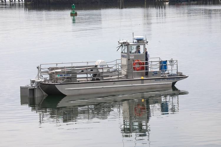
 Parks Canada's RV David Thompson and its crew are currently en route to the wreck of HMS Erebus from Cambridge Bay, NU.
(Parks Canada)

Today Parks Canada archaeologists are planning to excavate both Franklin ships, but Erebus is their priority.
Harsh Arctic conditions now threaten the vessel.
Sea ice has scoured the stern and crushed the area where Franklin had his cabin, entombing or scattering its artifacts.

More haunting still are the conditions aboard Terror.
Thick sediment mantles the upper deck, but the ship’s wheel, helm, and bulwarks look eerily intact.
Windows and hatches, mostly unbroken, still seal the contents of the cabins.

Studies and excavations at the two wreck sites are expected to take years, and archaeologists hope to settle a long-standing controversy.
Historians have assumed that most of Franklin’s men died in 1848 on the foolhardy quest to the Back River.
But in the 1980s, David Woodman, a retired mariner and history writer based in Port Coquitlam, British Columbia, analyzed the reports of Inuit witnesses.
According to these accounts, few of Franklin’s men died on the trek.
Instead many returned to the ships after Crozier wrote his note, and managed to sail farther south.
When the two vessels finally sank, the castaways survived on salvaged provisions and occasional hunted game, until the last man died in the early 1850s.

But the accounts given by some 30 Inuit witnesses contained many ambiguities and contradictions, in part because of translation problems.
So the Parks Canada team hopes to recover written records from the shipwrecks, such as logs or personal journals, to help reveal what went wrong with the expedition.

In Britain, families of the dead men were left to wonder about their sons and husbands and how exactly they met their end—questions that linger among many descendants today.
And some relief may be in sight.
Stenton and his team have taken samples from skeletal remains and sent them to Lakehead University in Ontario.
Geneticists there successfully extracted DNA from the remains of 26 crew members.
Now Stenton is gathering DNA samples from living descendants.
By comparing the historical and modern DNA profiles, he and his colleagues hope to identify some of the bodies by name.

Moreover, the Parks Canada team may add to these identifications.
Historical Inuit witnesses reported boarding one of the ships and finding a crewman’s body lying on a floor.
The underwater archaeologists have yet to encounter any human remains, but if skeletons or bones turn up, the team will consider DNA testing.

For the first time in more than a century, hopes are high that the story of the lost expedition will be told.
The optimism is bringing a new sense of opportunity to remote Gjoa Haven, where young Inuit are landing jobs to watch over and protect the Franklin wreck sites from looters.
And officials are drawing up plans to expand the local museum, so it may one day house and display finds from the fabled Franklin ships.

“Tourists are already coming here,” Kogvik says proudly. And enticed by the icy wonders of the Northwest Passage and the famous story of Franklin and his men, “more will be coming next year.”

Links :

Tuesday, August 20, 2019

Scientists bid farewell to the first Icelandic glacier lost to climate change. If more melt, it can be disastrous

Satellite images from September 1986 (left) and Aug. 1
show the shrinking of the Okjökull glacier in west-central Iceland.

From CNN by Harmeet Kaur
Scientists say they are bidding farewell to Okjökull, the first Icelandic glacier lost to climate change, in a funeral of sorts.

 localization with the GeoGarage platform (ICG-HD nautical chart)

Researchers will gather Sunday in Borgarfjörður, Iceland, to memorialize Okjökull, known as Ok for short, after it lost its status as a glacier in 2014.
The inscription, titled "A letter to the future," on the monument paints a bleak picture.
"Ok is the first Icelandic glacier to lose its status as a glacier. In the next 200 years, all our glaciers are expected to follow the same path. This monument is to acknowledge that we know what is happening and know what needs to be done. Only you know if we did it," the plaque reads in English and Icelandic.

The memorial plaque for Iceland's Okjökull glacier contains a dire warning.

From the ice sheet in Greenland to the towering glaciers in West Antarctica, Earth's enormous masses of ice are melting fast. And though sea levels have risen and fallen throughout history, scientists say it's never happened at a rate this fast.
If glaciers continue to melt at the current rapid rate, it will pose a number of hazards for the planet, geologists say.

Here are some of the potential hazards:

It can displace people 

The Greenland ice sheet near Sermeq Avangnardleq glacier.

By 2100, up to 2 billion people -- or about a fifth of the world's population -- could be displaced from their homes and forced to move inland because of rising ocean levels, according to a 2017 study.
Bangladesh is particularly at risk.
About 15 million people in the country could become climate refugees if sea levels rise 1 meter, or about 3 feet. And more than 10% of the country would be underwater.
Some of the people who are displaced might not have anywhere to go.
They're not protected by international laws, so industrialized countries aren't legally obligated to grant them asylum.

It can put some islands underwater


The Marshall Islands is one of the island nations at risk of disappearing because of climate change.
If sea levels continue to rise at a rapid rate, some remote island nations would be at risk of disappearing, including Tuvalu, the Maldives and the Marshall Islands.

It can diminish drinking water

The Imja glacial lake in the Himalaya.

Millions of people depend on glaciers for drinking water, particularly in the Hindu Kush Himalayan region and the Andes Mountains.
In dry climates near mountains, glaciers collect precipitation and freshwater and store it as ice during colder months. When summer comes along, the ice melts and runs off into rivers and streams, providing drinking water.
A world without glaciers would threaten that water supply and potentially have devastating effects, Jason Briner, a geologist at the University of Buffalo, told CNN.

It can threaten our food supply

The Géant Glacier in eastern France.

Melting glaciers also threaten the food supply.
Rising sea levels contribute to warmer global temperatures, changing what kinds of crops farmers can grow. Some climates will become too hot for what farmers are growing now.
Other climates will see more flooding, more snow or more moisture in the air, also limiting what can be grown.
As a result, food will become scarcer, grocery prices will spike and crops will lose their nutritional value, as the UN Intergovernmental Panel on Climate Change noted in a report earlier this year.

It can cause a health crisis


The Santa Ines glacier in southern Chile.

As sea levels rise, coastal communities are more susceptible to flooding.
One particularly gross consequence of that flooding is the impact on sewage treatment plants, which are often built at low elevations close to the oceans.
Floods can cause massive amounts of untreated sewage to flow into rivers, streams, streets and even homes.
That pollutes sources of water, harms wildlife and helps spread diseases.
"A lot of times when people think about sea level rise, they think about inundation of land," Andrea Dutton, geology professor at the University of Florida, told CNN.

"They think that 'If my house isn't in the area that's flooded, I don't need to worry about it,' which is a complete misconception."

It can disrupt the global economy

The Rhône Glacier in Switzerland.

More than 90 percent of the world's trade is carried by sea, according to the United Nations.
So, there's a good chance that most of the things you buy have passed through at least two ports: one during export and one during import.
Ports are critical to the global economy, providing jobs in industries like shipbuilding, fishing, seafood processing and marine transportation.

Rising sea levels could damage the infrastructure of many ports and disrupt all kinds of processes, creating a ripple effect throughout the economy.
"[Melting glaciers] will affect people's access to food, water and energy, which are fundamental, critical things that we need to survive," Dutton said.

It can change life as we know it

Eqi Glacier in Greenland.

The large ice sheets in the Arctic and Antarctic are part of Earth's energy balance, Briner said.
Those massive white surfaces work to reflect rays from the sun back into the environment, keeping temperatures mild.
As more and more glaciers melt, energy from the sun will instead be absorbed into the ocean.
As the oceans get warmer, global temperatures become hotter and cause even more glaciers to melt.
That creates a cycle that amplifies the climate crisis, Briner said.
Links :

    Monday, August 19, 2019

    Brazil (DHN) layer update in the GeoGarage platform

    186 nautical raster charts updated & 81 new charts added in the GeoGarage platform

    Brexit fishing map: The vast body of UK waters at risk from EU fishing - even after Brexit

    Brexit fishing map: The future of UK waters depends on whether it would allow foreign vessels to access its EEZ
    (Image: Express)

    From Express by Kate Whitfield

    The Conservative Party committed in its 2017 manifesto to leaving the Common Fisheries Policy after Brexit, saying the UK “will be fully responsible for the access and management of its waters”.
    But there are widespread doubts about whether this is actually possible.

    Under the Common Fisheries Policy (CFP), European fishing fleets are given equal access to all EU waters and fishing grounds up to 12 nautical miles from EU member’s coasts.
    The question is whether the UK, after Brexit, will have an arrangement allowing EU boats to fish in its water.
    Currently, the answer to this question is unknown, along with the exact nature of any Brexit arrangements, or whether the UK will leave without any deal at all.

    The Government has suggested the resulting status of its fishing waters after Brexit will depend on what kind of agreements the UK makes with the EU and whether it would allow foreign vessels to access its Exclusive Economic Zone (EEZ).

    Outside the EU, an EEZ extends 200 nautical miles (370km) off a country’s coastline, giving the state the authority to exploit and control the fish resources within this zone.

    The (roundly rejected) Brexit deal negotiated by former Prime Minister Theresa May was vague on fishing policy, only saying that “the Union and the United Kingdom shall use their best endeavours to conclude and ratify” an agreement in future.

    It’s worth noting that while the EU wants to make sure its fishing fleet has access to UK waters, the UK industry also wants access to the European market - the UK has been allocated €243.1m in subsidies between 2014 and 2020 under the CFP, which will end after Brexit.

    However, others argue that as the UK has a relatively large fishing zone compared to many of its continental European neighbours, EU fishermen benefit more from access to UK waters.
    In the June 2017 Queen’s Speech, the Government announced a Fisheries Bill with the purpose of “enabling the UK to control access to its waters and set UK fishing quotas once it has left the EU.”

    But now, a Government memo recently leaked to the BBC has revealed how much uncertainty there is about the UK’s capacity to patrol its waters and control access.
    The memo, from the Department for the Environment, Food and Rural Affairs (Defra), says there are just 12 ships “to monitor a space three times the size of the surface area of the UK”.


    Under the Common Fisheries Policy (CFP), European fishing fleets are given equal access to all EU waters and fishing grounds up to 12 nautical miles from EU member’s coasts.
    The question is whether the UK, after Brexit, will have an arrangement allowing EU boats to fish in its water.
    Currently, the answer to this question is unknown, along with the exact nature of any Brexit arrangements, or whether the UK will leave without any deal at all.
    Brexit fishing map: The UK has a relatively large fishing zone compared to many of its continental European neighbours
    (Image: Express)

    Defra’s internal memo referred to a number of media stories which planned to look at the preparation being made to deter EU fishermen from UK waters in the case of a no deal Brexit, and also whether the UK will enforce the exclusion of foreign vessels.

     There will be just 12 ships to monitor space three times the size of the UK used by trawlers

    The note reads: “While our public position on this wider issue is already clear and widely communicated, in that post-Brexit we will be an independent coastal state with control of our waters, both policy and MoD have indicated we are not on an overly strong footing to get ahead of the potential claims that could arise from this story.
    “At this stage, there is a lot of uncertainty about the sufficiency of enforcement in a no-deal because we have 12 vessels that need to monitor a space three times the size of the surface area of the UK.”

    Admiral Lord West, a Labour peer and former First Sea Lord, said the email appeared to show the UK has “insufficient assets to patrol and look after our exclusive economic zone for fisheries, and also our territorial seas”.
    He added: “This is something a number of us have been saying for some time now, but it has always been denied by Defra and the Government.”

    However, Barrie Deas, the CEO of the National Federation of Fisherman’s Organisations (NFFO), said any EU vessel would be “foolish” to fish in UK waters - even without a deal in place.
    He told the BBC: “Under international law, the UK would automatically become an independent coastal state with the rights and responsibilities of that status and there is an obligation under the UN Law of the Sea for countries that share stocks to co-operate.
    “So I think there will be a fisheries agreement post-Brexit between the UK and the EU, but on a different basis from the Common Fisheries Policy.”

    Links :


    Sunday, August 18, 2019

    The swimmer

    This short film tells the story of Walter Strohmeyer who for almost all of his 90 years has been swimming in the waters off Long Island.
    An honest and at times heartfelt story about the power of ritual.