Saturday, December 18, 2021

Drone sails into category 4 hurricane, sends back incredible video and data

 Follow Saildrone Explorer SD 1045 through the eye of a category 4 hurricane.
This incredible "point of view" footage was captured before, during, and after Hurricane Sam passes over the vehicle in the Atlantic Ocean.
SD 1045 was approximately 450 nautical miles northeast of Puerto Rico when it encountered Hurricane Sam, which would prove to be the most powerful hurricane of the 2021 season.
This video was made possible by NOAA's Atlantic Oceanographic and Meteorological Laboratory and Pacific Marine Environmental Laboratory with the Saildrone team.
 
From Gizmodo by Brian Kahn 
 
HD video isn't the only thing Saildrone captured. 
Data from the heart of the storm could help researchers, too.

While us average folks enjoyed the incredible footage captured by a floating drone in the midst of a Category 4 hurricane, scientists were geeking out on the data.

And now, they’re ready to share some of the results and insights into how the fiercest storms on Earth can gain strength.

The findings were presented at the American Geophysical Union’s annual meeting as part of a series of talks wrapping up the year in research for Saildrone.
The company has worked closely with federal scientists to deploy its fleet of seafaring drones from the tropics to the poles.
Among their most daring feats in 2021 was sending one of their autonomous vehicles into the maw of Hurricane Sam.

The powerful storm mercifully stayed far out to sea for most of its life, though its outer edges did glance off Bermuda.
But Saildrone 1045 didn’t need to be close to shore to operate; the vehicles can traverse basically any patch of sea.
And researchers steered it right into Sam on a late September day, as the stormwas undergoing rapid intensification, a meteorological term for when storms see winds increase at least 35 mph (56 kmh) in 24 hours.
The trip represented a first for Saildrone vehicles, which have never entered a storm that fierce.

“I told everyone, ‘If this vehicle can survive a hurricane, then this would be a big success story,’” Chidong Zhang, director of the Ocean Climate Research Division of the federal Pacific Marine Environmental Lab, said in a statement.
“The whole mission exceeded my expectations.”

The drone sent back unreal images as it was heaved about in towering waves.
The research team reported that it flipped over a few times as it slid up and down the face of 50-foot (15-meter) swells.
It not only survived.
It thrived, transmitting images and data to the team on land.

Some of that data shocked researchers and made them wonder if an instrument had failed.
The Saildrone data showed an obstinate pool of warm water clinging to the surface, giving Sam even more fuel to power up.
Hurricane winds usually churn up the ocean, drawing cooler water up from below the surface.
That mixing can help slow down hurricane intensification.

Not only was the water warm under Sam’s violent thunderstorm, but it was also less salty.
Using data from a buoy in the area, researchers were able to confirm the instruments on the drone were working just fine.
They also gleaned the likely source: the Amazon River.
Ocean currents transported the warm, less salty—and thus, less dense—water into the midst of the Atlantic, where it acted like a lid on the ocean.
Researchers also deployed underwater drones known as gliders and Hurricane Hunter aircraft along with the Saildrones, adding to the pile of data.

The scientists will continue to comb over the data in the coming months, but the preliminary findings show how natural processes can influence hurricanes and even build on climate change’s effects.
Other research has shown how the ocean is becoming more stratified due to surface heating and generally creating an environment where storms can intensify more rapidly.
(It’s also upping the odds of prolific rainmaking hurricanes and tropical storms and raising sea levels, so really there’s no shortage of woes.)
 
SD 1040 captured this photo of a wall of water in strong winds and waves on the edge of Tropical Storm Wanda (after the storm had weakened to a post-tropical low) on November 7, 2021, off the coast of Delaware as it made its way to Newport, Rhode Island, for retrieval.
Photo: Saildrone

“I like to look at it as [global warming is] increasing the maximum intensity that a hurricane can reach,” Greg Foltz, a physical oceanographer at the federal Atlantic Oceanic and Meteorological Laboratory, said in a statement.
“It’s not that every hurricane will increase in intensity, it’s that under the right conditions, a hurricane that would normally reach a wind strength of 150 mph could reach 160 mph. It’s creating the potential to have stronger storms.”

Getting a view from inside a hurricane, even one being influenced by a natural heat source, could provide researchers valuable insights for future forecasts.
The Saildrone research team also sent their unmanned vehicles into five other tropical cyclones in the Atlantic this year in order to understand rapid intensification.
Now, it’s about making the most of that data so we can get ready for whatever the future holds.

Links :

Friday, December 17, 2021

Rising from the Antarctic, a climate alarm

 Around the frozen continent, a vast current circles the world.
New science is revealing the power it holds over the future.
Ice shelves are in retreat, and researchers are alarmed at what they’re learning.
“From no perspective is there any place more important than the Southern Ocean,” said Joellen L. Russell, an oceanographer at the University of Arizona.
“There’s nothing like it on Planet Earth.” 
see interactive on NYTimes
Sources: Map data from the British Antarctic Survey, NASA Earth Observatory, Lamont-Doherty Earth Observatory of Columbia University, Natural Earth, Bright Earth e-Atlas Basemap.
Upwelling data from Tamsitt et al. based on the CM2.6 model by NOAA/Geophysical Fluid Dynamics Laboratory.
 

From NYTimes by Henry Fountain and Jeremy White

Wilder winds are altering currents.
The sea is releasing carbon dioxide.
Ice is melting from below.

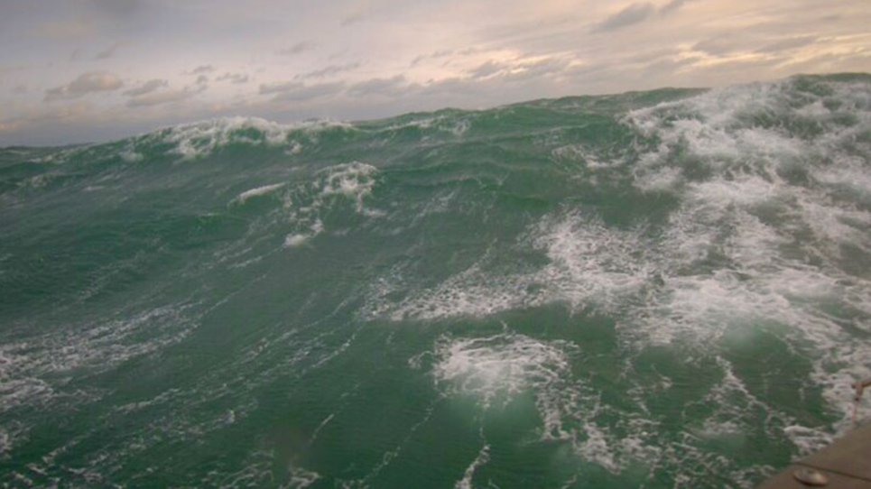
THE IMMENSE AND FORBIDDING Southern Ocean is famous for howling gales and devilish swells that have tested mariners for centuries.
But its true strength lies beneath the waves.

The ocean’s dominant feature, extending up to two miles deep and as much as 1,200 miles wide, is the Antarctic Circumpolar Current, by far the largest current in the world.
It is the world’s climate engine, and it has kept the world from warming even more by drawing deep water from the Atlantic, Pacific and Indian oceans, much of which has been submerged for hundreds of years, and pulling it to the surface.
There, it exchanges heat and carbon dioxide with the atmosphere before being dispatched again on its eternal round trip.

Without this action, which scientists call upwelling, the world would be even hotter than it has become as a result of human-caused emissions of carbon dioxide and other heat-trapping gases.

“From no perspective is there any place more important than the Southern Ocean,” said Joellen L. Russell, an oceanographer at the University of Arizona. 
“There’s nothing like it on Planet Earth.”

For centuries this ocean was largely unknown, its conditions so extreme that only a relative handful of sailors plied its iceberg-infested waters.
What fragmentary scientific knowledge was available came from measurements taken by explorers, naval ships, the occasional research expeditions or whaling vessels.

But more recently, a new generation of floating, autonomous probes that can collect temperature, density and other data for years — diving deep underwater, and even exploring beneath the Antarctic sea ice, before rising to the surface to phone home — has enabled scientists to learn much more.

They have discovered that global warming is affecting the Antarctic current in complex ways, and these shifts could complicate the ability to fight climate change in the future.

Scientists can model ocean patterns all the way to the seafloor on a planetary scale.
They have found that immense volumes of deep water, shown as blue dots, flow toward the Antarctic.
As the ancient water rises, shown here in yellow, over nearly a century, it circles the continent.
Researchers are worried about the impact of climate change on this upwelling.

As the world warms, Dr. Russell and others say, the unceasing winds that drive the upwelling are getting stronger.
That could have the effect of releasing more carbon dioxide into the atmosphere, by bringing to the surface more of the deep water that has held this carbon locked away for centuries.

In addition, the Southern Ocean is getting warmer, and that has another important climate effect.
Some of this upwelling water, which is already relatively warm, flows beneath ice shelves on the Antarctic coast that help keep the continent’s vast, thick ice sheets from reaching the sea more quickly.

In effect, “Antarctica is melting from the bottom,” said Henri Drake, an oceanographer at the Massachusetts Institute of Technology.

That, scientists say, is already adding to sea level rise.
Over time it could contribute much more, potentially swamping coastlines in the next century and beyond.

While the potential magnitude of all these effects remains unclear, oceanographers and climate scientists say that it is increasingly urgent to understand this interplay of powerful forces and how human activity is transforming them. 
“There’s lots of questions left,” said Lynne Talley, an oceanographer at Scripps Institution of Oceanography in La Jolla, Calif.

MUCH OF HUMANITY’S LIMITED scientific understanding of the Southern Ocean was long linked to an industry that saw money to be made there: whaling.

Beginning in the late 19th century, whaling ships began heading southward, to the Antarctic, in growing numbers as whale populations in the more hospitable waters of the Atlantic and Pacific oceans declined from overhunting.
Hundreds of ships sailed the violent southern waters on voyages that could last a year or longer.

But in time, overhunting became a problem in the Southern Ocean as well.
And the British government decided more needed to be learned about the environment and behavior of the whales there in hopes of sustaining their numbers.

Which is why, in the late 1920s, George Deacon, a young London university graduate with a passion for chemistry and a longing for the sea, received an intriguing job offer: sampling the waters of the Southern Ocean as part of an expedition to help preserve the whaling industry.

For Deacon it would be the start of a storied career in oceanography.
He would go on to help develop secret World War II submarine detection devices, direct the National Institute of Oceanography and eventually receive a knighthood.

But on Christmas Eve, 1927, just 21 years old, he set sail on a tiny research ship, the William Scoresby, toward Antarctica.
Deacon’s work there, even though some of his conclusions were later viewed as incorrect, would shape scientific understanding of the Southern Ocean for years to come.

He spent the better part of the next decade aboard ships, analyzing water samples from various depths. It could be dangerous work.
Storms would leave the pulleys and cables used to lower equipment into the water so heavily caked with ice that torches had to be used to free them.
Sample bottles, once pulled from the water, would often freeze even before they could be brought below decks, spoiling his tests.


The William Scoresby, Deacon’s ship, during a later expedition.Bearnes Hampton & Littlewood, Fine Art Auctioneers & Valuers, Exeter, England

But Deacon overcame these obstacles, ultimately sampling enough of the ocean to gain a broad understanding of its mechanics.
He combined his ideas with those of others in a 1937 book, “The Hydrology of the Southern Ocean,” that became the standard textbook describing the waters around Antarctica.

Deacon and his fellow voyagers were hardly the first to experience the hardships of the Southern Ocean. Archeological findings suggest it was explored as early as the 12th or 13th century by Indigenous Polynesians, about 500 years before Europeans first sailed there.

Visitors were rare then — and still are today.
Even in a modern ship, a voyage in the Southern Ocean can be harrowing.

That’s a result of geography. The nearest significant landmass to Antarctica is Cape Horn, the southern tip of South America, about 500 miles distant across the Drake Passage.
As a result, the ocean’s westerly winds have nothing to impede them, so they sweep completely around the world, building up ferocious strength and creating huge swells.

Because relatively few ships have ventured there over the years, researchers even today look for data wherever they can find it.

It can turn up in surprising places.

Just a few years ago Praveen Teleti, while working on his doctorate on the historical variability of Antarctic sea ice at the University of Cambridge, realized that the logbooks of a British whaling company’s ships contained invaluable climate measurements — air and water temperatures, barometric pressure, wind strength — from the 1930s and 1950s.

Along with the data, the logbooks also contained occasional personal comments, Dr. Teleti said, which were often breathtakingly understated.
Numbers reporting hurricane-force winds, for instance, would be accompanied by a benign comment about a gale. 
“They wrote it as if it’s nothing much,” he said.

While hardly a comprehensive survey, the 9,000 or so data points that Dr. Teleti unearthed are among the relative few that document the Southern Ocean before much research was undertaken there.
They can be invaluable in helping scientists better understand how the region has already changed as the world has warmed.

Around the 1950s, though, research efforts expanded. Expeditions became more commonplace, systematic and sophisticated.
Instruments were developed that could make measurements from the bottom to the surface.
And by the late 1970s, polar-orbiting satellites began gathering data as well.

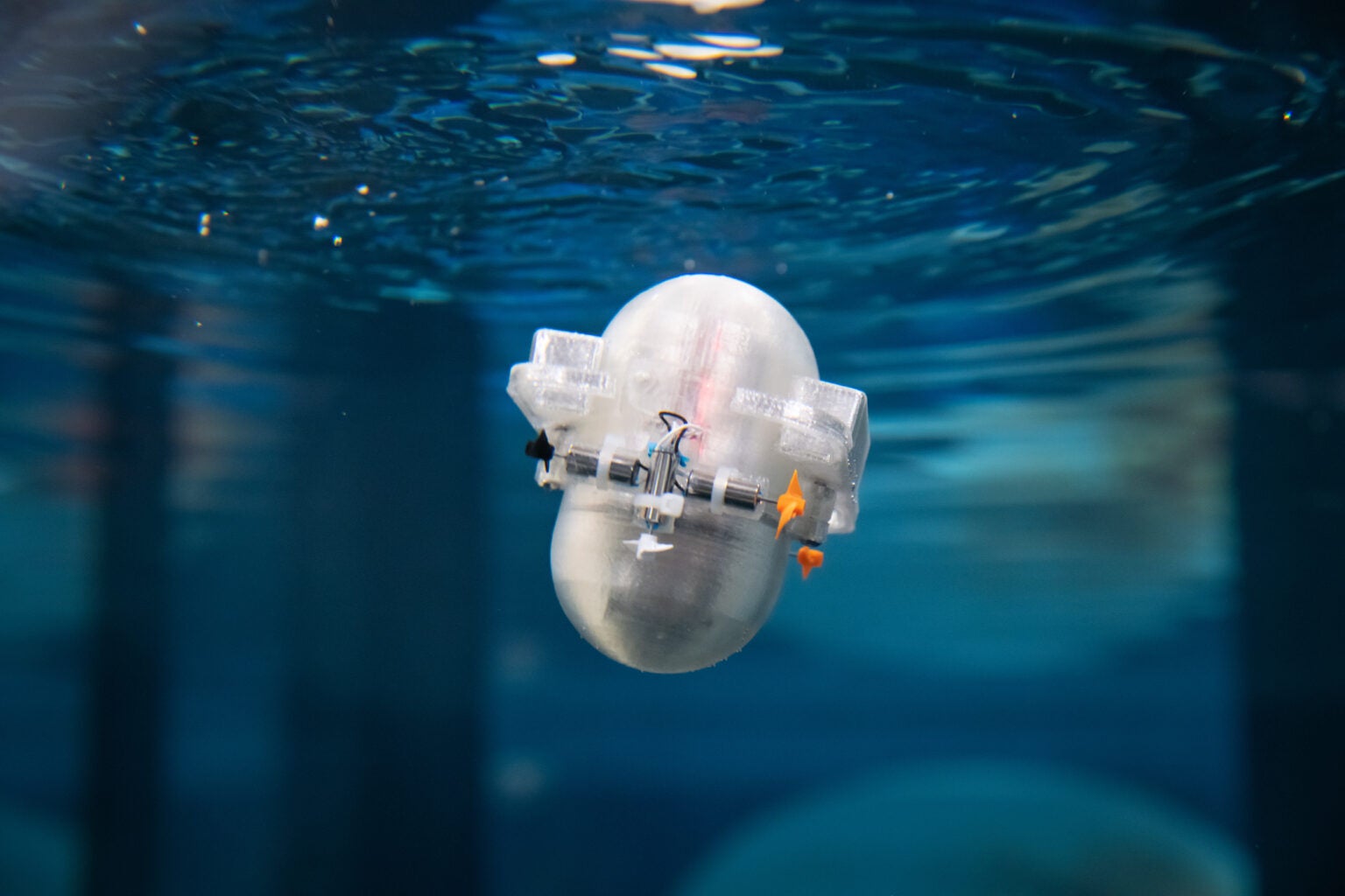
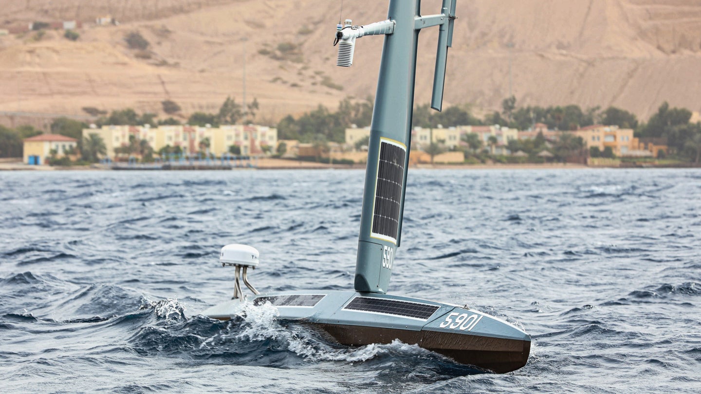
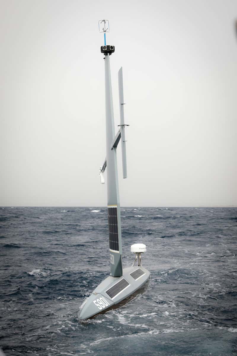
BUT THE REAL REVOLUTION in Southern Ocean science began in the mid-2000s, with the use of drifting floats that can adjust their buoyancy, like fish, to move up and down in the water as they take readings.
They surface only occasionally, to beam their data to satellites, before sinking once again below the waves. Some even explore beneath the sea ice.

The floats, part of a worldwide project called Argo, have helped transform oceanographers’ understanding of the Southern Ocean.


Researchers dropped a float in the Southern Ocean in 2017.Greta Shum/Southern Ocean Carbon and Climate Observations and Modeling Project

They now know, for instance, that Deacon’s description of the ocean in his 1937 book was incorrect in some ways.
For one thing, he described the movement of water as a recirculating loop, later named a Deacon cell in his honor, in which deep water rose in the southern part of the circumpolar current, moved northward across the current, sank, and was drawn south to upwell again.

Oceanographers now know much more about the complex cycle of worldwide oceanic currents, of which the Antarctic upwelling is only a part.
The waters circling Antarctica are completing an epic journey from the Atlantic, Pacific and Indian oceans, flowing southward and slowly cycling upward as if climbing an ocean-sized circular staircase.

“This is deep ocean water that hasn’t seen the atmosphere for centuries,” said Veronica Tamsitt, who, as a doctoral student, worked with Dr. Talley, Dr. Drake and others to build computer models of what all the new data was revealing.

Scientists better understand how closely intertwined the Southern Ocean is, despite its remoteness, with the rest of the world. The circular flow of water around Antarctica is, in effect, a climate engine spinning on a continental scale.

With this new knowledge, researchers are now growing increasingly alarmed about how the ocean and current may change as the Earth continues to warm.

Dr. Russell, the Arizona oceanographer, has dedicated her life to this work.
She grew up in the Arctic, on the coast of the Chukchi Sea in Kotzebue, Alaska.
As a child, she said, “I wanted to know where the sea ice went,” when it retreated from shore every summer.
“You never quite give up what you fall in love with when you’re young,” she said.

As a graduate student, she went on her share of Southern Ocean expeditions, describing the peculiar terror of working on a 300-foot ship being tossed about on huge swells. 
“You’re chugging up the side of the wave and then schuss down the other side until you stick the prow into the next wave and a mountain of water proceeds to just fall on you,” she said.

On her first voyage she was measuring dissolved oxygen in the water, and kept getting readings that suggested a startling rate of upwelling.
“It was coming from so deep, so fast,” she said. “That’s when my Southern Ocean obsession really started.”

Since then she, like other oceanographers, has focused on the carbon dioxide that is dissolved, in vast quantities, in the deep waters surfacing around Antarctica.

ONE OF THE MOST IMPORTANT processes that occurs in the Southern Ocean is the exchange of carbon dioxide between the ocean and the atmosphere.
And how this process may change as the world warms has huge implications for fighting climate change.

Global warming is mainly caused by carbon dioxide put into the atmosphere by the burning of fossil fuels.
Oceans absorb large amounts of these emissions, while also absorbing heat from the atmosphere, serving as a critical buffer against climate change and keeping the world from otherwise becoming a practically unlivable hothouse.

By some estimates the oceans have taken up about 25 percent of the excess carbon dioxide, and more than 90 percent of the excess heat, that has resulted from burning of fossil fuels and other human activities since the 19th century.
But the deep ocean water that upwells around Antarctica contains even more carbon dioxide — not from current emissions, but dissolved over centuries from organic matter including decaying marine organisms, tiny and immense, that sink when they die.
“It’s been accumulating the rot of ages,” Dr. Russell said.

When this ancient water reaches the surface, some of that carbon dioxide is released, or “outgassed,” as the scientists say.

Researchers have long thought that the Southern Ocean absorbs more carbon dioxide than it releases, with a beneficial effect for climate.
But if more water upwells, more of this carbon dioxide could be outgassed, shifting this critical balance.
That would make it more difficult to fight climate change: Nations would have to reduce their emissions even more to keep warming in check.

Upwelling is driven by those incessant Southern Ocean winds, which push surface water northward, drawing up deep water behind it.
The winds are affected by warming, and they have already strengthened in recent decades.

A recent study suggested that the Southern Ocean is still absorbing more carbon dioxide than it is releasing.
But many researchers think the ocean may already be outgassing more carbon dioxide than previously thought.
And if the winds keep strengthening as the world warms, they say, the upwelling and outgassing could keep increasing.

Scientists point out that more upwelling might actually have one benefit in the effort to fight climate change: It could allow more of the atmosphere’s excess heat to be absorbed.
But overall, they are concerned.
“We’re excited about it, because it would take up more heat,” Dr. Russell said.
“But we’re worried about it because of all that deep-ocean carbon.”
 
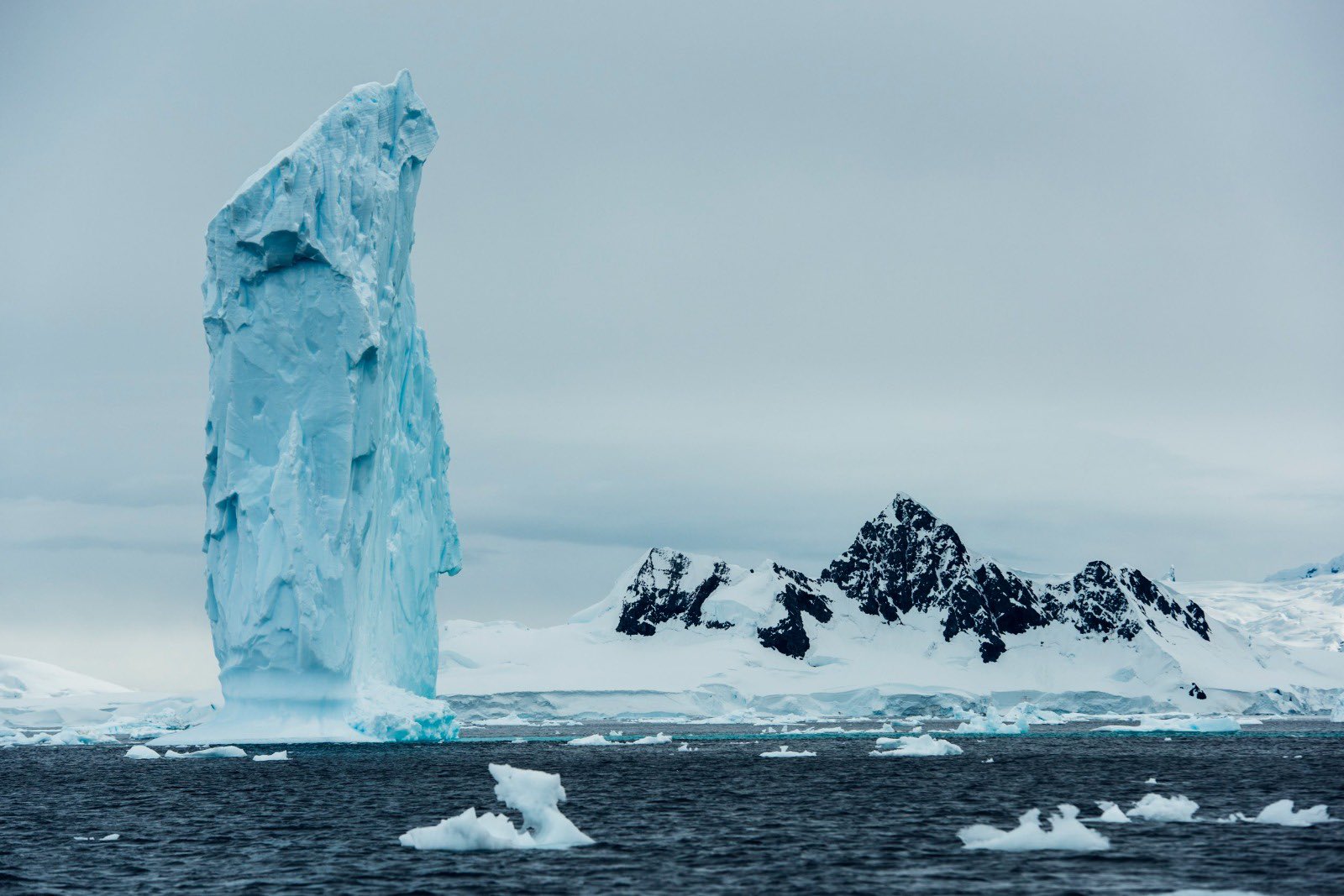
An iceberg monolith overlooking Wilhelmina Bay in Antarctica.
photo Kelvin Trautman


CARBON, HOWEVER, ISN’T THE ONLY CONCERN.
The water that’s welling up in the Southern Ocean is also relatively warm, and warming more, which spells trouble for the planet in the form of sea level rise.

Some of that warm water reaches Antarctica’s continental shelf, where it flows beneath ice shelves, the tongues of ice at the ends of glaciers.
These glaciers act as buttresses, helping to hold back the massive ice sheets that cover the continent and that are slowly moving toward the ocean.

But scientists discovered several decades ago that this upwelling water is melting the ice shelves from underneath.
As the ice thins, the glaciers lose some of their ability to keep the ice sheets in check.

Ice shelves like the Thwaites are shrinking at an accelerating pace.

Along the continental shelf, centuries-old water from deep beneath the world’s oceans rises toward Antarctica.

This warming water meets ice at the base of the shelf, as illustrated here, melting away the base.

Plumes also rise to weaken the shelf from below: Antarctic ice shelves are not only retreating, but getting thinner.

Most of this melting is occurring on Antarctica’s western side, where the circumpolar current comes closest to the coast.
 

There, the ice shelves of two large glaciers, Thwaites and Pine Island, hold much of the region’s ice sheet back.

So far, their melting and thinning has contributed only a relatively small amount to rising sea levels. But the concern is that if the ice shelves melt too much, they could collapse, accelerating the movement of the glaciers, and eventually much of the West Antarctic ice sheet, to the ocean. New research suggests such a collapse of part of the Thwaites ice shelf, and a resulting speed-up of the flow there, could occur within the next decade.

Were the West Antarctic ice sheet to flow into the ocean, seas could rise as much as 12 feet over centuries.
Already, the rate of melting of these glaciers is accelerating.
And again, the winds play a key role.

In the case of ice-shelf melting, the winds that matter are those close to the continent, said David Holland, a mathematician and climate scientist at New York University.
But the effect is the same. In the past, studies suggest, these close-in winds have kept colder water at the surface, preventing the warmer water from rising high enough to reach the continental shelf and the ice shelves.

Across the continent, ice is constantly flowing toward the open sea.
Floating ice shelves at the end of immense glaciers act as an important brake, slowing those flows.
Their sheer mass blocks the ice on land from reaching the ocean more quickly.
As shelves melt, the land ice can reach the sea faster, eventually causing seas to rise more.
 

Research team surveying the seafloor near Thwaites Glacier
(Alex Mazur/British Antarctic Survey)
 
But those winds have shifted, said Dr. Holland, who was a leader of pioneering research that drilled through the Thwaites ice shelf to measure the water temperature below. 
“Right now the wind is pushing the cold water away, and so the warm water is coming to fill the void,” he said.
“And it’s looking like there will be more of that, based on computer models.”

In less than a century, the state of the art has progressed from Deacon’s solitary whaling research ship, to fleets of autonomous oceangoing probes circling the world, to sophisticated computer models.

And today, scientists are on the brink of getting even more data.
The Argo program is about to deploy globally a new generation of more sophisticated floats capable of measuring much more than basic temperature and salinity.

Of particular interest to Dr. Russell and others are acidity readings, because they can be used to determine the water’s carbon dioxide content.
That could help further illuminate the profound importance of deep, ancient, carbon-laden water to the world’s future.

Despite all that has been learned, Dr. Russell said, “Unlike any other field of exploration, we are at the absolute frontier here.

Links :

Thursday, December 16, 2021

New Zealand (Linz) update in the GeoGarage platform

12 nautical raster charts updated & 2 new charts added

This tiny AI-powered robot is learning to explore the ocean on its own

An AI-powered ocean-surveying robot from Caltech can learn to navigate without remote controls or engineers.
Caltech
 
From PopularSciences by Charlotte Hu

A new Caltech robot could use machine learning to navigate through turbulent and unknown terrains in the ocean.
 
The ocean is big, and our attempts to understand it are still largely surface-deep.
According to the National Oceanic and Atmospheric Organization, around 80 percent of the big blue is “unmapped, unobserved, and unexplored.”
 
Ships are the primary way to collect information about the seas, but they’re costly to send out frequently.
More recently, robotic buoys called Argo floats have been drifting with the currents, diving up and down to take a variety of measurements at depths up to 6,500 feet.
But new aquatic robots from a lab at Caltech could rove deeper and take on more tailored underwater missions.

“We’re imagining an approach for global ocean exploration where you take swarms of smaller robots of various types and populate the ocean with them for tracking, for climate change, for understanding the physics of the ocean,” says John O. Dabiri, a professor of aeronautics and mechanical engineering at the California Institute of Technology.

In comes CARL-Bot (Caltech Autonomous Reinforcement Learning Robot), a palm-sized aquatic robot that looks like a cross between a pill capsule and a dumbo octopus
It has motors for swimming around, is weighted to stay upright, and has sensors that can detect pressure, depth, acceleration, and orientation.
Everything that CARL does is powered by a microcontroller inside, which has a 1-megabyte processor that’s smaller than a postage stamp.

CARL is the latest ocean-traversing innovation out of Dabiri’s lab, created and 3D-printed at home by Caltech graduate student Peter Gunnarson.
The first tests Gunnarson ran with it were in his bathtub, since Caltech’s labs were closed at the start of 2021 because of COVID.

Right now, CARL can still be remotely controlled. But to really get to the deepest parts of the ocean, there can’t be any hand-holding involved.
That means no researchers giving CARL directions—it needs to learn to navigate the mighty ocean on its own. Gunnarson and Dabiri sought out computer scientist Petros Koumoutsakos, who helped develop AI algorithms for CARL that could teach it to orient itself based on changes in its immediate environment and past experiences.
Their research was published this week in Nature Communications.

CARL can decide to adjust its route on-the-fly to maneuver around the rough currents and get to its destination.
Or it can stay put in a designated location using “minimal energy” from a lithium-ion battery.
 

Peter Gunnarson describes his work in the Dabiri Lab to use Reinforcement Learning to give robots the ability to navigate flow autonomously.
 
CARL’s power lies in memories

The set of algorithms developed by Koumoutsakos can perform the wayfinding calculations on-board the small robot.
The algorithms also take advantage of the robot’s memory of prior encounters, like how to get past a whirlpool.
“We can use that information to decide how to navigate those situations in the future,” explains Dabiri.

CARL’s programming enables it to remember similar paths it has taken in previous missions, and “over repeated experiences, get better and better at sampling the ocean with less time and less energy,” Gunnarson adds.

A lot of machine learning is done in simulation, where all the data points are clean.
But transferring that to the real world can be messy. Sensors sometimes get overwhelmed and might not pick up all the necessary metrics.
“We’re just starting the trials in the physical tank,” says Gunnarson.
The first step is to test if CARL can complete simple tasks, like repeated diving.
A short video on Caltech’s blog shows the robot clumsily bobbing along and plunging into a still water tank. 
 
 
As testing moves along, the team plans to put CARL in a pool-like tank with small jets that can generate horizontal currents for it to navigate through.
When the robot graduates from that, it will move to a two-story-tall facility that can mimic upwelling and downwelling currents.
There, it will have to figure out how to maintain a certain depth in a region of the ocean where the surrounding water is flowing in all directions.
“Ultimately, though, we want CARL in the real world. He’ll leave the nest and go into the ocean and with repeated trials there, the goal would be for him to learn how to navigate on his own,” says Dabiri.

During the testing, the team will also adjust the sensors in and on CARL.
“One of the questions we had is what is the minimal set of sensors that you can put onboard to accomplish the task,” Dabiri says
 When a robot is decked out with tools like LiDAR or cameras, “that limits the ability of the system to go for very long in the ocean before you have to change the battery.”

By lightening the sensor load, researchers could lengthen CARL’s life and open up space to add scientific instruments to measure pH, salinity, temperature, and more.
 
CARL’s software could inspire the next bionic jellyfish

Early last year, Dabiri’s group published a paper on how they used electric zaps to control a jellyfish’s movements. It’s possible that adding a chip that harbors similar machine learning algorithms to CARL’s would enable researchers to better steer the jellies through the ocean.
“Figuring out how this navigation algorithm works on a real live jellyfish could take a lot of time and effort,” says Dabiri.
In this regard, CARL provides a testing vessel for the algorithms that could eventually go into the mechanically modified creatures. Unlike robots and rovers, these jellies wouldn’t have depth limitations, as biologists know that they can exist in the Mariana Trench, some 30,000 feet below the surface.
CARL, in and of itself, can still be an useful asset in ocean monitoring.
It can work alongside existing instruments like Argo floats, and go on solo missions to perform more fine-tuned explorations, given that it can get close to sea beds and other fragile structures.
It can also track and tag along with biological organisms like a school of fish.
“You might one day in the future imagine 10,000 or a million CARLs (we’ll give them different names, I guess) all going out into the ocean to measure regions that we simply can’t access today simultaneously so that we get a time-resolved picture of how the ocean is changing,” Dabiri says. “That’s going to be really essential to model predictions of climate, but also to understand how the ocean works.”

Links :

Wednesday, December 15, 2021

U.S. Navy tests unmanned sailboat off Jordan

 
US Navy Share
 
From The Drive by Joseph Trevithick
 
The sailboat test is part of an effort to learn how unmanned platforms can help in the Middle East and, eventually, globally.

The U.S. Navy has kicked off an operational test of a wind and solar-powered Saildrone Explorer unmanned surface vessel in the Gulf of Aqaba at the northern end of the Red Sea.
Linked into a network that makes use of artificial intelligence and machine learning capabilities, these drone sailboats could be a valuable new tool to help keep an eye out for maritime threats in the region and beyond.
 
Gulf of Aqaba with the GeoGarage platform (NGA nautical raster chart)

Navy personnel assigned to Task Force 59 launched the Saildrone Explorer on its first mission in the region, which is part of a demonstration exercise nicknamed Digital Horizon, from the Royal Jordanian Navy base at the Port of Aqaba on Dec. 12, 2021.
The service established this task force within its existing command structure in the Middle East, typically referred to collectively as U.S. 5th Fleet/Naval Forces Central Command, or 5th Fleet/NAVCENT, in September.
It is, at present, primarily a testbed unit intended to help rapidly explore the integration of new unmanned and artificial intelligence (AI) capabilities into Navy operations in the region.


USN
U.S. Navy Vice Adm. Brad Cooper, commander of U.S. 5th Fleet/Naval Forces Central Command, at left, and Jordanian Col.
Hisham Khaleel Aljarrah, commander of the Royal Jordanian Naval Force, examine Saildrone Explorer belonging to Task Force 59.


“These are exciting times for Task Force 59 as we team with the Royal Jordanian Navy to establish our hub for Red Sea operations in Aqaba and deploy some of our new maritime robotics,” Navy Capt.
Michael Brasseur, the task force's commander, said in a statement.
“Our Saildrones leverage machine learning and artificial intelligence to enhance maritime domain awareness, extending the digital horizon with a sustainable, zero-carbon solution."

Saildrone's Explorer design, the smallest of the California-headquartered company's offerings, presents a potentially ideal platform for persistently monitoring littoral and open-ocean areas.
Developed initially for collecting various kinds of oceanographic data, the 23-foot-long unmanned vessel uses wind power for propulsion and solar power for its sensor package.
Though these drone sailboats have an average speed of only three knots, Saildrone says they have an effectively unlimited range and are designed to operate autonomously for at least a year, even through periods of extreme weather.
The actual maximum endurance would be determined by the exact configuration.

The Navy has not said what sensors or other systems are on the Explorer that is now taking part in the Digital Horizon demonstration.
Saildrone's website says the electro-optical cameras with some degree of machine learning-enabled automatic target detection, as well as various oceanographic sensors, are available for this design, with radars and other capabilities found on its larger offerings.

A group of Saildrones with various full-motion video cameras, including night vision or thermal imaging capable types, networked together and with links to other vessels and command centers ashore, might be useful to the Navy for detecting and tracking threats or potential threats, as well as just improving overall persistent situational awareness within a specific area.
Automated target recognition and other capabilities that make use of AI or machine-learning algorithms could add to their utility.

These drone sailboats would also be able to provide these kinds of capabilities without the need to deploy significant numbers of more traditional assets or personnel or the costs associated with doing so.
Right now, the Navy has a limited capacity to conduct more persistent small boat operations, including surveillance and presence missions, across larger areas.
The service is also planning to eliminate its fleets of Mk VI and Cyclone class patrol boats entirely, supplanting them, at least in part, with examples of its two subclasses of littoral combat ships (LCSs).
However, LCSs cost tens of millions of dollars to operate and maintain annually.
In 2018, Bloomberg reported that Saildrone's products could be operated for as little as $2,500 per day, or $30,000 per year, for scientific purposes.

With all of this in mind, Navy Saildrone Explorer could be a valuable addition to the service's capabilities in the Gulf of Aqaba, which touches Israel to the north and Egypt's Sinai Peninsula to the west, as well as Jordan to the East.
It is an important link to the Red Sea for Israel and Jordan, both for naval operations and commercial shipping, with the Port of Aqaba being the latter country's only major port facility.


U.S. Navy

The Navy's Saildrone Explorer out on the water in the Gulf of Aqaba.

It is also a potential chokepoint, something that could be of concern as various types of threats in and around the Red Sea from Iranian-backed Houthi militants in Yemen, as well as Iran itself, continue to grow.
The Houthis have already demonstrated their proficiency in using unmanned, explosive-laden boats, as well as suicide drones, ground-launched cruise and ballistic missiles, and naval mines, to threaten naval vessels, commercial ships, and coastal infrastructure, among other targets, in and around neighboring Saudi Arabia.
There have been clear indications that the Houthis, together with Iranian forces themselves, might be working to extend the reach of those threats north, including bringing them within range of southern Israel.

Of course, additional persistent maritime situational awareness could be useful elsewhere in the Middle East beyond the Gulf of Aqaba.
This includes operations in the Bab Al Mandeb Strait, at the southern end of the Red Sea, and the Strait of Hormuz, which links the Persian Gulf to the Gulf of Oman.
These are two other highly strategic chokepoints in the region where Iran and its proxies present real threats.
 
Graphic showing details of the sensors on the Saildrone Explorers in the 2022 Gulf Stream mission
 
Beyond that, it would seem very likely that the outcome of the Digital Horizon demonstration could have implications for how the Navy might deploy these drone sailboats elsewhere around the world.
If the testing in the Gulf of Aqaba shows promise, it would not be hard to imagine the service being interested in using Saildrone Explorers for similar missions in broad expanses of the Pacific, among other areas.

Task Force 59's activities in the Middle East are almost certain to have impacts on the service's larger unmanned plans.
This operational test of the Saildrone Explorer is only one example of the work the unit has been doing already since its activation just three months ago.
It completed its first unmanned integration exercise in the Persian Gulf back in October.
That event saw a Maritime Tactical Systems, Inc., (MARTAC) MANTAS T12 unmanned surface vessel work with Navy and Coast Guard Patrol boats, as well as an MH-60S Sea Hawk helicopter and a V-Bat drone.
Forces from the Bahraini military also participated in the exercise, which was nicknamed New Horizon.

The T12 is a speedboat-like unmanned design and the Navy's example in the Middle East has been seen equipped with a sensor turret containing full-motion video cameras.
Task Force 59 has described the 12-foot-long T12 in the configuration they are testing as another potential way to improve "maritime domain awareness," just as with the Saildrone Explorer.


USN Task Force 59's MANTAS T12 sails together with the US Coast Guard's Island class patrol boat USCGC Mauiduring the New Horizon exercise.

“This is a significant milestone for our new task force as we accelerate the integration of unmanned systems and artificial intelligence into complex, cross-domain operations at sea,” Capt.
Brasseur, Task Force 59's commander, said in a statement at the conclusion of the New Horizon exercise.
“Real-world evaluation is essential.”

Earlier this month, Task Force 59 conducted another similar test in the Persian Gulf with a MARTAC Devil Ray T38 unmanned surface vessel.
The T38 shares a general shape with the T12, but is significantly larger at 38 feet in overall length.


U.S. Army
A Devil Ray T38 unmanned surface vessel in the Persian Gulf during a test in December 2021.


The Navy, as a whole, is increasingly exploring ways to increasingly integrate unmanned surface vessels of various types, as well as unmanned underwater vehicles and drones, into its concepts of operation.
Earlier this year, the service conducted a massive manned-unmanned teaming event, known as Unmanned Integrated Battle Problem 21, or UxS IBP 21, off that coast of Southern California.
UxS IBP 21 featured a variety of different platforms working together to conduct a number of different simulated missions, including the targeting of a mock surface vessel with an SM-6 missile.
The Navy plans to conduct more demonstrations like this in the near future.

The new test of the Saildrone Explorer in the Gulf of Aqaba, together with the previous operational demonstrations of the T-12 and T-38, shows that Task Force 59 is already conducting important work despite having only been in existence for a matter of months.
The unit's activities are set to help pave the way for increasingly routine use of unmanned platforms for surveillance and other missions in support of Navy operations in the Middle East and beyond.

Links :

Tuesday, December 14, 2021

‘Our boat was surrounded by dead bodies’: witnessing a migrant tragedy

Migrants arriving at a beach last month in Dungeness, on the southeast coast of England, after being rescued while crossing the English Channel.
Credit...Ben Stansall/Agence France-Presse — Getty Images


From NYTimes by Jane Arraf, Sangar Khaleel and Megan Specia


Migrants who were on a separate boat described the horrible aftermath of the sinking in the English Channel that took at least 27 lives.
 
The boat packed with migrants was about halfway across the English Channel when one of the passengers spotted two orange life jackets bobbing in the water.
The seas were rough, and it was only when they got closer that Zana Hamawandani saw the vests contained dead bodies.

Soon, other bodies started appearing.
As Mr. Hamawandani watched, the current pushed one of them under his inflatable boat, where it collided with the whirling blades of the outboard motor.
“It came up again but I saw it floating for just a few seconds before the waves took it away,” he said.
He remembered it was the body of a man wearing baggy pants.

Another migrant, Karzan Mangury, said he was so horrified by the corpses that he tried to look away. “Our boat was surrounded by dead bodies,” said Mr. Mangury.
“At that moment my entire body was shaking.”

Their accounts, in phone interviews from an immigration facility in England, are the first time they have spoken to news media and are among the only witness descriptions of the last minutes of the disaster.
At least 27 people are believed to have died, the biggest single loss of life in the channel since the International Organization for Migration began collecting data in 2014.

Along with the accounts of relatives of some of the victims, their descriptions also tell a story of hours of frantic and futile calls for help to French and English authorities as the migrant boat was sinking.
At one point, Mr. Mangury said, he made 10 calls to a number the French police had given him to try to report his location, and no one answered.

His description of his phone calls is the first public account by a migrant who spoke directly with English and French police to report the sinking.

A few minutes after seeing the corpses, Mr. Hamawandani and Mr. Mangury said, they saw a mostly submerged, deflated boat with at least two people clinging to it — believed to be the only survivors of a migrant boat that sank in the channel on Nov 24.
“They were shouting, we could hear them yelling for help,” said Mr. Hamawandani, a 21-year-old Iraqi Kurd.

Eventually the British Coast Guard rescued Mr. Hamawandani’s vessel and a French fishing boat picked up the two survivors of the sunken boat.

ImageInflatable boats used by migrants who crossed the English Channel from France being secured by an official in Dover last month.
Credit...Peter Nicholls/Reuters

In reporting from cities and towns in the Iraqi Kurdistan region where many of the victims came from, my colleagues and I first heard about Mr. Hamawandani from his family, who feared he had been one of the victims after he told them he was in a boat crossing the channel and then dropped out of touch.

Mr. Hamawandani eventually put us through to Mr. Mangury, who spoke to us on the same phone. A location app indicated they were at a facility that local immigration activists confirmed is used to house migrants in Crawley, a town in southern England.

The disaster has injected a new sense of urgency into efforts by European countries to better control high-risk channel crossings. Activists also believe the deaths, which included children, highlight a contentious, ineffective partnership between Britain and France that has failed to improve the protocols for rescuing migrants in distress.

Mr. Hamawandani and Mr. Mangury set off with 23 other people in the early morning hours of Nov. 24. After more than 10 hours in the water, the engine on their own boat was failing and they were running out of fuel when they spotted the bodies.

Mr. Mangury said their boat was in French waters when they saw the two people clinging to the deflated boat. He started calling 112, the French distress number. “I told them there is a boat broken and people dead. Please help them and help us,” he said.

He said the French police asked him to send his location, but he could not send to a three-digit number. They gave him another number to try, but he said it went unanswered 10 times. Eventually he was able to get a number to send a location via WhatsApp.

“I said ‘10 times I called! Please answer me,’” he recalled. “‘Please help me!’”

He said that after an hour the French Coast Guard had not arrived. At about 12:30 p.m. he reached the English police, who told him they had alerted the French.

About 40 minutes later, after their own boat engine had stalled, Mr. Mangury said they saw a helicopter circling and British Coast Guard boats heading toward the bodies.

ImageMigrants rescued by the Royal National Lifeboat Institution, a volunteer rescue organization, being brought to Dungeness last month.
Credit...Ben Stansall/Agence France-Presse — Getty Images

His account raises new questions about the response of the French and British rescue teams.
Many of the victims’ relatives accuse the two countries of deflecting responsibility by saying the boat was in each other’s waters and failing to respond to distress calls.

The British Coast Guard said in a statement that in the early hours of Nov. 24, in response to distress calls, it launched a search and rescue operation that included a border patrol boat and a helicopter. It did not specify which distress calls it received.

“Three small boats were located and those onboard rescued,” a spokesperson said. “No other small boats or people in the water were identified in the search area.”

In France, both judicial and local authorities in the north declined to comment about whether they had received calls from the migrant boat or from Mr. Mangury, saying they could not discuss a case while it was under investigation. A spokeswoman for the maritime authorities in northern France said they had only been alerted to the ill-fated migrant boat by fishermen who found it adrift in the channel.

The only two known survivors of the sinking were an Iranian Kurd and a Somali, presumed to be the migrants seen by Mr. Mangury’s boat.

They told the Iraqi Kurdish television network Rudaw that their inflatable boat had sprung a leak and started to deflate while taking on water.

The Somali migrant, identified by Rudaw as Mohammed Isa Omar, said they were frantically calling both the French and British police as the flimsy boat started to sink.

“Most of the calls were to Britain saying ‘Help. Help us.’ They said ‘Send us the location’; we didn’t have the chance,” he told the network.
He said at that point the leaking boat capsized, throwing everyone in it into the water along with their phones.

The other known survivor, an Iranian Kurd living in Iraq identified by Rudaw as Mohammad Shekha Ahmad, described fellow migrants holding hands in the frigid water and said that one by one they lost the strength to hold on and were carried away.

Mr. Hamawandani and Mr. Mangury said they were haunted by not being able to help the two surviving migrants holding onto the sunken boat.
“Some of us said ‘Let’s go and help them’ but most of them were afraid because they saw the dead bodies in the sea and they thought the same thing would happen to us,” said Mr. Hamawandani.

Many of the victims were Iraqis from the country’s Kurdistan region in northern Iraq, and the sinking has sent waves of grief and anger through Kurdish towns and villages.
More than two weeks after the sinking, none of the families have been officially notified of the fate of their relatives.

In the picturesque mountain town of Hajiawa, Nazdar Sharif swung between desperate hope that her son Twana Mamand was still alive, and resignation that he was among the victims.
Twana had tried six times over the last two months to cross the channel to Britain, where his sister has lived for years, said his brother, Zana Mamand.
Each time, he was caught by the French authorities and sent back.

On his seventh attempt, Twana set off with a relative. He sent his brother a live location showing them roughly in the middle of the channel, Zana Mamand said.

He told him by speaker phone that they would be in British waters in an hour. Mr. Mamand could hear the passengers on the other end of the line.
“Everybody was happy and laughing,” Zana Mamand said.
An hour later, when he was no longer able to reach his brother, he called their sister and brother-in-law in London.
The brother-in-law, who for privacy reasons asked to be identified only by his last name, Abdullah, said he spoke to the relative Twana was traveling with at about 1 a.m., and told him to call the police.
He said two hours later his relative told them other people on the boat had called the French and English police but had been told they were in each other’s waters.
That was the last time he was able to reach him.

At the Mamand family’s home near the town of Ranya, where hundreds of young men have left for Britain in the past few months, Twana’s mother emerged from a back room, distraught, wearing a string of blue plastic beads meant to ward off harm.
“I tell myself he is coming back,” said Ms. Sharif, 49, leaning against another of her sons for support. “I need an answer soon whether he is dead or alive. I want my son.”

Links :

Monday, December 13, 2021

USF launches first mission to map vulnerable coastal areas in Tampa Bay and Gulf of Mexico using a remotely operated ‘uncrewed’ vessel


University of South Florida marine scientists are leading an academic-federal-private enterprise partnership that will deploy a remotely operated ‘uncrewed’ vessel to map complex, coastal seafloor areas of interest in Tampa Bay and the Gulf of Mexico.
Along with the robotic vessel with acoustic sensors, this mission will utilize laser-based sensors mounted on airplanes and satellite-derived data to develop high-resolution maps of the region’s coastal zone to inform everything from storm surge forecasting to maritime safety to protecting cultural resources, such as shipwrecks.
Additional drone footage by Eckerd College / Joe Salcedo
other assets are available here

From USF by  Kristen Kusek

USF marine scientists launch first mission to map Tampa Bay’s vulnerable coastal areas using remotely operated ‘uncrewed’ vessel.
Lessons learned from an innovative approach will inform coastal resiliency efforts in Florida and beyond.

This week, University of South Florida marine scientists launched their first field mission in Tampa Bay and the Gulf of Mexico to test a new approach to mapping shallow coastal areas -- the most vulnerable to coastal changes and storm events, but the hardest to survey.

They are using a suite of technologies to generate high-resolution maps of these coastal areas: acoustic sensors mounted on an uncrewed surface vessel (USV) that is remotely operated, laser-based sensors mounted on an airplane, and satellite-derived imagery.

“Coastal areas may be the easiest to get to, but they are the hardest to survey from large ships that have depth limitations and may be less nimble than smaller craft,” said Steve Murawski, who heads the Center for Ocean Mapping and Innovative Technologies (COMIT) at the USF College of Marine Science (USF CMS) that is leading the mission in partnership with NOAA and two private companies. “We’re excited to figure out the best mix of agile technologies for surveying complex, shallow areas — a top priority for Florida, the nation and the globe,” Murawski said. “That’s our primary goal.”

The target areas in Tampa Bay and the Gulf of Mexico exhibit an array of conditions with differences in depth, water clarity, boat traffic and habitat types, which makes this area a fertile testing ground.
The work will be applicable to other coastal areas around Florida and beyond, said Murawski, who previously led the 10-year research effort in response to the Deepwater Horizon oil spill.


Target areas for the USV and plane on this inaugural coastal mapping expedition in Tampa Bay and the Gulf of Mexico.

The mapping products from this approach will also be used to improve storm surge modeling and prediction, maritime safety, fisheries management and more.

“Coastal resiliency is a top priority for our state, whose valuable natural resources and other assets are vulnerable to rising sea levels, escalating storm events and other environmental hazards,” said Florida House Speaker Chris Sprowls.
“I’m delighted to see USF and its partners answering the call for research and innovation in coastal mapping.”

More than 50 percent of our nation’s Exclusive Economic Zone (EEZ) remains unmapped, and experts say new approaches are needed.

"COMIT and its partners have achieved a significant milestone in advancing USV technologies with this mission,” said Neil Weston, chief scientist in NOAA’s Office of Coast Survey. 
“Our office is particularly interested in the outcomes from these field trials, especially when new technology approaches can improve our national priorities such as shallow water mapping, coastal resilience and emergency response."

A deeper dive into the experimental technology approach

The USV, about 16 feet long, is powered by solar panels and was built by a Massachusetts-based company called SeaTrac.
The boat is autonomous, meaning it operates on its own once a mission is programmed and remotely controlled from shore.
A “chase boat” follows the USV to ensure safety of the boat and anything in its vicinity as it progresses along its track, moving at about 3-5 knots, in a manner similar to mowing a lawn.
A team of USF graduate students and undergraduate students from Eckerd College will take shifts on the chase boat to watch for marine mammals or other unexpected hazards.
The USV’s course can be changed swiftly as needed.
“We’re excited to see how our platform can be leveraged in the broader seafloor survey toolkit to efficiently and effectively map in shallow coastal areas,” said Hobie Boeschenstein, director of business development and operations manager for SeaTrac. “We expect to learn a lot from this inaugural expedition with USF.”

SeaTrac’s work will be complemented by airplane surveys in early January 2022, executed by a global company called Fugro that developed a lightweight survey technology called a Rapid Airborne Multibeam Mapping System (RAMMS).
In total, it will survey about 90 square miles mostly between John’s Pass and Anna Maria Island, and one area off Egmont Key in the Gulf of Mexico.

Mark MacDonald, Hydrography Director for Fugro in the Americas, said: “We built RAMMS exactly for this purpose—to deliver efficient, high accuracy nearshore and coastal mapping data that address multiple stakeholder needs, from nautical charting to marine and coastal engineering and coastal zone management. We’re looking forward to seeing how the data will help the COMIT team better understand how we can efficiently map our coastal environments.”

The sensors used by the surface vessel and the plane vary in their resolution and performance under different conditions of water clarity and more – and each has its place in the mix, Murawski said.

In future missions, the COMIT team plans to test sensors mounted on other kinds of vehicles as well, such as drones and robotic gliders.


“We have a long history of leadership in coastal resiliency,” said Tom Frazer, dean of the USF CMS, “and it’s thrilling to watch our portfolio of action-based research grow in a way that will benefit the state of Florida and beyond.”

The CMS was recently designated the home of a state-funded Florida Flood Hub for Applied Research & Innovation, which will serve the state of Florida and harness the broad suite of talent that exists within academia, government and private sectors to accomplish its mission.
In addition, the college’s expertise sits at the heart of a new Center of Excellence in Environmental and Oceanographic Sciences that aims to establish the USF St. Petersburg campus as a nerve center of innovation around the blue-green economy, sustainability and coastal resiliency.
“This mission is a great example of the kind of innovation you can expect from USF moving forward,” said Frazer.


In January 2022 SeaTrac’s work with the USV will be complemented by airplane surveys executed by a global company called Fugro.
 
Links :

Sunday, December 12, 2021

Rare photos of giant phantom jellyfish from 3,200 feet under the sea

In November, a ROV operated by Monterey Bay Aquarium Research Institute captured this clip of a giant phantom jellyfish, more than 1,000 m deep.
Scientists have only encountered it ~100 times in ~120 years
 
 From Petapixels
 
 Researchers from the Monterey Bay Aquarium Research Institute (MBARI) recently captured footage of a giant phantom jellyfish. Sightings are exceedingly rare, and this species has only been seen nine times over thousands of dives. 

The MBARI remotely operated vehicle (ROV) Doc Ricketts spotted what the Institute describes as a “billowing crimson curtain.”

This giant phantom jellyfish (Stygiomedusa gigantea) is more than one meter (3.3 feet) across and trails four ribbon-like oral (or mouth) arms that can grow more than 10 meters (33 feet) in length.

MBARI says it has logged thousands of dives, but this particular species has only been seen nine times.

MBARI says that the first phantom jelly was collected in 1899, but since then scientists have only encountered the giant jellyfish about 100 total times.

It was not until 1859 that scientists recognized it as a new specicies, and even now very little is known about the animal.

The majestic deep-sea creature appears to have a global distribution and has been recorded in all oceans except for the Arctic. MBARI says that the challenges of deep-sea exploration are likely why there have been a relative scarcity of sightings for such a large and widely distributed species of jellyfish. 

“Historically, scientists relied on trawl nets to study deep-sea animals.

These nets can be effective for studying hardy animals such as fishes, crustaceans, and squids, but jellies turn to gelatinous goo in trawl nets,” MBARI notes.  

“The cameras on MBARI’s ROVs have allowed MBARI researchers to study these animals intact in their natural environment. High-definition—and now 4K—video of the giant phantom jelly captures stunning details about the animal’s appearance and behaviors that scientists would not have been able to see with a trawl-caught specimen.”

The giant phantom jelly can live anywhere between the surface and 21,900 feet, but is usually found in the midwater, or midnight zone (bathypelagic zone).

This is the layer of the oceanic zone at depths generally between about 1,000 and 4,000 meters (3,280 to 13,120 ft).

It receives no sunlight and, as expected, water pressure is considerable.

While it is only speculation, giant phantom jellies are presumed to feed on plankton and small fish.

During this particular expedition, researchers watched as a fish called the pelagic brotula (Thalassobathia pelagica) hovered around the bell of the jelly and swam in and around the large oral arms. 

“The wide-open waters of the midnight zone offer little shelter, so many creatures find refuge in the gelatinous animals that are abundant in this environment,” MBARI says.

The photos and footage are extraordinary. MBARI has a detailed feature on the giant phantom jelly on its website as well as a page dedicated to all the fascinating creatures it has discovered.