Visual Designer | Zooey Liao Senior Project Manager | Danielle Ramirez Creative Director | Brandon Douglas Director of Content | Jonathan Skillings
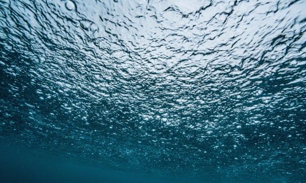
Multimillion-dollar cables crisscrossing the bottom of the ocean have become the vital connections of our online lives.
The concert is in London. You're watching it live from your home in Atlanta. What makes that possible is a network of subsea cables draped across the cold, dark contours of the ocean floor, transmitting sights and sounds at the speed of light through bundles of glass fiber as thin as your hair but thousands of miles long.
These cables, only about as thick as a garden hose, are high-tech marvels. The fastest, the newly completed transatlantic cable called Amitié and funded by Meta, Microsoft and others, can carry 400 terabits of data per second. That's 400,000 times faster than your home broadband if you're lucky enough to have high-end gigabit service.
And yet subsea cables are low-tech, too, coated in tar and unspooled by ships employing basically the same process used in the 1850s to lay the first transatlantic telegraph cable. SubCom, a subsea-cable maker based in New Jersey, evolved from a rope manufacturer with a factory next to a deep-water port for easy loading onto ships.
Though satellite links are becoming more important with orbiting systems like SpaceX's Starlink, subsea cables are the workhorses of global commerce and communications, carrying more than 99% of traffic between continents.
TeleGeography, an analyst firm that tracks the business, knows of 552 existing and planned subsea cables, and more are on the way as the internet spreads to every part of the globe and every corner of our lives.
You probably know that tech giants like Meta, Microsoft, Amazon and Google run the brains of the internet.
They're called "hyperscalers" for operating hundreds of data centers packed with millions of servers.
You might not know that they also increasingly run the internet's nervous system, too. "The whole network of undersea cables is the lifeblood of the economy," said Alan Mauldin, an analyst with TeleGeography.
"It's how we're sending emails and phone calls and YouTube videos and financial transactions."
Two thirds of traffic comes from the hyperscalers, according to consulting firm McKinsey. And the data demands of hyperscalers' subsea cable is surging 45% to 60% per year, said SubCom Chief Executive David Coughlan.
"Their underlying growth is fairly spectacular," he said.
Subsea Internet Cables Light Up the Bottom of the World's Oceans
Hyperscalers' data demands are driven not just by their own content needs, like Instagram photos and YouTube videos viewed around the world.
These companies also often operate the cloud computing businesses, like Amazon Web Services and Microsoft Azure, that underlie millions of businesses' global operations.
"As the world's hunger for content continues to increase, you need to have the infrastructure in place to be able to serve that," said Brian Quigley, who oversees Google's subsea and terrestrial networks.
The first subsea cables spanned major communication routes like London to New York. Those remain critical, but newer routes are bringing bandwidth far off the beaten track: the west coast of Greenland, the volcanic island of St. Helena west of Africa, the southern tip of Chile, Pacific island nations, the 8,000-person town of Sitka, Alaska.
It's all part of a gradual transformation of subsea communications. Where once cables were the exception, linking a few high-priority urban centers, now they're becoming a world-spanning mesh. In other words, subsea cables are coming to resemble the rest of the internet, despite high costs and exotic technology.
But as more internet traffic traverses subsea cables, there's also reason to worry about them. The explosive sabotage last year of the Nordstream 1 and 2 natural gas pipelines connecting Russia and Europe was much more logistically difficult than cutting an internet cable the thickness of your thumb. An ally of Russian leader Vladimir Putin said subsea cables are fair game for attack. Taiwan has 27 subsea cable connections that the Chinese military could see as tempting targets in an attack.
The risks are vivid: Vietnam's internet performance suffered thanks to outages on all five of its cables for months earlier this year, and the volcanic explosion on the island of Tonga severed it from most communications for weeks.
But those risks are dwarfed by the very real benefits, from the macroeconomic to the purely personal. The network is growing more reliable and capable with faster speeds and a surge in new cables extending the network beyond today's 870,000 miles of routes, and that'll coax more and more countries to join.
That makes the internet richer and more resilient for all of us -- including you getting work done and finding entertainment after the workday's over.
Why subsea cables are spreading
The economic advantages are considerable. Subsea cable links mean faster internet speeds, lower prices, a 3% to 4% boost in employment and a 5% to 7% boost to economic activity, McKinsey estimates.
At the same time that hyperscalers' traffic demands were surging, the telecommunications companies that traditionally installed subsea cables pulled back from the market.
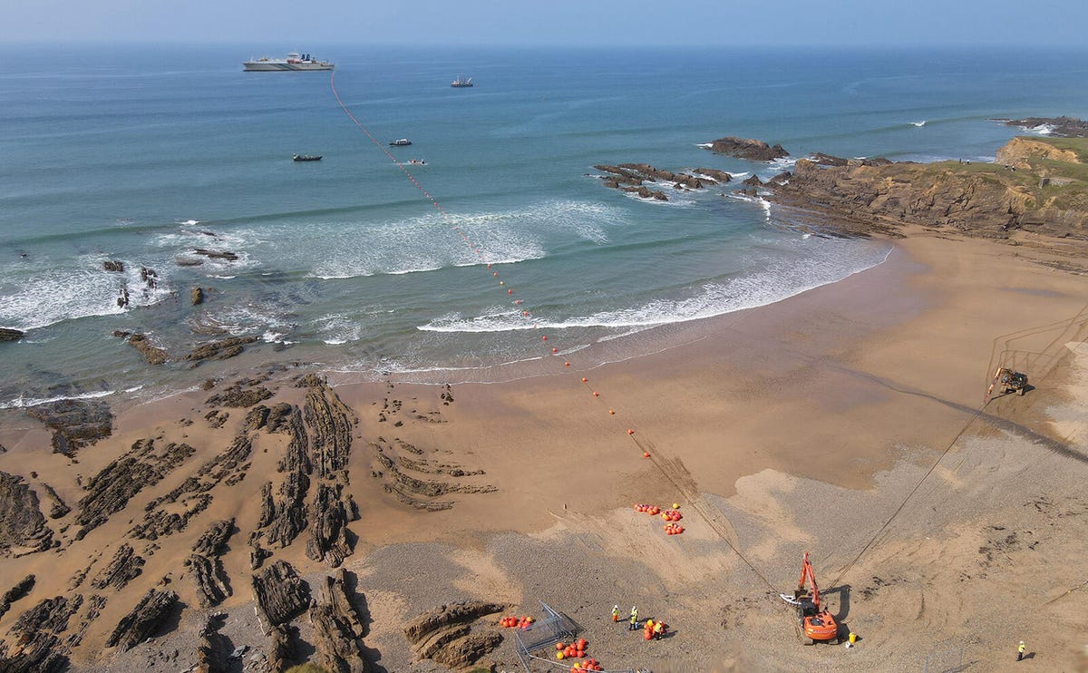
A SubCom cable undergoes installation, between the cable-laying ship in the distance and a landing site on the beach. Later, the orange floats will be removed and the cable buried so it's no longer visible.
SubCom
"Roughly 10 years ago, a lot of the traditional telco providers started to really focus on wireless and what was happening within their last-mile networks," said Frank Ray, who leads hyperscale network connectivity for Microsoft's Azure cloud computing business. The wait for new cables grew longer, with the planning phase alone stretching to three to five years. The hyperscalers needed to take control.
Hyperscalers initially began with investments in others' projects, a natural move given that subsea cables are often operated by consortia of many allies. Increasingly, hyperscalers now build their own.
The result: a massive cable buildout. TeleGeography, which tracks subsea cables closely, projects $10 billion will be spent on new subsea cables from 2023 to 2025 around the world. Google-owned cables already built include Curie, Dunant, Equiano, Firmina and Grace Hopper, and two transpacific cables are coming, too: Topaz this year and, with AT&T and other partners, TPU in 2025.
Such cables don't come cheap: A transatlantic cable costs about $250 million to $300 million to install, Mauldin said.
The cables are critical. If one Azure region fails, data centers in another region come online to ensure customers' data and services keep humming. In the US and Europe, terrestrial cables shoulder most of the load, but in Southeast Asia, subsea cables dominate, Ray said.
With the hyperscalers in charge, pushing data instead of voice calls, subsea networks had to become much more reliable. It might be a minor irritation to get a busy signal or dropped call, but interruptions to computer services are much more disruptive. "If that drops, you lose your mind," Coughlin said. "The networks we make today are dramatically better than what we made 10 years ago."
The number of subsea internet cables has surged. By 2025, a total of 552 should be operational.
Data: TeleGeography; graphic: Viva Tung/CNET
Subsea communications: The origin story
Today's cables send up to 250 terabits per second of data, but their technology dates back to the 1800s when scientists and engineers like Werner Siemens figured out how to lay telegraph cables under rivers, the English Channel and the Mediterranean Sea. Many of the early cables failed, in part because the weight of a cable being laid on the bottom of the ocean would rip the cable in two. The first transatlantic cable project that succeeded operated for only three months in 1858 before failing and could only send just over one word per minute.
But investors eager to cash in on rapid communications underwrote the development of better technology. Higher copper purity improved signal transmission, stronger sheathing reduced cable breaks, repeaters installed periodically along the cable boosted signal strength and polyethylene insulation replaced the earlier rubberlike material harvested from gutta-percha trees.
Telephone calls eventually replaced telegraph messages, pushing technology further. A transatlantic cable installed in 1973 could handle 1,800 simultaneous conversations. In 1988, AT&T installed the first transatlantic cable to use glass fiber optic strands instead of copper wires, an innovation that boosted capacity to 40,000 simultaneous phone calls.
A subsea internet cable from manufacturer SubCom shows, from the center outward, its optical fibers for data transfer, steel cabling for strength, copper for power distribution and plastic for electrical insulation and protection.
Stephen Shankland/CNET
SubCom's subsea cable factory dates back to its rope-making roots in the 1800s. "Most rope in that time was used on ships or needed to be transported by ships," CEO Coughlan said. "A factory on a deep port, with quick access to the ocean and with winding capabilities, is what was needed to transform into the telephone cable business."
How subsea cables work
Fiber optic lines transmit data as pulses of laser light. As with terrestrial fiber optic lines, using multiple frequencies of light -- colors, to you and me -- means more data can be sent at once. Network equipment ashore at either end of a cable encodes data into the light for transmission and decodes it after it's received.
Fiber optics are great for long-haul data transmission, but they have their limits. That's why there's a big bulge in the cable every 30 to 60 miles called a repeater, to boost the signal strength.
Repeaters require power, though, and that's where another part of the cable construction comes into play. Outside the fiber optic strands, a copper layer carries electricity at up to 18,000 volts. That's enough to power repeaters all the way across the Pacific Ocean just from one end of the cable, though power typically is available from both ends for greater reliability.
Why not keep raising the laser power, so you don't need repeaters as often? Because boosting it too high would eventually melt the fibers, said Brian Lavallée, a senior director at networking technology giant Ciena.
His company makes the network equipment at either end of the subsea cables, employing different data encoding methods -- manipulating light waves' frequency, phase and amplitude -- to squeeze as much data as possible onto each fiber.
"We've been able to get very, very close to the Shannon limit, which is the maximum amount of information you can send down a communication medium," Lavallée said.
How subsea cables are installed
Companies installing a cable start by picking a route, surveying the route to dodge marine problems like nature preserves, rough seafloor and other cables. When multiple countries, telecommunications firms and businesses are involved, finding an agreeable route and obtaining permits can be very complex.
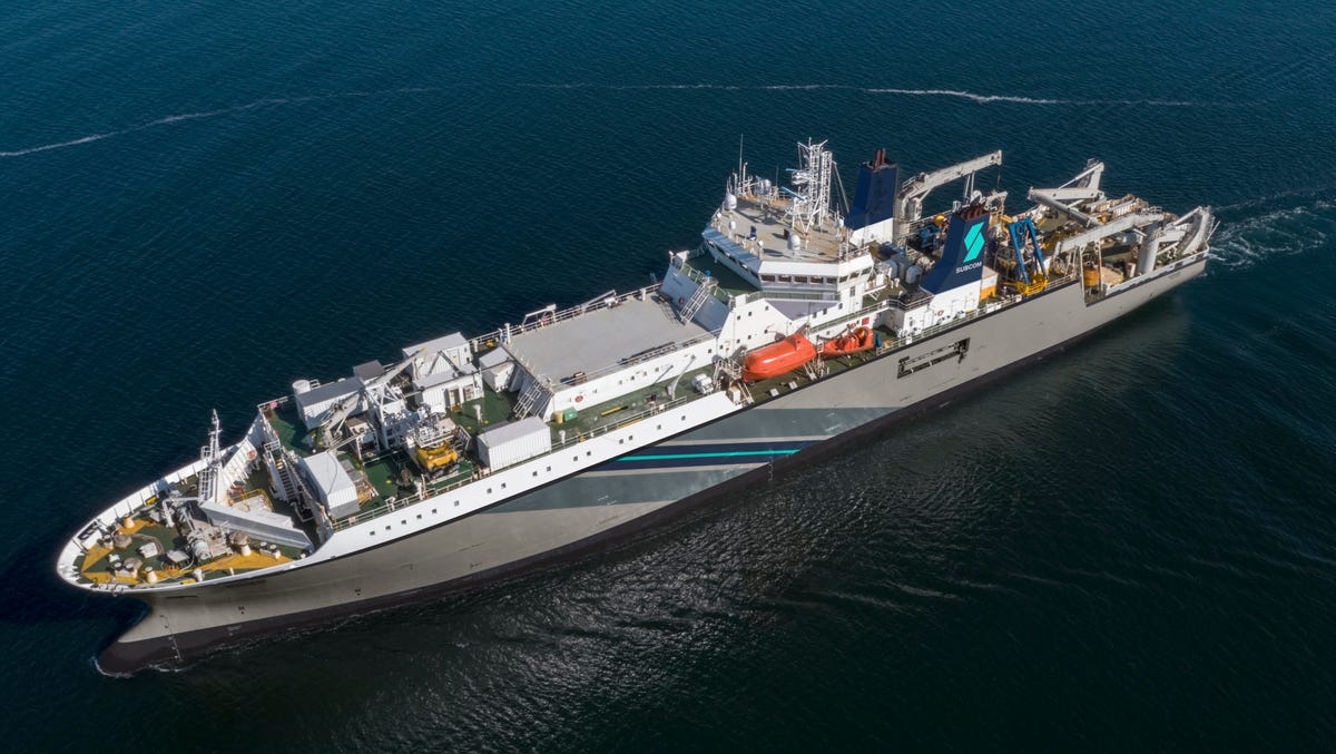
This is SubCom's Responder. Inside the subsea cable-laying ship are three large "tanks" that can hold 5,000-ton coils of cable.SubCom
The cables themselves are gradually paid out from specialized ships. That isn't as simple as unspooling your string when you're flying a kite on a windy day.
Fiber optic strands are narrow, but subsea cables are thicker, heavier and bulkier. They're stored in metal cylinders that wind and unwind the cables as they're moved from shore to ship or from ship to ship. A single ship's three "tanks" can hold 5,000 tons of cable, which works out to about 1,800 miles of lightweight cable and 600 miles of cable that's been armored for busy waters.
SubCom has to figure out the installation order for each cable segment and make sure that when installation begins, the right end of the cable is at the top of the coil. That means before loading onto the ship, while the cable is stored at SubCom's depot, it must be stored "flipped" the other way up. It reverses direction to the correct configuration as it's transferred loop by loop onto the ship, SubCom's Coughlan said.
That's already complicated, but weather, permits or other concerns can force changes to the installation order. That can require flipping a cable at sea with two ships side by side. In a very digital business it turns out to be a very analog problem trying to account for factors like the ships lurching on the open ocean and the cable's weight and bending limits.
"We have one guy in particular that's just a savant at this," Coughlan said. "He has to be able to solve it with his hand with string first, because we found the computer modeling never works."
Near shore, cables are armored with steel cable and buried in the sea floor with a special plow towed behind the ship. The plow pulls up into the water any time the new cable crosses another that's already installed. In the deeper ocean, where fishing equipment and anchors aren't a problem, the cable has less protection and is simply laid on the bottom of the sea floor. Subsea cable cuts and fixes
Subsea cables are pretty tough, but every three days or so, one gets cut, TeleGeography said. The primary culprits, accounting for about 85% of cuts, are fishing equipment and anchors. Ships often will anchor themselves to ride out storms, but the storms push the ships and they drag their anchors.
SubCom engineers, manufactures, and installs subsea fiber optic data cables - the unsung heroes of global communication.
With an unrelenting focus on quality, reliability, and value, SubCom offers flexible end-to-end building blocks for the high-tech networks that are the backbone of the world's digital infrastructure.
Since 1955, SubCom has deployed enough cable to circle the equator more than 21 times.
Most of the other cuts are from the Earth itself, like earthquakes and mudslides. Tonga, whose single subsea cable connection was severed by a volcanic eruption, is another example.
Human-caused climate change, which is creating more extreme storms, worries Microsoft's Ray. "What keeps me awake at night is large-scale climate events," he said. In 2012, Hurricane Sandy cut 11 of the 12 high-capacity cables that connected the US and Europe, he said.
Most cuts occur closer to land, where boat traffic is higher and water is shallower. There, cables are clad in metal armor and buried in the sea floor, but even so, cable cuts are a matter of when, not if. At any given moment, more than 10 cables are typically cut around the world, Google's Quigley said. The worst season for outages is October to December because of a combination of harsher weather and fishing activity.
Cable operators can pinpoint cable cut locations, but repair ships often must await government permits. Repairs average two weeks, Ray said, but three or four is common, according to.marine cable division chief Takahiro Sumimoto of Japanese telecommunications power NTT. After the Fukushima earthquake of 2011, it took two months.
"It was too deep, and the cable was cut into pieces," Sumimoto said.
Subsea cables are high-tech creations, but fixing them employs devices like grapnels invented hundreds of years ago. This holding grapnel is used to retrieve the ends of cut cables resting on the ocean floor.SubCom
The repair requires a ship to fish up one end of the broken cable, often latching on with the same kind of grappling equipment that's been used for centuries. The ship floats that end of the cable with a buoy while the other end is retrieved. The ship splices the optical fibers back together, with splices housed in a thicker package. Making subsea cables faster
With cables so expensive to install, there's a strong incentive to pack in more data. There's plenty of room for more optical fibers, but that approach is limited by the need for electrical power for the repeaters.
Today's new cables use 16 pairs of fibers, but a new cable that NTT is building between the US and Japan employs 20 fiber pairs to reach 350Gbps. Another Japanese tech giant, NEC, is using 24 fiber pairs to reach speeds on its transatlantic cable to 500Tbps, or a half petabit per second.
"Especially after the pandemic, we observed a capacity shortage everywhere. We urgently need to construct new cables," Sumimoto said. "The situation is a bit crazy. If we construct a cable, the capacity is immediately sold out."
Along with the new cable installations, sometimes older cables can be upgraded with new network hardware. A recent Ciena upgrade quadrupled the capacity of fiber optic lines without changing anything underwater, Lavallée said.
"The whole network of undersea cables is the lifeblood of the economy. It's how we're sending emails and phone calls and YouTube videos and financial transactions." Alan Mauldin, TeleGeography analyst
Microsoft also is betting on a fundamental improvement to optical fibers themselves. In December, it acquired a company called Lumenisity developing hollow fibers with a tiny central tube of air. The speed of light in air is 47% faster than in glass, a reduction to the communication delay known as latency that's a key limit to network performance.
Transpacific cables have a latency of about 80 milliseconds. Cutting latency is important for time-sensitive computer interactions like financial transactions. Microsoft also is interested in hollow fibers for shorter-haul fiber optic lines, since lower latency effectively brings data centers closer together for faster fallback if one fails.
Also coming are fibers with multiple data transmission cores inside instead of just one. "We can't get much more improvement in bandwidth over a single fiber," TeleGeography's Mauldin said.
A portion of Google's TPU cable will use two-core fibers, the company confirmed, but that's only a first step. Fiber optic company OFS announced four-core fiber optics this year and sees a path to subsea cable capacity of 5Pbps. That's 20 times more data than today's new cables. Geopolitical complications of subsea cables
There's only one internet, but strains can show when it connects countries that are at odds, for example when the Chinese government blocks Google and Facebook or US companies sever their connections to Russia's internet. These techno-political tensions have spread to the world of subsea cables.
The US effectively blocked three cables that would have directly linked China and the US, causing them to reroute to other Asian nations. And the US has worked to sideline HMN Tech, a Chinese subsea cable installation and maintenance company that grew out of Huawei, according to a report by The Financial Times.
But with many other countries in Southeast Asia, there are many indirect connections, with more to come. "There are 17 new intra-Asian cables that are currently in the works, and many more that haven't been announced yet," TeleGeography analyst Tim Stronge said in a June blog post. And when it comes to internet routing rules that govern the flow of traffic around the world, there are effectively open borders. In other words, the internet itself doesn't care much about where exactly the cables go.
The new geopolitics has complicated business for SubCom, which serves the US military as well as private companies like Google.
"A lot of governments exert their power in ways they had in the past," Coughlan said, and it isn't just the China-US issue. Several countries, including Canada and Indonesia, are enforcing cabotage laws that require work done in their territorial waters to be done by a sovereign ship of that nation.
Cable-laying ships hold hundreds of miles of cable spooled up inside three "tanks." Note the scale showing this tank to be 7 meters (22 feet) deep. This shows a segment of the Merea cable built by Microsoft and Facebook parent Meta.Microsoft
"This is leading to a lot of complications around the duration of permits and how to perform the work," Coughlan said. "Because of these cabotage laws, cables are harder to put in. They take longer. Some of these countries only have one ship, and you have to wait to get it."
But ultimately the economic incentives to build the cable usually prevail.
"Whatever big dustups there are going to be -- trade wars, actual wars -- when it gets to the local level, the local countries want these cables," SubCom's Coughlan said. "That's the only reason this gets built."
Subsea cable vulnerabilities
Cable vulnerabilities are real. Anchors and fishing equipment are the main risks, particularly in crowded corridors where there are multiple cables. The cables are designed to thwart corrosive salt water, not an attacking human.
"It would not take much to break these cables. And a bad actor could do it," Coughlan said. A 2017 think tank paper by Rishi Sunak, who's since become prime minister of the UK, concluded that subsea cables are "indispensible, insecure."
In a 2021 report, the Center for a New American Security, a bipartisan national security think tank, concluded that subsea cables are vulnerable. It simulated Chinese and Russian military actions using adversarial "red teams." In these simulations, Chinese attacks cut off Taiwan, Japan, Guam and Hawaii, but Russian attackers had a harder time thanks to the large number of Atlantic subsea cables.
"In CNAS wargames, Chinese and Russian red teams launched aggressive attacks on undersea cables, specifically where they 'land' ashore. In nearly every case, these attacks allowed red teams to disrupt and degrade US, allied, and partner communications, and contributed to confusion and distraction at the strategic level as governments were forced to respond to sudden losses of connectivity," CNAS senior fellow Chris Dougherty said in the report.
The Marea cable from Microsoft and Meta is high-tech enough to carry 200 terabits of data per second, but employs centuries-old nautical technology too: It's coated in tar.
Microsoft
Sunak recommended a treaty to protect cables, NATO wargames to better understand their importance, and sensors on the cable to better detect threats. The most practical advice, though, was simple: build more cables for geographic diversity and redundancy. Building a more resilient subsea cable network
Given the importance and vulnerability of subsea cables, it's no surprise there's a race afoot to make the technology more robust.
That's why there's a major push to expand to new landing sites. When Hurricane Sandy struck, all the most powerful transatlantic cables landed in New York and New Jersey. Now more leave from Massachusetts, Virginia, South Carolina and Florida.
"If you run all cables on the same path, you're an anchor drag away from multiple cables being brought down," Quigley said.
Often, operators will swap capacity on each others' cables, access that gives each a fallback data pathway if their cable is cut. Effectively, they're not putting all their communication eggs in one cable basket.
Ultimately, the geographic diversity Sunak seeks is becoming a reality, boosted by better branching technology that makes multistop cables economical. The new Sea-Me-We 6 cable stretches from France to Singapore by way of 17 other countries. And new cables are being built to connect Europe, Africa, the Middle East, Asia, the Americas and many island nations.
"They're all over the world," Ciena's Levallée said. "There is truly a mesh of these cables."
As soon as Andrew Christ peered at the sample inside his microscope, he knew he had found something special. Bits of tiny twigs, moss and leaves were mixed with sediments extracted from deep beneath a Cold War military facility on the Greenland ice sheet. It was as if he’d opened a time capsule from the deep past — revealing proof that a tundra ecosystem once flourished where there is now nearly a mile of ice.
But it wasn’t until years later, after Christ and his colleagues figured out the age of those samples, that he fully grasped the importance of the discovery. New analysis suggests that the material comes from a period about 416,000 years ago, when Earth’s temperature wasn’t much higher than it is now. The results mean that Greenland once lost a tremendous amount of ice under climate conditions very much like the ones humans have created and are currently living in. They imply that coastlines could soon be submerged under several feet of sea level rise — unless people manage to stop emitting greenhouse gases and reverse the dangerous warming of the world.
“If the Greenland ice sheet could melt substantially in the past, it is going to change our projections for the future,” said Christ, a postdoctoral researcher at the University of Vermont. “It could have a financial cost as well as a massive humanitarian cost.”
The findings published Thursday in the journal Science add to a growing body of research exposing Greenland’s vulnerability to even moderate amounts of warming. Other studies — including a preliminary analysisof Christ’s Cold War sediments published in 2021 — have showed that the ice sheet nearly vanished at least once in the past million years.
But knowing exactly when parts of Greenland were last uncovered is crucial to understand the fate of the ice sheet today, Christ said.
For the past 2.4 million years, the climate has shifted back and forth between frigid ice ages and warmer phases known as interglacials. Unlike today’s warming, which is caused by the rapid release of planet-warming pollution from burning fossil fuels, those ancient fluctuations in the planet’s temperature were triggered by slight changes in the Earth’s orbit. Depending on the way the planet wobbled as it circled the sun, an interglacial might be hot and brief, or longer and milder.
Sediment melting out of the Greenland ice sheet near 660, Kangerlussuaq, Greenland.
(Paul Bierman, University of Vermont)
The interglacial that occurred between 426,000 and 396,000 years ago, which is known to scientists by the unwieldy name “Marine Isotope Stage 11,” was of the long and mild variety. If plants were growing in northwest Greenland back then — as the new Science study suggests — the same could happen during a future stretch of prolonged warm conditions.
Prolonged warming is exactly what humans are causing now, Christ said. The carbon dioxide released by people driving cars, burning fuel and destroying natural ecosystems will linger in the atmosphere for thousands of years. And without a drastic shift in the way we live, humanity is on track push global average temperatures to 3 degrees Celsius (5.4 degrees Fahrenheit) above preindustrial levels by the end of this century, according to the Intergovernmental Panel on Climate Change. That is well above the highest temperatures reached during Marine Isotope Stage 11.
Study co-author Paul Bierman, a geologist at the University of Vermont, called the implications “frightening.” When the researchers calculated how much the Greenland ice sheet would have to shrink to allow plants to grow in that particular corner of the island, they found it could lead to between 4.5 and 18 feet of sea level rise.
“If you look at where sea level was 400,000 years ago, and where humans are today, a huge number of the Earth’s population lives within that distance of sea level,” Bierman said. “It really implies that we’ve got to turn around this trajectory of pumping carbon into the atmosphere or we’re going to trigger things that are irreversible on a human time scale and grossly damaging to our planet and our people.”
Despite the sediments’ scary message, Bierman says scientists are lucky to have them. It takes so long to drill through ice that very little material has ever been uncovered from beneath the ice sheet. If not for a decades-old military boondoggle, these particular samples wouldn’t exist at all.
More than 60 years ago, amid ratcheting Cold War tensions, the United States began to dig a military base beneath the surface of the Greenland ice sheet. In public, officials claimed “Camp Century” was merely a research facility, and they invited scientists to conduct experiments at the remote location in northwest Greenland. But privately, the U.S. Army was planning “Project Iceworm” — a top-secret initiative to hide dozens of soldiers and potentially hundreds of weapons in a network of tunnels under the ice.
It didn’t take long for the motion of the ice sheet — which is constantly flowing under the pressure of its own weight — to expose the folly of this scheme. Tunnels collapsed, equipment malfunctioned and the encampment was eventually abandoned. Thousands of tons of building materials, unused diesel fuel and radioactive waste were left to languish under the ice.
The project did yield one breakthrough. To lend credibility to the camp’s scientific cover story, experts spent three years drilling a first-of-its-kind ice core at the site. Encompassing nearly a mile of ice and some 10 feet of subglacial sediment, the core helped spark the rise of a whole new field of research on Earth’s climatic past. By studying tiny bubbles of oxygen trapped within layers of ice, scientists were able to create a timeline of the planet’s temperature going back tens of thousands of years.
Fewer people were interested in the dirt at the bottom of the core. Over the decades, as it was shuffled between freezer facilities in the United States and Denmark, scientists largely forgot the sample existed.
This was another stroke of luck, said Tammy Rittenour, a geoscientist at Utah State University and a co-author on the study. She specializes in a kind of analysis that uses light to determine how long a material has been hidden from the sun. When sediments are buried, they are exposed to constant, low-level bombardment of radiation from the surrounding soil. This causes tiny electrons to accumulate within the molecular framework of the minerals, the way dirt might accumulate in the weave of a shirt that was never washed.
Exposing the sediments to light is like dunking the shirt in bleach — the accumulated detritus of centuries is instantly lost.
A resting egg pouch of a water flea in a fossil from Camp Century. Today, water fleas are common in freshwater bodies around the world, including in the Arctic. (Halley Mastro, University of Vermont)
A fossil of an eight-petal mountain avens (Dryas octopetala) leaf from Camp Century. This species is currently a circumpolar species common in Arctic tundra environments. (Halley Mastro, University of Vermont)
But by the time the Camp Century sediments were rediscovered in a freezer at the University of Copenhagen, it was clear no one had touched the sample in decades. Working in darkroom conditions, scientists were able to carefully carve out slices for Rittenour to analyze.
At her lab, Rittenour melted the frozen sediment and sieved it to extract individual grains of the mineral feldspar. Next, she used a beam of light to “stimulate” the electrons that long been trapped inside the minerals. By observing how the material reacted, she could calculate how much radiation it experienced during its burial, which in turn would indicate when the sediments last saw daylight.
Rittenour repeated the experiment roughly 100 times, and each go-round yielded the same estimated age: about 416,000 years, smack in the middle of Marine Isotope Stage 11.
“It’s the history of the Earth,” Rittenour said, “written in a grain of sand.”
Ayden Carpenter and Andrew Christ prepare a sample of Camp Century sub-ice sediment in the National Science Foundation/University of Vermont Community Cosmogenic Facility.
(Josh Brown, University of Vermont)
Juliana Souza dilutes samples of pore water extracted from Camp Century sub-ice sediment samples. (Paul Bierman, University of Vermont)
Nicolás Young, a geologist and Arctic researcher at the Lamont-Doherty Earth Observatory at Columbia University who was not involved in the new study, said the findings offer important insight into the state of the Greenland ice sheet during Marine Isotope Stage 11. But they can’t be completely definitive about where the island was ice-free, he said, because of the way sediments move around.
“They collected them at the Camp Century site, but they likely weren’t always resting at the Camp Century site,” Young said. “That introduces some uncertainty.”
Yet Rittenour said it’s unlikely the sediments were found far from their original source. The fragile fossilized mosses and leaves mixed in with the minerals would have been crushed if they’d been plowed by a glacier or carried by a roaring river for hundreds of miles.
Christ thought back to the people who originally collected the Camp Century core more than half a century ago. They’d journeyed to the high Arctic amid fears of nuclear annihilation — never expecting they would uncover an entirely different existential threat.
To him, the story underscores the power of science.
Amudalat Ajasa and Brady Dennis contributed to this report.
The Earth’s oceans have never been warmer. Every day since late March, the world’s average sea surface temperature has been well above the previous highest mark for that day. And there will be ripple effects: Marine heat waves are affecting about 44 percent of the global ocean, whereas only 10 percent is typical, and they can have “significant impacts on marine life as well as coastal communities and economies,” according to the National Oceanic and Atmospheric Administration.
Baffled scientists are unsure what exactly has caused the rapid spike in ocean temperatures first detected in March. They believe it could be some combination of numerous factors: the massive heat domes that have July on track to be the planet’s hottest month on record and could make this the hottest year on record; reduced air pollution from ships; weaker winds carrying less Saharan dust over the Atlantic Ocean; and the influence of human-caused climate change and El Niño, which itself is an abnormal warming of the waters in the tropical Pacific Ocean that alters weather patterns worldwide.
The exceptionally warm oceans are making heat waves worse, disrupting marine life and destroying coral reefs. They are also intensifying fires and flooding by increasing land temperatures, and could make hurricanes stronger. Here, we take you on a tour of the worst of the ocean’s hot spots.
The North Atlantic has baked in record daily warmth every day since early March. With the average sea surface temperature in this region now approaching 77 degrees Fahrenheit, as hot as it’s ever been and more than 2.5 degrees above average, the North Atlantic has warmed almost beyond the most extreme predictions of climate models.
“Here we do have some evidence that something exceptional is happening to North Atlantic sea surface temperatures,” wrote Zeke Hausfather, a climate scientist at Berkeley Earth and the tech company Stripe.“...
The specific drivers of this anomaly … are still under investigation by scientists so it will be some time before we know for sure what’s driving these regional extremes.”
Scientists were shocked when ocean temperatures around the Florida Keys climbed into the mid-90s in early July. A temperature of 101.1 degrees, more typical of a hot tub than ocean water, was recorded Monday by a buoy in Manatee Bay to the south of Miami. Many buoys in the area were reading at or above 95 degrees earlier this week.
Ocean waters surrounding Florida have steadily warmed as the state experiences its hottest July on record with most of South Florida on pace for its hottest year on record. In Miami, the heat index reached 100 degrees or higher on 46 consecutive days, shattering the previous longest stretch of 32 days.
As that sweltering heat wave continues, the ocean temperatures are soaring, and historically warm waters are damaging coral reefs, with one researcher calling it the “worst bleaching event that Florida has ever seen.” In a visit last week to Sombrero Reef, south of Marathon in the Florida Keys, scientists found “100% coral mortality.” The ocean warmth could also help hurricanes maintain their intensity or rapidly intensify near land.
The Mediterranean Sea warmed to an average sea surface temperature of 28.7 degrees Celsius this week, its warmest sea surface temperature on record, according to Spain’s Institute of Marine Sciences. Some areas have seen the water temperature soar past 30 degrees Celsius (86 degrees Fahrenheit), more than 5 degrees Celsius (9 degrees Fahrenheit) above average.
The waters across the Mediterranean have warmed rapidly since early July amid record heat across much of southern Europe this month. Excessively warm temperatures included a high of 118.4 degrees Fahrenheit (48 degrees Celsius) Monday on the Italian island of Sardinia, the highest July temperature in Europe on record.
The heat is helping to fuel deadly wildfires in Greece and several other southern European and northern African countries. Raging fires forced the evacuation of 19,000 tourists and residents on the Greek island of Rhodes, the country’s largest preventive fire evacuation.
The eastern and central Pacific Ocean near the equator has continued to heat up since NOAA declared the arrival of El Niño in early June. Sea surface temperatures are generally 3 to 4 degrees Celsius (5 to 7 degrees Fahrenheit) above average in the eastern Pacific, with localized areas of more than 5 degrees Celsius (9 degrees Fahrenheit) above average off the coasts of Peru and Ecuador.
The development of El Niño, which is typically associated with warmer global temperatures and bouts of extreme weather, has increased the odds of this year becoming Earth’s warmest on record. El Niño also tends to reduce hurricane activity in the Atlantic Ocean, although the extremely warm ocean waters there could counteract that impact. Forecasters say there is a greater than 90 percent chance that El Niño will continue through the upcoming winter.
Water temperatures well above normal stretch across the northern Pacific Ocean from Asia to North America. Sea surface temperatures are especially warm around Japan, which has seen record heat, record rainfall and deadly flooding this month. Tokyo has reached higher than 95 degrees Fahrenheit nine times in July, a record number for the month, while several cities have set records for hourly and daily rainfall, according to meteorologist Sayaka Mori.
Weather historian Maximiliano Herrera tweeted “hundreds of records have fallen so far in Japan and hundreds more will fall.” He called it“one of the worst heat waves in Japanese history.” Temperatures are “brutally hot” in East Asia, Herrera tweeted, including in Vietnam, Hong Kong and southeast China. The warm waters helped fuel Typhoon Doksuri, which made landfall Friday in southeast China.
Waters aren’t quite as warm off the west coast of Canada. But sea surface temperatures around 2 to 4 degrees Celsius (3 to 7 degrees Fahrenheit) above normal could be contributing to the country’s worst wildfire season ever and to scorching temperatures that reached as high as 100 degrees Fahrenheit in the Northwest Territories.
Russian-born business tycoon Oleg Tinkov was removed from UK’s sanctions list last week, days after an appeal was made by British billionaire Richard Branson. This makes Tinkov the first of the Russia-linked businessmen and oligarchs sanctioned after the Ukraine conflict to be taken off the list. Soon after the announcement was made, the $100 million icebreaker superyacht La Datcha owned by the banker started transmitting its location data. Much like many other superyachts owned by sanctioned Russian oligarchs, La Datcha had gone dark shortly after Tinkov’s name was added to the sanctions list.
Via Instagram / @olegtinkov
Tinkov, the founder of digital bank Tinkoff, was sanctioned by the UK a month after the conflict began in February 2022, claiming the 55-year-old to be “a prominent Russian businessman” who had been involved in an area of strategic significance to the Russian government, per Reuters. Critical of Moscow’s actions on Ukraine, Tinkov renounced his Russian citizenship in October of last year and even asked other prominent Russian businessmen to follow him in his footsteps. As a consequence, he was forced to offload his stake in Tinkoff Bank. Interestingly, Tinkov has not been sanctioned by the US or the EU.
La Datcha with her Triton submarine.Via Charterworld
While under sanction, Tinkov’s UK assets were frozen and he was forbidden from traveling to the UK. To protect his prized possession from being seized by the authorities, the vessel had shut off its AIS transponders from transmitting its live location in the month of May last year. Before going dark, the last location transmitted by the superyacht according to AIS data was Cabo San Lucas, in Baja California Sur, Mexico.
Tinkov with his Dassault Falcon 8X jet.Via Instagram / @olegtinkov
Additionally, Tinkov’s $63 million 2018 Dassault Falcon 8X M-TINK jet also went dark around the same time to avoid being seized. Now that the prominent banker is off the sanctions list, the $100 million superyacht has reemerged on AIS tracking websites and is free to move around.
La Datcha Explorer in Sea of Cortez
According to Marine Traffic, La Datcha recently sailed from Cabo San Lucas to another Mexican port city of Ensenada, where it’s currently located.
Via Instagram / @yachtcharterfleet
La Datcha – a first-of-its-kind expedition yacht
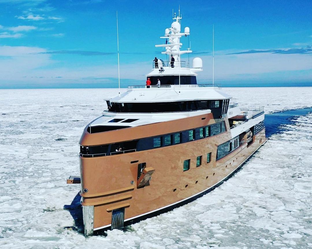
La Datcha is a groundbreaking expedition yacht that was commissioned in 2019 by Oleg Tinkov, who was heavily involved in the design process of the vessel. Built by Damen Yachting, the $100 million superyacht is touted to be the world’s first private icebreaker. It’s the first hull in Damen’s SeaXplorer 77 expedition yacht series and was finally delivered to Tinkov at the end of 2020. Specifically built for exploratory voyages, the superyacht can easily travel to the remotest parts of the planet, including the frigid poles.
The Al Fresco dining area.
Via Charterworld
Measuring 77 meters in length, the Ice Class vessel’s hull features a high tensile belt with increased plate thickness and extra intermediate ice framing, which makes it capable of powering through 16-inch-thick ice. Furthermore, La Datcha can operate in complete autonomy for up to 40 days at sea, making it a true expedition yacht.
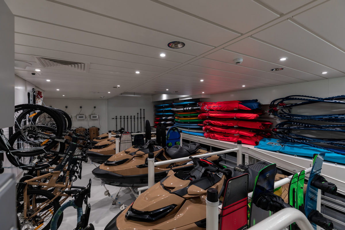
Decked out in bronze and white, the exterior of the vessel was done by Azure Yacht Design and Naval Architecture. On the other hand, Damen’s superyacht arm, Amels, was responsible for coming up with the interior design. The vessel has enough space to provide accommodation for up to 12 guests in six cabins complete with a walk-in dressing room and en suite bathroom. Designed for adventure-filled expeditions, La Datcha has a dive center, ski room with avalanche safety equipment, and two tender garages.
Via Charterworld
In terms of onboard toys, the vessel gets two beach lander tenders, two expedition RIBs, two snow scooters, and a three-person submarine. Additionally, La Datcha also boasts two Airbus H125 helicopters, a fully certified helideck, and an enclosed hangar.
The master cabin.
Via Charterworld
But don’t be fooled into thinking that La Datcha is only a hardcore expedition vessel and not a luxury superyacht. Damen previously described the yacht as “the ultimate crossover of superyacht quality and finish with serious capability.”
It gets all the top-shelf amenities you’ll expect from a luxury superyacht of its size. In addition to an onboard hospital, the vessel gets a Turkish spa and other five-star amenities.
The saloon and games room.
Via Charterworld
One of the highlights is a protected observation deck in the nose of the bow that offers unobstructed views of the surroundings. Before finding his name on the sanctions list, Tinkov planned on using the explorer for 20 weeks a year.
With tender.
Via Charterworld
Time will tell if other oligarchs and businessmen will get off the sanctions list.
A collapse would bring catastrophic climate impacts but scientists disagree over the new analysis
The Gulf Stream system could collapse as soon as 2025, a new study suggests. The shutting down of the vital ocean currents, called the Atlantic Meridional Overturning Circulation (Amoc) by scientists, would bring catastrophic climate impacts.
The new analysis estimates a timescale for the collapse of between 2025 and 2095, with a central estimate of 2050, if global carbon emissions are not reduced. Evidence from past collapses indicates changes of temperature of 10C in a few decades, although these occurred during ice ages.
Other scientists said the assumptions about how a tipping point would play out and uncertainties in the underlying data are too large for a reliable estimate of the timing of the tipping point. But all said the prospect of an Amoc collapse was extremely concerning and should spur rapid cuts in carbon emissions.
Amoc carries warm ocean water northwards towards the pole where it cools and sinks, driving the Atlantic’s currents. But an influx of fresh water from the accelerating melting of Greenland’s ice cap and other sources is increasingly smothering the currents.
A collapse of Amoc would have disastrous consequences around the world, severely disrupting the rains that billions of people depend on for food in India, South America and west Africa. It would increase storms and drop temperatures in Europe, and lead to a rising sea level on the eastern coast of North America. It would also further endanger the Amazon rainforest and Antarctic ice sheets.
“I think we should be very worried,” said Prof Peter Ditlevsen, at the University of Copenhagen in Denmark, and who led the new study. “This would be a very, very large change. The Amoc has not been shut off for 12,000 years.”
The Amoc collapsed and restarted repeatedly in the cycle of ice ages that occurred from 115,000 to 12,000 years ago. It is one of the climate tipping points scientists are most concerned about as global temperatures continue to rise.
The new study, published in the journal Nature Communications, used sea surface temperature data stretching back to 1870 as a proxy for the change in strength of Amoc currents over time.
The researchers then mapped this data on to the path seen in systems that are approaching a particular type of tipping point called a “saddle-node bifurcation”. The data fitted “surprisingly well”, Ditlevsen said. The researchers were then able to extrapolate the data to estimate when the tipping point was likely to occur. Further statistical analysis provided a measure of the uncertainty in the estimate.
The analysis is based on greenhouse gas emissions rising as they have done to date. If emissions do start to fall, as intended by current climate policies, then the world would have more time to try to keep global temperature below the Amoc tipping point.
The most recent assessment by the Intergovernmental Panel on Climate Change concluded that Amoc would not collapse this century. But Ditlevsen said the models used have coarse resolution and are not adept at analysing the non-linear processes involved, which may make them overly conservative.
Prof Niklas Boers, from the Potsdam Institute for Climate Impact Research in Germany, revealed the early warning signs of Amoc collapse in 2021. “The results of the new study sound alarming but if the uncertainties in the heavily oversimplified model [of the tipping point] and in the underlying [sea temperature] data are included, then it becomes clear that these uncertainties are too large to make any reliable estimate of the time of tipping.”
Prof David Thornalley, at University College London, UK, agreed the study had large caveats and unknowns and said further research was essential: “But if the statistics are robust and a relevant way to describe how the actual Amoc behaves, then this is a very concerning result.”
Dr Levke Caesar, at the University of Bremen, Germany, said using sea surface temperatures as proxy data for the strength of the Amoc currents was a key source of uncertainty: “We only have direct observational data of the Amoc since 2004.”
The extrapolation in the new analysis was reasonable, according to Prof Tim Lenton, at the University of Exeter, UK. He said the tipping point could lead to a partial Amoc collapse, for example only in the Labrador Sea, but that this would still cause major impacts. Ditlevsen said he hoped the debate would drive new research: “It’s always fruitful when you do not exactly agree.”
Prof Stefan Rahmstorf, at the University of Potsdam, Germany, said: “There is still large uncertainty where the Amoc tipping point is, but the new study adds to the evidence that it is much closer than we thought. A single study provides limited evidence, but when multiple approaches have led to similar conclusions this must be taken very seriously, especially when we’re talking about a risk that we really want to rule out with 99.9% certainty. Now we can’t even rule out crossing the tipping point in the next decade or two.”

 "British lighthouse chart of general coast lights" (1874, par W.H.F Hardinge)