Saturday, May 13, 2017

NZ tech could reveal planet's largest waves

The RNZN vessel HMNZS Otago sailing through a storm in the Southern Ocean.
20m swells with 80KMph winds.


New Royal New Zealand Navy Offshore Patrol Vessel HMNZS Wellington sailed to Antarctica to undertake sea trials.

From NZ Herald by Jamie Morton

A Kiwi company expects to record some of the largest waves ever known - potentially reaching up to the height of an eight-storey building - after just deploying a wave buoy in the thick of the world's wildest ocean.
In a collaboration with the New Zealand Defence Force, science-based consultancy Metocean Solutions recently moored the high-tech instrument in the Southern Ocean off Campbell Island, nearly halfway between the South Island and Antarctica.
Persistent westerly winds and an unlimited area for waves to build combined to make Southern Ocean waves among the biggest in the world.
But because subantarctic waters were difficult to work in, reliable wave data for the area had been scarce.
Managing director Peter McComb said the moored buoy - the southernmost ever deployed - was designed strong enough to survive a monster wave with a height of 25m.
"And indeed, that's what we are hoping to measure if we get a big storm coming through."

The buoy, fixed in 150m of water, has already registered waves as high as 16m - taller than huge waves that were detected off the Bay of Plenty during Cyclone Cook.
However, this was still well short of the largest on the books: a 19m wave recorded rolling in the North Atlantic Ocean between Iceland and the UK last year.
"Anecdotally, we know that individual waves of 25m height can occur in this area; it might have to be out there many years before it could capture one, but we are hopeful."
By comparison, 25m is the height of 16 cars stacked on top of each other, or an eight-storey building.

The wave buoy is lowered into the Southern Ocean off Navy vessel HMNZS Otago. 
Photo / Supplied

It's also half the draught (vertical distance between waterline and bottom of hull) of an ultra large container vessel, and nearly half the distance between the waterline and the deck of cruise liner Oasis of the Seas.
McComb said these beasts tended to come not as a single wave rolling across the ocean, but one that emerges from a combination of different wave forms amid a heavy storm.
"You'd likely have a big trough occurring at the same time a large crest comes through - and having been at sea in big storms myself, it's a little bit like a big hole suddenly opening up in front of you.

 The buoy sits moored in 150m of water near Auckland Island.

"You don't always get the sense of an exceptionally large crest, but you do get one a large hole forming, and that's just terrifying."
Understanding more about how big waves in the Southern Ocean was crucial to improving the design of vessels that operate in that part of the world.
Ships tended to negotiate heavy seas by sailing head-on into the direction the waves were coming from - but, particularly in the Southern Ocean, this could prove challenging when vessels faced long, large swells from one side and shorter, steeper seas from another.

The buoy has been deployed roughly halfway between New Zealand and Antarctica.


Ships plying the ocean ranged from icebreakers and research boats to fishing vessels and small cruise liners.
"Of particular interest to our company is the next generation of Navy ships; we have a search and rescue responsibility that goes all the way to the ice, so, as a nation, it's on our patch and it's of interest to the Navy to understand that as well."
The buoy's open access data feed further had much wider benefits to the world's ocean science community, providing crucial information to improve forecasting and climate models.
"Currently, the models perform the worst in the Southern Ocean, so it's of fundamental importance to collect the data and then feed that new understanding of the physics back into the science."
It comes alongside separate plans for a multi-million dollar research station on subantarctic Auckland Island, which would allow scientists to study deep-sea currents in latitudes where projected changes in climate are expected to be seen most rapidly.


Rogue waves could help design better electronics, lasers

Meanwhile, Kiwi scientists are attempting to better understand fearsome "rogue" waves with fibre-optic experiments in an Auckland lab.
Appearing from nowhere, or at least amid a series of ordinary waves, these monsters have the mass and power to sink ships.
Rogue waves were once thought to be mythical, but satellite surveys have now confirmed the dreaded reality.
More recently, physicists have been studying their properties by studying waves of light, which similarly conform to physical laws.
"In the ocean, some rogue waves come at twice the height of what's called significant wave height: so, in a system where you normally get one-metre waves, all of a sudden you get a four-metre wave," explained Professor Neil Broderick of the University of Auckland.
"So it just comes from out of the blue and disappears again: and in fibre lasers, and in optics, you can often see the same thing."
In a Marsden Fund-supported study, his team has been investigating the behaviour of light pulses to understand the origins of rogue flashes.
Because pulses of light propagating along a fibre-optic cable are easier to control and quicker to study than waves of water, fibre-based lasers have become a major focus of current research into oceanic waves.
And by better understanding rogue waves, Broderick and his team have also been seeking how to prevent destructive laser bursts that can fry fibre-optic systems, while also feeding the new insights into oceanographic research and ship design.
"We also want to know how they form, because, if we can control them, then we can get a high-intensity pulse that lets us do things we currently can't do with low-intensity pulses.
"So the aim has been to try to make these things on demand, and then see what sort of applications they have."

Links :

Friday, May 12, 2017

Canada CHS update in the GeoGarage platform

54 nautical raster charts updated 

'Discovery' treasure hunter may have found Columbus’s anchor using a map from space


From Newsweek by Abigail Jones

The next sentence you are about to read might sound like a movie idea conjured up from the depths of oddball film star Nicolas Cage’s psyche: Professional treasure hunter, armed with a map from outer space, sets out to unearth hundreds of shipwrecks around the world—and finds a centuries-old artifact that just might be Christopher Columbus’s anchor.
Real life beat you to it, Mr. Cage: This actually happened.
That treasure hunter is Darrell Miklos, and a new Discovery docu-series, Cooper’s Treasure, has been following him as he searches for underwater treasure, guided by the ghost of his dear friend, the late NASA astronaut Gordon “Gordo” Cooper.

This is a picture of one of the maps used during the Discovery Channel exploration. It has been blurred by the network to keep part of the location a secret

Turks and Caicos islands in the GeoGarage platform

The maps (two of which are pictured) were kept a secret for almost 40 years before Gordon decided to share them with Miklos

In the 1960s, Cooper was one of NASA’s original space pioneers—the youngest of the “Original Seven” astronauts, the first to sleep in space, and the last American to make a solo trip to space.
On one of his missions, Cooper was using long-range detection equipment to search for nuclear sites when he claimed he noticed a series of anomalies—dark patches that showed up on photos he took of Earth.
He believed they were shipwrecks.
He spent decades tracking the coordinates on his space map against known shipwreck sites.
Cooper died in 2004, but not before bestowing hundreds of documents upon his longtime friend, Miklos, who set off with Discovery cameras in tow to find out if that map from space would lead to buried treasure.
It did.

Two days ago, Discovery leaked a 30-second clip of an upcoming episode with an extraordinary reveal: Miklos and his crew believe they may have found an anchor that belonged to one of Columbus’s ships that sailed between Spain and the New World.
“As soon as I saw it, I knew what it was: an early 1500s anchor. I knew in my mind that we were onto something so historically significant, just by the first line of site,” Miklos tells Newsweek in his first interview about the discovery.
“A lot of four-letter words came out of my mouth. I was shaking… And the beauty of [the anchor] laying there. It looked so elegant and ladylike to me. It seemed so fragile. There was something tender about that anchor.”

It sounds crazy... But this is a treasure map from space | Cooper's treasure

Miklos and his crew were searching off the coast of Turks and Caicos when they discovered the 1,200- to 1,500-pound bower anchor resting at the bottom of the Atlantic Ocean.
They quickly set out to verify their discovery. Miklos says the size of the anchor and details about its shape and design line up with other ships from the Columbus era.
“If you think of the early Colonial period, there was only one group of people out there: Columbus, the Pinzon brothers, and the Columbus fleet,” he says.
Miklos also thinks the anchor met a violent end—the crown was bent and the anchor ring was broken, suggesting it was detached from its ship during a storm.
(He tells the story of a ship that Martin Alonso Pinzon, one of the Pinzon brothers who voyaged with Columbus, supposedly tried salvaging along that very route in the early 1500s.)
“The importance of the anchor…is its age and nationality,” says Jim Sinclair, a consulting archaeologist on the show.
“The anchor has all of the attributes or characteristics that early period Spanish ships of exploration carried. While it is impossible to say this is from any particular ship, it remains a tantalizing clue and a possible link to Columbus and the Pinzon brothers.”

The anchor discovered off the Turks and Caicos Islands
("Cooper's Treasure"/Discovery Communications)

Now, Miklos is focused on proving the provenance of his anchor.
“They didn’t build these things with stamps on them that say, ‘Built by Columbus,’” he says.
“We’re still assessing the area to see if we can find other wreckage, and the more you find from that period, the more substantial evidence you have. But everything we’ve seen thus far, I truly believe the anchor comes from one of the ships in Columbus’s fleet.”
He’s already found pottery shards believed to be an olive jar painted with indigo paint and a Majorcan pot, both of Spanish origin, that can be used to date the wreck to the Columbus era.
Several iron and bronze spikes found nearby also help date the materials to Columbus-era ships. This summer, Miklos heads back to Turks and Caicos to see what else he can find in that vast underwater cemetery.
“If we continue our search along that trail, I believe we stand a very good chance of finding shipwreck material related to that anchor,” he says.
“That’s what we’re hoping for: something momentous. That’s the point of finding anchors, they’re like underwater arrows, pointing in the direction of that lost ship.”


Miklos's father, Roger, also is a treasure hunter, and in the early 1980s he claimed he’d found the Pinta, one of the three ships in Columbus’s first voyage.
But the discovery, near the Bahamas, was controversial.
Even his own son now doubts it.
“ I do believe that the wreckage and material he found probably comes from that same era. I won’t say it is the Pinta—I don't believe that it is,” Darrell says.
“I don’t want to follow my dad’s footsteps. I want to make a substantive discovery done in my own way—a proper way, utilizing scientific methodologies everyone can respect. This is not ‘Miklos the Sequel.’ This is ‘Cooper’s Treasure.’ It’s me on a quest to find what it is Gordon sent me out there for.”


Miklos was a boy when he started hanging out with Cooper, and over time they developed a close friendship (and mentorship), despite their 36-year age difference.
“I remember the way he talked: his pregnant pauses, his mild manner. You’d think someone so mild-mannered wouldn’t be a superhero, but he truly is a superhero. He’s an incredible human being, and I miss talking with him probably more than anybody can imagine. I met his daughter recently. Oh, it was emotional for me. She looks so much like her dad… She said, ‘I know why my dad picked you. You’re the right one for the job.’”
Miklos says it would take him 1,000 years to investigate all 60 anomalies on Cooper’s treasure map if he only had one crew.
If he had 50 boats, he’d need 50 years.
“I hear Gordon all the time in the back of my head: ‘You’re on the right trail!’”

Links :

Thursday, May 11, 2017

How maps became deadly innovations in WWI

This 1918 map depicts the deadly toll taken by German U-boats during the war.
Each red dot represents a sunken ship (see below for a close-up of the British coast).
Maps Courtesy Library of Congress

From National Geographic by Greg Miller

Advances in weaponry and cartography had deadly repercussions in World War I, which the United States entered 100 years ago today.

By the time the United States entered World War I, 100 years ago today, the conflict had been raging in Europe for nearly three years.
It was to become one of the deadliest wars in human history, claiming more than 15 million lives.

Advances in military technology—including more lethal artillery and rapid-fire machine guns— contributed to the heavy toll.
Maps, too, played a role.
Recent cartographic innovations allowed artillery gunners to fire at targets they couldn’t directly see and aim their guns without first firing “ranging shots” that would ruin the element of surprise. Airplanes—another relatively recent invention—allowed both sides to update their maps daily with the positions of enemy troops.

This map tracks the S.M.S. Emden, an infamous German raider (see main text) that attacked Allied commercial ships in the Indian Ocean—a reminder that WWI was a truly global conflict.
Maps Courtesy Library of Congress

The maps illustrate these deadly innovations and other defining features of the war, including the complex networks of trenches dug by both sides and the devastating German U-boat attacks on Allied commercial ships—a major factor in drawing the U.S. into the conflict.
Many of the maps, which come from the Library of Congress, were featured in a recent paper and two blog posts by Ryan Moore, a cartographic specialist at the library with an interest in military history.

This secret map made by the British Navy shows the position of German mines and progress on clearing them in August 1918.Maps Courtesy Library of Congress

Throughout most of human history, people could only take aim at an enemy they could see.
By WWI that had changed, thanks to powerful artillery that could fire well beyond the line of sight. But this created a new challenge: how to aim at a target that’s not directly visible.

One approach was to use spotters, who’d take up a vantage point on a hill or other elevated area and send messages back to the gunners about where their shots were landing.
Radios had been invented by that point, but they were still too bulky to be widely used in the field. Instead, both sides used cable telephone lines—and human runners when the lines got cut by enemy fire.
“Someone would actually be running back and forth through the shell fire to communicate the messages,” Moore says.
The gridded map below, which shows the effective range of different types of artillery pieces, is an example of the type used by spotters and gunners to coordinate artillery fire.
It’s no work of art, but it represents a remarkable step in the evolution of warfare.

Aerial Photographic Analysis by Doughboy Cartographer Willard B. Prince
Map Courtesy Library of Congress


Aerial photography turned out to be another deadly innovation. Flying was still new and dangerous back then, but photos shot from above vastly improved tactical maps, Moore says.
“These guys would risk their lives in these ‘flying coffins,’ as they were called, flying at 12,000 feet above the enemy with a guy leaning out the back with a camera.”
That altitude was considered safe from anti-aircraft fire, but photographing crucial details sometimes required flying lower.
“They would be taking photos on a daily basis, and a whole crew of analysts would pore over the photos looking for the smallest changes in the landscape,” Moore says.
To speed the process along, pilots would fly over the mapmakers’ position and drop the latest film from the plane in a cannister, along with notes on the crew’s observations.
The mapmakers would develop the film in the field and update the maps with new targets.

In the meantime, of course, the enemy would be on the move again.
Both sides dug elaborate networks of trenches to protect their men and enable them to hold a line.
At the highest levels of command, the positions of friendly and enemy troops alike would be depicted (see above).
But maps given to junior officers showed only enemy troop locations, Moore says.
A junior officer would already know the position of his own troops, so there was no need to put that on a map that could be captured by the enemy.

The “exclusion zone” enforced by German U-boats off the coast of North America (shown on the map, top left, in this German illustration) was a major factor in drawing the U.S. into WWI.
Maps Courtesy Library of Congress

Another new technology put to deadly use in WWI was the submarine.
Although military subs date back to the American Revolutionary War, the Germans’ widespread use of U-boats to attack civilian and commercial vessels was unprecedented.
Several maps in the gallery depict the war at sea, including British intelligence maps of efforts to track a notorious German raiding vessel and keep their own harbors free of German mines.

Most of these maps were never seen by civilians.
But after the war ended, people around the world were fascinated by maps of the treaty negotiations.
Redrawing the borders of Europe was a contentious and political process—and the end result helped set the stage for World War II—but maps published around this time were wildly popular, Moore says.
“All sections of society were interested in these changes,” he says.
“What’s the world going to look like now?”

Links :

Wednesday, May 10, 2017

As Arctic ice vanishes, new shipping routes open


From NYTimes by

As global warming melts sea ice across the Arctic, shipping routes once thought impossible — including directly over the North Pole — may open up by midcentury.
But high costs may keep the new routes from being used right away.

On March 7, 2017, Arctic sea ice reached its annual wintertime maximum extent, according to scientists at the NASA-supported National Snow and Ice Data Center (NSIDC) and NASA.
The Arctic sea ice extent set a record low after a warm winter.
Combining the Arctic and Antarctic numbers shows that the planet’s global sea ice levels on Feb. 13 were at their lowest point since satellites began to continuously measure sea ice in 1979.

The amount of sea ice covering the Arctic Ocean has declined sharply each decade since the 1980s, according to measurements taken each September when the ice is at its minimum.
Older, thicker ice is disappearing as well.
Scientists say global warming is largely responsible for the changes.
Parts of the Arctic are warming twice as fast as elsewhere.


The changing conditions offer an opening to shipping companies.
The Arctic is potentially a faster, more direct route between Asia and ports in Europe and eastern North America.
Currently there is relatively little cargo shipped through the region.
Although shipping will increase over the next decade, especially as Russia develops oil and gas fields in Siberia, total Arctic cargo tonnage is expected to remain only a small fraction of the amount carried along southern routes through the Suez and Panama canals.
But with “middle of the road” warming — higher than the 2015 Paris accord target but lower than the most extreme climate change forecasts — more Arctic shipping routes could open, both for ordinary ships and those that are built to move through thicker ice.

Optimal September navigation for hypothetical projected trans-arctic shipping routes seeking to cross the Arctic Ocean between the North Atlantic (Rotterdam, The Netherlands and St. John's, Newfoundland) and the Pacific (Bering Strait) during consecutive years 2006--2015 and 2040--2059 as facilitated by ensemble-average GCM projections of sea ice concentration and thickness assuming RCPs 4.5 (medium-low radiative forcing) and 8.5 (high radiative forcing) climate change scenarios. Red lines indicate fastest available trans-Arctic routes for PC6 ships; blue lines indicate fastest available transits for common OW ships.
Backdrops indicate period-average sea ice concentrations in 2006--2015 and 2040--2059.
Data-source: Smith, L.C. and Stephenson, S.R. (2013). New Trans-Arctic shipping routes navigable by midcentury.

Even direct over-the-pole routes would potentially be navigable, at least during some part of the summer-fall shipping season.
“We know what is likely to happen to sea ice,” said Nathanael Melia, one of the researchers at the University of Reading in Britain who calculated how the routes might change as warming continues to the middle of the century.
“It will reduce decade on decade, and open up vast swaths of the Arctic Ocean.”
As Arctic routes become more direct, voyage times could fall to less than three weeks in some cases, making Arctic shipping potentially more attractive than the southern routes in coming decades, Dr. Melia’s research shows.


Just because shippers could make greater use of Arctic routes does not necessarily mean they will.
Ice conditions will still vary greatly from year to year, which would discourage shipping companies for which precise timing of shipments is crucial.
Other costs including higher insurance rates, as well as safety considerations, may deter other efforts. A report last year by Copenhagen Business School concluded that trans-Arctic shipping by ordinary vessels between Europe and Asia was unlikely to become economically viable before 2040.

Links :


Tuesday, May 9, 2017

France SHOM layer update in the GeoGarage platform

137 international SHOM nautical charts added
see GeoGarage news

 new charts coverage

Caraïbes 

 Mediterranean Sea

 Polynesia

 Africa

Cybercrime on the high seas: the new threat facing billionaire superyacht owners

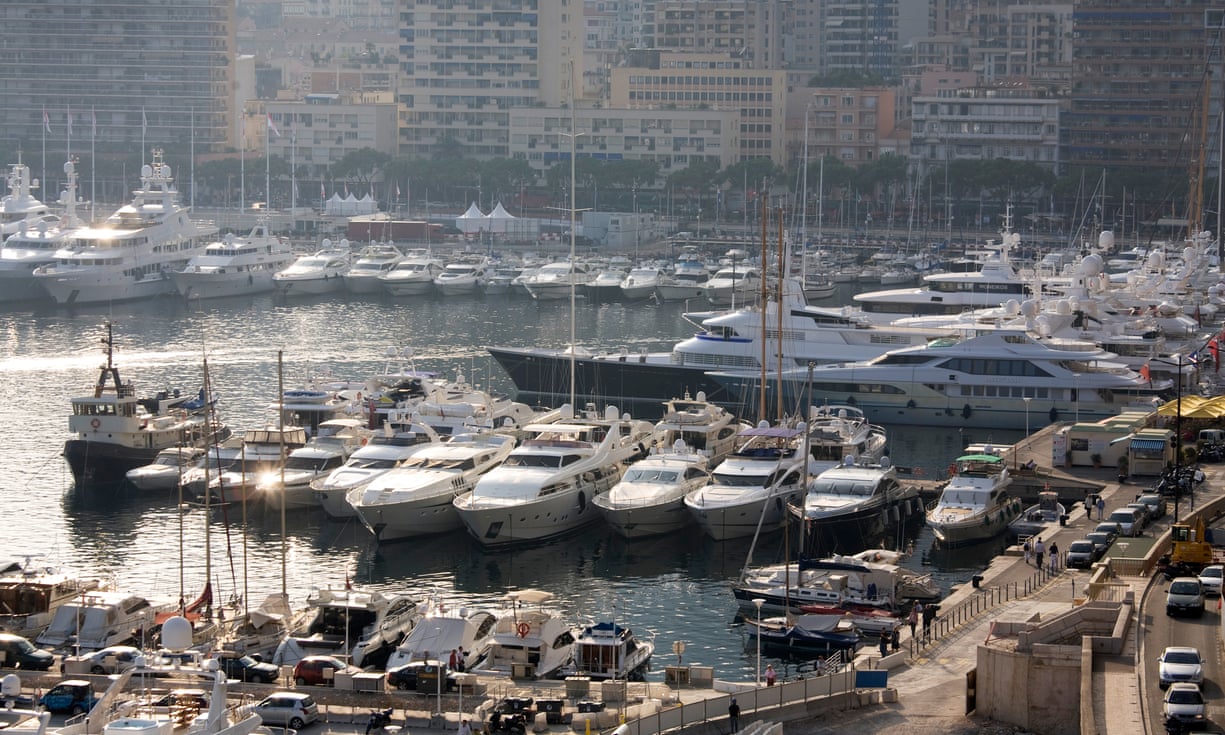
Yachts moored in Monaco harbour.
The superyacht industry is enjoying its best sales figures since the 2008 financial crash.
Photograph: David Levene for the Guardian
 
From The Guardian by Rupert Neate

Buyers at London superyacht conference shown the ease with which hackers can take control of vessels – and even procure private photos

Within a few hours of mooring up and opening his laptop, Campbell Murray had taken complete control of a nearby multimillion-dollar superyacht.
He could easily have sailed it – and its super rich owner – off into the sunset.
“We had control of the satellite communications,” said Murray, an IT specialist.
“We had control of the telephone system, the Wi-Fi, the navigation … And we could wipe the data to erase any evidence of what we had done.”

The ease with which ocean-going oligarchs or other billionaires can be hijacked on the high seas was revealed at a superyacht conference held in a private members club in central London this week.
Murray, a cybercrime expert at BlackBerry, was demonstrating how criminal gangs could exploit lax data security on superyachts to steal their owners’ financial information, private photos – and even force the yacht off course.

The seaborne cybercrime threat is real: one billionaire had more than £100,000 stolen when criminals hacked his bank account.
Others have been blackmailed with compromising photos, and some have already been forced to pay a ransom to unlock their vessel’s navigation systems.

The cybercrime session was one of the most popular at the Superyacht Investor London conference, where the industry was celebrating the best annual sales since the 2008 financial crisis.

Over lunch of smoked salmon and roast chicken, superyacht builders and financiers discussed the best ways to win over new customers in growing but underexploited markets such as China and the Middle East.
The key to both of these markets was said to be two galleys, so that one could be dedicated to their home cuisine and the other for preparing western meals.


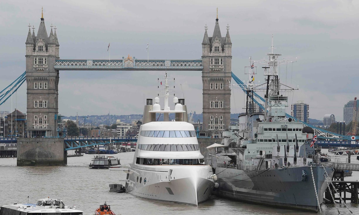
The superyacht A, owned by the Russian tycoon Andrey Melnichenko,
moored beside HMS Belfast in London
 Photograph: Toby Melville/Reuters

Other James Bond-style accessories were showcased, such as exploration submarines and snow rooms designed to mimic winter conditions in case it gets too hot up on deck.
Some clients have also demanded dealing rooms with Bloomberg terminals, or operating theatres, so that ultra-rich owners could receive immediate treatment in case of injury or illness onboard.
Oliver Blanchet, head of yacht financing for the French bank BNP Paribas, said his bank had calculated that there were more than 100,000 people in the world who could afford a superyacht, but only 5-7% of them had bought one – so there was plenty to play for.

By comparison, the private jet industry, he said, has had much more success selling jets as a business tool: at least 20% of people who had the money had purchased one.
He told his colleagues that the industry needed to do more to promote yachts as a way for the rich to save time.
“Time is a new currency,” he said.
“A yacht is an amazing tool for saving time and a platform for new experiences.”

In a live demo, a detector deploys direction-of-arrival sensing to alert users on board a superyacht to GPS spoofing

Robb Maass, a US lawyer who arranges superyacht sales and dubbed “the godfather of yachting law”, said US sales were booming after the election of Donald Trump boosted the confidence of billionaires.
“Superyachts are all about confidence, not about money,” he said.
“The money has always been there, but following the election there has been a significant impact in people feeling more confident to be boastful and brash.”
Maass said Trump’s planned tax reforms would likely give the rich an income boost and had encouraged them to spend, particularly as Trump is expected to introduce a tax holiday to encourage multinationals to repatriate some of the billions held offshore.
“We have seen more and more young buyers coming from the tech sector and buying a very large yacht,” he said.

To see for himself just how vulnerable superyachts are to attack, Campbell and a colleague hacked one themselves.
He said that within 30 minutes they had taken control of the ship’s Wi-Fi and could read, delete and even edit emails.
“Imagine you’ve got a high-value guest on one of your ships and they want to send a press release, if I can capture it and change it I can cause a lot of reputational damage,” he said.

Yachts are vulnerable due to less-secured Wi-Fi networks, which Murray said could be hacked into from some distance.
“Owners like to have strong Wi-Fi so they can operate their businesses from the vessel,” said Murray.
“But this means that the network extends quite far from the actual ship to other vessels and the shore. If you moor up in Monaco, who are you moored up next to?”

As well as stealing financial data and potentially compromising photos, Murray said he also had control of the ship’s CCTV so he could have helped assist a physical attack or kidnap.
“We could let people onto the boat, and then wipe [the CCTV] so no one would know.”

Security experts said physical attacks on superyachts were very rare but data hacks leading to blackmail and ransom demands had become more common in the past 18 months.
“People on yachts are what cybercriminals call high-value targets,” said Malcolm Taylor, a former GCHQ officer who now heads up cybersecurity for the private security firm G3.
“They are wealthy, and money is what people want to steal or extort.”

Taylor said superyachts used to be seen as floating luxury hotels, “now they are more often used as floating offices and require a lot of technology. But the security has not kept up and is vulnerable to attack”.
“The biggest problems are extortion,” said Ben Lind, a superyacht insurance underwriter at AIG. “People will hold photos of owners and guest to ransom. Our client base is wealthy and high-profile: they are targets.”

Hacking might not even be necessary, Lind said, if the yacht crew post photos on social media. “Anyone on the internet can find the address of anyone streaming on Facebook Live, so if you do have crew members onboard who are streaming live on the ship’s Wi-Fi, that ship’s internet presence is immediately available to anyone watching that video if they know where to look.”

Once the location of the ship is known, long-lens photographers can be dispatched to try and take compromising photos of the rich and their often well-known guests.
To combat the threat, many superyacht owners have banned their crew from using Facebook or Instagram.

“Confidentiality clauses have been in crew contracts for a long time; [they have] got to remember who they are looking after,” William MacLachlan, a senior associate at law firm Holman Fenwick Willan, said.
“[The owners] will be high net worth individuals and they could be very much in the public domain and very sensitive, they don’t need the crew facilitating the release of photos whether accidentally or otherwise.
“We recognise that 99% of the time it’s not deliberate it’s not malicious – use of social media without thinking is just part of youth.”

Links:

Sunday, May 7, 2017

The infinite now

Over the past months I've been working with Australian photographer Ray Collins to bring his amazing oceanscapes to life in the form of cinemagraphs, a blend between photography and video. Each cinemagraph is created from one of Ray's stills, and sets it in infinite motion, making a unique moment in time last forever.
These cinemagraphs inspired André Heuvelman from the Rotterdam Philharmonic Orchestra to get together with pianist Jeroen van Vliet to record a very moving custom soundtrack, which I combined with a selection of the cinemagraphs.
You can see the original cinemagraphs at armanddijcks.com/cinemagraphs-waves


Links :