Saturday, October 18, 2014

'In the heart of the sea' trailer pits Thor against Moby Dick

For there is no folly of the beast of the earth which is not infinitely outdone by the madness of men.
~ Herman Melville, Moby Dick

From HuffingtonPost

If you ever wondered how Herman Melville's "Moby Dick" came to be, Ron Howard has made your perfect movie.
"In The Heart Of The Sea," based on Nathaniel Philbrick's book about traveling to the Essex, tells the the story of the real-life maritime disaster that inspired "Moby Dick."
Howard follows the crew in 1820 as they sail from Nantucket to the South Pacific and encounter the infamous 80-foot sperm whale.
Per Warner Bros., "The ship’s surviving crew is pushed to their limits and forced to do the unthinkable to stay alive.
Braving storms, starvation, panic and despair, the men will call into question their deepest beliefs, from the value of their lives to the morality of their trade, as their captain searches for direction on the open sea and his first mate still seeks to bring the great whale down."

Almost 60 years ago, the most famous adaptation was the John Huston 1956 film with Gregory Peck as Captain Ahab :


Friday, October 17, 2014

Swimming through garbage

The author swimming over the Aqaba Marine Protected Area in the Red Sea. 
photo : Kelvin Trautman 

From NY Times by Lewis Pugh

You get a good feel for the health of the oceans when you stick your head in them for four weeks. This summer, I swam long distances in the Seven Seas: the Mediterranean, Adriatic, Aegean, Black, Red, Arabian and North Seas.
The longest swim was 37 miles and took me two days.
The swims were intended to draw attention to the health of the oceans.
But I seriously underestimated the urgency of the issue I was swimming for.
As the United Nations Patron of the Oceans, I have given many speeches stressing the need to protect our environment for the sake of our children and grandchildren.
I now realize it’s not about our children.
It’s about us.
And the situation is much worse than I thought.
I was shocked by what I saw in the seas, and by what I didn’t see.
I saw no sharks, no whales, no dolphins.
I saw no fish longer than 11 inches.
The larger ones had all been fished out.
When I swam in the Aegean, the sea floor was covered with litter; I saw tires and plastic bags, bottles, cans, shoes and clothing.

 And a little more than a mile away, outside of the marine protected area. 
Credit Kelvin Trautman 

The Black Sea was full of Mnemiopsis, a rapidly reproducing species of jellyfish.
This species is not native; it was brought in with the ballast on visiting ships, and has wrought havoc on the ecosystem.
As I was about to jump into the Red Sea, I asked the boat’s skipper whether I should keep a lookout for sharks. He told me not to worry — they’re long gone.
Well, that’s exactly what does worry me.
An estimated 100 million sharks are fished out of the world’s oceans every year.
That’s like removing the lions from the Serengeti.
It wouldn’t be long before the gazelles, zebras and wildebeests had multiplied and eaten all the grass.
And when the land was laid bare the grazers would starve.
Predators are crucial for a healthy ecosystem, be it on land or in the water.

 Lewis Pugh - Ordinary Won't Change the World
He was the first person to complete a long distance swim in every ocean of the world.
He was the first to undertake a swim across the icy waters of the North Pole and the first to swim across a glacial lake on Mt Everest.
In a career spanning 27 years the maritime lawyer has pioneered more swims around famous landmarks than any other swimmer in history.
I’m 44 years old.
I like to think I’m only halfway through my life.
That’s hardly a comforting thought, though, when I imagine the changes in the oceans in the first half of my life continuing into the second.
World population is expected to grow from seven billion to nine billion.
As developing countries become developed, they will demand more resources like fuel, fresh water and food.
Much of that food is expected to come from our oceans.
And they simply don’t have the capacity to provide it anymore.

A priest who traveled to the New World with Christopher Columbus described in his diaries the turtles they encountered.
“The sea was all thick with them,” he wrote, “so numerous that it seemed the ships would run aground on them.”
We have forgotten what our seas used to look like.
Many species are now on the brink of extinction, from the Mediterranean monk seal to the hawksbill turtle in the Arabian Sea.

 Lewis Pugh talks about the methods he uses to undertake swims, which were deemed “impossible” – choosing the right team, meticulous preparation, the right mind-set, never quitting, and changing when circumstances dictate.
Most of all, he talks about having a driving purpose, which for him is to protect our oceans.

In 2005, I swam in the Southern Ocean, just off Antarctica. It was cold — very cold — when I swam over a graveyard of whale bones near an old whaling factory.
As far as I could see, there were bleached white bones piled up on the seafloor.
Man hunted whales almost to the point of extinction, not seeming to care that we could lose one of the wonders of the sea forever.
It is the coldness of the water that preserves the bones and makes it look as if they were left there yesterday, but I like to think they are there as a reminder of man’s potential for folly.

Fortunately, in 1986 most countries ceased commercial whaling, and some whale populations have made a spectacular recovery.
Whales like the Southern right were brought back from the brink of extinction.
Their numbers are now increasing 7 percent year after year. If we can do it with one species, surely we can do it for entire ecosystems.
We just need to give them the space to recover.
Marine protected areas, which are like national parks for the seas, are the best way to make that happen. 
In the Red Sea, I saw no coral and no fish.
It looked like an underwater desert.
But then, a little more than a mile later, I swam into a protected area, where fishing had been restricted.
It was a sea as it was meant to be: rich and colorful and teeming with abundant life.

We need far more of these protected areas.
They allow the habitat to recover from overfishing and pollution, which helps fish stocks recover.
When we create them, we protect the coral, which protects the shoreline and provides shelter for fish.
They become places people want to visit for ecotourism.
They are good for the world economy, for the health of the oceans, for every person living on this planet.
This year in the Aegean I swam over tires and trash.
In a few years, I hope to return, and swim over thriving coral reefs.

Links :
 

Thursday, October 16, 2014

Lost Louisiana: the race to reclaim vanished land back from the sea


From The Guardian by Suzanne Goldenberg

World’s fastest submerging state is looking to nature in an ambitious plan to turn back the tide, and to BP to fund it – but will it work?

The GPS showed David Morgan still on dry land – but the waves bumping beneath his boat revealed the reality of this lost Louisiana landscape.
Rising seas have obliterated 30 points on the map in the last three years at Plaquemines Parish where Morgan lives.

Sugarcane fields, citrus groves, backwoods – all gone.
“This was all land here when I was a kid. There was no water anywhere,” said Morgan, 57, slowing the boat to pass oyster beds. “I used to hunt rabbits there with my dog,” he said.

 Brown pelicans in the fast submerging mangroves on Cat Island, a former nesting ground which has mostly eroded into the Barataria Bay in Plaquemines Parish, Louisiana.
Photograph: Julie Dermansky/Corbis

Louisiana is losing land to the sea faster than anywhere else in the world.
But the authorities say they have a plan to turn back the seas – and get BP to pay a substantial share of the $50bn (£31bn) cost out of criminal penalties from the blowout of its well in the Gulf of Mexico.
The plan includes proposals for more than 100 engineering projects along the coastline, diverting the Mississippi, dumping fresh sand on barrier islands, and re-planting degraded wetlands to reinforce the coast.
The state’s computer forecast shows that, if all the projects come in on time, by 2060 Louisiana could start regaining land.
The big question is: will it work?

Dead mangrove at Cat Island and Bay Jimmy in Plaquemines Parish 
Photograph: Gerald Herbert/AP

Officials say the ambitious plan is the best hope yet for saving the coast. Louisiana has lost nearly 1,900 square miles of land over the past 80 years – a disappearing act that claims on average a football field an hour.
In Plaquemines Parish, the remaining land looks moth-eaten, chewed up by oil industry canals and the incoming waters of the Gulf of Mexico.
Left unchecked, the state is projected to lose an additional 1,750 sq m in the next 50 years.
The land began vanishing from southern Louisiana about 80 years ago when the authorities began penning in the Mississippi after catastrophic floods.
The system of levees cut off the river from the delta, choking off the sediment needed to shore up the coast.
A decade later, oil drilling took off in coastal areas of Louisiana. Industry canals tore up the coastal wetlands.
Rising seas under climate change accelerated the land loss, exposing New Orleans and the valuable oil, shipping and seafood industries on the coast to hurricanes and storm surge.

Sea level rise is now the leading cause of land loss, said Virginia Burkett, chief scientist for climate and land use change at the US Geological Survey, leading a recent tour of the restoration projects organised by the Society of Environmental Journalists.
“If sea level rise doubles as we expect over the next century, can you imagine what is going to happen to this landscape?” she asked.
“Without the barrier islands and marshes to attenuate the storm surge, the people of New Orleans are basically surrounded by an earthen levee.”
Even the state’s Republican governor, Bobby Jindal, who publicly downplays the dangers of climate change, has committed to the plan to hold back the seas.
Local politicians have also signed on.
“This is how we are going to save Louisiana. It is doable,” said Billy Nungesser, president of Plaquemines Parish.
“I think we can realistically put back what we had 25 or 30 years ago.”
However, the engineering projects are prohibitively expensive.
Congress has refused to fund the $50bn and private estimates for the engineering works range up to $94bn – which is where BP comes in.

The Louisiana authorities are banking heavily on BP paying a large share of the costs.
Under a law passed by Congress, 80% of the penalties obtained from BP following the 2010 blowout of its oil well in the Gulf of Mexico are designated for coastal restoration.
The oil company has already made a downpayment of about $1bn for coastal restoration.
After a judge in New Orleans last month found BP had exercised “gross negligence” in the run-up to the disaster, the oil company could now be on the hook for as much as $18bn in penalties under the Clean Water Act. The judge will begin court proceedings on penalties in January.
A separate lawsuit is trying to get oil and gas companies to pay for restoration, because of the damage done by the canals.
Burkett said the plan was different from earlier – failed – restoration efforts because it aims to mimic the way sediment, debris and even trees were carried along by the Mississippi and deposited on the delta, extending land into the Gulf of Mexico.
“What we have learned through time is restoring the natural process is more effective than building concrete dams and dykes,” she said.

 Water from the Gulf of Mexico floods Highway 23 in Plaquemines Parish, Louisiana, in the aftermath of hurricane Isaac on 31 August 2012.
 Photograph: Sean Gardner/Reuters

This time around, engineers are importing sand to rebuild barrier islands scoured by hurricanes.
At Pelican Island, a 2.5 mile strip in the Barataria Bay, crews used 2.5m cubic yards of sand and silt mined from the Gulf of Mexico to build dunes and marshes, and rolled out protective fences around newly planted grasses.

But it has cost $77m so far to restore Pelican Island, and the coastal restoration authority admits that, even after all this effort, Pelican Island has a limited life-span, just 20 years, before it too is devoured by the sea.
Given the rate of land loss, it’s hard to keep pace.
“Even though a couple of billion dollars sounds like a lot of money we have found it woefully inadequate to do a lot of good here on the coast that we’re looking at,” said Brad Inman, a senior project manager on the restoration project from the Army Corps of Engineers.
It’s also unclear whether re-engineering the coast can ever work – no matter how massive the scale. In research published earlier this year, Richard Condrey, a retired coastal ecologist from Louisiana State University, said this approach to restoring the coast was bound to fail.
It was time to start again – before it’s too late.
“The data doesn’t support that putting sand on a barrier island has impacted the rate of loss,” Condrey said. “We need to recognise that what we are doing is not working. We are not protecting the citizens of Louisiana. We are not protecting the coasts and barrier islands. … We need to stop fooling ourselves.”

Links :

Wednesday, October 15, 2014

Lost treasures reclaimed from 2,000-year-old Antikythera shipwreck

Antikythera (highlighted) which now has a population of only 44, was on one of antiquity's busiest trade routes, and a base for Cilician pirates, some of whom once captured and held the young Julius Caesar for ransom.
He later had them all captured and crucified.

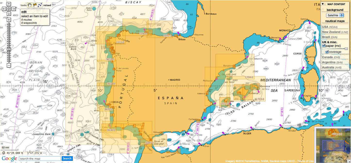
Antikythera island with the Marine GeoGarage (NGA chart)
The new items have indicated the wreck site is much bigger than previously believed,
scattered across 300 meters of seafloor.

From CNN by Lauren Said-Moorhouse

In the azure waters off the rocky coast of Antikythera, a remote island in the Mediterranean with a population of less than 50, an international team of archaeologists has recovered new treasures from one of the most mysterious shipwrecks of all time.

 After spending the last month at the historic wreck site, the Woods Hole Oceanographic Institute (WHOI) announced that an international team of archaeologists had recovered new items from the Antikythera wreck.
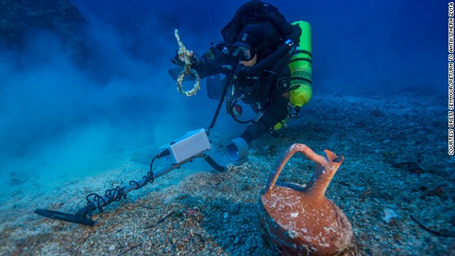
Pictured, Greek technical diver Alexandros Sotiriou discovers an intact "lagynos" ceramic table jug and a bronze rigging ring.

The group of maritime archaeology experts have been at the site since mid-September and armed with the most advanced marine technology available, they have conducted the first-ever scientific excavation of the Antikythera wreck.
Despite facing fierce winds and choppy seas during the 30-day mission, the reclaimed items include tableware, anchors and other maritime components, as well as a giant spear, which they believe once belonged to a life-sized bronze warrior statue.


Sirius, the underwater robot, aka.
Autonomous Underwater Vehicle (Sirius AUV), from the Australian Centre for Field Robotics was used in September 2014 to produce very high resolution 3D digital maps of the Antikythera shipwreck. 

The recovered artifacts have been described as "very promising" by project co-director Theotokis Theodoulou in a press release from Woods Hole Oceanographic Institute (WHOI).
The U.S.-based WHOI worked with Theodoulou and the Hellenic Ephorate of Underwater Antiquities in Greece to lead the expedition.
He added: "We have a lot of work to do at this site to uncover its secrets."

 "Return to Antikythera" project chief diver Philip Short is pictured inspecting the magnificent two-meter-long bronze spear reclaimed from the shipwreck, which archaeologists say was once part of a life-size warrior statue.

World's first computer found at wreck

In 1900, sponge divers from the Greek island of Symi anchored along the eastern coastline of the island while waiting for a ferocious storm to pass.
What they would stumble upon would stun the world.
Underneath the crystalline waters, lay the incredible wreck undiscovered for thousands of years. And as the site was explored over the next year, they would uncover life-size bronze statues and remarkable artifacts.
But it was the 1902 recovery of a clump of calcified stone with mysterious inscriptions that would push the wreck into archaeological lore.

 In 1900, Greek sponge divers inadvertently stumbled upon an incredible ancient shipwreck off the coast of Antikythera.
More intriguing were the heavily corroded bronze fragments -- 82 in total, with the largest pictured -- brought to the surface in 1902.
The find would stun the world when it was revealed to be a mechanical computer from the 1st century BC.

The heavily corroded bronze fragments would turn out to be what has been described as the world's earliest known "computer," designed in the first century BC -- the Antikythera Mechanism.

 "The Antikythera Mechanism is just mind blowing. It's maybe the most important, certainly most surprising, artifact recovered from an archaeology site anywhere," said expedition co-director Brendan Foley.
"Our question is: if this ship is carrying this kind of stuff, what else is still down there? You can't even guess. The Antikythera Mechanism had no precedence. Could there be other things of that sort of culture, and technological and scientific significance still down there?"

Built to track the astronomical calendar and lunar movements, later radiographic image analysis of the mechanism revealed 30 intricate gear wheels.

 At first, the Antikythera Mechanism, as it became known, confounded archaeologists who were unsure if it was an astrolabe or an ancient astronomical clock.
Today, it is widely believed the mechanism was a complex computer tracking the astronomical calendar and lunar movements, with its manufacture dated to around 100 BC.
Radiographic image analysis on the mechanism revealed 30 intricate gear wheels.

Famed underwater explorer Jacques Cousteau visited the site in 1976 to film a documentary and returned from below the surface with treasures galore.
Since then, the site had remained dormant under the aegis of the Hellenic Ministry of Culture for almost 40 years.

 A reconstruction of the device now sits at the Archaeological Museum in Athens. Built out of a thin bronze sheet, the mechanism has the first known set of scientific dials and scales.
Surrounded by Greek inscriptions, the large upper dial follows the Metonic cycle -- a period of 19 years in which there are 235 lunations.
Useful for regulating calendars, there was also a four-year dial for monitoring when the well-loved Panhellenic games -- including the ancient Olympics -- should take place.

 Archaeologists are also translating findings from the reports from 1900 and 1901 operations from Ancient Greek hoping to reveal more clues to the initial find.
Foley said one of the journals revealed there were two main areas where it was reported marble and bronze lay, so technical divers will be carrying metal detectors to aid their search.
He added: "If we get a really big metal detection hit in one localized area then obviously that would be a place to test trench and see what's down there. Maybe there's another mechanism ..."

"The Antikythera shipwreck is maybe the most important, most famous shipwreck from antiquity," Brendan Foley, an archaeologist from WHOI and co-director of the expedition told CNN before the dive began in September.
"We are hardcore scientists and archaeologists. We hate to speak of treasure but in this case, it's actually a treasure ship and there are just no two ways about it."

Shrouded in mystery

Analysis of the reclaimed artifacts has dated the vessel to the first century BC, while a horde of gold coins retrieved from the water suggests the boat's origins lie east, from Asia Minor.
But no one knows for certain how big it is, what it was doing there or why it went down. Yet.


Scientists, technical divers, archaeologists and documentary filmmakers made up the 32-person team returning to the wreck site in September for the first ever scientific excavation.
Three years in the making, the experts hoped to answer some of the enigmatic questions surrounding the ship, including how big it is, why it was there, where it came from and who might have been traveling on it.
Considering all the treasure and female trinkets that have been brought up from the seafloor, one idea is that the ship was transporting a young woman and her dowry but they never made it to their final destination.

Foley said: "This not just an everyday trader. This is probably one of the largest, most expensive ships that was sailing in the first century BC. The 1901 sponge divers reported that the artifacts were spread among an area about 52 meters along the seafloor. And that corresponds nicely with what we've observed in our dives on the site."

Supported by the Hellenic Navy, Foley and his 32-man team have been provided with research vessels capable of raising artifacts weighing up to five tons straight off the seabed.
"You never want to speak about absolutes or guarantees but I've never felt more confident in a shipwreck that there is going to be something interesting on it," Foley said.
"In the 1901 and '76 operations, they were getting gemstones, gold stones and human remains. And human remains almost never come up from ancient shipwrecks. So with modern ancient DNA analysis, there are all kinds of questions that can now be posed if we recover some."

 Greek archaeologist and fellow co-director of the dive, Theotokis Theodoulou inspects the 400-pound lead anchor stock of Antikythera Wreck B, found last year at one end of the debris field during a preparatory dive. The other end of the wreck is signaled over 50 meters away by roof tiles believed to be from the galley structure at the stern of the ship. Based on this evidence, scientists estimate the vessel to be one of the largest ships from antiquity, making it bigger than some of the most colossal boats known from that time -- Caligula's pleasure barges on Italy's Lake Nemi.

With the location at around 55 meters deep, it's not particularly hard to get to.
Foley explained: "This shipwreck is close to the shore. It's only about 70 meters off the cliff face so it makes it very difficult to bring in a big ship to support any kind of robotic systems so we came up with a plan and have been putting it into practice over the last three years -- incrementally training on new technology so that we could get and do very vigorous science.
"At the most basic level, if we can come away from this important shipwreck site with a very, very good map and a much better understanding of the layout of the wreck, from that data we can begin to pose new questions to drive forward the research," explained Foley, who has worked with the Ministry of Culture in Greece for the last decade.

The AUV conducted a high-resolution survey of the wreck site to create precise 3D documentation of the expansive debris field.
Meanwhile, technical divers equipped with metal detectors scanned the seafloor to determine the extent of the wreckage under the sediment before test trench excavations were able to begin.


 Here's some raw diver footage taken at a depth of 45 metres by Phil Short while exploring the Antikythera shipwreck using a closed circuit rebreather.

Underwater "Iron Man"

The team also arrived in Greece with a next-generation diving suit that could revolutionize the future of ocean exploration.
Looking like something straight out of "Iron Man," the Exosuit is an atmospheric diving system, created by Vancover-based Nuytco Research, originally designed for offshore exploration of oil fields.
Repurposed for the expedition, Foley explained it offers the team extensive bottom time at the site.

 WHOI diving safety officer Edward O'Brien "spacewalks" in the next-gen atmospheric "Exosuit," during the 2014 Return to Antikythera project, which ran from September 15 to October 7.
The divers are planning to return to the Antikythera next year to continue excavating the site following a successful first season.

"The system itself for the Exosuit has life support for something like 40 hours if all went to hell. I mean, really, it's when you get tired and sore, and want to have a sandwich and use the toilet, that you come up," he said.

And the best part is the simplicity of the technology, revealed its creator Phil Nuytten.
"You can literally operate the Exosuit after a few hours of training. The majority of the training is spent in emergency drills. But the actual functioning of it is as simple as learning to drive a golf cart," said Nuytten, a pioneer in deep-sea exploratory technology.


 The team used next-generation diving apparatus, the "Exosuit."
It was designed and created by underwater tech pioneer Phil Nuytten of Canada's Nuytco Research.
"You can literally operate Exosuit after a few hours of training. The majority of the training is spent in emergency drills. But the actual functioning of it is as simple as learning to drive a golf cart," said Nuytten.

"The suit is controlled by footpads that can tilt forward, backwards or from side to side."
Aside from Exosuit's ease, Nuytten also highlighted how the suit negates some of the side effects of conventional saturation diving, like decompression sickness and prolonged, unnecessary dive times.
 "In the Exosuit, you jump into it and the compression time is zero. You're down to 1,000ft within 10 minutes and you can spend six to eight hours there and then come back in 10 minutes instead of 10 days."


Highlights of a test dive of the Exosuit, before heading to Antikythera.
Mr Panos Laskaridis of the Aikaterini Laskaridis Foundation was the diver in the Exosuit for the trial.

But for the dive team, it's the opportunity for exploration that is the biggest pull of Exosuit.
"We figure by the end of the first two days with Exosuit, we'll have more time on the Antikythera shipwreck than any other dive put together that's gone before it," said Foley.

A doomed dowry? 

It's been a mammoth undertaking and with a bill at over €2 million (over $2.5 million), the team was hoping the Mediterranean would yield some of its secrets.
Prior to this scientific dive, the archaeologists had little to go on and were left to come up with theories based on the little historical evidence at hand.

When human remains -- including a skull that was 80% intact -- were recovered in '76, a treasure trove of jewelry, perfume bottles and other female-related trinkets were found close by.
"One of our pet theories is that maybe this ship was carrying a really wealthy woman from Asia Minor, and she was going to be married and this cargo was her dowry. It's impossible to prove but it's a nice romantic notion," said Foley.

With such a long passage of time between when the ship sank and the present day, and so many unanswered questions, the scientists and archaeologists expect to be working on the project for at least the next five years.
And it's a journey Foley is excited to have embarked on.
"I like to think of shipwrecks as books, books in a library. The seafloor is a vast library and with every single shipwreck, there is a book telling us about the past and the artifact that we raise is like a page in that book.
"So if we want to try to recreate the ancient past and figure out who we are, who we came from, why we live in this modern world, then the only way to do that is to look at the physical remains of past cultures."

 Links :


Tuesday, October 14, 2014

The greatest maps in history, collected in one fantastic book

Made in 1500, Jacopo De'Barbari's woodcut map of Venice is the first known birds-eye view of any city.
Predating modern surveying techniques, the cartographer achieved his impressively accurate scale by building a custom geometric grid before overlaying the city's buildings, canals, and labyrinthine streets.
Rreproduced by permission of DK, a division of Penguin Random House ©2014

From Wired by Nick Stockton

Maps are more than a measure of space; they are also records of how humans have understood, examined, and reconsidered the earth throughout history.
In his new book, Great Maps, Jerry Brotton uses over 60 milestones to guide us through our cartographic heritage.

Petrus Plancius' map to the riches of the Moluccas was the first successful attempt
to convince mariners that the Mercator projection was a useful navigational tool.
The State Library of New South Wales

“A map is about space, but it is also an object in time,” said Brotton, a professor of Renaissance studies at Queen Mary College in London.
They tell stories: how far-reaching the borders were of a great civilization, or what another culture believed about Earth’s place in the cosmos.
For Brotton, some of the most fascinating map stories are about how humans have solved complex cartographic problems.


The Korean-made Kangnido map (c.1402) is dominated by Ming China, which was Asia's dominant regional power.
Like other Asian mapmakers, Cartographer Kwŏn Kŭn emphasized rivers because they were viewed as arteries for terrestrial energy.

For instance, measuring space is an innovation we often take for granted, but it was a problem solved over great swaths of time and in several different cultures.
No matter when or where they were born, sailors have always needed tools to help them travel safely from one place to another, and this has consistently been one of the biggest motivators for creating accurate methods of measurement.

 Joan Blaeu's 1648 copperplate engraving was the first map to acknowledge that the Earth circled the sun.
Despite his forward-thinking heliocentrism, Blaeu couldn't resist preserving the myth of California as an island.

In the west, this evolved with Ptolemaic lines of latitude and longitude, compasses, and lines of bearing like those in the Carte Pisan.
Other cultures had their own, no less ingenious ways of solving the challenges of ocean navigation, such as the stick charts that Pacific Islanders used to colonize hundreds of remote islands.


Native sailors of the Marshall Islands in the south Pacific developed their own sophisticated navigational charts.
The curved sticks indicate swells, the horizontals measure distance between islands, and the chevrons show how swells refract around important islands.
These charts allowed Pacific Island culture to propagate among hundreds of remote islands.

Brotton explains that he took special care in choosing the maps in his book so he could emphasize the importance of these stories.
“When you make a book called Great Maps, there is a central spine of maps that people in the field expect to see,” he explains, listing Ptolemy‘s and Mercator‘s maps as canonical examples. “But alongside those I wanted to tell other stories,” he says.
In this a way, Great Maps is a broader, illustrated successor to Brotton’s last book of cartographic history, A History of the World in 12 Maps.
The recurring theme in both is that maps, in a addition to showing geographic information, also betray the values and biases of their makers.


Like most early Islamic world maps, Al-Sharīf al-Idrīsī's 1154 "Entertainment for He Who Longs to Travel the World" is oriented towards the south.
The mountains in the middle of Africa were believed to be the source of the Nile.

“European maps are known for being more objective and scientific than the other great mapping cultures,” he said, which is a by-product of the European nations’ colonial ambitions.
“But Islamic culture was much less concerned with colonizing new territory, and their maps emphasize a consolidation of the empire and its cultural ideas.”
Similarly, Chinese and Korean cultures were relatively insular, and their maps tend to focus on cultural harmony.
Because the landscape was believed to affect this harmony, those cultures’ maps paid special attention to the arrangement of rivers and other natural features, Brotton says.

It took until 1710 for someone to explore California thoroughly enough to prove it was not an island.
Unfortunately, because the explorer, Eusebio Kino, was a missionary and (despite his obvious mapmaking ability evinced above) not a trained cartographer, nobody believed him.

Each culture had its own word for these tools that look at the world from above.
In the West, ‘map,’ comes from the Latin ‘mappa,’ which means cloth or napkin.
In Arabic a map is ‘surah’ —a figure—and in Chinese it’s ‘tu’—usually meaning a diagram.
“All these words describe slightly different manifestations of what we in the modern west designate as a map,” he said.
“And, they’re all connected to how those cultures view the world.”

Monday, October 13, 2014

UK & misc. update in the Marine GeoGarage

As our public viewer is not yet available
(currently under construction, upgrading to Google Maps API v3 as v2 is officially no more supported),
this info is primarily intended to our B2B customers which use our nautical charts layers in their own webmapping applications through our GeoGarage API.

Today 951 charts (1815 including sub-charts) from UKHO
are available in the 'UK & misc.' chart layer
regrouping charts for different countries :
  1. UK
  2. Argentina
  3. Belgium
  4. Netherlands
  5. Croatia
  6. Oman
  7. Portugal
  8. Spain
  9. Iceland
  10. South Africa
  11. Malta
 2 charts have been withdrawn (813, 3764) since the last update
and 1 chart has been added (3492)


634 charts for UK
(1 chart withwdrawn 813 Colombo to Sangama Kanda Point;
1 chart added 3492 Approaches to Port Sudan)

24 charts for Argentina :

  • 226    International Chart Series, Antarctica - South Shetlands Islands, Deception Island.
  • 227    Church Point to Cape Longing including James Ross Island
  • 531    Plans on the Coast of Argentina
  • 552    Plans on the Coast of Argentina
  • 557    Mar del Plata to Comodoro Rivadavia
  • 1302    Cabo Guardian to Punta Nava
  • 1331    Argentina, Approaches to Bahia Blanca
  • 1332    Isla de los Estados and Estrecho de le Maire
  • 1751    Puerto de Buenos Aires
  • 1982B    Rio Parana - Rosario to Parana
  • 2505    Approaches to the Falkland Islands
  • 2517    North-Western Approaches to the Falkland Islands
  • 2519    South-Western Approaches to the Falkland Islands
  • 3065    Punta Piedras to Quequen
  • 3066    Quequen to Rio Negro
  • 3067    Rio Negro to Isla Leones
  • 3106    Isla Leones to Pto San Julian
  • 3213    Plans in Graham Land
  • 3560    Gerlache Strait  Northern Part
  • 3566    Gerlache Strait  Southern Part
  • 3755    Bahia Blanca
  • 4063    Bellingshausen Sea to Valdivia
  • 4200    Rio de la Plata to Cabo de Hornos
  • 4207    Falkland Islands to Cabo Corrientes and Northeast Georgia Rise
27 charts for Belgium & Nederlands :

  • 99 Entrances to Rivers in Guyana and Suriname
  • 110 Westkapelle to Stellendam and Maasvlakte
  • 112 Terschellinger Gronden to Harlingen
  • 120 Westerschelde - Vlissingen to Baalhoek and Gent - Terneuzen Canal
  • 122 Approaches to Europoort and Hoek van Holland
  • 124 Noordzeekanaal including Ijmuiden, Zaandam and Amsterdam
  • 125 North Sea Netherlands - Approaches to Scheveningen and Ijmuiden
  • 126 North Sea, Netherlands, Approaches to Den Helder
  • 128 Westerschelde, Valkenisse to Wintam
  • 207 Hoek Van Holland to Vlaardingen
  • 208 Rotterdam, Nieuwe Maas and Oude Maas
  • 209 Krimpen a/d Lek to Moerdijk
  • 266 North Sea Offshore Charts Sheet 11
  • 572 Essequibo River to Corentyn River
  • 702 Nederlandse Antillen, Aruba and Curacao
  • 1187 Outer Silver Pit
  • 1408 North Sea, Harwich and Rotterdam to Cromer and Terschelling.
  • 1412 Caribbean Sea - Nederlandse Antillen, Ports in Aruba and Curacao
  • 1414 Bonaire
  • 1503 Outer Dowsing to Smiths Knoll including Indefatigable Banks.
  • 1504 Cromer to Orford Ness
  • 1546 Zeegat van Texel and Den Helder Roads
  • 1630 West Hinder and Outer Gabbard to Vlissingen and Scheveningen
  • 1631 DW Routes to Ijmuiden and Texel
  • 1632 DW Routes and Friesland Junction to Vlieland
  • 1874 North Sea, Westerschelde, Oostende to Westkapelle
  • 2047 Approaches to Anguilla

13 charts for Croatia :
  • 201 Rt Kamenjak to Novigrad
  • 202 Kvarner, Kvarneric and Velebitski Kanal
  • 269 Ploce and Split with Adjacent Harbours, Channels and Anchorages
  • 515 Zadar to Luka Mali Losinj
  • 680 Dubrovnik
  • 1574 Otok Glavat to Ploce and Makarska
  • 1580 Otocic Veliki Skolj to Otocic Glavat
  • 1996 Ports in Rijecki Zaljev
  • 2711 Rogoznica to Zadar
  • 2712 Otok Susac to Split
  • 2719 Rt Marlera to Senj including Approaches to Rijeka
  • 2773 Sibenik, Pasmanski Kanal, Luka Telascica, Sedmovrace, Rijeka Krka
  • 2774 Otok Vis to Sibenik
 7 charts for Oman :

  • 2853 Gulf of Oman, approaches to Sohar       
  • 2854 Northern approaches to Masirah
  • 3171 Southern Approaches to the Strait of Hormuz
  • 3409 Plans in Iran, Oman and the United Arab Emirates
  • 3511 Wudam and Approaches
  • 3518 Ports and Anchorages on the North East Coast of Oman
  • 3762 Oman - South East coast, Ad Duqm


125 charts for Spain & Portugal :
(1 chart withdrawn, 3764)
  • 45 Gibraltar Harbour
  • 73 Puerto de Huelva and Approaches
  • 83 Ports on the South Coast of Portugal
  • 85 Spain - south west coast, Rio Guadalquivir
  • 86 Bahia de Cadiz
  • 87 Cabo Finisterre to the Strait of Gibraltar
  • 88 Cadiz
  • 89 Cabo de Sao Vicente to Faro
  • 91 Cabo de Sao Vicente to the Strait of Gibraltar
  • 93 Cabo de Santa Maria to Cabo Trafalgar
  • 142 Strait of Gibraltar
  • 144 Mediterranean Sea, Gibraltar
  • 307 Angola, Cabeca da Cobra to Cabo Ledo
  • 308 Angola, Cabo Ledo to Lobito
  • 309 Lobito to Ponta Grossa
  • 312 Luanda to Baia dos Tigres
  • 366 Arquipelago de Cabo Verde
  • 469 Alicante
  • 473 Approaches to Alicante
  • 518 Spain East Coast, Approaches to Valencia
  • 562 Mediterranean Sea, Spain - East Coast, Valencia.
  • 580 Al Hoceima, Melilla and Port Nador with Approaches
  • 659 Angola, Port of Soyo and Approaches
  • 690 Cabo Delgado to Mikindani Bay
  • 1094 Rias de Ferrol, Ares, Betanzos and La Coruna
  • 1096 Ribadeo
  • 1110 La Coruna and Approaches
  • 1111 Punta de la Estaca de Bares to Cabo Finisterre
  • 1113 Harbours on the North-West Coast of Spain
  • 1117 Puerto de Ferrol
  • 1118 Ria de Ferrol
  • 1122 Ports on the North Coast of Spain
  • 1133 Ports on the Western Part of the North Coast of Spain
  • 1142 Ria de Aviles
  • 1145 Spain - North Coast, Santander
  • 1150 Ports on the North Coast of Spain
  • 1153 Approaches to Gijon
  • 1154 Spain, north coast, Gijon
  • 1157 Pasaia (Pasajes) and Approaches
  • 1172 Puertos de Bermeo and Mundaka
  • 1173 Spain - North Coast, Bilbao
  • 1174 Approaches to Bilbao
  • 1180 Barcelona
  • 1189 Approaches to Cartagena
  • 1193 Spain - east coast, Tarragona
  • 1194 Cartagena
  • 1196 Approaches to Barcelona
  • 1197 Plans on the West Coast of Africa
  • 1215 Plans on the Coast of Angola
  • 1216 Baia dos Tigres
  • 1290 Cabo de San Lorenzo to Cabo Ortegal
  • 1291 Santona to Gijon
  • 1448 Gibraltar Bay
  • 1453 Gandia
  • 1455 Algeciras
  • 1460 Sagunto
  • 1514 Spain - East Coast, Castellon
  • 1515 Ports on the East Coast of Spain
  • 1589 Almeria
  • 1595 Ilhas do Principe, de Sao Tome and Isla Pagalu
  • 1684 Ilha da Madeira, Manchico and Canical
  • 1685 Ilha de Madeira, Ponta Gorda de Sao Lourenco including the Port of Funchal
  • 1689 Ports in the Arquipelago da Madeira
  • 1701 Cabo de San Antonio to Vilanova I la Geltru including Islas de Ibiza and Formentera
  • 1703 Mallorca and Menorca
  • 1704 Punta de la Bana to Islas Medas
  • 1724 Canal do Geba and Bissau
  • 1726 Approaches to Canal do Geba and Rio Cacheu
  • 1727 Bissau, Bolama and Approaches
  • 1730 Spain - West Coast, Ria de Vigo
  • 1731 Vigo
  • 1732 Spain - West Coast, Ria de Pontevedra
  • 1733 Spain - West Coast, Marin and Pontevedra
  • 1734 Approaches to Ria de Arousa
  • 1740 Livingston Island, Bond Point to Brunow Bay including Juan Carlos 1 Base and Half Moon Island
  • 1755 Plans in Ria de Arousa
  • 1756 Ria de Muros
  • 1762 Vilagarcia de Arosa
  • 1764 Ria de Arousa
  • 1831 Arquipelago da Madeira
  • 1847 Santa Cruz de Tenerife
  • 1850 Approaches to Malaga
  • 1851 Malaga
  • 1854 Motril and Adra
  • 1856 Approaches to Puerto de La Luz (Las Palmas)
  • 1858 Approaches to Santa Cruz de Tenerife, Puerto de San Sebastian de la Gomera, Santa Cruz de la Palma and Approaches
  • 1861 North Atlantic Ocean – Islas Canarias, Gran Canaria to El Hierro 
  • 1862 North Atlantic Ocean – Islas Canarias, Lanzarote to Cabo Bojador  
  • 1863 Islas Canarias, Puerto de los Marmoles to Puerto del Rosario  
  • 1895 Ilha de Sao Miguel
  • 1950 Arquipelago dos Acores
  • 1956 Arquipelago dos Acores  Central Group
  • 1957 Harbours in the Arquipelago Dos Acores (Central Group)
  • 1959 Flores,Corvo and Santa Maria with Banco Das Formigas
  • 2742 Cueta
  • 2761 Menorca
  • 2762 Menorca, Mahon
  • 2831 Punta Salinas to Cabo de Formentor including Canal de Menorca
  • 2832 Punta Salinas to Punta Beca including Isla de Cabrera
  • 2834 Ibiza and Formentera
  • 2932 Cabo de Sao Sebastiao to Beira
  • 2934 Africa - east coast, Mozambique, Beira to Rio Zambeze
  • 2935 Quelimane to Ilha Epidendron
  • 3034 Approaches to Palma
  • 3035 Palma
  • 3220 Entrance to Rio Tejo including Baia de Cascais
  • 3221 Lisboa, Paco de Arcos to Terreiro do Trigo
  • 3222 Lisboa, Alcantara to Canal do Montijo
  • 3224 Approaches to Sines
  • 3227 Aveiro and Approaches
  • 3228 Approaches to Figueira da Foz
  • 3257 Viana do Castelo and Approaches
  • 3258 Approaches to Leixoes and Barra do Rio Douro
  • 3259 Approaches to Setubal
  • 3260 Carraca to Ilha do Cavalo
  • 3291 Angola, (Cabinda), Cabinda and Malongo Terminals    
  • 3448 Plans in Angola
  • 3578 Eastern Approaches to the Strait of Gibraltar
  • 3633 Islas Sisargas to Rio Mino
  • 3634 Montedor to Cabo Mondego
  • 3635 Cabo Mondego to Cabo Espichel
  • 3636 Cabo Espichel to Cabo de Sao Vicente
  • 4114 Arquipelago dos Acores to Flemish Cap
  • 4115 Arquipelago dos Acores to the Arquipelago de Cabo Verde


14 charts for Iceland :

  • 2733 Dyrholaey to Snaefellsjokull
  • 2734 Approaches to Reykjavik
  • 2735 Iceland - South West Coast, Reykjavik
  • 2897 Iceland
  • 2898 Vestfirdir
  • 2899 Iceland, Noth Coast, Horn to Rauoinupur
  • 2900 Iceland, North East Coast, Rauoinupur to Glettinganes
  • 2901 Iceland, East Coast, Glettinganes to Stokksnes
  • 2902 Stokksnes to Dyrholaey
  • 2955 Iceland, North Coast, Akureyri
  • 2956 Iceland, North Coast, Eyjafjordur
  • 2937 Hlada to Glettinganes
  • 2938 Reydarfjordur
  • 4112 North Atlantic Ocean, Iceland to Greenland


48 charts for South Africa :

  • 578    Cape Columbine to Cape Seal
  • 632    Hollandsbird Island to Cape Columbine
  • 643    Durban Harbour
  • 665    Approaches to Zanzibar
  • 1236    Saldanha Bay
  • 1806    Baia dos Tigres to Conception Bay
  • 1846    Table Bay Docks and Approaches
  • 1922    RSA - Simon's Bay
  • 2078    Port Nolloth to Island Point
  • 2095    Cape St Blaize to Port S. John's
  • 3211    Zanzibar Harbour
  • 3793    Shixini Point to Port S Johns
  • 3794    Port S Johns to Port Shepstone
  • 3795    Port Shepstone to Cooper Light
  • 3797    Green Point to Tongaat Bluff
  • 3859    Cape Cross to Conception Bay
  • 3860    Mutzel Bay to Spencer Bay
  • 3861    Namibia, Approaches to Luderitz
  • 3869    Hottentot Point to Chamais Bay
  • 3870    Chamais Bay to Port Nolloth
  • 4132    Kunene River to Sand Table Hill
  • 4133    Sand Table Hill to Cape Cross
  • 4136    Harbours on the West Coasts of Namibia and South Africa
  • 4141    Island Point to Cape Deseada
  • 4142    Saldanha Bay Harbour
  • 4145    Approaches to Saldanha Bay
  • 4146    Cape Columbine to Table Bay
  • 4148    Approaches to Table Bay
  • 4150    Republic of South Africa, South West Coast, Table Bay to Valsbaai
  • 4151    Cape Deseada to Table Bay
  • 4152    Republic of South Africa, South West Coast, Table Bay to Cape Agulhas
  • 4153    Republic of South Africa, South Coast, Cape Agulhas to Cape St. Blaize
  • 4154    Mossel Bay
  • 4155    Cape St Blaize to Cape St Francis
  • 4156    South Africa, Cape St Francis to Great Fish Point
  • 4157    South Africa, Approaches to Port Elizabeth
  • 4158    Republic of South Africa - South Coast, Plans in Algoa Bay.
  • 4159    Great Fish Point to Mbashe Point
  • 4160    Ngqura Harbour
  • 4162    Approaches to East London
  • 4163    Republic of South Africa, South East Coast, Mbashe Point to Port Shepstone
  • 4170    Approaches to Durban
  • 4171    Republic of South Africa – South East Coast, Port Shepstone to Tugela River
  • 4172    Tugela River to Ponta do Ouro
  • 4173    Approaches to Richards Bay
  • 4174    Richards Bay Harbour
  • 4205    Agulhas Plateau to Discovery Seamounts
  • 4700    Port Elizabeth to Mauritius 
    5 charts for Malta :

    • 36 Marsaxlokk
    • 177 Valletta Harbours
    • 211 Plans in the Maltese Islands
    • 2537 Ghawdex (Gozo), Kemmuna (Comino) and the Northern Part of Malta
    • 2538 Malta


    55 international charts from NGA
  •  3 Chagos Archipelago
  • 82 Outer Approaches to Port Sudan
  • 100 Raas Caseyr to Suqutra
  • 255 Eastern Approaches to Jamaica
  • 256 Western Approaches to Jamaica
  • 260 Pedro Bank to the South Coast of Jamaica
  • 333 Offshore Installations in the Gulf of Suez
  • 334 North Atlantic Ocean, Bermuda
  • 386 Yadua Island to Yaqaga Island
  • 390 Bahamas, Grand Bahama Island, Approaches to Freeport
  • 398 Grand Bahama Island, Freeport Roads, Freeport Harbour
  • 457 Portland Bight
  • 462 The Cayman Islands
  • 486 Jamaica and the Pedro Bank
  • 501 South East Approaches to Trinidad
  • 700 Maiana to Marakei
  • 868 Eastern and Western Approaches to The Narrows including Murray's Anchorage
  • 920 Chagos Archipelago, Diego Garcia
  • 928 Sulu Archipelago
  • 959 Colson Point to Belize City including Lighthouse Reef and Turneffe Islands
  • 1043 Saint Lucia to Grenada and Barbados
  • 1225 Gulf of Campeche
  • 1265 Approaches to Shatt Al 'Arab or Arvand Rud, Khawr Al Amaya and Khawr Al Kafka
  • 1450 Turks and Caicos Islands, Turks Island Passage and Mouchoir Passage
  • 1638 Plans in Northern Vanuatu
  • 2009 Sheet 2  From 23 deg 40 min North Latitude to Old Bahama Channel
  • 2065 Northern Antigua
  • 2133 Approaches to Suez Bay (Bahr el Qulzum)
  • 2373 Bahr el Qulzum (Suez Bay) to Ras Sheratib
  • 2374 Ra's Sharatib to Juzur Ashrafi
  • 2658 Outer Approaches to Mina` al Jeddah (Jiddah)
  • 2837 Strait of Hormuz to Qatar
  • 2847 Qatar to Shatt al `Arab
  • 3043 Red Sea, Ports on the coast of Egypt.
  • 3102 Takoradi and Sekondi Bays
  • 3175 Jazirat al Hamra' to Dubai (Dubayy) and Jazireh-ye Sirri
  • 3179 UAE and Qatar, Jazirat Das to Ar Ru' Ays
  • 3310 Africa - east coast, Mafia Island to Pemba Island
  • 3361 Wasin Island to Malindi
  • 3432 Saltpond to Tema
  • 3493 Red Sea - Sudan, Bashayer Oil Terminals and Approaches.
  • 3519 Southern Approaches to Masirah
  • 3520 Khawr Kalba and Dawhat Diba to Gahha Shoal
  • 3522 Approaches to Masqat and Mina' al Fahl
  • 3530 Approaches to Berbera
  • 3709 Gulf of Oman, United Arab Emirates, Port of Fujairah (Fujayrah) and Offshore Terminals.
  • 3723 Gulf of Oman, United Arab Emirates, Approaches to Khawr Fakkan and Fujairah (Fujayrah).
  • 3785 Mina' Raysut to Al Masirah
  • 3907 Bahama Islands and Hispaniola, Passages between Mayaguana Island and Turks and Caicos Islands.
  • 3908 Passages between Turks and Caicos Islands and Dominican Republic
  • 3910 Little Bahama Bank including North West Providence Channel
  • 3912 Bahamas, North East Providence Channel and Tongue of the Ocean
  • 3913 Bahamas, Crooked Island Passage and Exuma Sound
  • 3914 Turks and Caicos Islands and Bahamas, Caicos Passage and Mayaguana Passage
  • 3951 Sir Bani Yas to Khawr al `Udayd