Saturday, November 21, 2015

Litto3D : a French coastal DTM

Litto 3D : a 3D seamless representation of French coastal areas

The French national program Litto3D was launched in April 2003 as a need for a better management of coastal areas.
It remains the first data set coming from the collaboration of the French National Mapping Agency (IGN) and the Hydrographic and Oceanographic Service of the French Navy (SHOM).
Litto3D is an seamless altimetric digital elevation model of French coastal foreshore.

Litto3D builds upon both bathymetric and topographic lidar surveys completed by water depths measurements using multi-beam sounder

From this results an accurate knowledge of the French wholecoastal areas (homeland andultra-peripherals: Guadeloupe, Martinique, Réunion, Guyane, Mayotte and Saint-Pierre-et-Miquelon).

The aim of Litto3D® is to produce a seamless bathymetric and topographic database
 covering the littoral zone, right now available for Brittany.

Chaussee de Sein

 Les Glénans - Fort Cigogne

Finistere 2014 available in Open Data on SHOM website

Links : 

Friday, November 20, 2015

Here's how we started measuring the oceans from space

Top image: Ellen Weaver in front of her ocean monitoring sensor package.
Ellen Weaver, an associate professor of biology from California State University is shown developing instrumentation to be used in satellites for ocean monitoring.
In the early 1970s, NASA researchers and ocean explorer Jacques Cousteau formed a team to study productivity of the sea.
The team devised a sensor system to monitor ocean temperatures and chlorophyll levels by aircraft. This sensor was used in the satellite communication and weather equipment provided by NASA to assist in the accuracy of satellite observation.
Credit: NASA

From io9 by Mika McKinnon

February 8, 1973: Biologist Ellen Weaver creates a sensor package to measure ocean temperature and detect chlorophyll levels.
The sensors were loaded onto communications and weather satellites in NASA’s first foray into sea productivity monitoring.
In the early 1970s, NASA put together a team of researchers including legendary explorer Jacques Cousteau, and associate professor at California State University Ellen Weaver.
Their task was deceptively simple: figure out how to use satellites for monitoring ocean productivity. The team invented a sensor package to ride on airplanes, monitoring ocean temperatures and chlorophyll levels.
Once proven in little patchworks of regional measurements, that same sensor package was loaded onto communication and weather satellites, bringing ocean observation to space.


In direct contrast to current political pressure for NASA to focus on space at the exclusion of Earth observation missions, a 1973 Star-News article describing the collaboration started:
The loudest criticism leveled against the nation’s space program in the last decade is that too much money is spent on projects that have too little value to earthlings.
The same article goes on to describe the mission.
While Cousteau roamed the seas providing local updates from his research vessel Calypso, Weaver paired up with NASA Ames’ John Arvesen to analyse the data coming down from the first Earth Resources Technology Satellite (ERTS-1), Nimbus, and NOAA weather satellites.
They used the ground-truthed data to calibrate their instruments, learning how changes in sea colour could reflect phytoplankton levels and other tricks for remote sensing the ocean’s health.

1972: Prototype subsystem testing for the Nimbus-5 meteorological satellite. 
The satellite launched on December 10, 1972 and operated until March 29, 1983.
Image credit: NASA


 Landsat 1: "Earth Resources Technology Satellite" ERTS 1973 NASA
This film illustrates how the Earth Resources Technology Satellite (ERTS) helped to meet the need for a worldwide survey of Earth resources in order to assist scientists and governments plan their use and conservation.

NASA’s Earth observing satellites have come a long way in the intervening decades.
Now they track everything from carbon distribution to algae blooms, helping us learn about the complex dynamics of our ever-changing world.

Thursday, November 19, 2015

Plastic by the numbers in the Atlantic Ocean


From National Geographic by Gregg Treinis

In late 2014, Adventurers and Scientists for Conservation partnered with the Atlantic Rally for Cruisers, a fleet of sailboats that makes an annual crossing of the Atlantic.

In total, 93 of the 251 boats gathered water samples for our Global Microplastics Initiative, contributing 521 samples to ASC’s dataset and covering an estimated 602,000-square-nautical-mile area.

The sources of microplastics pollution include microbeads manufactured for many face washes and toothpastes, particles weathered from larger debris like bottles and bags, and microfibers shed down the drain when synthetic clothing is washed.


 Click on a map location to see how many pieces of plastic we found in each ASC sample

In addition to the ARC sailors, volunteer sea kayakers, surfers, rowers divers and hikers have collected samples from places including Scandinavia, the Antarctic Peninsula, the Falkland Islands, South Georgia Island, and West Africa.
They have contributed more than 1,200 samples to the ASC dataset, which is likely the largest of its kind.
Once we have enough data, we plan to use this information to leverage change, working with legislative, corporate and public partners to stop the influx of microplastics.

Links :

Wednesday, November 18, 2015

He who defends everything defends nothing

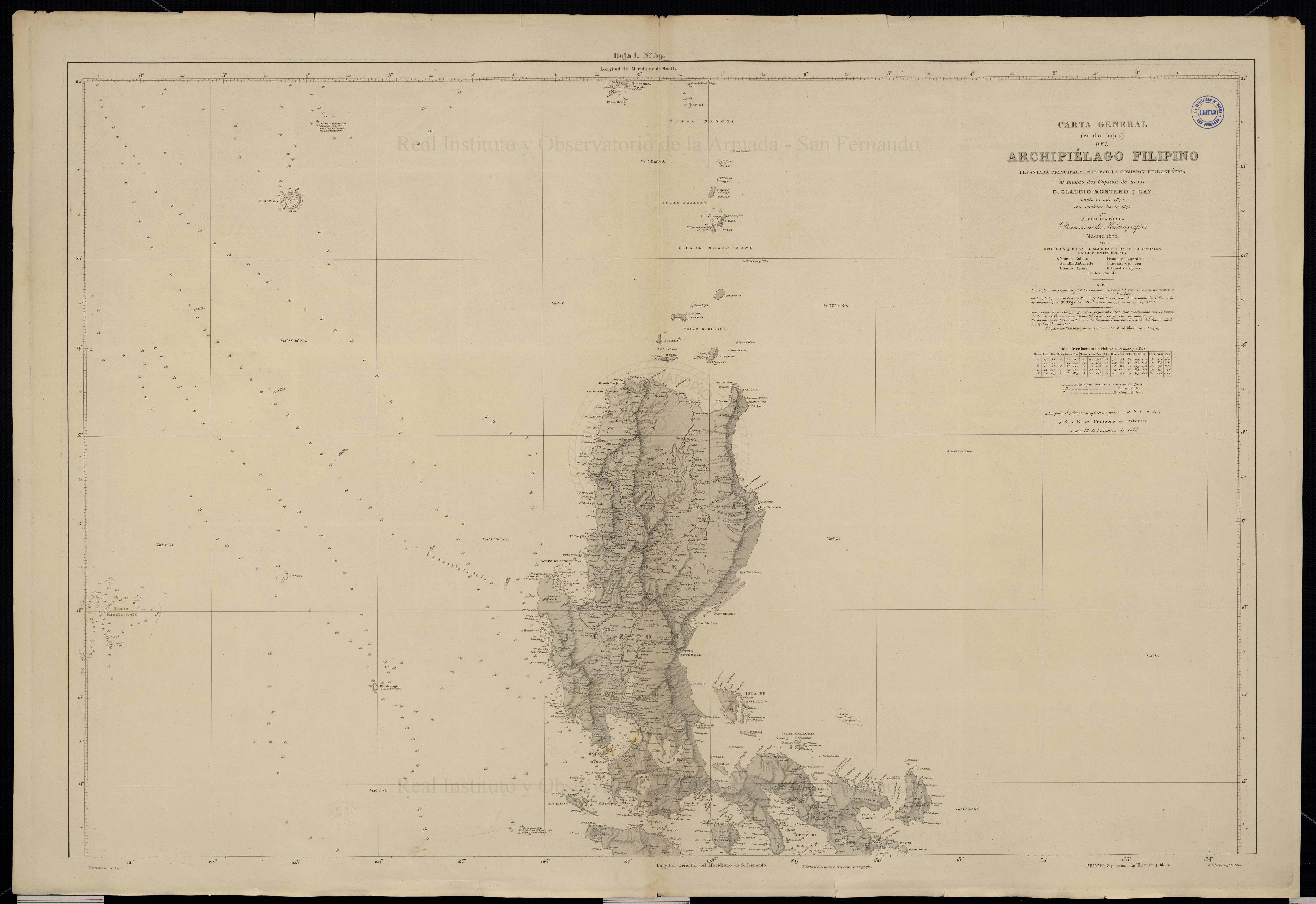
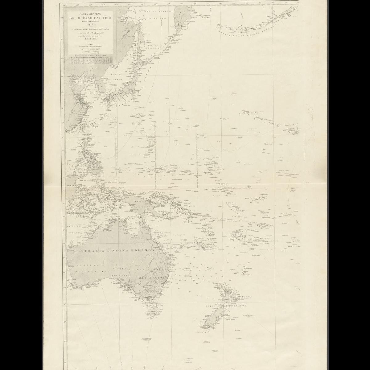
Eastern half of the General Chart of the Pacific Ocean,
published in 1897 by the Hydrography Section of the Spanish Navy.

From CIMSEC by Alex Calvo 

He who defends everything defends nothing: The Philippines, Scarborough Shoal, the South China Sea, and Sabah and the Sultanate of Sulu

The Philippines’ South China Sea strategy brings together rearmament, rapprochement with the US, tighter security and defense links with Japan, and an international arbitration case under UNCLOS, whose fate is still pending, with oral hearings on jurisdiction having taken place over the summer. Manila’s narrative and legal arguments concerning Bajo de Masinloc (Scarborough Shoal) are grounded on post-World War II developments.
On 18 April 2012 the Philippines’ Department of Foreign Affairs stated that “The Philippines considers Bajo de Masinloc an integral part of Philippine territory on the basis of continuous, peaceful and exclusive exercise of effective occupation and effective jurisdiction over the shoal”, stressing this was not based on UNCLOS but “anchored on other principles of public international law”, and also underlining that it “is not premised on the cession by Spain of the Philippine archipelago to the United States under the Treaty of Paris”.
While, alternatively, the Philippines may seek to resort to historical arguments from earlier eras, this may play into China’s hands, as noted by some observers.
The offer to Malaysia to downgrade Filipino claims on Sabah in exchange for moves reinforcing Manila’s position in the international arbitration case under UNCLOS seems to confirm that the Philippines have indeed decided to focus on post-WWII arguments.

Alternatively, Manila may have sought to follow one of three routes to prove the past exercise of sovereign powers as the foundation for her territorial claims in the South China Sea.
The first possible line of argument would involve proving that the Spratly were part of the Spanish Philippines, and were transferred to the US after the 1898 war.
The second would be to claim that they were incorporated into the Philippines following their transfer to American sovereignty.
Finally, a third approach would be to argue that they were part of the Sultanate of Sulu, thus linking the two claims.

The Spanish colonial era

Three international conventions regulate the geographical extent of the territorial transfer following the 1898 war: the Treaties of Paris and Washington between the US and Spain, and that concluded between the United States and Great Britain on 2 January 1930.
A range of potential problems would loom large if Manila tried to resort to the geographical extent of this territory.
First of all, the mentioned treaties do not provide a fully detailed picture of the resulting borders. Second, the actual reach of the colonial administration was not always clear, with widespread resistance to Spanish rule and insurgency in a number of areas.
In line with many other colonies, actual control was often a measure of distance from the capital, and went from long-standing exercise of sovereign powers, resulting in widespread cultural, linguistic, legal, economic, and social, influence, to little more than nominal sovereignty (or suzerainty when indirect rule was favored) on paper.
Third, geographical knowledge was not always accurate, with some territories imperfectly mapped or chartered, and confusion sometimes arising out of conflicting accounts.
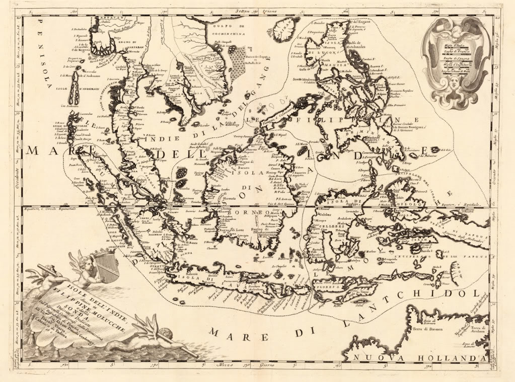
Having said that, some maps, like the one below, do explicitly include features currently under dispute, such as Bajo de Masinloc (Scarborough Shoal).

Spanish colonial era map of the Philippines, including Bajo de Masinloc / Scarborough Shoal. Kindly provided by Dr David Manzano Cosano, Escuela de Estudios Hispano-Americanos
(CSIC; Spanish National Research Council)

Furthermore, some expeditions and other activities took place featuring Bajo de Masinloc (Scarborough Shoal).
After a long history of uncertainty over its existence and location, the grounding of HMS Scarborough, chartered by the East India Company to transport tea, on 12 September 1748 led not only to its modern English-language name, but to its precise chartering.
Navigation charts published after the incident reflected it, but uncertainty still meant some debate on exactly where the ship had run aground, and some decades would pass until this was dispelled.
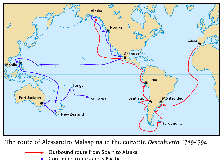

It was the Malaspina Expedition which in May 1792 finally ascertained the exact location of Scarborough Shoal, and confirmed that some reefs appearing on maps actually referred to this feature.
This was followed, in 1800, by the first detailed Spanish survey, conducted by the frigate Santa Lucia, part of the Cavite-based naval squadron.
Commanded by Captain Francisco Riquelme, she was one of the first steam-powered warships deployed in the Philippine Islands to take part in the campaigns against the Sultan of Sulu and the Moro slave-raiding pirate bands.
Thus, this ship illustrates two aspects of Spanish colonial rule which to some extent are contradictory, supporting and weakening potential historical arguments in line with Philippine claims.
On the one hand, it illustrates the connection between the Philippines and Scarborough Shoal, with activities from Luzon-based ships.
On the other, it reflects how conflict with insurgents and pirates were a constant of the period, with sovereignty on paper extending further than on the ground (and the waters).

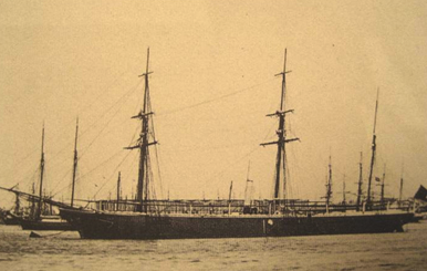
Frigate Santa Lucia, which commanded by Captain Francisco Riquelme
conducted the first Spanish survey of Scarborough Shoal (Bajo de Masinloc) in 1800

“This low-lying reef, per Riquelme, extends more than 8 2/3 miles from North to South, and 9 1/2 miles from East to West from one end to the middle part, but from there narrowing until it ends in a tip. It is surrounded by horrible dangers that may appear without warning or other markings to serve notice of their proximity. Some rocks can be seen slightly above water only by close observation on a clear day, and only by having careful look-outs can one see the reef at a distance of 7 miles”
Capitan Riquelme’s findings were incorporated into the “Dorroteo del Archipielago Filipino”, the Spanish pilot’s guide.

An 1879 edition reads:
Spanish colonial authorities did not only incorporate details of Scarborough Shoal into their charts, but also began to exercise search and rescue jurisdiction over the shoal, sending ships from Manila to assist vessels in distress.
Since this is one of the activities traditionally considered to fall under the umbrella of exercise of sovereign powers, it is worth noting.

“This map, from present-day Italy, included the Spratly in the Philippines’ territory”

The Philippines under American sovereignty

A second possibility would be to argue that once under American sovereignty, currently disputed features clearly came to be officially considered part of Filipino territory.
A significant obstacle to any such assertion is Washington’s long-held position that it takes no position on territorial disputes in the South China Sea, restricting its policy to how disputes are solved (insistence on peaceful solutions in accordance with international law) and the extent of any resulting settlement, with particular emphasis on freedom of navigation and overflight, and compliance with US views on the extent of coastal states powers in their EEZs.
In December 2014 The Department of State published No 143 in its “Limits in the Seas” series, titled “China: Maritime Claims in the South China Sea”, which again emphasized that “The United States has repeatedly reaffirmed that it takes no position as to which country has sovereignty over the land features of the South China Sea”.

However, this view does not reflect the fact that the activities described earlier under Spanish colonial rule continued to take place after 1898.
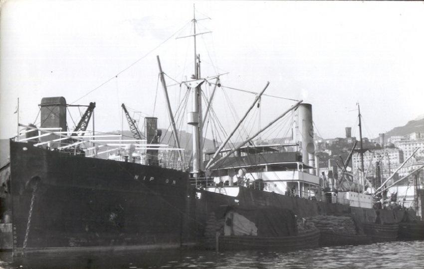
The most famous, and a well-documented, incident took place in 1913.
A typhoon hit the S.S. Nippon, a Swedish steamer carrying copra, and she was wrecked on Scarborough shoal.
This prompted Philippine authorities to intervene, together with private ships, in the rescue of the crew, investigate the accident, and carry out a scientific study on the effects of the sea on her cargo.
In addition, the ship came under the salvage laws of the Philippines, and the resulting legal case was appealed all the way up to the Supreme Court of the Philippines, leaving behind an extensive paper trail documenting the exercise of a wide range of powers by the Philippine authorities in connection with Bajo de Masinloc (Scarborough Shoal).


The SS Nippon, owned by the Swedish East Asiatic Co., which shipwreck on Scarborough Shoal in 1913 led to a civil case that ended up before the Supreme Court of the Philippines

In the 1930s, the Commonwealth Government sought an explicit assertion of sovereignty over Scarborough Shoal, going beyond the exercise of administrative powers, including search and rescue. On December 6, 1937, Mr. Wayne Coy (Office of the US High Commissioner for the Philippines) asked Captain Thomas Maher (head of the US Coast and Geodetic Survey) whether any country had claimed Scarborough Shoal.
The reply, dated 10 December 1937, was that no information was available on whether any nation had.
Concerning the Santa Lucia 1800 survey, Captain Maher said “If this survey would confer title on Spain or be a recognition of sovereignty, or claim for same without protest, the reef would apparently be considered as part of Spanish territory the transfer of which would be governed by the treaty of November 7, 1900”.
He also suggested that a new survey take place, and a navigational light be installed.

The next year saw Mr. Jorge B. Vargas (secretary to the president) write to Mr. Coy, asking about the status of Scarborough Shoal and saying that “The Commonwealth Government may desire to claim title thereto should there be no objection on the part of the United States Government to such action”.
This prompted Mr Coy to forward this correspondence to the US War Department, which in turn sent them to the State Department, resulting in an interesting exchange.
For example in a letter dated 27 July 1938 Secretary of State Cordell Hull told Secretary of War Harry Woodring that his department “has no information in regard to the ownership of the shoal”, which “appears outside the limits of the Philippine archipelago as described in Article III of the American-Spanish Treaty of Paris of December 10, 1898”.
However, Hull wrote, “in the absence of a valid claim by any other government, the shoal should be regarded as included among the islands ceded to the United States by the American-Spanish treaty of November 7, 1900” and therefore the State Department would not object to the Commonwealth Government’s proposal to study the possible setting up of air and ocean navigation aids, as long as “the Navy Department and the Department of Commerce, which are interested in air and ocean navigation in the Far East, are informed and have expressed no objection”.
The reply from Acting Secretary of the Navy W.R. Furlong to Acting Secretary of War Louis Johnson was positive, both concerning navigation aids and “the possibility of later claiming title”.
The secretary of commerce also said his department had no objections.

We can observe a measure of ambiguity, though, with the US Government having no objections to the Commonwealth Government claiming Scarborough, and even considering it to be included in the second treaty with Spain following the 1898 War, but not actually claiming the features itself.
Manila also expressed an interest in the Spratly, but despite this prompting Washington chose to keep a “low profile” concerning the archipelago, with non-recognition of claims by others and a close eye on Japanese interests and activities going hand in hand with a failure to officially claim the islands.
The same applied could be said about Scarborough Shoal.
In the words of François-Xavier Bonnet (IRASEC; Research Institute on Contemporary Southeast Asia), “the geographical proximity spoke in favor of the Philippines (rescue operations).
In a way, Bajo de Masinloc could be seen as integrated in the sphere of influence of the Philippines, but outside the main archipelago.
Political and symbolic acts, like naming the shoal, surveying, mapmaking, and organizing rescue operations, were the only appropriate activities that the Spanish and American authorities could do on an isolated shoal, which was, for the most part, underwater during high tide”.

The Sultanate of Sulu

A third possibility for Manila would be to claim sovereignty over Bajo de Masinloc as having historically been under the Sultanate of Sulu, that is merging the claim with that over Sabah.
However the Philippines seem to be leaning towards focusing on Scarborough, going as far as offering Malysia to downgrade her claim to Sabah in exchange for support on the former conflict.
This was clear in one of the Filipino moves this year connected to the international arbitration case, namely the offer to Malaysia, in a Note Verbale, to review its protest against the 6 May 2009 joint Vietnamese-Malaysian submission to the UN Commission on the Limits of the Continental Shelf (CLCS), containing a claim by Kuala Lampur of an extended continental shelf (350 nautical miles from the baselines) projected from Sabah.
In exchange for this, Manila is requesting two actions that she believes would reinforce her case against China:
First, to “confirm” that the Malay claim of an extended continental shelf is “entirely from the mainland coast of Malaysia, and not from any of the maritime features in the Spratly islands”.
Second, to confirm that Malaysia “does not claim entitlement to maritime areas beyond 12 nautical miles from any of the maritime features in the Spratly islands it claims”.

The impact on Manila’s Sabah claims has not been lost on observers, with former Philippine permanent representative to the United Nations Lauro Baja Jr., if Malaysia explaining that if the deal is accepted the Philippines’ claim to Sabah will be “prejudiced”, adding that “We are in effect withdrawing our objection to Malaysia’s claim of ownership to Sabah”.
Some voices argue that the Philippines need to stop claiming Sabah, since otherwise they are favoring Chinese claims to South China Sea features.
William M. Esposo has criticized the “charlatans and overnight Sabah claim experts” who “thought they were patriots fighting for Philippine national interest” but “didn’t even realize that the arguments they were mouthing were supporting China’s very claims to our territory in the South China Sea”.
Esposo cites Renato de Castro (De La Salle University International Studies Department), to stress that “historic claims, such as the one we have with Sabah, are the weakest cases when international courts decide territorial dispute”.

Conclusions

The Philippines are basing their South China Sea narrative on post-Second World War developments, and going as far as appearing ready to sacrifice their claim to Sabah in order to reinforce the arguments put forward in their international arbitration case against Beijing.
This fits with Washington’s agnostic view of territorial claims, even when they involve areas formerly under US sovereignty.
However, it is still interesting from a historical perspective to examine other possible arguments of this nature that could support Filipino claims on Bajo de Masinloc (Scarborough Shoal).

Links :

Tuesday, November 17, 2015

El Niño expected to strengthen further: High Impacts, unprecedented preparation

The El Niño of 2015-2016 
WMO has produced an animation to explain this year’s El Niño event. 

From WMO (U.N. system’s authoritative voice on weather, climate and water)

A mature and strong El Niño event, which is contributing to extreme weather patterns, is expected to strengthen further by the end of the year, according to the latest Update from the World Meteorological Organization.

Peak three-month average surface water temperatures in the east-central tropical Pacific Ocean will exceed 2 degrees Celsius above normal, placing this El Niño event among the three strongest since 1950. (Strong previous El Niños were in 1972-73, 1982-83 and 1997-98).


1997 vs. 2015: Animation Compares El Niños Side-by-Side

The El Niño-Southern Oscillation is a naturally occurring phenomenon which is the result of the interaction between the ocean and atmosphere in the east-central Equatorial Pacific.
Typically, El Niño events peak late in the calendar year, with maximum strength between October and January of the following year.
They often persist through much of the first quarter of that year before decaying.

“Severe droughts and devastating flooding being experienced throughout the tropics and sub-tropical zones bear the hallmarks of this El Niño, which is the strongest for more than 15 years,” said WMO Secretary-General Michel Jarraud.

“We are better prepared for this event than we have ever been in the past.
On the basis of advice from National Meteorological and Hydrological Services, the worst affected countries are planning for El Niño and its impacts on sectors like agriculture, fisheries, water and health, and implementing disaster management campaigns to save lives and minimize economic damage and disruption,” he said.

“The level of international, national and local mobilization is truly unprecedented, exemplifying the value of actionable climate information to the society”, said Mr Jarraud. “The preparedness for this El Niño will benefit from the systems WMO has been working to strengthen since the last major event in 1997-1998”, he added.


 What a difference a year makes. Strong El Niño settling in, comparing a year ago with today, as shown by this visualization of sea surface temp anomalies.

WMO released its Update on the eve of an international El Niño Conference in New York, of which WMO is a major co-sponsor, to increase scientific understanding of this event as well as its impacts, and help boost resilience to anticipated global socio-economic shocks.

“Our scientific understanding of El Niño has increased greatly in recent years.
However, this event is playing out in uncharted territory. Our planet has altered dramatically because of climate change, the general trend towards a warmer global ocean, the loss of Arctic sea ice and of over a million square km of summer snow cover in the northern hemisphere,” said Mr Jarraud.

“So this naturally occurring El Niño event and human induced climate change may interact and modify each other in ways which we have never before experienced,” he said.

“Even before the onset of El Niño, global average surface temperatures had reached new records. El Niño is turning up the heat even further,” said Mr Jarraud.

Comparison of the existing El Niño to past strong events.
In short, we're in the middle of one of the strongest El Niño's in recorded history.

It is important to note that El Niño and La Niña are not the only factors that drive global climate patterns.
For example, the state of the Indian Ocean (the so-called Indian Ocean Dipole), or the Tropical Atlantic Sea Surface Temperature, are also capable of affecting the climate in the adjacent land areas.

Most Recent 2 Months Sea Surface Temperature Anomaly Animation (Western Hemisphere)
NOAA SST anomalies

Regionally and locally applicable information is available via regional/national seasonal climate outlooks, such as those produced by WMO Regional Climate Centres (RCCs), Regional Climate Outlook Forums (RCOFs) and National Meteorological and Hydrological Services (NMHSs).

WMO released its Update on the eve of an international El Niño Conference to increase scientific understanding of this event and help boost resilience to anticipated global socio-economic shocks. The conference takes place on 17-18 November at Colombia University in New York and is co-sponsored and jointly organized by the World Meteorological Organization, the International Research Institute for Climate and Society (IRI), the U.S. Agency for International Development and the U.S. National Oceanic and Atmospheric Administration.

The conference will:
  • Provide an overview of the 2015 El Niño and its potential impacts
  • Explore the connection between the current El Niño and global change
  • Foster dialogue between climate scientists and development practitioners to strengthen action for climate resilience and sustainable development
  • Examine the progress, and lessons learned, over last 20 years in international, national and regional climate services, with a focus on El Niño
The full agenda is available here.
The conference will be livestreamed.

Background Information

The ongoing El Niño has already been associated with a number of major impacts.
These include:

Coral bleaching: Record ocean temperatures, caused in part by El Niño, have contributed to a major coral bleaching event.
It began in the north Pacific in summer 2014 and expanded to the south Pacific and Indian oceans in 2015. It is hitting U.S. coral reefs disproportionately hard.
NOAA estimates that by the end of 2015, almost 95 percent of U.S. coral reefs will have been exposed to ocean conditions that can cause corals to bleach.

Tropical cyclones: El Niño has contributed to a very active tropical cyclone season in the Western North Pacific and Eastern North Pacific basins.
Hurricane Patricia, which made landfall in Mexico on 24 October, was reportedly the most intense tropical cyclone in the western hemisphere.
El Niño tends to reduce hurricane activity in the Atlantic and around Australia.

Regional Impacts:

South East Asia: El Niño is typically associated with drought in South East Asia.
This has helped fuel wildfires in Indonesia, among the worst on record, which has caused dense haze to cover many parts of Indonesia and other neighbouring countries, with significant repercussions for health.

Pacific Islands: Historically, El Niño has caused reduced rainfall in the southwest Pacific (from southern Papua New Guinea southeast to the southern Cook Islands) and enhanced rainfall in the central and eastern Pacific (e.g. Tuvalu, Kiribati, Tokelau and Nauru).
But it also affects the number of tropical cyclones and their preferred tracks, so that there is a risk of extreme rainfall events even where drier than normal conditions are forecast.
More information here.

South Asia: Southwest monsoon.
The India Meteorological Department reported that the June-September rainfall over India as a whole was 86% of its long period average.
El Niño situation is believed to have played a key role in the rainfall deficit, which was successfully forecast by the India Meteorological Department as early as in June 2015.

Eastern Africa: The October to December rainfall season is expected to be highly influenced by the El-Nino phenomenon which is usually associated with enhanced rainfall within the equatorial sector of the Greater Horn of Africa during the October – December period.
However, local systems and the sea surface temperature patterns of the Indian Ocean impart highly on the influence of El-Nino to the region’s seasonal rainfall performance.
More information here.

Southern Africa; A number of countries in southern Africa are reporting below average rainfall leading to drought conditions and fears of food insecurity.
El Niño is a contributory, but not the only, factor. Further reading here.

South America: El Niño has a major impact on a number of countries in South America.
For instance, in the 1997-98 El Niño, central Ecuador and Peru suffered rainfall more than 10 times normal, which caused flooding, extensive erosion and mudslides with loss of lives, destruction of homes and infrastructure, damage to food supplies.
In Peru about 10% of the health facilities were damaged.
National meteorological services throughout the region have been very active in advising governments on preparedness measures to try to limit damages from this year’s El Niño.

The International Center for the Investigation of the El Niño Phenomenon, is WMO’s Regional Climate Centre for Western South America and is based in Ecuador.
It has organized briefings for policy makers and representatives from disaster risk management, agriculture and food production, health, tourism and other industries in South America.

In Central America, the Caribbean Climate Outlook Forum is issuing outlooks for El Niño-related conditions.

North America: the U.S. National Atmospheric and Oceanic Administration is regularly issuing El Niño Updates and advisories, along with regular blogs.

Monday, November 16, 2015

Canada CHS update in the GeoGarage platform

45 nautical raster charts updates + 1 chart added

New report and maps: Rising seas threaten land home to half a billion

Redesign of the sea level rise maps for every coastline around the globe

by ClimateCentral

Carbon emissions causing 4°C of warming — what business-as-usual points toward today —- could lock in enough sea level rise to submerge land currently home to 470 to 760 million people, with unstoppable rise unfolding over centuries.
At the same time, aggressive carbon cuts limiting warming to 2°C could bring the number as low as 130 million people.

How to avoid the next Atlantis

These are the stakes for global climate talks December in Paris.
Our analysis details the implications of different warming scenarios for every coastal nation and megacity on the planet, and our globally searchable Mapping Choices tool maps them.
We are also publishing Google Earth fly-over videos and KML contrasting these different futures for important cities around the world, and printable high-resolution photorealistic images of select global landmarks. We have made these visualizations embeddable and downloadable.
These are the stakes for global climate talks, in pictures.


Some of our major findings include: China, the world’s leading carbon emitter, leads the world, too, in coastal risk, with 145 million people living on land ultimately threatened by rising seas if emission levels are not reduced.
China has the most to gain from limiting warming to ​2°C, which would cut the total to 64 million.
Twelve other nations each have more than 10 million people living on land at risk, led by India, Bangladesh, Viet Nam, Indonesia, and Japan.
The U.S. is the most threatened nation outside of Asia, with roughly 25 million people on implicated land.
Meeting the 2°C​ goal would cut exposure by more than half in the U.S., China, and India, the world’s top three carbon emitters, as well as in many other nations.
Global megacities with the top-10 largest threatened populations include Shanghai, Hong Kong, Calcutta, Mumbai, Dhaka, Jakarta, and Hanoi.


Links : 
  • NOAA : Sea Level Rise and Coastal Flooding Impacts

Sunday, November 15, 2015

Safe at sea with satellites

At sea, space technology is used to help save lives every day: managing traffic between ships, picking up migrants and refugees in distress or spotting oil spills.
The European Space Agency is once again at the forefront developing new technologies and satellites: to keep us safe at sea and to monitor the environment.
Space makes a difference here on Earth and certainly at sea where there is no infrastructure.