Saturday, December 8, 2012

Humour : "It is curious that sailors need to make sentences*"


Radio conversation between a US navy ship and the north west of Spain, with English subtitles.
A Spanish version after Canadian and British versions : but still funny after all these years.

The story of the obstinate USA warship captain and the lighthouse attendant has been round for a long time.
According to a Snopes online article, there are naval staff who talk about seeing the joke passed around in the 1960s.
Kevin Wensing, an Atlantic Fleet spokesman in Norfolk, wrote in the article, “The first time I heard of it was – oh, let’s see, how long – about 10 years ago or so, I think. That story’s so old, it probably started out back in the galleon days, or back when there was a big lighthouse at Alexandria, Egypt.”

In 1996 the US Navy contributed to a newspaper article debunking the veracity of the urban myth (US Navy denial), in response to uncritical use of the story in high profile newspapers and television talk shows.

 Wikipedia : Lighthouse and naval vessel urban legend

Silva, the Sweden-based manufacturer of marine navigational equipment, borrowed a vintage naval joke in 2004 in the television advertisement, “The Captain”.
The campaign was designed to enhance Silva’s reputation in the provision of equipment for marine and outdoor lesiure activities with provision of compasses, GPS, mobile lighting, optics, headlamps, binoculars, outdoor instruments and marine electronics.
The Silva Captain ad won a Bronze Lion at Cannes International Advertising Festival in 2004 for entertainment and leisure.
It has been suggested that the reason the ad wasn’t given higher recognition was the fact that the spot is based on a well known tall tale...

* English translation of the famous French movie dialog from Michel Audiart : 


Other funny sea conversation video : German Coast Guard trainee dealing with his first 'Mayday' call.


Friday, December 7, 2012

James Cameron relives voyage to Ocean's deepest spot

Into the Deep: James Cameron's Mariana Trench Dive

From OurAmazingPlanet

The first thing James Cameron saw 7 miles below the sea was man-made: tracks from a remotely operated vehicle.


"When I got to the bottom, I saw skid marks from the ROV," Cameron said yesterday (Dec. 4) here at the annual meeting of the American Geophysical Union, referring to a survey by the Japanese ROV Kaiko.
Scientific results of the film director's expedition to the Mariana Trench were presented at the meeting this week, and Cameron and the researchers described the highlights to a packed crowd.

Cameron reported a new, corrected depth for his landing — 35,803 feet (10,912 meters) — which beats by five feet (1.5 m) the record set by U.S. Navy Lt. Don Walsh and Jacques Piccard in 1960 at the same spot.
However, "because the error [calculating the depth] on Don's dive is much greater, we're just going to have to call it a tie," Cameron said.

 Filmmaker and National Geographic explorer-in-residence James Cameron emerges from the Deepsea Challenger submersible after his successful solo dive to the Mariana Trench, the deepest part of the ocean.
CREDIT: Mark Thiessen/National Geographic.

Deepsea Challenger

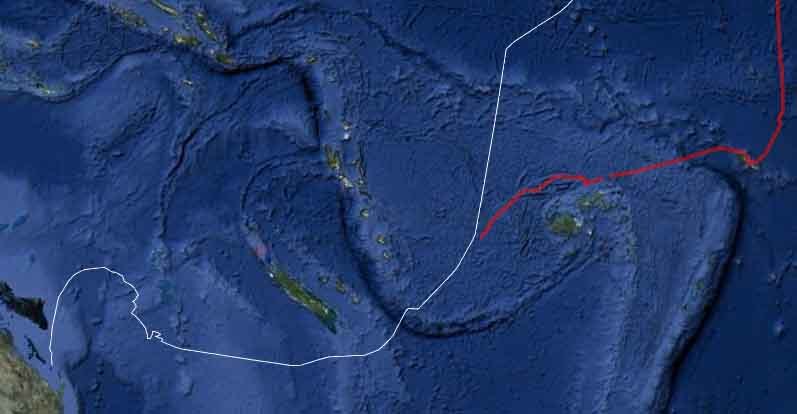
Cameron's Deepsea Challenger expedition made dives to the New Britain Trench and the Mariana Trench in the southwestern Pacific Ocean between Jan. 31 and April 3, with one manned dive by Cameron to the Mariana's Challenger Deep, the deepest spot in any ocean.

Unusual, never-before-seen species were snared and brought back to the surface.
A bizarre microbial mat community was discovered living on altered rocks in the Sirena Deep, another deep pool 6.77 miles (10.9 kilometers) below the surface.

Changes in temperature and salinity starting at 26,200 feet (8 km) deep hint at an unknown current coming into the Challenger Deep, said Doug Bartlett, a microbiology professor at the Scripps Institution of Oceanography at UC San Diego.

The filmmaker journeyed inside a high-tech lime-green machine — a steel sphere encased in foam — dubbed the Deepsea Challenger. The expedition traveled with two unmanned seafloor "landers" — large contraptions hoisted over the side of a ship and dropped to the seafloor. Once on the bottom, bait attached to the lander lured seafloor creatures to the craft, and a suite of instruments took samples, photographs and data. [Images: James Cameron's Historic Deep-Sea Dive]

The two contraptions working together proved to be a very good system, Cameron said. "We could rendezvous on the bottom and see the results of that bait running for six to eight hours, and that's how Doug could find a new species of giant arthropod," Cameron said.

 The Challenger Deep is the deepest canyon in the oceans.

Challenging journey

The March 26 dive proved to be a physical and mental challenge for Cameron. "I did yoga for six months so I could contort myself into the sphere," he said.

As he sank through the water, Cameron said he "burned though my whole checklist," designed to distract him during the long hours of the dive. "I still had 3,000 meters left to go with pretty much nothing left to do but sit quietly and think about the pressure building up around the hull," he said.

The sub touched down gently, and Cameron immediately took a sample of the seafloor, as planned.
This was a good contingency, because the sub's hydraulic fluid line then burst, leaving him unable to collect more samples.

To his surprise, the sub's voice communications worked perfectly.
"We actually expected they wouldn't, and I would have to default to texting," he said.
"Texting while driving is not a good thing, especially if you're using two hands to operate seven joysticks and you're 7 miles down."

Cameron first drove the sub about 200 meters, finding the seafloor elevation stayed the same.
In fact, Challenger Deep turned out to be remarkably flat, and the sub was easy to drive.
"The vehicle was quite nimble, the sub's yaw rate was very good," he said.
(Yaw describes the left-to-right rotation of a craft.)

A quick return

After about three hours, some of the submersible's batteries had low charge readings, the steering was problematic, and it was time to return to the surface.
The mission should have lasted five to six hours.
"I hate this. I hated having to go back," Cameron recalled thinking.

The trip to the top was mercifully short at 73 minutes.
The submersible covered nearly 7 miles in a little over an hour — slow in a car, but like riding a missile for a human in a metal ball.
Cameron said the surface trip is when he noticed the aches and pains from the cramped sub.
"That's when your butt is really sore, and when you notice how much it hurts."

The sub now sits in a barn in Santa Barbara, waiting for Cameron or another group with enough money to send it back to the deep ocean.
He declined to say how much it cost to build and mount the expedition.

"I would love for the sub to dive again," he said.
"I personally feel that we just barely got started before we had to turn back and there's just so much out there."

"And if not, at the very least, the technical innovations can be incorporated into other vehicle platforms," Cameron added.
"As far as I'm concerned, it's an open source situation."

Links :

Thursday, December 6, 2012

Vendee Globe : stressful areas

Situation 06/12/2012 12:00 PM UTC (Armel Le Cléac'h Not Localized at the 'Crozet security gate')
The orange lines represent the "northern limit of icebergs found".
The horizontal white line is Latitude 40° S.

Roaring Forties area
Welcome to the south (VG2012 news)

Alex Thomson at 25 knots onboard 'Hugo Boss'
located the most southern of the fleet

The Prince Edward Islands are two small islands in the sub-antarctic Indian Ocean that are part of South Africa : the islands are named Marion Island and Prince Edward Island.

The Crozet Islands (French: Îles Crozet; or, officially, Archipel Crozet) are a sub-antarctic archipelago of 5 small islands in the southern Indian Ocean

The ice is close...
"Previously we were much further south and so the high pressure areas would not have the same impact. It is difficult now, much more complicated." Mike Golding

monitoring of sea ice and icebergs (MDA / CLS)

The decision has been made for the Crozet ice gate to be moved by more than 400 miles, extending the Vendée Globe course by around 300 miles.
The reason for this move is due to the detection of an abnormal cluster of small icebergs, measuring over 20 meters in diameter.
Due to the risk of Icebergs, the Collecte Localisation satellite (CLS) constantly tracks the movement of the icebergs for the Vendée Globe and sends daily updates to the skippers.
Ice gates were brought into the race in 2000-2001 for safety reasons, whereas previously skippers played the risk of sailing further south to reduce the distance of their circumnavigation.
These gates can be moved during the race if there is reason to do so, which is the case this year.


Radarsat2 capable to detect 100m size iceberg max

Swimming robot reaches Australia after record-breaking trip

A self-controlled swimming robot has completed a journey from San Francisco to Australia.
A second robot is scheduled to make it to Australia early next year, and though one robot has to return to Hawaii for repair, another is currently en route to Japan.
Current locations of the PacX Wave Gliders (larger map / Google Earth kmz file)

From BBC

The record-breaking 9,000 nautical mile (16,668km) trip took the PacX Wave Glider just over a year to achieve.


Liquid Robotics, the US company behind the project, collected data about the Pacific Ocean's temperature, salinity and ecosystem (wave heights and frequency, weather, fluorescence and dissolved oxygen) from the drone.
Papa Mau also observed phytoplankton blooms around the equator in the Pacific, measuring increased concentrations of chlorophyll-A, confirming an increase in such events since the late 1960s caused by climate change.

Liquid Robotics chief scientist Luke Beatman told iTnews that approximately five million data points have been gathered by Papa Mau.
Different sets of data are collected from the Wave Gliders, Beatman said.
"We have the the environmental data that measures what's going around the Wave Glider, and the scientific data," Beatman said.
The second US-Australia Wave Glider, Benjamin, is continuing to transmit data.
The Wave Gliders communicate with the Internet using the Iridium satellite network, which allows for 2400 bits per second data speeds.
This allows the Wave Gliders to provide real-time data to researchers, a feature that Beatman said is unique and really surprised him when he started work at Liquid Robotics.
The company said its success demonstrated that such technology could "survive the high seas".

However, Beatman said the Wave Gliders also utilise Iridium's RUDICS (Router-Based Unrestricted Digital Internetworking Connectivity Solutions) that allows customers to send and receive data traffic over the Iridium network using an optimised circuit switched data channel.
Nevertheless, Beatman admits that using the Iridium service which has standard charges of US$1.20 ($1.15) per 1000 bytes is the big budget item in the Liquid Robotics PacX project.
Data gleaned by the Wave Riders is presented through a web interface, in comma separated values format for analysis by researchers.

The PacX voyage so far.
A short documentary on the occasion of Papa Mau's arrival in Australia

The robot is called Papa Mau in honour of the late Micronesian navigator Pius "Mau" Piailug, who had a reputation for finding ways to navigate the seas without using traditional equipment.

"During Papa Mau's journey, [it] weathered gale-force storms, fended off sharks, spent more than 365 days at sea, skirted around the Great Barrier Reef, and finally battled and surfed the east Australian current to reach his final destination in Hervey Bay, near Bundaberg, Queensland," the company said in a statement.

>>> geolocalization with the Marine GeoGarage <<<

Some of the data it gathered about the abundance of phytoplankton - plant-like organisms that convert carbon dioxide into oxygen and provide food for other sea life - could already be monitored by satellite.
However, the company suggested that its equipment offered more detail, providing a useful tool for climate model scientists.

Ongoing travels

Liquid Robotics still has a further three robots at sea.
A second is due to land in Australia early next year.
Another pair had been heading to Japan, but one of them has suffered damage and has been diverted to Hawaii for repair.


Each robot is composed of two halves: the upper part, shaped like a stunted surfboard, is attached by a cable to a lower part that sports a series of fins and a keel.

They do not use fuel but instead convert energy from the ocean's waves, turning it into forward thrust.
Solar panels installed on the upper surface of the gliders power numerous sensors that take readings every 10 minutes.

Mixing electronics and water might sound like a risky idea - but Dr Jeremy Wyatt, from the school of computer science at the University of Birmingham, said there was good reason there was so much interest in marine robotics.
"The ocean is a very big place and therefore a safe place to test autonomous robots - these Wave Gliders move slowly and have a low risk of bumping into other objects," he said.
"There are also autonomous sailing competitions in which craft plot their journey completely independently - unlike the Wave Gliders which autonomously follow a prescribed route - and there are a variety of types: robots which bob on the ocean surface, gliders and even fully autonomous submarines which plan their own routes and dive to collect data.

Eventually, Liquid Robotics hopes to have hundreds of next generation Wave Gliders with improved solar panels for more power traversing the oceans, and believes the solution is scalable.
Several uses are envisaged for teams of Wave Riders, including early detection of cataclysmic events such as tsunamis through pressure and wave height sensors.
"We are reaching a tipping point in that the technology is becoming so cheap that it's now a much cheaper to use a robot to gather data than to pay for a manned ship to be at sea for months at a time."

Links :

Wednesday, December 5, 2012

What Arctic warming means for one seabird


George Divoky: the bird-watcher who saw the future
For nearly 35 years George Divoky has been returning to Cooper Island, a small, low strip of desolate land close to Barrow, AK.
Initially he went there simply to study Black Guillemots, but as - over the decades - he tracked the dates of their arrival and the new chicks hatching, he realized he was documenting how climate change was affecting both an organism and an ecosystem.
As summer ice retreated, food for the chicks was harder and harder to find - and polar bears began to roam the beach.
(other video BBC)

From BBC

A small colony of black guillemots living on a gravel spit off Point Barrow is providing a unique insight into the changing Arctic environment.

>>> geolocalization with the Marine GeoGarage <<<

The Cooper Island birds feed their young on cod that hug the underside and edges of the polar pack ice.
But their access to this prey source is being limited by the big retreat in seasonal ice cover now under way.

How the guillemots respond will turn a lens on the wider changes taking place in Arctic ecosystems, biologists say.
"Things could go either way for these birds," explains George Divoky, who has studied the guillemots since 1975.
"It's just not known at this stage whether they will be able to cope with the big change by adapting to new food sources, or if they will have lower and lower breeding success until the colony eventually disappears," he told BBC News.

Dr Divoky was speaking here at the American Geophysical Union (AGU) Fall Meeting, the largest annual gathering of Earth scientists.
The bird biologist spends three months of the year on Cooper Island, which is about 40km east of the Alaskan town of Barrow.
He has tracked the roller coaster ride of the spit's black guillemots (Cepphus grylle mandti) across four decades.

It was the warming climate that first allowed the birds to make the island their home.
They nest in the cavities found in abandoned old boxes and piles of driftwood, but need 80 days clear from snow to give their chicks time to hatch and fledge.
And it was only in late 1960s and early 1970s that such summer conditions persisted to enable the guillemots to breed routinely and successfully on Cooper.
The following couple of decades then saw the colony flourish.
The Arctic pack ice was rarely more than about 25km off shore, providing the parent birds easy access to the nutritious Arctic cod (Boreogadus saida) they prefer to feed their young.

In the past two decades, however, the summer marine ice-cover has retreated far from land.
This September, the lowest ice extent ever recorded in the satellite-observing era, saw the edge of the ice pack sit hundreds of km from the island.

That has severely restricted the guillemots' ability to retrieve the cod, which feed on the plankton that in turn depend for their existence on the algae that coat the underside of the ice.
The guillemots have responded by shifting to lower quality fish, such as fourhorn sculpin (Triglopsis quadricornis).
But their breeding success has suffered as a consequence.
"The sculpin is a bottom-fish. It doesn't have a very high fat content. It also has a very bony, spiny head and guillemot chicks don't even like to eat it," explained Dr Divoky.
"When the ice leaves, or the water temperature picks up to the point where the cod leave, the guillemots are going back to the same feeding spot but don't find anything. Then there's a day or two or three lag before they realise they have to switch to the sculpin. And it's in that lag that chicks die because the parents don't provide their young with the food they need."

What is more, the warmer conditions on Cooper mean sub-arctic species have begun to invade the spit and compete with the guillemots.
Horned puffins (Fratercula corniculata), for example, will try to seize guillemot nests, kicking out any eggs and nestlings that are already present.
Polar bears, too, now seek refuge on the island when the ice is at its most distant in August/September, and will eat guillemot young.

In 2011, Mr Divoky replaced all of the guillemot nest sites with plastic cases to make it difficult for the puffins and bears to disturb the colony
 But the food issue is something the biologist can do nothing about.
All he can do is document its impact.
"Guillemots are generalists and we now see the likes of capelin, sandlance, and pollock - a whole number of forage fish that are abundant in the sub-arctic - moving north into the Chukchi Sea and the Beaufort Sea.
"Guillemots, because they will be going out for the six-week period when the parents are raising young and feeding on whatever prey is there - they may be the first indicator of what's happening with these forage fish getting to the area.
"It's going to be very interesting to see what happens next. I've got all the guillemots banded - and have had since 1975 - and there could well be some sort of selection for birds that realise that the ice is not the future and turn to exploit sub-arctic prey. They would be the successful birds and one could get a sub-arctic guillemot on Cooper."

Tuesday, December 4, 2012

Study: our oceans are so acidic they're dissolving snails


More than a hundred thousand marine species build their bodies using calcium carbonate, including snails, oysters, sea stars, coral, and plenty of planktonic animals.
This incredible diversity of life evolved over millions of years, as animals figured out ways to pull calcium and carbonate ions from the water to build shells and skeletons so robust that they remain intact long after the animals perish.
But all of this is changing.
Our addiction to fossil fuels and the billions of tons of carbon dioxide we're pumping into the atmosphere each year may be undoing millions of years of evolution in a geological blink of time.

From TheAtlantic

Problem :
In 2008, a U.S. scientist predicted the corrosive effects that ocean acidification could have on tiny shellfish called pteropods, also known as marine snails, also known as sea butterflies, and sometimes referred to as "the potato chips of the oceans."
She warned they would not only be the "canaries in the coal mine" of climate change, but that the impact of losing a snail the size of a lentil would undoubtedly creep its way up the food chain.

The pteropod (marine snail) Limacina helicina antarctica (Nina Bednarsek/British Antarctic Survey)
The full study in Nature GeoScience journal

Methodology :
Turns out, this hypothetical disaster was already happening.
Also in 2008, during what should have been a relaxing trip in the Antarctic seas (or at least, that's what the phrase "science cruise" evokes for me), researchers from British Antarctic Survey, the University of East Anglia, the US Woods Hole Oceanographic Institution, and the National oceanic and Atmospheric Administration collected pteropods from the top 200m of the ocean's surface, where they tend to live, and examined them for shell damage.

Planktonic snails known as sea butterflies build fragile shells.
Will they survive an acidifying ocean? Plankton Chronicles Project by CNRS

Results :
The sea snail's shells were found to be "severely dissolved."
Part of the acidity in the water sample was due to upswelling, a natural occurrence in which cold water from the depths of the ocean is pushed up to the surface by heavy winds.
Upwelled water itself can be corrosive, and it's expected to occur more frequently as climate change intensifies.
But the ocean's pH is also decreasing at least in part because of atmospheric carbon dioxide attributed to the burning of fossil fuels.

Conclusion :
The impact of ocean acidification is, as predicted, significant, and is affecting marine ecosystems and food systems.

Implications :
"The tiny snails do not necessarily die as a result of their shells dissolving," said co-author (and science cruise leader) Geraint Tarling, "however it may increase their vulnerability to predation and infection."
This can go on to affect bigger fish, and from there, penguins and polar bears.
The snails are also the only food source of the "Sea Angel," another pretty name for something that's really just a slug, but is no less important for it.
And these little guys are only the first to start dissolving -- if ocean acidification continues at its current rate, the consequences can extend even further. First it's the sea butterflies, then it's everything else.

Links :

Monday, December 3, 2012

Vendee Globe : welcome to the Land of the Albatross

South part of South Africa with Cape of Good Hope and Cape Agulhas
>>> geolocalization with the Marine GeoGarage <<<

The first five have passed the Gate of Aiguilles.
The lead pack have now entered mythical seas.

There is a misconception that the Cape of Good Hope (Cape peninsula) is the southern tip of Africa, because it was once believed to be the dividing point between the Atlantic and Indian Oceans.
In fact, the southernmost point is Cape Agulhas, about 150 kilometres (90 mi) to the east-southeast.


A place where tales can only be told by a few; tales of the albatross, the tinted grey light, the jet black mountainous savage seas, majestic icebergs and minefields of growlers, large semi-submerged chunks of solid, boat breaking ice.

The Agulhas Current flows along the southeastern coast of Africa from the Indian Ocean into the southern Atlantic Ocean.
It's well known for its treacherous winds, monster waves and shark-infested waters.
It also turns out to be an important site to study global climate. 

The Cape of Good Hope

"Cape of Storms" was the original name of the "Cape of Good Hope"

Greenland and Antarctica 'have lost four trillion tonnes of ice' in 20 years

The study found that while eastern Antarctic was gaining some ice,
other areas were losing twice as much.
Photograph: Mike Powell/Corbis

From TheGuardian

• Landmark study by global team of scientists published
• Finds melting polar ice has led to 11mm rise in sea level
• Greenland losing ice five times faster than early 1990s


More than 4 trillon tonnes of ice from Greenland and Antarctica has melted in the past 20 years and flowed into the oceans, pushing up sea levels, according to a study that provides the best measure to date of the effect climate change is having on the earth's biggest ice sheets.

 Each summer, streams channel much of the melt that is produced by the warmer temperatures along lower levels of the Greenland ice sheet
Photograph: Courtesy Ian Joughin/AAAS

The research involved dozens of scientists and 10 satellite missions and presents a disturbing picture of the impact of recent warming at the poles.
The scientists claim the study, published in the journal Science, ends a long-running debate over whether the vast ice sheet covering the Antarctic continent is losing or gaining mass.
East Antarctica is gaining some ice, the satellite data shows, but west Antarctica and the Antarctic peninsula is losing twice as much, meaning overall the sheet is melting.

 Over the course of several years, turbulent water overflow from a large melt lake carved this 60-foot deep canyon
For several summers this deeply incised melt channel transported overflow from a large melt lake to a moulin (a conduit that drains the water through many hundreds of feet to the ice sheet's bed
Photograph: Courtesy Ian Joughin/AAAS 

"The estimates are the most reliable to date, and end 20 years of uncertainty of ice mass changes in Antarctica and Greenland," said study leader, Andrew Shepherd, of Leeds University. "
There have been 30 different estimates of the sea level rise contribution of Greenland and Antarctica, ranging from an annual 2mm rise to a 0.4mm fall.
"We can state definitively that both Greenland and Antarctica are losing mass, and as [the] temperature goes up we are going to lose more ice."

 Photograph: Mike Powell/Corbis

The study shows the melting of the two giant ice sheets has caused the seas to rise by more than 11mm in 20 years.
It also found Greenland is losing ice mass at five times the rate of the early 1990s.


The uncertainties over ice cap melting have made it difficult for scientists to predict sea level rise.
But Prof Richard Alley, of Penn State University, US, who was not involved in the study, said: "This project is a spectacular achievement. The data will support essential testing of predictive models, and will lead to a better understanding of how sea level change may depend on the human decisions that influence global temperatures."
Rising sea level is one of the greatest long-term threats posed by climate change, threatening low-lying cities and increasing the damage wrought by hurricanes and typhoons.

 A large melt lake, around 0.75 miles in diameter, that is just one of the many supraglacial lakes (liquid water on the top of a glacier) that form on the ice sheet's surface during the period of strong summer melt
Photograph: Courtesy Ian Joughin/AAAS  

The study combined satellite measurements of the ice caps' heights from laser and radar instruments with measurements of the small changes in gravity caused by ice loss.
The data was analysed ensuring the same regions and time periods were compared, as well as using the consistent estimates of the rebound that land experiences when heavy ice sheets start to melt.
The 11mm sea level rise caused by melting in Greenland and Antarctica makes up about a fifth of the total rise in the oceans since 1992, but the increasing rate of melting means the ice caps' contribution today is about two-fifths.
The other contributions to rising seas are the expansion of water as it warms and a smaller contribution from the melting of ice caps and glaciers outside the poles.
A study in February found that, over the past decade at least, the Himalayas had on average lost no ice.

 A close-up of crevasses produced by rapidly stretching ice in Antarctica's Pine Island glacier
photo : Ian Joughin/Science/AAAS

Another recent study showed the changes to winds caused by global warming meant that sea ice – whose melting does not add to sea level rise – was very slightly increasing around Antarctica, at the same time as rapidly vanishing in the Arctic.

 An iceberg that likely calved from Jakobshavn Isbrae, the fastest glacier in western Greenland.
photo : Ian Joughin/Science/AAAS
 
Ian Joughin, another member of the team, of University of Washington, Seattle, said: "Climate change is likely to accelerate ice loss greatly."

photo : Ian Joughin/Science/AAAS

He added significant challenges remained in predicting ice melting, due to the complexity of the interactions between the warming air and oceans and the great ice sheets and glaciers.
"In Greenland, we are seeing really dramatic losses in ice, but it is still uncertain if it will slow, stay the same or accelerate further."

Links :
  • BBC : Sea-level rise from polar ice melt finally quantified

Sunday, December 2, 2012

For those in peril on the sea... Terrifying images of fishing boat being battered by 30ft waves in the far North Sea show dangers faced by our trawlermen every day

Deadliest catch in North Sea storm
"The fishermen know that the sea is dangerous and the storm is terrible, but they have never found these dangers sufficient reason for remaining ashore." --- Vincent Van Gogh 

From DailyMail 

The next time you pop out for a cod and chips, spare a thought for the men who caught your dinner.
These amazing images show a fishing boat being hurled about by gale force winds in the North Sea as the crew battles to keep control.
Caught in mountainous 30ft waves, the state-of-the-art Harvester ploughs through relentlessly to collect cod and plaice.


For the team, it is just another trip - part of the daily life of the unsung heroes who harvest the ocean, as men from Peterhead, north-east Scotland, have done for the last 400 years.


North Sea trawlermen have been fishing like the men on this boat in some of the world's most unpredictable seas for hundreds of years

Fortitude: North Sea trawlermen have been fishing like the men on this boat in some of the world's most unpredictable seas for hundreds of years

Lashed by waves: The Harvester is seen here caught in mountainous thirty-foot waves

Lashed by waves: The state-of-the-art Harvester is part of the Lunar fishing fleet from Peterhead, north-east Scotland

Struggling: The skipper is almost entirely submerged by water as it steers through the stormy waters

Struggling: The skipper is almost entirely submerged by water as it steers through the stormy waters

Danger: The trawlermen have a daily struggle with the elements every time they leave the shelter of their home ports on the UK's north-east coast

Danger: The trawlermen have a daily struggle with the elements every time they leave the shelter of their home ports on the UK's north-east coast

Using the power of her 900hp engine, the skipper has to steer a safe course for the 90ft-long vessel, part of the Lunar fishing fleet.
And at times, the boat almost disappears in the yawning troughs between the huge waves.
Peterhead is one of the biggest trawler communities in the region, where, against the odds, fishing is still the main industry employing more than 500 men and where 100,000 tonnes of fresh fish are landed every year, despite dwindling stocks of cod, plaice and other fish that used to be bountiful in the area.
Earnings are just as risky as the job itself as wages are split between the crew and the vessel depending on how great a haul of fish they manage to bring in.
Some crews could be out at sea for long periods - months at a time - depending on the harvest. 

Against the odds: Peterhead is one of the biggest trawler communities in the region, where fishing is still the main industry

Against the odds: Peterhead is one of the biggest trawler communities in the region, where fishing is still the main industry employing more than 500 men and where 100,000 tonnes of fresh fish are landed every year, despite dwindling stocks of cod and plaice 

Making waves: Using the power of her 900hp engine, the captain has to steer a safe course for the 90ft-long vessel

Making waves: Using the power of her 900hp engine, the captain has to steer a safe course for the 90ft-long vessel

Here comes another one: Life in the fishing grounds can still be a dangerous challenge - as these remarkable pictures clearly show

Here comes another one: Life in the fishing grounds can still be a dangerous challenge - as these remarkable pictures clearly show

Where once a trawlerman was almost guaranteed a high gain after hauling in tonnes of fish, these days typical earnings are plummeting.
According to a report by the Seafish Industry Authority, some two thirds of fishing fleets pay their fishermen less than the average UK wage.
The North Sea is under great pressure as numbers of cod, plaice, haddock, salmon and prawns - the 'Big Five' popular fish - fail to satisfy demand.
Consumption of these breeds makes up 75 per cent of total fish consumption in the UK.
And Herring, cod and plaice fisheries may soon face the same plight as mackerel fishing which ceased in the 1970s due to overfishing.
Part of the issue is that rules to protect the stocks of fish, such as limited fishing times and limited numbers of fishing boats, have not been systematically enforced.
The town of Grimsby on Lincolnshire's east coast once laid claim to the title of the 'largest fishing port in the world', with a fleet of over 700 trawlers and the rail links from the town to London's Billingsgate Fish Market allowed Grimsby fish to be renowned nationwide. Today Grimsby's fish docks are virtually deserted, though the towns port is still a hive of activity for cargo vessels.
But Peterhead has been the largest fishing port in Europe from the 1970s onwards. In its prime in the 1980s Peterhead had over 500 trawlers staying at sea for a week each trip.
Peterhead has seen a significant decline in the number of vessels and the value of fish landed has been reduced due to several decades of overfishing which in turn has reduced fishing quotas.
Last month, Tesco announced it would offer new, sustainably caught seasonal lines such as cuttlefish, octopus, Dover sole and squid in response to widespread concerns about over-fishing.
All of the new fish varieties will be caught in and around British coastal waters, particularly in the south west of England.
Initiatives like this one will take the pressure off the North Sea, but could also see Peterhead's fishermen struggle further as the south west begins selling more fish in its stead.

Hang on: The Harvester trawler hurtles straight into the oncoming swell and takes on board a flood of seawater

Hang on: The Harvester trawler hurtles straight into the oncoming swell and takes on board a flood of seawater

Gone fishing: The Harvester is a state-of-the-art part of the Lunar fishing fleet, seen here caught in mountainous thirty-foot waves

Gone fishing: The Harvester is a state-of-the-art part of the Lunar fishing fleet, seen here caught in mountainous thirty-foot waves

Despite that tragic proportion, officially, the most dangerous job in the world is commercial fishing, with an annual death rate of 116 per 100,000

Read more: http://www.dailymail.co.uk/home/books/article-2195278/The-riskiest-worst-paid-jobs-world-WORLDS-MOST-DANGEROUS-JOBS-BY-PAULA-REID.html#ixzz2DQrBzhlh
Follow us: @MailOnline on Twitter | DailyMail on Facebook
Back on course: The ship begins to right itself as the worst of the storm passes on

Back on course: The ship begins to right itself as the worst of the storm passes on 


And the trawlermen's jobs are set to get even more difficult...

Peterhead trawler in rough seas 
These striking images evoke the famous naval hymn 'Eternal Father, Strong to Save', whose refrain 'For those in peril' has become an anthem for British and US Navy and US Marine Corps.
The original hymn was written by William Whiting of Winchester, England, in 1860.
It was originally intended as a poem for a student of his, who was about to travel to the United States.
The first verse is based on psalm 104 in which God forbids water to flood the earth:     
    Eternal Father, strong to save,
    Whose arm hath bound the restless wave,
    Who bidd'st the mighty ocean deep
    Its own appointed limits keep;
    Oh, hear us when we cry to Thee,
    For those in peril on the sea!

It was the favorite hymn of U.S. President Franklin Roosevelt and was sung at his funeral in Hyde Park, New York, in April 1945.
The Navy Band also played it in 1963 as U.S. President John Kennedy's body was carried up the steps of the U.S. Capitol to lie in state.

Fish are likely to get smaller on average by 2050 because global warming will cut the amount of oxygen in the oceans, according to a study.
Average maximum body weights for 600 types of marine fish, such as cod, plaice, halibut and flounder, would contract by 14-24 percent between 2000 and 2050 under a scenario of a quick rise in greenhouse gas emissions, according to the the study last month from the University of British Columbia.
The change is likely to have huge repercussions to both the marine eco-system, as well as the fishing industry.
Lead author William Cheung said: 'The reductions in body size will affect whole ecosystems.'
His team of scientists said a trend towards smaller sizes was expected to have large implications for ocean food webs and for human 'fisheries and global protein supply.'
'The consequences of failing to curtail greenhouse gas emissions on marine ecosystems are likely to be larger than previously indicated,' the U.S. and Canada-based scientists wrote.

Boxes of fish lined up on the quayside at the white fish port of Peterhead Harbour, Scotland
Peterhead Harbour
Back at harbour: The Peterhead fleet rest on calmer waters and on shore thousands of tonnes of fish are loaded up to be transported to the rest of the UK 
 
Links :