Saturday, May 18, 2019

Mysterious planetwide rumble may have come from the largest underwater eruption ever recorded

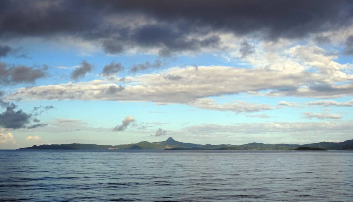
View of Mayotte island coast, 10 avril 2014
© AFP/Archives/Sophie Lautier

From Gizmodo by Robin George Andrews

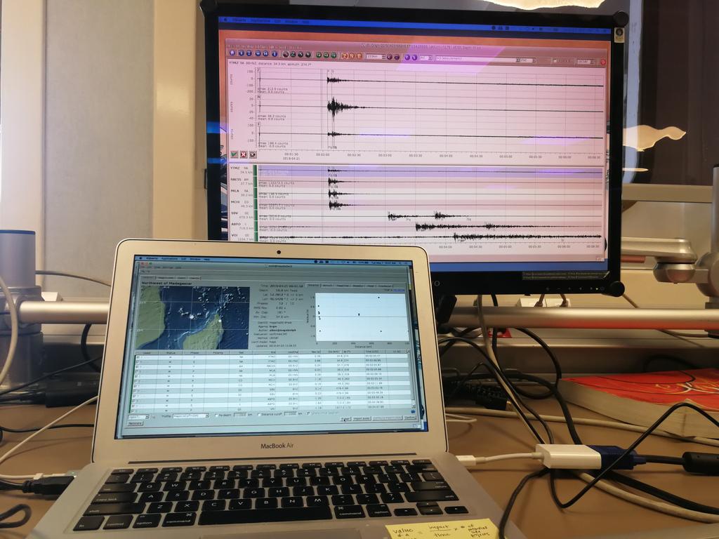
On November 11, 2018, a deep rumble ricocheted around the world, one that humans couldn’t feel but that registered quite clearly on seismometers.
A new pre-print paper about the event is now suggesting that it was caused by the largest offshore volcanic event in recorded history.

 Mayotte island with the GeoGarage platform (SHOM nautical chart)


Originating 30 miles east of the island of Mayotte, near Madagascar, the mid-November signal immediately caught the attention of a disparate group of geoscientists.
They subsequently took to Twitter to express their fascination over this mysterious event—one even joked about a “giant prehistoric sea monster.”


Source 
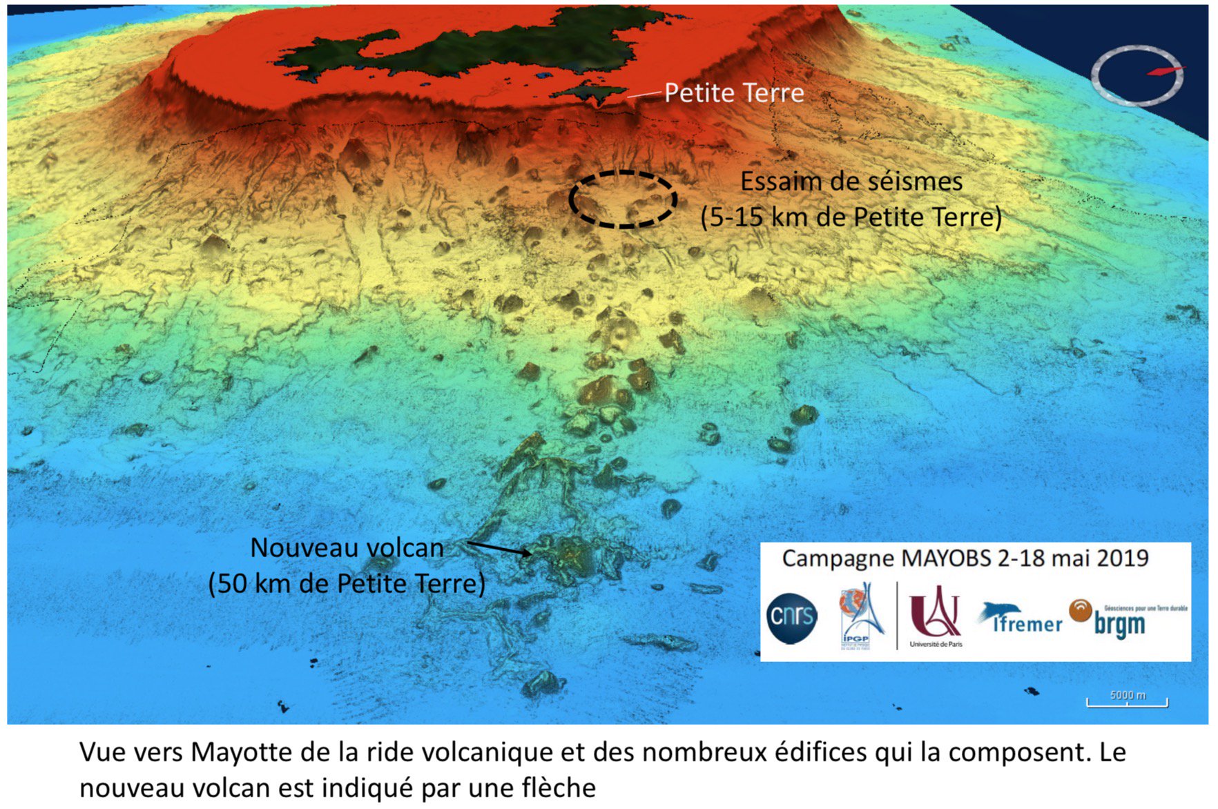
of prolonged Mayotte earthquake swarm identified: new active volcano discovered 3.5km below sea surface, 0.8km high and 4-5km diameter.
Fluid release reaches 2km above volcano.

The rumble formed part of a prolonged seismic sequence that had started in the area back in May 2018, but the very low-frequency, potent growl in November stood out because it wasn’t immediately obvious what caused it.
These scientists eventually agreed that it could only have originated from a volcanic event, one involving the movement of a vast volume of magma beneath the seafloor, causing the ground there to significantly deflate.

Now, a new paper by researchers at the French Geological Survey and France’s Ecole Normale Supérieure has been uploaded to the public server EarthArXiv.
Although there are plenty of unanswered questions, this first-order estimation of what happened between May and mid-November matches up with the calculations of those geoscientists that took to social media.
In fact, the volume of magma involved is so huge that this is certainly one of the largest offshore volcanic events to be spotted by modern scientific instrumentation.
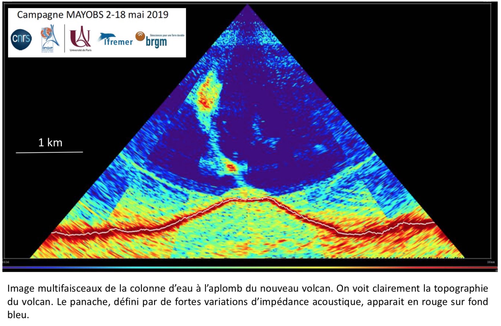

Another amazing view, in section, of the newly discovered active volcano 50km offshore Mayotte Topography of the volcanic edifice and the rising fluid column above it are clearly imaged.
Fluid column is ~2km high but do not reach the surface.

There is a major caveat to all this, however.
Compared to land-based monitoring, there’s a huge lack of offshore monitoring happening around the world today, and there are likely plenty of offshore events that have taken place since modern records began that scientists haven’t picked up on.

Make no mistake, though: The recent event offshore from Mayotte, which is still ongoing, is colossal.

 
Previous internet detection in Mayotte Region
10 min ago is confirmed by seismic signal 

According to the data from the onshore GPS stations, as well as the seismic signals—including the weird November 11 event—the rumbling is definitely being generated by volcanic activity of some sort.
The way the ground on Mayotte is moving implies that the seafloor off its eastern shoreline is sinking at a rate of around 0.4 inches per month.
At the same time, Mayotte itself is shifting eastward at a rate of 0.63 inches per month.
Both indicate something huge underground is on the move, causing some serious deflation.

The nature of these tremors suggest that the magmatic source is centered at a depth of 16 miles beneath the seafloor.
In the first six months of the sequence alone, at least 0.24 cubic miles of magma has shifted around.
That’s roughly equivalent to 385 Great Pyramids of Giza.


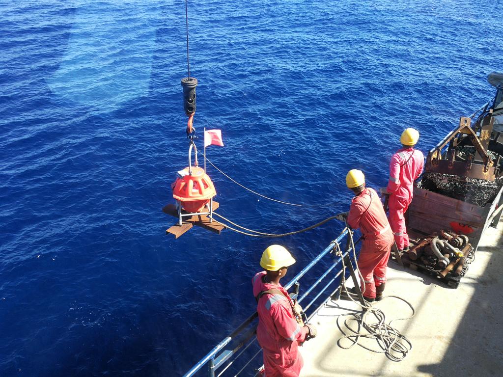
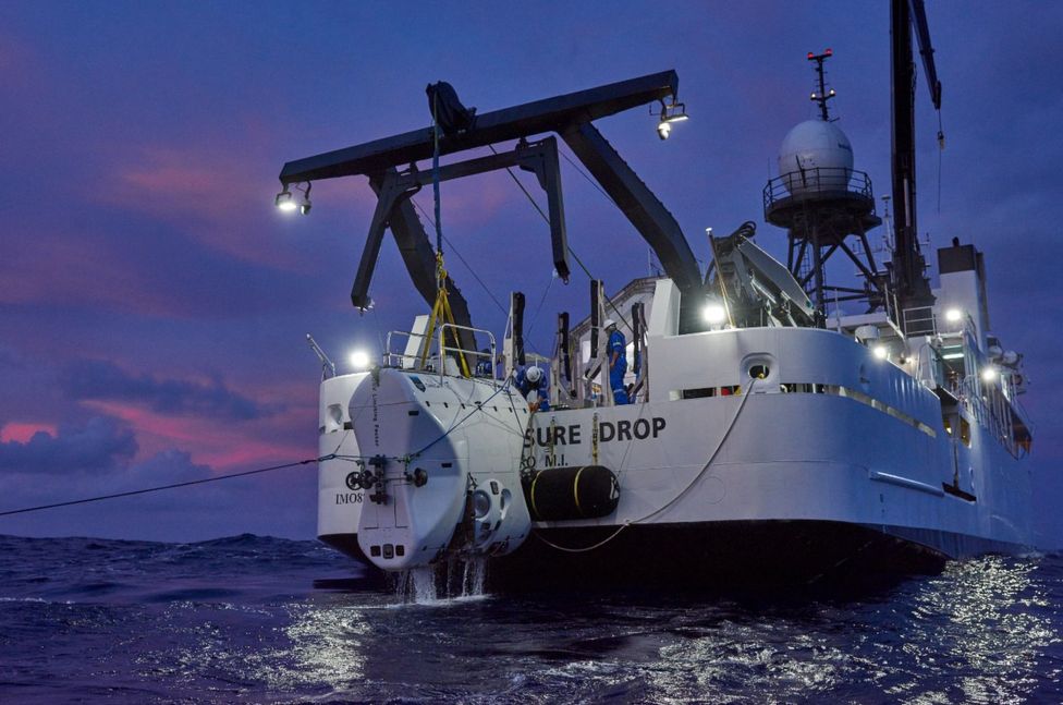
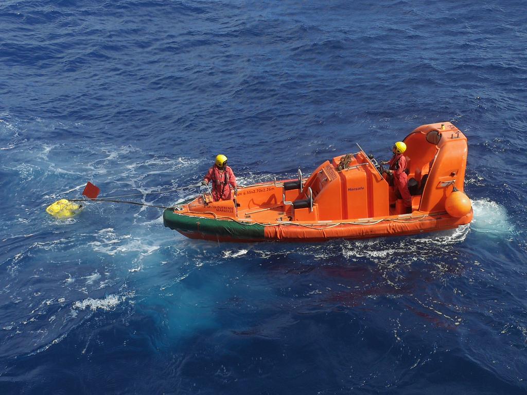
Last working day of MAYOBS cruise on the Marion Dufresne.
In total, we collected 6 OBS, relocated ~700 events, deployed 14 OBS, conducted 5 dredges, took 5 water column samples, collected plume data, and collected bathymetry and chirp data within 2 weeks

Helen Robinson, a geothermal expert and PhD candidate at Glasgow University, compared it to volumes of other submarine eruptions.
From the 1998 Axial Seamount eruption offshore from Oregon, to the Havre paroxysm north of New Zealand on the Kermadec arc, “it certainly seems this is the largest submarine event in terms of volume on record,” she told Gizmodo.

Samuel Mitchell, an expert in underwater eruptions at the University of Hawaii at Mānoa, and who worked on the Havre eruption, agreed that the amounts of volcanic material involved are definitely comparable.
“The 2018 event at Mayotte does appear to show a substantial volume of magma leaving a deep storage region which, if erupted, would make this indeed one of the largest recent submarine eruptions documented,” he said.

That’s a big “if,” though.
As Robinson also points out, and as the new pre-print paper acknowledges, what’s happening near Mayotte is not necessarily an eruption.


Pierre Briole, a geophysicist at France’s Ecole Normale Supérieure and one of the authors of the pre-print, told Gizmodo that the indirect evidence means that he’s “pretty sure it’s an eruption.
” But as there is currently no direct evidence of an eruption having taken place, “there is a significant probability that no lava reached the surface.”That the low-frequency rumble spread across the world was probably due to a “perfect storm.”

Failing to breach into the sea, the migrating magma might have injected itself into thick sediments in the seafloor and spread itself around.
Mitchell explained that this has been observed elsewhere, when the magma is denser than the surrounding sediment.

Although the overall volume of magma involved is comparable to the 2012 Havre eruption, the two are likely to be quite different events.
The former definitely involved plenty of eruptive material, whose huge pumice raft was first spotted from a plane.
At the same time, large, gloopy volcanic domes formed on the seafloor.


In Mayotte’s case, if an eruption did take place, Mitchell explained, it’s more likely to be some sort of fissure effusion involving more fluid lava, a bit like an underwater version of what happened on the slopes of Hawaii’s Kīlauea in 2018.

Jean Paul Ampuero, a seismologist and director of research at France’s Research Institute for Development, told Gizmodo that “this whole sequence is record-breaking in many aspects.” Along with the huge volume of magma, the November 11 signal was also easily one of the largest low-frequency tremors of its kind.

That the low-frequency rumble spread across the world was probably due to a “perfect storm,” according to Stephen Hicks, a seismologist at the University of Southampton.

In this case, that meant having both a very large source and vibrations at the exact right pitch to carry them across a considerable distance.

The November 11 signal’s individual elements still remain deeply puzzling.
In particular, its repeated high-frequency bursts, which are similar (but aren’t related to) industrial activity, are difficult to explain.
Ampuero said that they fall into a timing pattern that indicates they are strongly connected to the low-frequency pulses, indicating the two components “are talking to each other in some way.”

One highly speculative explanation is that the high-frequency events are related to the collapse of the rocky walls surrounding the magmatic monster.
This disturbs the magma reservoir, causing it to oscillate or ‘hum.’ At the same time, waves bouncing back and forth hit other flanks and trigger more collapses, generating more high-frequency events.
This all happens, Ampuero suggests, in a way that causes the low- and high-frequency events to synchronize, forming the November 11 signal.

It’s very difficult to say for sure.
Some smaller tremors in the sequence also had a similar signal, Ampuero added, so “perhaps they’ll catch another one” like the big tremor and take it apart to see what it’s made of.
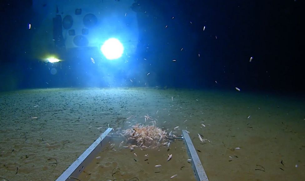
There’s another element to the story that’s currently unexplained: the emergence of lots of dead fish offshore from Mayotte.


The earthquake swarm (BRGM)

The geological setting is also pretty weird.
This major volcanic event is taking place on the eastern end of the island chain, whereas the youngest volcanic islands are to the west.
So it appears to be happening in the ‘wrong’ place.

It’s also unclear what’s responsible for the volcanism in the first place.
It could be caused by action along a tectonic plate boundary, an upwelling plume of superheated mantle material, or even an extension of the East African Rift, a major tectonic event that’s slowly tearing the continent apart, said Hicks.

There is even an ecological element to the story that’s currently unexplained: the emergence of lots of dead fish offshore from Mayotte.
Volcanic gases can suffocate sea life during eruptions, but the pre-print reports that the gases remained trapped in the magma.

Briole has heard unverified reports that the fish that died were deep-sea fish.
The magmatic activity might have scared them up to the surface, where they experienced low pressures that they couldn’t survive in.
Robinson said that the magma, which may have intruded into seafloor sediments, cooked those sediments and released carbon dioxide into the water column, which could also have asphyxiated those deep-sea fish.

Like much about the event, this remains speculative for now.
Clearly more instrumentation is required, and the French National Centre for Scientific Research—with help from the BRGM and other authorities—are now deploying plenty.
This includes equipment on Mayotte, at the site of the activity, and on the Glorioso Islands to the east, so that they can ‘listen’ to the disturbances from the other side.

That still won’t solve all the enigmas.
Mitchell pointed out that underwater drones and ship-based radar surveys will be required to determine how much lava erupted at the surface, if any, and Hicks suggested that numerical simulations and laboratory work may be required to better comprehend what’s going on beneath the surface.

As Ampuero emphasizes, this isn’t just about scratching a scientific itch, but helping out the local communities, too.
“The people in Mayotte really want to know what’s going to happen next,” he said.
As a recent report on the situation notes, there is often an atmosphere of confusion and distrust on the island.
The more research that’s conducted, the better off everyone will be.

Links :

Friday, May 17, 2019

A massive Gulf oil spill is finally being contained after more than 14 years

The drillship Rowan Resolute in the Gulf of Mexico during a flight out of New Orleans in July 2018.
(Bonnie Jo Mount/The Washington Post)

From WP by Darryl Fears

Up to 1,000 gallons of oil per day are being removed from the site of the Taylor Energy spill, says the owner of company that installed a containment system.

The U.S. Coast Guard said Thursday that it is finally containing and collecting oil from a massive 14-year spill in the Gulf of Mexico, the longest offshore disaster in U.S. history.

More than 30,000 gallons of oil have been collected over several weeks since a containment system was installed about 12 miles off the coast of Louisiana, the Coast Guard said.
Capt. Kristi Luttrell, who is overseeing work performed by a contractor, the Couvillion Group, called the containment a major milestone that could significantly reduce the impact of the spill, which will enter its 15th year in September.

Location of the MC20 Taylor oil spill, off the southeast coast of Louisiana with the GeoGarage platform (NOAA nautical raster chart)
A 32-mile-long oil slick stretches east from the former site of Taylor Energy's Mississippi Canyon 20 A platform (X), which was knocked down and covered by a landslide during Hurricane Ivan in 2004.
(NASA Aqua satellite / Taylor Energy slick terra aqua 06.18.2013) 

see WaterMapping video

Luttrell entered into a contract with Couvillion last year after the company responsible for the spill, Taylor Energy, failed to follow her orders to do so on its own.

The system’s success could be a serious setback to Taylor Energy’s efforts to stop the containment effort.
The company filed a federal lawsuit in December, claiming that Couvillion lacked the expertise to install a system to capture oil leaking from its wells.
They broke open when Hurricane Ivan caused the walls of a deep sea canyon to collapse and sink an oil platform.

In a separate lawsuit, the company also claimed that Luttrell’s order to mount a more aggressive response to the spill was rash.
It came a day after The Washington Post revealed an expert analysis that contradicted Taylor Energy’s claims that almost no oil was present at the site.

The wake of a supply vessel heading toward a working platform crosses over an oil sheen drifting from the site of the former Taylor Energy oil rig in the Gulf of Mexico in 2015.
The Coast Guard says it has contained the oil spill.
Gerald Herbert/AP

The analysis by Oscar Garcia-Pineda, a geoscience consultant who specializes in impacts from oil spills, estimated that 1.5 million to 3.5 million barrels spilled into the gulf from the Taylor Energy site over more than 14 years.
Acting on that finding, as well as other scientific reports, the Coast Guard issued Taylor Energy an ultimatum to hire a company to build a device to contain the oil or face a fine of up to $40,000 per day.

Crews work to install the structure that will help contain the Taylor oil leak.
(Source: U.S. Coast Guard)

Weeks of monitoring by the Coast Guard shows that Couvillion’s containment system is working, Luttrell said Thursday.
The system was completed and fully operational April 29, but Couvillion started collecting oil 12 days before that.

The oil is pumped from deep-water storage tanks to a ship that brings it to shore to separate it from water.
Oil that can be salvaged is sent to a licensed receiving facility, and the rest is recycled or disposed.

 Taylor Oil Leak Site Containment System (Source: U.S. Coast Guard)

Recovered oil is U.S. property, Luttrell said, and proceeds from its sale are credited against Couvillion’s bill.

Timmy Couvillion, owner and chief executive of the company, said it is collecting up to 1,000 gallons of oil each day.
“We’re absolutely proud of what we’ve accomplished,” Couvillion said.
Workers, as many as 100 at times, battled inclement weather and rough waters as they installed the system.
They were sometimes caked in oil and had to guard against it entering their working quarters.
The large amount of oil “was no surprise at all,” Couvillion said, considering the length of the sheen on the gulf’s surface at the site and an acute smell.

As a result of the work, the oil sheen is nearly gone, but the oil is not, he said.
“It is a reminder that these wells need to be plugged . . .
per the federal government’s standard,” Couvillion said.
He called the containment “a temporary solution to an evolving problem.
We’ve contained the oil but it’s still being released into the environment.”

 The Taylor spill as seen from a 2015 Louisiana Environmental Action Network aerial patrol.

Todd Ragusa, a Taylor Energy spokesman, provided a company statement that said it “looks forward to receiving the information needed to confirm the Coast Guard’s statement, which, if accurate, is encouraging.”

During proceedings at the federal court in New Orleans where Taylor Energy’s case is being heard, U.S.
District Judge Ivan Lemelle asked pointed questions to both the Coast Guard and Taylor Energy about why the cleanup is taking so long.
Lemelle asked the Coast Guard’s attorney at a hearing in March why the containment effort took 14 years: “This occurred in 2004. How long does it take the government to decide what to do?”

OR&R Scientists Partner with the U.S. Coast Guard to Study Oil in the Gulf of Mexico

The attorney, Erica Zilioli, said new data shows that the site is ejecting more oil into the environment than previously thought.
Before now, the government relied heavily on reports from contractors hired by Taylor Energy to estimate the size of the spill.

Later the judge asked Taylor Energy why it was seeking to block the containment effort.
The company’s attorney, Carl Rosenblum, repeated its belief that the system would not work and stir up oil on the ocean floor.

Lemelle addressed Rosenblum directly.
“Look, you tried,” he said. “But it’s still going on after all this time. Let’s get someone else to look at this.”

Based on the results the Coast Guard reported, its attorneys are preparing a motion to declare that Taylor Energy’s claims are moot and request to have the case dismissed.
They anticipate filing the motion by Friday of next week.


It would be the second legal blow to Taylor Energy in as many months.
In April, the Court of Federal Claims dismissed its earlier lawsuit seeking to reclaim more than $430 million remaining in a trust fund to plug 16 wells at the site.

U.S. Federal Claims Court Judge Nancy B. Firestone ruled against the company’s claim that the federal government should not be allowed to control its funds indefinitely as it determines how to address the spill.

Firestone said the trust contract is valid until the Interior Department says, in writing, that Taylor Energy “has complied with all of its obligations under the . . . agreement,” the ruling said.

A group that was allowed to join on behalf of the Coast Guard in the current lawsuit cheered the revelation of the containment system’s success.

“After 14 years, we are glad the Coast Guard is taking action to contain this runaway oil spill,” said Dustin Renaud, a spokesman for the group, Healthy Gulf.
“Now we must make sure that they follow through on a permanent solution and ensure a spill like this never goes unchecked again.”

Links :

Thursday, May 16, 2019

Their islands are being eroded. So are their human rights, they say.

A view of Masig Island, north of mainland Australia.
As climate change pushes the tides ever higher, this island and others nearby are at risk of vanishing.
Credit Matthew Abbott for The New York Times

From NYTimes by Livia Albeck-Ripka

Indigenous Australians from low-lying islands in the Torres Strait argue that the government, by failing to act on climate change, has violated their fundamental right to maintain their culture.

MASIG ISLAND, Australia — Every weekend, Yessie Mosby visits the sandy, washed-out graves of his ancestors to gather their scattered bones.
Their shallow burial place, just yards from the shore of Masig Island, north of mainland Australia, has been eroded by rising seas.

“Other parents around the world go to the beach with their kids and pick up shells,” Mr.
Mosby, 37, a craftsman and father of five, said as he moved fragments of his sixth great-grandmother’s bones to a spot beneath a coconut tree.
“We pick up remains.”

The lives of the people here are tied to the island, one of 18 spits of earth in the Torres Strait inhabited by Indigenous Australians.
It holds the histories of those who came before; it protects and nourishes.
But as climate change pushes the tides ever higher, these islands, and their ancient culture, are at risk of vanishing.

So Mr. Mosby, and seven other Torres Strait Islanders, are taking action.

Yessie Mosby with his children.
Watertight plastic boxes hold their clothes and other household possessions.
His family is moving to another house after a cyclone damaged their home.
Credit Matthew Abbott for The New York Times

In a landmark claim to be submitted on Monday at the United Nations, they argue that Australia, by failing to take adequate steps to reduce carbon emissions, has violated their fundamental human rights, including the right to maintain their culture.

The action is part of a burgeoning movement in which litigants, including a group of 21 young people in the United States, have made the novel argument that governments face a fundamental duty to ensure a livable environment.

But the Australians’ argument is the first to seek the weight of the United Nations behind such a climate claim, and it could set a precedent for how the populations most vulnerable to the effects of global warming can seek redress under international law.

 Masig island with the GeoGarage platform (AHS nautical chart)

It is also the first time that the Australian government — which has failed to meet emissions reduction targets and continues to approve embattled coal mine projects — has faced climate change litigation that asserts a human rights violation.
The claimants call on the country to help fund sea walls and other infrastructure that might save the Torres Strait Islands, which have a population of about 4,500, and to meet the emissions targets set under the Paris climate agreement.

If successful, the case “would really break new ground internationally,” said John Knox, a professor of international law at Wake Forest University and a former special rapporteur on human rights and the environment to the United Nations.

Flooding on Boigu, part of the Torres Strait Islands.
Credit Matthew Abbott for The New York Times

While the United Nations cannot force Australia to take action, those leading the case say they hope it will apply pressure on governments around the world to protect the rights of marginalized citizens whose culture is tethered to a particular place, and for whom dispossession could reignite the trauma of colonization.

“They are losing everything — they can’t just pick it up and go somewhere else; their culture is unique to that region,” said Sophie Marjanac, a lawyer with ClientEarth, the environmental law organization that is lodging the claim.
“That’s the crux of the argument,” she said.
“If Indigenous people are disposed of their homelands, then they can’t continue to practice their culture.”

According to the Intergovernmental Panel on Climate Change, a scientific body appointed by the world’s governments, global sea levels could rise by an average of up to 3.2 feet by 2100, which could force people from low-lying atolls in the Pacific Ocean, the Indian Ocean and the Torres Strait to evacuate.

On Masig Island, which lies on average less than 10 feet above sea level, people are already struggling to combat the impacts of climate change.
As the shoreline has crept closer, fresh water wells have turned brackish, and coconut trees have been uprooted and fallen into the ocean.
Other trees, withering from the heat, have stopped bearing edible fruit.

Eric Nai, who lives on Masig Island, walking along a barrier intended to help protect the coastline from further erosion.
Credit
Matthew Abbott for The New York Times

“This is our mother,” Mr. Mosby said of the sickened trees.
“It’s scary.”

Local residents have tried to restore the sandbanks by creating barriers of concrete blocks, wood pallets, coconut husks and driftwood.
But their efforts are no match for the king tides that sweep through the island on full moons, sometimes flooding homes on the coast.

The erosion of the land, along with the unpredictability of the seasons and intensified cyclones, islanders said, also gnaws at their mental health.

Sacred sites for birthing and initiation ceremonies are vanishing beneath the water.
“The erosion is hurting us,” said Ned Mosby, a 61-year-old priest and police officer on Masig Island, who is not involved in the claim.
“The land is us, and we are the island.”

Kabay Tamu, a crayfisherman and another of the claimants, who lives on the island of Warraber, said even his 8-year-old son was anxious about their family’s future.
“He keeps asking, ‘Will we have to move?’ That’s one of the things that gets me, and drives me to do something,” Mr. Tamu said.

The eroded coastline on Boigu Island.
Credit Matthew Abbott for The New York Times

Ninety miles to the northeast, on the island of Boigu, the prospect of relocation is palpable.
Here, the unpaved roads are flooded, and a partially built sea wall has failed to protect the island — which lies on average just three feet above sea level — from having its cemetery inundated, or losing its white sand beach.

Standing in front of the Anglican church at the highest point on the island, Stanley Marama, the priest and one of the claimants in the case, pointed north across the water.
The shore, he said, used to extend at least 100 yards farther, and was a sacred place for conducting ceremonies.

 Boigu island with the GeoGarage platform (AHS nautical chart)

On weekdays, residents of Papua New Guinea travel a few miles across the channel to trade drums, woven mats and mud crabs.
They bring with them their own stories of the effects of climate change.
“A big high tide destroyed our crops,” said Ene Musu, a 38-year-old farmer from the village of Buzi.
“Now we have a shortage of food.”

In the Torres Strait Islands, stores import groceries, so the food supply is not similarly threatened.
But some of the items that supplement it — fish, crab, turtle and dugong, which are related to manatees — live in habitats that are threatened by coral bleaching and ocean acidification.
And saltier soil and flooding have made it more difficult to maintain gardens of banana, yam, cassava and taro.

“Normal people would say, Let’s pack up and get out of here,” said Dimas Toby, a councilor for Boigu Island, who is not involved in the claim.
But while some islanders have migrated to the mainland, he said he would remain to protect his culture.
Otherwise, he said, “we’ll go extinct, because we’ll have nowhere to practice it.”

The streets of Boigu Island after rain.
Credit Matthew Abbott for The New York Times

That is the foundation of the islanders’ legal argument in their claim at the United Nations.

Under the International Covenant on Civil and Political Rights — a multilateral treaty to protect global freedoms — Australia has an obligation, the claimants say, to protect their culture, as well as their rights to family and life.

In recent years, countries including Ecuador and Bolivia have granted constitutional rights to nature.
In other cases, individuals have sued fossil fuel companies and governments for their contributions to, or inaction on, climate change.

 Magnus island with the GeoGarage platform (AHS nautical chart)

The United Nations has previously accused Australia of flouting international law in its detainment of asylum seekers on Manus Island.

“Australia has a poor record on human rights,” Ms. Marjanac, the ClientEarth lawyer, said, “but potentially, this is an opportunity to improve that.”

In October, the United Nations released a statement asserting for the first time that climate change and environmental degradation posed “some of the most pressing and serious threats to the ability of present and future generations to enjoy the right to life.”

The claimants hope this bodes well for their petition.
But for now, they will continue to try to save their heritage from being lost to the sea.

“I don’t want my child to grow up knowing that they are from Yorke Island, but there’s no island,” Mr. Mosby said, using the English name for his home.

Overhead, a flock of frigatebirds ascended into the darkening sky.

A structure designed to help protect the coastline from further erosion.
Credit Matthew Abbott for The New York Times 

Links :

Wednesday, May 15, 2019

Strange things are afoot in the Strait of Hormuz

Four tankers, including the Saudi Arabian-owned Al Marzoqah, were “sabotaged” in the Strait of Hormuz on Sunday, raising tensions in the Gulf.
Reports said a US official had suggested Iran was responsible
photo : AFP

From The Economist by

Mysterious attacks and military planning are raising war jitters


When Donald Trump hired John Bolton to be his national security adviser, he reportedly joked that the mustachioed hawk was “going to get us into a war”.
It is easy to see why.
When serving under George W. Bush, Mr Bolton embellished intelligence on Cuban and Syrian weapons and lobbied hard for the invasion of Iraq.
After leaving government he argued that America should bomb Iran to set back its nuclear programme.
Now that he’s back, he appears to be on the warpath once again.

 About 40% of the world's traded oil passes through the Strait of Hormuz,
making it the global market's most important chokepoint

It was Mr Bolton, not the commander-in-chief, who announced on May 5th that America had dispatched an aircraft-carrier strike group and bombers to the Persian Gulf.
This was in response to undisclosed intelligence which, unnamed officials claimed, showed that Iran and its proxies were planning attacks on American forces (or its allies) in the region.
On May 9th Mr Bolton reviewed war plans, updated at his request, that call for sending up to 120,000 troops to the Middle East if Iran attacks or restarts work on nuclear weapons, according to the New York Times.
Such planning is not a sign of imminent conflict.
But Mr Trump is reported to be telling that joke again, now with more seriousness, as Mr Bolton also ratchets up pressure on Venezuela.

 An Emirati coast guard vessel passes an oil tanker off the coast of Fujairah, United Arab Emirates. Saudi Arabia said two of its oil tankers were sabotaged off the coast of the United Arab Emirates near Fujairah in attacks that caused "significant damage" to the vessels.
(AAP)

Some fear Mr Bolton is looking for a provocation by Iran, adding ominous undertones to recent events in the region.
On May 12th four oil tankers were struck by a “sabotage attack” off Fujairah, part of the United Arab Emirates (UAE).
The incident remains murky, but Emirati, Saudi and American officials claim that four ships—two Saudi, one Emirati and the other Norwegian—had 1.5-metre to 3-metre holes blown in their hull, near the waterline.
Unnamed American officials were quoted fingering Iran or its proxies as the likely culprit, without presenting evidence.
Fujairah lies just outside the Strait of Hormuz, a key chokepoint that Iranian officials have threatened to block if America attacks.

 Fujairah port with the GeoGarage platform (UKHO chart)

That was not the only flare-up.
On May 14th Saudi Arabia said two of its oil-pumping stations were attacked.
The damage was limited, but the Houthis, Shia rebels who control much of Yemen, claimed responsibility and threatened more such attacks.
They are fighting a Saudi-led coalition, supported by America, that backs the Yemeni government.
America and Saudi Arabia accuse the Houthis of being an Iranian puppet.
That is an exaggeration, though the Houthis have received arms from Iran.
The facilities that came under attack lie more than 700km north of the Yemeni border.
They were probably hit by long-range drones that the Houthis acquired last year.

More than 16 million barrels a day of crude and condensate was shipped through the Strait of Hormuz in the first four months of 2019

The two incidents taken together highlight the vulnerability of Gulf energy supplies—and thus Gulf economies.
Fujairah is connected via a pipeline to Abu Dhabi's oil fields.
The pumping stations hit in Saudi Arabia are part of the “east-west pipeline”, which moves crude from eastern oil fields to western ports.
Both pipelines are meant to help producers bypass the Strait of Hormuz.

Iran has a record of subversive action and supporting allied militias in the region—and of attacking shipping.
The so-called tanker war between Iran and Iraq ravaged international shipping in the 1980s.
Over 500 ships were attacked.
Four years into the tanker war, after an American-flagged ship was struck by an Iranian mine, America conducted its largest ever attack on Iran, destroying two oil platforms and sinking a frigate.
At least some in the White House look back fondly on that show of force.

But the timing of the incident in Fujairah, and the quickness with which American officials blamed Iran, has raised eyebrows.
Max Boot, a hawkish foreign-policy scholar, writes that Mr Bolton “may be trying to provoke Iran into striking first”.
He and others are reminded of the Gulf of Tonkin incident—a murky naval skirmish in 1964 used by America as a pretext for expanding its involvement in Vietnam.

Some officials have tried to calm matters.
On May 14th John Abizaid, America’s ambassador to Saudi Arabia, who previously commanded American troops in the Middle East, called for a “thorough investigation to understand what happened [and] why it happened”.
Only then, he said, should America “come up with reasonable responses short of war”.
Mr Abizaid insists that it is not in America’s interest to have a conflict.

 Strait of Hormuz (marine vessel traffic)

 Strait of Hormuz with the GeoGarage platform (UKHO nautical chart)
The Strait of Hormuz is the only sea passage from Persian Gulf to Arabian Sea.

Even so, European officials are nervous.
On May 13th Jeremy Hunt, Britain’s foreign secretary, said he was “very worried about the risk of a conflict happening by accident with an escalation that is unintended”.
That was shortly before a meeting with Mike Pompeo, America’s secretary of state, who received a frosty reception from his European counterparts in Brussels.
On May 14th Spain, sensing trouble ahead, withdrew its frigate from the American aircraft-carrier strike group heading towards the Gulf.
Major General Christopher Ghika, the top British officer in the American-led coalition against Islamic State, said, “There’s been no increased threat from Iranian-backed forces in Iraq and Syria.”

Many in Europe blame America for the rising tensions.
Last year Mr Trump pulled out of a deal that curbed Iran’s nuclear programme in return for economic relief.
Now he seems intent on undermining what is left of the pact by imposing crippling sanctions on Iran.
On May 8th President Hassan Rouhani said Iran would abrogate parts of the deal and gave the remaining signatories—Britain, China, France, Germany, Russia and the European Union—60 days to work out how to relieve the economic pressure it was under.
If they cannot, Iran would feel free to enrich uranium to ever higher levels, which would shorten its path to producing fissile material for a nuclear bomb.

Mr Trump, for his part, runs hot and cold on Iran.
After Mr Rouhani’s announcement, he said Iran should call him for direct talks (Mr Rouhani has spurned several such offers).
After the incident in Fujairah, however, Mr Trump said, “It’s going to be a bad problem for Iran if something happens.”
But he said the war plans involving tens of thousands of troops are fake news: “We have not planned for that. Hopefully we’re not going to have to plan for that.”
Though he added, “If we did that, we’d send a hell of a lot more troops than that.”

Links :

Tuesday, May 14, 2019

Canada (CHS) layer update in the GeoGarage platform

39 nautical raster charts updated

Mariana Trench: Deepest-ever sub dive finds plastic bag

The latest dive reached 10,927m (35,849ft) beneath the waves - a new record
photo : Tamara Stubbs

From BBC by Rebecca Morelle

An American explorer has found plastic waste on the seafloor while breaking the record for the deepest ever dive.
Victor Vescovo descended nearly 11km (seven miles) to the deepest place in the ocean - the Pacific Ocean's Mariana Trench.

see other video

He spent four hours exploring the bottom of the trench in his submersible, built to withstand the immense pressure of the deep.
He found sea creatures, but also found a plastic bag and sweet wrappers.
It is the third time humans have reached the ocean's extreme depths.

 The explorers believe they have discovered four new species of prawn-like crustaceans called amphipods


The Five Deeps Expedition successfully dived to the deepest point in the Indian Ocean, in the Java Trench. During one dive, what is believed to be a new species of Jellyfish was recorded on video.photo : Atlantic productions dor Discovery Channel

The first dive to the bottom of the Mariana Trench took place in 1960 by US Navy lieutenant Don Walsh and Swiss engineer Jacques Piccard in a vessel called the bathyscaphe Trieste.
Movie director James Cameron then made a solo plunge half a century later in 2012 in his bright green sub.

The latest descent, which reached 10,927m (35,849ft) beneath the waves, is now the deepest by 11m - making Victor Vescovo the new record holder.

Don Walsh (left), who dived to the bottom of the Mariana Trench in 1960,
congratulated Victor Vescovo (right)
photo : Reeve Jolliffe

In total, Mr Vescovo and his team made five dives to the bottom of the trench during the expedition. Robotic landers were also deployed to explore the remote terrain.
Mr Vescovo said: "It is almost indescribable how excited all of us are about achieving what we just did.
"This submarine and its mother ship, along with its extraordinarily talented expedition team, took marine technology to a ridiculously higher new level by diving - rapidly and repeatedly - into the deepest, harshest, area of the ocean."


Witnessing the dive from the Pacific was Don Walsh.
He told BBC News: "I salute Victor Vescovo and his outstanding team for the successful completion of their historic explorations into the Mariana Trench.
"Six decades ago, Jacques Piccard and I were the first to visit that deepest place in the world's oceans.
"Now in the winter of my life, it was a great honour to be invited on this expedition to a place of my youth."

The team believes it has discovered four new species of prawn-like crustaceans called amphipods, saw a creature called a spoon worm 7,000m-down and a pink snailfish at 8,000m.
They also discovered brightly coloured rocky outcrops, possibly created by microbes on the seabed, and collected samples of rock from the seafloor.

Humanity's impact on the planet was also evident with the discovery of plastic pollution.
It's something that other expeditions using landers have seen before.
Millions of tonnes of plastic enter the oceans each year, but little is known about where a lot of it ends up.

Victor Vescovo spent four hours exploring the bottom of the trench
photo : Atlantic productions dor Discovery Channel

The scientists now plan to test the creatures they collected to see if they contain microplastics - a recent study found this was a widespread problem, even for animals living in the deep.
The dive forms part of the Five Deeps expedition - an attempt to explore the deepest points in each of the world's five oceans.
It has been funded by Mr Vescovo, a private equity investor, who before turning his attention to the ocean's extreme depths also climbed the highest peaks on the planet's seven continents.

The 4.6m-long, 3.7m-high DSV Limiting Factor submersible was built by the US-based company Triton Submarines
photo : Reeve Jolliffe
After the record dive, the submersible was brought back on the expedition's main vessel - the DSSV Pressure Drop

As well as the Mariana Trench in the Pacific, in the last six months dives have also taken place in the Puerto Rico Trench in the Atlantic Ocean (8,376m/27,480ft down), the South Sandwich Trench in the Southern Ocean (7,433m/24,388ft) and the Java Trench in Indian Ocean (7,192m/23,596ft).

The final challenge will be to reach the bottom of the Molloy Deep in the Arctic Ocean, which is currently scheduled for August 2019.

The 4.6m-long, 3.7m-high submersible - called the DSV Limiting Factor - was built by the US-based company Triton Submarines, with the aim of having a vessel that could make repeated dives to any part of the ocean.
At its core is a 9cm-thick titanium pressure hull that can fit two people, so dives can be performed solo or as a pair.
It can withstand the crushing pressure found at the bottom of the ocean: 1,000 bars, which is the equivalent of 50 jumbo jets piled on top of a person.

Mariana Trench
10,994 Deepest natural trench in metres
1960 First dive
3 Number of dives to date
2,146Higher than Mount Everest in metres, if inverte
Source: Deepsea Challenge/Geology.com
photo : Atlantic productions dor Discovery Channel
As well as working under pressure, the sub has to operate in the pitch black and near freezing temperatures.


On the deepest dive ever made by a human inside a submarine, a Texas investor found something he could have found in the gutter of nearly any street in the world: plastic rubbish.
Victor Vescovo, a retired naval officer, made the unsettling discovery as he descended nearly 6.8 miles (35,853 feet/10,928 meters) to a point in the Pacific Ocean's Mariana Trench that is the deepest place on Earth, his expedition said in a statement on Monday.
His dive went 52 feet (16 meters) lower than the previous deepest descent in the trench in 1960.
Vescovo found the manmade material on the ocean floor and is trying to confirm that it is plastic.

These conditions also made it challenging to capture footage - the Five Deeps expedition has been followed by Atlantic Productions for a documentary for the Discovery Channel.
Anthony Geffen, creative director of Atlantic Productions, said it was the most complicated filming he'd ever been involved with.
"Our team had to pioneer new camera systems that could be mounted on the submersible, operate at up to 10,000m below sea level and work with robotic landers with camera systems that would allow us to film Victor's submersible on the bottom of the ocean.
"We also had to design new rigs that would go inside Victor's submersible and capture every moment of Victor's dives."

After the Five Deeps expedition is complete later this year, the plan is to pass the submersible onto science institutions so researchers can continue to use it.
The challenges of exploring the deep ocean - even with robotic vehicles - has made the ocean trenches one of the last frontiers on the planet.
Once thought to be remote, desolate areas, the deep sea teems with life.
There is also growing evidence that they are carbon sinks, playing a role in regulating the Earth's chemistry and climate.

Monday, May 13, 2019

New Zealand (Linz) layer update in the GeoGarage platform

14 nautical raster charts updated

Plumbing the depths of the seas in the hidden battle for the internet

Subsea cables carry almost 99pc of the world's internet data and traffic.
About critical undersea fibre optic cable network, not from the usual physical vulnerability angle but examining who is increasingly building & operating new large capacity data pipes, notably Google & Huawei, in attempt to gain control.

From The Telegraph by Hasan Chowdhury

Tourists to the scenic port city of Valparaiso, on the Pacific coast of Chile, have plenty to admire.
Traditionally, visitors have swarmed across the city’s hillside to look at its vibrantly hued clifftop homes, street murals and sea views that inspired Pablo Neruda, the Nobel laureate.
“If we walk up and down all the stairs of Valparaiso, we’ll have walked all around the world,” the poet once wrote.

More recently, the city has been hosting a new visitor: Google, which is building a connection with the world of an entirely different kind.
Last month, the US technology giant laid the final section of a giant undersea cable, named Curie after the Polish scientist, that stretches 6,500 miles across the Pacific Ocean from Los Angeles.

Undersea cables are the vital unseen plumbing of the internet, carrying near 99pc of the world’s data and web traffic at close to the speed of light across the sea floor.
By being hooked up to them, places such as Valparaiso and cities across Latin America and beyond can enjoy the economic fruits delivered by high-speed broadband connectivity.

The subsea fibre cable which arrives here is not unique.
Around the world – from the remote island of Tonga to the shores of Cameroon – some of America and China’s biggest technology companies, including Facebook, Microsoft and Huawei, are forking out billions of dollars on similar underwater projects in a bid to gain an edge in a battle for control of the physical infrastructure of the internet.


There is a lot at stake.
Mark Sedwill, Britain’s former national security adviser, warned parliament in 2017 that by severing undersea internet cables an attacker could “achieve the same effect as [was] achieved in World War Two by bombing the London docks”.

Much of the debate around who controls access to the data on which our modern lives depend has revolved around the roll-out of 5G telecom networks.
But a similar debate over who owns and controls access to these subsea networks is emerging, amid growing concerns about security and espionage.

“Because we’re so connected by wireless devices, people often think about things being up in the air,” says Jayne Stowell, an infrastructure specialist at Google.
“The reality is [that] bits of information [travel] through fibre optic until the very last mile of delivery.
Intercontinentally, almost all of it goes through the sea.”

Many of the existing subsea links were built at the height of the dotcom boom of the late Nineties, when more than $20bn (£15bn) was spent on the technology.
But the decades-old fibre optic links that were laid by telecoms firms are starting to be replaced by tech giants looking to seize control of cables to provide faster and better links, including to new regions where internet use is booming.

In 2017, Facebook, Microsoft and telecoms firm Telxius teamed up to build a cable running over 4,000 miles from Virginia Beach on the east coast of the US to Bilbao, Spain.
Microsoft claims the cable, called Marea, about the weight of 34 blue whales, can deliver 160 terabytes of data per second – enough, it says, to make it 16m times faster than the average home internet connection.


Google is planning another cable, named Dunant, that will connect the US to France by 2020 along one of the busiest global routes for the internet, taking its tally of investments in subsea cables to 13.
Facebook is planning to develop a cable named Simba to encircle the entire African continent.

US firms aren’t the only players. Huawei, the Chinese telecoms giant that has been at the heart of a debate about the security of 5G infrastructure, is the dominant player from China in the subsea cables market.

A giant, 9,000-mile cable linking South Africa with the UK, built initially by former telecoms firm Alcatel-Lucent, was upgraded by Huawei Marine in 2015.
In total, Huawei is working to build or reconstruct close to 100 subsea cables.


The South Atlantic Inter Link project, a 3,700-mile cable connecting Cameroonian beach resort Kribi to Brazilian city Fortaleza, is the result of a joint investment by telecoms firms China Unicom and Camtel.

At present, there are around 380 deep sea cables owned by companies that control the internet.
But with just 30pc of the possible routes currently in use, according to market research firm TeleGeography, an image of cables sprawling from one continent to the next starts to emerge.

“You get this amazing pattern that emerges of the physical infrastructure of the internet built on centuries-old trading paths,” says Andrew Blum, author of Tubes, a book on the physical infrastructure of the internet.
“You have networks that connect the same cities that have always been connected by networks: New York and London, Singapore, Hong Kong, Mombasa – classic port cities.”

Deep sea cables are about the size of a garden hose.
A number of fibre optic wires about the thickness of horse’s hair can be packed into a loose tube that is wrapped by a mesh to keep the wires in place.
The more fibre, the faster the internet.

Surrounding that is another layer of copper welded tight and a final layer of plastic to allow electrical signals to zip across the ocean without the fear of seawater ruining the cable.
A specialised boat lowers a digging device into the ocean that ploughs the sea floor and lays the cable.

At regular, 62-mile (100km) intervals, the signals that carry the data of internet users around the world require a boost.
“Because you can’t put power plants under the ocean, you have power equipment on either end to power the cable,” says Stowell.

Traditionally, subsea cables have been the product of a consortium of companies and organisations working together to achieve similar goals.

But the advantage of taking control of one’s own sea cables have become apparent.
Google’s Curie cable is privately owned by the firm, allowing them to build it in “under two years”, Stowell says.
That compares to a normal time frame of four or five years.

Not only that, it gives a company such as Google full autonomy over the exact technology used, the end goal to be served by the cable and the precise configuration of its route.
“You have no public internet but just a very large collection of privately owned networks that connect to each other,” says Blum.
“Who pays who for use of those networks and who pays who to carry their data becomes a really complex issue.”

China Telecom Global Network Infrastructure Map 2018

The complexities run deep.
As the US and Chinese firms fight to gain control of cables, the question of who can, and should, control the internet, becomes a muddied one.
“There are moments where internet companies exceed the bounds of state players and I think there are moments where there’s still a state interest in controlling infrastructure.” says Blum.

Deeper still is a question of security.
As undersea cables bounce some of the most sensitive user data back and forth between regions, the tussle to grab hold of cables becomes inherently geopolitical.

Last year, Australia inked a deal to build a cable to the Solomon Islands.
The $78m project was initially due to be managed by Huawei, but the Chinese firm was ultimately left out over security concerns.

The decision is one that is likely to shape a debate for other countries around the most vital components of the internet, and could turn out to be as polarising as the one that has shaped around 5G.

In the more immediate future, the US and China may have a more menial problem facing their subsea cables.
“The areas of vulnerability are usually fishermen and ship anchors,” says Stowell.
“Almost 90pc of outages of cables are caused in shallow waters and are caused by those two sources.”

Links :