Saturday, June 5, 2021
Ocean crossing in an outboard boat: The Al Grover story
Friday, June 4, 2021
Oceans' extreme depths measured in precise detail
From BBC by Jonathan Amos
Scientists say we now have the most precise information yet on the deepest points in each of Earth's five oceans.
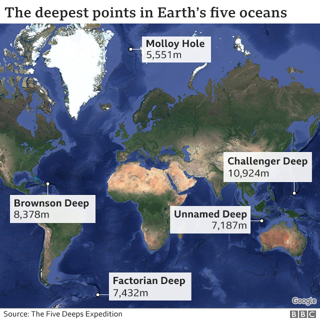
The key locations where the seafloor bottoms out in the Pacific, Atlantic, Indian, Arctic and Southern oceans were mapped by the Five Deeps Expedition.
Some of these places, such as the 10,924m-deep (6.8 miles) Mariana Trench in the western Pacific, had already been surveyed several times.
But the Five Deeps project removed a number of remaining uncertainties.
For example, in the Indian Ocean, there were two competing claims for the deepest point - a section of the Java Trench just off the coast of Indonesia; and a fracture zone to the southwest of Australia.
The rigorous measurement techniques employed by the Five Deeps team confirmed Java to be the winner, but this lowest section in the trench - at a depth of 7,187m - is actually 387km from where previous data had suggested the deepest point might be.
Likewise, in the Southern Ocean, there is now a new place we must consider that region's deepest point. It's a depression called Factorian Deep at the far southern end of the South Sandwich Trench. It lies 7,432m down.
There is a location in the same trench, just to the north, that's deeper still (Meteor Deep at 8,265m) but it's technically in the Atlantic Ocean.
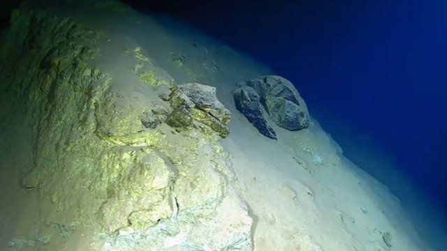 Mariana Trench: Deep ocean trenches occur where Earth's tectonic plates meet
 All of the new bathymetry (depth data) is contained in a paper published in the Geoscience Data Journal.
Its lead author is Cassie Bongiovanni from Caladan Oceanic LLC, the company that helped organise the Five Deeps Expedition, which had as its figurehead the Texan financier and adventurer Victor Vescovo.
media caption
The former US Navy reservist wanted to become the first person in history to dive to the lowest points in all five oceans and achieved this goal when he reached a spot known as the Molloy Hole (5,551m) in the Arctic on 24 August, 2019.
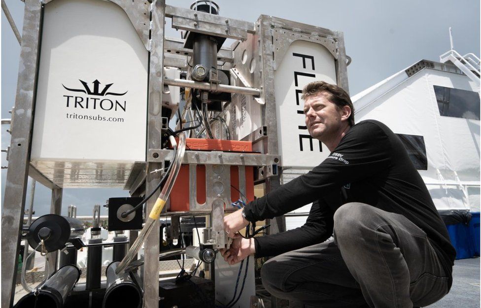
But in parallel to Mr Vescovo setting dive records in his submarine, the Limiting Factor, his science team were taking an unprecedented number of measurements of the temperature and salinity (saltiness) of the seawater at all levels down to the ocean floor.
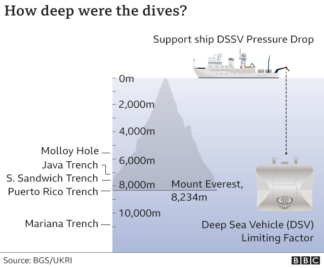
This information was crucial in correcting the echo-sounder depth readings made from the hull of the sub's support ship, the Pressure Drop.
In this context, refining the observations any further will be extremely hard.
The wider context here is the quest to get better mapping data of the seabed in general. Current knowledge is woeful.
"Over the course of 10 months, as we visited these five locations, we mapped an area the size of continental France. But within that was an area the size of Finland that was totally new, where the seafloor had never been seen before," explained team-member Dr Heather Stewart from the British Geological Survey.
"It just shows what can be done, what still needs to be done. And the Pressure Drop continues to work, so we are gathering more and more data," she told BBC News.
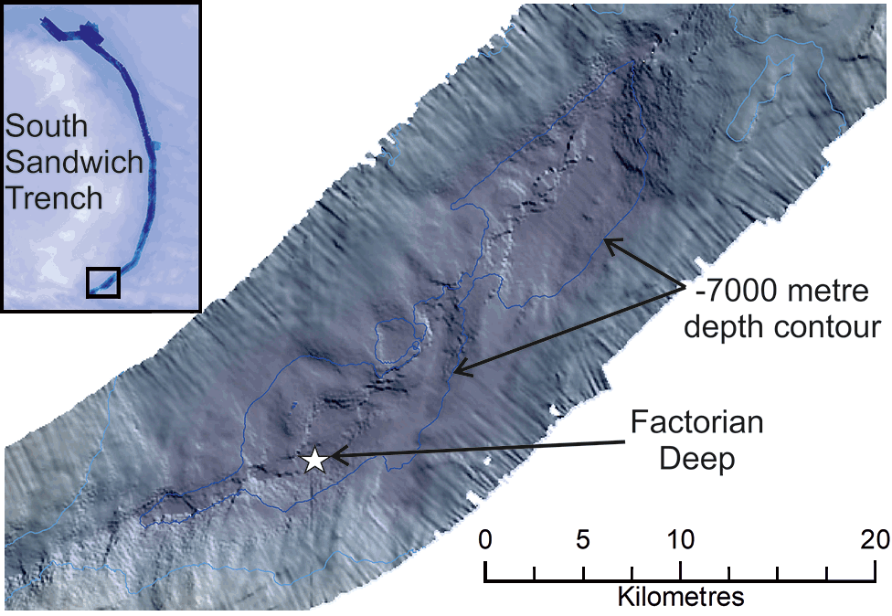 Factorian Deep is at 60.4 degrees South, and therefore just in the Southern Ocean
All of this information is being handed over to the Nippon Foundation-GEBCO Seabed 2030 Project, which aims to compile, from various data sources, a full-ocean depth map by the end of the decade.
It would be a critical resource.
They are essential for navigation, of course, and for laying underwater cables and pipelines.
They are also important for fisheries management and conservation, because it is around the underwater mountains that wildlife tends to congregate.
In addition, the rugged seafloor influences the behaviour of ocean currents and the vertical mixing of water.
And if you want to understand precisely how sea-levels will rise in different parts of the world, good ocean-floor maps are a must.
The BBC made contact at the weekend with the Pressure Drop, which is currently sailing west of Australia in the Indian Ocean.
Team-member and co-author on the new paper, Prof Alan Jamieson, is still aboard.
"For example, there are some major animal groups in the world for which we just don't know how deep they go. Just last month, we recorded a jellyfish 1,000m deeper than 9,000m, which was the previous record by us. So we've now got jellyfish down to 10,000m.
"Three weeks ago, we saw a squid at 6,500m. A squid at that depth! How did we not know this? And during the Five Deeps Expedition, we added 2,000m on the depth range for an octopus.
"These are not obscure animals; it's not like they're some sort of rare species. These are big animal groups that are clearly occupying much larger parts of the world than we thought," Prof Jamieson said.
The deepest place in the Atlantic is in the Puerto Rico Trench, a place called Brownson Deep at 8,378m. The expedition also confirmed the second deepest location in the Pacific, behind the Challenger Deep in the Mariana Trench.
Thursday, June 3, 2021
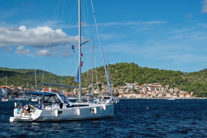
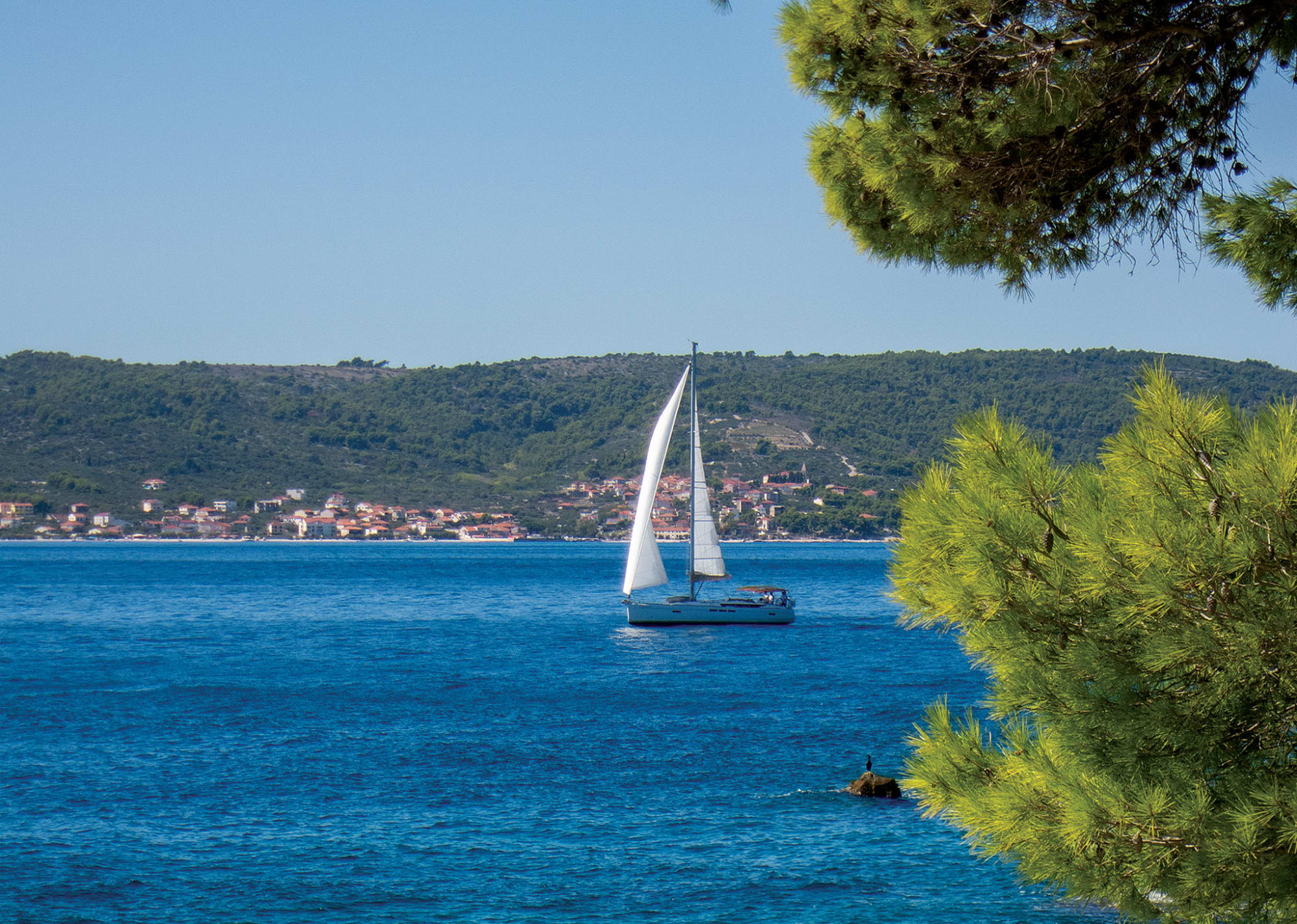
Cruising charter to Croatia
As is the case with so much of the Mediterranean, to sail in Croatia is to take a journey through time.
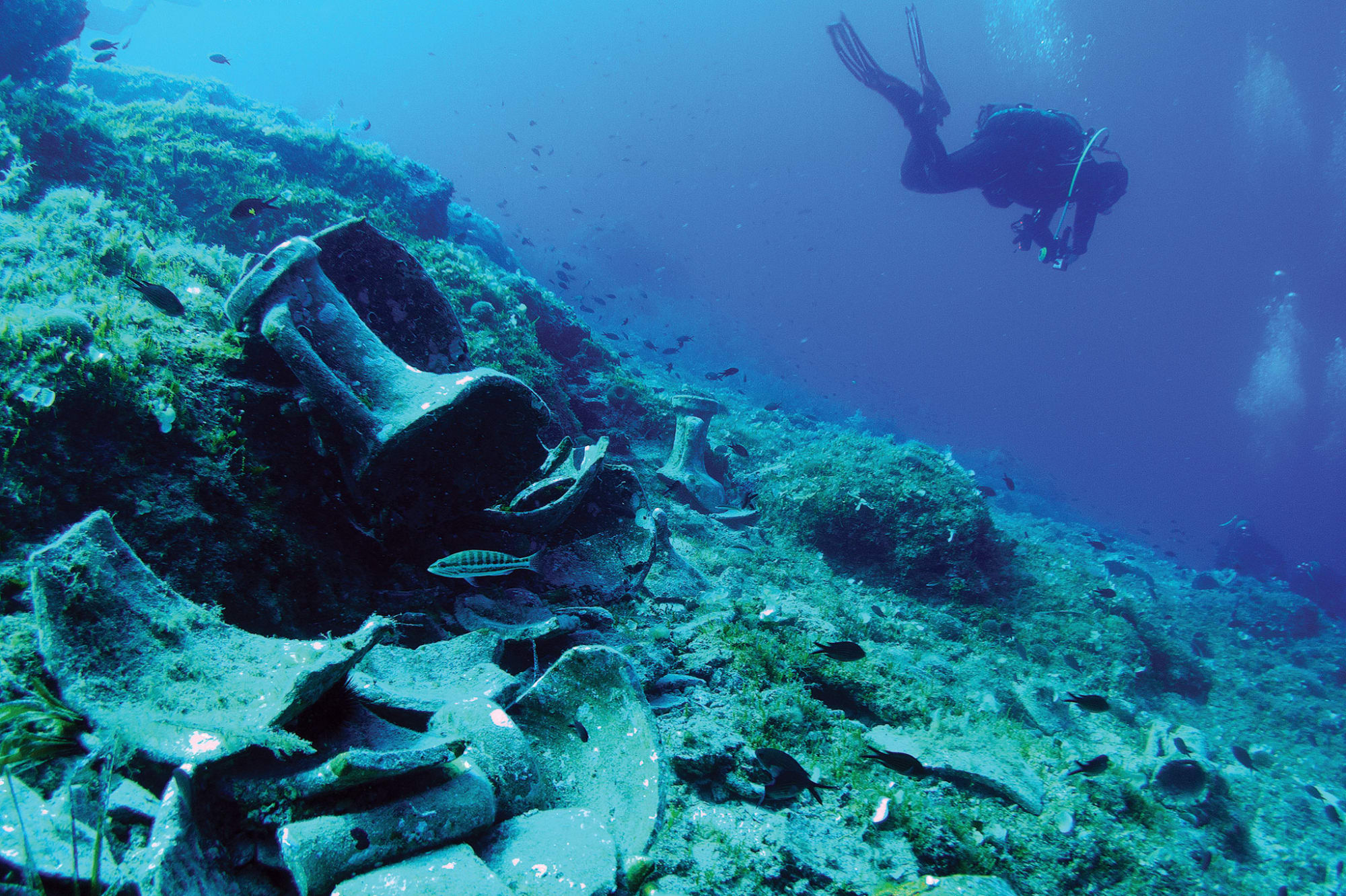
Centuries before the birth of Christ, Greeks traded amphoras of oil, wine and grain across these waters.
During the first millennium, the Romans built lavish palaces and fortresses here.
More recently, the islands of the Adriatic have been home to secret WWII airbases and Cold War military installations.
Before heading out, we did our homework, especially with regard to the variable winds in this part of the world, each of which has its own name—Bura, Jugo, Maestral, Levant, Tramontana, Oštro, Lebić and Pulenat.
We needed to be particularly aware of the northeast Bura and the southeast Jugo, both of which can be especially strong in fall and winter.
The Bura has been clocked at 150 knots, equal to a Category 5 hurricane, and even the less-intense Jugo can sometimes dish out 50-knot winds and 15ft seas.
If ever one of these winds is forecast, seek shelter, preferably in a marina.
Luckily, Sail Croatia provided us with a very thorough briefing and free Wi-Fi onboard, allowing us to get up-to-date weather reports around the clock.
Coastal Croatia can get pretty busy, and with the steep shorelines you encounter there, we knew we wouldn’t find even half as many places to drop a hook as in the Caribbean.
Luckily, there are quite a few mooring balls scattered, and given we would be chartering during the off-season, we figured we’d be alright, as long as we didn’t arrive at any of our destinations too late.
Our first destination, Vis, is roughly 30 miles from Split, which is doable, but a long sail.
So we decided to break it up and stop in at a wonderful little bay on the eastern end of Solta island called Uvala Sesula.
It’s an easy 11 miles from the base and provides good shelter in most weather conditions.
There are also two great restaurants there that have mooring balls we could reserve in advance for free with a dinner reservation, a common routine in Croatia.
As we made our approach, we radioed in and one of the staff at Konoba Sesula came out to help us secure our boat.
(“Konoba” is the local term for a restaurant that serves traditional food.) Afterward, we took a narrow foot path over to the quaint fishing village of Maslinica, which has a lovely little harbor, more restaurants and cafés, and a number of grocery stores for last-minute provisioning.
The following morning the wind clocked a little south and then steadily increased throughout the day, providing a rather spirited close-reach and getting us into the lovely main port of Vis by early afternoon.
The town of Vis, which borrows its name from the island, is on the northern side of the island.
There is a large mooring field and a number of marinas that were all pretty empty when we arrived, but filled up considerably by sundown.
Due to its strategic position, Vis played a key role during both WWII and the Cold War.
In the 1940s, it was the site of a crucial emergency airbase for crippled Allied bombers.
In the 1980s, Yugoslav leader Josip “Tito” Broz built a pair of clandestine military bases both here and in neighboring island of Lastovo.
On our first full day on Vis we planned to explore the remains of a few of these military sites.
But while shopping for a scooter rental, we learned that many of them are poorly marked and therefore hard to find.
We were then directed to the local tour company Alternatura, run by Pino Vojkovic, who apparently was the “go-to guy” for military tours of the island.
The following morning we climbed aboard one of Pino’s signature blue Land Rovers and drove to a high vantage point where our guide, Goran, pointed out the ghost-like remnants of the now completely overgrown airstrip Allied bombers once made their emergency landings.
We also toured a small shop that now serves as a kind of de facto museum of ancient bomber wings, propellers, parachutes and other odd parts left behind by the Allies.
From there we drove to Cape Stupišće, where Goran took us down an impossibly rutted dirt road leading to a large clearing hidden by rotted camouflage netting.
Goran explained that this is where Tito hid the enormous trucks that served as both transport vehicles and launching platforms for his country’s Soviet-made, surface-to-air missiles.
He then handed us helmets and headlamps, and we entered the eerie darkness of one of the tunnels used to store these kinds of missiles.
Inside we found bunkers with foot-thick steel doors on greased hinges and explored narrow escape routes that terminated in small rock shelters disguised to look like shepherd outposts.
It was all like something out of a James Bond movie.
After that came ARK Vela Glava the headquarters for Tito’s operations in Vis and the island’s largest network of tunnels.
These tunnels were much darker and deeper and led to a network of side tunnels and rooms that once housed troop barracks and ammunition stores.
At the end of one of these tunnels we exited into the blinding sun only to find a decrepit gun battery aimed directly across the Adriatic in the direction of Italy.
Of course, the rich history of Vis is not only found on land, and our next stop was the local dive company, Nautica Vis Diving Center.
On one of our dives we got up close and personal with a U.S.
bomber that had sunk during the war.
Apparently, the now coral-encrusted B-24 had been circling the island trying to get its landing gear down when it ran out of fuel.
As the story goes, the captain first let his crew bail out before attempting a crash landing, a heroic maneuver he tragically didn’t survive.
Another dive took us to the wreck of an ancient trading vessel that pre-dates Christ.
Nothing was left of the actual ship.
But a large assortment of amphoras remains, many of them intact and presumably still full of their ancient cargo.
On our last day on the island, we took a relaxed scooter ride along Vis’s rock-strewn landscape dotted with wild rosemary bushes and chicory, thistle and rockrose flowers.
One of our stops, Komiža, the island’s other port town on the opposite side, has a wonderful selection of outdoor cafes along its historic harbor front.
We also explored a site called the Queen's Cave, near the abandoned village of Okijunca.
The trail there is poorly marked, so if you don’t like getting lost, you might want to hire a guide to take you there.
Okijunca itself makes for fantastic exploring with its small Capella and empty stone houses overlooking dark-green olive groves and the expansive sapphire waters of the Adriatic.
Before moving on, we spent a night in Blue Lagoon, a sheltered harbor on the western shore of Budikovac Island just off the southeast corner of Vis.
This beautiful little anchorage provided a wonderful respite before the long sail to our next port-of-call, Lastovo.
There are plenty of mooring balls here, a nice beach and a friendly family-run restaurant.
Although the bay is popular with day cruises, it largely empties out at night.
Lastovo is about 40 mile southeast of Vis, and the scattering of beautiful islands off its eastern end creates a spectacular entryway.
One of Lastovo’s larger Cold War military bases is located in Jurjeva Bay—a well-sheltered anchorage on the nearby island of Prezxba.
Jurjeva Bay has a nice little beach and is surrounded by an assortment of abandoned buildings and guard towers.
Exploring on the southern side of the bay, we stumbled upon a small entrance in a rock face that led to another one of Tito’s extensive tunnel systems.
Carefully watching our step and avoiding the ghostly camel crickets (that looked even more monstrous by the light of our headlamps), we picked our way down a long dark corridor and eventually came to a large munitions area similar to what we’d seen at Cape Stupi.
We also found evidence of troop quarters—barracks, ventilation equipment, old generator stands and bathrooms.
It wasn’t until we exited that we saw the small sign prohibiting entrance, so explore at your own risk.
Having had our fill of damp, dark tunnels, we re-energized our bodies in the warm Croatian sun by scrambling up an unmarked trail leading south to yet another bay called Uvala Kremena.
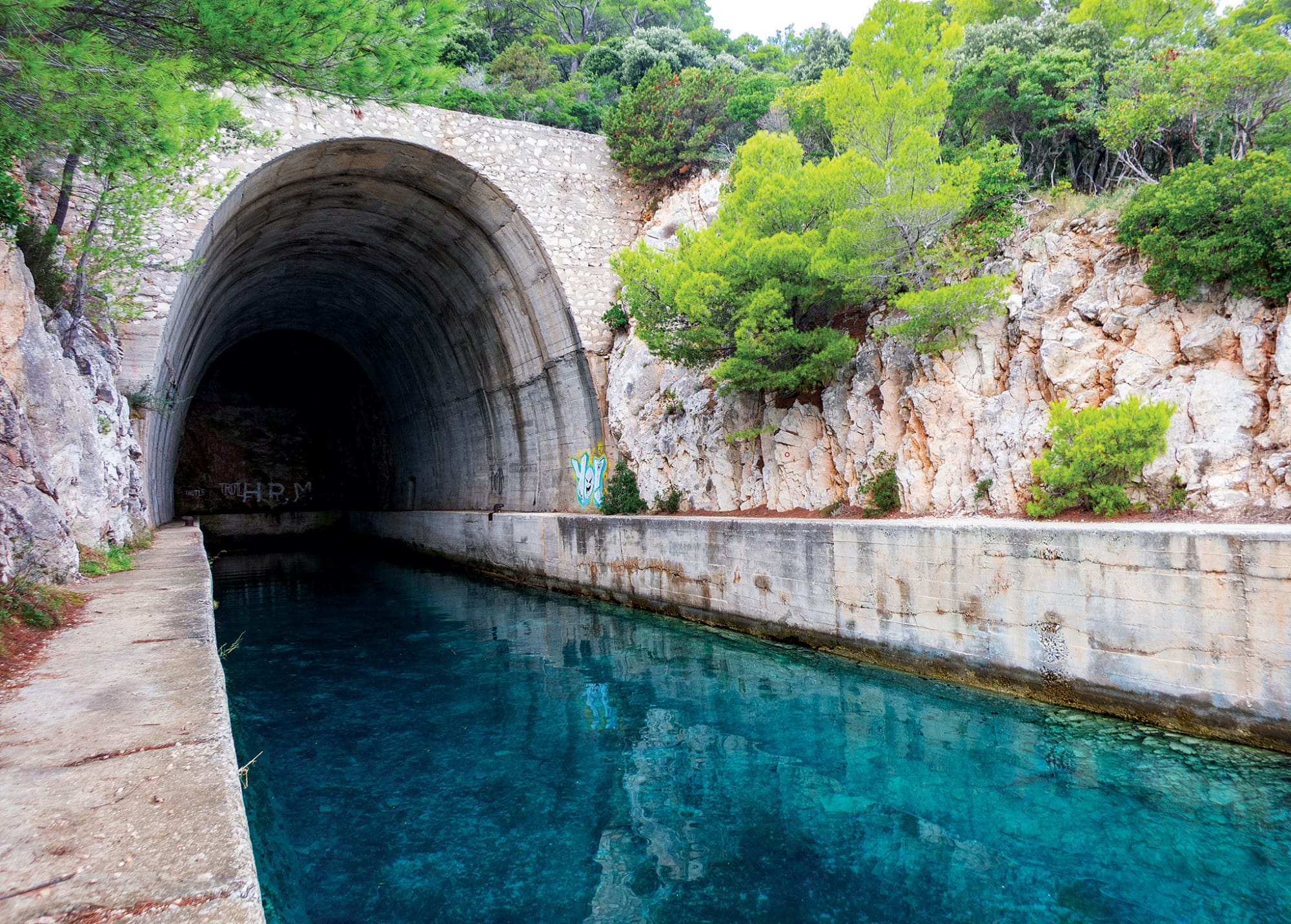
Here we found one of the sea tunnels carved out of the mountain that Tito used for hiding his gunboats.
There are a number of these on Lastovo and Vis that yachties now like to use for overnight stays, although it was not clear to us whether doing so was 100 percent legal.
Satisfied with our rather extensive military tour, our next stop was the lively port of Zaklopatica, a wonderfully sheltered bay on Lastovo’s northern shore and the site of an equally wonderful marina and restaurant called the Konoba Triton, a popular sailors’ hangout.
In Zaklopatica I also had a chance to practice my docking skills in front of a good-sized crowd, an experience that was not for the faint of heart.
The process was essentially “Med mooring,” except instead of dropping an anchor before reversing, there was a set of permanent bow lines you retrieved via a messenger line.
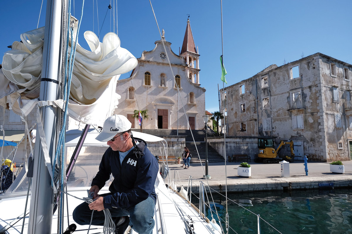
Located roughly 30 miles northwest of Lastovo on the western end Hvar, Fisherman’s House is run by the Matijević family and is the quintessential relaxed, bucolic Croatian island retreat, complete with its own vineyard and vegetable gardens.
In fact, we loved Fisherman’s House so much, we originally decided to spend our last couple of nights there, sunbathing and soaking in the relaxed life of the Adriatic.
However, nasty weather was approaching, which our host said would likely turn into a Bura, in which case our wonderful little bay on Sveti Klement would provide limited shelter at best.
He recommended we shift to a marina in Milna and the much better protected harbor on Brac.
Without hesitation, we called to book a slip.
The weather was relatively calm when we arrived there, but it was amazing how quickly the storm hit.
After securing our boat, I was ashore taking a leisurely stroll along the waterfront when a few paper bags and paper trash started spinning in circles around me.
I didn’t think much of it until a patrons in a nearby restaurant told me to take cover—fast—prompting me to make a bee-line back to our boat.
The storm hit minutes later with torrential rain and such violent winds some of the crews taking shelter in the harbor had to adjust lines to prevent their sterns quarters from hitting the pier.
Afterward, when the storm had passed, Milna’s many quaint restaurants, bars and clubs quickly came back to life.
Milna is a picture-postcard, classic Croatia seaside town, with its classic stone architecture and baroque church with a characteristic Dalmatian bell tower.
The surrounding countryside is equally enchanting, consisting of a patchwork of old stone farms and picturesque orchards.
Sadly, Milna represented the end of our charter.
It was also time to top up our fuel tanks, something we wanted to do while still out among the islands to avoid the long lines and general mayhem we’d seen at the fuel dock in Split.
Unfortunately, we ended up facing the same problem in Milna—boats drifting into each other, no real system or queue, plenty of screaming and short tempers.
I’m guessing the only way to avoid this kind of chaos is to fill up out on the islands late Thursday night or super early Friday morning.
Anyway, we survived.
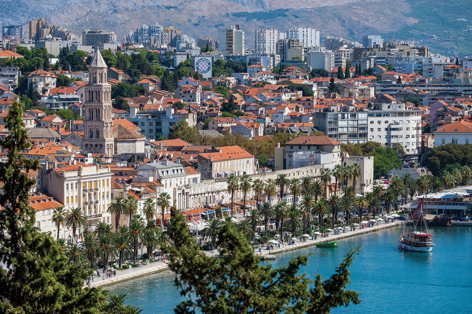
Once safely back in the harbor of Split, we spent a few days exploring the city with its old Roman Palace and narrow alleys.
We stayed at Divota, a wonderful hotel that included some of the magnificently restored century-old stone houses in the ancient neighborhood.
If you prefer staying in the heart of the palace “compound,” as it’s called, the Marmot is nice as well.
For dinner, there are plenty of choices, but we particularly liked Articok, as the chef there is amazing.
Trattoria Tavulin is also located inside the palace “compound” and the outside seating there is nothing less than magical.
A place called Dujkin Dvor, along the waterfront, is an especially friendly local eatery where the owners regularly circulate among the guests, making it a great place to end your visit to this charming corner of the world.
Just be mindful of the weather and plan ahead.
You want to enjoy the history here, not become part of it!
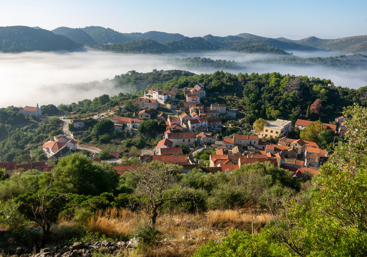
Cruising Tips: Croatia
May through June and late September to October are the best times to sail in Croatia.
The weather is great, you avoid the crazy summer crowds, and you’ll find great deals and availability of boats.
The winds in Croatia blow for all directions, at all times of the day and year, and can change quickly, both in direction and intensity.
Be prepared to find safe harbor, preferably a marina, during rough weather.
Mooring balls are the norm, as most of the bays have steep shorelines and rocky bottoms.
Overnight wind shifts are also common.
Most of the smaller coves and bays offer free moorings to those who book a dinner at one of the restaurants ashore.
- GeoGarage blog :Bura wind in Croatia /Valentine Day / Soul sailing in Croatia / How many islands does Croatia have
Wednesday, June 2, 2021
Real-time satellite system to monitor global reef bleaching
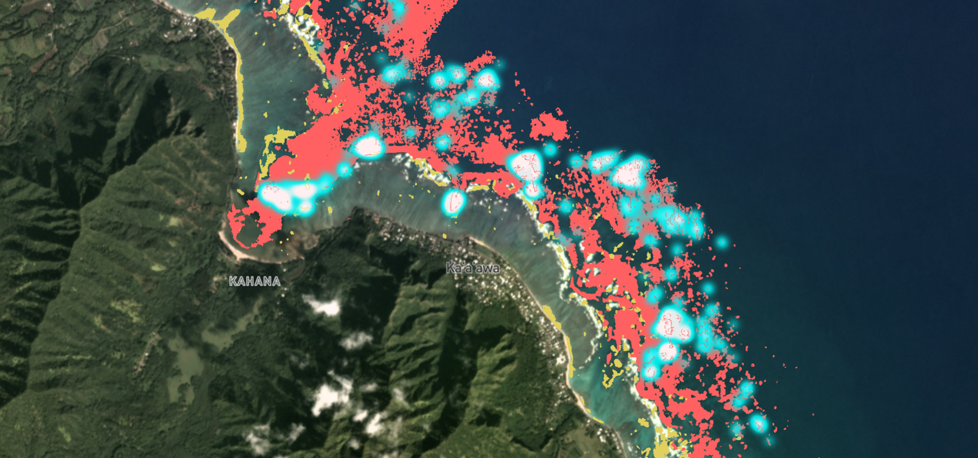
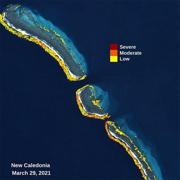
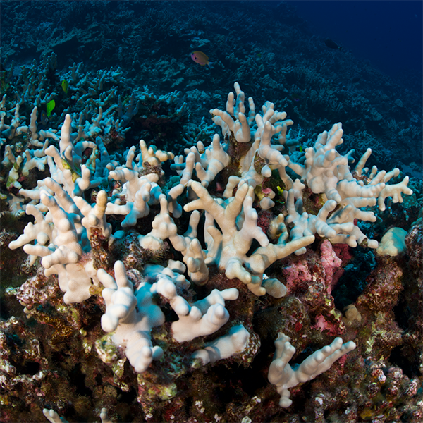
The Allen Coral Atlas project, an international research collaboration featuring University of Queensland scientists, are using unprecedented detailed habitat maps of all global coral reefs – over 230,000 of them – to detect reef bleaching anywhere in the world.
“The current prognosis for the world’s coral reefs is bleak,” Dr Roelfsema said.
Previously, only disparate data sets and maps that were available to scientists and policymakers.
Satellites detect variations in reef brightness by using high-resolution satellite imagery powered by an advanced algorithm indicating whether reefs are under stress or resilient to marine heatwaves.
“This monitoring capability will help us to see, where and to what extent coral bleaching is likely to be occurring as well as where it isn’t bleaching so we can identify resilient reefs,” Dr Roelfsema said.
“The platform can observe where corals are bleaching throughout the world, ranging from no bleaching to severe.
“Once we know where this is happening, governments and NGOs on the ground can swoop in to take action sooner, rather than later.”
Satellite data was then cleaned up via the Carnegie Institution - Asner Lab, before UQ scientists used the data to create the first global map that represent coral and algae, seagrass, sand, rubble and rock.
“This is just the first global version of our monitoring system, with the partnership intending to improve and expand it to include a broader range of impacts on reefs such as land-sea pollutants and sediments,” Dr Roelfsema said.
“This first, truly global reef monitoring system is simply a drop in the bucket for what is to come.”
The Allen Coral Atlas, named for the late Microsoft co-founder Paul G. Allen, is funded by Vulcan Inc. and directed by Arizona State University, and was developed through a unique partnership between UQ, Arizona State University, National Geographic Society, Planet, and Vulcan.
Links :
- The Guardian : Scientists launch tool to detect bleaching of coral reefs in near real time
- Discover : How Volunteers Are Helping Keep Coral Reefs Alive
- Paul Allen Foundation : Helping corals survive the climate crisis
Tuesday, June 1, 2021
Boom in ships that fly ‘fake’ flags and trash the environment
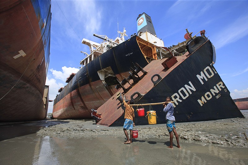
From Nature by Quirin Schiermeier
The number of ships using a ‘flag of convenience’ loophole that allows them to be scrapped in a place with lax environmental regulations is skyrocketing.
Ships transport 90% of the world’s traded cargo, so are crucial to the global economy.
Research now shows1 that the number of vessels misleadingly registered to nations other than their true country of origin — called flags of convenience — has skyrocketed since 2002.
Business owners in wealthy nations, including members of the European Union as well as the United States, South Korea and Japan, control the large majority of the world cargo and tanker fleet.

Poor environmental regulation
The study reveals that the use of flags of convenience has become the default among business owners in the EU over the past few decades.
Countries are responsible for enforcing international and regional safety and environmental rules on ships registered under their flags — but some flag-of-convenience nations are known not to do so. Between 2002 and 2019, the proportion of EU-nation-owned ships registered in low-income countries rose from 46% to 96%, the study finds.
By registering ships abroad, owners can also escape taxes and operate substandard vessels.
Failure of maritime rules
International treaties — including the 1992 Basel Convention to prevent transfer of hazardous waste from developed to less developed countries, and the 2009 Hong Kong Convention for the safe and environmentally sound recycling of ships — are woefully ineffective with regard to preventing environmental injustice, says study author Zheng Wan, a transport researcher at Shanghai Maritime University in China who led the analysis.
Ship-scrapping in low-income countries comes with fatal health risks and severe environmental pollution, including releases of mercury, lead, asbestos, ozone-depleting substances and pesticides into the soil and sea.
“Business practices are rendering many international treaties and regional regulations unenforceable because ‘flags of convenience’ nations tend to have little interest in regulation,” says Wan.
“It is immoral if ship owners in wealthy developed countries are circumventing international conventions and potentially exposing workers in low-income countries to serious harm,” adds John Cheerie, a workplace-health researcher at the Institute of Occupational Medicine in Edinburgh, UK.
doi: https://doi.org/10.1038/d41586-021-01391-3
