True color image captured by Sentinel2 with small contrast and saturation adjustment
Saturday, July 31, 2021
Image of the week : Impressive shallow seafloor at the coast of Mozambique
True color image captured by Sentinel2 with small contrast and saturation adjustment
Friday, July 30, 2021
A brief geography of time
From Worldmapper by Benjamin Hennig
Sometimes referred to as the fourth dimension, time has a highly geographical relevance
For human geography, population sizes can have as much impact on the ‘tempo of places’ as culture or even climate.
In physical geography, the concept of time is indispensable for an understanding of how the natural environment has changed and keeps changing.
In the 21st century, time has been described as being a commodity itself, affecting everything from manufacturing and trade, to financial flows and global transport links.
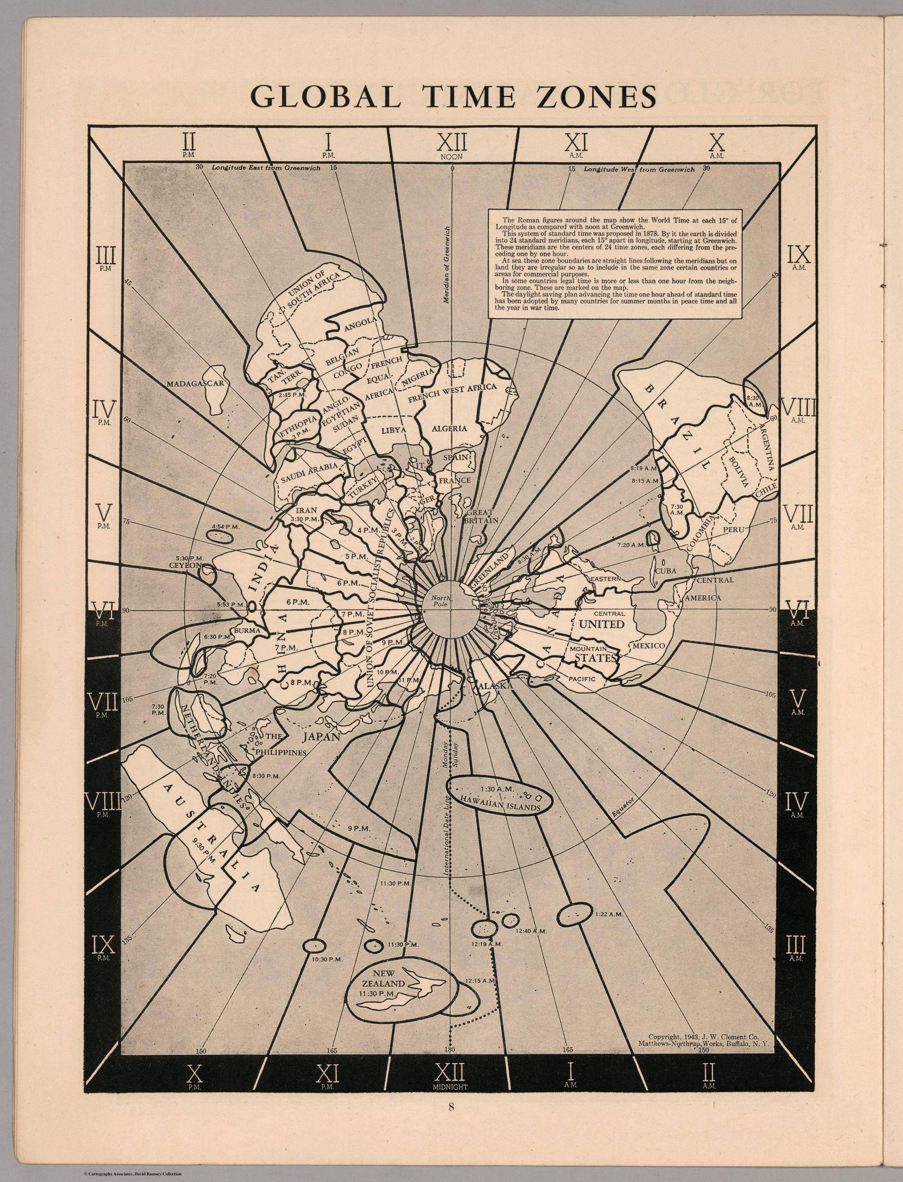
The general geographic distribution of time zones is based on the general concept of dividing the world into zones of equal time following a 24-hour day around the world.
In theory, this means that there are 12 time zones of 15° width in which each differs by one hour’s time difference.
The necessity of time zones was closely linked to growing needs of transport and communication links during industrialisation.
British railway companies began adopting Greenwich Mean Time (GMT) which helped to coordinate timetables.
In 1880, GMT became standard across Britain and time differences of tens of minutes between cities in the country started vanishing.
At a global level, time zones became established in the first decades of the 20th century.
But as much as time zones are legal, commercial and social constructs, they are also highly political issues which find their expression in the spatial patterns of today’s time zones.
The adoption of the Greenwich meridian itself can be seen as a highly political act that helped in manifesting a Euro-centric world view.
Furthermore, many of the time zone boundaries do not follow the geographical pattern of each zone.
Most boundaries follow political boundary lines such as country or state borders.
While in some cases this can be practical minor deviations, more often the political decisions for time zones have a considerable impact on people’s everyday lives.
The most extreme example for geographical distortion through time can be seen in the case of China which covers the extent of five time zones, but only uses one, orientated on the location of Beijing (at UTC +8 hours).
At the most extreme ends of the country, people use the same time even if sunrise is approximately four hours apart.
India made a similar decision to continue using only one time zone by adjusting Indian time half way between the two time zones that used to divide the country (now at UTC +5:30 hours), with only approximately two hours solar difference appearing between the outermost parts of the country.
Another political decision was North Korea’s creation of Pyongyang Time in 2015, creating a 30-minute distance to its southern neighbour.
Another political decision was Iceland’s move to abolish changing the clocks between summer and winter time in 1968.
Iceland’s decision meant a move towards adopting Greenwich Mean Time and becoming the westernmost country in that zone.
On GMT’s eastern edge, almost all of the western European countries that would geographically fall into this zone instead adopted Central European Time (GMT +1), which has become equally large, touching the geographic extent of almost four time zones.
Larger populations are not always affected by such deviations from the theoretical time zone: The most extreme deviation was created by Kiribati’s decision to realign the zone for the Line Islands with the same date as its territory, meaning that the sparsely populated islands follow the same time as Hawai’i but are one day ahead as the ‘easternmost land’ with the earliest time zone (GMT +14 hours).
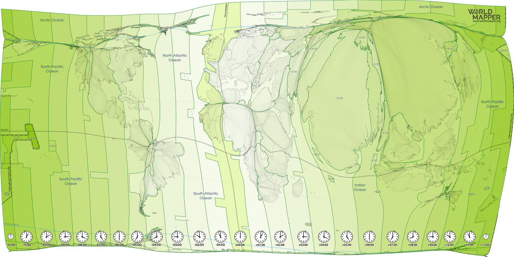
The above cartogram shows time zones from the perspective of an equal-population projection – a gridded population visualisation where each small area is proportional to the population living there.
The map highlights how these geopolitical considerations have an effect on the impact that time has on people and the functioning of the world.
Globalisation is far from having resulted in a compression of space and time.
On the contrary, time defines our contemporary world because it has put a new meaning to the spaces of humanity, or, as Tennessee Williams describes it in The Glass Menagerie: ‘Time is the longest distance between two places.’
In an interconnected world, time is equally the longest distance between two people.
Links :
- GeoGarage blog : World Maritime Time Zone API / How does a country go about changing its time zone / Lines of Longitude explained, with maps / Opinion: How the Prime Meridian changed the world / Why time will stop for a leap second
- WP : North Korea’s new time zone is perfectly bizarre
Thursday, July 29, 2021
We’ve discovered an undersea volcano near Christmas Island that looks like the Eye of Sauron
From The Conversation by Tim O'Hara
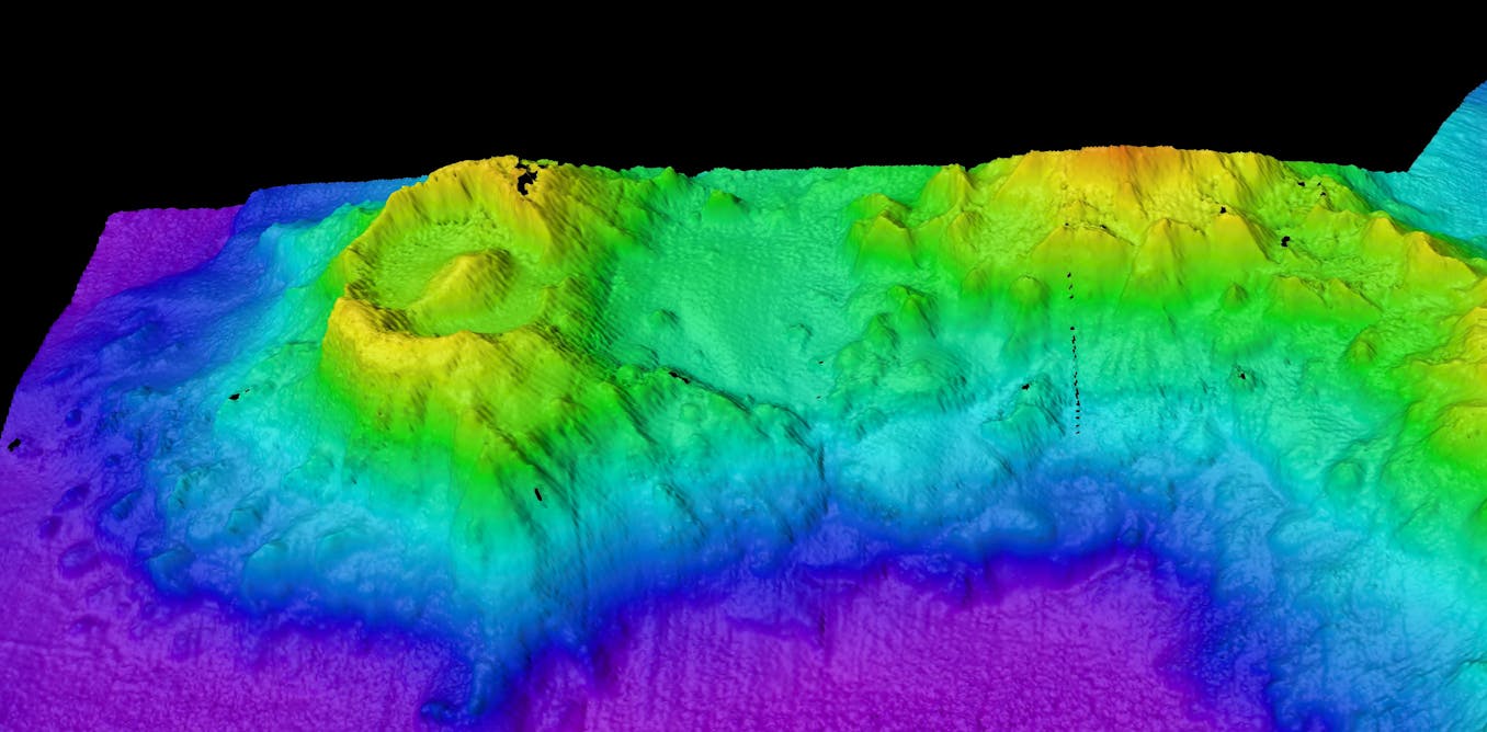
Looking like the Eye of Sauron from the Lord of the Rings Trilogy, an ancient undersea volcano was slowly revealed by multibeam sonar 3,100 metres below our vessel, 280 kilometres southeast of Christmas Island.
Previously unknown and unimagined, this volcano emerged from our screens as a giant oval-shaped depression called a caldera, 6.2km by 4.8km across.
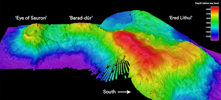 Sonar image of the ‘Eye of Sauron’ volcano and nearby seamounts on the sea bed south-west of Christmas Island.
In contrast, we may not even be aware of volcanic eruptions when they happen deep under the ocean.
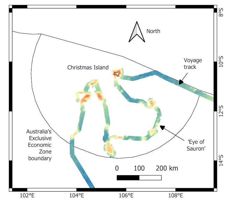
The summit of Ered Lithui is now 2.6km below sea level.
Our mission is to map the seafloor and survey sea life from these ancient and secluded seascapes.
Scientists from museums, universities, CSIRO and Bush Blitz around Australia are participating in the voyage.
We are close to completing part one of our journey to the Christmas Island region.
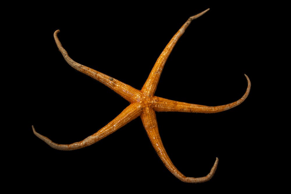
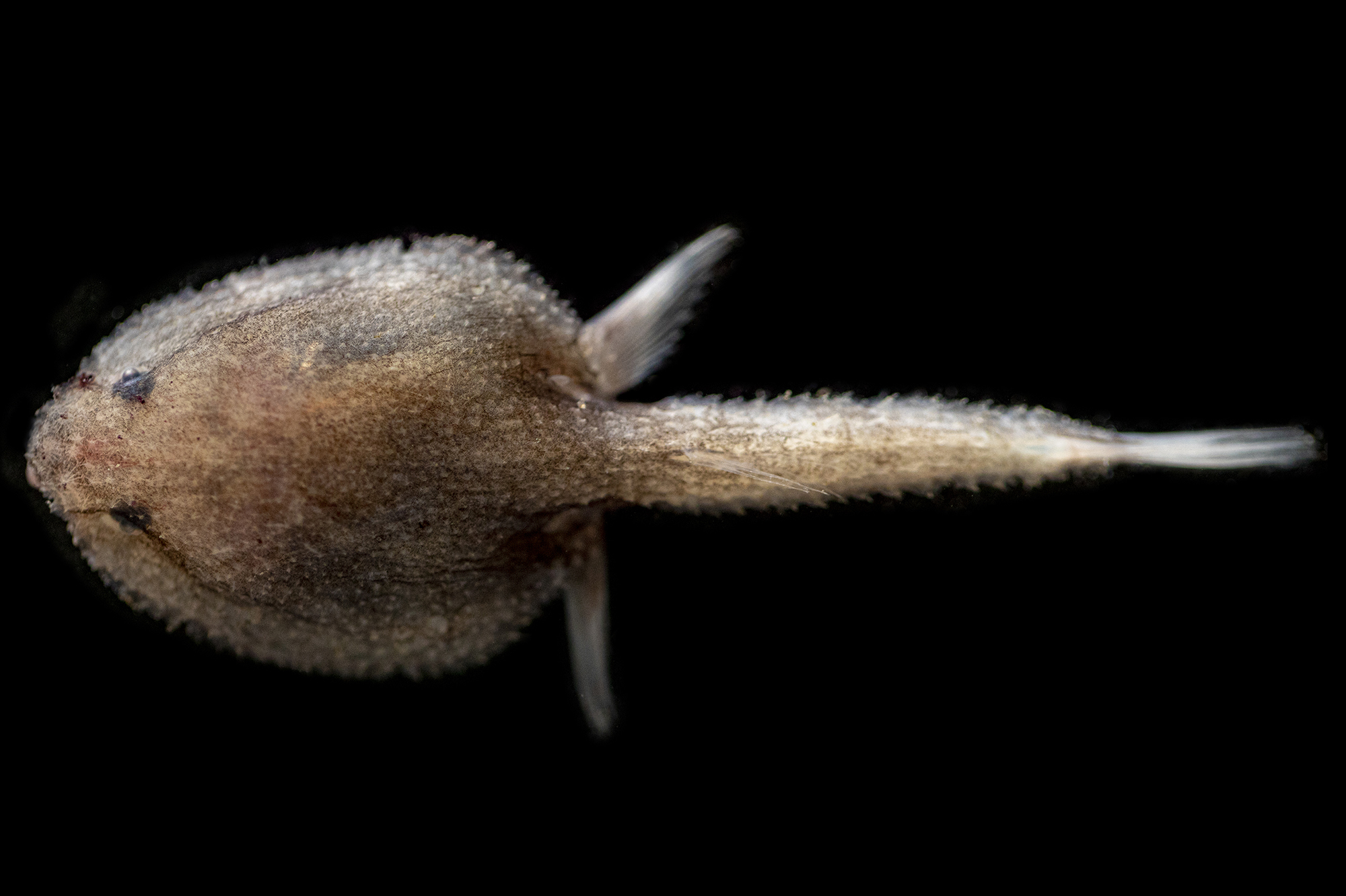
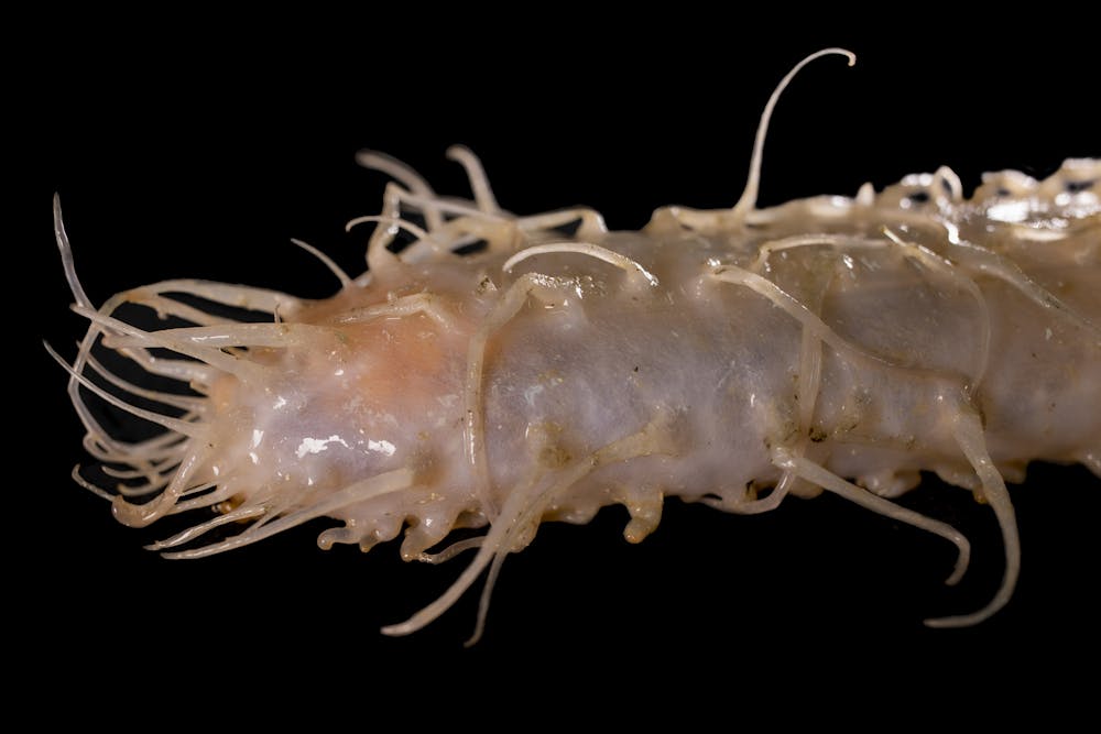
No doubt many animals that we find here will be new to science and our first records of their existence will be from this region. We expect many more surprising discoveries.
Wednesday, July 28, 2021
Deadly coral disease sweeping Caribbean linked to wastewater from ships
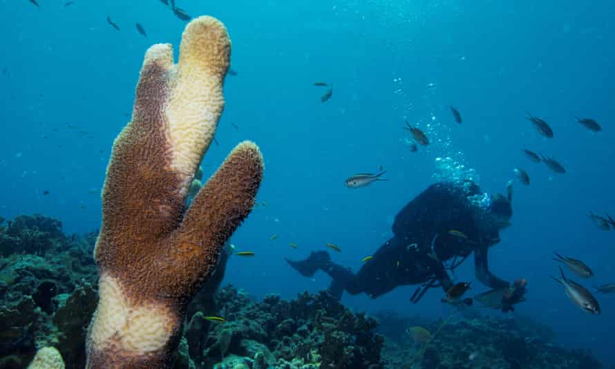
Photographs: Lucas Jackson/Reuters
From The Guardian by Jewel Fraser
Researchers find ‘significant relationship’ between stony coral tissue loss disease and nearby shipping
A virulent and fast-moving coral disease that has swept through the Caribbean could be linked to waste or ballast water from ships, according to research.
The deadly infection, known as stony coral tissue loss disease (SCTLD), was first identified in Florida in 2014, and has since moved through the region, causing great concern among scientists.
It spreads faster than most coral diseases and has an unusually high mortality rate among the species most susceptible to it, making it potentially the most deadly disease ever to affect corals.
More than 30 species of coral are susceptible.
It was found in Jamaica in 2018, then in the Mexican Caribbean, Sint Maarten and the Bahamas, and has since been detected in 18 other countries.
In Mexico, more than 40% of reefs in one study had at least 10% of coral infected by SCTLD, and nearly a quarter had more than 30%.
In Florida, regional declines in coral density approached 30% and live tissue loss was upward of 60%.
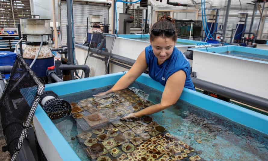 Biologist Emily Williams moves corals between tanks as researchers try to find out more about an outbreak of SCTLD in Florida in 2019
Scientists have not yet been able to determine whether the disease is caused by a virus, a bacterium, a chemical or some other infectious agent, but the peer-reviewed study in the journal Frontiers in Marine Science supports the theory that ballast water from ships may be involved.
Conducted in the Bahamas by scientists at the Perry Institute for Marine Science, it found that SCTLD was more prevalent in reefs that were closer to the Bahamas’ main commercial ports, in Nassau and Grand Bahama, suggesting a likely link between the disease and ships.
Judith Lang, scientific director at the Atlantic and Gulf Rapid Reef Assessment project, which has been tracking the disease, said: “The prevailing currents in the Caribbean push seawater to Florida and not in the reverse direction, and the predominant wind direction is westward.
So human dispersal [to those three territories] in 2018 seems necessary.”
In 2017, the spread of deadly pathogens by ships when they discharge ballast water prompted the International Maritime Organization to implement the Ballast Water Management Convention, which requires that ships discharge their ballast water – used to maintain the ship’s stability – 200 nautical miles from shore in water at least 200 metres deep before entering port, to ensure they do not bring in harmful foreign pathogens.
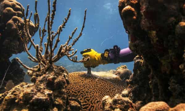
In the Bahamas, SCTLD has spread rapidly since first being identified in December 2019.
Krista Sherman, senior scientist at the Perry Institute and a co-author of the recently published paper, said: “The disease is spread along about 75km of reef tract, about 46 miles – so for Grand Bahama that is a large structure of reef.
We’re talking about mostly covering the entire southern coastline of the island.”
The disease is also widespread in the coral reefs of New Providence, where the Bahamas’ capital, Nassau, and main port are located.
The study notes the presence of international container ships, cruise ships and pleasure boats at that location, as well as a fuel shipping station.
Infection rates among the most susceptible species were 23% and 45% across New Providence and Grand Bahama respectively, and recent mortality rates have reached almost 43%.
With the exception of two species, the researchers found “there was a significant relationship” between the disease and proximity of reefs to the major shipping ports.
They noted “an increasing proportion of healthy colonies as distance from the port increased on both islands, and a greater proportion of recently dead colonies closer to the port than farther away”.
The locations where SCTLD is prevalent in the Bahamas are all popular with tourists, recreational fishers and divers, Sherman said.
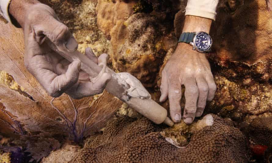
There are concerns that the coral disease could affect the country’s main fishery export, spiny lobster, said Adrian LaRoda, president of the Bahamas Commercial Fishers Alliance.
Although the lobster fishers work further out to sea, the industry would be affected if the reefs die.
The spiny lobster fishery brings in $90m (£66m) a year and employs 9,000 people.
“Any negative impact on our reefs would definitely drastically affect our spiny lobsters because the mature animals migrate [from the reefs] to the fish aggregating devices [a technique for catching fish],” LaRoda said.
He added that the lobsters’ reproduction rate and the food supply for juvenile lobsters in the reef would also be affected.
The Bahamian government has set up a national taskforce to tackle the problem.
Currently, the most effective treatment for the disease is the application of the antibiotic amoxicillin directly to the corals, which has seen some success in reducing mortality, but no realistic permanent solution is available.
According to Lang, rather than treating the symptoms, there is a need to tackle the possible human-made causes.
“Given a chance, nature can heal naturally,” she said.
Tuesday, July 27, 2021
The importance of surveying relic munitions and unexploded ordnance
From Euronews
The coastal waters of Germany and other European countries are scattered with old munitions.
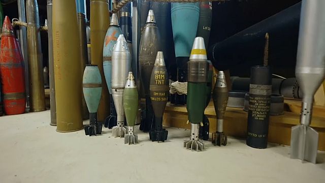
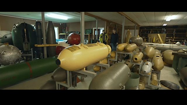
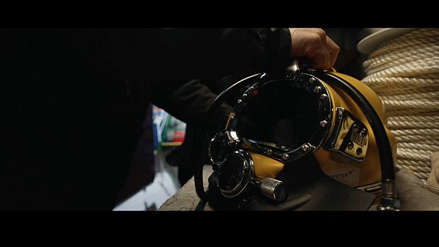
Frank Ketelsen, Head of the diving operations at the Schleswig-Holstein Bomb disposal unit, tells us that if they must detonate a bomb in the water, they set up "air bubble curtains to protect marine mammals".
Unexploded bombs found on land often make the news, but munitions on the seabed are rarely heard of, yet their quantity is unbelievable.
Oliver Kinast, Head of the Schleswig-Holstein bomb disposal unit, says that there's an estimated "1.6 million tonnes of munition from the World Wars in the North and Baltic Sea, 300 000 tonnes of which are in the Baltic Sea alone".
Aaron Beck is a researcher in aquatic biogeochemistry for the GEOMAR Helmholtz Centre for Ocean Research Kiel.
Much of the munitions on the seabed, both conventional and chemical, were deliberately disposed of in large numbers by the armed forces of many different countries.
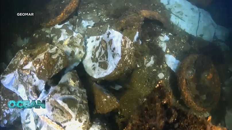
On the seafloor, we see a hoard of decaying munitions that includes two-meter-long bombshells and bare chunks of toxic explosives.
Similar dumpsites can be found off the coasts of various countries in Europe and around the world.
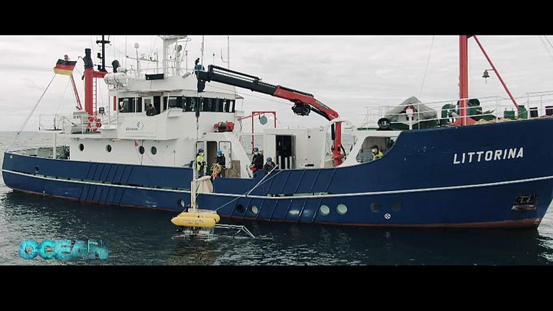 AUV LUISE being lowered into the seaeuronews
Marc Seidel, a Geophysicist for GEOMAR tells us that by combining the camera footage and the magnetic signatures that they measure, they get a good idea of what the object might be. Chemical analysis gives even more clarity.
Scientists from the ExPloTect project are developing a sampling system with special filters for catching dissolved particles of explosive materials from the seawater.
According to Aaron Beck, a researcher in aquatic biogeochemistry for the GEOMAR Helmholtz Centre for Ocean Research Kiel, with the new chemical analysis, they've gone from two to three months from collecting a sample to getting the data to the whole process potentially only taking 15 minutes.

The technology is also helping out the environment.
But how can the huge amount of data collected by underwater vehicles be processed?
Artificial intelligence
To the CEO and founder of Egeos, Jann Wendt, "automation is definitely helping".
Clearing the seabed is a task with huge economic potential.
Huge masses of underwater munitions are rusting and will release toxic content into the seas in the near future.
Monday, July 26, 2021
Getting to the bottom of trawling’s carbon emissions
From EOS by Nacy Averett
A new model shows that bottom trawling, which stirs up marine sediments as weighted nets scrape the ocean floor, may be releasing more than a billion metric tons of carbon every year.
Bottom trawling, a controversial fishing practice in which industrial boats drag weighted nets through the water and along the ocean floor, can unintentionally dig up seafloor ecosystems and release sequestered carbon within the sediments.
For the first time, researchers have attempted to estimate globally how this fishing technique may be remineralizing stored carbon that, as the seabed is tilled, ends up back in the water column and possibly the atmosphere, where it would contribute to climate change.
“So when we put in more human-induced CO2emissions, whether that’s directly dumping CO2 into deep waters or whether that’s trawling and enhancing remineralization of this carbon, we’re weakening that sink.”
Atwood helped build a model that shows that bottom trawling may be releasing as much as 1.5 billion metric tons of aqueous carbon dioxide (CO2) annually, equal to what is released on land through farming.
Her work was part of a paper recently published in Nature that presents a framework for prioritizing the creation of marine protected areas to restore ocean biodiversity and maximize carbon storage and ecosystem services.
Estimating Carbon Loss from the Ocean Floor
To create the model, Atwood and her coauthors first needed to figure out how much of the ocean floor is dredged by trawlers.
They turned to data from the nonprofit Global Fishing Watch, which recently began tracking fishing activity around the world and compiled data on industrial trawlers and dredgers from 2016 to 2019.
The next step was to find data on how much carbon is stored in the world’s ocean sediments.
Because that information was not readily available, Atwood and colleagues built a data set by analyzing thousands of sediment cores that had been collected over the decades.
Last, they dug through the scientific literature, looking at studies that examined whether disturbances to the soil in coastal ecosystems, such as seagrasses, mangroves, and salt marshes, exposed carbon that was once deep in marine sediments and enhanced carbon production in the ocean.
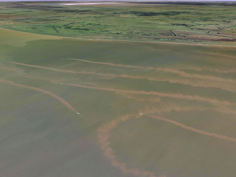
The trawlers are trailed by a plume of sediment, suggesting that their nets are scraping against the seafloor.
Credit: SkyTruth Galleries, CC BY-NC-SA 2.0
“We lean really heavily on that literature,” said Atwood.
“We used a lot of the equations [in previous papers] to build our model and extend it into the seabeds in these more open ocean locations.
And from there, we were able to come up with this first estimate.”
Their investigation did not attempt to determine whether sequestered carbon that has been released by bottom trawling remains in the water column or is released into the atmosphere, although they noted potential problems either way.
In the paper, the authors noted that it is likely to increase ocean acidification, limit the ocean’s buffering capacity, and even add to the buildup of atmospheric CO2.
Atwood and the lead author of the paper, Enric Sala, a conservation ecologist who is also a National Geographic Explorer-in-Residence, are working with Tim DeVries, who studies ocean biogeochemistry at the University of California, Santa Barbara, and scientists at NASA’s Goddard Space Flight Center to build atmospheric models to try to figure out where the released carbon goes.
Existing Trawling Data May Be Too Scant
Not everyone, however, is convinced that Atwood and Sala’s model on bottom trawling and loss of carbon sequestration in marine sediments is accurate.
Sarah Paradis, who is studying the effects of bottom trawling on the seafloor for her Ph.D.
at the Institute of Environmental Science and Technology in Barcelona, is skeptical.
In an email to Eos, Paradis noted that since the 1980s, there have been fewer than 40 studies that address the impacts that bottom trawling has on sedimentary organic carbon.
These few studies are not enough to build a model on, she said, and in addition, the studies reach different conclusions.
Some studies have observed that bottom trawling decreases organic carbon content of the seafloor, whereas others show it increases organic carbon.“We in no way intended our model to be the end-all in the trawling conversation.
We hope that many more studies will come along that help produce more localized results.”In addition, Paradis wrote that lower organic carbon on the seafloor does not necessarily mean its remineralization to CO2.
Rather, it could simply mean loss of organic carbon through erosion, which means the carbon moves to another area of the seabed but very little is remineralized into CO2.
She pointed to several studies, including one that she was a part of, that showed loss of organic carbon through erosion.
“I want to emphasize that [the authors] address a very important issue regarding how bottom trawling, a ubiquitous and very poorly-regulated anthropogenic activity, is affecting the seafloor,” she wrote.
“But the values they propose are far from being credible.”
Atwood disagreed.
“We don’t need lots of studies on the effects of trawling because we built our model using decades of carbon cycling research,” she wrote in an email to Eos.
“Trawling is simply a perturbation that mixes and re-suspends sediments, leading to increases in carbon availability.
All we needed to know about trawling to apply a carbon model to it is where trawling occurs and how deep in the sediment the trawls go.”
In addition, Atwood said, “We in no way intended our model to be the end-all in the trawling conversation.
We hope that many more studies will come along that help produce more localized results.”
Links :
- GeoGarage blog : Bottom trawling releases as much carbon as ...
- Eureporter : Closing up to 70% of Europe’s seas to bottom trawling: Little loss to fishing sector but huge environmental gains


