Thirty-nine trawlers are licensed to catch up to 4,170 metric tons of shrimp in Madagascar’s waters during the 2022 campaign, which officially began on March 1.
Chinese-owned company Mada Fishery, which holds eight exploration rights did not apply to catch shrimp this year, and its eight vessels are now sitting idle.
Three of the vessels were previously engaged in fishing violations in the Gambia, and under Malagasy law should not be eligible to fish in Madagascar now — unless there’s been a change in their ownership.
But a murky document trail and general lack of transparency into the vessels’ ownership makes it unclear whether that has happened; transparency advocates say the implementation of simple measures would have made a significant difference in the investigation of Mada Fishery.
ANTANANARIVO — During the current shrimping season, 39 trawlers will catch just over 4,000 metric tons of shrimp in Madagascar’s waters.
But one company, with a five-year exploitation right, didn’t apply for licenses to trawl this year. Its idle vessels highlight both improving regulation and potential weaknesses in monitoring of the country’s fishing sector.
An artisanal fisherman next to a ship in Madagascar.
The company bought exploitation rights for eight vessels. The company says it also bought eight shrimp trawlers, which spent part of last year being repaired at the state-owned shipyard at Antsiranana, on the northern tip of the island.
But Mada Fishery’s boats have a troubled history, according to an investigation by the Environmental Justice Foundation, an NGO that promotes environmental sustainability around the world. EJF says three of these trawlers previously violated fishing regulations off the West African coast and should be banned from operating in Malagasy waters.
“As recently as 4 November 2020, the vessels were intercepted by the Gambian Navy, Gambian Department of Fisheries and Sea Shepherd,” Steve Trent, founder and CEO of London-based EJF, told Mongabay.
“The trawlers were found to have been fishing inside protected waters reserved exclusively for small-scale fishers in Gambia,” he added. “The Gorde 105 and Gorde 107 vessels were also double-bagging their nets — another offense under Gambian fisheries regulations. As a result of the Gambian Navy and Department of Fisheries findings, fishing trawlers Gorde 105, Gorde 106 and Gorde 107 were impounded and escorted to the Gambian port of Banjul.”
Malagasy regulations state that “no vessel with a history of illegal fishing should be allowed to fish in the country’s waters” — unless there’s proof of a change in ownership.
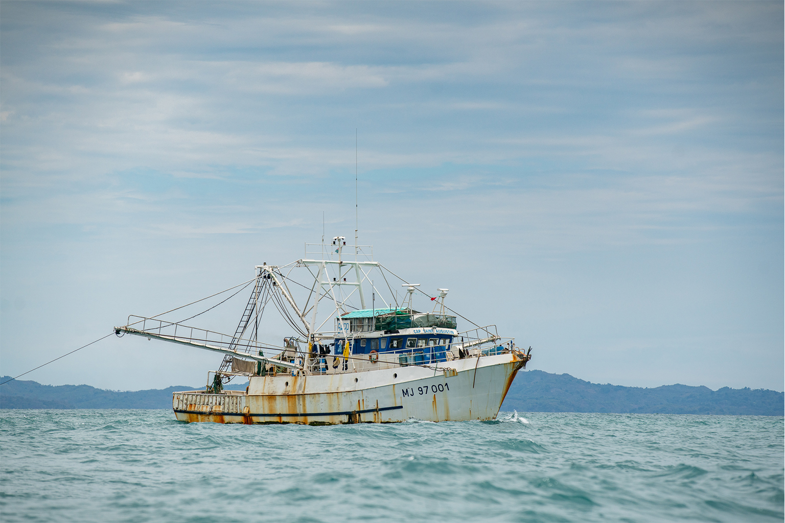
A fishing trawler — the Cap-Saint Augustin, not one of Mada Fishery’s — off the shore of Nosy Faly. Image by Mongabay.
Messy paperwork
EJF says it’s not clear that the vessels have actually changed hands. When Mada Fishery’s fleet of trawlers anchored in Seychelles en route to Madagascar, documents submitted by the captains of at least four of the boats appeared to have been forged.
EJF says the identification numbers for Gordes 105-108 correspond to ships in an entirely different fleet, officially registered to a company called Shandong Roncheng Dafa Fisheries Co. Ltd. But EJF found no such company listed in Chinese vessel registration records: every Chinese corporation has a unique number called a Unified Social Credit Identifier, but the number provided on the Gorde fleet’s documents for Shandong Roncheng Dafa does not match that of any existing company.
The ships’ documents and hulls all had the same call signs, making it difficult to identify them individually. Worse yet, the 16-digit number used by the Chinese government to identify fishing vessels also appeared to be wrong.
In light of these irregularities, the campaigners say the ships should not be licensed to fish until clear proof of ownership is provided. Perhaps tellingly, Mada Fishery did not attempt to register the disputed boats to fish for shrimp this year.
But what about the future?
If they are now owned by Mada Fishery, the eight trawlers should qualify for fishing licenses.
“That could be the case if they respect the existing laws and regulations,” Mahatante Tsimanaoraty Paubert, Madagascar’s minister of fisheries and the blue economy, told Mongabay. “The vessels changed names and owners. According to the Malagasy laws and regulations, we can issue license as long as they comply with our laws. They can apply for fishing licenses as they hold fishing rights they bought.”
A fishing trawler fishing off the shore of Nosy Faly in northwest Madagascar. Image by Mongabay.
Improving fisheries monitoring
While Mada Fishery’s boats are idle, the trawlers fishing off Madagascar this year will be more closely monitored than in the past. Paubert said the government’s own surveillance will be supplemented by several international collaborations. “Apart from the Fisheries Surveillance Center (CSP) within the ministry, the European-funded Ecofish Program, by the mean of its OSIRIS II ship intervening in the Western Indian Ocean, helps us stop any eventual illegal fishing activities in our waters.”
Other support will come from Amsterdam-based NGO Sea Shepherd Conservation Society. “They are to fully put a ship with its crew at our disposal to patrol our waters under the control of the government,” Paubert told Mongabay. “Madagascar hasn’t to pay for their service. What we have to do is to make available onboard the nearby 25 Malagasy fishing inspectors and the navy’s forces for the ship’s security.”
Paubert was only appointed to his role as minister overseeing fisheries in October last year. Just weeks later, Madagascar joined the Fisheries Transparency Initiative (FiTI). Its mission is to improve the sustainability of global fisheries by increasing the transparency of government management of stocks.
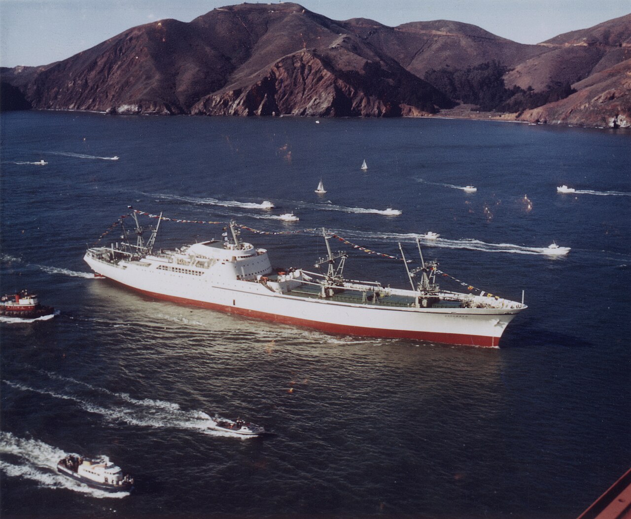
The N.S. Savannah, the world's first nuclear-powered merchant ship. At first glance, it looked like an ordinary cruise ship. But there's one thing that sets this ship apart from any other. Just a few meters from the passenger staterooms were a nuclear reactor
At first glance, the N.S. Savannah looked like an ordinary cruise ship. With a pool for taking a dip, a dining room, and a lounge that doubled as a movie theatre. But there’s one thing that sets this ship apart from any other. Inside this unmarked space, just a few meters from the passenger staterooms was a nuclear reactor. Something unheard of on a passenger-carrying ship before or since. And it meant the N.S. Savannah could do incredible things. Like circling the earth for years without ever stopping.
In the 1960’s, nuclear power was viewed as a revolutionary, near limitless source of energy. But what was less certain, was whether putting a nuclear reactor aboard a civilian ship was really a good idea.
The Nuclear Ship Savannah
As one of the first ships powered by a nuclear reactor, N.S.Savannah was going to prove that nuclear power was a safe, clean, and near-limitless source of energy that could revolutionize ships. Because to make one trip around the earth, a typical ship will burn through more than twenty thousand barrels of bunker oil. All the while, billowing toxic smoke into the atmosphere. The N.S. Savannah was designed to make that same trip without burning anything at all. Because it could circle the earth using just a few pounds of a new kind of fuel called uranium.
Replacing an oil-burning engine with a small nuclear reactor promised to make ships of the future more economical, faster, and more reliable. It would also eliminate the need for large fuel tanks, freeing up more room for cargo and passengers. Nuclear-powered ships could also travel for years on end before needing to refuel, and travel at much higher speeds. Opening up new trade routes that could reshape maritime trade. But despite all the promises of nuclear power, the world had good reason to be skeptical.
In the 1950s, nuclear really only meant one thing. Its enormous destructive potential and the hidden dangers of radiation were widely feared. Nuclear weapons had been around for nearly a decade, but the peaceful use of nuclear energy was still a new concept. So in 1953, U.S. President Eisenhower launched the Atoms for Peace program. In an effort to win over hearts and minds, research, funding, and equipment would be sent throughout the world to advance the peaceful use of nuclear energy. And the N.S. Savannah would be built as a floating example of what an atomic-powered future could offer. As the first of its kind, the ship would carry both passengers and cargo at the same time.
The N.S. Savannah was designed to look like the ship of the future. From the teardrop-shaped superstructure to the streamlined cargo cranes, everything about this ship was designed to stand out. But what really set it apart was the power plant.
The Savannah’s 74-milliwatt cylindrical reactor was designed with access from above for refueling. Along with the pressurized water reactor, the primary coolant loop, and steam generator, it is housed in a 50-foot containment vessel encased in lead, concrete, and polyethylene.
To keep passengers and crew safe, mere meters from the reactor, engineers built-in layers of protection. The reactor was surrounded by a primary radiation shield, a thick steel containment vessel, and a 500-ton biological shield.
To counter severe weather, Savannah featured one of the first ship stabilization systems, using hydraulically-actuated fins to counter rolling motions. The ship also featured a reinforced hull and energy-absorbing structures to protect against a collision with another ship.
And in the unlikely event that Savannah was to sink, the reactor was designed to automatically shut down and one-way valves would flood the containment vessel with seawater, preventing radioactive material from escaping. Engineers had thought of every possible disaster scenario and Savannah’s builders boldly claimed that they were shone of the safest ever built.
It only remained to convince the world.
Though it had taken six years to develop and build, Savannah surprised even its designers. The reactor produced more power than anticipated. The ship was designed to top out at 20 knots, but could easily surge along at 24. Among the grimy, soot-covered merchant ships of the era, Savannah was undeniably striking.
In May of 1964, Savannah set sail on an ambitious world tour to demonstrate the merits of nuclear power. Over the course of a year, it made visits to U.S. cities along the eastern seaboard and to over a dozen European ports, crossing the Atlantic several times in the process. The ship traveled nearly 150,000 kilometers, using only 35 pounds of uranium. Each time Savannah pulled into a new port, huge crowds formed to greet it. In the first year alone, 1.4 million people lined up to tour the ship. Savannah’s world tour had gone fantastically well, generating enormous public interest and plenty of positive press. Savannah’s commercial operator was so happy with the ship’s performance, they urged Congress to fund another four nuclear ships based on Savannah’s design. And back in the United States, additional crews were being trained in anticipation of serving aboard future nuclear ships. If nuclear propulsion really was the future, momentum seemed to be building. Savannah had made nuclear propulsion look easy, as the ship cruised effortlessly from port to port.
But hidden behind the sleek lines and gleaming white paint stood a harsh reality. There was nothing straightforward about operating a nuclear ship. Before Savannah could pull into a port, it needed special permission. And the request had to be made months in advance. And Ports often refused over safety concerns. So behind the scenes, Savannah’s representatives would have to fly out well in advance to begin negotiating agreements. Covering everything from how to respond if the ship were to cause a nuclear accident, to who would be liable. Gut-level scepticism about floating nuclear reactors wasn’t going to disappear overnight.
And to make matters worse, Savannah’s design wasn’t very practical.
The unusual half-passenger half-cargo configuration meant the ship wasn’t good at carrying either. The passenger accommodations took up a lot of space, while the cargo holds were too small. And with so much emphasis having been placed on an eye-catching design, the ship’s sleek lines made cargo handling difficult.
Savannah also needed a highly-trained crew about a third larger than on a conventional ship. For a ship built to prove that nuclear power could be commercially viable, Savannah seemed to do the opposite. Even as the ship’s operator publicly boasted about Savannah’s performance, their operating costs were heavily subsidized, consuming millions each year in taxpayer money.
But in one very important way, the Savannah could still be considered a success. Because It helped inspire other countries to build their own nuclear-powered ships. In 1964, West Germany launched the NS Otto Hahn. In 1976, the Japanese launched Nuclear Ship NS Mutsu. And, a fourth, the Soviet Union nuclear cargo ship was built in the 1980s. But, public protests led to the ships being barred from entering major ports, and harbor workers, fearing radiation exposure, refused to unload cargo from the ship.
Follow along on an amazing day aboard the NS Savannah. Lounge on the deck with Mrs. Eisenhower or simply enjoy the many amenities that the ship has to offer.
While a technical success, Savannah’s design never became profitable and lasted just 5 years in commercial operation. In 1971, the reactor was refueled and made inoperable. Since the N.S. Savannah is historically significant, the ship was officially declared in 2001 a National Historic Landmark.
Otto Hahn carried cargo for 9 years, but it’s reactor was eventually removed and replaced with a conventional diesel engine. Mutsu Never carried cargo, and after having traveled just 82 thousand kilometers, its reactor was also swapped for a Diesel engine. Along with a handful of nuclear icebreakers, Russia still occasionally operates the only remaining nuclear cargo ship, mostly carrying military cargo in the far north of the country.
Today, more than 90,000 thousand merchant ships operate on the world’s oceans, and the majority burn low-grade bunker oil. The most polluting oil available. One large cargo ship can put out as much hazardous sulfur dioxide as fifty million cars. And while the public remains focused on the potential dangers of nuclear power, shipping-related emissions have led to four hundred thousand premature deaths each year from lung cancer and cardiovascular disease. If just a dozen large cargo ships were powered by nuclear reactors, the reduction in global emissions would be considerable. And they would join the hundreds of nuclear-powered vessels that have been operated safely by the U.S. military over the past 50 years. Today’s nuclear technology is safer and more economical than it was sixty years ago when Savannah first set sail. But the development of nuclear-powered civilian ships remains frozen in time. Because the biggest obstacles still remain, especially public perception.
Where to next for the most capable private deep-sea exploration vessel on earth, and its intrepid owner…
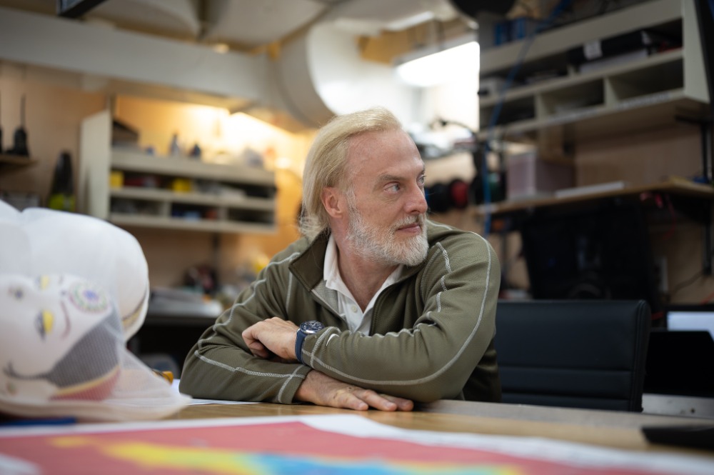
The last time we spoke with Victor Vescovo, Commander, USN (Ret.), he, the team at Caladan Oceanic and EYOS Expedtions, onboard the private expedition vessel Pressure Drop, had just successfully taken scientists on the first manned descent of the Atacama Trench off the northwest coast of Chile. Part of an ongoing series of dives to uncharted ocean depths, the Ring of Fire expedition now continues its way around the Pacific. I met with Mr Vescovo at a café in London, shortly before he was due to receive the Don Walsh award for marine oceanic research and exploration.
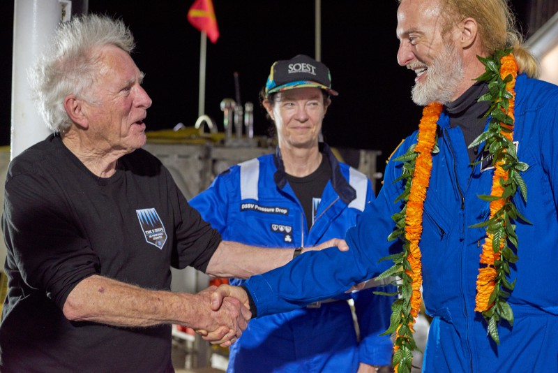
It was fitting that it was Don Walsh himself, one of two crew on the first descent to the Mariana trench in 1960, along with Jacques Picard, to hand over the award that bears his name. In what remains a mind-blowing feat of pioneering engineering, calculated risk, and an innate desire to explore, Walsh and Picard laid down a marker as to what was possible 60 years ago. Mr Vescovo, his team, and a growing fleet of private scientific explorers now continue in this spirit. In my last conversation, I left Mr Vescovo onboard Pressure Drop, expecting that soon he would be diving a new trench off the coast of Mexico. His explanations as to why they did not, underline the frustration that must go hand in hand with the thrill of exploration.
“We were supposed to go and execute a dive in the MesoAmerican Trench, with a local Mexican scientist. And we never got a permit. They never denied it. But they just never awarded it, either. And I'm still not clear why we didn't get a permit. Maybe there was something happening between the scientific team and the government - we just don't know, “ says Mr Vescovo.
The first person to the bottom of the Mariana Trench - Don Walsh (left), greets Victor Vescovo (Right).
Image Reeve Jolliffe
A fully crewed and operational private vessel, or superyacht, operates on an entirely different timescale to the ebbs and flows of the bureaucratic system. A vessel as finely tuned as Pressure Drop cannot simply be turned off and wait dormant for the open-ended filling of paperwork and permits. As Mr Vescovo says, paraphrasing another highly influential figure in the world of private exploration, EYOS founder & Expedition Leader Rob McCullum, “Sometimes the biggest hurdle to ocean exploration is not the science, it’s other people.”
As Mr Vescovo describes his team at Caladan Oceanic, working alongside EYOS expeditions, he claims it feels as if they are walking on eggshells at times. There is a tightrope to walk concerning regulations, and there is very little in the way of international regulatory framework to operate within. If someone has never been to a remote place, and the authorities and academic institutions do not have the technology that could get close, there is not much chance that there is a standard form to fill out that allows these operations to proceed. At times, Mr Vescovo points out, it feels as if he and his team are restarting the process entirely before each trip.
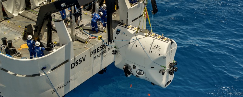
DSV Limiting Factor being lowered off DSSV Pressure Drop
There is no definition within the UN Convention on the Law of the Sea (UNCLOS) as to what marine scientific research actually entails. It is perhaps a testament to the rapid evolution of both the capabilities and desire of private vessels and their owners to engage with this research and push these boundaries, that these hurdles are encountered at all. It is unlikely that those who write the legislation had anything in mind quite like a private vessel with a submersible that can operate at over 11,000m in mind. “It's an extraordinary situation really. If you're a private, completely philanthropic oceanographic research mission” continues Mr Vescovo, “you are subjected to a level of scrutiny that is akin to brain surgery, while a container ship can plough through and accidentally dump out four or five containers, and nothing happens. So, the dichotomy of how the commercial world is treated and how philanthropic scientific, so-called good guy research is handled, is irrational.”
Part of the issue, Mr Vescovo explains, is that countries are now exerting a level of influence over their exclusive economic zones (EEZ) that is more akin to what is defined as territorial waters. The 12-mile limit around most coastlines is sovereign territory, and he explains, Caladan Oceanic’s expeditions will always be very respectful of this demarcation. EEZs, on the other hand, were established without full sovereignty in mind. They are legally international waters. New Zealand, for example, has the 4th largest EEZ in the world, but it does not have the fourth largest territory. The designation of these zones is designed to protect economic, and natural resources such as fisheries, and oil and gas deposits from foreign exploitation. Countries such as Norway have benefited hugely from their rights to the North Sea oil fields, for example. However, the single sentence in the UNCLOS allowing countries to “regulate Marine Scientific Research” (MSR) in their EEZs has put an enormous brake on such research because now countries can – and usually do – highly restrict or even prohibit it – which is not what the drafters of UNCLOS seem to have intended.
DSV Limiting Factor returning to DSSV Pressure Drop.
Image - Reeve Jolliffe
Mr Vescovo and his team have encountered local governments who are reinterpreting their own definitions, and they appear unsure how to interact with an expedition such as his. As he stresses, they are there to explore, and all of the research and data collected will be made freely available. Having the freedom to operate transparently, and in partnership with a more diverse collection of governments will allow the work that Caladan Oceanic has pioneered to expand, and, crucially, be emulated by a growing fleet of like-minded private vessels.
Superyachts for scientific exploration is, in my estimation, the most positive and impactful activity the industry can undertake. The resources and capabilities of Caladan Oceanic, REV Ocean and OceanX have redefined what is possible, not just for intrepid individuals, but the scientific community as a whole. While not all exploration and research-minded superyachts can undertake such extreme missions as they perform, they can conduct meaningful research and collectively the worldwide community of yacht owners can form their own scientific ecosystem, as Mr Vescovo explains:
“I actually had dinner with the head of NOAA (The National Oceanic and Atmospheric Administration), who asked me: ‘What can we do to have a greater partnership between the public and the private sector?’ My simple answer is to publish a list of research priorities. For example, what are the 10 research objectives that are the most challenging, but that the private sector could, with the assistance of certain governments, take on? We have a growing number of vessels and owners that are expressing interest. Is it a fun trip cruising the Amalfi Coast? No, but it is more positively impactful.”
DSV Limiting Factor awaiting pick up.
Image - Reeve Jolliffe
Continuing to channel the competitive nature of the owners and organisations behind exploration vessels towards impactful research will bear fruit. One needs only to look at the reinvigoration of NASA and the space program, thanks largely to Elon Musk’s development of reuseable launch systems, for an example of what private industry can help achieve. When we spoke about the recent successful expedition to find the Endurance, Ernest Shackleton’s ship that was lost under the Antarctic Ice Sheet a century ago, I saw the spark in Mr Vescovo, who concluded. “Gosh, I would love to have found that ship! I am so happy for the team that did. That is the exact kind of expedition that we would love to have done.”
Where to next then for Pressure Drop and the team at Caladan Oceanic & EYOS Expeditions? They are wasting no time heading across the Pacific for a fresh round of firsts in Micronesia. Departing Gaum on the 12th of July, the team will head back to the Challenger Deep with Dr Dawn Wright, an American cartographer and the Chief Scientist at multi-billion dollar geospatial intelligence firm, ESRI. This will be followed by a trip to the bottom of the Yap Trench with master Micronesian Navigator Sesario Sewralur and finally a dive at the Palau Trench with former president of Palau, Tommy Remengesau. Then, fittingly for someone who has achieved so much on the blue planet, Mr Vescovo will be part of Blue Origin’s next New Shepard Mission NS-21, which will fly six customer astronauts into space on just the 5th human flight from the Blue Origin program.
Rob McCallum, founder of EYOS expeditions.
Regarding that flight and potential criticism that they are simply “rides” for the wealthy into space where very few people will ever get to go, Victor stressed that “Customers paying to go up in these new, 99% reusable rockets – as the New Shepard is - is actually a great thing.”
He explained, “Anything that allows us to build experience launching and recovering them increases their reliability, safety, and drives down the cost to access space for everyone over time – just like the early days of powered flight.”
Back at sea, Mr Vescovo and the team at Caladan Oceanic are far from alone in the field of private scientific exploration. The aforementioned REV Ocean and OceanX, along with Caladan Oceanic are part of a growing group of scientifically centred private exploration organizations. Colloquially known as the Pink Flamingo Society, they are working in conjunction with 14 international scientific organisations to coordinate the use of private vessels for research free of charge. Concurrently, organisations such as Yachts For Science and the Seakeepers Society are working to connect eager yachts that may not be scientific specialists with suitable programs of research that can work in tandem with their operational schedules.
The combined potential to affect positive change for the ocean that this expanding network of philanthropic vessels and organisations presents is hard to overstate. Some of the issues that Mr Vescovo has encountered will undoubtedly cause headaches again, but the next generation of collective action that these vessels and associated organisations undertake may see some of the barriers fall away as awareness increases, and our understanding of the ocean and our obligation to protect it, deepens.
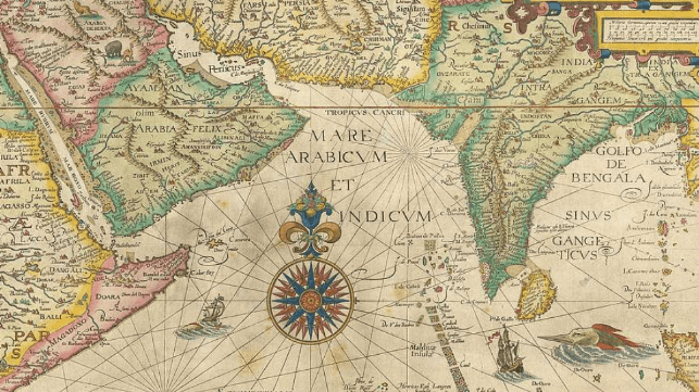
Recent studies in geopolitics appear to concur that the Indian Ocean rim could become the world’s most important economic region, surpassing the Pacific Rim.
Indeed, the competition amongst global super powers for control of the Indian Ocean and its resources has intensified.
An important trade route for centuries, the Indian Ocean now commands major sea-lanes where half of the world’s container ships pass, as well as 70 percent of the world’s oil shipments.
It is a critical resource for the region’s littoral states, as well as outside powers.
However, as more countries scramble for a share, some blind spots in the geography and the key regional players have emerged.
This hinders the ability to assess the region’s importance to global competition.
“The Indian Ocean is often split among the South Asian, African, and Middle Eastern regions, but these artificial divisions emphasize the landmasses and push the maritime domain to the periphery. Further, they move the concerns and priorities of island nations, which otherwise would act as important regional players, under the challenges of their continental counterparts,” observed Darshanah Baruah and Caroline Duckworth, marking the launch of a new interactive map by the Carnegie Endowment aimed at modernizing the understanding of the region.
To fully monitor and absorb key developments in this strategic maritime domain, the Indian Ocean must be viewed as a single region, argue Baruah and Duckworth.
For instance, Sri Lanka and the Maldives are considered part of South Asia, while Mauritius and Seychelles are considered part of Africa.
Though these regional divisions suggest these nations have major differences in economic goals and security needs, they are united on issues of climate change, the importance of multilateralism and pursuit of promoting blue economy.
In addition, four key points arise when Baruah and Duckworth view the Indian Ocean holistically.
First, although the Indian Ocean is known to have three chokepoints - the Strait of Malacca, the Strait of Hormuz and the Strait of Bab-el-Mandeb – the Mozambique channel has emerged as a critical backup trading route.
This was visible during the blockage of the Suez Canal in 2021, when some ships re-routed around the Cape of Good Hope and through Mozambique Channel.
These chokepoints provide a strategic military advantage to any regional player that gains their control. If a single nation gets the power to keep these sea lines of communication (SLOC) open during peacetime, it also has power to close them during times of conflict.
Take the case of the Strait of Hormuz, where approximately 21 million barrels of oil pass each day, according to estimates by the U.S Energy Information Administration (EIA).
Even a slight event along this route can affect global energy supply and trade.
Second, while China is considered a primary trading partner for Indian Ocean’s island nations, their trade with the UAE (United Arab Emirates) frequently surpasses that of China, India and the U.S. Further, Qatar and Turkey are emerging as new players in this trade dynamic, gradually replacing the European and African countries that have been the historical trade partners.
Third, the Indian Ocean’s fifteen ongoing territorial disputes highlight the region’s complicated colonial legacy.
Some of the notable unresolved issues include France’s multiple disputes with Comoros and Madagascar, and the protracted dispute between the United Kingdom and Mauritius over the Chagos Islands.
“These sovereignty disputes with the West open the door for islands to deepen their relationship with China. While assertive in the South China Sea, China has no territorial disputes in the Indian Ocean region, seeking instead to balance the western influence,” note Baruah and Duckworth.
Finally, in viewing the Indian Ocean as a single theater, France, India and Australia have an overarching regional role.
By virtue of having territorial islands in the Indian Ocean, their military and trade security objectives intersect.
Hence the need for a harmonized strategy, implemented collaboratively through the Indian Ocean Rim Association (IORA).
From Medium I / II by Timothy G. Nelson for The Maritime Executive
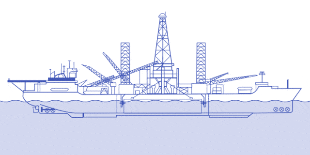
In June 1974, a large and bulky ship, the Hughes Glomar Explorer, exited Long Beach, California, sailing westward into the Pacific. Boasting an enormous drilling tower, and owned by the notorious and reclusive billionaire, Howards Hughes, the vessel was reportedly intended to recover thousands of tons per week of copper, nickel, manganese and cobalt from the floor of the Pacific. These resources, real enough, exist in potato-sized nodules on the deep sea bed, way beyond any nation’s home waters.
Even by Hughes’s standards, a project to mine the deep seabed was intriguing. Manganese, a light metal used in a variety of industrial contexts, commands a certain price in world commodity markets — though many doubted whether this could justify the massive costs of building the Hughes Glomar Explorer,particularly given how deep the Pacific’s seabed can be. Indeed, in the waters off California, the Pacific floor soon drops to depths of 3,000 to 4,000 meters (1.8 to 2.4 miles). Even assuming such a vessel need not reach the deepest parts of the Pacific seabed floor (such as the Mariana Trench, which can be in excess of 10,000 meters, or 6 miles), the required effort, in terms of capital, labor and know-how, required to reach the manganese nodules would have been both enormous and unprecedented.
Aerial photograph of ships in Suisun Bay, California, mothballed for future defense use by the US Navy.
At the bottom left is the Howard Hughes barge HMB-1 which was used with the Glomar Explorer, to transport defense-sensitive vessels in a manner protected from observation.
Wikimedia Commons
Legally too, the notion of mining the deep seabed (or “ocean floor”) was a novel topic. Historically, the ocean floor was not the subject of significant commercial use, except for the laying of transoceanic submarine cables. It was only charted in detail in the mid-1870s, by the British vessel HMS Challenger (in whose honor a space shuttle was later named). Even with the laying of transoceanic cables — which began in the 1850s — this area did not receive much legal attention. It was widely accepted that the deep seabed had essentially the same status as the high seas themselves — namely, that each state has the right to travel there, and no state can claim exclusive ownership over its resources. It was thus recognized that the deep seabed was distinct –physically and legally — from the “continental shelf” (the area immediately alongside the coastal areas). A 1958 convention provided that the continental shelf belonged to the appurtenant coastal state — but stopped short of regulating the deep seabed.
New technology changed the focus.
In 1960, in a project sponsored by the U.S. Navy, the bathyscaphe Trieste reached the ocean floor in part of the Mariana Trench, at a depth of 10,916 meters. In the same decade, both the U.S. and Soviet navies fielded large submarine fleets, led by nuclear-powered, nuclear-armed boats on permanent rotation (albeit at far shallower depths than the Trieste). Technology had by now confirmed that the seabed held potentially significant mineral deposits, as noted above. Yet, legally, the seabed was still a “no man’s land.”
Things changed in 1967, when at the urging of the Maltese Ambassador to the United States, Arvid Pardo, the United Nations General Assembly established an ad hoc committee to study a legal regime that would ensure “that the exploration and use of the seabed and the ocean floor should be conducted in accordance with the principles and purposes of the Charter of the United Nations, in the interests of maintaining international peace and security and for the benefit of all mankind.”
Alongside these efforts, a separate U.N. committee became responsible for “seabed-related military and arms control issues.”
This had the enthusiastic support of the Nixon Administration. On March 18, 1969, President Nixon supported efforts to ban deployment of nuclear weapons on the seabed, remarking that this would “prevent an arms race before it has a chance to start.”
And on May 23, 1970, President Nixon proposed that “all nations adopted as soon as possible a treaty under which they would renounce all national claims over the natural resources of the seabed beyond the point where the high seas reach a depth of 200 meters (218.8 yards) and would agree to regard these resources as the common heritage of mankind.”
President Nixon further called for an international body to regulate mining of the deep seabed.
The first of these initiatives bore fruit almost immediately: in 1971, in recognition that “prevention of a nuclear arms race on the seabed and the ocean floor serves the interests of maintaining world peace,” the major powers signed the “Seabed Arms Control Treaty,” committing each party to refrain from placing on the seabed “any nuclear weapons or any other types of weapons of mass destruction as well as structures, launching installations or any other facilities specifically designed for storing, testing or using such weapons.”
The second Nixon proposal — a treaty to regulate the deep sea bed — had a promising start. In 1970 the U.N. General Assembly had passed a resolution to establish a general “Third United Nations Conference on the Law of the Sea” (“UNCLOS III”), to establish a new comprehensive treaty on the law of the sea. UNCLOS III, which first met in 1973, became an ongoing convocation international lawyers and experts from 160 countries, whose mission was to formulate a “Law of the Sea Convention” (or “LOSC”).
For much of its nine years of activity, much of UNCLOS III’s work consisted of codifying existing rules (e.g., rights of navigation on the high seas and the rights of coastal states to exploit their adjacent continental shelf). But on some issues, such as how and whether the deep seabed could be exploited — which formed “Part XI” of the draft Law of the Sea Convention, UNCLOS III’s delegates were grappling with new policy issues.
In early sessions of UNCLOS III, U.S. State Department negotiators favored a system that would give security of title, and a transparent regulatory system, for mining operators seeking to mine the deep seabed. They sought to promptly conclude a treaty along those lines. Meanwhile, some members of Congress, suspicious of this internationalist approach, sponsored unilateral legislation (a Deep Seabed Hard Minerals Act) that would explicitly permit mining under purely national regulations. Despite bills being introduced between 1971 and 1975, none made it out of committee, apparently because of pressure from the Executive (which was negotiating at UNCLOS III).
Other countries’ negotiators had a quite different vision of how the deep seabed should be regulated, and in May 1974, a group of developing and landlocked states issued what become known as the “Kampala Declaration,” demanding that UNCLOS III take into account the needs of “landlocked and geographically disadvantaged States.”
This agenda, which was taken up by the so-called “Group of 77” (a coalition of developing states), led their negotiators to urge for a strong central seabed authority with wide rule-making powers over seabed mining. The developing states furthermore viewed the “common heritage of mankind” as meaning that deep seabed minerals were collectively owned by all countries. In the words of one negotiator (a Sri Lankan diplomat), “[i]f you touch the nodules at the bottom of the sea, you touch my property. If you take them away, you take away my property.”
UNCLOS Maritime Zones
Things came to head in July 1977, with the release of the UNCLOS III “Informal Composite Negotiating Text” for the LOSC. This text included a “Part XI” to regulate the deep seabed. Under this text, the deep seabed (defined as “the Area”) was declared to the “common heritage of mankind.” It would be subject to regulation by a UN body, the International Seabed Authority, which would license commercial exploitation and collect royalties from operators. So far, this was broadly consistent with the U.S. policy. But, as proposed, this “Authority” also would operate its own company, identified as the “Enterprise,” to conduct deep seabed mining, alongside commercial operators. “Enterprise” profits then would be distributed among member states on the basis of “equitable sharing,” with particular regard for the interests of developing and landlocked states. Member states would be required to transfer their technology to this “Enterprise” and to “developing countries” to allow them to engage in seabed mining alongside established operators.
The then-chief negotiator for the United States at UNCLOS III, U.S. Ambassador Elliot Richardson (a former U.S. Attorney-General) declared these features “fundamentally unacceptable,” but remained at the UNCLOS III bargaining table, in the hopes of reaching better terms. Meanwhile, members of Congress stepped up efforts to pass domestic legislation to permit deep seabed mining unilaterally, and in late 1977 the Carter Administration indicated it would support this. In 1979, a robust bill allowing the U.S. government to license seabed mining was being actively considered by Congress.
Thus, in the space of fewer than 10 years, U.S. policymakers had shifted from supporting a multilateral treaty system for seabed mining, overseen by an international body (the Nixon proposal of 1972) to favoring a unilateral regulatory system, with the U.S. regulating U.S. mining activities on the deep seabed. But, as will be seen, this did not prevent the rest of the world from moving forward with a comprehensive treaty, despite growing discomfort with that model within the U.S.
During the 1970s, a U.N. conference, “UNCLOS III,” was commissioned to draft a comprehensive Law of the Sea Convention, (“LOSC”), to regulate, among other things, the the deep seabed. Though initially, this had White House support, things changed in 1977, when the treaty text took a leftward turn — providing for seabed mining to be governed by a central U.N.-affiliated “Authority,” whose “Enterprise” would also engage in mining itself, with profits distributed to developing states, on the basis that the seabed was the “common heritage of mankind.”
Members of Congress reacted by sponsoring legislation to regulate seabed mining unilaterally, via U.S. government licensing.
In 1979, this legislation was being actively considered. In that same year, yet another treaty text, from another UN body — the United Nations Office of Outer Space Affairs — sent critics of the draft LOSC into overdrive. Titled the “Moon Agreement,” this too described both the Moon and all celestial bodies as “common heritage of mankind,” and envisaged a system whereby an international regulator would license and supervise the exploitation of outer space. One U.S. critic (future Secretary of State Alexander Haig) complained that the treaty “would doom any private investment directed at space resource exploration.”
It was clear that attitudes towards the “common heritage of mankind” formula had changed. In 1970, when the Nixon administration declared the deep seabed to be the “common heritage of mankind,” the phrase was little more than a political bromide. By decade’s end, the phrase was viewed as socialistic.
Not that the Group of 77 was blind to market forces: Part XI of LOSC (both in its draft and final versions) included a carefully-crafted set of production ceilings for the minerals expected to be extracted from the deep seabed (namely, nickel, manganese, copper and cobalt). This was apparently intended to protect developing countries from the adverse price effects (to their economies) from such minerals becoming more abundant.
It thus was not surprising that Congress enacted the “Deep Seabed Hardbed Mineral Resources Act” of 1980 to facilitate U.S. commercial mining on the ocean floor without U.N. or international approval, based on licenses issued by a U.S. regulator. In 1982, President Reagan issued a national security directive stating that he would only support a treaty that “will not deter development of any deep seabed mineral resources to meet national and world demand” and “[would] give the United States a decision-making role in the deep seabed regime that fairly reflects and effectively protects its political and economic interests and financial contributions.”
Later that year, the United States signed a series of bilateral treaties with its major trading partners that provided for mutual recognition of their mining legislation and rights.
In December 1982, the final LOSC text was presented for signature at the ceremonial final meeting of UNCLOS III in Montego Bay. Despite some modifications, Part XI of the text retained many controversial features from the 1977 draft– including the strong central Seabed Authority, its operating “Enterprise,” its profit redistribution rules, and mandatory “technology transfer” provisions obligating Western operators to share their seabed mining technology with the Enterprise and developing nations. Many countries, including Western states, signed LOSC, but the United States did not.
For some, the U.S. refusal to sign LOSC was a disappointment, since LOSC had many features that were beneficial to U.S. maritime, naval and commercial interests. Despite discomfort with Part XI, non-adherence came at a potentially heavy price, since it put U.S. mining interests outside the treaty’s protection. As the former U.S. chief negotiator, Elliot Richardson, pointed out in 1983:
Domestic United States law cannot confer on anyone a generally recognized legal right to exploit a defined area of the seabed. But without such a right good for at least twenty years, no rational investor will gamble $1.5 billion on a deep seabed mining project. It will not suffice for seabed mining claims to be recognized only by a handful of like-minded countries. And even the seabed mining States concede that international law would not require non-members of the reciprocal regime to respect it.
As to Mr. Richardson’s estimate of a $1.5 billion dollar cost of seabed mining, it may have been conservative. The supposedly original seabed drill ship, Hughes Glomar Explorer, cost over $800 million, if not more, in 1970s dollars.
Glomar Explorer mothballed in Suisun Bay, California, during June 1993.
During the 1980s and early 1990s, the United States’ “holdout” status was immaterial because the LOSC still had not been ratified by enough countries. But on November 16, 1993, Guyana became the sixtieth state to ratify, meaning LOSC would take effect on November 16, 1994. The Seabed Authority, and all of its associated treaty machinery, was to spring into life.
Having failed to stop the LOSC, and the Seabed Authority, from coming into existence, the U.S. and other Western nations hurriedly negotiated a reconciliation package to ameliorate the more troublesome features of Part XI and the Seabed Authority structure, and thus enable the U.S. to enter the LOSC. In June 1994, the U.S. and other countries endorsed an “Agreement on Implementation” of Part XI, creating a more market-friendly regime for the seabed. This reduced the license application fee, reduced funding for the so-called “Enterprise,” abolished production ceiling rules, made seabed activity subject to GATT rules, and dropped mandatory technology transfer. It further provided for voting on the Seabed Authority to be done in groups, with the U.S. virtually guaranteed a seat on such groups — and placed all key financial decisions in the hands of a Finance Committee, in which the largest donors would automatically be members and decisions would be based on consensus.
The Clinton Administration signed both the “Implementation Agreement” and the LOSC in mid-1994, in the hope that the Senate would soon ratify it. This never occurred, however. Despite bipartisan support for LOSC (including from the second Bush administration), it has continued to draw enough criticism to make a ratification vote nonviable. In 2012, for example, over 33 Senators indicated they would oppose ratification, citing concerns over the Seabed Authority’s powers, as well as other objections to the LOSC.
Yet the LOSC exists, and since November 1994, the Seabed Authority has been the international regulator of the deep seabed. Based in Montego Bay, and with all of the trappings of U.N. bureaucracy — an “Assembly,” a “Council” and its own Secretariat — the Seabed Authority has granted various licenses to explore for polymetallic nodules, cobalt-rich ferromanganese, polymetallic sulfides. Most of these licenses have centered in the zone of the Pacific known as the “Clarion-Clipperton Zone,” just southwest of Hawaii.
The Seabed Authority has yet to grant actual mineral exploitation licenses. Its “Mining Code” — rules to govern the actual extraction of seabed minerals — has been the subject of ongoing internal debate since 2018. Once finalized, however, the path will be open for mining licenses to issue.
Notably also, while some exploration contracts have gone to Western applicants (e.g., German and British operators), others have gone to applicants from or supported by Cuba, Russia and China (see https://isa.org.jm/exploration-contracts/polymetallic-nodules). U.S. players are conspicuously absent.
While the Seabed Authority’s work has largely escaped public attention, its work remains important, not just because of the intrinsic value of the minerals in question, but also because the environmental significance of the deep seabed, and its ecosystems, has come to be far better understood. Critics have even accused the Seabed Authority of having an inherent conflict of responsibilities, in that it oversees both mining and environmental issues.
All of this, moreover, is occurring without active involvement of the U.S. — which, as a non-party to the LOSC, has no say in the Seabed Authority’s governance — all at a time when supply chain uncertainty and renewed international tensions have re-ignited concerns over access to natural resources.
What, then, became of the Hughes Glomar Explorer — the vessel whose 1974 expedition, for many, started the debate over deep seabed mining?
Did it find manganese nodules on the sea floor, and if so, did it extract and sell them?
How did the U.S. steal a sunken nuclear submarine?
Right out from under the nose of the Soviet Union...
Cool thumb details: The Hughes Mining Barge, or HMB-1, is a submersible barge about 99 m (324 ft) long, 32 m (106 ft) wide, and more than 27 m (90 ft) tall.
The HMB-1 was originally developed as part of Project Azorian (more widely, but erroneously, known as "Project Jennifer"), the top-secret effort mounted by the Central Intelligence Agency to salvage the remains of the Soviet submarine K-129 from the ocean floor.
The HMB-1 was designed to allow the device that would be used to grasp and lift the submarine to be constructed inside the barge and out of sight, and to be installed in the Glomar Explorer in secrecy.
This was done by towing the HMB-1, with the capture device inside, to a location near Catalina Island (off the coast of California), and then submerging it onto stabilizing piers that had been installed on the seafloor.
The Glomar Explorer was then maneuvered over the HMB-1, the retractable roof was opened, and the capture device lifted into the massive "moon pool" of the ship, all within clear sight of people on the beach ------- It’s March 1968.
An unexplained event causes a Soviet Golf-II submarine known as the K-129 to sink to the bottom of the Pacific Ocean while enroute to its patrol station off the coast of Hawaii.
Publicly, no one in the world knew what happened, where the submarine was, or what secrets might be hidden on board.
Behind the scenes, however, reporters caught wind of a classified US government operation to pry the wreckage from the floor with a giant claw and uncover whatever secret technology might be hidden within.
The mission was codenamed Project Azorian, and it was launched from a covert ship named the Glomar Explorer.
Pressed for comment on the operation, a US government spokesman flatly replied, [quote] “We can neither confirm nor deny the existence of the information requested but, hypothetically, if such data were to exist, the subject matter would be classified, and could not be disclosed…"
It turns out that the Hughes Glomar Explorer was, in reality, a front operation; not a drillship. It was purpose-built by the U.S. Central Intelligence Agency as part of “Project Azorian,” a covert, mission to find and raise a sunken Soviet nuclear submarine (the K-129) that had been lost in the North Pacific in 1969. The mission was partly successful, with portions of the submarine raised in August 1974 — following which, the Glomar Explorer was mothballed. The vast expense of the mission ( over $800 million) is still keenly debated among Cold War historians.
Despite its fanfare, therefore, the Hughes Glomar Explorer was not a pioneer of seabed mining. Although large scale seabed mining has not begun, policymakers, including in the United States, will soon be faced with some hard questions. The deep seabed covers literally two-thirds of the world’s surface. If robotic technology continues to accelerate, if commodity prices rise and if supply chain uncertainty intensifies, the issue of how and whether to mine the ocean floor — and how to deal with rival attempts to mine it — may become a topic of real and pressing concern.
On May 11, 2022, NOAA shared the first images of the Western Hemisphere from its GOES-18 satellite. The satellite’s Advanced Baseline Imager (ABI) instrument captured these images on May 5.
GOES-18, NOAA’s newest geostationary satellite, launched on March 1.
The ABI views Earth with sixteen different channels, each measuring energy at different wavelengths along the electromagnetic spectrum to obtain information about Earth’s atmosphere, land, and ocean.


 DSV Limiting Factor being lowered off DSSV Pressure Drop
 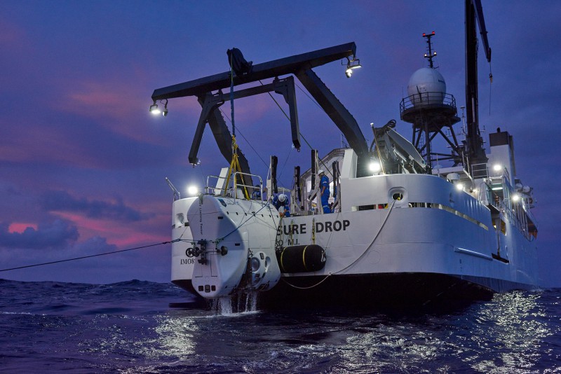 DSV Limiting Factor returning to DSSV Pressure Drop.
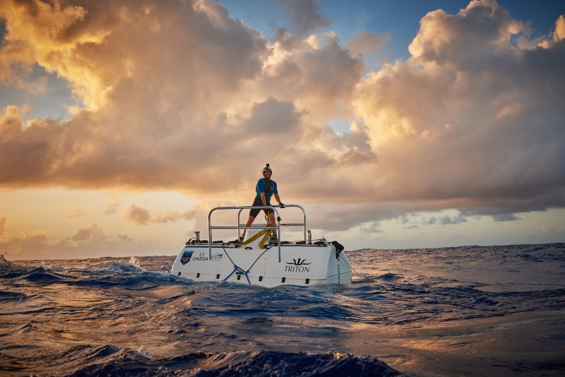 DSV Limiting Factor awaiting pick up.
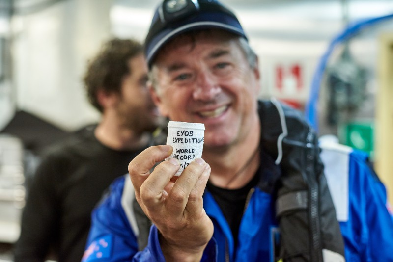
 Aerial photograph of ships in Suisun Bay, California, mothballed for future defense use by the US Navy.
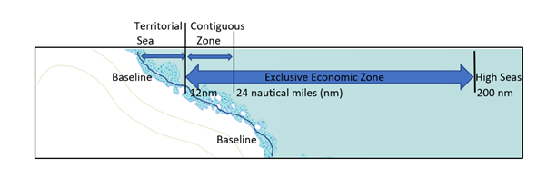
 Glomar Explorer mothballed in Suisun Bay, California, during June 1993.