Saturday, November 7, 2020
Windsurfer in big waves
Friday, November 6, 2020
GEBCO bathymetry version 2020
 Central to southern segment of the Mariana Trench.
The latest 2020 GEBCO bathymetry dataset is impressive at 15 arc-seconds resolution.
Among the contributors, Crowd source bathymetry data provided by Olex (distributed in France by Magic Instinct Software, by the way developer of the GeoGarage platform)
These data are primarily single beam soundings collected by fishing vessels using the Olex acquisition system. The data are provided gridded at a resolution of 400x400 m.
Links :
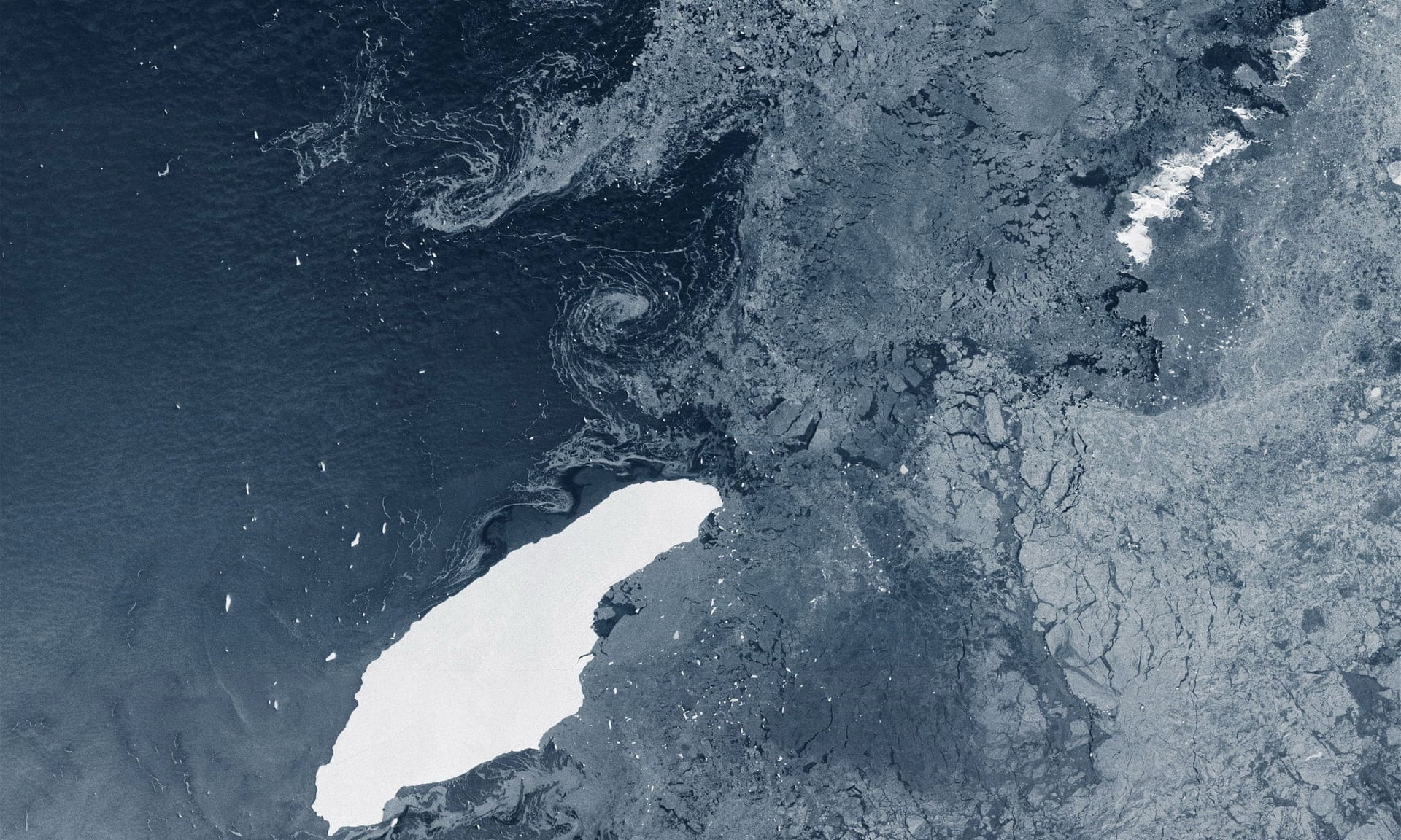
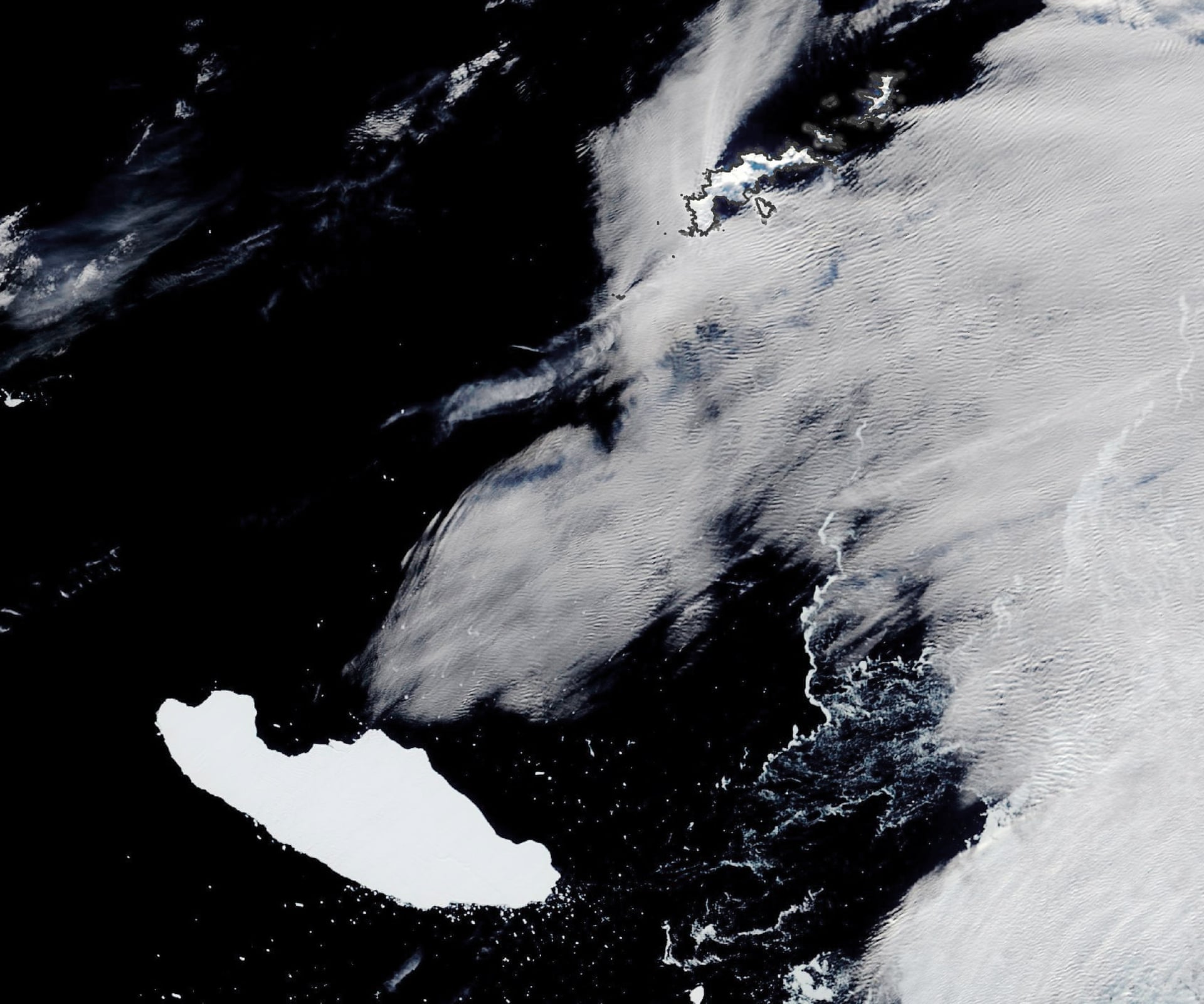
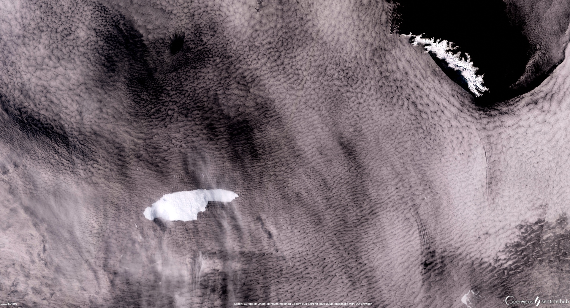
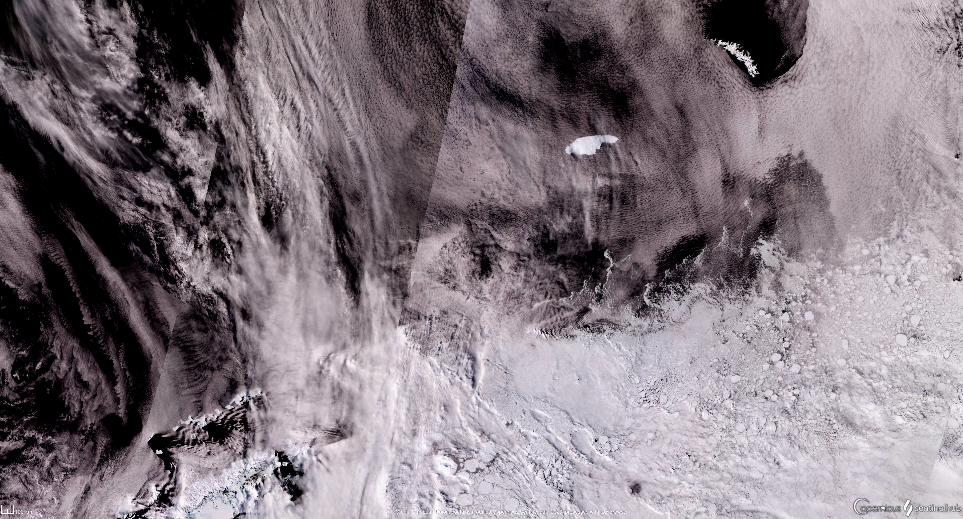
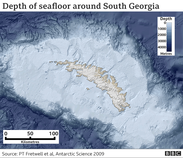
Giant Antarctic iceberg on collision course with British territory of South Georgia
From The Guardian by Graham Readfearn
A massive Antarctic iceberg the size of a small country is heading for the island of South Georgia with concerns it could disrupt the British territory’s economy and its wildlife.
Iceberg A-68A broke off the Larsen C ice shelf on the east of Antarctica’s peninsula in July 2017 and is about the same size as South Georgia, where it’s feared it could be heading.
A-68A, which is now 150km (93 miles) long and 48km (30 miles) wide, has since drifted about 1,400km north through an area known as “iceberg alley” to find itself about 500km away from South Georgia.
“It is absolutely huge and it’s the largest iceberg around in the Southern Ocean,” said Dr Sue Cook, a glaciologist at the Australian Antarctic Program Partnership.
She told the Guardian the iceberg was following a familiar track to many others, but its ultimate fate was very hard to predict. “It’s lasted for three years which is longer than was expected,” she said.
Cook said weather patterns, currents and the shape of the iceberg made predictions difficult. The giant floating ice island, which is only about 200 metres thick, could break apart or run aground.
The thin profile of the iceberg, which has been monitored by satellites, may make it more liable to float closer to South Georgia before getting stuck on the ocean floor.
Prof Geraint Tarling of the British Antarctic Survey told the BBC he was concerned about the iceberg’s potential to impact South Georgia.
“When you’re talking about penguins and seals during the period that’s really crucial to them – during pup and chick-rearing – the actual distance they have to travel to find food really matters. If they have to do a big detour, it means they’re not going to get back to their young in time to prevent them starving to death in the interim.”
Tarling said while the ecosystems would bounce back there was a risk the iceberg could sit around for a decade. “That would make a very big difference, not just to the ecosystem of South Georgia, but its economy as well,” he said.
The chunk broke away from Antarctica’s Larsen C ice shelf in July 2017 and, at the time, was about 175km long and about 50km wide – bigger than Luxembourg.
According to the European Space Agency, the iceberg lost a chunk early, sparking a naming convention where the largest section was renamed from A-68 to A-68A and the smaller piece A-68B.
A-68A lost another piece in April 2020 (spawning A-68C) and is now about 150km long and 48km wide. South Georgia is 165km long and 35km wide.
In April, the iceberg was 230km west-southwest of the South Orkney Islands.
“It’s about 500km off South Georgia at the moment, but given it’s 150km long that’s not very far and I can see why people would be concerned. Because most of it is under water, it will project a long way underneath which means it’s easy for it to run aground, and that’s also common.”
She agreed that depending on where the iceberg ended up it could disrupt the routes that animals used to get to feeding grounds.
Cook said the release of icebergs was natural and there was nothing about the size of A-68A that was particularly unusual “but this is happening in a region where there’s a lot of change”.
Ice shelves to the north had gone through disintegration events and there was speculation that Larsen C was also vulnerable to disintegration.
Dr Andrew Fleming, also of the British Antarctic Survey, told the BBC that A-68A could also spin around South Georgia and head into warmer waters, where it could break apart much faster.
Ice shelves are already floating on the ocean, so when they break apart they don’t directly lead to a rise on ocean levels.
Thursday, November 5, 2020
How a floating hotel on the Great Barrier Reef became a North Korean ghost ship
From Vice by Gavin Butler & Junhyup Kwon
What started its life as a five-star holiday hotspot now sits abandoned and rusting just north of the Korean demilitarized zone.
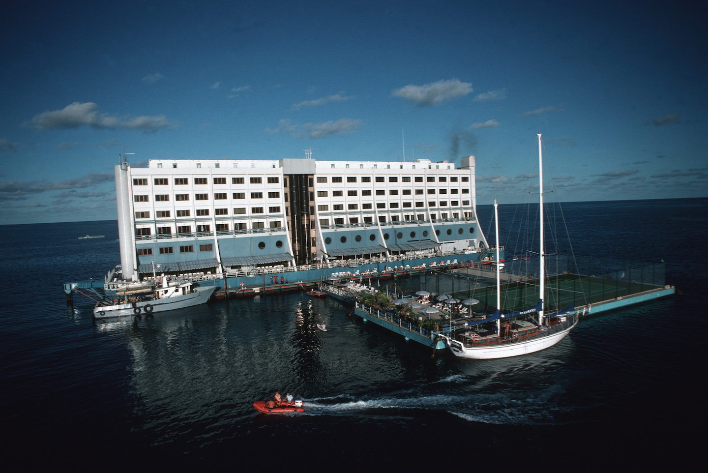
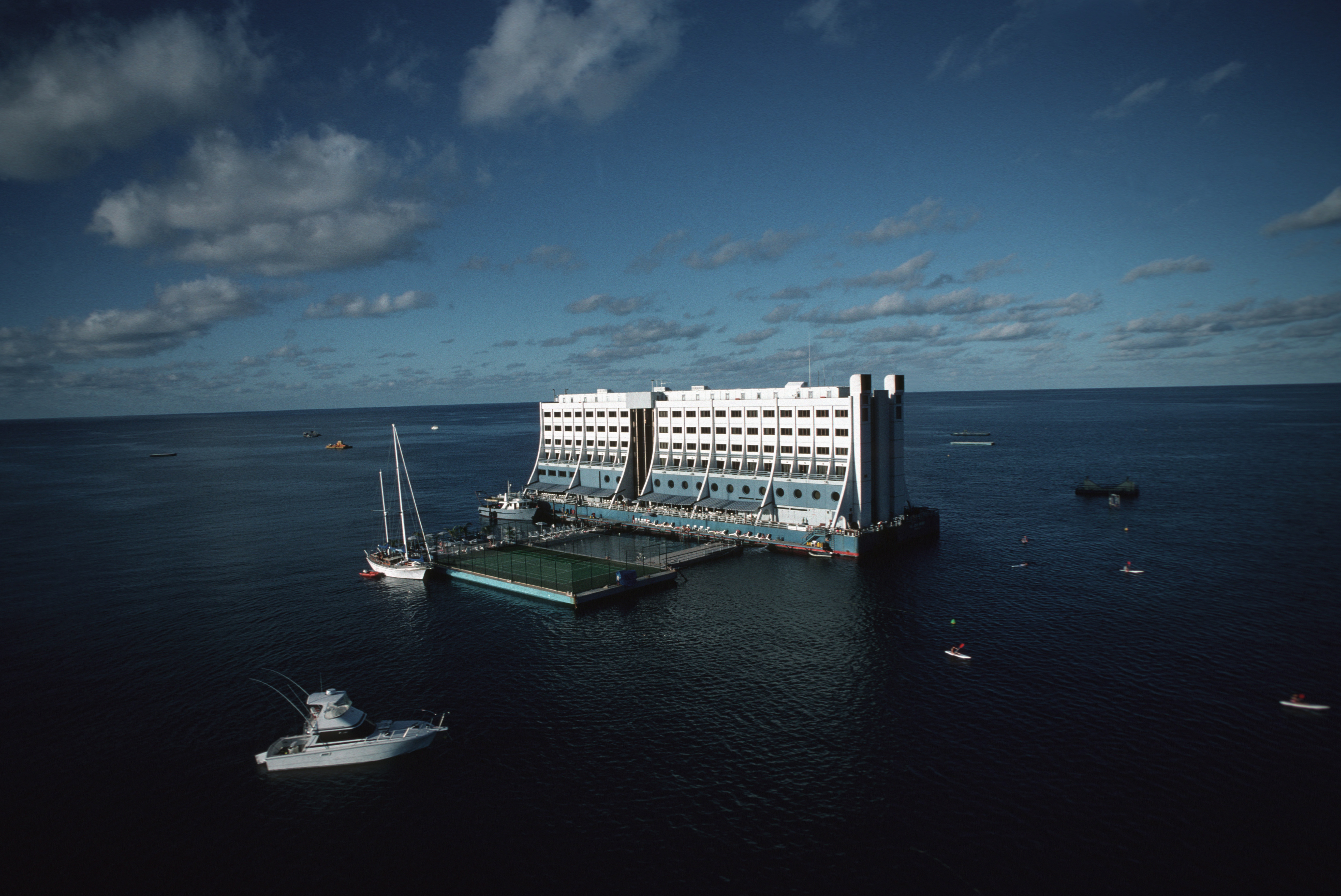
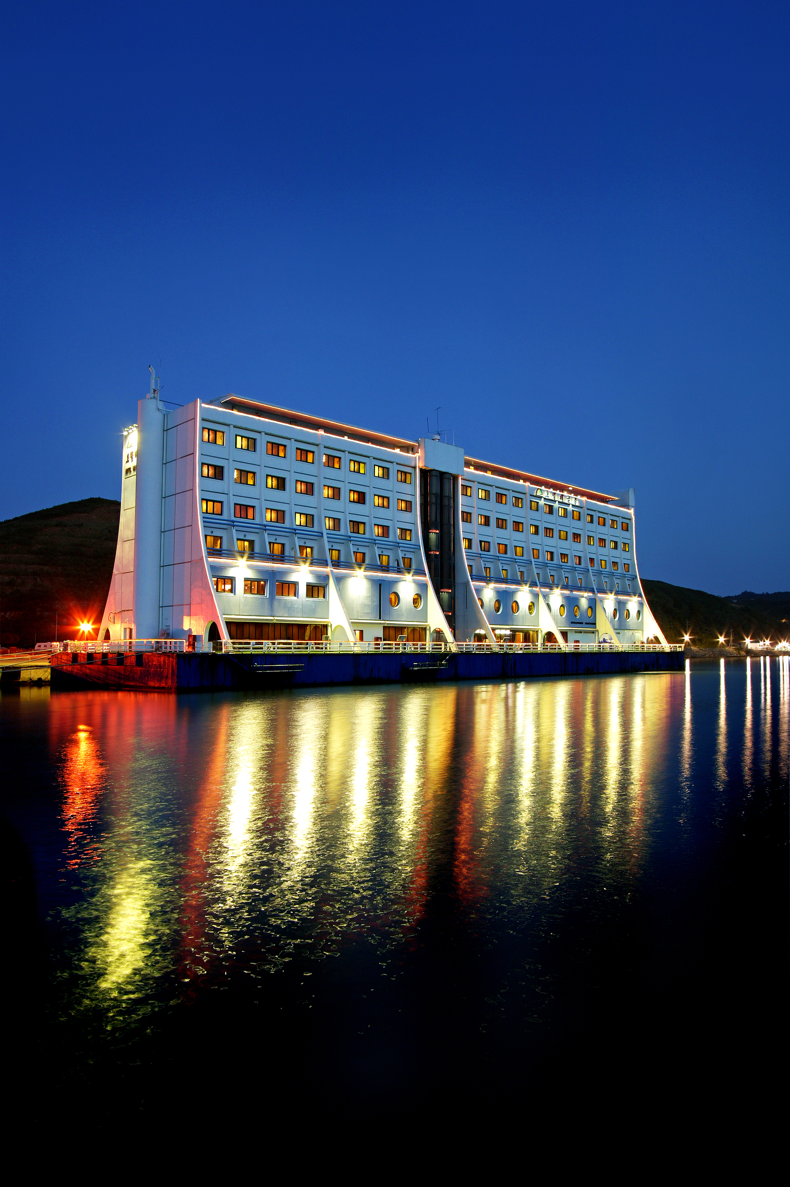
In a small portside tourist town on North Korea's east coast, just 11 miles from the demilitarized zone at the South Korean border, sits a hulking, derelict vessel once known as the Barrier Reef Floating Resort.
In the late-80s, this seven-storey structure—fitted with nearly 200 rooms as well as a nightclub, a helipad and a tennis court—was spruiked as the world's first floating hotel, offering guests the chance to spend several luxurious nights out on the waters of the Great Barrier Reef, about 40 miles off Australia's northeastern coast.
That port had been a significant symbol of co-operation between North Korea and South Korea.
Now it sits abandoned and destitute more than 4,000 miles north: a 12,000-tonne wreck that was towed from Australia to North Korea, where it has sat for the past decade.
Kim Jong Un recently denounced the structure as "shabby", and ordered its removal.
But there are many who still have fond memories of the floating hotel: first as a five-star party hotspot, then as an ill-fated tourist attraction, and finally as an improbable symbol of diplomatic relations between North and South Korea.
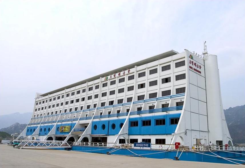 The 12,000-Tonne Vessel Now Sits Moored In The North Korean Tourist Town Of Mt Kumgang.
Image Courtesy Of Hyundai Asan
Amid the compounding difficulties of global nuclear tension and a raging pandemic, the floating hotel's future has perhaps never been so uncertain.
"I remember so many amazing days living on the hotel," Belinda O'Connor, who worked as a water taxi driver during the Barrier Reef Floating Resort's Australian tenure, told the ABC in 2018.
"Fishing trips, crew parties, diving under the hotel, having pizzas flown out by chopper… It was an impressive sight."
"It was pretty amazing to see the hotel floating on the reef, with that beautiful blue water background right behind it," Peter Tarca, whose father designed the structure, agreed.
"From a distance it just kind of looked like another ship.
But as you got closer and closer, clearly you'd see it was a different kind of structure."
The Barrier Reef Floating Resort opened in 1988, but was beleaguered by several years of acutely bad weather and frequently wracked by cyclones.
Visitor numbers steadily dropped—and by the end of 1989 the floating hotel had been towed 3,400 miles northwest, to its second home on the Saigon River in Ho Chi Minh City, Vietnam.
Renamed the Saigon Floating Hotel—or "The Floater", among locals—the one-of-a-kind structure rode the wave of Vietnam's post-war tourism boom and became a popular accommodation venue until, eventually, it once again ran into financial difficulties and was sold to a new buyer.
At the turn of the millennium, during a period of relative peace and reconciliation between North and South Korea, the floating hotel was relocated to its current resting place of Mount Kumgang Port, 130 miles east of Pyongyang.
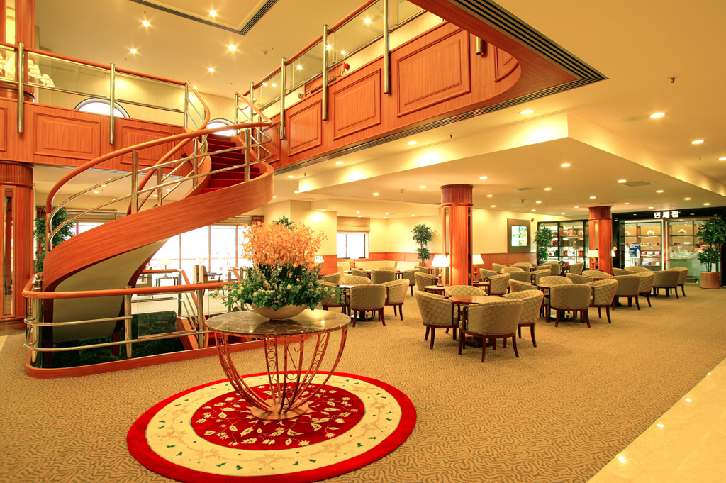
A rare view inside the floating hotel.
The ship looks in pretty good condition but these photos were taken several years ago.
image courtesy of hyundai asan
"Apparently it was transferred to North Korea, when there was a time in the history of the two Koreas of appeasement and thawing of relations," Robert De Jong, from the Townsville Maritime Museum, told the ABC.
"It was thought that the hotel in North Korea could be suitable for attracting tourists."
The floating hotel became an iconic fixture of Mount Kumgang's tourist resort, which was developed in the 90s by a South Korean company, Hyundai Asan, which operated tours in the area.
Renamed Hotel Haegumgang, the vessel was frequently used to accommodate tourists from south of the border until, in 2008, a North Korean guard shot dead a South Korean tourist who had reportedly wandered into a military area.
Tours to Mount Kumgang were subsequently suspended—and since then, relations between the two countries have only become frostier.
photo by str / kcna via kns / afp
Kim Ha-young, a spokesman for the Hyundai Asan, told VICE News that while there had been previously been discussions between the North and the South regarding the future of tourism in Mt Kumgang, those conversations ceased altogether amid the COVID-19 outbreak—and "There has been nothing much going on between the two sides since then."
Kim noted that, after the shooting incident in 2008, the floating hotel was mainly used by Chinese tourists.
But on his most recent visit to Mt Kumgang in early 2019, he said, the vessel seemed to have been completely shuttered.
"When we went to the North early last year, we inspected the hotel with the naked eye.
At that time, they were not using the facilities… North Korea has stopped its operations since the floating hotel has aged."
"It's hard to say that they're operating the hotel due to the situation of the global pandemic," Kim added.
"We are not sure how they're operating the hotel since we are not able to visit the North now."
And so the Barrier Reef Floating Resort's future remains shrouded in uncertainty.
South Koreans are not permitted to keep in touch with North Koreans legally, and it's even difficult for the South Korean government to communicate with the North.
It's also been more than a year since Kim Jong Un ordered the destruction of the vessel, according to state media.
One has to wonder: is it possible that the iconic floating hotel has been sunk or destroyed in the time since Kim Ha-young was last there?
"No," he said, simply.
"As far as we know, the building remains as it is."
- ABC : The bizarre story of Australia's floating hotel and its 14000km ...
- DailyMail : End of world's first floating hotel: Began life in Great Barrier ...
- Business Insider : The long journey of the world's first floating hotel – which was ...
- Stuff : The bizarre story of how Australia's floating hotel ended up in North Korea
Wednesday, November 4, 2020
Antarctica is Earth's one virus-free continent: science fights to keep it that way
From The Guardian by Robin McKie
This week, 40 men and women will emerge from quarantine and board the Royal Research Ship James Clark Ross as it prepares to sail from Harwich in Essex to the South Atlantic.
Their mission is straightforward.
They will attempt to salvage scientific operations in Antarctica while also keeping it Covid-free.
The continent is the only place on Earth that is still untouched by the pandemic – though keeping the virus at bay there has come at a cost.
All major research projects in the Antarctic have been halted.
As a result, no senior British scientist will have embarked on a mission to the continent this year for the first time in decades.
Nor is Britain alone in interrupting research in a region viewed as vital for studying climate change and biodiversity loss.
Most other nations that send scientists there are also putting their research on hold because of the pandemic.
“The problem is that we simply do not have the logistical support to get scientists to the Antarctic while ensuring that we can keep them Covid-free,” said Jane Francis, director of the British Antarctic Survey (BAS).
“However, we are going to maintain all our data monitoring so there will be no gaps in our long-term collection of weather data, ice-sheet information and wildlife statistics. That is going to be a vitally important undertaking.”
And it will be up to the men and women who will set sail from Harwich on 5 November to ensure that these minimum scientific operations are maintained in Antarctica and crucial data collection is carried out.
In addition, equipment will be serviced and made ready for the re-starting of research missions next year or later.
The James Clark Ross will be carrying technicians, divers, field guides and other service personnel so that they can collect data, maintain and run instruments and gather biological samples in the months ahead.
Ensuring they arrive free of coronavirus has required extraordinary efforts by the BAS.
“Our key principal is to stop Covid getting to Antarctica,” said the survey’s head of polar operations, John Eager.
“To do that, we have picked only very fit and healthy staff who have no Covid risk factors. Then we have quarantined them for 14 days. And on top of that, we have made sure the ship will not enter any port en route so there is no further risk of picking up the virus. It will sail directly to our research stations around Antarctica.”
“We are being very, very careful about keeping the continent virus-free simply because if anybody were to become really sick in Antarctica, it would be very difficult to treat them.”
Summer will be starting by then.
Indeed, at Rothera, sea ice has already begun to melt as the weather warms.
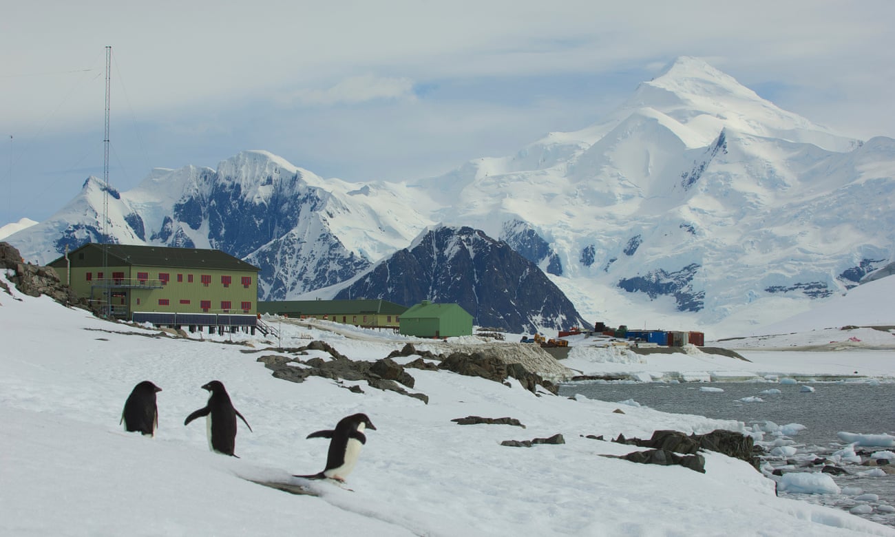
“Wildlife has started to return to the station, with elephant seals and Adélie penguins already making appearances,” Robert Taylor, a field guide based at Rothera, told the Observer last week.
“Normally, scientists would be flying in now and we would be preparing to take them out on the projects they would have planned. But those have all been postponed. It has become very quiet here.”
The decision to cut back on Antarctic operations is a blow for many areas of research, in particular climate science.
The most dramatic changes inflicted by global heating are occurring at the poles.
In Antarctica, warming waters are eating at many of the great ice shelves that extend from the land over the ocean and melting them, a development that threatens to trigger significant rises in sea levels round the planet in coming years.
“We desperately need to carry out full research programmes in Antarctica,” said Francis.
“It has so much to tell us, and hopefully we will be able to pick up where we left off in a year’s time and return with large numbers of scientists.
Then we can resume all the projects that we have had to postpone.
Obviously that cannot be guaranteed, and we may have to postpone things for another year.
We will just have to wait and see what happens.”
The James Clark Ross is scheduled to return to Britain in March, bringing home those who have spent the past 12 months on the continent.
They will be coming back to a nation that has changed dramatically in that time, raising serious concerns for their future.
“Most of us left jobs to come to Antarctica – with the assumption that when we got back things would be fairly similar to when we left.
It’s clear that this will not be the case,” said Taylor.
“In one way, we have been fortunate because we are currently at no risk of Covid and can interact with one another in the pre-Covid fashion.”
That will change when Rothera and other station staff get back to the UK, Taylor acknowledged.
“Normally, going home would mean regaining every freedom we sacrificed to come south, but this time it means swapping the natural restrictions of Antarctica for the ‘new normal’: social distancing, masks, adjusting our travel and behaviour.
For good measure, there will be the added challenge of trying to see friends and family again and, of course, of finding work.”
Science on the edge
Tuesday, November 3, 2020
The global push to share ocean data

From ChinaDialogueOcean by David Adam
A promising partnership between China and the EU aims to open up an ocean of information
It’s often said that we know more about deep space than the deep sea.
Marine scientists are working to change that.
In recent years, technologies to sense, interpret and model the ocean have become more powerful, widespread and cheaper to install and use.
Smart buoys bristling with sensors bob in the water and gather data on temperature, salinity, light and noise.
Sensitive listening devices towed behind ships scan surrounding waters for life.
And samples from good old-fashioned buckets and bottles thrown over the side of research vessels still play an important role in examining water.
As a result of all this activity, marine scientists are swimming in data.
Much of it is collected by national oceanographic services or research groups scattered across the world.
The quality of this data varies, and so do the ways it is gathered, stored, organised and formatted.
All of which presents a problem.
Given the ocean is a shared resource, and one that is growing in importance for a number of environmental, social and economic reasons, it would be better if all of these overlapping, conflicting and incompatible data streams could be organised – or at the very least, better coordinated and made more accessible.
“In the past, the gathering of marine data was quite territorial, with people collecting data within different sectors and sometimes being quite possessive,” says Clare Postlethwaite, an oceanographer who coordinates the Marine Environmental Data and Information Network(MEDIN) in the UK.
“Now there’s a big push to get data into a single place for users to find.”
This concerted push is establishing open data platforms such as MEDIN that allow many different types of user – from academics to private enterprises – to share and make use of data, helping to deliver insights quickly, avoid unnecessary research effort, and improve research quality.
MEDIN, for example, brings together organisations such as marine conservation groups, renewable energy companies and government agencies.
It issues guidelines and standards on how those who generate data – on everything from seabed surveys and wave height records to the status of wildlife populations – should submit them to a series of accredited databases so they can be re-used by others.
Some of these standards refer to metadata – how, where and when the information was collected, for example.
Others aim to smooth the way for interested parties to access the findings.
“I think that for data to be classed as available online it should be able to be retrieved after just a couple of web-clicks.
Otherwise the process can get very frustrating,” Postlethwaite says.
Progress in the EU
There are many other open data platforms, some arranged by individual scientific field (such as bathymetry, which maps the shape of the seabed) and others by geographic area.
One of the most established such regional platforms is the European Marine Observation and Data Network (EMODnet).
A key plank of the EU’s Marine Knowledge 2020 strategy, it brings together some 120 organisations from across Europe and collates, organises and shares data on seven marine themes, including geology, seabed habitats and human activities.
For each, the network offers an online gateway to a range of data archives managed by local, national, regional and international organisations.
Through these gateways, users have free access to standardised observations, data quality indicators and processed data products, such as maps of ocean basins.
Speaking during a webinar to celebrate EMODnet’s tenth anniversary last month, Koen Verbruggen, director of Geological Survey Ireland, said: “Before EMODnet it was very much a case of separate projects, separate silos, separate standards… there were lots of projects but not a lot of joined-up thinking.”
Verbruggen and his colleagues would carry out seabed surveys and log the results in a database from which users could download geological and bathymetric data.
“But probably the easiest way to get at our data was, believe it or not, through the US, through NOAA’s National Geoscience Data Centre.
So it wasn’t really ideal from the European point of view.” Becoming a member of the network helped offer direction, he said.
“We had to produce joined-up data.”
One of the project’s goals is to tap these various data sources to produce useful products that marine companies and others can use in their work.
For example, the project produces monthly “vessel density” maps of European maritime activity, which show the most heavily used routes.
According to project organisers, these maps will help scientists who want to monitor shipping emissions, engineers identifying the best routes to lay pipelines and cables, conservationists assessing the impact of fishing on the seafloor and companies planning offshore wind farms.
“With increasing economic activities at sea, not least the large expansion of offshore wind energy, marine space is not only at a premium, but also under growing pressure,” says Felix Leinemann, head of the European Commission’s unit in charge of maritime spatial planning.
“When making maritime spatial plans to manage these new activities, planners need to know where and when other activity takes place.
The availability and interoperability of these new [vessel density] maps can be an important contribution towards developing these plans.”
Collaborating with China
The project reaches beyond Europe, too.
Earlier this year, EMODnet started a collaboration with China’s National Marine Data and Information Service (NMDIS) that aims to develop the use of standards and improve global access to China’s marine data.
Among its scientific goals are plans to look at – and to try to improve – the contrasting results of European and Chinese numerical models of ocean currents and coastal vulnerability.
There is also a positive political angle to the partnership, with the EU announcing it would “enhance cooperation in key areas of ocean governance” and “facilitate political convergence towards a collective approach to tackling global ocean challenges”.
Europe hopes the data collaboration project will build trust and establish strong working relationships as part of the EU-China Ocean Partnership signed in 2018.
Among its goals are greater transparency on fisheries data.
The project has been delayed by the Covid-19 pandemic, but at a meeting in September last year Karmenu Vella, EU Commissioner for Environment, Maritime Affairs and Fisheries said:
“We should use our joint influence to take the lead globally and ensure the conservation and sustainable use of the oceans.
We want our partnership with China to go beyond words and deliver tangible results.”
Links :
Monday, November 2, 2020
Venezuela performs bathymetric surveys with own satellite
From Hydro
Ever since the launch of the VRSS-2 Antonio José de Sucre satellite in 2017, researchers have been looking into how best to use and apply the information that it provides for the benefit of environmental development and sustainability.
For example, the bathymetry derived from satellite images is very beneficial for hydrographic services, since it allows information to be obtained that has not been explored with traditional acoustic methods.
The Venezuela Hydrographic Office has started to use this method, also to improve its hydrographic coverage.
The Antonio José de Sucre satellite is Venezuela's third artificial satellite.
It was launched from the Jiuquan Launch Center in Gansu Province, China, and captures images for cartographic survey work, with a new high-definition camera and an infrared camera for soil, water resources diagnosis and seismological prevention data.
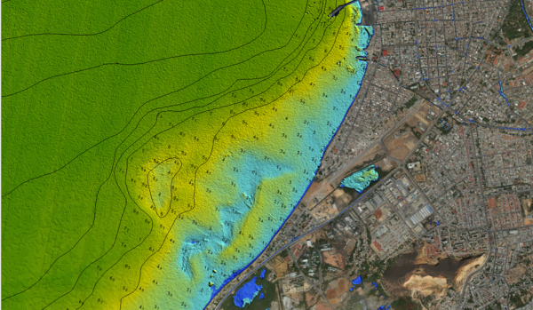
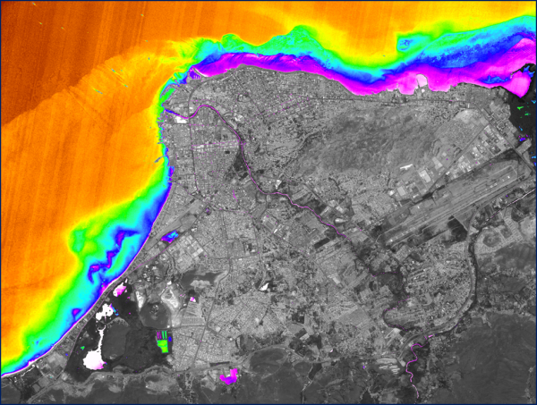
Lt.Cmdr Daniel Rojas Contreras, master in hydrography and specialist in marine cartography and data processing and currently head of marine cartography at the Venezuela Hydrographic Office, is conducting research in cooperation with the Bolivarian Agency for Space Activities (ABAE) into the use of these high-resolution optical images to calculate depths by applying the Stumpf algorithm, using the green, blue, red and infrared bands of the satellite images.Satellite-derived bathymetry, Cumaná coast area, Venezuela.
Methodology and Results
A satellite image of the east of Venezuela was used, which included Cumaná, a city in the east of the country, the Gulf of Cariaco, and Puerto De Sucre, which serves various locations and industries.
Maritime traffic levels are high, as there is a lot of tourism and fishing activity in the area.
The image used was provided by ABAE and captured on 29 November 2019, with an optical resolution of four metres for the green, blue and red band, allowing the processing to obtain perfect depths and digital seabed models.
The Stumpf (2003) model was applied, which is based on the assumption that each band has a different level of absorption depending on the depth, therefore generating the relation between the blue, green or red bands.
A characteristic shallow water area can be identified near the port, called Bajo Brito, which was captured, modelled and represented almost in its real form with spectacular images and accurate depths that coincide with acoustic methods.
At the end of the application of the algorithm, significant differences were identified between the survey depths and the paper chart VE-503 Puerto de Cumaná.
This area has high levels of sedimentation at the exit of the Gulf of Cariaco and has not been updated since 2010; however, very serious problems of low water depths due to sedimentation have been seen, due to the presence of strong marine and underwater currents.
This type of image analysis makes it possible to determine the extent of this problem in the northern area of Cumaná, where it affects navigation for tourism and fishing.
For this analysis, the optimization approach for a vertically invariable water column was used.
A subcategory of this is a relation that derives the bathymetry based on the relationship between two bands applied in the Stumpf model.
The bathymetry estimates derived from the Antonio José de Sucre satellite images were evaluated using a large number of field sampling points obtained with acoustic methods, yielding very good results up to the extinction depth, which in this case was calculated to be ten metres.
Cost-effective Solution
The use of the VRSS-2 satellite images will allow review and analysis of areas that have not yet been surveyed, and enable important advances at very low costs, resulting in great benefits for the construction of large infrastructure, science and marine technology, port design, tsunami modelling, the development of coastal management plans and the safe planning of new surveys.
Bathymetry derived from satellite images is a faster and more cost-effective solution than traditional methods.
This study and the applicability of SDB will greatly advance hydrography in Venezuela and increase the coverage of hydrographic surveys, as it is a new, feasible technique that is capable of providing very good results in a short time.
Links :
Sunday, November 1, 2020
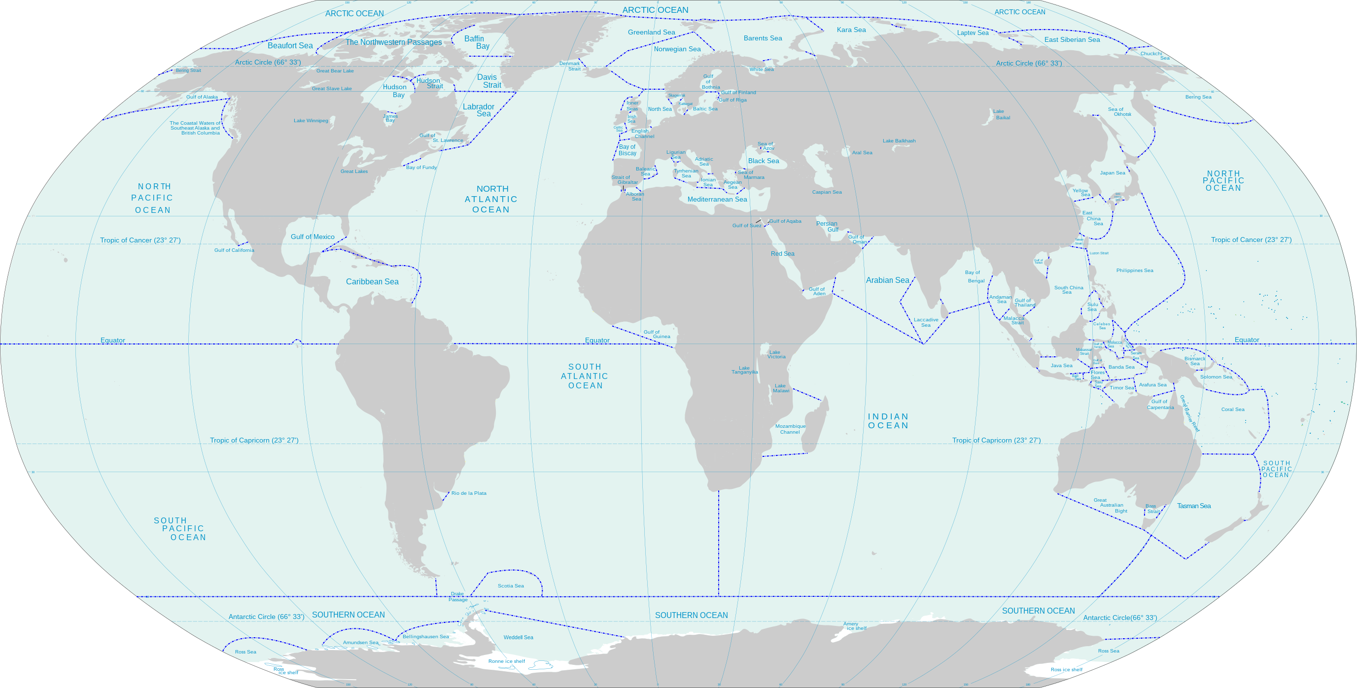
How many oceans are there in the world?
From World Atlas by Antonia Cirjak
Earth can have anywhere from 1 to 7 oceans, depending on how you look at it.
There is one global ocean called the World Ocean, because the entire body of water on our planet is connected.
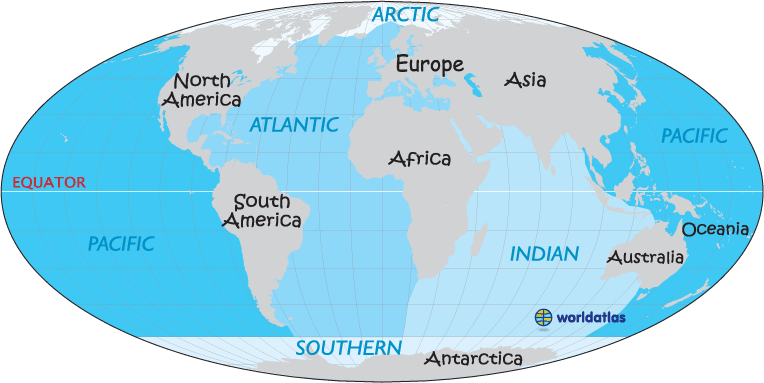
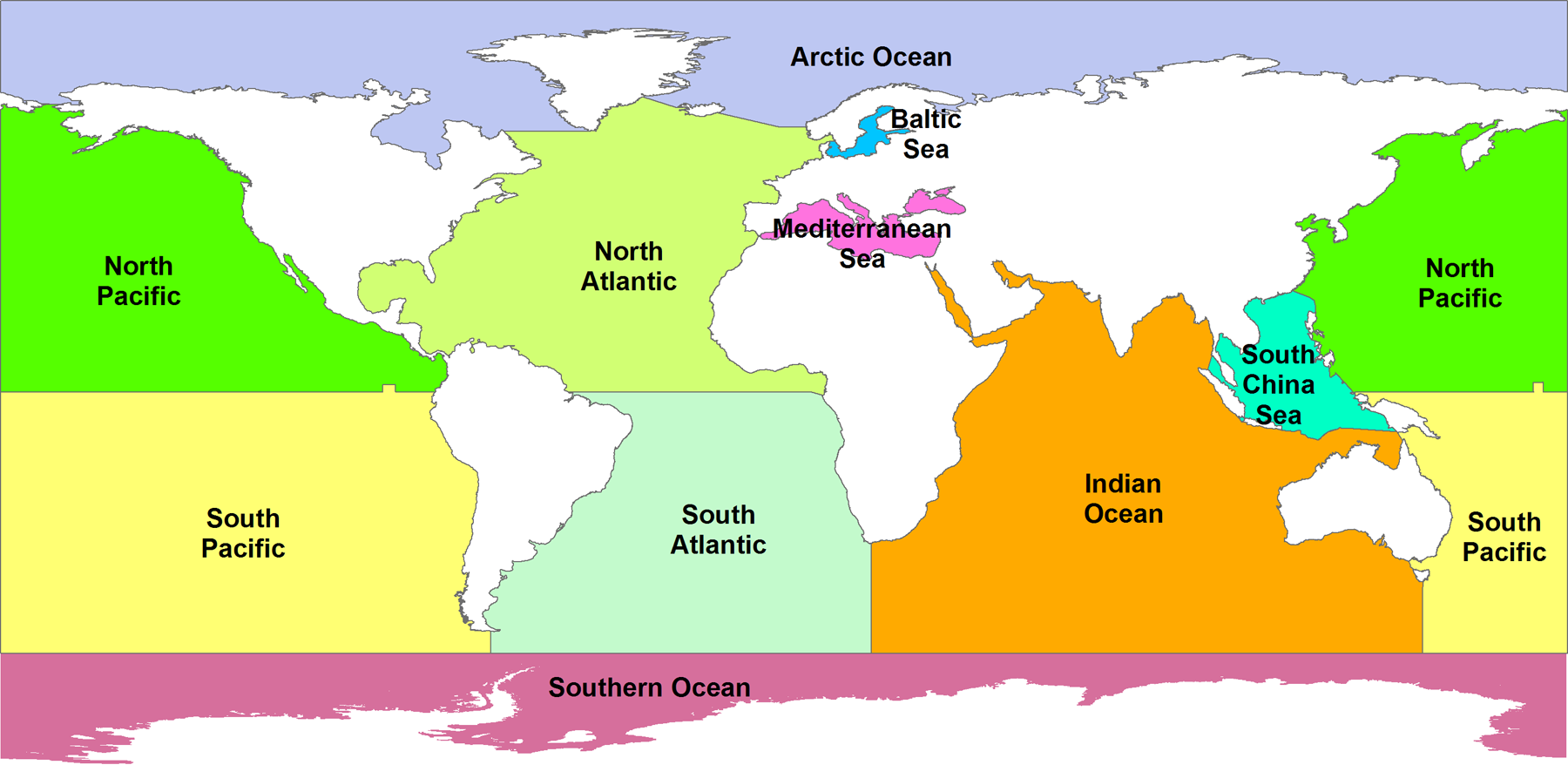
Nowadays, it is widely accepted that the Earth has five oceans: the Arctic, Atlantic, Indian, Pacific, and the Southern Ocean.
The largest and the deepest ocean on our planet is the Pacific Ocean.
This ocean extends all the way from the Arctic to the Southern Ocean from north to south and is bound by the Americas in the east and Asia and Australia in the west.
Earth can have anywhere from 1 to 7 oceans, depending on how you look at it.
Yes, there is one global ocean called the World Ocean, because the entire body of water on our planet is connected.
It covers 71 percent of the surface of our planet, but we usually divide it into distinct regions, all named accordingly.
The Earth has five oceans: the Arctic, Atlantic, Indian, Pacific, and the Southern Ocean.
Over time, the boundaries we use to determine these regions have evolved due to various geographical, cultural, and historical reasons.
Nowadays, it is widely accepted that the Earth has five oceans: the Arctic, Atlantic, Indian, Pacific, and the Southern Ocean.
1. Arctic Ocean
Out of the five major oceans on our planet, the Arctic Ocean is the smallest and the shallowest one.
It is also the coldest one, which makes sense considering its geographical position.
Some oceanographers consider it a sea, but it is recognized as an ocean by the International Hydrographic Organization.
It is the northernmost part of the World Ocean, found in the Arctic north polar region.
It is surrounded by the continents of Eurasia and North America and is covered in sea ice in some parts.
The ice melts during specific times of the year, which can influence the temperature and salinity of the ocean.
On average, the Arctic Ocean has the lowest salinity out of all the five oceans.
2. Atlantic Ocean
The Atlantic Ocean is the second-largest ocean, and its area is determined to be 106,460,000 square kilometers.
This ocean covers about 20 percent of the surface of our planet.
The Atlantic Ocean is often looked at as the boundary between the “Old World” and the “New World.” It is shaped in the form of the letter “S,” and it occupies the space between North and South America to the west and Europe and Africa to the east.
It is also connected to all other oceans directly, so it can be considered the middle component of the World Ocean.
There were many famous explorations of this ocean throughout human history, such as the Challenger expedition and the German Meteor expedition, among others.
3. Indian Ocean
As the third-largest part of the World Ocean, covering 70,560,000 square kilometers, the Indian Ocean makes up for almost 20 percent of the water on the surface of our planet.
Asia surrounds this ocean on its north side, Africa, on the west, and Australia to the east.
On its south side, it is connected and wounded by the Southern Ocean.
Many regional seas can be found along with the core of the Indian Ocean, such as the Somali Sea, the Bay of Bengal, the Arabian Sea and the Laccadive Sea.
Monsoons and cyclones mostly dictate the climate in this ocean.
The Indian Ocean is the warmest out of all the five oceans on our planet, and it is known as a fruitful fishing ground.
4. Pacific Ocean
The largest and the deepest ocean on our planet is the Pacific Ocean.
This ocean extends all the way from the Arctic to the Southern Ocean from north to south and is bound by the Americas in the east and Asia and Australia in the west.
The size of this ocean is 165,250,000 square kilometers, which makes it the largest part of the World Ocean.
The Pacific Ocean covers 32% of the surface area of our planet, which means that it is larger than all of the land area on Earth when combined.
This ocean is usually divided into two subdivisions by the equator.
These are the Northern and the Southern Pacific Oceans.
On average, the depth in the Pacific Ocean is 13,000 feet.
It also features the deepest point in the world, the Challenger Deep that can be found in the Mariana Trench, and that reaches the depth of 35,853 feet.
Not only that, but the ocean also features the second and the third deepest points on our planet, the Horizon Deep (35,509 feet) and the Sirena Deep, respectively.
5. Southern Ocean
This ocean encircles the continent of Antarctica, and it is the second smallest of the five oceans.
The Southern Ocean is known as being the zone where the colder waters from the Antarctic that are flowing northwards mix with the warm waters from subantarctic regions.
Throughout history, many have debated whether the Southern Ocean should be considered an ocean at all.
Many believed that it does not exist and considered it just to be various parts of other oceans.
However, in time researchers managed to discover how important Southern Circulation is and since this body of water-limited that circulation, they called it the Southern Ocean, thereby confirming that it does exist after all.
Links :
- World Atlas : Oceans Of The World By Size


