Saturday, October 31, 2020

Watch: Biggest wave ever surfed in Ireland?

 
Watch Conor Maguire surfing a 60-foot monster wave at Mullaghmore Head, in County Sligo, Ireland. Maguire has taken the surf world by storm in recent years.
And when Hurricane Epsilon produced 60-foot waves off the coast of County Sligo, in his native Ireland, he was quick to embrace the opportunity of a lifetime.
Conor Maguire started surfing when he was 11 and went on to become the youngest European to be shortlisted for the World Surf League's Big Wave Awards.
In 2017/2018, the 26-year-old Irish swell hunter received an invitation to compete at the Punta de Galea Challenge.
The participation catapulted him to bigger, global recognition.
This time around, Maguire was quick to pounce on a weather forecast, which looked almost too good to be true when he traveled to Mullaghmore Head.
The powerful Atlantic Ocean conditions were caused when tropical Hurricane Epsilon merged with a depression and produced massive, freak swells out at sea.
Mullaghmore Head is well-known by European big wave riders.
It is a brutal surf break with cold water and often rainy and cloudy winter skies.
This storm surge created waves up to 18 meters high, and Maguire was accompanied closely by a safety team for his trip out.
"There are only a handful of days like this one in your whole life pretty much, so to experience that today was pretty special," stated Conor Maguire after taking on the historic XXL waves at Mullaghmore Head.
 
From Surline by Dashel Pierson
 
All eyes are on the North Atlantic, as the XXL swell window kicked off this week with a bang.
And while the collective gaze is mostly fixated on Nazaré, and the historic sessions currently going down there, the rest of Europe is worth a look, too.

Case in point: Ireland. Earlier today, Ireland’s premier slab and big-wave spot saw some of the heaviest water to ever detonate upon the reef.
And local charger, Conor Maguire, got the wave of the day…if not the century.
At first glance, the wave is reminiscent of the Code Red swell at Chopes, or the XXL freesurfs from the Volcom Fiji Pro in 2012 – but then you notice the characteristic Irish hue: emerald green.

To hear more about the momentous ride, magicseaweed’s Jason Lock caught up with Maguire.
Check out their chat and more angles of the wave below.
 
A monster wave measuring 30 Mtr (29.883 m) – 98.4 Ft was recorded at 03:00 today by the Marine Institute M6 buoy located 200nm West of Ireland ( M6 62095 52 59.2 N 15 52 W 52° 59′ 09″ N 15°52′ 0 ” W 52.986 -15.866 Deep Atlantic Approximately 210 nautical miles (389 km) west southwest of Slyne Head )
 
The wave generated by the tail end of Hurricane Epsilon was one of the highest ever recorded in Irish waters 
The network is managed by the Marine Institute in collaboration with Met Éireann and the UK Met Office. 
The Irish Weather Buoy Network is designed to improve weather forecasts and safety at sea around Ireland. 
The buoy network provides vital data for weather forecasts, shipping bulletins, gale and swell warnings as well as data for general public information and research.
source : The Skipper 
 
Links :

Friday, October 30, 2020

'Sleeping giant' Arctic methane deposits starting to release, scientists find

 Researchers worry that the Laptev Sea findings may signal a new climate feedback loop has been triggered.
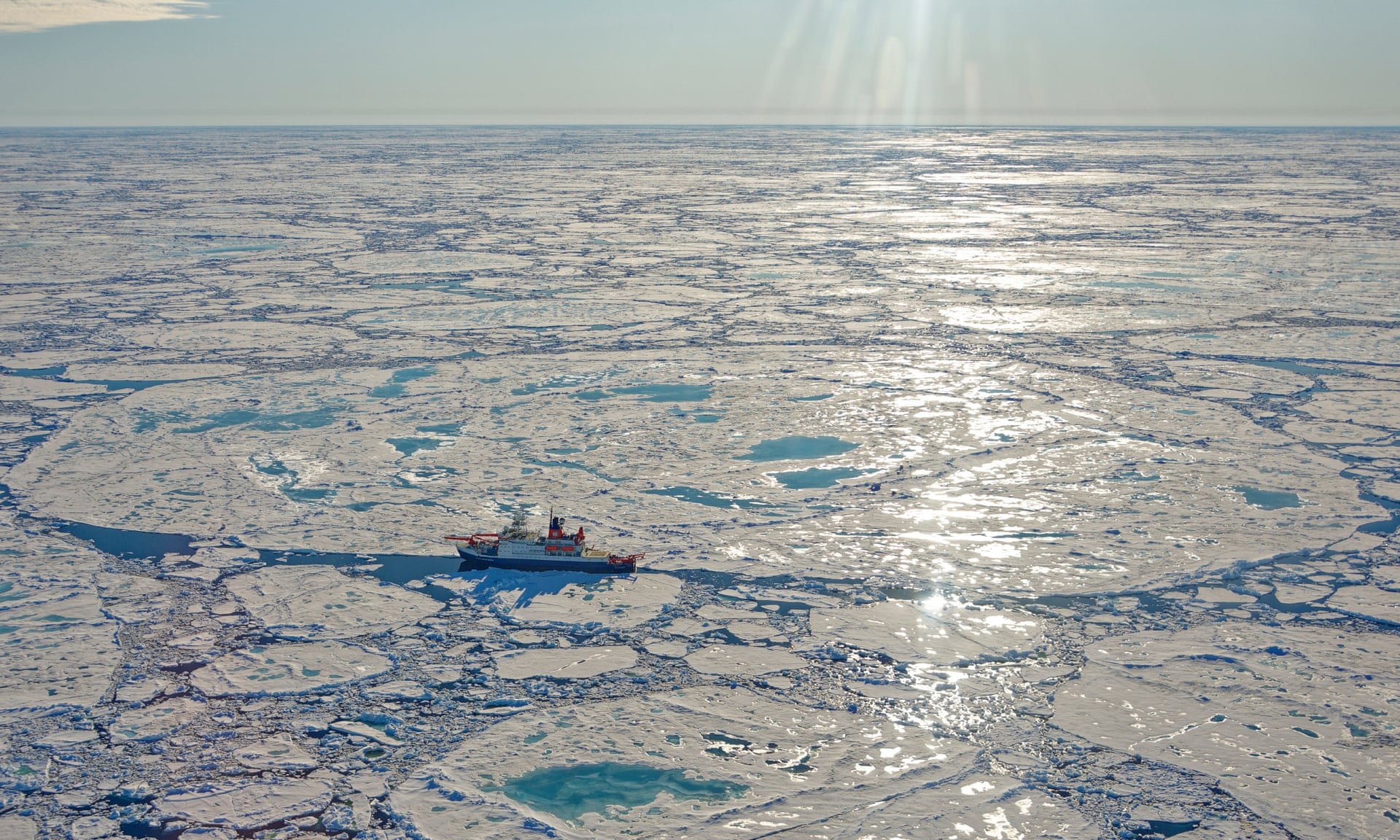
Photograph: Markus Rex/Alfred-Wegener-Institut

From The Guardian by Jonathan Watts

Exclusive: expedition discovers new source of greenhouse gas off East Siberian coast has been triggered

Scientists have found evidence that frozen methane deposits in the Arctic Ocean – known as the “sleeping giants of the carbon cycle” – have started to be released over a large area of the continental slope off the East Siberian coast, the Guardian can reveal.

High levels of the potent greenhouse gas have been detected down to a depth of 350 metres in the Laptev Sea near Russia, prompting concern among researchers that a new climate feedback loop may have been triggered that could accelerate the pace of global heating.

The slope sediments in the Arctic contain a huge quantity of frozen methane and other gases – known as hydrates.
Methane has a warming effect 80 times stronger than carbon dioxide over 20 years.
The United States Geological Survey has previously listed Arctic hydrate destabilisation as one of four most serious scenarios for abrupt climate change.

The international team onboard the Russian research ship R/V Akademik Keldysh said most of the bubbles were currently dissolving in the water but methane levels at the surface were four to eight times what would normally be expected and this was venting into the atmosphere.

“At this moment, there is unlikely to be any major impact on global warming, but the point is that this process has now been triggered. This East Siberian slope methane hydrate system has been perturbed and the process will be ongoing,” said the Swedish scientist Örjan Gustafsson, of Stockholm University, in a satellite call from the vessel.

The scientists – who are part of a multi-year International Shelf Study Expedition – stressed their findings were preliminary.
The scale of methane releases will not be confirmed until they return, analyse the data and have their studies published in a peer-reviewed journal.

But the discovery of potentially destabilised slope frozen methane raises concerns that a new tipping point has been reached that could increase the speed of global heating.

The Arctic is considered ground zero in the debate about the vulnerability of frozen methane deposits in the ocean.

With the Arctic temperature now rising more than twice as fast as the global average, the question of when – or even whether – they will be released into the atmosphere has been a matter of considerable uncertainty in climate computer models.

The 60-member team on the Akademik Keldysh believe they are the first to observationally confirm the methane release is already under way across a wide area of the slope about 600km offshore.

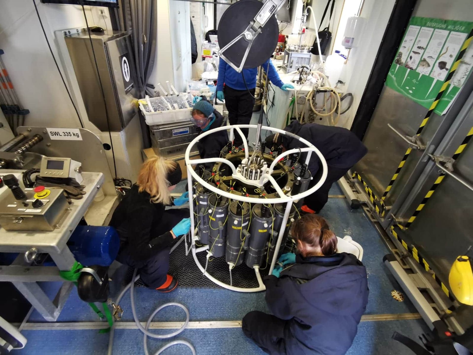
Scientists at work on the test cruise Electra 1, prior to the Akademik Keldysh expedition.
Photograph: ISSS2020
 
At six monitoring points over a slope area 150km in length and 10km wide, they saw clouds of bubbles released from sediment.

At one location on the Laptev Sea slope at a depth of about 300 metres they found methane concentrations of up to 1,600 nanomoles per litre, which is 400 times higher than would be expected if the sea and the atmosphere were in equilibrium.

Igor Semiletov, of the Russian Academy of Sciences, who is the chief scientist onboard, said the discharges were “significantly larger” than anything found before. 
“The discovery of actively releasing shelf slope hydrates is very important and unknown until now,” he said. 
“This is a new page. Potentially they can have serious climate consequences, but we need more study before we can confirm that.”

The most likely cause of the instability is an intrusion of warm Atlantic currents into the east Arctic. This “Atlantification” is driven by human-induced climate disruption.

The latest discovery potentially marks the third source of methane emissions from the region. Semiletov, who has been studying this area for two decades, has previously reported the gas is being released from the shelf of the Arctic – the biggest of any sea.

For the second year in a row, his team have found crater-like pockmarks in the shallower parts of the Laptev Sea and East Siberian Sea that are discharging bubble jets of methane, which is reaching the sea surface at levels tens to hundreds of times higher than normal.
This is similar to the craters and sinkholes reported from inland Siberian tundra earlier this autumn.

Temperatures in Siberia were 5C higher than average from January to June this year, an anomaly that was made at least 600 times more likely by human-caused emissions of carbon dioxide and methane. Last winter’s sea ice melted unusually early.
This winter’s freeze has yet to begin, already a later start than at any time on record.
 
Links :
 

Thursday, October 29, 2020

Coral reef taller than the Empire State Building discovered in Australia's Great Barrier Reef

Australian scientists have discovered a massive detached coral reef just off Cape York on the Great Barrier Reef that’s taller than the Empire State Building.
The 500m high reef was discovered while a team from James Cook University were mapping the northern Great Barrier Reef seabed.
Scientists discover 500 metre-tall skyscraper reef at Australia's Great Barrier Reef.
 
From NBC news by Denise Chow

An enormous, 1,600-foot-tall coral reef was discovered in Australia’s Great Barrier Reef, scientists announced Monday, in the first such find in more than a century.

The massive underwater structure — the first newfound reef in 120 years — dwarfs iconic skyscrapers such as New York City’s Empire State Building and the Petronas Twin Towers in Kuala Lumpur, Malaysia.
 
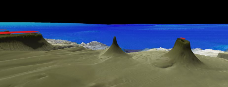
Side mapping profile of the new reef.
Image: Schmidt Ocean Institute
 
Broad mapping profile of new 500 m detached reef.
Image by Schmidt Ocean Institute. 

Video by Schmidt Ocean Institute

The detached reef was first observed Oct. 20 by a team of Australian scientists aboard a research vessel from the Schmidt Ocean Institute, a nonprofit foundation that supports marine research.
The 12-month expedition is designed to explore the oceans surrounding Australia and map the seafloor around the northern Great Barrier Reef.

“This unexpected discovery affirms that we continue to find unknown structures and new species in our ocean,” Wendy Schmidt, the institute’s co-founder, said in a statement.
 
Join RV Falkor as we conduct ROV SuBastian’s 401st dive on a newly discovered 500 m tall reef.
This is the ninth dive of the ‘Northern Depths of the Great Barrier Reef’ expedition.
Today we are exploring this 500 m tall ‘detached’ reef, one of seven other detached reefs offshore of Cape York Peninsula, which lie upon a ~500 m deep ledge extending out from below the Great Barrier Reef shelf.
The dive will cross the broader base, then climb the steep flanks of the reef to the summit at about 50 m depth - an underwater mountain climb to find out what is living on this newly discovered reef.
 
 
On Sunday, the team used an underwater robot to explore the new reef, finding that it measures almost a mile wide at its base.
The reef’s tallest point extends to roughly 130 feet below the ocean’s surface, according to the researchers.

The robotic dive was streamed live over the weekend, offering close-up views of the massive reef structure.
“We are surprised and elated by what we have found,” Robin Beaman, a marine geologist at James Cook University in Queensland, Australia, who is leading the expedition, said in a statement.

“The base of the blade-like reef is 1.5km wide, then rises 500m to its shallowest depth of only 40m below the sea surface,” said Dr Tom Bridge, a Principal Investigator on the expedition who is based at the ARC Centre of Excellence for Coral Reef Studies at James Cook University (CoralCoE at JCU).
It’s the first detached reef found in more than 120 years.
“This newly discovered detached reef adds to the seven other tall detached reefs in the area—all otherwise mapped in the late 1800s,” Dr Bridge said.
The collection includes the reef at Raine Island, which is the world’s most important green sea turtle nesting area.
 
The reef is located off the coast of North Queensland, in the area around Cape York.
Seven other detached reefs have been discovered in this region since the late 1800s.
 
R/V Falkor holding position on the outside of Ribbon Reef #5 as ROV SuBastian works its way up the shelf, working to reveal – for the first time – evidence into the origins of the Great Barrier Reef.

“To find a new half-a-kilometer tall reef in the offshore Cape York area of the well-recognized Great Barrier Reef shows how mysterious the world is just beyond our coastline,” Jyotika Virmani, executive director of Schmidt Ocean Institute, said in a statement.
“This powerful combination of mapping data and underwater imagery will be used to understand this new reef and its role within the incredible Great Barrier Reef World Heritage Area.”

Beaman and his colleagues will continue exploring the northern area of the Great Barrier Reef until Nov. 17. Data from the expedition will be publicly available through AusSeabed, a national Australian seabed-mapping program.

The reef is located off the coast of North Queensland, in the area around Cape York.
Seven other detached reefs have been discovered in this region since the late 1800s.

Links :

Wednesday, October 28, 2020

British Isles & misc. (UKHO) layer update in the GeoGarage platform

 
Map of the sea coasts around England, Scotland and Ireland circa 1700
 

Arctic headache for ship insurers as routes open up


Greenpeace's Arctic Sunrise ship navigates through floating ice in the Arctic Ocean, September 15, 2020.
Picture taken September 15, 2020.
Picture taken with a drone.
Natalie Thomas/File Photo
 
From Reuters by Jonathan Saul

When Captain Will Whatley guides a ship through Arctic waters, he is starkly aware of what can go wrong.

Double the manpower is needed to navigate.
Lookout shifts are kept to just one hour, so sailors don’t lose concentration and miss a mass of floating ice.
Big icebergs show up on radar, but smaller, truck-sized “bergy bits” - even more dangerous - can be missed, the captain says.

The cold can freeze equipment and the earth’s magnetic field disrupts compasses.
If anything goes wrong, “you are so far away from help,” said Whatley, 31, who sails through Arctic and Antarctic waters for the British Antarctic Survey.

As climate change opens new sea routes, experienced polar captains like Whatley are coveted for Arctic voyages that can save money on the run between Europe and Asia.
But as activity in the Arctic’s waters picks up, insurance companies are grappling with a fundamental question: If something goes wrong, who pays?

So far, it’s unclear that the cost of a major accident would be completely covered by insurance.
Damages from a ship spilling oil, hitting an iceberg or becoming marooned can run into the hundreds of millions of dollars.

“It’s all very much new territory,” said Helle Hammer, chair of the policy forum with the International Union of Marine Insurance (IUMI), the leading association for the global marine insurance market.
Without years worth of data on the number of casualties, accidents, collisions or oil spills, she said, “it’s impossible to do the risk modelling.”

More than 10 insurance companies or brokers interviewed by Reuters said they still had too little knowledge of the region to resolve all questions about liability.

In the past few years, marine insurers in general have been paying out more for ship damage than they collected in premiums, according to IUMI data.
Brokers say some are pulling out of the market completely.
So the appetite to underwrite risks in the Arctic market is not high.

It’s “not like the rest of the world, with tried and tested shipping routes and known risks,” said Michael Kingston, an Arctic marine consultant and adviser to the Arctic Council, an intergovernmental forum on Arctic affairs.

For insurers that do contemplate new ice routes, there is a dramatic precedent: The Titanic, which hit an iceberg and went down in the freezing waters of the North Atlantic in April 1912.
The loss was as devastating then as more recent catastrophes like Hurricane Katrina have been since, leading global insurance market Lloyd’s of London says.

That cruise liner went down in relatively familiar waters.
But only about 6% of the Arctic Ocean is charted, said Ian Church, an ocean acoustic mapping specialist at the University of New Brunswick.
 
Arctic tour ship MS Polarstar and Norwegian coastal ship MS Finnmarken are seen in the port in Tromso, Norway September 19, 2019.
 Reuters/Ints Kalnins/File Photo

Improvising Premiums
 
The risk can be worth it.
A journey between Europe and Asia via the North Pole takes roughly 30 days - at least 10 fewer than the Suez Canal route.
That can save a cargo ship carrying iron ore or grain $200,000 or more on fuel, food, crew wages and tolls.

Such potential savings are attracting big shipowners – to haul cargo including natural gas and oil mostly from Russia, Canada and China - to waters where so far mostly fishing trawlers have ventured.

The Northern Sea Route along Russia’s Arctic coast is increasingly popular.
In the four years up to 2019, the number of voyages that used at least part of that route increased by 58% to 2,694, according to a study by Norway’s Nord University.

“This trade will get bigger and bigger,” said Andrew James, executive director of marine at the UK arm of insurance broker and risk manager Arthur J.
Gallagher and Co.
“Underwriters will have to respond to that.”

Larger cargo ships present higher risk.
Complete with cargo, crew, fuel and ballast water, such a ship is much harder to manoeuvre or tow than a trawler.

The Venta Maersk in the Russian port of Vladivostok as it prepares to set off on its Arctic voyage, Russia August 22, 2018. Picture taken August 22, 2018.
Reuters/Yuri Maltsev/File Photo

So far, the most common problems have not involved hitting icebergs, but equipment that freezes and seizes up.

Out of 512 incidents reported through 2019, machinery damage or failure accounted for almost half, according to a 2020 shipping and safety report by insurer Allianz Group.
Other incidents included a crack in the hull, onboard explosions and sinkings.

That means much of an insurer’s cost is getting a damaged ship to back ports from remote locations.
“The fees for the tug could run into millions of dollars,” said Gallagher’s James.
“The claim itself could be quite small for the physical damage, but the overall claim could be a lot of money.”

In assessing Arctic risks, insurers effectively improvise.
In interviews with Reuters, those that cover Arctic voyages said they conduct their own assessments, then add up to 40% to the basic premium of $50,000 to $125,000 for the ship alone to guarantee a single Arctic journey.
The final price depends on the ship, the route and how near an icebreaker is, the insurers said.

In 2010 a passenger vessel, Clipper Adventurer, ran aground with more than 100 passengers in the Canadian Arctic.
It was lucky: The country’s only Coast Guard mapping vessel was just 500 nautical miles away and arrived some 40 hours later.

“Luckily the weather was perfect that day, sunny and perfectly calm, so we were able to get everybody off,” said mapping specialist Church, who was on the rescue vessel.

The Clipper Adventurer had to return to Europe for repairs.
Its owners sued Canada for $13.5 million for the grounding, but lost the case, Canadian court records show.
Canada counter-sued and was awarded some $445,000 for costs incurred for pollution control.
 
A view across Yoldiabukta Bay towards Wahlenbergbreen glacier on Spitsbergen island, part of the Svalbard archipelago in northern Norway, September 27, 2020.
Picture taken September 27, 2020. 
Reuters/Natalie Thomas/File Photo

“Polar code”

In 2017, the U.N.’s International Maritime Organization introduced new standards for Arctic navigation including ship design and equipment, search and rescue protocols, and special training for captains.

These have reduced the accident rate from between 50 and 71 a year to 43 in 2018 and 41 in 2019, the Allianz study showed.

But compliance with some of that “Polar Code” is voluntary.
On top of this, there is no central authority collating national and company accident reports, so there is no way to know the full extent of Arctic accidents.

Norway this year launched an expert group on shipping safety, two years after a Norwegian flagged trawler ran aground while fishing off the ice-heavy Svalbard archipelago on Dec.
28, 2018.

The 14-member crew of the Northguider were evacuated and the fuel onboard safely removed.
But it took another two years for the vessel to be fully salvaged, as work crews struggled to carve up the ship and remove it in pieces amid bouts of bad weather and months of darkness.

“The Northguider was a wakeup call,” said Rune Bergstrøm of Norway’s Coastal Administration.
“The whole operation - saving people, offloading the fuel and removing the ship - was a challenge.
If there had been more people and a bigger ship it would have been very difficult to have saved the people.”
 
Floating ice is seen during the expedition of the The Greenpeace's Arctic Sunrise ship at the Arctic Ocean, September 14, 2020.
Reuters/Natalie Thomas/File Photo

Best charts available

Aside from the cold and the rogue ice floats, heavy fog can obscure observations.

And the lack of maps means that beneath the water’s surface, the sea floor largely remains a mystery.
Because routes shift frequently with changes in ice conditions, navigation is even more treacherous.

This was a problem two years ago for another passenger vessel, Akademik Ioffe, which ran aground in the Canadian Arctic.
 
Nautical chart coverage (North of Canada) CHS with the GeoGarage platform

There had been too much ice in the bay where the ship was scheduled to sail, so it made a last-minute change of route.

“They definitely had the best charts available to them,” said Dwight Coleman, a marine geologist and coastal mapping expert at the University of Rhode Island who was helping direct the science efforts on board.
“It was just an unfortunate incident of a grounding on a shoal or a rock that was uncharted.”

Church said map coverage of the Arctic is slowly increasing, but it’s expensive and time-consuming to re-issue charts.
Even as new hazards are found, sometimes they’re only recorded as notices to mariners, so may be missed.

“What it comes down to is a cost-benefit analysis,” he said.
“How many ships are up in the Arctic navigating around versus how much does it cost to map it?”

Links :

Tuesday, October 27, 2020

Surveillance tech helped INTERPOL crack down on marine pollution crime

INTERPOL launched “Operation 30 Days at Sea” in cooperation with Europol to address the marine pollution violations and geospatial technologies were at the forefront of this operation.
 
 From GW Prime
 
This case study is based on a Report originally published by INTERPOL, Reference:2019/405/OEC/ILM/ENS/BNI.

Marine pollution is a serious threat to environmental health.

It also leads to transnational organized crime, with offenders disposing of pollutants in the sea to save cost on waste treatment.
In order to address the complex nature of this crime, law enforcement agencies have to come up with a comprehensive response that is internationally coordinated.
To foster such a response, INTERPOL’s Pollution Crime Working Group (PCWG) launched “Operation 30 Days at Sea” in cooperation with Europol in 2018.
Geospatial technologies such as satellite imagery, aerial surveillance systems, vessel tracking systems and mobile applications were at the forefront of the operation.

Scope: Targeting marine pollution offences globally

The operation aimed at bringing together relevant national enforcement and environmental protection agencies to act in concert against marine pollution, by targeting the following activities:
  • Illegal discharge from vessels and offshore platforms
  • Ocean dumping; ship breaking
  • Violations of ship emission regulations
  • Land-based and river pollution impacting the marine environment

Objective: Enhancing marine pollution enforcement

The overall objective of the Operation was to enhance the global law enforcement response to marine pollution in violation of international conventions and national legislations, to improve sea quality.
The Operation involved supporting investigations to identify, arrest and prosecute individuals and/or companies responsible for marine pollution through:
Intelligence gathering and international cooperation;
Collecting and analyzing geospatial data to profile risk indicators, modus operandi and hotspots, with a view to enhance early detection of violations and develop long-term law enforcement strategies.
 
Operational activities

As many as 58 countries joined the “Operation 30 Days at Sea”, mobilizing 276 national agencies (Figure 1).
Each participating country defined its own targets and operational activities based on its national priorities and technological capabilities.

Figure 1. Map and list of participating countries in the Operation

Intelligence-led operational targets

In majority of participating countries, target identification resulted from intelligence gathering through screening vessels and companies of interest based on records of non-compliance.

Variety of sources were used, including national compliance targeting matrix for marine traffic and related lists of ships of interest; and databases of the regional MoUs on Port State Control.
Some countries coupled historical data with intelligence collected during the Operation through vessel traffic management information systems, National Aerial Surveillance Program over flights, and satellite monitoring.

  • Thailand conducted a multi-target operation deploying onshore and offshore assets to inspect ports, coastal areas and territorial waters.
  • Four intelligence principles guided target selection: probability, information sharing, intelligence gathering and statistical leads.
  • Portugal selected its operational targets through an intelligence gathering and analysis cycle as part of an integrated management approach at strategic, tactical and operational levels.
  • Argentina conducted operational actions including intelligence gathering, satellite monitoring, and aerial surveillance, on board inspections, vessel tracking and sea patrolling coordinated by a maritime traffic system that was operational 24/7.
  • In Germany, authorities performed 313 inspections, 28 air surveillance flights, 27 AIS investigations and analyzed over 40 satellite pictures.
  • As a result, they detected 165 marine pollution offenses and initiated 37 investigations on water pollution crime and illegal shipments from Europe.
  • The total security deposits exceeded EUR 63,000 (USD71, 000).
  • Angola deployed several navy units with maritime and aerial assets, under the Command and Coordination Centre in Luanda.
Geospatial technologies deployed
 
The Operation saw an extensive use of both traditional surveillance vehicles and equipment, such as aerial surveillance and sea patrols, and innovative technologies and techniques applied to marine pollution detection.
Innovative techniques and technologies deployed by countries during the Operation included:
  • Satellite imagery;
  • Advanced aerial surveillance technologies: drones, including technologies such as sulphur sensors and mapping software; aircrafts equipped with side looking airborne radar (SLAR), electro optical infrared camera system (EO/IR) and infrared and ultraviolet line scanner (IR/UV);
  • Vessel tracking systems, including automatic identification systems (AIS) and various software and mobile applications;
  • Various IT equipment such as facial capturing systems, fingerprints scanning systems, night vision cameras, XRF scanners, X-ray scanners and special equipment for oil spills;
  • The Operation marked the first integration of EMSA’s (European Maritime Safety Agency) CleanSeaNet and SafeSeaNet satellite systems into an INTERPOL operation, benefiting endeavors in several countries through satellite imagery, including in Denmark, Germany, Portugal and the United Kingdom.
  • Indonesia focused its operation on oil spill monitoring using satellite sensors, namely ESA Sentinel Image, Lapan Landsat Image, SeonSE BARATA-BROL KKP application, and Bakamla’s Dashboard application.
  • 218 radar images were received, processed and analyzed in near real time at INDESO station.
  • Sweden mapped mineral-oil pollution incidents through satellite imagery.
  • In the Republic of Korea, the use of AIS supporting 552 inspections allowed detection of 49 violations, including 11 cases of discharge of noxious liquid substances resulting from tank washing.
  • In Pakistan, satellite imagery was instrumental to identifying the vessel responsible for a large oil spillage detected during the Operation, with over 40 metric tons of bunker oil dumped in the sea.
  • In Kenya, the use of Sea Vision technology and TV32 was instrumental to identifying vessels of interest by providing real-time traffic information in areas around suspicious maritime events.
  • The technology also assisted the operation team to prioritize vessels for inspections.
  • Transport Canada deployed its National Aerial Surveillance Program conducting 20 night flights to detect pollution incidents.
  • Aircraft were equipped with night vision cameras, Side Looking Airborne Radar (SLAR), Electro-optical Infrared Cameras (EO/IR) and Infrared/Ultraviolet Line Scanners (IR/UV).
  • In several countries, including Finland, Greece, Ireland, Norway, Spain and the United Kingdom, operational tactics encompassed aerial surveillance.
  • For example, France’s POLMAR helicopters and aircrafts conducted 187.6 hours of surveillance flights.
  • In Norway, the use of drones with Sulphur detectors found the noncompliance of vessels with regulations against air pollution from ships.
  • Vessels tracking systems, including automatic identification system (AIS), software and applications, were used in Angola to monitor vessels positions and itineraries, and detect risk indicators.

Key achievements

15,446 Inspections were conducted worldwide which resulted in the detection of 1,507 marine pollution-related offences (Figure 2) and 701 investigations initiated with subsequent fines and prosecutions in numerous cases.
Cases reported by national authorities to INTERPOL allowed to identify 202 vessels and 76 companies involved in marine-pollution offences.

Figure 2. Map of the key results of the Operation
  • The 1,507 marine pollution related offences detected on land, in internal waters or at sea area portion of the over 2,000 violations uncovered during the operation, including hundreds of minor violations and deficiencies and cases related to other types of offences, such as fishery crime, drug trafficking and violations of safety regulations, which were detected during multipurpose inspections.
  • The immediate impact of this Operation was the effective containment of sea contamination following a large number of incidents and violations in every regions of the world, along with the disruption of some illicit businesses with subsequent arrests and prosecutions.
  • While in some countries use of drones, satellite imagery, etc. were incorporated routinely in marine pollution enforcement, in other nations, the Operation triggered their use. For example, Nigeria experienced the unprecedented use of drones for port inspections for the first time. Flyovers of the ports were conducted with orthomosaic photogrammetry for mapping purposes, as well as to observe shipping movements and identify potential pollution events. This initiative marked an important step forward in Nigeria’s capacity to detect marine pollution crimes.

Strategic and long-terms impacts

The impact of this Operation and the application of geospatial technologies was particularly important in a number of African, Asian and Pacific countries, where marine pollution is still a very new and neglected area of law enforcement.
In these countries, the development of technical capacities to address challenges, and advocacy at the policy level to increase prioritization of marine pollution enforcement was encouraged.
The Operation generated actionable intelligence from the analysis of the operational results, to drive future targeted intelligence-led marine pollution operations.

Monday, October 26, 2020

England’s Sea-Kit leads rivals in race to map Earth’s seabed


The Maxlimer on its return from the Atlantic.
Photographer: Rich Edwards, Enp Media
 
From Bloomberg by Amy Thomson

A comprehensive atlas would help find minerals needed for electric cars and mobile phones.

On July 24 a 40-foot-long boat called Maxlimer set out from the port of Plymouth on the southern coast of England, steering southwest out of the English Channel into the open ocean.
The unmanned vessel, guided by pilots at a computer onshore, carries sonar that sends out an average of 10,000 sound pulses per hour to chart the topography of the ocean floor.
The goal of the boat’s three-week journey was to put together for the first time a detailed map of about 600 square miles of Europe’s continental shelf, the place where the ocean floor plunges from a few hundred feet beneath the surface to several thousand.

As the Maxlimer’s sonar pings bounced off the seabed, scientists around the world took turns listening for alarms indicating gales, approaching ships, or problems with the vessel’s sensors.
The Maxlimer, whose bullet-shaped hull looks like a submarine that’s just surfaced, had never spent this long a time in such a harsh environment, and researchers fretted a storm might hobble it, says Neil Tinmouth, 37, chief operating officer of Sea-Kit International Ltd., the company that builds the £1.3 million ($1.7 million) boats.
“We wanted to push the limits,” he says, “to do operations in open oceans where you don’t know what you’re going to encounter.”

Sea-Kit is at the forefront of accelerating efforts to map the ocean floor, a terrain that’s less understood than the surfaces of the moon or Mars.
Only 20% of the seabed has been mapped, and an atlas would boost efforts to find everything from minerals used in electric cars and mobile phones to new species.
The Seabed 2030 project worked with Sea-Kit on the voyage, getting data for its mission to map the ocean floor in the next decade and ultimately make the data freely available.
The initiative comes as the United Nations’ International Seabed Authority drafts a framework to allow deep-ocean mining, which may come into effect next year.


The Remote Operations Centre at Sea-Kit’s base in Tollesbury, England.
The Sea-Kit team is remotely controlling and monitoring the Maxlimer at sea.
Photographer: Rich Edwards, Enp Media


The ISA is grappling with how to fairly distribute wealth from international waters and protect the poorly understood ecosystems of the deep ocean.
“The law of the sea was written on the idea that if you use something that belongs to everybody, it’s equally shared,” says Marzia Rovere, a marine geologist at the Institute of Marine Sciences in Bologna, Italy, who’s been working on the UN framework.
“How to do this—it’s still a matter of debate.”

For centuries, sailors have sought to measure the ocean’s depth as a way to gauge the approaching shore and gain a better understanding of the topography.
Until the early 20th century, the technology was simple: a weight and a long rope.
The Challenger expedition in the 1870s used such sounding lines for a four-year trip that sought to map the seabed and catalog creatures in various parts of the ocean; it discovered the Mariana Trench, home to what’s now called the Challenger Deep, at more than 35,000 feet the deepest known part of the ocean.
After the Titanic sank in 1912, explorers proposed using sound waves to find its hull in the North Atlantic, accelerating the development of sonar, the most common technique used today.

Using the Sea-Kit Maxlimer, GEBCO-NF, a 14-nation team let by Rochelle Wigley and Yulia Zarayskaya, last year won the Ocean Discovery XPrize, netting $4 million in the competition aimed at nurturing technologies for mapping the seabed.
Other groups submitted ideas such as deploying multiple robots to map an area quickly, dropping retrievable pods from drones, and using lasers to determine the shape of the terrain.
The XPrize judges said a key differentiator for Sea-Kit was the way it tapped cloud technology to process data and create a detailed map in a tight, 48-hour window.

Corporations are also starting to study the ocean’s depths.
Ocean Infinity, based in Austin, does surveys for the oil industry with robots that can map terrain 20,000 feet below the surface.
International Business Machines Corp. is working with marine researcher Promare to build the Mayflower Autonomous Ship, which next year will attempt an Atlantic crossing guided by artificial intelligence.
Fugro NV, a Dutch company that also serves energy producers, has been developing similar mapping technologies—and this year it bought two of Sea-Kit’s boats and invested in the company.

Teledyne Caris and researchers this summer analyzed the 1.5 billion data points the Maxlimer gathered.
Schools of fish, temperature changes, and the drop-off of an underwater canyon can muddy the information coming back from the sonar; until recently, sorting through those anomalies to build an accurate map took an hour of computer time for every hour spent collecting data.
AI has cut that to less than 10 minutes.

Those are the kinds of advances needed to reach the goal of mapping the entire ocean, says Jyotika Virmani, who was executive director of the XPrize.
With that information in hand—and available to the public, as envisioned by Seabed 2030—scientists will better understand, say, where a tsunami might hit, how much sea levels might rise because of climate change, and potential shifts in ocean currents as temperatures climb.
“It works to everyone’s advantage to get this information out,” says Virmani, who now runs the Schmidt Ocean Institute, established by former Google head Eric Schmidt.
“Once we know what’s there in its entirety, we can really truly start to figure out what’s what on this planet.”
 
Links :

Sunday, October 25, 2020

22nd October 1884: International Meridian Conference in Washington D.C. the Greenwich prime meridian

 
At the start of the 19th century there was no universally agreed point from which to measure longitude, and this caused problems both for identifying geographical locations and measuring time.
Although latitude was able to be measured from the equator, variations in geographical longitude meant that different towns and cities had slightly differing time standards since the vast majority of settlements around the world observed local mean solar time.
 
The arrival of the railways in the mid-19th century increased the need for a standardised time across the network, since local time would differ in all the towns the train visited.
In Great Britain, Greenwich Mean Time was first adopted by the Great Western Railway and in 1870 Charles F. Dowd proposed a unified time system for North America based on the Washington Meridian.
 
Following further developments by Sandford Fleming and Cleveland Abbe, who proposed time zones for the entire world, U.S. President Chester Arthur requested a conference to discuss the choice of ‘a meridian to be employed as a common zero of longitude and standard of time reckoning throughout the world’.
 
41 delegates from 26 nations travelled to Washington, D.C. where the International Meridian Conference began on 1 October 1884.
Three weeks later, on 22 October, they adopted a series of resolutions that resulted in the Greenwich Meridian becoming the international standard for zero degrees longitude, ensuring continuity with most existing nautical charts.
Nevertheless the resolution was not accepted unanimously since San Domingo voted against, and both France and Brazil abstained.
 
Links :