From BBC by Zaria Gorvett
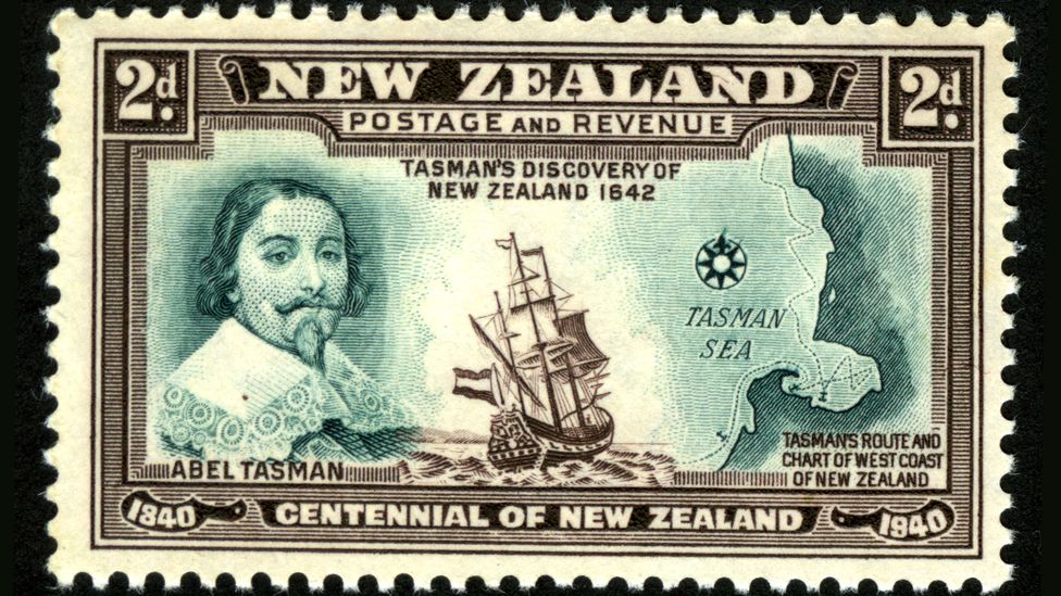
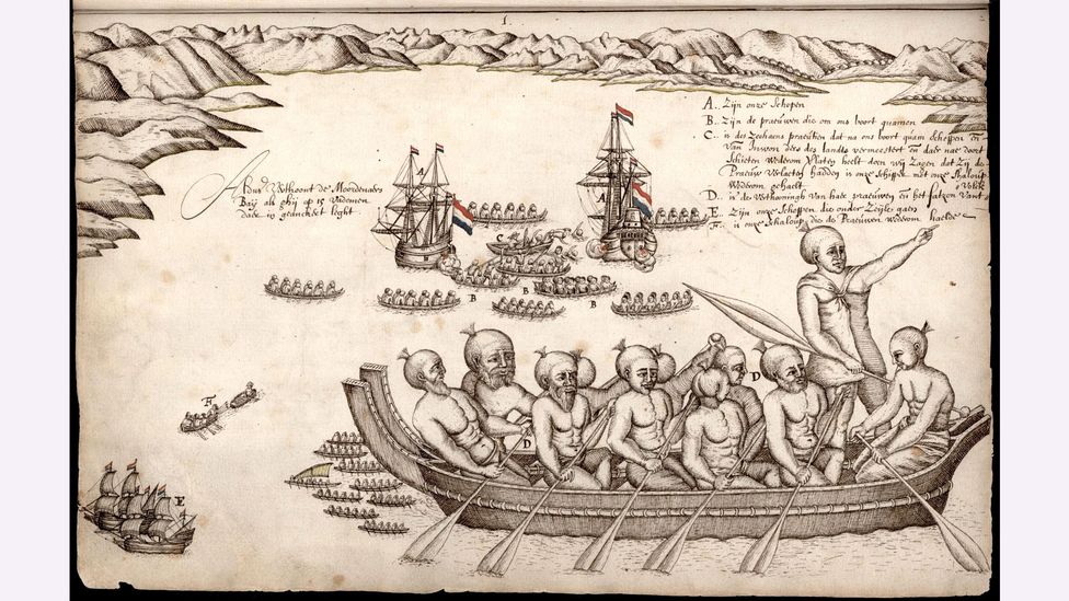
It was 1642 and Abel Tasman was on a mission.
The experienced Dutch sailor, who sported a flamboyant moustache, bushy goatee and penchant for rough justice – he later tried to hang some of his crew on a drunken whim – was confident of the existence of a vast continent in the southern hemisphere, and determined to find it.
At the time, this portion of the globe was still largely mysterious to Europeans, but they had an unshakeable belief that there must be a large land mass there – pre-emptively named Terra Australis – to balance out their own continent in the North.
And so, on 14 August, Tasman set sail from his company's base in Jakarta, Indonesia, with two small ships and headed west, then south, then east, eventually ending up at the South Island of New Zealand.
His first encounter with the local Māori people did not go well: on day two, several paddled out on a canoe, and rammed a small boat that was passing messages between the Dutch ships.
Four Europeans died.
Later, the Europeans fired a cannon at 11 more canoes – it’s not known what happened to their targets.
(By this time, Australia was already known about, but the Europeans thought it was not the legendary continent they were looking for. Later, it was named after Terra Australis when they changed their minds).
In 2017, a group of geologists hit the headlines when they announced their discovery of Zealandia –Te Riu-a-Māui in the Māori language.
A vast continent of 1.89 million sq miles (4.9 million sq km) it is around six times the size of Madagascar.
Though the world's encyclopaedias, maps and search engines had been adamant that there are just seven continents for some time, the team confidently informed the world that this was wrong.
"This is an example of how something very obvious can take a while to uncover," says Andy Tulloch, a geologist at the New Zealand Crown Research Institute GNS Science, who was part of the team that discovered Zealandia.
But this is just the beginning.
A laborious discovery
In fact, Zealandia has always been difficult to study.
More than a century after Tasman discovered New Zealand in 1642, the British map-maker James Cook was sent on a scientific voyage to the southern hemisphere.
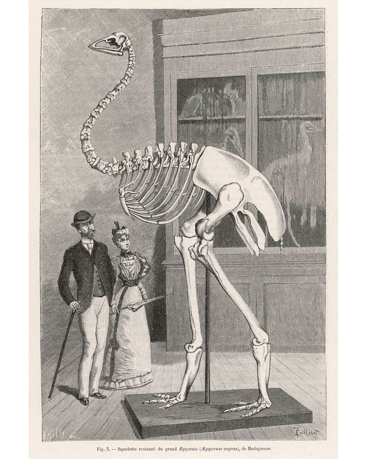
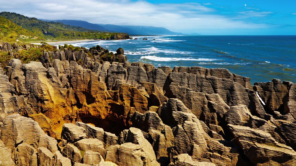
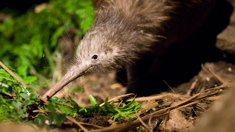 Possibly due to a quirk of geology, the enigmatic kiwi bird’s closest relative hails from Madagascar (Credit: Alamy)
The first real clues of Zealandia's existence were gathered by the Scottish naturalist Sir James Hector, who attended a voyage to survey a series of islands off the southern coast of New Zealand in 1895. After studying their geology, he concluded that New Zealand is "the remnant of a mountain-chain that formed the crest of a great continental area that stretched far to the south and east, and which is now submerged…".
Despite this early breakthrough, the knowledge of a possible Zealandia remained obscure, and very little happened until the 1960s.
Then in the 1960s, geologists finally agreed on a definition of what a continent is – broadly, a geological area with a high elevation, wide variety of rocks, and a thick crust. It also has to be big.
Still, the mission stalled – discovering a continent is tricky and expensive, and Mortimer points out that there was no urgency.
If New Zealand could prove that it was part of a larger continent, it could increase its territory by six times.
The final flourish came from satellite data, which can be used to track tiny variations in the Earth's gravity across different parts of the crust to map the seafloor.
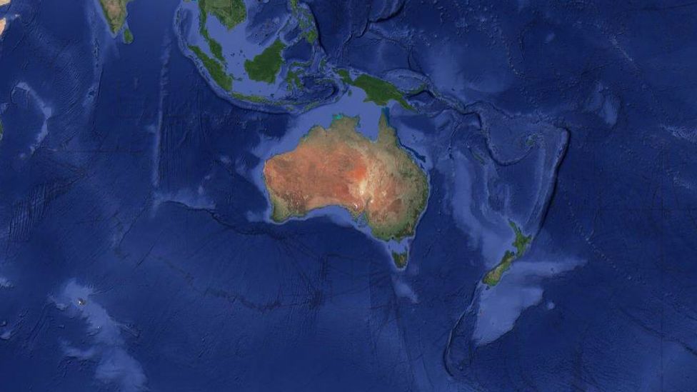
In addition to New Zealand, the continent encompasses the island of New Caledonia – a French colony famous for its dazzling lagoons – and the tiny Australian territories of Lord Howe Island and Ball's Pyramid. The latter was described by one 18th-Century explorer as appearing "not to be larger than a boat."
A mysterious stretching
Zealandia was originally part of the ancient supercontinent of Gondwana, which was formed about 550 million years ago and essentially lumped together all the land in the southern hemisphere.
Then around 105 million years ago, "due to a process which we don't completely understand yet, Zealandia started to be pulled away", says Tulloch.
Continental crust is usually around 40km deep – significantly thicker than oceanic crust, which tends to be around 10km.
Eventually, the wafter-thin continent sank – though not quite to the level of normal oceanic crust – and disappeared under the sea.
Despite being thin and submerged, geologists know that Zealandia is a continent because of the kinds of rocks found there.
Continental crust tends to be made up of igneous, metamorphic and sedimentary rocks – like granite, schist and limestone, while the ocean floor is usually just made of igneous ones such as basalt.
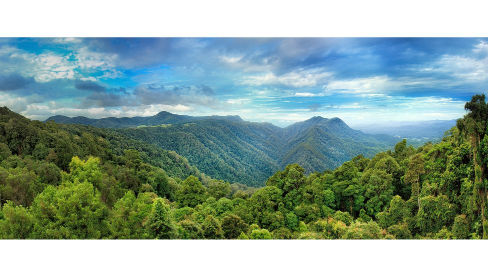 When the supercontinent of Gondwana broke up, fragments drifted all across the globe. Many of its ancient plants still live in the Australian Dorrigo forest (Credit: Getty Images)
Another mystery is exactly when Zealandia ended up underwater – and whether it has ever, in fact, consisted of dry land. The parts that are currently above sea level are ridges that formed as the Pacific and Australian tectonic plates crumpled together.Tulloch says opinion is split as to whether it was always submerged apart from a few small islands, or once entirely dry land.
With its mild climate and 39 million-sq-mile (101 million-sq-km) range, Gondwana itself was home to a vast array of flora and fauna, including the first four-limbed land animals and later, an abundance of the largest to ever live – the titanosaurs.
A debate about dinosaurs
Fossilised land animals are rare in the southern hemisphere, but the remains of several were found in New Zealand in the 1990s, including the rib bone of a giant, long-tailed, long-necked dinosaur (a sauropod), a beaky herbivorous dinosaur (a hypsilophodont) and an armoured dinosaur (an ankylosaur). Then in 2006, the foot bone of a large carnivore, possibly a kind of allosaur, was discovered in the Chatham Islands, about 500 miles (800km) east of the South Island.
This, in turn, suggests that at least part of now-submerged Zealandia has remained above sea level the whole time.
In 2017, a team undertook the most extensive surveys of the region so far, and drilled more than 4,101ft (1,250m) into the seabed at six different sites.
"If you have water, which is only you know, 10m (33ft) deep or something like this, then there's a good chance that there was land around as well," says Sutherland, who explains that the pollen and spores also hint at the possibility that Zealandia was not quite as submerged as was thought.
A (literal) twist
Another lingering mystery can be found in Zealandia's shape.
"If you look at a geological map of New Zealand, there are two things that really stand out," says Sutherland.
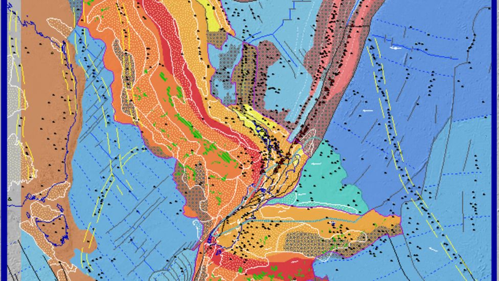
An easy explanation for this is that the tectonic plates moved, and somehow deformed them out of shape.
"There are various interpretations, but this is quite a large unknown thing," says Tulloch.
Sutherland explains that the continent is unlikely to give up all its secrets anytime soon.
If nothing else, the world's eighth continent surely shows that – nearly 400 years after Tasman's quest – there is still plenty to be discovered.
No comments:
Post a Comment