Credit: Shutterstock
From Safety4Sea
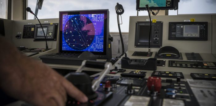
The Britannia P&I Club has issued its latest “Crew Watch” edition, highlighting the growing concern over navigational risks at sea due to the increasing threat of GNSS (Global Navigation Satellite System) jamming and spoofing.

According to Britannia, such risks can disrupt all equipment reliant on GPS PNT data. According to the US Coast Guard ‘Navigation Center’ (NAVCEN), recent reports show marine GPS signal disruptions in regions such as the eastern Mediterranean, Black Sea, Red Sea, coastal waters of China, and the Persian Gulf—many of which are near areas of geopolitical conflict.

What is jamming?
Jamming is the intentional Radio Frequency Interference (RFI) with GNSS signals.
Jamming is the intentional Radio Frequency Interference (RFI) with GNSS signals.
It occurs when interference disrupts the signals at GNSS frequencies, preventing the GNSS receiver from detecting and processing the authentic signal.
This happens because the strength of the jamming device exceeds that of the weaker GNSS signals received.
What is spoofing?
Spoofing involves transmitting a fake GNSS signal to deceive receivers, causing them to compute incorrect PNT data.
This should not be confused with Automatic Identification System (AIS) spoofing, where altered or fabricated AIS data is transmitted to deceive AIS tracking systems regarding a ship’s identity, position, and other information.
How to detect GNSS jamming or spoofing
How to detect GNSS jamming or spoofing
- A position loss alarm on the GPS receiver or other navigation and communication systems that depend on PNT data
- Unexpected deviations in the vessel’s track displayed on the Electronic Chart Display and Information System (ECDIS) when compared to RADAR
- Sudden jumps in the vessel’s position or unexpected increases in speed on ECDIS, even when the GPS receiver’s horizontal dilution of precision (HDOP) is below 2
- Inconsistencies between RADAR overlay and the ECDIS when the vessel is near land
- Discrepancies in the plotted ship’s position when cross-referencing GNSS data with RADAR or visual verification at regular intervals
- Differences between the echosounder depth and the expected depth according to contour lines when passing a depth contour
Safety implications of GNSS disruptions

- In open sea navigation, where GNSS positioning is the only available method, ships will need to rely on dead reckoning (DR) positions or celestial navigation techniques
- A sudden GNSS loss will trigger alarms on all navigational and communication systems relying on GNSS PNT data, which can be distracting for the bridge team, especially in high traffic areas or confined waters
- AIS positions of other vessels may become inaccurate, and your own ship’s AIS position could mislead nearby vessels
- If crew members are not properly trained to handle such situations, the safety of the ship’s navigation could be seriously compromised
A map of global GNSS interference on Nov. 20, 2024 based on Automatic Dependent Surveillance-Broadcast (ADS-B) data.
Credit: Flightradar24
Actions to take once GNSS outage/disruption is detected
- Change the ECDIS position (both primary and secondary) and speed input to DR position and log speed
- Identify RADAR-conspicuous objects in the passage plan
- Begin manually plotting the vessel’s position using visual or RADAR means if near land
- Use tools such as RADAR parallel indexing and RADAR overlay on ECDIS to monitor the vessel’s position near land
- Confirm that the RADAR speed input is log speed, if not already set
- Other ships in the vicinity may also be affected by GNSS disruption; navigate cautiously and rely less on AIS information from other vessels
- Turn off AIS overlay on ECDIS if anomalies are observed in the AIS information of target vessels
- Advise the master of the situation. An extra deck officer may be required on the bridge for assistance
- Give wide room to any encountered traffic
- Consider arriving during daylight hours when approaching a port or area known for GPS disruptions
- Report any marine GPS signal disruptions to NAVCEN at https://www.navcen.uscg.gov/report-a-problem
- Alternatively, any GPS disruption can be reported to NATO at https://shipping.nato.int/nsc/page10303037
Crew responsible for safe navigation should be trained to recognize GNSS disruptions and identify the systems and equipment affected on board.
GNSS failure drills should be conducted to familiarize the crew with the necessary steps, including adjusting equipment settings during such disruptions.
Links :
Links :
- GPS world : Slingshot Aerospace advances GPS jamming detection for military intelligence and security
- Reuters : Finland detects satellite navigation jamming and spoofing in Baltic Sea
- SpaceNews : America is at risk of high impact GPS jamming and spoofing from space / The urgent need for a national GPS jamming detection system / Lockheed Martin challenges narrative on GPS vulnerability
- Spire : GNSS interference
- GeoGarage blog : GPS jamming and spoofing: when good signals go bad / Understanding GPS spoofing in shipping: How to stay ... / What is GNSS spoofing? / GPS jamming reported in Gelendzhik Bay amid suspected ... / The rise of cyber threats and GPS-jamming on OSVs / How vulnerable is GPS / Report: Russian GPS spoofing threatens safety of navigation / Ghost ships, crop circles, and soft gold: A GPS mystery in ... / Mass GPS spoofing attack in Black Sea? / Mysterious GPS outages are wracking the shipping industry / The long ocean voyage that helped find the flaws in GPS / Chinese GPS spoofing circles could hide Iran oil shipments / Superyacht GPS spoofing experiment on the high seas / Iridium buys service that uses L-Band satellites for GPS ... / eLoran: Part of the solution to GNSS vulnerability / IXblue unveils The Cetos Suite, an AI Based E-Navigation ... / Navigating without GPS is one thing – so let's jam it and ... / Combatting maritime cyber security threats / Cyber threats prompt return of radio for ship navigation / Maritime Traffic Alert and Collision Avoidance System ...
No comments:
Post a Comment