Saturday, August 26, 2017

The trigonometry of sailing

If you want to sail upwind fast, you better understand Trigonometry.
Find out why in this video by Waterlust.

Friday, August 25, 2017

Russian tanker sails through Arctic without icebreaker for first time

A Russian tanker has carried a cargo from Hammerfest in Norway to Boryeong in South Korea in 22 days, about 30% quicker than the conventional southern shipping route through the Suez Canal

From The Guardian by Patrick Barkham

Climate change has thawed Arctic enough for $300m gas tanker to travel at record speed through northern sea route

A Russian tanker has travelled through the northern sea route in record speed and without an icebreaker escort for the first time, highlighting how climate change is opening up the high Arctic.


The $300m Christophe de Margerie carried a cargo of liquefied natural gas (LNG) from Hammerfest in Norway to Boryeong in South Korea in 22 days, about 30% quicker than the conventional southern shipping route through the Suez Canal.

The tanker was built to take advantage of the diminishing Arctic sea ice and deliver gas from a new $27m facility on the Yamal Peninsula, the biggest Arctic LNG project so far which has been championed by the Russian president, Vladimir Putin.

The Christophe de Margerie carried a cargo of liquefied natural gas from Hammerfest in Norway to Boryeong in South Korea in 22 days.

On its maiden voyage, the innovative tanker used its integral icebreaker to cross ice fields 1.2m thick, passing along the northern sea section of the route in the Russian Arctic in a record six-and-a-half days.

“It’s very quick, particularly as there was no icebreaker escort which previously there had been in journeys,” said Bill Spears, spokesperson for Sovcomflot, the shipping company which owns the tanker.
“It’s very exciting that a ship can go along this route all year round.”

© Olga Maltseva/Pool Photo via AP

Environmentalists have expressed concern over the risks of increased ship traffic in the pristine Arctic but Sovcomflot stressed the tanker’s green credentials.
As well as using conventional fuel, the Christophe de Margerie can be powered by the LNG it is transporting, reducing its sulphur oxide emissions by 90% and nitrous oxide emissions by 80% when powered this way.
“This is a significant factor in a fragile ecosystem,” said Spears.


The northern sea route between Siberia and the Pacific is still closed to conventional shipping for much of the year.
But the Christophe de Margerie, the first of 15 such tankers expected to be built, extends the navigation window for the northern sea route from four months with an expensive icebreaker to all year round in a westerly direction.

In the route’s busiest year so far, 2013, there were only 15 international crossings but the Russian government predicts that cargo along this route will grow tenfold by 2020.
This link with the Pacific reduces its need to sell gas through pipelines to Europe.
“There has been a steady increase in traffic in recent years,” said Spears.
“There’s always been trade along this route but it’s been restricted a lot by the ice. It’s exciting that this route presents a much shorter alternative than the Suez route. It’s a major saving.”

Simon Boxall, an oceanographer at the University of Southampton, said that shipping companies were making a “safe bet” in building ships in anticipation that the northern sea route will open up.
“Even if we stopped greenhouse emissions tomorrow, the acceleration in the loss of Arctic ice is unlikely to be reversed,” he said.
“We’ve been able to sail through the north-west passage for several years now but the northern passage, which goes past Russia, has opened up on and off since 2010. We’re going to see this route being used more and more by 2020.
“The irony is that one advantage of climate change is that we will probably use less fuel going to the Pacific.”

While sea ice in the Arctic grows and shrinks with the seasons, there is an overall declining trend, as north pole has warmed roughly twice as fast as the global average.
In March 2017, the annual maximum extent of Arctic sea ice hit a record low for the third straight year, according to the US National Snow and Ice Data Centre.

The extent of Arctic ice fell to a new wintertime low in March this year after freakishly high temperatures in the polar regions, and hit its second lowest summer extent last September.

Links :

Thursday, August 24, 2017

The shipping forecast: a map of Britain's splendid isolation


From Bigthink by Frank Jacobs


The Shipping Forecast is quite possibly the most British thing ever.

The general synopsis at midday: High west Sole 1028 expected east Sole 1019 by midday tomorrow. Low southern Portugal 1010 losing its identity.
The area forecasts for the next 24 hours.
Viking, North Utsire: Northwesterly 4 or 5, occasionally 6 at first. Moderate or rough. Occasional rain. Good, occasionally poor.

The Shipping Forecast is quite possibly the most British thing ever.
It’s quirkier than cricket, defiantly old-fashioned and ceremonial, and as reassuringly regular as Big Ben (1).
Produced by the UK’s Meteorological Office, it's broadcast four times a day by BBC Radio Four.

But it is more than mere maritime meteorology.
For over 90 years, the Shipping Forecast has been a punctual reminder of Britain’s island status – a declaration of geopolitical detachment expertly disguised as a weather bulletin. Splendid isolation masquerading as shifting isobars (2). 
And as such, one of the greatest examples of classic British understatement.
If that isn’t an oxymoron.
South Utsire: Northwesterly 5 or 6. Moderate or rough. Occasional rain. Good, occasionally poor. Forties, Cromarty: Northwest 4 or 5, occasionally 6 at first. Moderate, occasionally rough in northeast Forties. Rain or drizzle, fog patches developing. Moderate or good, occasionally very poor.
Listing the weather conditions in 31 sea areas surrounding the British Isles, the Shipping Forecast is read out at 5.20 am, 12.01 pm, 5.54 pm and 00.48 am.
The first and last broadcasts of the day also include reports from additional weather stations and inshore waters forecasts.
The last one also includes an outlook for next-day weather across the UK itself.
Forth, Tyne, West Dogger: Westerly or northwesterly 4 or 5, occasionally 6 at first. Slight or moderate. Fair. Good. East Dogger, Fisher, German Bight: Northwesterly 5 or 6. Moderate, occasionally rough. Fair then occasional rain, fog patches later. Moderate or good, occasionally very poor later.
Much of the Forecast’s charm derives from the – literally – outlandish names of the sea areas listed in the bulletin. The names derive from sandbanks (e.g. Dogger, Bailey), estuaries (Forth, Thames, Shannon), islands or islets (Wight, Rockall, Utsire), towns (Dover), or other geographic features (e.g. Malin Head, Ireland’s northernmost point).
Humber, Thames: West or northwest 4 or 5. Slight or moderate. Mainly fair. Good. Dover, Wight, Portland, Plymouth: Variable 3 or 4. Slight. Fair. Good.
One is named FitzRoy, after the captain of HMS Beagle, Britain’s first professional weatherman and the founder of the Met Office.
The southernmost region, Trafalgar is only mentioned standard in the last forecast of the day.
The regions are always listed in the same order, starting north with Viking, between Scotland and Norway, and then proceeding in a roughly clockwise direction:

Viking, North Utsire, South Utsire, Forties, Cromarty, Forth, Tyne, Dogger, Fisher, German Bight, Humber, Thames, Dover, Wight, Portland, Plymouth, Biscay, Trafalgar, FitzRoy, Sole, Lundy, Fastnet, Irish Sea, Shannon, Rockall, Malin, Hebrides, Bailey, Fair Isle, Faeroes and Southeast Iceland.
Biscay: Northeast 4 or 5, increasing 6 at times. Slight or moderate. Fair. Good. Southeast Fitzroy: Northerly or northeasterly 5 or 6, occasionally 7 at first. Moderate or rough. Showers. Good.
The map shown here also lists the coastal weather stations mentioned in the Shipping Forecast:

(1) Tiree, (2) Stornoway, (3) Lerwick, (4) Fife Ness, (5) Bridlington, (6) Sandettie Light Vessel Automatic, (7) Greenwich Light Vessel Automatic, (8) Jersey, (9) Channel Light Vessel Automatic, (10) Scilly Automatic, (11) Valentia, (12) Ronaldsway, (13) Malin Head

A few others are mentioned only in the 00:48 broadcast: Boulmer, Milford Haven, Liverpool Crosby, Machrihanish Automatic, among others.
Northwest Fitzroy: Northeasterly 4 or 5 becoming variable 3 or 4. Moderate. Rain later in west. Good. Sole: Variable 3 or 4, becoming southerly 4 or 5 in west. Slight or moderate. Rain later in west. Good.


One of the Shipping Forecast’s attractions to others than fishermen and sailors is its poetic effect, the result of its very strict format and an arcane terminology, only intelligible to the initiated.

Each bulletin begins with exactly the same opening line, and follows the same structure.
Preceded by gale warnings if necessary, a General Synopsis gives the position, pressure in millibars and track of pressure areas.
Then follows the forecast for each of the 31 areas, sometimes with some areas grouped together if they have the same outlook.
Each of these lists wind direction and strength, precipitation if applicable, and visibility (‘good’ for more than 5 nautical miles, ‘poor’ for less than 2 nm, and ‘fog’ for less than 1,000 metres).
The whole thing never exceeds 370 words.
Lundy, Fastnet, Irish Sea: Westerly 4 or 5 at first in east Lundy, otherwise variable 3 or 4. Smooth or slight, occasionally moderate in Fastnet. Fair. Good. Shannon, Rockall: Southerly or southwesterly 4 or 5, occasionally 6 in west. Slight or moderate, becoming moderate or rough. Rain later in west. Mainly good.
The gap between Radio Four’s last programme of the day and the final Shipping Forecast, at 48 minutes past midnight, is plugged with as much as necessary of ‘Sailing By’, an orchestral piece by Ronald Binge, otherwise famous for his arrangements for Mantovani.
The repetitive waltz helps sailors find the right frequency.
For the many landlubbers tuning in to the last Shipping Forecast of the day, the cozy number signals that it’s almost time to turn in for the night.
Malin: Southwest 4 or 5. Slight or moderate. Mainly fair. Good. Hebrides: West 5 or 6, backing southwest 4 or 5. Moderate. Occasional drizzle. Good, occasionally poor.
Thousands use the day’s last forecast as a lullaby.
Adding to its hypnotic, soporific effect is the fact that it’s read out at a deliberately slow pace, to allow seafarers to make notes. 
The strange place-names and the weird jargon give the Shipping Forecast a magical shine.
And perhaps they give the thousands tucked away safe in their beds pause to think about those out at sea at that very moment, in the dark, listening to the same bulletin.

The forecast is followed by God Save the Queen, after which it’s exactly 1 am, and BBC World Service takes over.
Bailey: West backing south or southeast 5 or 6, decreasing 4 for a time. Moderate. Occasional rain. Good, occasionally poor. Fair Isle, Faeroes:West or northwest 4 or 5, occasionally 6 at first, becoming variable 3 or 4 at times later. Mainly moderate. Occasional rain, fog patches developing. Moderate or good, occasionally very poor.
The Shipping Forecast has made a huge mark on music, literature and the wider culture. 
 
It inspired songs by Jethro Tull, Manfred Mann’s Earth Band, Wire, Blur, Radiohead, Tears for Fears, British Sea Power, Beck and the Prodigy, among others, and it was used in the opening ceremony of the 2012 London Olympics.
Nobel-prize-winning poet Seamus Heaney wrote a sonnet called ‘The Shipping Forecast’, and British Poet Laureate Carol Ann Duffy mentions “the radio’s prayer” in one of her poems.
The programme is used in books, films, tv series, and has been parodied countless times (once as ‘The Shopping Forecast’, listing UK supermarkets instead of sea regions)

Southeast Iceland: Cyclonic becoming easterly or southeasterly 4 or 5, increasing 6 or 7 later in west. Moderate, occasionally rough. Occasional rain. Good, occasionally poor. Trafalgar: Cyclonic 4 in southeast, otherwise northerly 5 to 7. Slight or moderate in southeast, otherwise moderate or rough. Thundery showers. Good, occasionally moderate.

Here is BBC Radio 4’s Shipping Forecast page.
Quoted text is that of the Shipping Forecast issued by the Met Office at 16.25 on Monday 21 March 2016, retrievedhere from the Met Office website.
Map of the sea regions by Emoscopes, found here on Wikimedia Commons.

Update 27 March 2016: changed the composer's name from Ronald "Ronnie" Biggs, whose fame derives from his participation in the Great Train Robbery. Thanks Aneel for pointing out the error!

Update 11 January 2017: Many thanks to Janos Vargha for sending in this news item about this artwork by Jane Tomlinson, awarded the John C Bartholomew Award for Thematic Mapping by the British Cartographic Society. 


"Dogger, Fisher, German Bight" shipping forecast celebrates 150 years of weather predictions

The shipping forecast is a radio broadcast - that began in 1924 and can still be heard four times a day - which provides weather forecasts and storm warnings for the seas around the British Isles.
In this video you can learn a bit about its history and also learn how to interpret the forecast - make sure your sound is turned on! 

From The Telegraph by Sarah Knapton

The Shipping Forecast is celebrating 150 years of continual weather predictions today, but sailors be warned, new statistics show that one in seven gales is a false alarm.
The first gale warning was issued following a violent storm in 1859 but it was not until
1867 that storm warnings at sea were issued on a regular basis and they have continued ever since.

 We look at the history of the Met Office shipping forecast

When it began, the forecast predicted around 75 per cent of strong winds correctly, but could only get the direction of the gales correct around one third of the time.
Today, The Met Office gets the wind direction correct 80 per cent of the time, but has a false alarm rate of around 15 per cent, meaning roughly one in seven storms will not happen.

 The forecast helps rescue agencies predict when they will be needed 
Credit: Apex

However overall forecasts, which also include wave heights, visibility and weather, are 93 per cent accurate, thanks to the Met Office’s new supercomputer which takes in data from all around the world.
The forecast is read on BBC Radio 4 each morning, although the Maritime and Coastguard Agency receive three updates throughout the day.


The Met Office have produced uninterrupted marine forecasts for 150 years.
Starting with gale warnings in 1867, these developed into the shipping forecast as we know it today.
This video gives a brief history of how marine forecasts began.
Calls for a regular shipping forecast were first made following the Royal Charter storm off the coast of North Wales in 1859 which led to the deaths of 800 people and the loss of 133 ships, double the amount of tragedies usually recorded in an entire year.
Following the disaster, Vice Admiral Robert FitzRoy persuaded the Board of Trade to allow him to start storm warnings in a bid to prevent similar occurrences and regular forecasts began eight years later.

 An engraving of The Royal Charter sinking

The maritime storm warnings evolved into what is now today’s shipping forecast and eventually led to the daily Met Office weather forecasts. Peter Dawes, Lifesaving Services Manager for the RNLI said: “The Met Office Shipping Forecast is an excellent source of information, and a vital tool in helping people make critical safety decisions at the coast and at sea.
“We urge everyone to check the weather before heading to the coast, in order to stay safe.”

 Chart outlining the shipping forecast areas in 1932

Map of the Shipping Forecast regions, including their coordinates,
and the coastal weather stations of the British Isles.
courtesy of ManuscriptMaps

Not only have the number of forecasts we produced increased but so has our accuracy.
Met Office Advisor, Penny Tranter, said: “The Met Office is highly regarded internationally the experience we have providing severe weather warnings for over 150 years is unprecedented. We are trusted for good reason.”


Links :

Wednesday, August 23, 2017

The hollow steel ball that changed ocean exploration forever

William Beebe in the bathysphere.
© Wildlife Conservation Society

From Atlas Obscura by Lida Tunesi

In the 1930s, the bathysphere propelled scientists deeper into the sea than they had ever been before.

IN THE SPRING OF 1930, a group of scientists and artists sailed to a tropical island called Nonsuch in Bermuda.
They awaited a submersible called the “bathysphere,” which would bring the team of men and women deeper into the ocean than humans had ever gone before and permit the first studies of deep-sea creatures in their natural waters.

The bathysphere—“bathy” meaning “deep” in Greek—was a hollow, steel ball less than five feet in diameter with three small windows and a steel cable to tether it to a ship.
Engineer Otis Barton and boat architect John Butler designed it for an expedition led by William Beebe, a naturalist with the New York Zoological Society’s Department of Tropical Research.
The record human aquatic descent at the time was a mere 525 feet and Beebe wanted to see what life was hidden further beneath the waves.

In May, the completed bathysphere arrived at the research station.
After several unmanned test dives and a short, manned descent to 45 feet, it was deemed ready for a plunge.

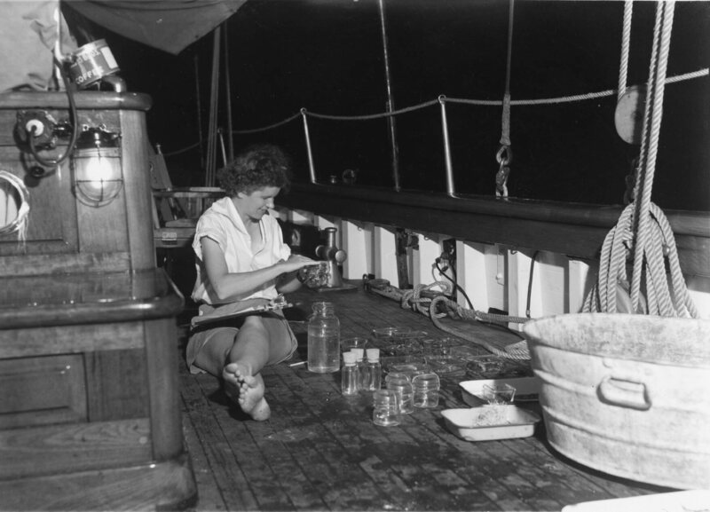
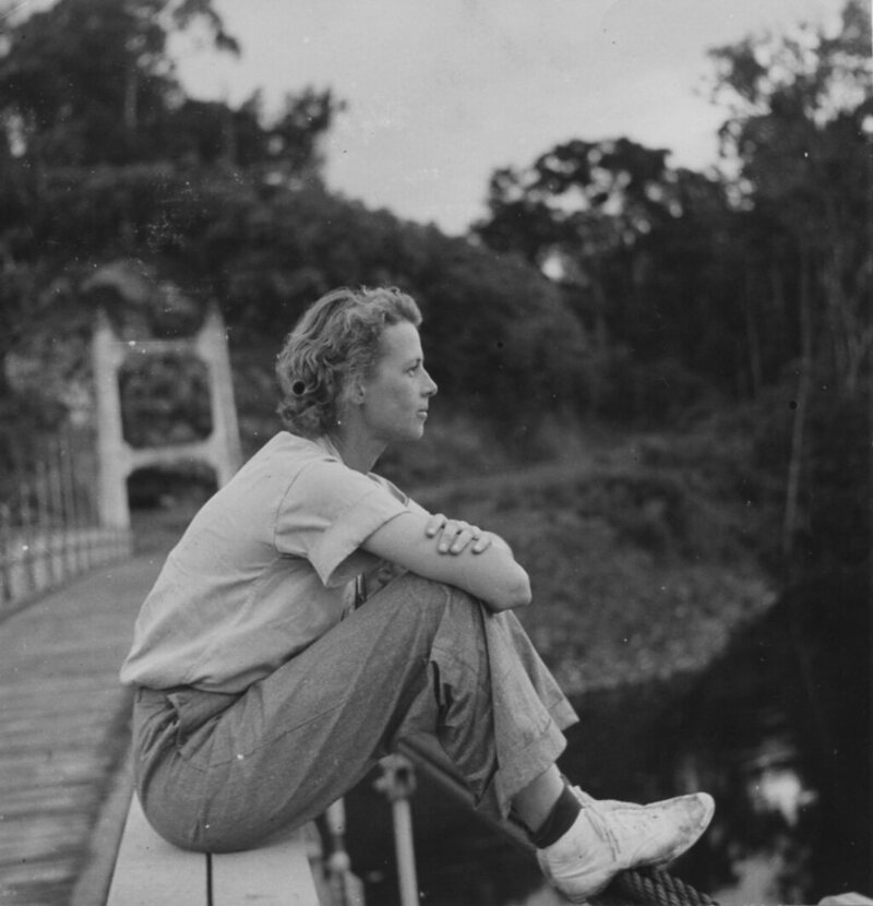
From left: Gloria Hollister, William Beebe and John Tee-Van next to the bathysphere, 1932.

On June 6, a tug towed a barge bearing the sphere out to sea.
Beebe and Barton wriggled through the pod’s 14-inch opening, arranged themselves on the cold, curved floor, and the crew tightened the lid.
As reported in Descent by Brad Matsen, oxygen flowed from two tanks, trays of soda lime and calcium chloride absorbed exhaled carbon dioxide and moisture, and the men waved palm leaf fans about for circulation.

Slowly the crew cranked the winch to raise the bathysphere up, over the ship’s deck, and down into the cerulean sea.
Gloria Hollister, the chief technical associate for the Department of Tropical Research, stood on deck with a telephone in her hand.
She served as the passengers’ only line of communication to the world above—copying down Beebe’s every observation, relaying their depth, and passing on orders to raise or lower the sphere—via a telephone line clamped to the steel cord.

Down the bathysphere sank.
Fanged and bioluminescent animals swam before the window.
The blue ocean light was a strangely brilliant hue that the English language could not account for, Beebe wrote in his account of the expedition, entitled Half Mile Down.
He and Barton were witnessing the gradual disappearance of each color in the rainbow as they were absorbed by the water above, an optical effect that produced nameless shades.
They stopped at 803 feet that day, getting a glimpse of a previously secret realm.

As summer rolled on the crew made more descents and meticulously recorded each lanternfish, eel larva, and sea sapphire that floated past the pod.
The world’s knowledge of deep-sea fish came mostly from the practice of dragging nets through the water, but some fish could escape the nets and others exploded as the pressure dropped on the way up, leaving scientists with an imperfect picture of what lay below.
Now they watched the creatures in their homes and were surprised to find that large fish could exist under the crushing pressure of deep water.

After dives, nature artist Else Bostelmann took to her studio on Nonsuch and transformed Hollister’s notes and Beebe’s recollections of the animals into paintings.
Her technical illustrations would be the primary visual documentation of the work in Bermuda, and would appear alongside Beebe’s words in National Geographic Magazinein 1931 and 1934.

Though she painted much of what floated past the bathysphere’s windows, the “greatest fun,” Bostelmann said, “was actually to paint at the bottom of the ocean.” Some days Bostelmann donned a copper diving helmet with air hose attached, climbed down a ladder into the sea, and had her canvas and oil paints, which wouldn’t mix with the water, sent down after.
Standing in sandy clearings under the waves Bostelmann painted “tall coral reefs, swaying sea-plumes, slender gorgonians, purple sea-fans”—what she called her own underwater “fairyland.”

The May 1922 cover of Scientific American, “with waterproof paints and canvas: Painting a submarine scene at first hand”.

In July another female researcher, named Jocelyn Crane, arrived fresh from college graduation.
Critics chastised Beebe for hiring women in science, calling him “unprofessional.
” Beebe responded that he hired based on “what’s above the ears” and that he had chosen Crane and Hollister for their “sound ideas for scientific research.” Hollister and Crane continued to study sea creatures and dive in the bathysphere, and Bostelmann continued to paint in spite of these criticisms.

On days the sphere didn’t descend, the team studied dredged fish in the lab.
Hollister often used her own system of chemical baths, dyes, and ultraviolet light, to decolor fish organs until they became translucent.
This revealed the red-stained skeleton and allowed her to study tail structures.

The team left the tropics in autumn and when the following summer came, bad weather and a broken winch prevented the bathysphere from diving, though other research continued.

Jocelyn Crane on an expedition in Manzanillo, Mexico, November 22, 1937, long after the bathysphere’s last dive.
© Wildlife Conservation Society

The sphere dove again into the world of languid siphonophores and flying snails in 1932, and on one descent, the National Broadcasting Company invited all of America into the deep sea, transmitting right from Hollister’s phone line.
On another eventful dive Beebe reported two six-foot fish he did not recognize.
They resembled barracudas, he wrote, but with bioluminescent lights down their side and two long tentacles, each with lights on the end.
Beebe dubbed the creature Bathysphaera intacta—the untouchable bathysphere fish—but it was eventually reclassified as a new species of dragonfish.

The bathysphere did not always lend itself to glamorous discovery.
Dives were thwarted by bad weather and a roiling ocean.
More than once the sphere came up full of water, releasing jets of dangerously pressurized water.
When, on one occasion, the telephone line up to Hollister failed, Beebe described a feeling of sudden, true isolation, “as if hose, cable, and all had gone. We had become veritable plankton.”

After exhibiting at the 1933 Chicago World’s Fair, the bathysphere returned to Bermuda in 1934.
That summer, Hollister set a women’s world record during a dive to 1,208 feet.
On August 15, 1934, Beebe and Barton sat in the cramped steel sphere 3,028 feet below sea level.
They rested about a tenth of the distance underwater that Mount Everest towers above sea level.
Beebe described the region as akin to “naked space itself, out far beyond atmosphere, between the stars.”
They peered out at an unfamiliar fish, about 20 feet long, that the Chicago Tribune described as “illuminated by myriads of tiny lights glittering like a diamond tiara.”

Gloria Hollister on a suspension bridge at Garraway, British Guiana (now Guyana), 1936.
© Wildlife Conservation Society

Submerged excursions proved too expensive to continue past 1934 given the sad state of the U.S.
economy.
Hollister took off to lead scientific treks in the jungles of British Guiana (now Guyana), while Bostelmann illustrated children’s books and painted for National Geographic.
Crane and Beebe continued to work together and she took over as Director of the Department of Tropical Research when Beebe passed away.
Barton the engineer turned to filmmaking with Titans of the Deep, a flop of a film that combined footage taken in Bermuda with invented drama.

The bathysphere itself now sits on display at the New York Aquarium while remotely operated submersibles like the Deep Discoverer descend almost four miles into watery darkness.
The Alvin can carry passengers down nearly three miles, untethered.
But before them came a little steel sphere in Bermuda, the submersible that carried science into a new domain.

Tuesday, August 22, 2017

Baja California’s recipe for saving fishing communities

Matthew W. Chwastyk, NGM staff
sources: Juan Bezaury-Creel, The Nature Conservancy; Jorge Urbán Ramírez, Laguna San Ignacio ecosystem science program; Jeffrey Seminoff, NOAA; Erik Vance; the state of the world’s sea turtles

From National Geographic by Erik Vence & Thomas P. Peschak (photos)

As fish populations crash elsewhere, towns limit catches to stabilize harvests, boost tourism, and preserve a way of life.

It’s a half hour before sunrise, and the ocean appears inky black as it slaps against the sand.
A dozen fishermen are lounging in the boat master’s office in Punta Abreojos, laughing and talking about the party they’ll have that night.

 Baja California with the GeoGarage platform (NGA chart)

The mood is festive in this hamlet at the midpoint of Mexico’s Baja California peninsula because today is a day the town looks forward to all year long—the opening of abalone season.
Actually the season opened four months earlier, but Punta Abreojos observes an unusual self-imposed ban.
Rather than fish for abalone as soon as the government allows, in January, the community waits until April, when the shellfish have put on more weight.


I head out into the Pacific Ocean with three fishermen in their 50s who have been working together since they were teenagers.
“Horse” runs the engine, “Mole” hauls up the bags of abalones, and “Fish,” naturally, is the diver.
(They are Porfirio Zúñiga, Eduardo Liera, and Luis Arce, but no one here calls them that.)

Fish is in especially high spirits—he’s just returned from Pebble Beach, California, where he surfed and played golf.
His buddies poke fun at him as he slips into a crisp new wet suit.
The sun is up, and the water has turned from black to deep blue.
Before they arrive at their fishing spot, Horse stops the boat over a reef crawling with abalones.
“Those are the green abalone,” Mole says.
“They won’t be ready for a month at least.”

A great white shark swims in the Isla Guadalupe Biosphere Reserve, 160 miles off Baja California.
As one of two places in the world where these sharks congregate in clear water, it’s a magnet for adventurous dive tourists.
Ecotourism in Baja brings hundreds of millions of dollars to Mexico.

A few miles later Fish hops into the water.
Within two hours he’s hit the catch limit and comes up with a smile and a bag full of healthy abalones.
In most fishing towns in Mexico—or in much of the rest of the developing world, for that matter—men like these would be pulling a meager catch out of depleted waters, living hand to mouth.
What makes these men so optimistic about the season ahead?
How can they afford new gear and vacations at elite golf courses?

The town’s fishing cooperative started in 1948 and for years operated like others—taking as much from the sea as it could.
But in the 1970s, after a few disappointing harvests, the fishermen decided to try something new.
They would manage the lobster (and later the abalone) for the long term instead of immediate profits.

Today Abreojos and a few like-minded Baja communities following the same strategy catch more than 90 percent of Mexico’s abalones.
Houses in Abreojos are freshly painted.
The town has a baseball team and a surfing team.
The lobster and abalone are canned at a modern processing plant and sold directly to Asia, maximizing profits.
The town’s waters are guarded using radar, boats, and planes.
Retired fishermen collect pensions.

Perhaps no one better reflects this success than 67-year-old Zacarías Zúñiga.
His father helped found the cooperative yet struggled to make his daily catch.
Zúñiga works as a quality control specialist in the cannery.
Thanks to a scholarship to college offered by the cooperative, his son is a computer science professor.
“We all work, and at the same time we all are owners,” he says.

Punta Abreojos is not the only success story in this part of Mexico.
Around the world, fish populations are crashing, and species such as tuna, turtle, and grouper are ever more scarce.
Yet, in northwestern Mexico, a few communities have managed to protect their underwater resources.
These micro-conservation areas were created by or with the support of the communities, which many environmentalists see as the key to conservation that works.
How they did it holds lessons for the world’s fishing communities.

Octavio Aburto dives near Isla Espíritu Santo, in the Gulf of California.
The marine biologist studies why some reserves succeed and others fail.
He’s found the secret is in the community that lives there.
“You start creating pride,” he says, “a commitment to recovery.”

The history of Baja fishing is a saga of booms and busts.
When author John Steinbeck visited the peninsula in 1940, he marveled at the incredible biodiversity—huge schools of manta rays, beds of pearl oysters, and so many turtles that older people here say you could cross the sea walking on their shells.
But within a couple decades, man had found the limits, decimating the wild oyster beds.
After that he turned to turtles, tuna, sharks, groupers, and a dozen other species.

The Mexican government, making things worse, for decades encouraged unemployed workers to become fishermen in a program called March to the Sea.
In southern Baja, which didn’t become a Mexican state until 1974, this led to a lone-cowboy culture that persists.

“People are used to doing things on their own,” says Octavio Aburto, a marine biologist with Scripps Institution of Oceanography who has studied Baja fisheries for 20 years.
“They are not expecting the government to do things.”
A native of Mexico City, Aburto first came to the region in the 1990s and fell in love with its congenial fishing culture and beguiling underwater safari.


In the late 1980s the waters around the Islas Revillagigedo were being targeted by commercial fishing.
In 1994 the Mexican government made the area a reserve, and in 2007 sport fishing was outlawed.
Today whitetip reef sharks, which have nearly vanished elsewhere, gather here by the dozens.

After decades of overfishing, though, the region was seeing fishery collapse of target species as families moved from camp to camp chasing the remaining fish.
In a few places small communities began to devise ways to maintain their resources.
Eventually their ideas spread.

From these scattered success stories, five rules emerge as the key to sustainable, community-supported ocean management.
First, like Abreojos, it helps if the site is fairly isolated, with just a community or two using it.
Second, the community needs a resource of high value, such as lobster or abalone.
Strong, visionary community leaders are the third necessity.
Fourth, fishermen need a way to support themselves while the resources recover.
And, lastly, the community must be bound together by trust.


Many Baja tour operators once made a living from fishing.
Dive operators in Cabo Pulmo are now trying to convince shark fishermen working near the national park (shown here) to go into tourism as a way to enlist them in protecting the ecosystem.

In Baja several communities besides Abreojos illustrate the importance of these rules.
One remarkable example of a high-value resource can be seen—and touched—in Laguna San Ignacio, a few miles down the coast.

In 1972, according to local legend, Francisco “Pachico” Mayoral was fishing in his usual spot in the lagoon.
As fishermen did in that region, he carried an oar to bang against the boat whenever a gray whale swam too close.
Gray whales, everyone thought, were dangerous creatures capable of snapping a boat in half.
Before long, one sidled up to his boat.
Perhaps it was curiosity or daring, but for some reason Mayoral reached out to touch it.
The whale leaned in and allowed him to stroke its smooth, spongy skin.
And in that moment a cottage industry was born.
By the late 1980s Mayoral and other fishermen were guiding tourists to the whales by the dozens.

Today whale-watching is among the most important economic activities in the region, with ecotourism lodges now dotting the shoreline.
Incredibly the gray whales and their calves still cuddle up to boats, though no one is sure why.

Just as incredible is how the people there have managed it.
Unlike Bahía Magdalena to the south, where guides chase down the animals in free-for-all whale-petting hunts, San Ignacio limits the number of boats on the water to around 16.
Fishing in the lagoon is banned during the whale-watching season, so the whales have some peace and quiet with their young offspring.

The preservation of this natural estuary does more than protect the whales; it also protects crucial nursery habitats for fish and invertebrates.
In the mid-1990s Mitsubishi tried to build a saltworks near the mouth of the lagoon that could have had a deleterious effect on the ecosystem.
The community, with the help of environmental organizations, mobilized a fierce campaign to block the project and eventually succeeded.

I head into the bay on a 24-foot panga with tourists hoping to have the absurdly unique experience of petting a whale.
Roberto Fischer, the fisherman taking us on the water, warns that there’s no guarantee we will touch or even see a whale.
They must choose to come to us; we aren’t allowed to chase them.
A few hundred yards off, a warden paid by the community eyes us to make sure we follow the rules.
Suddenly a whale spout appears and a jolt of excitement rocks the boat.
“I see it! Did you see it?” shouts a tourist.
Timidly a mother gray whale comes over to inspect us.
Her calf approaches less timidly, and soon it’s popping up on either side of the boat as the tourists cautiously stick out their hands.
The mother joins in, and a third also takes a passing interest.
“It’s whale soup!” Fischer says.
There’s a time for journalistic detachment.
But when a young whale leans up against your boat and opens its mouth, seemingly wanting to be petted, that is not such a time.
I reach out my hand and touch the soft, knobby skin and then, astonishingly, pet its tongue.
The massive creature looks at the dumbfounded writer and slides back into the water.

Nowhere is the third rule of successful marine conservation—the need for visionary leaders—more evident than in Cabo Pulmo.
In the 1980s it was a backwater fishing village near the tip of Baja.
Too small and poor to afford ice machines to cool fish and to maintain roads to get them to market, Cabo Pulmo supported just a few fishermen, some of whom worked the reef—the only true coral one in the Gulf of California—just offshore.
In the mid-1980s, locals say, biologists visited and loaned the fishermen a diving mask.
What they saw alarmed them—pockmarks from their anchors and overturned coral heads everywhere.
And very few fish.
“We saw the reef like it was our own garden.
But not like an ecosystem,” says Judith Castro, a community leader.
“The fishermen didn’t know about the damage they were doing."


Ocean life figures prominently in Baja history.
Pre-Hispanic cultures painted rays, sharks, dolphins, tuna, and seals in the remote canyons of the Sierra de San Francisco mountain range
Today these animals play an important role in tourism in places like Mexico’s Archipiélago de Revillagigedo Biosphere Reserve, in the Pacific Ocean about 240 miles southwest of Baja’s southern tip.
Divers there see sights like a manta ray being cleaned by Clarion angelfish.

In the early 1990s Castro’s brother Mario, a fisherman and diver, and Tito Mijares, a bar owner, led Cabo Pulmo’s fishermen to make a bold decision to support a marine reserve.
By 1995 most fishing was forbidden in a 27-square-mile area, creating a legal no-take reserve—the only well-enforced one in the region.
It’s not big, but it turns out you don’t need much space to bring back an ocean community.
Today Cabo Pulmo National Park has two to three times more biomass than in 2000 and a vibrant economy now based on diving tourism.

If your community boasts the area’s only coral reef or a pod of affection-hungry whales, developing a tourism model is an excellent way to save a threatened ecosystem.
But not every fishing village has that luxury.
Besides, tourism doesn’t create many jobs.
In San Ignacio it supports only about 200 people and only for a few months a year.
Then they go back to fishing.

This brings up the fourth rule.
For conservation to work, fishermen need a way to make money while they wait for their resource to recover.
And the conservation efforts need manpower.
To this end the community of El Manglito—on the estuary that borders the city of La Paz—has adopted an interesting strategy.

Fishermen once harvested shellfish with abandon from the broad, shallow bay west of town.
By 2009 very few were left.
With financial support from Noroeste Sustentable, a nonprofit in La Paz, the fishermen—many of whom had turned to poaching—stopped fishing and began managing their resources.
They were paid to watch for poachers and to do biological surveys estimating the amount of shellfish, now mostly a scallop-like creature called callo de hacha.
The first survey estimated that fewer than 100,000 shellfish were left.
Today it’s more like 2.3 million.
“It’s always said that fishermen are the ones that destroy species, but not anymore.
The sea has already given a lot.
Now we give something back,” says Antonio “Chiflo” Méndez, a fisherman.

El Manglito and Noroeste Sustentable did a lot right to bring the fishery back to life.
But most important, the fishermen guarding or assessing the resource received salaries while the shellfish recovered.
Paying them turned them from fishermen into professional environmental stewards.


The ocean provides an incredible bounty for Baja.
The Nature Conservancy estimates that nature-based marine tourism in Baja California Sur alone generates $300 million a year and supports more than 2,000 jobs.
Tourists in Laguna San Ignacio gape at a gray whale.
Manta Trust marine biologist Guy Stevens measures himself against a manta ray in the Islas Revillagigedo reserve, where a 100-square-mile expansion has been proposed.
The last rule is perhaps the hardest to follow.
For conservation to work, community cohesion and trust are essential.
In places such as Abreojos and El Manglito, locals enforce the fishing bans when it comes to outsiders, but there is also a fundamental presumption that people in the community will play by the rules.

In rural Baja, trust in one’s neighbor can be hard to find, but it’s possible to create it.
At least that’s what a conservation organization called Niparajá, based in La Paz, is betting on.
Niparajá works on sustainable fisheries in an especially desolate region of southeastern Baja, along the Loreto–La Paz corridor.
Along the ragged shorelines and breathtaking vistas there are few people and even fewer roads.
But those isolated fishing communities overlook some of the best unprotected habitat in the region.

When Niparajá started working in those communities, it didn’t focus on fishing.
Instead it promoted soccer tournaments.
“How do you start building trust?” asks Amy Hudson Weaver, who coordinates the program.
“You don’t start by talking about fishing.
You’ve got to be like, Is this guy going to kick me in the shin, or is he going to respect the rules? Is he someone I can trust?”

Sponsoring soccer tournaments in tiny towns might seem like a waste of time and money, but it slowly built trust between villages that have jealously guarded fishing grounds from each other.
Next Niparajá took some fishermen to Cabo Pulmo to see the impact a fishing ban can have on ocean life.
Eventually, after years of discussions, the villages decided to try conservation.
Each selected a small area and agreed not to fish in it for five years.
The areas are not big—the largest is just under three square miles—but it was a start.

A northern elephant seal pup peers into the camera near Isla Guadalupe while other juveniles play nearby.
Reserves create sanctuaries where once nearly extinct species can reproduce.
How to maximize this ability to restock populations is a key question in ocean conservation today.

“The idea is to have like a savings account,” says José Manuel Rondero, a 35-year-old fisherman who has watched lobster and fish populations plummet.

To monitor the reserves, Niparajá struck on a clever idea.
Each year it charters a research vessel for a trip down a 60-mile stretch of the corridor with biology students, government scientists, and fishermen from each community.

Rondero rolls his eyes when told I’ll be trailing him.
We drop into the water near a steep underwater slope.
Many of the fishermen on the boat have dived in the Cabo Pulmo reserve, but several tell me they were unimpressed.
Sure, there are a lot of fish, but nothing compared with what the corridor could have.

I see what they mean.
The countless nooks and boulders are perfect habitat.
Rondero takes out a tape measure, pulls it out 30 meters, and swims along it with a clipboard, counting fish one way and invertebrates the other.
Then he sits and counts all the fish in his field of view.


Baja communities employ different strategies to make a living from the ocean’s resources.
Some rely on tourism, including a former fisherman in Bahía Magdalena who takes visitors to see sharks, whales, and pelicans diving for fish.


Magdalena has suffered from failed conservation efforts, whereas to the north the people of Punta Abreojos carefully manage their resources for high-value products like abalone and lobster.

The totals are a little dismal—a few lone fish and some urchins.
Once we are out of the water, Rondero explains that this no-fishing zone is small and very new.
In the bigger ones he’s seen biodiversity increase in just a couple of years, from a few goatfish to huge groupers, grunts, and parrotfish.
A few miles north of here, one marine reserve has blossomed recently, and the communities have decided to expand it.
“This year is better than all of the past years I’ve seen,” he says.
“I’m seeing it very replenished. Lots of fish.”

From a scientific perspective, this research is crucial.
The five largest protected areas on Earth are marine parks, and ocean life rebounds within their borders.
But what kinds of habitats yield the best ecological results? How big must a park be to make a difference on the surrounding areas?

The corridor’s tiny reserves are the perfect place to answer these questions.
But these trips also serve an equally important outreach role.
In Baja, as in most of Mexico, few trust the government, and many view conservation efforts as shadowy conspiracies.
But in the corridor each community hears back from fishermen who have worked alongside marine biologists.
At night, after grueling days of swimming transects, fishermen, scientists, and government employees hang out together, talking and laughing.
Whenever he returns from the research vessel, Rondero says, his community peppers him with questions.


Whale sharks frequent the bays around La Paz, perhaps attracted by the calm, shallow water.
Their appearance just offshore is as steady as clockwork.
Today researcher Dení Ramírez Macías of Whale Shark Mexico calculates that whale shark tourism brings an estimated $1.3 million to the local economy.
In fact, the tourist boats in La Paz sometimes outnumber the whale sharks.

“I have a lifetime of great fishing experiences,” he says, sitting on the boat one evening.
“I’m proud to be a fisherman.
The community has many needs, but we live happily here.”

Gazing across the water at the stunning coastline, I ask whether he wants his daughter to marry a fisherman.
He pauses and then smiles.
“No. I’d like her to be a marine biologist—and do the sort of work I am doing right now.”

Links :

Monday, August 21, 2017

Brazil DHN update in the GeoGarage platform

68 nautical raster charts

How hackers are targeting the shipping industry

This film looks at the subject of cyber security in the maritime industry and gives simple, clear non-technical advice for seafarers and shore-based colleagues on avoiding the most common cyber threats.

From BBC by Chris Baraniuk

When staff at CyberKeel investigated email activity at a medium-sized shipping firm, they made a shocking discovery.
"Someone had hacked into the systems of the company and planted a small virus," explains co-founder Lars Jensen.
"They would then monitor all emails to and from people in the finance department."

Whenever one of the firm's fuel suppliers would send an email asking for payment, the virus simply changed the text of the message before it was read, adding a different bank account number.
"Several million dollars," says Mr Jensen, were transferred to the hackers before the company cottoned on.


After the NotPetya cyber-attack in June, major firms including shipping giant Maersk were badly affected.
In fact, Maersk revealed this week that the incident could cost it as much as $300 million (£155 million) in profits.

But Mr Jensen has long believed that that the shipping industry needs to protect itself better against hackers - the fraud case dealt with by CyberKeel was just another example.
The firm was launched more than three years ago after Mr Jensen teamed up with business partner Morten Schenk, a former lieutenant in the Danish military who Jensen describes as "one of those guys who could hack almost anything".
They wanted to offer penetration testing - investigative tests of security - to shipping companies.
The initial response they got, however, was far from rosy.
"I got pretty consistent feedback from people I spoke to and that was, 'Don't waste your time, we're pretty safe, there's no need'," he recalls.

Today, that sentiment is becoming rarer.
The consequences of suffering from the NotPetya cyber-attack for Maersk included the shutting down of some port terminals managed by its subsidiary APM.

 CargoSmart has pulled together a Vessel Monitoring Dashboard to monitor vessels during this time of recovery from the cyber attack.

The industry is now painfully aware that physical shipping operations are vulnerable to digital disruption.
Breaking into a shipping firm's computer systems can allow attackers to access sensitive information.
One of the most serious cases that has been made public concerns a global shipping conglomerate that was hacked by pirates.
They wanted to find out which vessels were transporting the particular cargo they planned to seize.

A report on the case by the cyber-security team at telecoms company Verizon describes the precision of the operation.
"They'd board a vessel, locate by barcode specific sought-after crates containing valuables, steal the contents of that crate - and that crate only - and then depart the vessel without further incident," it states.

  The control systems on ships are often connected to the internet

But ships themselves, increasingly computerised, are vulnerable too.
And for many, that's the greatest worry.

Malware, including NotPetya and many other strains, is often designed to spread from computer to computer on a network.
That means that connected devices on board ships are also potentially vulnerable.
"We know a cargo container, for example, where the switchboard shut down after ransomware found its way on the vessel," says Patrick Rossi who works within the ethical hacking group at independent advisory organisation DNV GL.
He explains that the switchboard manages power supply to the propeller and other machinery on board.
The ship in question, moored at a port in Asia, was rendered inoperable for some time, adds Mr Rossi.

Seizing the controls

Crucial navigation systems such as the Electronic Chart Display (Ecdis) have also been hit.
One such incident is recalled by Brendan Saunders, maritime technical lead at cyber-security firm NCC Group.

This also concerned a ship at an Asian port, but this time it was a large tanker weighing 80,000 tonnes.
One of the crew had brought a USB stick on board with some paperwork that needed to be printed.
That was how the malware got into the ship's computers in the first instance.
But it was when a second crew member went to update the ship's charts before sailing, also via USB, that the navigation systems were infected.

Malware can hit a ship's navigation systems 

Departure was consequently delayed and an investigation launched.
"Ecdis systems pretty much never have anti-virus," says Mr Saunders, pointing out the vulnerability.
"I don't think I've ever encountered a merchant ship Ecdis unit that had anti-virus on it."

These incidents are hugely disruptive to maritime businesses, but truly catastrophic scenarios might involve a hacker attempting to sabotage or even destroy a ship itself, through targeted manipulation of its systems.

Could that happen?
Could, for example, a determined and well-resourced attacker alter a vessel's systems to provoke a collision?
"It's perfectly feasible," says Mr Saunders.
"We've demonstrated proof-of-concept that that could happen."

And the experts are finding new ways into ships' systems remotely.
One independent cyber-security researcher, who goes by the pseudonym of x0rz, recently used an app called Ship Tracker to find open satellite communication systems, VSat, on board vessels.
In x0rz's case, the VSat on an actual ship in South American waters had default credentials - the username "admin" and password "1234" - and so was easy to access.
It would be possible, x0rz believes, to change the software on the VSat to manipulate it.

A targeted attack could even alter the co-ordinates broadcast by the system, potentially allowing someone to spoof the position of the ship - although shipping industry experts have pointed out in the past that a spoofed location would likely be quickly spotted by maritime observers.

The manufacturer behind the VSat unit in question has blamed the customer in this case for not updating the default security credentials.
The unit has since been secured.


Safe at sea

It's obvious that the shipping industry, like many others, has a lot of work to do on such issues.
But awareness is growing.

The Baltic and International Maritime Council (BIMCO) and the International Maritime Organisation (IMO) have both recently launched guidelines designed to help ship owners protect themselves from hackers.
Patrick Rossi points out that crew with a poor understanding of the risks they take with USB sticks or personal devices should be made aware of how malware can spread between computers.
This is all the more important because the personnel on board vessels can change frequently, as members go on leave or are reassigned.

Commercial ships carry 90% of the world's trade 

But there are more than 51,000 commercial ships in the world.
Together, they carry the vast majority - 90% - of the world's trade.
Maersk has already experienced significant disruption thanks to a piece of particularly virulent malware.
The question many will be asking in the wake of this and other cases now being made public is: What might happen next?

Links :