At the moment, Scotland is doing a really good job of trashing our insgore waters"
Lauren Smith and Chris Rickard
Photograph : Murdo Macleod/The Guardian
An unofficial network of fishers, divers and scientists are banding together to stop illegal fishing and curb coastal destructionScotland’s coastal waters are in trouble.
They contain some of the world’s richest and most diverse marine life: bottlenose dolphins, porpoises, minke whales and orcas are among 20 cetacean species found along its coast, while seagrass and kelp forests host otters, octopus, lobsters, sea urchins and squid.
But these waters are vulnerable.
A
sobering assessment by the Scottish government in 2020, found that it had failed to meet targets to prevent damage to priority marine environments, causing five large seabed habitats to shrink.
Years of dredging, trawling, anchoring and overfishing are to blame, according to the report, which found that the climate crisis, ocean acidification, storms, disease and pollution from fish farms have also played a part.
As politicians fall short in tackling the accelerating human pressures on the seas, many coastal communities are taking matters into their own hands.
Howard Sargent and Rose Reid: saving marine life from rogue dredgersAt the end of a jetty on Holy Isle, in the Firth of Clyde on Scotland’s west coast, a sign informs visitors the seabed is a protected biodiversity hotspot.
In the clear waters of Lamlash Bay – a ribbon of sea between Holy Isle and the larger Isle of Arran – otters hunt for sea urchins among its kelp beds and
maerl, a pink coralline seaweed, carpets the seabeds.
But despite their protected status, these waters are threatened, says Howard Sargent, 56, a former architectural designer who lives on Holy Isle.
Localization with the GeoGarage platform (UKHO raster chart)
The sea here was not always so full of life.
By the early 2000s, decades of trawling and dredging for fish had left it close to collapse.
Sargent traces the problems back to the government’s decision in the 1980s to allow trawlers to fish closer to the coastline.
“It’s the
‘tragedy of the commons’ – if it’s a free-for-all, everyone takes everything before anyone else can,” he says.
Residents intervened and in 2008, after a campaign, Lamlash Bay was designated a “no-take zone” – banning damaging fishing practices.
Since then, the waters have seen a
dramatic revival.
Lobsters are now four times as abundant and scallop density is four times higher.
But rogue fishing vessels still seek to dredge the seabed for prawns and scallops.
Sargent and his partner, Rose Reid, 39, are part of an unofficial network of coastal defenders.
“We keep an eye out for dubious fishing activities,” says Sargent.
 Howard Sargent and Rose Reid at Lamlash Bay.
Photograph: Murdo MacLeod/The Guardian
He reports any potentially illegal fishing to Marine Scotland, the branch of government regulating Scotland’s seas and fisheries, but it is hard to secure convictions without solid proof, as vessels are allowed to transit through no-take zones.
In March 2019, Sargent spotted a trawler dragging nets through the bay early in the morning.
He grabbed his camera and managed to get photographic evidence.
“It had big nets out the back and there were seagulls overhead,” says Reid, a psychologist.
They were due to give evidence against the vessel in court but at the last minute, the skipper pleaded guilty to having fishing gear deployed and was fined £2,200.
Campaigners called the fine “paltry” – the maximum penalty is £50,000 – and the couple were disappointed the prosecution was stopped.
But Sargent believes the case is a deterrent: “Local fishing boats are now aware that Lamlash Bay is well monitored.”
A spokesperson for Marine Scotland says it assesses all reports of suspected breaches of marine protected area (MPA) regulations and, where possible, deploys a compliance vessel to gather evidence and detain suspect boats.
It is also “rolling out tracking and remote electronic monitoring across the inshore fleet”.
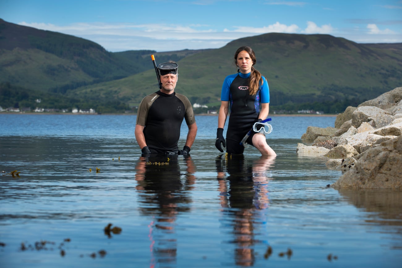
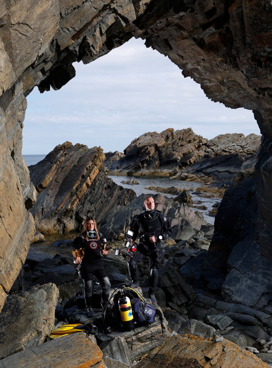
Lauren Smith and Chris Rickard, at the Needle’s Eye in Macduff.
Photograph: Murdo MacLeod/The Guardian
Chris Rickard and Lauren Smith: fighting to save the ‘manta ray of the north’Three years ago, Chris Rickard became one of the few people in Britain to have seen a flapper skate in the wild.
He spotted the elusive, critically endangered animal on a dive in the Summer Isles in the Scottish Highlands.
“I was struck by how something so massive and majestic could be so unknown in our waters,” says Rickard, a marine conservation consultant and keen diver, who lives near Macduff in Aberdeenshire.
The world’s largest skate, sometimes known as the “manta ray of the north”, flapper skates can reach up to three metres in length, with a wingspan of 2.5 metres.
The giant predator, once common in British waters, is so rare that it has been described as extinct in large parts of its former range due to overfishing; the north-west coast of Scotland is one of
its last strongholds.
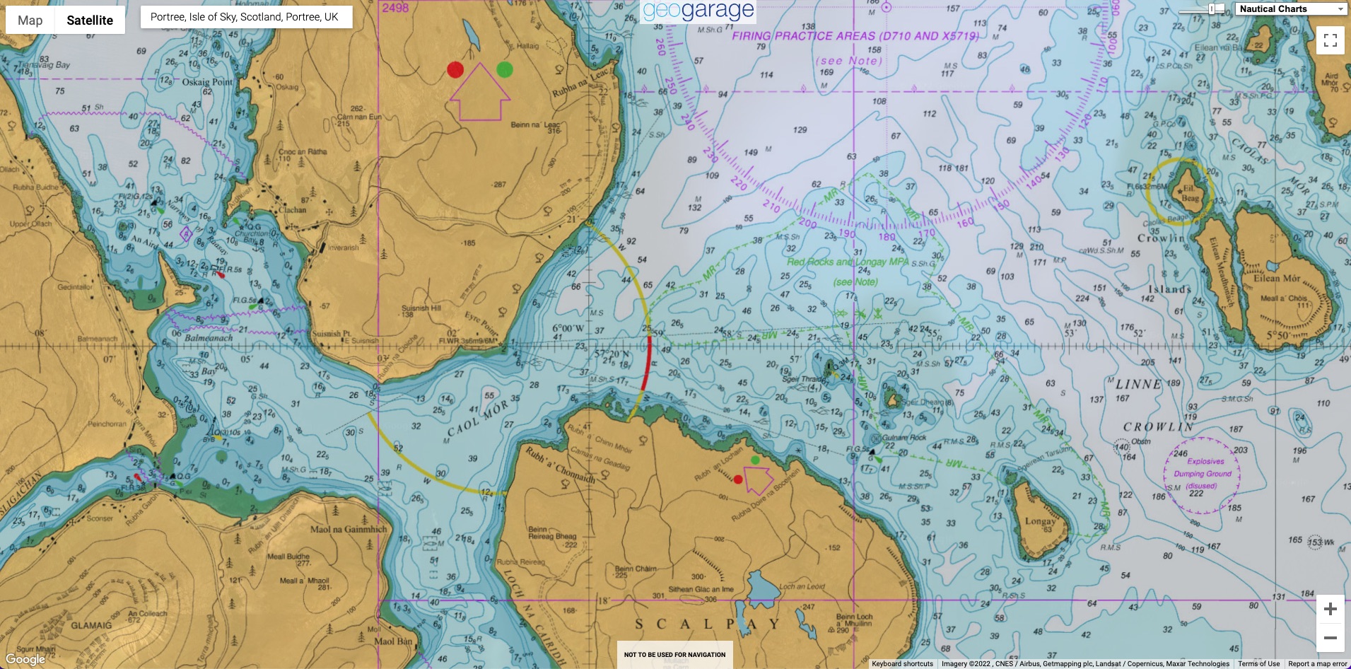
A few weeks after his sighting, Rickard, 45, saw on social media that a mermaid’s purse – the egg case of skates – had been found by a scallop dive boat on Scotland’s west coast.
He persuaded the boat’s skipper to take him to where it was found – the cold, dark waters of the Inner Sound of Skye, near the uninhabited island of Longay.
They dived more than 30 metres below the surface, where Rickard shone his torch through the gloom: “Suddenly I spotted a couple of purses.” By the end of the dive he had counted 40.
“I knew they were alive, as I could see embryos wriggling inside some of them.”


Localization with the GeoGarage platform (UKHO raster chart) On surfacing, he texted Lauren Smith, a friend and marine biologist who runs Saltwater Life, a shark research and conservation NGO.
“This was really something,” says Smith, 39.
But live eggs, lying unprotected near scallop grounds, could be wiped out in seconds by dredgers.
Rickard contacted Marine Scotland but no protection was put in place.
Returning to the site in 2020 with Smith and others, they found more than 100 egg cases – the largest known flapper skate egg-laying site in the world.
With the help of Our Seas, an alliance of groups supporting sustainable seas, and Blue Marine Foundation, they publicised the find and called on the Scottish government to take action.
In March 2021, the government designated the site “the Red Rocks and Longay urgent marine protected area” and banned all fishing.
It is now deciding
on permanent protection measures.
Smith and Rickard would like to see more of Scotland’s waters protected from trawling.
“At the moment, Scotland is doing a really good job of trashing our inshore waters,” Rickard says.
A Scottish government spokesperson said 37% of Scottish waters were MPAs and it was committed to increasing protections, including through new
highly protected marine areas.
These will cover at least 10% of Scottish waters by 2026, “prohibiting all extractive, destructive and depositional activities”.
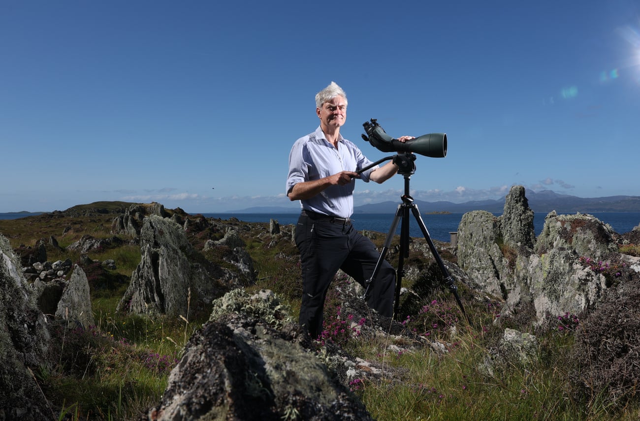 John Aitchison at the Sound of Jura, with his spotting telescope.
Photograph: Murdo MacLeod/The Guardian
John Aitchison: halting a fish farm in a protected areaJohn Aitchison, a wildlife cameraman, director and producer, has travelled to some of the world’s most remote places for films including the BBC’s Frozen Planet, to witness the wildlife crisis at first-hand.
But it was back home, in Mid-Argyll, that he decided to take action.
A few weeks before Christmas 2016, he discovered plans for an industrial-sized fish farm off the Sound of Jura, a designated MPA.
The company behind the farm planned to site a dozen 100-metre circular cages capable of housing 1 million rainbow trout, just off the coast at Dounie.
Nearly everyone thought the site was inappropriate, Aitchison, 56, says.
“It felt like a juggernaut coming towards us.”
Kames
Fish Farming argued its farm would be built and operated responsibly and would create local jobs.
The community argued that pesticide discharge, sea lice and fish escaping from the farm would threaten the environment and wild salmon.
Localization with the GeoGarage platform (UKHO raster chart)
Aitchison, chair of the Friends of the Sound of Jura, had to take a crash course in licensing and planning law: they only had 28 days to oppose the granting of a licence by the Scottish Environment Protection Agency.
More than 3,000 people signed a petition against the plans, more than a third from Argyll’s villages and hamlets.
It was a frustrating process, says Aitchison.
But they got a lucky break.
A seabed survey found northern sea fans, some of Scotland’s rarest sea life, close to the proposed site.
In December 2017, Kames Fish Farm
withdrew its application.
“Although we succeeded, it left us realising how difficult it is to influence that type of decision.
In Scotland, planning rules favour developers and they favour salmon farming,” Aitchison says.
A spokesperson for the Scottish Environment Protection Agency said itlistens to those who share an interest in Scotland’s water environment before it authorises a development.
 David Nairn, right, with David and Jean Ainsley.
There is a salmon farm in the background.Photograph: Murdo MacLeod/The Guardian
David Nairn and David Ainsley: protecting porpoises from noise pollution
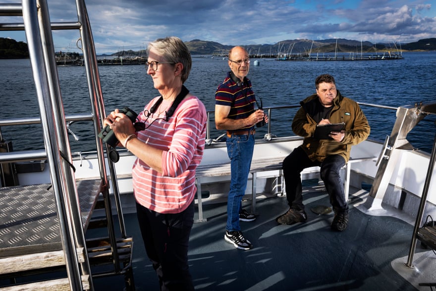
Five years ago, David Nairn, a skipper and conservationist, was watching porpoises on his cruiser in the Firth of Clyde, the deepest coastal waters in the UK, when he noticed something amiss.
“We’d been surveying them, zigzagging up the Clyde,” says Nairn, 50, who records underwater noise, identifying the mammals – a protected species in Scottish waters – by their high pitched clicks.
“But when I passed fish farms, there were none.”
Later analysis revealed a “horrendous noise”, says Nairn, founder of Clyde Porpoise.
It was an acoustic deterrent device (ADD) used to scare off seals that attack fish-farm cages.
Porpoises, which are not a threat to fish farms, “are really affected by high-frequency noise”, says Nairn, who estimates as many as 2,500 live in the Clyde during the calving season.
Localization with the GeoGarage platform (UKHO raster chart)
Farther up the west coast, a marine biologist working in wildlife tourism was also convinced that acoustic deterrents were driving cetaceans away.
“My life is out at sea, watching for porpoises, dolphins and whales,” says David Ainsley, a former creel skipper who runs Sealife Adventure, a wildlife tourism company in Seil Island, with his wife, Jean.
They say the difference between areas with salmon farms and those with none is like “chalk and cheese”.
“If you damage the hearing of an echo-locating animal, it can die because it can’t find food,” he says.
Nairn and Ainsley, who met through the Coastal Communities Network, an alliance of grassroot groups in Scotland, began working together to tackle the problem.
They knew that, under Scottish law, fish farms using acoustic deterrents need a licence, unless they can demonstrate that the devices do not disturb cetaceans.
They also knew that by 2018,
about 90% of Scottish fish farms were using them.
If you damage the hearing of an echo-locating animal, it can die because it can’t find food David Ainsley
Despite the licence requirement, Nairn and Ainsley discovered that Marine Scotland did not hold any information about how many acoustic deterrent devices were used in fish farms.
They argued – via petitions, parliamentary questions and using acoustic evidence – that the Scottish government should enforce existing law.
During this time, deterrent use dropped off dramatically.
In November last year, the pair enlisted Guy Linley-Adams, an environmental solicitor, who made a formal complaint to the independent regulator, Environmental Standards Scotland (ESS), accusing Marine Scotland of failing to ensure fish farms were complying with the regulations.
In August, ESS
published a report recommending improvements in the Scottish government’s “compliance process”, which it says have since been implemented.
Linley-Adams described this as a “de facto ban” on acoustic devices in salmon farming, because it would be “impossible” to prove the use of the device would not disturb cetaceans, or for the industry to successfully apply for a licence, especially as effective alternatives such as seal nets are available.
The Scottish government told the Guardian it welcomed the ESS report and said fish farmers must obtain any relevant consent or demonstrate that acoustic devices “will not harm marine mammals’”.
Salmon Scotland, which represents the salmon farming industry, said no devices were currently in use in Scottish farms.“There is no ‘victory’ or ‘de facto ban’,” a spokesman said.
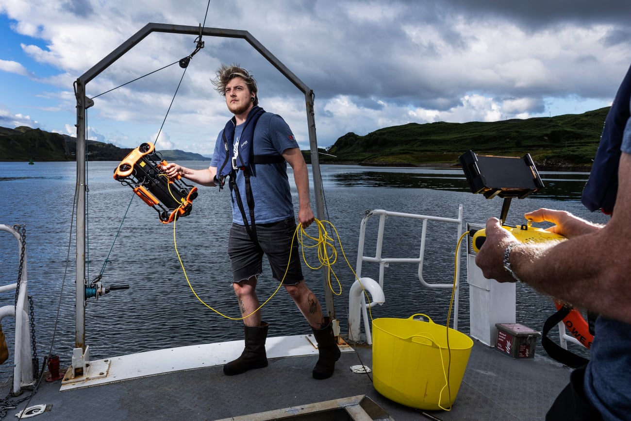 Theo Bennison prepares to deploy a remotely operated underwater vehicle from the Sea Beaver in Oban.
Photograph: Murdo MacLeod/The Guardian
Theo Bennison: mapping life on the seafloor
Marine ecologist Theo Bennison has spent the past five months on the Sea Beaver, a boat travelling around the Scottish coast to measure the health of the seas.
Operation Ocean Witness, run by Greenpeace and the Scottish charity Open Seas, relies on networks of local communities to report on threats including illegal fishing in MPAs.
In June, sources led them to Orkney, where they found dredging damage to maerl beds, which take decades to grow and act as a nursery for invertebrates and fish.
Localization with the GeoGarage platform (UKHO raster chart)
“It is shocking that damage like trawling and dredging is allowed to happen in protected areas,” says Bennison, 28, a researcher with Open Seas.
“The government said it was going to protect biogenic reefs, which maerl beds are, and the fact that this has happened is pretty worrying.”
Open Seas will report its findings to Marine Scotland.
By using drone footage, Bennison and the team also helped produce the first map of an important seagrass meadow off Papa Westray, measuring 30 hectares (74 acres) in total.
There are already five fish farms in the area, says Bennison.
“Hopefully, it will help the community in their battle against a new proposal for another fish farm.”


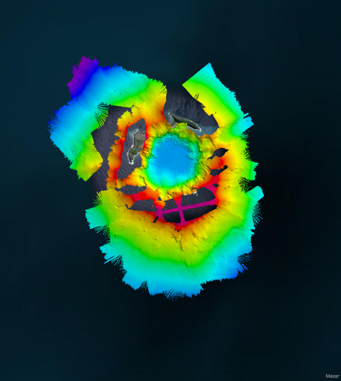
 SEA-KIT USV Maxlimer getting prepared for despatch to Tonga.
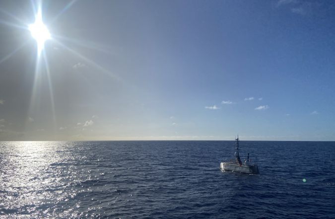 USV Maxlimer in Tonga.
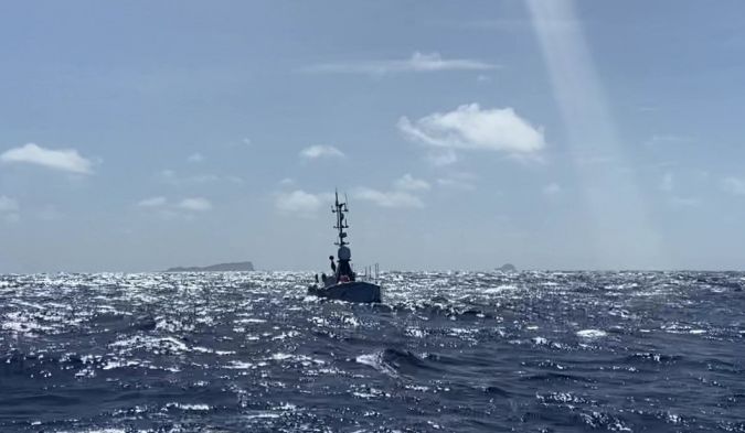 SEA-KIT USV Maxlimer returning from HT-HH caldera in Tonga.
 IPCC projections for 2081 to 2100 relative to 1995-2014 under best case scenario (1.5˚C rise, left) and worst case scenario (CO2 emissions double by 2050, right).
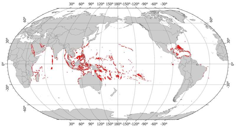
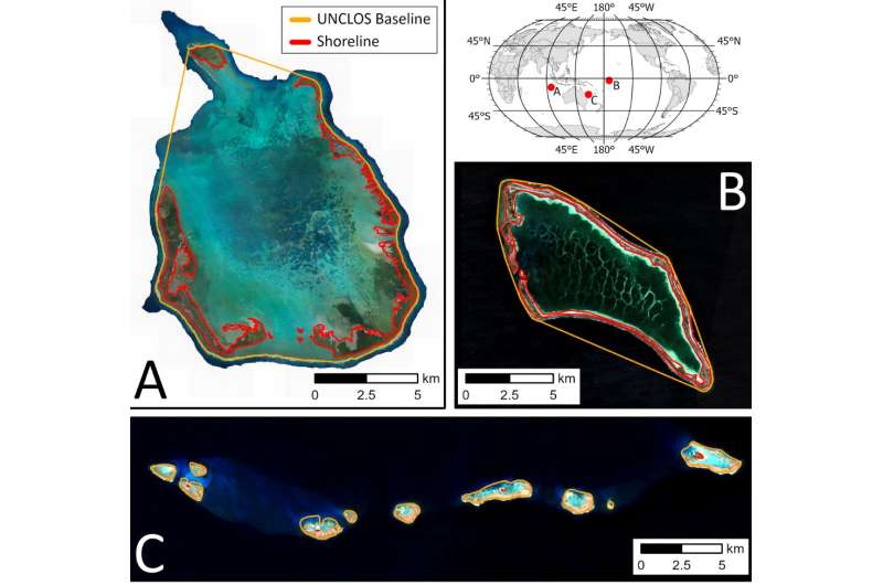 Coral reef island shorelines (red) and UNCLOS baselines (orange) at (a) Cocos Keeling Island, Australia (b) Kanton Reef, Kiribati, and (c) Wreck Reef, Australia.
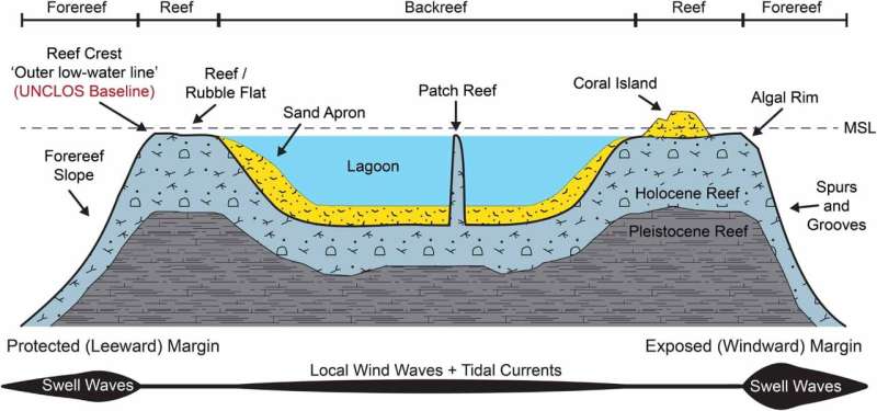 Cross-section of coral reef geomorphic zones, showing wave energy gradients, sedimentary features (islands, sand aprons and lagoons) and UNCLOS baselines.
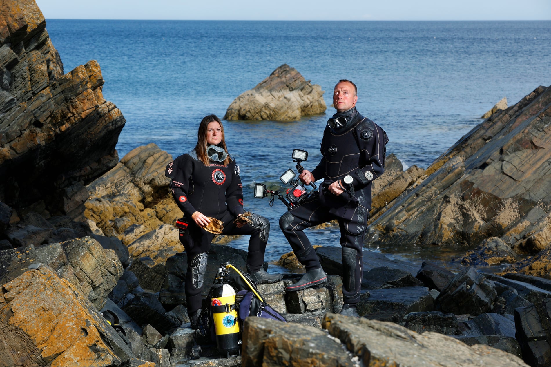


