Sunday, December 31, 2023

Norway (NHS) layer update in the GeoGarage platform

73 nautical raster charts updated


"The Seven Sisters" is located on the northern side of Geirangerfjorden, 
and directly across the fjord lies a single waterfall called "The Suitor".
 
The legend of the seven sisters is that they dance playfully down the mountain.
Meanwhile, across the fjord, the suitor (or courter) flirts playfully with them from afar.
This footage is taken in early summer when the snow melting from the high mountain peaks are making the waterfalls bigger and more majestic.

We went to the biggest iceberg in the world on RRS Sir David Attenborough | British Antarctic Survey

 ANTARCTICA: Scientists aboard the RRS Sir David Attenborough collected samples of seawater around the A23a mega iceberg, the largest iceberg in the world. New video footage shows the enormous iceberg, some 3,900km2 and 400m tall, stretching out into the distance beyond the research vessel.
Footage was captured by Theresa Gossman, Matthew Gascoyne and Christopher Grey, with additions from Roseanne Smith.
 
From BAS

Dr Andrew Meijers, Chief Scientist aboard the RRS Sir David Attenborough and Polar Oceans Science Leader at British Antarctic Survey (BAS), says :

“It is incredibly lucky that the iceberg’s route out of the Weddell Sea sat directly across our planned path, and that we had the right team aboard to take advantage of this opportunity. We’re fortunate that navigating A23a hasn’t had an impact on the tight timings for our science mission, and it is amazing to see this huge berg in person – it stretches as far as the eye can see.”
 
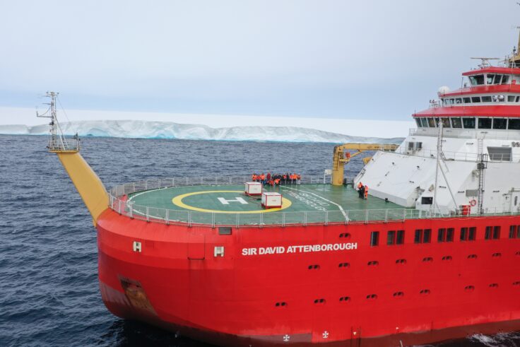
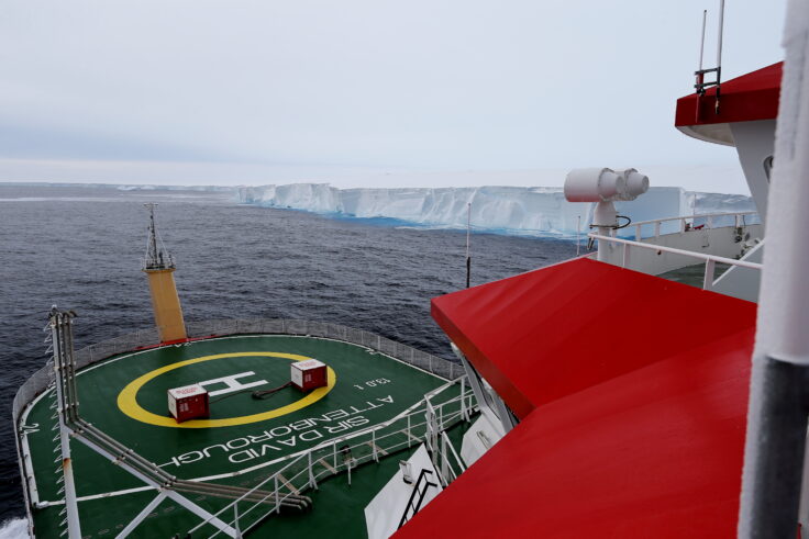
View of A23a from the deck of RRS Sir David Attenborough (Rich Turner)
 
A23a hit the headlines worldwide last week (24 November 2023) after it moved out of the Weddell Sea sector into the Southern Ocean.
It calved from the Filchner Ice Shelf in 1986, before being grounded on the seabed nearby.
A23a is now likely to be swept along by the Antarctic Circumpolar Current into ‘iceberg alley’, putting it on a common iceberg trajectory towards the sub-Antarctic island of South Georgia.
 
A high resolution view of A23a, the world's largest iceberg.
This image was captured by NOAA-21.
courtesy of @CIRA_CSU
 
The RRS Sir David Attenborough passed the iceberg as part of its planned route towards the Weddell Sea, where the team will start the intensive 10-day BIOPOLE cruise.
The cruise, which is the first scientific mission aboard the new research ship, is investigating how Antarctic ecosystems and sea ice drive global ocean cycles of carbon and nutrients.
Their results will help us understand how climate change is affecting the Southern Ocean and the organisms that live there, from microscopic marine plants and tiny copepods to charismatic penguins and whales, and their roles in regulating our climate and keeping our oceans healthy and productive.
 
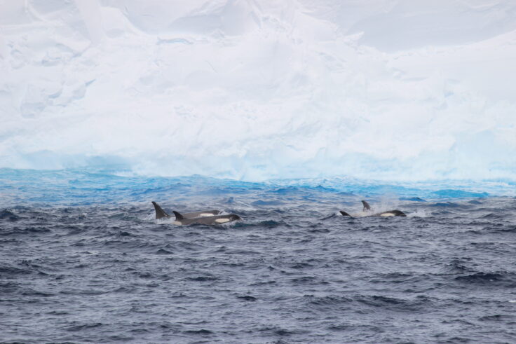
Orca in from of A23a (Liam O’Brien)
 
 Laura Taylor, a biogeochemist working on the BIOPOLE cruise, explained the significance of the A23a samples: 
“We know that these giant icebergs can provide nutrients to the waters they pass through, creating thriving ecosystems in otherwise less productive areas. What we don’t know is what difference particular icebergs, their scale, and their origins can make to that process.
“We took samples of ocean surface waters behind, immediately adjacent to, and ahead of the iceberg’s route. They should help us determine what life could form around A23a, and how this iceberg and others like it impact carbon in the ocean and its balance with the atmosphere."
 
A person riding a wave on a surfboard in the water
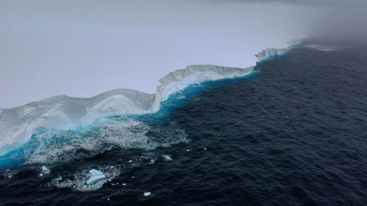
Edge of A23a, 1 December 2023 (Theresa Gossman, Matthew Gascoyne, Christopher Grey)
 
 Professor Geraint Tarling, Principal Investigator on the BIOPOLE Programme and Ecosystems Science Leader at BAS, says:

“Calving of icebergs from Antarctica’s ice shelves is part of the natural life cycle of glaciers. Polar ecosystems play a crucial role in regulating the balance of carbon and nutrients in the world’s oceans and are impacted by melting icebergs in numerous ways. The data being collected will improve our understanding of these processes and their sensitivity to climate change.”
 
 
RRS Sir David Attenborough in front of A23a iceberg, 1 Dec 2023
(Credit. Theresa Gossman, Matthew Gascoyne, Christopher Grey)
 
Links :

Saturday, December 30, 2023

Expedition to the end of the world

A grand, adventurous journey to the last uncharted areas of the globe. 
Yet no matter how far we go, and how hard we try to find the answer, the ultimate meeting is with ourselves and our own transience.
A real adventure film – for the 21st century.
On a three-mast schooner packed with artists, scientists and ambitions worthy of Noah or Columbus, we set off for the end of the world: the rapidly melting massifs of North-East Greenland.
An epic journey where the brave sailors on board encounter polar bear nightmares, Stone Age playgrounds and entirely new species.
But in their encounter with new, unknown parts of the world, the crew of scientist and artists also confronted the existential questions of life.
Curiosity, grand pathos and a liberating dose of humour come together in a superbly orchestrated film where one iconic image after the other seduces us far beyond the historical footnote that is humanity.
A film conceived and brought to life on a grand scale - a long forgotten childhood dream lived out by grown artists and scientists.

Friday, December 29, 2023

Scientists studying Antarctic Circumpolar Current to take closer look at 'heat flux gates' letting in warmer water

Satellite data is helping scientists understand the Antarctic Circumpolar Current

 From ABC by Jano Gibson
 
The Antarctic Circumpolar Current surrounds Antarctica like a force field, keeping out warmer waters, but scientists are worried about breaches.
They are concerned eddies spinning off from the current act as gateways to let warmer water reach the icy continent, speeding up melting.
What's next?
The researchers will embark on the RV Investigator on Wednesday and deploy high-tech monitoring devices in the Southern Ocean to better understand the problem.

It is the planet's strongest flow of water and behaves like a climatic force field in the Southern Ocean.
"The Antarctic Circumpolar Current flows around the icy continent from west to east and acts as our safety belt so that the warm water doesn't reach the Antarctic and melt the ice," the CSIRO's Benoit Legresy explained.

But scientists are concerned that eddies spinning off from the current are acting as a "gateway" for warmer waters to enter the frigid zones.
"If you get this warm water towards Antarctica, it starts to melt glaciers and then we have [a] runaway [situation] of ice melting into the ocean and rising sea levels," he said.
 

Scientists are concerned the warmer water will speed up the melting of Antarctic ice, leading to rising sea levels.
(Supplied: AAD/Jan Lieser)

To better understand the process, Dr Legresy and a team of Australian and international scientists are about to embark on a month-long voyage on board the CSIRO's research vessel, RV Investigator.
"There are five 'eddy heat flux gates', or hot spots, identified around the Antarctic Circle and they're acting as a gateway for the heat to go south," he said.
"We're going to track down those small features that we think explain the heat seeping into polar waters."
 

Dr Benoit Legresy on board CSIRO's RV Investigator
(Supplied: CSIRO)

Deep-sea 'gliders' to reach a depth of 1,000m


The researchers will deploy a range of high-tech observational equipment once the ship reaches one of the heat transfer zones, about halfway between Tasmania and Antarctica.

The equipment includes three autonomous deep-sea ocean "gliders", which can sample the water column down to a depth of about 1,000 metres.
 

The deep-sea ocean gliders will be deployed for six months in the Southern Ocean to study the "heat flux gates".
(Supplied: CSIRO)

The gliders will traverse a vast section of the Southern Ocean over a six-month period, automatically surfacing to transit data.

A floating monitoring system known as a tall mooring will also be deployed.

The device, which includes 35 instruments that measure currents, temperature salinity and oxygen, will be anchored in the middle of the research area and collect data for 18 months.
 

Anchors for the tall mooring, weighing 1.5 tonne each.(Supplied: CSIRO)

Other equipment will be towed behind the RV Investigator to gather information about the velocity, temperature, salinity and turbulence of the water.

The researchers hope all the data they collect will complement high-definition imagery captured by a "revolutionary" satellite jointly developed by NASA and the French space agency, CNES.

The Surface Water and Ocean Topography (SWOT) satellite, which is far more accurate than previous satellites, can map currents by detecting small height variations on the ocean's surface.
"Our first images already show the incredible two-dimensional structure of ocean eddies and fronts, and how they are stretched and strained by the turbulent ocean," CNES SWOT ocean lead, Dr Rosemary Morrow, said.

"The new SWOT observations, combined with measurements taken on the RV Investigator, will usher in a new era by extending our knowledge from on-dimensional sections to the full 3D ocean variations."

Unprecedented changes highlight importance of voyage
 

Australian research ship, RV Investigator, at sea.
The Investigator's sonar sensors, used to map the seabed, have also helped rediscover shipwrecks, including MV Blythe Star and the SS Iron Crown.(Supplied: CSIRO)

The RV Investigator has been uncovering secrets of the deep since 2014 and notched up its 100th voyage earlier this year.

When it departs Hobart on Wednesday, it will be carrying 54 people on board, including 20 crew, 20 scientists and 14 support staff.

While the Southern Ocean's heavy seas might cause some interruptions, the scientists plan to conduct research 24 hours a day, split evenly between two teams.
One 12-hour shift will be led by Dr Legresy, with the other stint overseen by Associate Professor Helen Phillips from the Australian Antarctic Program Partnership at UTAS.
 

Associate Professor Helen Phillips says scientists want a better understanding of how heat passes cross the current.
(Supplied: CSIR0)

Associate Professor Phillips said the voyage will provide important information at a time of unprecedented changes, including significant reductions in Antarctic sea ice.

"What's surprising to scientists is the speed at which these changes are happening," she said.
"This incredible reduction in the sea ice was way outside the bounds of what we might have expected and so there are surprises in the climate system.
"Understanding better how the heat moves across this current, that's a barrier to that heat, will really help us understand how much heat is moving southward to Antarctica to affect that sea ice."
 
20 millions year old mountain range found near Antarctica with 4 underwayer volcanoes
during the FOCUS voyage
An especially prominent volcanic seamount that the researchers dubbed "Mt. Doom" (CSIRO)  

The data collected during the trip will support research programs at the CSIRO, the University of Tasmania as well as institutions in the United States and Europe.

The RV investigator is scheduled to return to Hobart on December 20.

Thursday, December 28, 2023

The ghost ship Octavius: adrift at sea for 13 years

The Octavius was a legendary 18th-century ghost ship.
The story goes that it was discovered off the coast of Greenland in 1775.
Initially assumed to be empty upon being sighted, when boarded, a spine-shivering sight awaited. Below the deck, they came across the entire crew, completely frozen.
The captain sat rooted, almost stoically, at the table in front of him with a pen still in hand and his log laid out before him.
Written there was the log’s last entry, dated November 11, 1762, and its last recorded position marked their location about 250 miles north of Alaska’s arctic coast.
The ghost ship had been adrift for thirteen years before its discovery, meandering aimlessly for hundreds of miles.
Though it is a great story, there is no proof of whether the ship existed or not.
Image : Gustave Doré, The albatross, the Rime of the Ancient Mariner)

From History Defined by Justin Brown


The world’s oceans are vast and can be lonely, uninviting places.
Nevertheless, explorers have scoured the seas for centuries, uncovering all manners of oddities and mysteries.
Many such legends of the sea exist today.
But, if they were compiled and written down, the pages would be littered with a unique, mysterious type of story – ghost ships.
And almost none are as notorious as the ghost ship Octavius.
 
 
What are Ghost Ships?

Ghost ships, or phantom ships, are those found without living crew.
Such a ghostly vessel could be entirely fictitious, a product of folklore or mythology like the Flying Dutchman, or they can be genuine occurrences.

Real ghost shis, unmoored and wandering the seas, crop up now and again, the crew having vanished – or worse, found deceased.
One such famous example, the Mary Celeste, was discovered deserted in the middle of the Atlantic Ocean.
To this day, no one has any idea what happened to her crew.
However, some tales are more unnerving than the rest.
They send a chill down your spine, conjure up questions and confusion, and haunt the minds of sailors at night.
None more so than the chilling story of the Octavius.
 
The Flying Dutchman (Charles temple Dix, 1860)
 
The Ghost Ship Octavius

The Octavius was an 18th-century ghost ship discovered off the coast of Greenland in 1775.
Initially assumed to be empty upon being sighted, when boarded, a spine-shivering sight awaited.
Below the deck, they came across the entire crew, completely frozen.
The captain sat rooted, almost stoically, at the table in front of him with a pen still in hand and his log laid out before him.
Written there was the log’s last entry, dated November 11, 1762, and its last recorded position marked their location about 250 miles north of Alaska’s arctic coast.
The ghost ship had been adrift for thirteen years before its discovery, meandering aimlessly for hundreds of miles.
And the complete picture is even more chilling.

The Herald’s Discovery

As the story goes, the Octavius was found on October 11, 1775, by the whaling ship Herald.
The whalers had been working in the frigid waters when they noticed a vessel drifting not far in the distance, its sails still flying.
After signaling to the ship and getting no response, a boarding party was cobbled together.
The sailors leaped aboard the Octavius expecting to meet its crew, but to their surprise, they were met with an eerie silence and a barren deck.
Confused, the boarding party continued below. And what they saw would shake them to their core.

On Board a Ghost Ship

Every one of the 28 crew members was found frozen solid.
In the captain’s quarters, a woman and young boy were discovered, also fully encased in ice, and among them, the captain seated at his desk, pen frozen between his fingers, his logbook open in front of him.
In a mad hurry, terrified by what lay in front of them, the men dashed off the ship, but not before ripping away what they could of the captain’s log.
Back on their whaling ship, they managed to piece together the tale of the Octavius from what remained.
Its last marked position had been about 250 miles north of Utqiagvik, Alaska, a place today known as Point Barrow.
Lifeless and uninhabited, the ghost ship had somehow wandered hundreds of miles through the ice. Alone it drifted for thirteen years before finally being chanced upon by the Herald.

Octavius’ Departure and Disappearance


Before the unfortunate demise of its crew, the Octavius left England in 1761 on a journey to China. There they unloaded their cargo and planned to return home with new, exotic goods to sell in the British markets.
It was at this point their captain made a fatal mistake.
Aiming to seize the unseasonably warm temperatures, the captain set a course for the then-undiscovered and unproven Northwest Passage.
A risky gamble, one can imagine dreams of fame and glory dancing through his mind.
However, the ship would never be seen again, eventually being declared lost to the sea.
The treacherous, icy passage had never been conquered (and wouldn’t be until 1906) for a good reason. Upon rounding the northernmost tip of Alaska and entering the narrow, frigid straights, the Octavius likely found itself trapped in the sea ice, never to escape.
Never to escape alive, that is. If the legend of the ghost ship Octavius is true, its crew would have posthumously traversed the Northwest Passage – the first ever to do so.
Yet, that does raise a key question.

Was the Ghost Ship Octavius Real?

The truth behind the Octavius is difficult to determine.
One of the world’s strangest mysteries, the details seem to have been passed down for decades, but a primary source recounting the tale is still sorely lacking.
Furthermore, neither any additional information from official sources nor artifacts from the ship – like the captain’s log – have ever surfaced.
Then again, it’s possible that the story of the Octavius was truthful.
If a ship were found with its crew frozen near the rumored exit point of the fabled Northwest Passage, one can imagine how time could warp such a story into a myth of legendary proportion.

Where is the Octavius now?


After the Herald crew fled the ghost ship’s deck, the Octavius was never seen again.
Believing it to be cursed, the whalers abandoned the vessel, watching it drift away at the ocean’s mercy.
Whether the wind took it or it inevitably sank beneath the waves, its true location – its final resting place – is uncertain.
No vessel has ever been found, and it is likely none ever will be.
If Octavius and its frozen crew indeed did exist, it would seem they are destined to remain lost to us forever. But in the end, their legend lives on.

Wednesday, December 27, 2023

How ancient navigation techniques can still help sailors today


From Yachting Monthly by William Thomson
 
You may not need to rely on ancient navigation skills, but they can enrich your sailing, and enhance your sense of when something isn’t right, says William Thomson

Yacht navigation can be defined as knowing which way to go.
This sounds simple, but to do it you need to process three complex pieces of information.
Firstly, you need to know where you are.
Secondly, you need to know where your destination is.
Thirdly, you need to be aware of the hazards lie between you and your destination.
Computing this information is no easy feat, but luckily for modern sailors the world’s greatest minds have spent the past several thousands of years making it easier for us, culminating in the technological wonders many of us carry aboard today.

Most modern boats have several units giving your precise latitude and longitude; aboard my catamaran Luna we have an Icom IC-M506 radio with in-built GPS, an Iridium Go! and an iPhone.
That’s the position sorted.
As for the destination and hazards, we have chartplotters, paper charts, pilot books (both paper and digital) and navigation apps.
With all this information
to hand, all we need to do is push a button on the autopilot and the boat practically navigates itself.

What do you do then? Watch the birds fly past, the clouds scuttle along the horizon, the sun arc across the sky to cast a golden light over the waves as dusk falls and the stars light up the night in a dazzling array of light.
While these natural elements shape the beauty of the environment we sail in, they have another benefit, one of great value that few people make use of – they can help you navigate.


Ancient navigators were experts at reading clouds.
Photo: William Thomson

I have long been fascinated in natural navigation, a lifelong passion that took me to Tahiti last year.
Why there? Because it was in Polynesia that, thousands of years ago, ancient seafarers ventured out into the vast Pacific Ocean in canoes made from stone-age tools, using nothing but the stars, swell, birds and clouds to guide them.
If that wasn’t miraculous enough, they then charted hundreds of islands over an area of water larger than the continental United States, using no tools or instruments.

The purpose of my Polynesia trip was to learn how they achieved these feats and explore if their skills could be used alongside high-tech systems on modern boats to enhance our sailing navigation.
This article shares what I discovered.

It’s unlikely that using the techniques outlined below will ever be your sole source of position finding (though you never know), but as every good navigator knows, you should never rely on a single source of information alone.
It’s often something ‘not feeling right’ that alerts us to the fact that the GPS has gone on the blink, that the tide has pushed us further off course than we thought, or that the weather is brewing up something nasty despite a promising forecast.


Sailing at an angle to the swell, or noticing when the swell changes, can keep you on course.
Photo: Alamy Stock Photo

If nothing else, having a better understanding of the environment through which we’re sailing stops us being hypnotised by screens to be in the present moment and take in the beauty around us.

Yacht navigation using clouds


To the trained eye, clouds are like a neon sign hovering over an island or land mass, guiding you in from many miles away.
In perfect conditions, even a beginner can’t fail to notice cumulus piled up in an otherwise clear blue sky and it’s often the first clue of land many navigators experience when crossing the English Channel.


Clouds will tend to build on the windward side of an island and peter out to leeward.
Photo: William Thomson

The theory goes that as the land heats up faster than the sea by day, the hot air rises until it cools at altitude, condensing into cloud.
This means the cloud will hang directly above the island like a signpost.
The distance you first see the island depends on its altitude; a low-lying atoll or archipelago like the Isles of Scilly can only be seen at sea level from around 10-15 nautical miles, but the clouds above the island increases that distance by considerable margin.

If you’re heading towards a landfall in an area with strong cross-currents, the cloud can give you a quick and easy way to spot if your COG is taking you off track.
Simply set the autopilot on the bearing of where the island should be and keep track every so often to check whether you’re still pointing at the cloud.
I found this technique incredibly useful when sailing from Belle Isle to Île d’Yeu on France’s Biscay coast; an unusually strong ebb coming out of the Loire was pushing us off course more than I had accounted for.


Clouds forming over land are often visible long before the land itself.
Photo: William Thomson

Solitary cloud

With no visual sight of land in any direction it was impossible to get a sense of this, except for a solitary cloud hovering above Île d’Yeu telling us we were heading off course because we regularly needed to change our heading to stay on track.
This resulted in us steering further north than I had planned for, but sure enough, we ended up exactly where we needed to be thanks to the cloud.
This technique would be equally useful for double-checking your course to steer calculations when sailing out to the Scillies with the strong cross-currents off Land’s End.

On most days, it’s rarely a single cloud you’ll see.
More often than not, a 360º scan will reveal clouds of all shapes and sizes.
Which ones represent land? A key feature to look for is the movement of the cloud.
Generally speaking, most clouds at the same altitude will be moving roughly the same speed and direction, with the wind.
But the ones over land will have a sense of moving slower.
On the windward side of the island there will be an appearance of ‘piling up’ as new air flows over the island, while on the leeward side there will be a fizzling out effect as the air blows out to sea.


The volcano Stromboli.
Photo: Marcel Rabelo / Alamy Stock Photo

Direction and colours

While you’re scanning the clouds, if there are high altitude wispy cirrus you can also use these to get your bearings.
Study them over a period and note which direction they are travelling; in settled conditions they are likely to be continuing that way for several hours, giving you a guide to navigate by.
One quick tip for working out if a cloud is over land is to look at the colour of its underside, an observation that Polynesian navigators regularly employed.
The idea is that sunlight is reflected off a beach, lagoon or reef and creates a colour on the bottom of the cloud.

With this knowledge, they knew what type of island to expect before it even appeared in sight – this was especially useful when exploring new islands.
As a general rule, pink means there’s a reef, bright coloured means it’s a dry reef, whiter means there’s an expanse of sand, darker means there’s thick vegetation, and green means there’s a lagoon.
An island in the Tuamotus called Anna has such a vast lagoon that even when there are no clouds, the entire sky has a green tinge to it, leading a navigator into the sanctuary of its lagoon.

A very different type of cloud, but equally useful to navigators, is the type coming out of volcanoes.
While there are many of these in the Pacific, the Mediterranean is also a tectonic convergence zone.
Mount Etna in Sicily and the Italian island of Stromboli are perfect examples, with a regular stream of cloud coming from their summits.


Striking out across the tide to the low- lying Île d’Yeu, clouds can provide a reassuring reference.
Photo: Alamy Stock Photo

The air vapour resembles a pennant in the breeze, like smoke from a chimney, sharing another secondary piece of information to the tuned-in navigator by indicating the wind direction.
This flag-like effect is also clearly visible in Gibraltar, with the Levanter cloud streaming away to the west.
This happens anywhere moist air rises up a slope; I noticed it once off Rame Head near Plymouth Sound.

Yacht navigation using birds


In the tropics of the Pacific, Indian and Atlantic, birds are a navigator’s best friends, our eyes in the sky.
But not all birds are useful; the trick is to know which ones to look out for.

The four main types that are practical for navigation include the frigate-bird, the white tern, brown noddy and brown booby.
While each has its own unique behaviour, they share fundamental behaviours that can be of assistance; they (almost) always sleep on shore, flying out to sea at dawn and then returning to land at dusk.
Knowing this daily routine, by sailing in the direction birds have come from at sunrise, or following them at sunset, you can be confident you’re heading towards land.


A puffin heads home with food.
Alamy Stock Photo

Tern towards land

One exception to this rule is the white tern, during nesting season.
When they have chicks in the nest they fly out before dawn to catch fish, which they take to the nest before heading back out to sea at dawn.

Which months are nesting season? You don’t necessarily need to know; simply look at the mouth of the tern at dawn and see if they have a small fish horizontally across their mouths.
If they do, they’ll likely be heading towards land.

The same trick could be used for puffins in northern waters, though many immature puffins don’t return to land at all in their early years.
As with many things in natural navigation, a single clue could be an anomaly, but if you also notice ten noddies flying the opposite way, and a different shaped cloud in the direction the tern is flying, you can make an educated deduction.

As well as helping you find the direction of land, these four birds can also tell you how far you are from it.
This is because each type usually stays within a set distance from shore.
Frigate-birds are the furthest ranging, often soaring high up on the thermals 75 miles offshore.
Brown boobies are the next most adventurous, heading 30 miles out to sea.

Brown noddies and white terns rarely fly more than 20 miles from land, making them a clear indicator that you’re close.
Remember that their flight patterns are only of use at dawn and dusk; during the day they’re thinking of fish, not land.


Gannets on their migration north fly in formation across the English Channel.
Photo: Theo Stocker

In addition to the four diurnal seabirds, we can use migratory species to get our bearings; the Polynesians reputedly observed the long-tailed cuckoo, which migrates from Polynesia to New Zealand every September.
As a general rule, flocks of migratory birds in the northern hemisphere will fly south in the autumn to Africa, then return to northern Europe in the spring when things start heating up again.

Two types that follow this pattern are the gannet and the black-backed gull.
How do they do this? We don’t know exactly, but researchers have discovered that birds memorise iconic landmarks along the journey, use the earth’s magnetic field and even navigate by the stars.

Under pressure

Closer to home, seagulls can be especially useful for a navigator – but not for finding land.
Birds have a receptor in their ear called a vitali organ that makes them highly sensitive to changes in atmospheric pressure.
Birds can sense subtle changes long before we do, modifying their behaviour to prepare for bad weather.

Changes include eating more to compensate for the loss of feeding time during the storm, finding somewhere to take shelter and flying in tight circular flocks to adjust their sense of balance and direction in response to the changing air pressure.
If you notice these patterns, be prepared for wind and rain.
An added clue is that because the vitali organ makes birds so sensitive to atmospheric changes, when air pressure is falling they fly lower to relieve the discomfort because air is denser at sea level.


Orion is one of the best known constellations and provides a number of key navigation stars.
Photo: Richard Langdon

Yacht navigation using stars

Stars were the foundation of Polynesian navigation and you can use them to guide your night passages today.
In 2020 I wrote a series for this magazine exploring the basics of astro-navigation, but a new technique I learnt about on the Pacific trip was the use of horizon stars.
This is based on the principle that from your location, a star will always rise at exactly the same position.
It will then set at a mirror image (not reciprocal) bearing.
For example, if a star rises due east it will set due west, but if it rises north-east it will set north-west.

The exact bearing a star rises and sets depends on your latitude and the star’s declination (celestial latitude), but the easiest one to remember is Alnilam, the central star in Orion’s infamous belt.
Because Alnilam’s declination is 01º north, it rises and sets almost due east and west from anywhere in the world.
In contrast, Arcturus, with a declination of 19ºN, rises ENE and sets WNW.
Sirius, the brightest star in the sky, rises ESE and sets WSW because it’s declination is 17ºS.


A Polynesian navigation tool.
Photo: imageBROKER.com GmbH

Star tools

With 58 navigational stars, there will be one rising or setting on almost any cardinal point.
A great way to learn your constellations is with the SkyView Lite app; it’s free and by pointing your phone at the sky it shows you what star you are looking at.

For a list of the navigational stars and their co-ordinates, you can download a DIY Star Calculator at www.tide-school.com and it will also help you work out what time of year each star is best observed.
The Polynesians knew all this and used horizon stars to chart the Pacific, learning the bearings between islands in relation to where a star rose and set.

These days we have charts, and with a paper version you know the relative positions of nearby harbours.
So you can use the stars to help you hold a steady course rather than staring into the compass, to shape a course in the event of electrical malfunction, or just to test your skills.
Because winds and currents can take you off course, using the stars is not an exact science – but it doesn’t need to be.
Close to your destination clues start appearing, like birds, clouds and swell patterns, drawing you to shore like a magnet.


Most skippers will be aware of the boat’s motion over the waves.
When this changes it should sound alarm bells.
Photo: Richard Langdon

Yacht navigation using waves

There is a myth that Polynesians could navigate with their testicles.
This comes from the fact that they were so highly tuned to the motions of their vessels, noting minor changes and discerning valuable navigation information.
A fundamental technique was to feel the motion of the canoe at night while they were steering a precise course with the stars.

When dawn broke and the star compass disappeared, they would stay on track by maintaining exactly the same pitch and roll of their catamarans.
Too much of one or the other and they would adjust their bearing until the night, when they could reposition themselves with the stars.

The real benefit of tuning into the swell, for a modern sailor, is to notice any changes in your local environment – this is perfect if you are down below or at night when you can’t see what’s around.
A shift in the boat’s movement could indicate the tide has turned so now the tidal stream is going into the swell, making choppier seas.


Entering Burnham Harbour with the swell breaking to starboard and the small buoys just visible.
Photo: Ken Endean


It might mean the crew have accidentally steered off course, the boat is overpowered or that a new storm swell has appeared.
These are all considerations to note – but the most immediate is to check there is not a sudden shallowing of the sea bed.
This is especially vital in places with a sandy sea bed, where strong currents and storms can dramatically change the bathymetry since the last chart was made.

The Goodwin Sands is a notable place where this happens; a catamaran I was once on showed 1m under the keel when the chartplotter indicated 20m depth.
Lucky we weren’t in a monohull or we’d have run aground.

At other times, a change in swell indicates an island is nearby.
The simplest way to understand this is to think of a swell hitting a seawall and bouncing off; you can see this on a small scale in many harbours in the UK, especially Dover and Brighton., but any steep-to coastline will produce these ‘claptotic’ waves some way offshore.


This aerial view of the Isles of Scilly shows a cross-swell pattern and potentially confused seas to the east.
Photo: Alamy Stock Photo

Long distance

On a much larger scale, a sailor I met in the Pacific told me he had felt this effect 100 miles off the Marquesas, a steep archipelago of islands that rise precipitously up from the deep ocean and rebound swell that has travelled all the way from South America.
Closer to home, the effect is best observed on our Atlantic shores that experience long-period goundswells – especially in Europe where the continental slope is narrower.

In contrast to the bounce-back effect on the ‘upswell’ side of islands, a very different pattern happens on the ‘downswell’ side.
Immediately in the lee, as you would expect, is a swell shadow of smooth water that is perfect for anchoring if it coincides with an offshore breeze.
But what is less known are the areas of turbulent patches known as ‘swell nodes’.
This is where refracted swells that have wrapped around the island converge on the downswell side, making confused seas.


The approaches to the Isles of Scilly can be choppy, even in the islands’ lee

Unbeknown to me at the time, I navigated us into one of these horrible patches to the north-east of the Isles of Scilly last summer, when a south-west swell was rolling in from the Atlantic.
At the time I had no idea what was making it and I found it quite unnerving, not knowing if I was taking my nervous partner and two young children into even rougher waters or not.

In essence experiences like this are why we study the art of navigation; because it helps us better understand the sea so we can shape a course that keeps our crew both happy and safe.


Tahiti and the Pacific islands remain an idyll for sailors.
Photo: William Thomson

Conclusion

Ancient Polynesian navigators would have loved our modern technology.
The reason for their lack of tools and instruments was not because of a lack of sophistication, but a result of their geographical isolation from the rest of the world.
Pacific seafarers were intellectual pioneers, constantly developing new techniques and navigation systems using the elements around them.
There’s no doubt a master navigator would have accepted the offer of an iPad in his canoe, with up-to-date information on the weather, swell patterns, position, depth and speed.

But for all this love of tech, elite navigators would never have turned their backs on natural navigation.
Why?
Because the technology we have doesn’t make the decisions.
We do.
The tech’s job is to give us accurate information from which to make a decision.
We interpret the data, study the chart, choose waypoints and then shape our course.
Natural navigation helps us do this by adding another layer of intelligence to the process.
Ultimately, this makes us better informed when choosing which way to go.
 
Links :

Tuesday, December 26, 2023

El Niño is nearing historic strength. What this means and when it will end.

Sea surface temperature differences from normal show abnormally warm waters over the eastern and central tropical Pacific Ocean, indicating strong El Niño conditions. 
(earth.nullschool.net)

From The Washington Post by Scott Dance

El Niño is nearing historic strength. What this means and when it will end.
This could be one of the strongest El Niño events observed over the past 75 years, new data shows


The climate pattern El Niño that has pushed the planet to record warmth over the past six months is nearing its peak, potentially as one of the strongest El Niño events observed over the past 75 years, new data show.

Growing water-temperature anomalies and strengthening abnormal wind patterns over the central and eastern equatorial Pacific Ocean suggest the extreme weather impacts for which El Niño is known will continue — if not accelerate — around the world.
What happens in that zone of the Pacific has cascading effects around the globe.

That includes ongoing heat waves, drought and fires in Australia, deadly floods in Kenya, and drought and floods in parts of South America. In the United States, it is likely to mean more heavy rain along the Gulf Coast and in Florida, which has experienced major recent flooding, and wet and stormy conditions in California, a pattern that has been forecast to set in soon.

At the same time, scientists now see a coming end to the present El Niño.

Climate models suggest it is more likely than not that El Niño conditions dissipate by June, returning the Pacific to what are called neutral conditions — the absence of El Niño and its foil, La Niña — according to analysis published Thursday by the National Oceanic and Atmospheric Administration’s Climate Prediction Center.

What happens next is anyone’s guess, said Andrew Kruczkiewicz, a senior researcher at the International Research Institute for Climate and Society at Columbia University.
“How long will we stay in neutral? That’s one of the big questions we’re going to be asking more and more,” he said. “We don’t really have a strong indication either way.”

La Niña conditions have developed in the fall after five of the past six strong El Niños.
 
Halan Subeir Salat tries to collect some of her belongings in Garissa, Kenya, on Nov. 20 after flash floods.
The Horn of Africa experienced torrential rain and flooding linked to the climate pattern El Niño. (Luis Tato/AFP/Getty Images)

A strong El Niño with uncertain effects

El Niño is known for warmer-than-normal waters along the equator in the eastern and central Pacific, a pattern that drives wet and stormy weather to some parts of the planet while starving others of moisture. Recent observations in that area show heat continues to build in the ocean surface, influenced by unusual wind patterns blowing in from the west.

The conditions are so pronounced that the climate center forecasts a 54 percent chance that this becomes a historically strong El Niño.

“An event of this strength would potentially be in the top 5 of El Niño events since 1950,” the center’s forecasters wrote — meaning it would be in the same class as El Niño events in 2015-2016, 1997-1998, 1982-1983 and 1972-1973.

Those events are remembered for devastating floods, droughts and wildfires around the world. The most recent extreme El Niño pushed the planet to what were then record-high annual average temperatures in 2016.
A record-warm 2023 is already certain to break that record, and some climate scientists are suggesting it could be pushed even higher in 2024.

In which places this El Niño brings more weather extremes, and what kinds, depends on how it interacts with other climatic patterns and fluctuations.
Other phenomena that can dictate dominant local weather patterns include episodes of sudden stratospheric warming, when polar temperatures dramatically rise and frigid air shifts toward lower latitudes, and the Madden-Julian Oscillation, a pattern across the Indian and Pacific oceans that was largely responsible for last winter’s wet and snowy conditions in the American West.

“Each event is a little bit different,” said David DeWitt, the climate center’s director.

A transition away from El Niño — but to what?

So far, climate models’ predictions have largely been borne out as El Niño has developed, although few, if any, scientists predicted the record-setting warmth that has dominated the planet since July.
Now, those models predict a 60 percent chance that El Niño will fade away between April and June.

By late summer, the chances of neutral conditions and of a budding La Niña appear about even, according to NOAA, with both estimated at between 40 percent and 50 percent.
La Niña is known for cooler-than-normal waters across the central and eastern equatorial Pacific and is associated with intense Atlantic hurricane seasons, mild and dry U.S. winters and wet conditions in Southeast Asia, Indonesia and Australia.

But a resurgence of El Niño also is possible next fall, Kruczkiewicz said.
There is historical precedent for all outcomes.

Regardless of whether this El Niño has peaked or will peak soon, it will continue to affect global weather patterns for months to come, DeWitt said.
The Pacific will remain unusually warm at least through the winter.
“You can’t get rid of that much heat really fast,” he said. “It’s going to hang on for several months.”

If La Niña returns by the fall, it would tilt the odds toward another active Atlantic hurricane season.

Links :

Monday, December 25, 2023

The deadly Sydney to Hobart Yacht Race (1998)


Six sailors died and five boats were lost when a terrifying storm hit Bass Strait during the 1998 Sydney to Hobart yacht race.
Look back at this investigation by Debbie Whitmont for Four Corners, that retraces the horrific events that unfolded why it was so unexpected. 
 
Links :

Sunday, December 24, 2023

Going Greenland


Going Greenland from Mountain Hardwear
In this award-winning documentary, Going Greenland, MHW athlete Rachael Burks and her ski partner Jessica Baker combined a renewable energy sailboat with an arctic ski expedition in Greenland, enduring a harrowing and inspiring journey along Greenland’s west coast fjords and towering mountains.
Explore more at mountainhardwear.com/going-greenland.html
 
Links :

Saturday, December 23, 2023

Panama canal ancient maps

Maps of proposed Panama Canal between Gorgona and Panama City]. Section A (1895 ?)
source : LOC 
 

1895 Compagnie Nouvelle du Canal de Panama Map of the Panama Canal

1911 Antique PANAMA CANAL Map of the Panama Canal
 
Panama Canal - Pacific Coast Approaches - 1913
 
1916 
 
 1921

Friday, December 22, 2023

The extended continental shelf (ECS) : announcement of U.S. Extended Continental Shelf Outer Limits

The World Map of Extended Continental Shelf Areas depicts areas of ECS asserted by coastal States worldwide, as of the date of publication of this map.
Combined, these ECS areas cover approximately 9% of the ocean’s seabed.

 
Unilateral declaration of extension of the continentalshelf by the United States.
Note : The United States have not ratified the United Nations Convention on the Law of the Sea (UNCLOS). They therefore cannot have their claims validated by the Commission on the Limits of the Continental Shelf (CLCS)
 
The continental shelf

The continental shelf is the extension of a coastal State’s land territory under the sea. Under customary international law, as reflected in Article 76 of the 1982 Law of the Sea Convention (Convention), the continental shelf consists of the seabed and subsoil that extends (1) to the outer edge of the continental margin, or (2) to a distance of 200 nautical miles from the coast if the outer edge of the continental margin does not extend up to that distance.
This legal definition is different from the geological definition of a continental shelf.
The continental shelf is an important maritime zone that holds many resources and vital habitats for marine life.

The extended continental shelf (ECS)

The extended continental shelf, or ECS, refers to that portion of the continental shelf beyond 200 nautical miles from the coast (Figure 1).
See the World Map of ECS areas above.
ECS is a term of convenience; under the Convention, the term “continental shelf” includes both continental shelf within and beyond 200 nautical miles.

Figure 1: Maritime zones under the international law of the sea. ECS is that portion of the continental shelf that extends beyond 200 nautical miles.
 
Determining the outer limits of the ECS

Determining the outer limits of the ECS is different from determining the extent of other maritime zones, such as the territorial sea and exclusive economic zone. 
 These other maritime zone limits are determined based on a specified distance from the coastal baselines (Figure 1).

The outer limits of the ECS, however, depend on the geophysical characteristics of the seabed and subsoil. ECS limits are determined using complex provisions set forth under Article 76 of the Convention. (The text of Article 76 can be found here. )
A coastal State can use one of two formulas in any combination to determine the outer edge of its continental margin (Figure 2).
Article 76 also contains two constraint lines (Figure 3).
If the outer edge of the continental margin extends past the constraint lines, a coastal State can use either of the constraint lines to maximize its ECS.
The outer limit of the continental shelf is determined by the combined use of Article 76’s formula lines and constraint lines.

As discussed in the Data Collection section of the U.S. ECS website, bathymetric and seismic data are needed to apply the formula and constraint lines.
 
Figure 2: Formula lines under Article 76 of the Law of the Sea Convention. A coastal State can use either formula to determine the outer edge of the continental margin.
 
Figure 3: Constraints under Article 76 of the Law of the Sea Convention.
A coastal State can use either constraint to maximize the limits of its continental shelf.
 
Continental shelf rights

The sovereign rights and jurisdiction of a coastal State over its continental shelf are reflected in the Convention and include the following:Conservation, management, and use of living and non-living resources
Regulating marine scientific research
Construction, operation, and use of artificial islands, installations, and structures
Delineating the course for laying pipelines
Drilling for any purpose
Prevention of marine pollution in connection with some activities
 
Distinction between the continental shelf and EEZ

The continental shelf and the exclusive economic zone (EEZ) are distinct maritime zones (Figure 1). The continental shelf includes only the seabed and subsoil, whereas the EEZ also includes the water column.
In addition, while the maximum extent of the EEZ is 200 nautical miles from the coast, the continental shelf may extend beyond 200 nautical miles, depending on the depth, shape, and geophysical characteristics of the seabed and sub-sea floor.
The ECS is, therefore, not an extension of the EEZ. Some of the rights that a coastal State may exercise in the EEZ, especially rights over water column resources (e.g., fish), do not apply to the ECS. 
 
The United States has ECS in seven offshore areas (Figure 1): the Arctic, Atlantic (east coast), Bering Sea, Pacific (west coast), Mariana Islands, and two areas in the Gulf of Mexico.
The U.S. ECS area is approximately one million square kilometers – an area about twice the size of California.
The United States may also have ECS in other areas, and the U.S. ECS Project continues to analyze available data and undertake analysis in a range of areas. 
 
What is the ECS?
The continental shelf is the extension of a country’s land territory under the sea.
The continental shelf holds many resources (e.g., corals, crabs) and vital habitats for marine life.
The portion of the continental shelf beyond 200 nautical miles from the coast is known as the “extended continental shelf,” or ECS. The ECS includes the seabed and subsoil, but not the water column.
 
The Arctic Region of the U.S. continental shelf is located in the Arctic Ocean, north of the U.S. state of Alaska.
This region is bounded by Canada to the east and the Russian Federation to the west.
The extended continental shelf of the United States in this region extends north to a distance of 350 nautical miles (in the east) and more than 680 nautical miles (in the west) from the territorial sea baselines of the United States.

Where is the U.S. ECS?
The United States has ECS in seven regions: the Arctic, Atlantic (east coast), Bering Sea, Pacific (west coast), Mariana Islands, and two areas in the Gulf of Mexico.
The U.S. ECS area is approximately one million square kilometers – an area about twice the size of California.
The geographic coordinates and maps of the seven U.S. ECS regions are available in the Executive Summary posted on the U.S. ECS website at state.gov/shelf

The Atlantic Region of the U.S. continental shelf is located in the Atlantic Ocean off the east coast of the continental United States.
This region is bounded by Canada to the north and The Bahamas to the south.
The extended continental shelf of the United States in this region extends to between 206 and 350 nautical miles from the territorial sea baselines of the United States.
 
Why determine the ECS limits?

The United States, like other countries, has an inherent interest in knowing, and declaring to others, the extent of its ECS and thus where it is entitled to exercise sovereign rights.
Defining our ECS outer limits in geographical terms provides the specificity and certainty necessary to allow the United States to conserve and manage the resources of the ECS.

The Bering Sea Region of the U.S. continental shelf is located in the northern Pacific Ocean.
This region is bounded by the Alaska mainland to the northeast, the Aleutian Islands (U.S.) to the south, and mainland Russia to the northwest.
The extended continental shelf of the United States in this region is bounded by the 200 nautical mile limit of the United States and by the U.S.-Russia maritime boundary.
It extends to a distance of approximately 340 nautical miles from the territorial sea baselines of the United States.  
 
What are U.S. rights in the ECS?
Like other countries, the United States has exclusive rights to conserve and manage the living and non-living resources of its ECS.
The United States also has jurisdiction over marine scientific research relating to the ECS, as well as other authorities provided for under customary international law, as reflected in the 1982 UN Convention on the Law of the Sea.

The Eastern Gulf of Mexico Region of the U.S. continental shelf is located off the coast of the U.S. states of Alabama, Florida, Louisiana, and Mississippi in the eastern part of the Gulf of Mexico, a small ocean basin surrounded by the United States, Mexico, and Cuba.
The extended continental shelf of the United States in this region is bounded by the 200 nautical mile limit of the United States and by the U.S. maritime boundaries with Cuba and Mexico.
The Western Gulf of Mexico Region of the U.S. continental shelf is located off the coast of the U.S. states of Texas and Louisiana in the western part of the Gulf of Mexico, a small ocean basin surrounded by the United States, Mexico, and Cuba.
The extended continental shelf of the United States in this region is bounded by the 200 nautical mile limit of the United States and by the U.S.-Mexico maritime boundary. 
 
What’s down there?
Much of the ocean – especially the deep ocean – remains unexplored. Continued mapping and exploration of the ECS will be important to gaining a better understanding of its habitats, ecosystems, biodiversity, and resources.

The Mariana Islands Region of the U.S. continental shelf is located in the western Pacific Ocean and includes the U.S. territories of Guam and the Commonwealth of the Northern Mariana Islands. 
This region is bounded Japan to the north.
The extended continental shelf of the United States in this region is located northeast of the Mariana Islands and is bounded in part by the 200 nautical mile limits of the United States and Japan. 
 
How are ECS limits determined?
The continental shelf is defined in the 1982 UN Convention on the Law of the Sea, and the ECS outer limits are determined using the complex rules found in Article 76.
Applying these rules requires knowledge of the geophysical and geological characteristics of the seabed and subsoil.

The Pacific Region of the U.S. continental shelf is located in the eastern Pacific Ocean, off the west coast of the continental United States.
The extended continental shelf of the United States in this region extends approximately 285 nautical miles from the territorial sea baselines of the United States.
 
What information is needed to determine ECS outer limits?
Two primary datasets are needed to determine the outer limits of the ECS.
The first is bathymetric data, which provide a three-dimensional map of the surface of the seafloor.
The second is seismic data, which provide information on the depth, thickness, and other characteristics of the sediments beneath the seafloor.
Geological samples and other geophysical techniques, where available, are used to augment these primary data types.
U.S. data collection began in 2003 and constitutes the largest offshore mapping effort ever conducted by the United States.

Who did the work?
The ECS Task Force, an interagency body of the U.S. Government, coordinated the delineation of the outer limits of the U.S. ECS.
The Department of State chairs the Task Force, leads the ECS Project Office, and manages the project’s diplomatic and legal aspects.
The U.S. Geological Survey (USGS) leads the effort to collect, process, and interpret the seismic and geologic data.
The National Oceanic and Atmospheric Administration (NOAA) leads the effort to collect, process, and analyze the bathymetric data.
Many other Federal and academic partners collaborated to complete the work over the course of more than 20 years.

Is the United States extending its exclusive economic zone (EEZ)? 
No. The ECS is not an extension of the EEZ.
The continental shelf includes only the seabed and subsoil, whereas the EEZ also includes the water column.
In addition, while the maximum extent of the EEZ is 200 nautical miles from the coast, the continental shelf may extend beyond 200 nautical miles.
Some of the rights that a country has in its EEZ, especially sovereign rights over water column resources (such as fish), do not apply to the ECS.

Does the U.S. ECS overlap with the ECS areas of any neighboring countries?
Yes. The U.S. ECS partially overlaps with ECS areas of Canada, The Bahamas, and Japan.
In these areas, the United States and its neighbors will need to establish maritime boundaries in the future.
In other areas, the United States has already established ECS boundaries with its neighbors, including with Cuba, Mexico, and Russia.

Does the Administration still support joining the Law of the Sea Convention?
Yes. Like past Administrations, both Republican and Democratic, this Administration supports the United States joining the 1982 UN Convention on the Law of the Sea.
The announcement of the U.S. ECS limits in no way changes the Administration’s position toward the Convention.  
 
Links :