Saturday, December 2, 2023

1880 Brault map of Pacific ocean winds in July, August, and September

This is an 1880 Léon Brault significant map of Pacific Ocean winds. 
The map is innovative in its expression of both quantitative and qualitative data in relation to wind direction, intensity, and frequency - presaging the work of Matthew Fontaine Maury (1806 - 1873) in the mid-19th century.
A Closer Look Brault's innovative wind roses fill the Pacific and Indian Oceans.
The frequency of calm winds is noted at the center of the wind roses.
 
Description

This is an 1880 Léon Brault significant map of Pacific Ocean winds.
The map is innovative in its expression of both quantitative and qualitative data in relation to wind direction, intensity, and frequency - presaging the work of Matthew Fontaine Maury (1806 - 1873) in the mid-19th century.
A Closer LookBrault's innovative wind roses fill the Pacific and Indian Oceans.
The frequency of calm winds is noted at the center of the wind roses.
The overall length of the segments represents the total number of winds blowing in that direction, with notations representing the frequency of each of the five different wind classifications.
(At the time, the French used a scale of 10 wind classifications based on intensity.
On his wind roses, Brault differentiates between Class 2, 3, 4, and 5 winds, and then grouped Classes 6-10, as these occurred rarely.) On each, the branches follow wind direction.
Publication History and CensusThis map was compiled and designed by Léon Brault, drawn by Ernest Dumas-Vorzet, engraved by C. Legros, and published by the Dépôt des Cartes et Plans de la Marine in 1880.
We note two complete sets of Brault's four Pacific Ocean wind maps cataloged in OCLC which are part of the collections at the University of Oxford and the National Library of Australia.
The separate map is not cataloged in OCLC and we have found no records of this map entering the private market.

Cartographers

Louis Désiré Léon Brault (January 7, 1839 - August 27, 1885) was a French naval officer, meteorologist, and cartographer.
Born in Vendôme, he attended the École Polytechnique beginning in 1859.
He joined the French Navy in 1861, eventually rising to the rank of capitaine de frégate.
He fell ill from dysentery in 1868, and during his convalescence began contemplating how wind is represented on maps.
With this new fascination in mind, he requested a transfer to the Dépôt des cartes et plans de la Marine, which was granted.
He began working at the Dépôt on March 17, 1869, but, after the French declaration of war beginning the Franco-Prussian War, Brault requested to be sent back to sea.
He was assigned to the Invincible, an ironclad frigate.
A recurrence of dysentery forced him to convalesce for the entirety of 1871.
After regaining his health in January 1872, Brault asked to be reassigned to the Dépôt des cartes to finish his work on the wind maps.
In 1874 Brault published the first set of wind map, a set of our maps of seasonal winds of the North Atlantic.
He was named the Director of Meteorology at the Dépôt des cartes in 1878, a post he held until his death.
Brault also published several books, including Traité d'astronomie et de la météorologie appliquées à la navigation.
Brault eventually created wind maps for the Pacific, North Atlantic, South Atlantic, and Indian Oceans.

Ernest Dumas-Vorzet (18 - 18??) was a French line and letter engraver active in Paris in the late 19th century.
He engraved the lettering on nautical charts for the Dépôt des Cartes et Plans de la Marine.
His later work is often associated with Émile Delaune (18?? - 19??) and Hachette et Cie.
He is likely the father of Edouard Dumas-Vorzet, a French publisher and cartographer.

Dépôt des Cartes et Plans de la Marine (fl.1720 - present), often called the Dépôt de Marine, was a French hydrographic mapping organization founded in 1720 under Charles-Hercule of Albert de Luynes (1674 - 1734).
Much like the U.S. Coast Survey, the British Admiralty, and the Spanish Deposito Hydrografico, the Dépôt was initiated as a storehouse and distribution center of existing nautical and marine charts.
Eventually the Dépôt initiated its own mapping activities in an attempt to improve and expand upon existing material.
Some of the more prominent cartographers and hydrographers associated with the of Dépôt des Cartes were, Philippe Buache, Jacques-Nicholas Bellin, Giovanni Rizzi-Zannoni, Rigobert Bonne, and Jean Nicolas Buache. 
 
Links :


Friday, December 1, 2023

IBM extends NASA collaboration to apply generative AI to weather


Dr Juan Bernabé-Moreno.
Image: IBM

From Silcon Republic by Ann O'Dea


As part of its annual presence at COP28, IBM has announced that it will expand its collaboration with NASA to work on a new, separate AI foundation model for weather and climate.


As climate leaders gather at COP28 from today (30 November), IBM and NASA announced a new AI foundation model for weather and climate, which goes beyond their initial commitment to build and deploy a geospatial foundation model.
 
NASA satellite imagery of Hurricane Ida flooding in 2021.

By applying its AI technology, IBM says the new model aims to improve the accuracy, speed and affordability of weather forecasting and other climate applications.
As well as forecasting, sample applications of the model include identifying conditions conducive to wildfires and predicting extreme meteorological phenomena.
IBM says its researchers will work alongside NASA domain experts to train and validate the new model.

Earlier this year, IBM and NASA set out to build an open-source geospatial foundation model, to gain new insights on Earth’s climate through the power of AI technology, combined with the abundance of Earth observation and geospatial data that NASA has gathered.

The goal of this partnership was to provide an easier way for researchers to analyse and draw insights from these large datasets for climate research.
And sure enough, back in August the two partners announced they would release the large geospatial foundation model on open-source AI platform Hugging Face to make it widely available to scientists and researchers, saying at the time that it would be the largest geospatial foundation model on Hugging Face and the first-ever open-source AI foundation model built in collaboration with NASA.

As well as using the model to estimate the extent of past floods and wildfires, IBM is also using the model to help map urban heat islands in the UAE, track reforestation in Kenya and track climate resiliency in the UK.

Now, encouraged by these results, IBM and NASA have decided to branch out and build a new foundation model aimed at making weather and climate applications faster, more accurate and more accessible.
It says potential applications include helping climate experts infer high-resolution information from low-res data, identify conditions conducive to wildfires, and predict hurricanes, droughts and other extreme events.
When complete, this model too will be made open source.


Open access is key


The open access to these models is key if it is to help tackle extreme weather events and other climate challenges, says Dr Juan Bernabé-Moreno, the director of IBM Research Europe for the UK and Ireland, who also has responsibility for the accelerated discovery strategy for climate and sustainability at IBM.

Bernabé-Moreno was previously chief data officer and global head of analytics and AI at Eon, leveraging data and algorithms to support the energy transition.
He is greatly encouraged by the success of the initial NASA collaboration.
“We found that it was not just economies of scale we were achieving by performing many tasks more quickly, but the tasks we were doing were performing better,” he says. “That gave us a lot of encouragement.
“So, we proceeded from small tasks where we looked at whether an area had been affected or not by fire or by flood, and started on more complex tasks like understanding land use and its impacts over time, and it worked extremely well.”

He cites the work done in Kenya where, in December 2022, its president William Ruto unveiled the National Tree Growing and Restoration Campaign, which aims to plant 15bn trees across Kenya by 2032, including in areas of critically affected water towers (forested landscapes that retain water and source many rivers in Kenya).
Deforestation has been contributing to increasing water scarcity in these regions.

IBM has an agreement with the government there to support the initiative and leverage IBM’s geospatial foundation model to enable users to track and visualise tree planting and tree growing activities in specific water tower areas, to monitor forest restoration and measure above-ground biomass like sequestered carbon, with the ultimate aim of mobilising local efforts to plant more trees across Kenya.

“We measured the above-ground biomass at two different points of time to compute the difference, and then applied a multiplicator to understand how many gigatonnes of CO2 they are in a position to capture. So, we made climate mitigation measures quantifiable,” says Bernabé-Moreno.
“We need to be able to quantify how successful these measures are because it will encourage people to do more, because they will now have the proof. We did something very concrete, very local, it made a difference, and we can quantify the difference. So that’s what encouraged us to do more, and to do something as difficult as weather and climate.”

Bernabé-Moreno says the open-source nature of the models is crucial. 
“It’s vital to support open source. Yes, these kinds of models around weather and climate, these are innovations, and we will use these innovations to differentiate our product, but instead of keeping it for ourselves, we believe that the community is going to help us make the simulations even better.
“If you think about the foundational model, it is not a solution, it is a capability. Now imagine putting that in the hands of the community and having scientists create their own applications. Imagine that these scientists start tracking sustainability measures done locally, suddenly you have the whole community quantifying sustainability progress by a particular initiative or government, it changes the game.”

When it comes to climate change mitigation, the more we can do, and the sooner we can do it the better, and this is where AI can really make a difference, says Bernabé-Moreno. 
“The technology we’re developing and the open science spirit, they will help us measure things, and inform climate change strategies. Instead of trying everything, measuring nothing and hoping we are doing a good job, we can be way more targeted. I believe that’s the big role that technology has to play when it comes to climate change.”

Links :

Thursday, November 30, 2023

Adriatic Sea or Gulf of Venice? How medieval politics played out on maps


Atlas factice des possessions de Venise et de l’Archipel, created in 1571.

From Medivalists 

For centuries a debate was taking place among Europe’s mapmakers: should the Adriatic Sea be called the Gulf of Venice?

A new article in the Journal of Historical Geography explores this issue, examining 100 maps and nautical charts that were created between the 13th and 19th centuries.
They find that mapmakers were wrestling with whether or not to call the body of water separating Italy from the Balkans the Adriatic Sea or the Gulf of Venice.
And like some of the maritime naming disputes today, geopolitics was playing a role.

The name Adriatic Sea goes as far back as the 6th century BC and comes from the ancient Greeks, who named it after Adria, a port at the mouth of the Po River.
There were a couple of other names used, namely the Sea of Cronus and the Gulf of Rhea, but the Adriatic Sea predominated into the Middle Ages.

Around the year 1000, the Republic of Venice began to expand its power significantly, taking control of lands along the east coast of the Adriatic.
For the next several hundred years the Venetians became a maritime empire, extending as far as Crete and Cyprus.
Venetians were understandably proud of their Republic – in the words of one 16th-century writer, they saw their domain as “the work of immortal gods rather than of men; it is for this reason in particular that they think the city of Venice is superior to all others, whether in our time or even before.”

As the Venetians extended their political rule, as well as cultural and economic power, across the Adriatic, they began seeing that Sea as their particular zone of influence.
It was also during this period that a new name emerged for the Adriatic Sea: the Gulf of Venice (in Italian Golfo di Venezia).

The article’s authors note:
Geographical names are carriers of messages about the objects to which they refer – whose they are or whose they should be – that can influence how they are perceived.
Geographical names shape social space by labelling places and related ideas and images.

The first use of this name comes in the works of Abū’Abdullāh Muhammad al-Idrīsī, a cartographer working for King Roger II of Sicily in the 12th century.
A copy of his work, Nuzhat al-mushtaq fi’khtiraq al–afaq (‘The Book of Pleasant Journeys to Far–off Lands’), produced between 1250 and 1325 includes a map showing the southern part of the Adriatic.
Al-Idrīsī calls it in Arabic Sea/Gulf of Venice.
 
Bibliothèque nationale de France, MS Arabe 2221, 268 r

The authors of the article looked at 100 maps and nautical charts produced between the 13th and 19th centuries.
Among them, 29 refer the the waters as the Gulf of Venice, 28 as the Adriatic Sea, and 17 as both the Gulf of Venice and the Adriatic Sea.
A further 19 have no name, while 2 of them get the wrong names – in one case it was called the Tyrrhenian Sea, which lies on the other side of Italy, while another had an even more egregious mistake, naming it the Red Sea.

The use of the term Gulf of Venice would reach its height during the 17th and 18th centuries, which included maps made both in Venice and elsewhere in Europe.
The authors note that “the Venetian message was successfully transmitted and effectively disseminated in Europe, at least at the level of linguistic communication in and across space: the name Golfo di Venezia began to be used in other European languages, becoming in fact a widespread exonym.”
 
Map made by Olfert Dapper (1636–1689) in 1688.
Wikimedia Commons


However, this would all change with the downfall of the Republic of Venice.
In 1797 it was conquered by Napoleon and subsequently lost many of its possessions in the Adriatic to other European powers.
After this:

The centuries-old use of the name Golfo di Venezia on maps and nautical charts could not disappear ‘overnight’, so on some geographical maps and nautical charts restoration was gradual, with the Venetian name being retained for some years after the fall of Venice, whether written alone or in conjunction with the name ‘Adriatic Sea’.
The last known map with the Venetian name of the Adriatic Sea was made by the Spanish cartographers G. Massa, T. González and M. C. Maré (1824).

The debate over the name Adriatic Sea has been settled (at least for now), but it is a reminder of how countries often want particular names for bodies of land or water that show connections with their states.
This can still be seen in a couple of current disputes about maritime names: the Sea of Japan and the Persian Gulf.

The article, “Geographical names of the Adriatic Sea on medieval and early-modern maps and nautical charts,” by Josip Faričić, Orietta Selva and Dragan Umek, appears in Journal of Historical Geography.
Click here to read it.
 
 
A map by Girolamo Ruscelli from 1561.
Wikimedia Commons


Wednesday, November 29, 2023

Happy, faithful and tied to nature: life adapting to the climate crisis

Like most islands across the Pacific, climate chagne is changing the way of life in Kioa
Photo : Andrew Quilty

From The Guardian by Andrew Quilty and Virginia Harrison
 
Activists are pushing for action at the upcoming Cop28 summit as the way of life on Pacific islands such as Kioa in Fiji are reshaped by climate change

When Poiongo Lisati returned to her home of Kioa after decades away, she welcomed the shift in the pace of life.
The 58-year-old left the busyness of Fiji’s capital Suva for the island of about 400 people, who live off the land they are deeply connected to.
But some changes she noticed were stark.
 

Localization of Kioa Island, Fidji with the GeoGarage platform (UKHO nautical raster map)
 
“When I left the island, a good part of the beach was there,” Lisati says.
“But when I came back after 40 years … around six metres or more had been washed away.”

Lisati saw other changes: king tides now swept to the flats of the island and the water reached closer to the villages.
Coconut and pandanus plants, relied on for food and medicine, no longer grew on the beachfront.
Months that were once hot and dry had become colder and windier.
 
Kioa island, Fiji, at sunrise
 
A resident of Kioa strips the thorny edges from the fronds of pandanus palms.
 It is one of many steps in the process of preparing the fronds to be woven into traditional baskets, floor mats and ceremonial skirts.
 
Like islands across the Pacific, climate change is reshaping life in Kioa.
The tiny Fijian island has experienced increasingly frequent and more intense cyclones, disrupting crops.
Fish, a staple of the local diet, live further out from the shore.
In the past, residents would go fishing on the coast; now they must head out to deeper waters to get their catch.
Corals have bleached and some fish no longer survive in the reef.
 
Kioa island resident Lotomau Fiafia and his grandson John. Lotomau was born on the island in 1952 and has seen erosion of the shoreline in the past decades.
He stands in the water roughly where the shoreline used to be when he was young.
credit : Eddie Jim
 
 This week the Cop28 climate summit begins in the United Arab Emirates, aiming to build consensus for limiting global warming.
Maina Talia, a climate activist who also works on development projects in Kioa, says the region had a “big win” at last year’s summit in securing a loss and damage fund to support nations experiencing increasingly severe climate impacts.

“Now we need to see commitments from governments, including Australia, to make significant contributions to that fund,” he says.
 
Churchgoers leave Sunday morning service in Kioa.

Talia lives in Tuvalu and works regularly with his community on Kioa.
Last year he visited more than a dozen times.
The two places are tightly bound: in the 1940s a group of men from Tuvalu purchased Kioa over fears their homeland was becoming too crowded.
Later that decade some families migrated from Tuvalu to start life in Kioa.
Talia calls both places home.

He says almost all the food people eat in Kioa comes from their garden.
The islanders are “totally reliant on subsistence farms so the change in weather patterns challenges the way they do their traditional planting”.

“These people are very close to nature.
They are tied to the environment,” Talia says.
“They are happy people.”
A cook chases a chicken out of the kitchen of the Kioa community hall.


Children leave school for lunch break on Kioa.

Earlier this year Pacific activists and civil society groups met in Kioa to formalise the Kato Fund, a development launched at the Cop27 summit to enable better access to climate finance.
Talia was one of the organisers of the Kioa talks.
Now, he wants “more ambition from Australia” at the Cop28 summit, which begins on 30 November.

“Phasing out fossil fuels urgently must be their highest moral obligation to the region and the world – it can’t wait.”

As he pushes for action on the climate crisis, Talia also works on projects that help Kioa adapt to a changing environment.
They have built a seawall on the island – which is 18.6 sq km and around 120m above sea level – to battle erosion.
A “mini-fishery” fitted with solar panels, freezers and an ice maker gives them more steady stocks of fish.
After they fish, the men fill two big freezers with leftover catch, taking it to a nearby island to sell.
 
Maina Talia (wearing light blue shirt, third from the right) stands with Kioa elders as they prepare to receive Tuvalu’s climate change minister, Seve Paeniu, to the island for climate talks earlier this year.
Talia says climate change has ‘disturbed the traditional way of living on Kioa’.

“That’s how we generate income,” he says.
“Because of the change of climate and weather patterns … people who have refrigerators now will store them in case of bad weather.”
 
Children play in the shallows and aboard a boat on a rainy afternoon on Kioa.

For the men, the day starts in the plantation; after that they fish, sometimes into the evening.
The women weave handicrafts, baskets and mats.
They sell their wares to tourists, who arrive most weeks from neighbouring islands.
 
Alfred Kaisami in the doorway of his home.
 
A Kioa resident makes traditional fresh flower garlands, ‘salusalu’, and crowns for guests attending climate action meetings.

At night, Talia says, the men drink kava and the women get the children ready for school.
There’s a primary school on Kioa for about 80 children, while older children travel to a nearby island for secondary school.
After school they play and later a bell will chime for evening devotion.
Religion is a big part of life on the island, and time is given to hymns, recital and prayers through the day.
Lisati says it is mostly Methodist, but other religions are practised as well.

The Kioa island choir welcomed guests as they arrived for climate talks earlier this year.

Talia says the island is known across Fiji for its hardwood and the elders have been approached by many logging companies.
But they turn them away over fears of what cutting down trees might do to their water sources.

“[Elders] don’t want to engage in logging,” he says, explaining that many on the island don’t want life to change.

Lisati says it’s “good to back home”.
She lives with her sister in Kioa and connecting with family is central to life on the island.
“In Suva, life was very, very busy.
Now I’m back on the island the pace is very different, it’s more relaxed.
“Irrespective of what climate change is doing to us … it’s home for me and I’m happy to be home.”

Links :

Tuesday, November 28, 2023

Assessing China’s claims in South China Sea and East China Sea – Analysis


Detail of map showing maritime claims in South China Sea

From EurAsiaReview by Noiranjana Kashyap

China’s claims in the South China Sea (SCS) and the East China Sea (ECS) are based on notions of sovereignty, colonial victimhood, nationalism, and security.
The Chinese have long felt vulnerability from the sea ever since colonial powers used sea power to enslave their people.
Therefore, its current maritime strategy is aimed at eliminating such vulnerabilities by undertaking steps such as extending a ring of security around China’s periphery through force structure development, which often includes frequent dispatch of maritime petrol vassals and surveillance aircraft to its neighboring seas as well as skies, war exercises, modernizing its naval capabilities, and employing maritime militias, particularly in the South China Sea.

Currently, China is engaged in maritime disputes in the South China Sea and the East China Sea.
Both disputes have specific common characteristics, including the origins of the disputes.
Firstly, the origins of both disputes are based on sovereignty claims.
In the ECS, China, Taiwan, and Japan have been disputing a group of islands named Diaoyu by China and Senkaku by Japan.
The South China Sea, by comparison, contains four major island groups which have spelt contention between six claimant states- China, Taiwan, Vietnam, the Philippines, Malaysia, and Brunei.
The island groups include the Spratly Islands (Nanshsa Islands), Paracel Islands (Xisha Islands), Macclesfield Bank (Zhongsha), and Pratas Island and Reefs (Dongsha).
Within these, the Spratly Islands have garnered the majority of the tension due to the existence of rich marine resources as well as mineral and hydrocarbon deposits.
It is also located in one of the busiest SLOCs in the world.
Except for Brunei, all other Southeast Asian states involved in the Spratly Island dispute have established garrisons on the islands.
 
Chinese Coast Guard vessel (L) blocks the ML Kalayaan chartered supply boat (R) during a mission to deliver provisions at Second Thomas Shoal in the South China Sea on November 10, 2023.
(Photo by JAM STA ROSA/AFP via Getty Images)

The first major military conflict in the SCS happened between China and Vietnam in 1974, after which China established its claims over the Paracel Islands.
The second major confrontation occurred in 1988 between the two countries over the control of the Fiery Cross Reef, leading to Vietnam losing three naval vessels and 72 troops.
This was followed by China occupying Mischief Island, which falls within the Philippines’ EEZ.
However, unlike in the South China Sea, China and Japan have not gone to war or engaged in direct military confrontation with each other over the Diaoyu/Senkaku Islands after the two treaties.

Another source of the disputes stems from competition over natural resources in both regions.
In the case of the East China Sea, the competition began when the UN Economic Commission for Asia and the Far East (UNECAFE) announced that these islands were rich in hydrocarbon resources located under the continental shelf between Taiwan and Japan.
This resulted in the escalation of competition and conflict between the claimants to exploit these resources since the countries saw this as an opportunity to reduce their dependency on Arab states for oil and also transition to natural gas because they believed it would be ‘cheap and useful.’ Fish is another resource of contestation as both China and Japan, along with South Korea, regularly exploit the region for fish and algae.
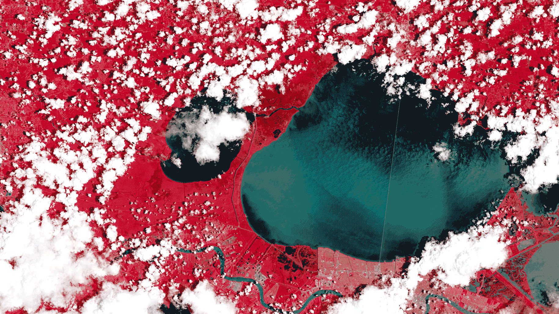
This is because the ECS yields the highest catch of fish at slightly over 3.8 million tonnes, which serves as a crucial food supply throughout the region since fish serves 22.3% of public diets across East Asia.

Similarly, the South China Sea is also a hub of marine and hydrocarbon resources.
For instance, the area serves as fishing grounds for Chinese fishermen and people living near the sea, with China becoming one of the largest fishing industries in the world since 2010, owing to the abundance of marine resources in the region.
The fishing industry in China not only contributes significantly to national economy but also lets China play an important role as the ‘biggest exporter of aquatic products in the world.’ Besides marine resources, the region is also rich in energy resources, with the US Geological Survey estimating in 2012 that the entire South China Sea contains around 12 billion barrels of oil and 1900 trillion cubic feet of natural gas.
Thus, regarding marine and hydrocarbon resources, the SCS and the ECS serve similar goals for China.
Beijing thus wants full sovereignty over th region to exploit its resources to their fullest potential.

The third reason for China’s ongoing dispute over the islands is historical tensions and modern power struggles.
Modern Sino-Japanese relations have mainly been antagonistic and influenced by a history of colonialism and competition.
China had been a target of Japan’s imperialist ambitions but has now evolved to overtake Japan’s role as a global economic powerhouse.
Therefore, the attempts to ‘recover’ territories in the ECS become a part of a larger programme of returning the country’s position as a ‘regional hegemon.’ For nationalists in China, the material considerations of the dispute (control of the EEZs and the continental shelves of the islands) become secondary to the historical aspect of the dispute.

Similar to the ECS dispute, the origins of the claims of China’s assertion of sovereignty over the entire island chains of the South China Sea also pertain to its ‘historic rights.’ China, like in the case of the East China Sea, has always perceived the SCS as their historical waters dating back to the past practices of navigation and trade during the Qing and Han dynasties.
The past colonial powers’ lack of general interest in solving the delimitation issues has given China a chance to put forth its historical rights façade to challenge the legitimacy of international law.
China also considers the SCS part of its ‘lost territories, ‘ which echoes its claims in the ECS.

The fourth reason for the disputes is strategic.
In terms of strategic significance, the ECS serves as a vital area for all the claimants, including the US.
In the north of the ECS is the entrance to the Sea of Japan, while in the south, there is Taiwan, which serves as a contested area between the US and China.
China also perceives Japan’s ‘assertive behaviour‘ in the ECS disputes as an attempt to ‘contain China’ just like the US, resulting in increasing insecurity leading to China’s assertive power positioning in its claims.
Therefore, China believes that acquiring the islands will help it successfully close its security gaps.
The Diaoyu islands can become a unique frontier to safeguard China from Japan and the US.
For instance, Japanese military experts claim that China can use the islands to establish missile bases, radar systems, and submarine bases, undoubtedly increasing China’s security and military presence in the region.
The South China Sea, just like the East China Sea region, is also significant to China strategically.
The SCS is a crucial SLOC that connects the Pacific Ocean to the Indian Ocean and forms the lifeline of global commerce of goods and energy shipments to China, Japan, South Korea, and Russia.
If China controls the SCS, it would guarantee its security in distant waters.
Moreover, China can expand its maritime navigation, which could challenge US maritime dominance and power projection in East Asia.

Another commonality between the two regions pertains to maritime boundaries.
Both raise the question of ‘how and where’ a maritime boundary can be drawn.
In ECS, China’s maritime boundary that runs along its continental shelf ends at the Okinawa Trough.
Japan’s maritime boundary is drawn halfway between the Ryukyu Islands and the Chinese mainland.
Similarly, in the SCS, China draws its maritime boundary based on the nine-dash-line that it first pronounced in 1947 and later submitted to the UN Commission on the Continental Shelf in 2009.
However, China has never articulated its nine-dash-line’s precise latitudinal and longitudinal location.
Therefore, all other claimant countries in the region assert no legal basis for this line under the UNCLOS.

However, both disputes also have quite a few differences.
Firstly, certain SCS disputes regarding maritime boundaries have been submitted to international arbitration.
For instance, the Philippines submitted a Memorial to the Permanent Court of Arbitration (PCA) in The Hague in March 2014 seeking to declare China’s nine-dash-line as ‘illegal and invalid’ and to get clarification on whether specific land features in the SCSC are ‘rocks, islands, or low-tide elevations.’ However, China has refused to participate in the case by stating that the PCA has no jurisdiction over the dispute, even though the Tribal ruled that there was no legal basis for China’s claims due to a lack of historical claims.
However, in the ESC, although Japan expressed an interest in international adjudication with China to resolve the dispute, particularly by the Democratic Party of Japan, the successive Shinzo Abe’s Liberal Democratic Party has generally refused to acknowledge the dispute, thereby preventing any international adjudication.

Secondly, while the South China Sea dispute is multilateral, the East China Sea dispute is bilateral.
Since multiple countries have overlapping claims over the Spratly Islands and the Paracel Islands in the SCS, these parties (excluding China) have taken diplomatic steps to resolve the disputes, such as the non-binding Declaration of the Code of Conduct of the South China Sea drafted in 2002, or the Philippines trying to enlist the ASEAN nations to address the dispute formally.
However, China has always scorned drafting a binding Code.
On the contrary, the ESC sovereignty claims over the Diaoyu/Senkaku Islands are limited to China and Japan.
Although Taiwan shares China’s claims, it has not been a part of China’s attempts to promote sovereignty over the Isles, mainly because China does not consider Taiwan a separate country.

Furthermore, compared to the South China Sea claimants, Japan is a more formidable military opponent to China.
This is because the main claimants of the SCS have significantly less military presence or modernization capabilities than China.
Vietnam only has a ‘respectable’ military force, while the Philippines’ armed forces are even less impressive in numbers than Vietnam.
By comparison, Japan’s Maritime Self-Defense Force (MSDF) consists of nearly 47,000 personnel and an equally impressive air force.
Its JCG (Japan Coast Guard) has been modernizing and building its capabilities for the long-term defence of the islets.
Japan’s military and coast guard forces pose a much more significant threat to the Chinese PLAN (PLA-Navy) than Vietnam or the Philippines.
However, the most crucial part of Japan’s military capabilities is the support of the US military.
Washington has been fully supporting Japan’s ‘valid and legal’ administration over the Senkaku islands, and any attempts by China to acquire the Diaoyu Islands would mean direct confrontation with Japan’s modern navy, air force, coast guard, and the US military.
In contrast, even though the Philippines is a US ally, its relationship with the latter is farther away than that of the US and Japan.
Moreover, as compared to Japan, wherein the US has its military forces stationed throughout the country and prepared for a Sino-Japan conflict, there is a lack of permanent and imposing US military presence on Filipino shores and therefore, its alliance with the US is less threatening to Beijing as compared to Tokyo.

Therefore, it can be observed that China’s unending appetite for territories in the South China Sea and the East China Sea stems from nationalistic beliefs of ‘historical injustices,’ material gains, strategic requirements and national security.
Empires have waged wars for much less.
As a state that considers its national security, economic prosperity and global hegemony as pertinent, it will not be wrong to presume that its expansionist tendencies towards its “historic territories” are far from over.
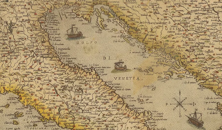
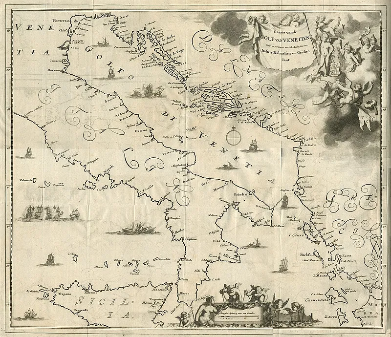
Links :

Monday, November 27, 2023

A23a: World's biggest iceberg on the move after 30 years


The colossus has awoken.  
Iceberg A23a is on the move almost 40 years after it calved from the Filchner Ice Shelf.
For nearly all the intervening time, it's been stuck in the Weddell Sea bottom-muds.
It's now about to spill beyond Antarctica
 
From BBC by Jonathan Amos

The world's biggest iceberg is on the move after more than 30 years being stuck to the ocean floor.

The iceberg, called A23a, split from the Antarctic coastline in 1986.
But it swiftly grounded in the Weddell Sea, becoming, essentially, an ice island.

At almost 4,000 sq km (1,500 sq miles) in area, it's more than twice the size of Greater London.

The past year has seen it drifting at speed, and the berg is now about to spill beyond Antarctic waters.

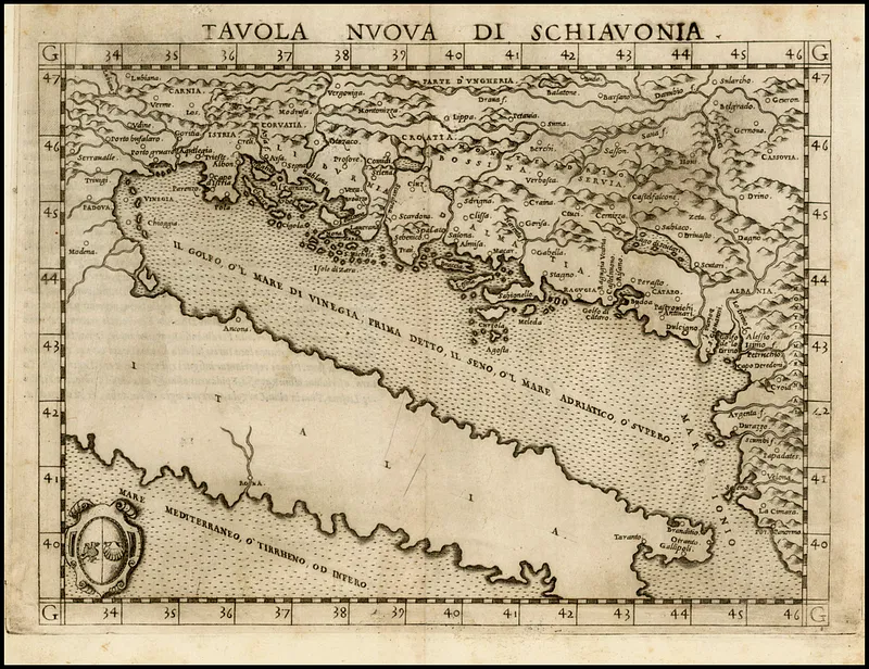
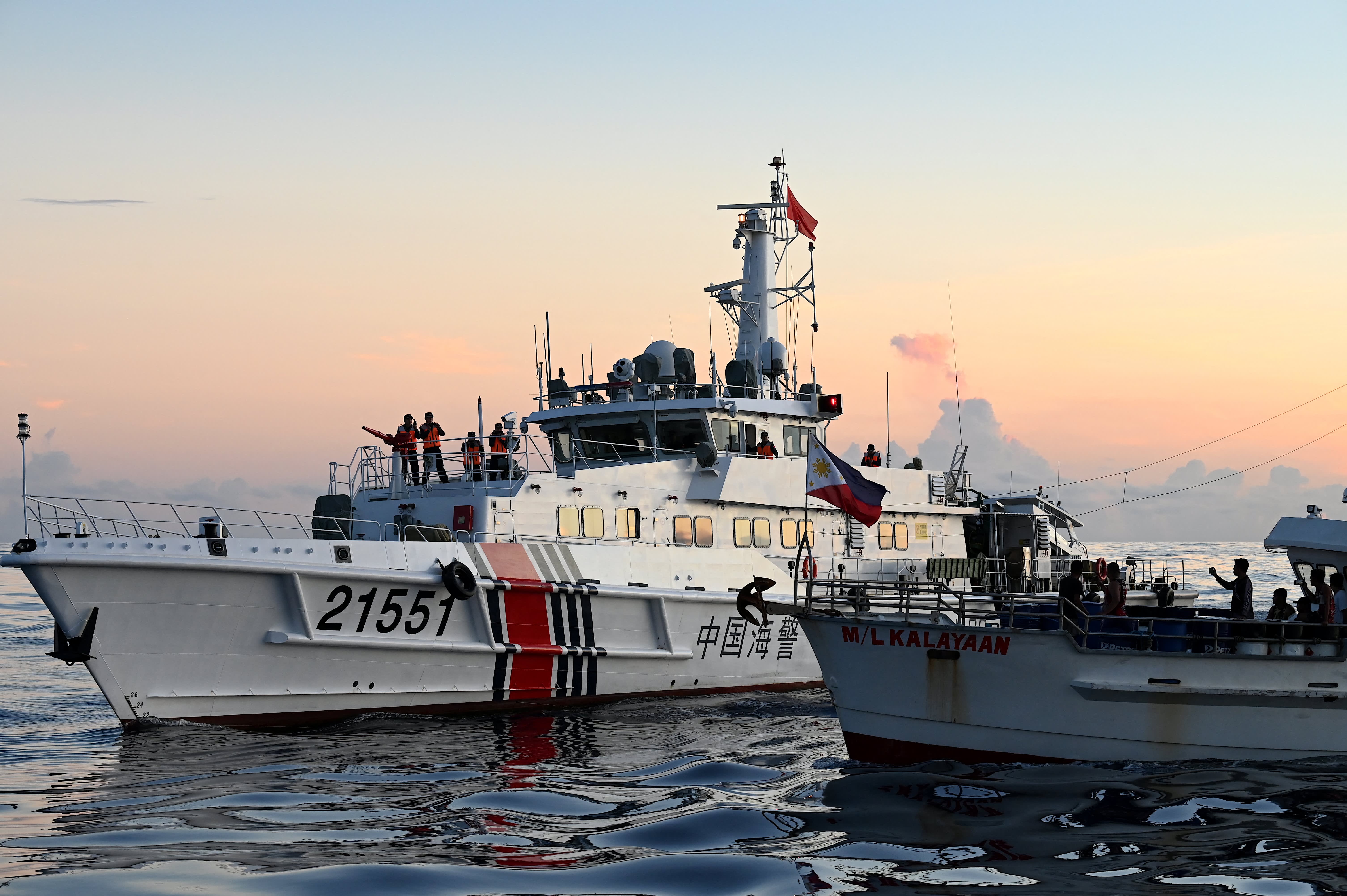
IMAGE SOURCE, CPL PHIL DYE RAF / CROWN COPYRIGHT
Great icebergs, such as the recent A68 object, "fertilise" the oceans with mineral nutrients


A23a is a true colossus, and it's not just its width that impresses.
This slab of ice is some 400m (1,312 ft) thick.
For comparison, the London Shard, the tallest skyscraper in Europe, is a mere 310m tall. 

A23a was part of a mass outbreak of bergs from the White Continent's Filchner Ice Shelf.

At the time, it was hosting a Soviet research station, which just illustrates how long ago its calving occurred.

Moscow despatched an expedition to remove equipment from the Druzhnaya 1 base, fearing it would be lost.
But the tabular berg didn't move far from the coast before its deep keel anchored it rigidly to the Weddell's bottom-muds.


Iceberg A23a first began to stir from its long static slumber in 2020

So, why, after almost 40 years, is A23a on the move now?

"I asked a couple of colleagues about this, wondering if there was any possible change in shelf water temperatures that might have provoked it, but the consensus is the time had just come," said Dr Andrew Fleming, a remote sensing expert from the British Antarctic Survey.
"It was grounded since 1986 but eventually it was going to decrease (in size) sufficiently to lose grip and start moving. I spotted first movement back in 2020."

A23a has put on a spurt in recent months, driven by winds and currents, and is now passing the northern tip of the Antarctic Peninsula.


Like most icebergs from the Weddell sector, A23a will almost certainly be ejected into the Antarctic Circumpolar Current, which will throw it towards the South Atlantic on a path that has become known as "iceberg alley".

This is the same movement of water - and accompanying westerlies - that the famous explorer Sir Ernest Shackleton exploited in 1916 to make his escape from Antarctica following the loss of his ship, the Endurance, in crushing sea-ice.

Shackleton aimed his lifeboat for South Georgia, and it's at this island that you will frequently see the big tabular bergs sitting offshore.
 

The blocks' keels mean they have a tendency to get pinned on the British Overseas Territory's shallow continental shelf.

Eventually, all bergs, however big, are doomed to melt and wither away.


Scientists will be following the progress of A23a closely.

If it does ground at South Georgia, it might cause problems for the millions of seals, penguins and other seabirds that breed on the island.
A23a's great bulk could disrupt the animals' normal foraging routes, preventing them from feeding their young properly.

But it would be wrong to think of icebergs as being just objects of danger - Titanic and all that.
There's a growing recognition of their importance to the wider environment.

As these big bergs melt, they release the mineral dust that was incorporated into their ice when they were part of glaciers scraping along the rock bed of Antarctica.
This dust is a source of nutrients for the organisms that form the base of ocean food chains.

"In many ways these icebergs are life-giving; they are the origin point for a lot of biological activity," said Dr Catherine Walker, from the Woods Hole Oceanographic Institution, who was born in the same year as A23a. "I identify with it; it's always been there for me."


Links :

Sunday, November 26, 2023

Seascape near Les Saintes-Maries-de-la-Mer

Early in 1888, Van Gogh travelled to the fishing village of Les Saintes-Maries-de-la-Mer.
He lived in Arles, and had never seen the Mediterranean Sea.
He had to travel for hours in a coach to get there.
But after the trip, he was greeted by the Mediterranean.
Van Gogh stayed a while in Les Saintes-Maries-de-la-Mer.
In barely a week, he made nine drawings and three paintings in and around the village.
This animation of ‘Seascape near Les Saintes-Maries-de-la-Mer’, (1888) is made by Andrey Zakirzyanov. courtesy of by Andrey Surotdinov