Saturday, January 31, 2015

IMOCA 60 BPVIII : foil lessons


From VPLP

In the IMOCA class, the transition to foils was a logical evolution.

The first change was to tilt the keel axis (keel rotation axis angled with respect to the water plane of the boat, typically angles between 4 and 9° with the new one design keel IMOCA) to create an angle attack on the keel and thus sustain the boat.


The direct consequence of this angle of tilt is the lose of righting moment because the force is applied windward.
The continuity of this philosophy was to work on the foils to regain the righting moment lost by the keel (the faster geos the boat, the more vertical forces are created by the keel and foil and then even faster goes the boat).
All the VPLP-Verdier 60 foot signed in 2015 will all be equipped with foils.
Each team has a specific brief for these foils, so that each pair of foil will be specific.
The six new IMOCA fleet will be very rich for this new page in the offshore racing monohull story.
We already know that there will be a significant gain in speed; the foils could win two days on a Vendée Globe.
The real gains will be for reaching and downwind sailing.
Upwind, it will be more complicated, but it's only represent 10% on a Vendée Globe.

And what next?
What developments could result from the emergence of these new appendages ? ...
The foils "enlarge virtually" from a significant amount the hull beam.
Why not reduce the beams of the boats? ...
To be continued ... "

Links :

Friday, January 30, 2015

Australia AHS update in the Marine GeoGarage

Australia AHS layer coverage


2 charts have been added and 54 charts have been updated in the Marine GeoGarage
(AHS update NtM 25/2014 19/12/2014)

  • Aus158 Australia South Coast - Victoria - Port Phillip South and West Channels
  • Aus328 Australia North West Coast - Western Australia - Montebello Islands to North West Cape
  • Aus722 Australia North Coast - Northern Territory - Beagle Gulf and Clarence Strait
  • Aus741 Australia North West Coast - Western Australia - Approaches to Dampier Archipelago
  • Aus742 Australia North West Coast - Western Australia - Rosemary Island to Barrow Island
  • Aus743 Australia North West Coast - Western Australia - Barrow Island to Onslow
  • Aus744 Australia North West Coast - Western Australia - Exmouth Gulf and Approaches
  • Aus26 Australia North Coast - Northern Territory - Approaches to Port Darwin
  • Aus29 Australia North Coast - Northern Territory - Approaches to Bynoe Harbour and Port Patterson
  • Aus834 Australia East Coast - Queensland - Claremont Isles to Cape Weymouth
  • Aus151 Australia South Coast - Victoria - Western Port (Entrance and North Arm)
  • Aus301 Australia North Coast - Queensland - Booby Island to Archer River
  • Aus378 Papua New Guinea - South Coast - Daru Roads to Kerema Bay
  • Aus52 Australia North West Coast - Western Australia - Entrance Channel to Port Hedland
  • Aus53 Australia North West Coast - Western Australia - Approaches to Port Hedland
  • Aus293 Australia North Coast - Torres Strait - Prince of Wales Channel
  • Aus296 Australia North Coast - Torres Strait - Prince of Wales Channel to Varzvin Passage
  • Aus754 Australia West Coast - Western Australia - Lancelin to Cape Peron
  • Aus299 Australia North Coast - Torres Strait - Approaches to Thursday Island
  • Aus244 Australia East Coast - Queensland - Plans in Port of Gladstone
  • Aus271 Australia East Coast - Queensland - Auckland Point to Fishermans Landing Wharves NEW
  • Aus272 Australia - East Coast - Queensland - Fishermans Landing Wharves to Laird Point NEW
  • Aus280 Australia East Coast - Plans in Queensland (Sheet 3)
  • Aus831 Australia East Coast - Queensland - Low Islets to Cape Flattery
  • Aus832 Australia East Coast - Queensland - Cape Flattery to Barrow Point
  • Aus833 Australia East Coast - Queensland - Barrow Point to Claremont Isles
  • Aus258 Australia East Coast - Queensland - Plans in Queensland (Sheet 1)
  • Aus262 Australia East Coast - Queensland - Approaches to Cairns
  • Aus270 Australia East Coast - Queensland - Plans in Queensland (Sheet 2)
  • Aus281 Australia East Coast - Queensland - First Three Mile Opening to Cape Direction
  • Aus830 Australia East Coast - Queensland - Russell Island to Low Islets
  • Aus367 Australia East Coast - Queensland - Swain Reefs to Penrith Island
  • Aus490 Australia East Coast - Queensland - Sandy Cape to Swain Reefs
  • Aus57 Australia North West Coast - Western Australia - Dampier Archipelago
  • Aus58 Australia North West Coast - Western Australia - Port of Dampier
  • Aus59 Australia North West Coast - Western Australia - Port of Dampier (Northern Sheet)
  • Aus60 Australia North West Coast - Western Australia - Port of Dampier (Southern Sheet)
  • Aus816 Australia - East Coast - Queensland - North Spit to Breaksea Spit
  • Aus818 Australia East Coast - Queensland - Sandy Cape to Bustard Head
  • Aus819 Australia East Coast - Queensland - Bustard Head to North Reef
  • Aus820 Australia East Coast - Queensland - North Reef to Port Clinton
  • Aus249 Australia East Coast - Queensland - Approaches to Hay Point and Mackay
  • Aus251 Australia East Coast - Queensland - Bailey Islet to Repulse Islands
  • Aus260 Australia East Coast - Queensland - Broad Sound Channel and Shoalwater Bay
  • Aus605 Australia Southern Ocean - Heard and McDonald Islands
  • Aus821 Australia East Coast - Queensland - Hydrographers Passage
  • Aus822 Australia East Coast - Queensland - Port Clinton to Percy Isles
  • Aus823 Australia East Coast - Queensland - Percy Isles to Mackay
  • Aus824 Australia East Coast - Queensland - Penrith Island to Whitsunday Island
  • Aus252 Australia East Coast - Queensland - Whitsunday Group
  • Aus255 Australia East Coast - Queensland - Approaches to Abbot Point
  • Aus256 Australia East Coast - Queensland - Cleveland Bay and Approaches
  • Aus825 Australia East Coast - Queensland - Whitsunday Island to Bowen
  • Aus826 Australia East Coast - Queensland - Bowen to Cape Bowling Green
  • Aus827 Australia East Coast - Queensland - Cape Bowling Green to Palm Isles
  • Aus828 Australia East Coast - Queensland - Palm Isles to Brook Islands and Palm Passage

Today 466 AHS raster charts (789 including sub-charts) are included in the Marine GeoGarage viewer.

Note : AHS updates their nautical charts with corrections published in:
Australian Notices to Mariners

HMS Enterprise spots underwater mountains

These stunning images of what appears to be two large mountains are actually underwater scans of the seabed off the coast of Northern Africa.

From RoyalNavy

These stunning images of what appears to be two large mountains are actually underwater scans of the seabed off the coast of Northern Africa.

Captured by one of the Royal Navy’s survey ships HMS Enterprise, the larger of the two seamounts, the technical name for underwater mountains, was measured at 1100m which is taller than Mount Snowden.


They have been spotted previously with the ship’s specialist equipment,
but they are now firmly on the map.
(Able Seaman Stephen Martin)

The second, which is just a fraction shorter at 930m, is tall enough to find a place inside England’s top ten peaks.

Though intriguing, the two seamounts pose very real dangers to shipping.
It is really special to know that you’re helping merchant vessels safely navigate around the world.

Using a hydrographic multi-beam echo sounder to send out multiple beams simultaneously, the ship’s expert team can create this incredibly detailed result.

Able Seaman Stephen Martin, one of the ship’s hydrographic trainees, said: “It was amazing to see such massive natural features under what looks like a flat calm and peaceful ocean.
“For me, it is really special to know that you’re helping merchant vessels safely navigate around the world.”

The hydrographic survey ship, which is usually based in Plymouth, gathers and processes hydrographic and oceanographic data for planning and operational purposes.

In addition this data will be dispatched to the UK Hydrographic Office for analysis and inclusion into navigational charts and other navigational safety publications.

Since she left the United Kingdom in June 2014, HMS Enterprise has been busy mapping some of the busiest shipping lanes and maritime choke-points in world, including the Suez Canal, the Bab el Mandeb Straits and the Strait of Hormuz.

After a minor refit in Bahrain, home to the United Kingdom’s Maritime Component Commander in the Middle East, the survey ship returned to sea to continue with important oceanographic work, helping scientists from around the world conduct climate modeling tests and making navigation safer for seafarers.

Thursday, January 29, 2015

UK & misc. update in the Marine GeoGarage

As our public viewer is not yet available
(currently under construction, upgrading to a new viewer
as Google Maps API v2 is officially no more supported),
this info is primarily intended to our universal mobile application users
(Weather 4D Android -App-in- on the PlayStore)
and also to our B2B customers which use our nautical charts layers
in their own webmapping applications through our GeoGarage API.

Today 952 charts (1816 including sub-charts) from UKHO
are available in the 'UK & misc.' chart layer
regrouping charts for different countries :
  1. UK
  2. Argentina
  3. Belgium
  4. Netherlands
  5. Croatia
  6. Oman
  7. Portugal
  8. Spain
  9. Iceland
  10. South Africa
  11. Malta
1 chart has been added (3764)


634 charts for UK

24 charts for Argentina :

  • 226    International Chart Series, Antarctica - South Shetlands Islands, Deception Island.
  • 227    Church Point to Cape Longing including James Ross Island
  • 531    Plans on the Coast of Argentina
  • 552    Plans on the Coast of Argentina
  • 557    Mar del Plata to Comodoro Rivadavia
  • 1302    Cabo Guardian to Punta Nava
  • 1331    Argentina, Approaches to Bahia Blanca
  • 1332    Isla de los Estados and Estrecho de le Maire
  • 1751    Puerto de Buenos Aires
  • 1982B    Rio Parana - Rosario to Parana
  • 2505    Approaches to the Falkland Islands
  • 2517    North-Western Approaches to the Falkland Islands
  • 2519    South-Western Approaches to the Falkland Islands
  • 3065    Punta Piedras to Quequen
  • 3066    Quequen to Rio Negro
  • 3067    Rio Negro to Isla Leones
  • 3106    Isla Leones to Pto San Julian
  • 3213    Plans in Graham Land
  • 3560    Gerlache Strait  Northern Part
  • 3566    Gerlache Strait  Southern Part
  • 3755    Bahia Blanca
  • 4063    Bellingshausen Sea to Valdivia
  • 4200    Rio de la Plata to Cabo de Hornos
  • 4207    Falkland Islands to Cabo Corrientes and Northeast Georgia Rise
27 charts for Belgium & Nederlands :

  • 99 Entrances to Rivers in Guyana and Suriname
  • 110 Westkapelle to Stellendam and Maasvlakte
  • 112 Terschellinger Gronden to Harlingen
  • 120 Westerschelde - Vlissingen to Baalhoek and Gent - Terneuzen Canal
  • 122 Approaches to Europoort and Hoek van Holland
  • 124 Noordzeekanaal including Ijmuiden, Zaandam and Amsterdam
  • 125 North Sea Netherlands - Approaches to Scheveningen and Ijmuiden
  • 126 North Sea, Netherlands, Approaches to Den Helder
  • 128 Westerschelde, Valkenisse to Wintam
  • 207 Hoek Van Holland to Vlaardingen
  • 208 Rotterdam, Nieuwe Maas and Oude Maas
  • 209 Krimpen a/d Lek to Moerdijk
  • 266 North Sea Offshore Charts Sheet 11
  • 572 Essequibo River to Corentyn River
  • 702 Nederlandse Antillen, Aruba and Curacao
  • 1187 Outer Silver Pit
  • 1408 North Sea, Harwich and Rotterdam to Cromer and Terschelling.
  • 1412 Caribbean Sea - Nederlandse Antillen, Ports in Aruba and Curacao
  • 1414 Bonaire
  • 1503 Outer Dowsing to Smiths Knoll including Indefatigable Banks.
  • 1504 Cromer to Orford Ness
  • 1546 Zeegat van Texel and Den Helder Roads
  • 1630 West Hinder and Outer Gabbard to Vlissingen and Scheveningen
  • 1631 DW Routes to Ijmuiden and Texel
  • 1632 DW Routes and Friesland Junction to Vlieland
  • 1874 North Sea, Westerschelde, Oostende to Westkapelle
  • 2047 Approaches to Anguilla

13 charts for Croatia :
  • 201 Rt Kamenjak to Novigrad
  • 202 Kvarner, Kvarneric and Velebitski Kanal
  • 269 Ploce and Split with Adjacent Harbours, Channels and Anchorages
  • 515 Zadar to Luka Mali Losinj
  • 680 Dubrovnik
  • 1574 Otok Glavat to Ploce and Makarska
  • 1580 Otocic Veliki Skolj to Otocic Glavat
  • 1996 Ports in Rijecki Zaljev
  • 2711 Rogoznica to Zadar
  • 2712 Otok Susac to Split
  • 2719 Rt Marlera to Senj including Approaches to Rijeka
  • 2773 Sibenik, Pasmanski Kanal, Luka Telascica, Sedmovrace, Rijeka Krka
  • 2774 Otok Vis to Sibenik
 7 charts for Oman :

  • 2853 Gulf of Oman, approaches to Sohar       
  • 2854 Northern approaches to Masirah
  • 3171 Southern Approaches to the Strait of Hormuz
  • 3409 Plans in Iran, Oman and the United Arab Emirates
  • 3511 Wudam and Approaches
  • 3518 Ports and Anchorages on the North East Coast of Oman
  • 3762 Oman - South East coast, Ad Duqm


126 charts for Spain & Portugal :
(1 chart added, 3764)
  • 45 Gibraltar Harbour
  • 73 Puerto de Huelva and Approaches
  • 83 Ports on the South Coast of Portugal
  • 85 Spain - south west coast, Rio Guadalquivir
  • 86 Bahia de Cadiz
  • 87 Cabo Finisterre to the Strait of Gibraltar
  • 88 Cadiz
  • 89 Cabo de Sao Vicente to Faro
  • 91 Cabo de Sao Vicente to the Strait of Gibraltar
  • 93 Cabo de Santa Maria to Cabo Trafalgar
  • 142 Strait of Gibraltar
  • 144 Mediterranean Sea, Gibraltar
  • 307 Angola, Cabeca da Cobra to Cabo Ledo
  • 308 Angola, Cabo Ledo to Lobito
  • 309 Lobito to Ponta Grossa
  • 312 Luanda to Baia dos Tigres
  • 366 Arquipelago de Cabo Verde
  • 469 Alicante
  • 473 Approaches to Alicante
  • 518 Spain East Coast, Approaches to Valencia
  • 562 Mediterranean Sea, Spain - East Coast, Valencia.
  • 580 Al Hoceima, Melilla and Port Nador with Approaches
  • 659 Angola, Port of Soyo and Approaches
  • 690 Cabo Delgado to Mikindani Bay
  • 1094 Rias de Ferrol, Ares, Betanzos and La Coruna
  • 1096 Ribadeo
  • 1110 La Coruna and Approaches
  • 1111 Punta de la Estaca de Bares to Cabo Finisterre
  • 1113 Harbours on the North-West Coast of Spain
  • 1117 Puerto de Ferrol
  • 1118 Ria de Ferrol
  • 1122 Ports on the North Coast of Spain
  • 1133 Ports on the Western Part of the North Coast of Spain
  • 1142 Ria de Aviles
  • 1145 Spain - North Coast, Santander
  • 1150 Ports on the North Coast of Spain
  • 1153 Approaches to Gijon
  • 1154 Spain, north coast, Gijon
  • 1157 Pasaia (Pasajes) and Approaches
  • 1172 Puertos de Bermeo and Mundaka
  • 1173 Spain - North Coast, Bilbao
  • 1174 Approaches to Bilbao
  • 1180 Barcelona
  • 1189 Approaches to Cartagena
  • 1193 Spain - east coast, Tarragona
  • 1194 Cartagena
  • 1196 Approaches to Barcelona
  • 1197 Plans on the West Coast of Africa
  • 1215 Plans on the Coast of Angola
  • 1216 Baia dos Tigres
  • 1290 Cabo de San Lorenzo to Cabo Ortegal
  • 1291 Santona to Gijon
  • 1448 Gibraltar Bay
  • 1453 Gandia
  • 1455 Algeciras
  • 1460 Sagunto
  • 1514 Spain - East Coast, Castellon
  • 1515 Ports on the East Coast of Spain
  • 1589 Almeria
  • 1595 Ilhas do Principe, de Sao Tome and Isla Pagalu
  • 1684 Ilha da Madeira, Manchico and Canical
  • 1685 Ilha de Madeira, Ponta Gorda de Sao Lourenco including the Port of Funchal
  • 1689 Ports in the Arquipelago da Madeira
  • 1701 Cabo de San Antonio to Vilanova I la Geltru including Islas de Ibiza and Formentera
  • 1703 Mallorca and Menorca
  • 1704 Punta de la Bana to Islas Medas
  • 1724 Canal do Geba and Bissau
  • 1726 Approaches to Canal do Geba and Rio Cacheu
  • 1727 Bissau, Bolama and Approaches
  • 1730 Spain - West Coast, Ria de Vigo
  • 1731 Vigo
  • 1732 Spain - West Coast, Ria de Pontevedra
  • 1733 Spain - West Coast, Marin and Pontevedra
  • 1734 Approaches to Ria de Arousa
  • 1740 Livingston Island, Bond Point to Brunow Bay including Juan Carlos 1 Base and Half Moon Island
  • 1755 Plans in Ria de Arousa
  • 1756 Ria de Muros
  • 1762 Vilagarcia de Arosa
  • 1764 Ria de Arousa
  • 1831 Arquipelago da Madeira
  • 1847 Santa Cruz de Tenerife
  • 1850 Approaches to Malaga
  • 1851 Malaga
  • 1854 Motril and Adra
  • 1856 Approaches to Puerto de La Luz (Las Palmas)
  • 1858 Approaches to Santa Cruz de Tenerife, Puerto de San Sebastian de la Gomera, Santa Cruz de la Palma and Approaches
  • 1861 North Atlantic Ocean – Islas Canarias, Gran Canaria to El Hierro 
  • 1862 North Atlantic Ocean – Islas Canarias, Lanzarote to Cabo Bojador  
  • 1863 Islas Canarias, Puerto de los Marmoles to Puerto del Rosario  
  • 1895 Ilha de Sao Miguel
  • 1950 Arquipelago dos Acores
  • 1956 Arquipelago dos Acores  Central Group
  • 1957 Harbours in the Arquipelago Dos Acores (Central Group)
  • 1959 Flores,Corvo and Santa Maria with Banco Das Formigas
  • 2742 Cueta
  • 2761 Menorca
  • 2762 Menorca, Mahon
  • 2831 Punta Salinas to Cabo de Formentor including Canal de Menorca
  • 2832 Punta Salinas to Punta Beca including Isla de Cabrera
  • 2834 Ibiza and Formentera
  • 2932 Cabo de Sao Sebastiao to Beira
  • 2934 Africa - east coast, Mozambique, Beira to Rio Zambeze
  • 2935 Quelimane to Ilha Epidendron
  • 3034 Approaches to Palma
  • 3035 Palma
  • 3220 Entrance to Rio Tejo including Baia de Cascais
  • 3221 Lisboa, Paco de Arcos to Terreiro do Trigo
  • 3222 Lisboa, Alcantara to Canal do Montijo
  • 3224 Approaches to Sines
  • 3227 Aveiro and Approaches
  • 3228 Approaches to Figueira da Foz
  • 3257 Viana do Castelo and Approaches
  • 3258 Approaches to Leixoes and Barra do Rio Douro
  • 3259 Approaches to Setubal
  • 3260 Carraca to Ilha do Cavalo
  • 3291 Angola, (Cabinda), Cabinda and Malongo Terminals    
  • 3448 Plans in Angola
  • 3578 Eastern Approaches to the Strait of Gibraltar
  • 3633 Islas Sisargas to Rio Mino
  • 3634 Montedor to Cabo Mondego
  • 3635 Cabo Mondego to Cabo Espichel
  • 3636 Cabo Espichel to Cabo de Sao Vicente
  • 3764 Cabo Torinana to Punta Carreiro   NEW
  • 4114 Arquipelago dos Acores to Flemish Cap
  • 4115 Arquipelago dos Acores to the Arquipelago de Cabo Verde


14 charts for Iceland :

  • 2733 Dyrholaey to Snaefellsjokull
  • 2734 Approaches to Reykjavik
  • 2735 Iceland - South West Coast, Reykjavik
  • 2897 Iceland
  • 2898 Vestfirdir
  • 2899 Iceland, Noth Coast, Horn to Rauoinupur
  • 2900 Iceland, North East Coast, Rauoinupur to Glettinganes
  • 2901 Iceland, East Coast, Glettinganes to Stokksnes
  • 2902 Stokksnes to Dyrholaey
  • 2955 Iceland, North Coast, Akureyri
  • 2956 Iceland, North Coast, Eyjafjordur
  • 2937 Hlada to Glettinganes
  • 2938 Reydarfjordur
  • 4112 North Atlantic Ocean, Iceland to Greenland


48 charts for South Africa :

  • 578    Cape Columbine to Cape Seal
  • 632    Hollandsbird Island to Cape Columbine
  • 643    Durban Harbour
  • 665    Approaches to Zanzibar
  • 1236    Saldanha Bay
  • 1806    Baia dos Tigres to Conception Bay
  • 1846    Table Bay Docks and Approaches
  • 1922    RSA - Simon's Bay
  • 2078    Port Nolloth to Island Point
  • 2095    Cape St Blaize to Port S. John's
  • 3211    Zanzibar Harbour
  • 3793    Shixini Point to Port S Johns
  • 3794    Port S Johns to Port Shepstone
  • 3795    Port Shepstone to Cooper Light
  • 3797    Green Point to Tongaat Bluff
  • 3859    Cape Cross to Conception Bay
  • 3860    Mutzel Bay to Spencer Bay
  • 3861    Namibia, Approaches to Luderitz
  • 3869    Hottentot Point to Chamais Bay
  • 3870    Chamais Bay to Port Nolloth
  • 4132    Kunene River to Sand Table Hill
  • 4133    Sand Table Hill to Cape Cross
  • 4136    Harbours on the West Coasts of Namibia and South Africa
  • 4141    Island Point to Cape Deseada
  • 4142    Saldanha Bay Harbour
  • 4145    Approaches to Saldanha Bay
  • 4146    Cape Columbine to Table Bay
  • 4148    Approaches to Table Bay
  • 4150    Republic of South Africa, South West Coast, Table Bay to Valsbaai
  • 4151    Cape Deseada to Table Bay
  • 4152    Republic of South Africa, South West Coast, Table Bay to Cape Agulhas
  • 4153    Republic of South Africa, South Coast, Cape Agulhas to Cape St. Blaize
  • 4154    Mossel Bay
  • 4155    Cape St Blaize to Cape St Francis
  • 4156    South Africa, Cape St Francis to Great Fish Point
  • 4157    South Africa, Approaches to Port Elizabeth
  • 4158    Republic of South Africa - South Coast, Plans in Algoa Bay.
  • 4159    Great Fish Point to Mbashe Point
  • 4160    Ngqura Harbour
  • 4162    Approaches to East London
  • 4163    Republic of South Africa, South East Coast, Mbashe Point to Port Shepstone
  • 4170    Approaches to Durban
  • 4171    Republic of South Africa – South East Coast, Port Shepstone to Tugela River
  • 4172    Tugela River to Ponta do Ouro
  • 4173    Approaches to Richards Bay
  • 4174    Richards Bay Harbour
  • 4205    Agulhas Plateau to Discovery Seamounts
  • 4700    Port Elizabeth to Mauritius 
    5 charts for Malta :

    • 36 Marsaxlokk
    • 177 Valletta Harbours
    • 211 Plans in the Maltese Islands
    • 2537 Ghawdex (Gozo), Kemmuna (Comino) and the Northern Part of Malta
    • 2538 Malta


    55 international charts from NGA
  •  3 Chagos Archipelago
  • 82 Outer Approaches to Port Sudan
  • 100 Raas Caseyr to Suqutra
  • 255 Eastern Approaches to Jamaica
  • 256 Western Approaches to Jamaica
  • 260 Pedro Bank to the South Coast of Jamaica
  • 333 Offshore Installations in the Gulf of Suez
  • 334 North Atlantic Ocean, Bermuda
  • 386 Yadua Island to Yaqaga Island
  • 390 Bahamas, Grand Bahama Island, Approaches to Freeport
  • 398 Grand Bahama Island, Freeport Roads, Freeport Harbour
  • 457 Portland Bight
  • 462 The Cayman Islands
  • 486 Jamaica and the Pedro Bank
  • 501 South East Approaches to Trinidad
  • 700 Maiana to Marakei
  • 868 Eastern and Western Approaches to The Narrows including Murray's Anchorage
  • 920 Chagos Archipelago, Diego Garcia
  • 928 Sulu Archipelago
  • 959 Colson Point to Belize City including Lighthouse Reef and Turneffe Islands
  • 1043 Saint Lucia to Grenada and Barbados
  • 1225 Gulf of Campeche
  • 1265 Approaches to Shatt Al 'Arab or Arvand Rud, Khawr Al Amaya and Khawr Al Kafka
  • 1450 Turks and Caicos Islands, Turks Island Passage and Mouchoir Passage
  • 1638 Plans in Northern Vanuatu
  • 2009 Sheet 2  From 23 deg 40 min North Latitude to Old Bahama Channel
  • 2065 Northern Antigua
  • 2133 Approaches to Suez Bay (Bahr el Qulzum)
  • 2373 Bahr el Qulzum (Suez Bay) to Ras Sheratib
  • 2374 Ra's Sharatib to Juzur Ashrafi
  • 2658 Outer Approaches to Mina` al Jeddah (Jiddah)
  • 2837 Strait of Hormuz to Qatar
  • 2847 Qatar to Shatt al `Arab
  • 3043 Red Sea, Ports on the coast of Egypt.
  • 3102 Takoradi and Sekondi Bays
  • 3175 Jazirat al Hamra' to Dubai (Dubayy) and Jazireh-ye Sirri
  • 3179 UAE and Qatar, Jazirat Das to Ar Ru' Ays
  • 3310 Africa - east coast, Mafia Island to Pemba Island
  • 3361 Wasin Island to Malindi
  • 3432 Saltpond to Tema
  • 3493 Red Sea - Sudan, Bashayer Oil Terminals and Approaches.
  • 3519 Southern Approaches to Masirah
  • 3520 Khawr Kalba and Dawhat Diba to Gahha Shoal
  • 3522 Approaches to Masqat and Mina' al Fahl
  • 3530 Approaches to Berbera
  • 3709 Gulf of Oman, United Arab Emirates, Port of Fujairah (Fujayrah) and Offshore Terminals.
  • 3723 Gulf of Oman, United Arab Emirates, Approaches to Khawr Fakkan and Fujairah (Fujayrah).
  • 3785 Mina' Raysut to Al Masirah
  • 3907 Bahama Islands and Hispaniola, Passages between Mayaguana Island and Turks and Caicos Islands.
  • 3908 Passages between Turks and Caicos Islands and Dominican Republic
  • 3910 Little Bahama Bank including North West Providence Channel
  • 3912 Bahamas, North East Providence Channel and Tongue of the Ocean
  • 3913 Bahamas, Crooked Island Passage and Exuma Sound
  • 3914 Turks and Caicos Islands and Bahamas, Caicos Passage and Mayaguana Passage
  • 3951 Sir Bani Yas to Khawr al `Udayd

S@iLink, stay connected at sea !

 Official launch of the 4G system for Internet access in coastal areas
Datasheet / Doc
Price : 923 EUR (ext VAT)

S@iLink (update : now called NeptuLink) aims to satisfy the broadband IP communication needs of users on board ships and various vessels in coastal areas (fishing boats, yachts, research vessels, wind farms, coast guard & sea rescue vessels…,) as well as in port areas.
It brings to your ship super fast internet access up to 100 Mbits/s, with ship-to-shore communication in a radius of approximately 20 nautical miles (37 km).


S@iLink is comprised of a transmitter-receiver with two antennas.
Installed on a boat, the terminals connect to 4G networks (frequency bands 1, 3, 7, 8 and 20), thus allowing communications at over 100 Mbits/s for distances up to 20 nautical miles.
If the terminal is not in an area with 4G coverage, it is able to fall back on less advanced technology (UMTS and then GSM) to stay connected.

The system lets you connect a PC transparently via its Ethernet connection so that it can directly access a high-bandwidth IP network.
The same Ethernet connection can also be connected directly to a Wi-Fi router, which will provide access to a wireless broadband network for everyone on board.
 A good way at sea to stay tuned to the Marine GeoGarage

With its reinforced mechanics, the S@iLink is made for the maritime environment, and is designed to withstand humidity and salt spray.
Depending on sea conditions, the vessel may be subject to pitching and rolling motions.
In order to maintain optimal communication, regardless of the movement of the boat on which the system is installed, the antenna radiation pattern needed to be optimized.

S@iLink is a result of two years of research in MVG in partnership with Thales Communications & Security, Alcatel-Lucent, Déti, Telecom Bretagne, supported by the two innovation hubs, "Images & Réseaux" and "Mer Bretagne Atlantique" (project TMS).

Prototype maritime autonomy system completes first self-guided voyage

Anti-Submarine Warfare (ASW) Continuous Trail Unmanned Vessel (ACTUV)
"Sea Hunter",  an unmanned vessel equipped with a prototype maritime autonomy system has been developed to counter the threat of potential asymmetric attacks.

From Leidos

Leidos, a national security, health, and engineering solutions company, announced today that its prototype maritime autonomy system for the Defense Advanced Research Projects Agency (DARPA)'s Anti-Submarine Warfare Continuous Trail Unmanned Vessel (ACTUV) program recently completed its first self-guided voyage between Gulfport and Pascagoula, Mississippi.


The prototype maritime autonomy system was installed on a 42-foot work boat that served as a surrogate vessel to test sensor, maneuvering, and mission functions of the prototype ACTUV vessel.


ACTUV seeks to develop an independently deployed, unmanned naval vessel that would operate under sparse remote supervisory control and safely follow the collision avoidance "rules of the sea" known as COLREGS.

A command station allows one operator to monitor the activities of multiple ACTUVs simultaneously

Controlled only by the autonomy system, and with only a navigational chart of the area loaded into its memory and inputs from its commercial-off-the-shelf (COTS) radars, the surrogate vessel successfully sailed the complicated inshore environment of the Gulf Intracoastal Waterway.

Once close to the target, focused sonar takes an acoustic image of the submarine so ACTUV's sophisticated logic can classify it

During its voyage of 35 nautical miles, the maritime autonomy system functioned as designed.
The boat avoided all obstacles, buoys, land, shoal water, and other vessels in the area – all without any preplanned waypoints or human intervention.

While Leidos continues to use the surrogate vessel to test ACTUV software and sensors, the company is continuing construction of Sea Hunter, the first ACTUV prototype vessel, in Clackamas, Oregon.
Sea Hunter is scheduled to launch in late fall 2015 and begin testing in the Columbia River shortly thereafter.

Wednesday, January 28, 2015

A floating artificial reef would let you walk down into the ocean deep

Biodivercity, Ocean Awareness Zoo

From Gizmodo by Kelsey Campbell-Dollaghan

This month, a grim study in the journal Science reported what we've feared for decades: That the ocean may "be sitting on a precipice of a major extinction event," in the words of one author.
There's a colossal amount of work to be done if we want to turn it around—including reclaiming habitats, which is the goal of this ambitious proposal by three young architects. 
 
Of course, one of the best ways we can do this is by reducing carbon emissions and ocean acidification, a horrifying phenomenon in which CO2 is actually changing the chemistry of our oceans to make them toxic to sea life.
 But there are plenty of smaller measures that can help, like the reclamation of habitats for ecosystems that once thrived naturally.
Artificial reefs have been around for centuries, of course, but in this case we're talking about a kind of reef that's built not as a defensive measure for cities or ports, but as a proactive way to help life flourish anew in areas that were once natural habitats. 

These reefs can take a huge range of forms, which is what makes them so cool.
Sea life, like all life, really, is incredibly adaptable and resilient.

Disposing of old subway cars in the ocean creates habitats for marine life and supports recreational fishing.
New York City Transit has provided more than 2,500 retired subway cars to several states along the east coast of the U.S.A. Before the cars are 'buried' at sea, they are stripped of potential environmental contaminants and then steam-cleaned.

Most artificial reefs take the form of sunken industrial remains or old ships, but there are also fascinating aberrations, like Florida's Neptune Reef—which is both a mausoleum for cremated remains and a thriving eco-habitat, as our sister site io9 reported last year—or the artificial reefs created by dumping decommissioned subway cars into the ocean.

And then there's this proposal, from a trio of French and Romanian architects named Quentin Perchet, Thomas Yvon and Zarko Uzlac, who won one of the Jacques Rougerie Foundation's International Architecture Competition laureate awards this week.
Ignore the name—BIODIVER[CITY]—and focus on the renderings, which show a huge floating platform that's accessed via boat on the surface.
Below it, hundreds of tubular struts hand down into the ocean, serving as a place to cling for the coral and other microorganisms that thrive on reefs.  


According to the architects, the idea is to allow visitors to this natural "zoo" to descend deeper into the reef to observe how the ecosystem changes as you move further away from the surface.
At the top, you might see larger mammals like dolphins and small fish, but as you descend into the circular tunnels that hang from the floating mega-structure, you'll see less common species, which the architects describe as "creatures of another time."

 Of course, this is just a concept.
It's easy to imagine that such a structure could have a negative environmental impact—hey, is that a cruise ship in one rendering?!—but it's still an interesting (and beautiful) take on an idea that needs as much public support as it can get. 


Another more realistic new development in this fight comes from a group of marine biologists who argue that the mega-structures that can promote habitat reclamation already exist in the ocean—in the form of our aging oil rigs.
In some cases, they argue, rich ecosystems already exist beneath the surface of these hulking steel machines, and they ought to be left standing in place to benefit the sea life that's already sprung up around them.

Links :

Tuesday, January 27, 2015

How the fishermen of a tiny Irish island tackled the EU's big bureaucracy

Fishing for a future (Euronews)
Will Europe manage to save its fish stocks?
And what will happen to the fishermen?
Do Irish fishermen have a future?

From Worldcrunch by Eric Albert

The battle is not totally over, and total victory remains uncertain.
But the fishermen from Arranmore have managed to make Brussels sway.
This handful of diehard Irish fishermen is slowly managing to lift Europe’s fishing ban, which has been stifling the economy of this remote island for the past seven years.
Arranmore is located off the coast of northwestern Ireland.
The wind here is merciless, and a good many boats have been crushed on the reefs surrounding it. Fishing has traditionally been the main source of work here, and it is the heart of life on this 22-square-kilometer island.
Things changed dramatically when in 2006, following a directive from the Brussels-based European Commission, Dublin decided to ban salmon fishing in a bid to stop the decline of fish stocks.
Another bill two years later outlawed all net fishing around the country, in a zone nicknamed “VIa.” The ban affected numerous species, including cod and whiting, allowing only the fishing of crabs and lobsters.

 Arranmore island aerial view

The sea as a unique resource

The Irish government was offering fishermen all over the country financial compensation. Most of them accepted, but not on Arranmore.
Along with its neighbors of the islands of Tory and Inisbofin, Arranmore rebelled against the authorities, refusing to sign a declaration stating they would stop fishing salmon forever.
The proposed government deal was unacceptable for the strapping Neily Kavenagh.
Despite his short and snappy sentences, the 48-year-old fisherman struggles to find words that are strong enough to condemn this attempt to “buy [him] off.”
“They offered me 40,000 euros ($54,000). It’s a lot of money. But my dad got this salmon fishing license in the 1950s. I wanted to pass it on to my own child,” he says.
The fishermen came together in 2007.
Hugh Rodgers, one of the group’s leaders, remembers it as if it were yesterday.
“We managed to convince everybody save one not to accept the compensation,” he recalls.
“For us, it was self-evident. We have no factories, and tourists come only in summer. The sea is our own resource. It should be for the locals, and we should have the right to reap our own harvest.”

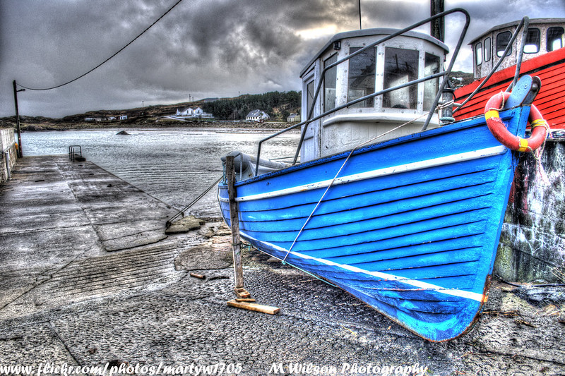
 Arranmore fishing boat
In 7 years, the number of operating boats dropped 40% on Arranmore

An “attack” on Arranmore’s life

The Arranmore fishermen use traditional methods and say they have nothing to do with the drop in fish populations.
Because their boats are scarcely over 15 meters long (50 feet), they hardly venture into the open sea.
On the other hand, they saw an armada of factory boats — mainly from Spain, Holland and France — coming just a few kilometers from their coast after they had bought Irish fishing rights.
“These guys can keep working the way they do far from the coast, even today,” Kavenagh says angrily.
“As for us, we have nothing left.”
For him, the fishing ban is an “attack” on the very life of Arranmore.
The island inhabitants have asked for a protection similar to that of an oppressed minority.

 Arranmore island with the Marine GeoGarage (UKHO chart)

On the small island, the ban’s impact was rapidly felt.
In seven years, as the few rusty wrecks in the harbor show, the number of operating boats dropped 40%.
The population fell from 768 to 487.
A hotel, a pub and three shops have closed.
One of the two primary schools only has 12 pupils left and its days are probably numbered.
“If it goes on like this, there will be nothing on Arranmore in 10 years,” says a worried Loïc Jourdain. The French director has been filming the island’s revolt from the beginning and is working on a documentary expected to be released in 2014.
Having followed the fishermen for so long, he remembers their face-to-face meetings with politicians and lobbyists.
“A lot of them went to Brussels and Dublin to pressure the authorities. Even the priest, a very influential man, went along with them.”
Little by little, they were joined in their fight by other European islands, and the balance started to shift in their favor.


“I will violate the law before I give up on fishing”

In the last few months, the fishermen have won their first victories.
In May, the European reform of the common fisheries policy recognized the importance of protecting local communities as well as the fish.
The new directive supports small-scale fishing less than 12 nautical miles from the coast.
The Irish government has also agreed to loosen bans on the “VIa” zone.
By November, new licenses are to be given to boats under 15 meters long (50 feet).
But no changes are afoot for salmon fishing, even though it is the most economically constraining ban.
Though Deputy Prime Minister Eamon Gilmore had indicated support for the fishermen when he was in the opposition, since he entered the government in 2011 he has been silent on this issue.
On Arranmore, the fishermen keep saying they won’t give up.
They have vowed to keep the pressure up, as they believe it’s their only chance for the island and its residents to survive.
In a cold and determined voice, Neily Kavenagh warns, “I will violate the law before I give up on fishing.”

Links :
  • Le Monde (in French) : Arranmore, l’île des irréductibles pêcheurs irlandais
  • RTE : Survival of an island (audio)
  • TheJournalIE : A super trawler (Margiris) banned from Australia is back in Irish waters

Monday, January 26, 2015

US NOAA update in the Marine GeoGarage

As our public viewer is not yet available
(currently under construction, upgrading to a new viewer
as Google Maps API v2 is officially no more supported),
this info is primarily intended to our universal mobile application users
(Marine US iPhone-iPad on the Apple Store &
Weather 4D Android -App-in- on the PlayStore)
and also to our B2B customers which use our nautical charts layers
in their own webmapping applications through our GeoGarage API

 NOAA raster chart coverage

41 charts have been updated in the Marine GeoGarage
(NOAA update January 2015, released January 20th 2015)

  • 11402 ed23 Intracoastal Waterway Apalachicola Bay to Lake Wimico
  • 11489 ed40 Intracoastal Waterway St. Simons Sound to Tolmato River
  • 11490 ed21 Approaches to St. Johns River;St. Johns River Entrance
  • 11491 ed39 St. Johns River-Atlantic Ocean to Jacksonville
  • 11536 ed20 Approaches to Cape Fear River
  • 12286 ed32 Potomac River Piney Point to Lower Cedar Point
  • 13278 ed29 Portsmouth to Cape Ann; Hampton Harbor
  • 13303 ed14 Approaches to Penobscot Bay
  • 13323 ed9 Bar Harbor Mount Desert Island
  • 14810 ed6 Olcott Harbor to Toronto (Metric);Olcott and Wilson Harbors
  • 14965 ed23 Redridge to Saxon Harbor;Ontonagon harbor;Black River Harbor;Saxon Harbor
  • 16041 ed9 Demarcation Bay and approaches
  • 16042 ed8 Griffin Pt. and approaches
  • 16043 ed8 Barter Island and approaches;Bernard Harbor
  • 16044 ed8 Camden Bay and Approaches
  • 16045 ed8 Bullen Pt. to Brownlow Pt.
  • 16046 ed8 McClure and Stockton Islands and vicinity
  • 16061 ed9 Prudhoe Bay and vicinity
  • 16062 ed8 Jones Islands and approaches
  • 16063 ed8 Harrison Bay-eastern part
  • 16064 ed7 Harrison Bay-western part
  • 16065 ed7 Cape Halkett and vicinity
  • 16066 ed8 Pitt Pt. and vicinity
  • 16067 ed8 Approaches to Smith Bay
  • 16081 ed8 Scott Pt. to Tangent Pt.
  • 16082 ed8 Pt. Barrow and vicinity
  • 16083 ed7 Skull Cliff and vicinity
  • 16084 ed8 Peard Bay and approaches
  • 16085 ed7 Wainwright Inlet to Atainik
  • 16086 ed8 Nakotlek Pt. to Wainwright
  • 16087 ed8 Icy Cape to Nokotlek Pt.
  • 16088 ed6 Utukok Pass to Blossom Shoals
  • 16101 ed7 Pt. Lay and approaches
  • 16102 ed6 Kuchiak River to Kukpowruk Pass
  • 16103 ed6 Cape Beaufort
  • 16104 ed6 Cape Sabine
  • 16121 ed6 East of Cape Lisburne
  • 16122 ed6 Cape Dyer to Cape Lisburge
  • 16123 ed7 Point Hope to Cape Dyer
  • 16124 ed7 Cape Thompson to Point Hope
  • 16594 ed14 Marmot Bay and Kupreanof Strait;Whale Passage;Ouzinkie Harbor
Today 1026 NOAA raster charts (2168 including sub-charts) are included in the Marine GeoGarage viewer (see PDFs files)


How do you know if you need a new nautical chart?
See the changes in new chart editions.
NOAA chart dates of recent Print on Demand editions

Note : NOAA updates their nautical charts with corrections published in:
  • U.S. Coast Guard Local Notices to Mariners (LNMs),
  • National Geospatial-Intelligence Agency Notices to Mariners (NMs), and
  • Canadian Coast Guard Notices to Mariners (CNMs)
While information provided by this Web site is intended to provide updated nautical charts, it must not be used as a substitute for the United States Coast Guard, National Geospatial-Intelligence Agency, or Canadian Coast Guard Notice to Mariner publications

Please visit the
NOAA's chart update service for more info or the online chart catalog

The secrets of the shelf seas – one of Earth’s most important ecosystems

 Children of the Tide - Microscopic life in the ocean
This science/art video presents the rarely-filmed embryo and larval development of common marine invertebrates during the first few weeks of their lives as "Children of the Tide".
Mostly filmed under a microscope using a "dark field" lighting technique.
This 8 minute version is cut down from the original 24 minute version that was distributed to marine science centers and schools.
Filmed at Friday Harbor Laboratories (Washington, USA) and Vancouver Island, Canada. 

From The Guardian by Rebecca Bell 

The sea off our coasts teems with microscopic life that breaks down the carbon dioxide we pump into the air.
Now a series of expeditions aims to find out more

Our coastal seas play a much bigger role in our lives than simply providing a nice backdrop to a fish and chip supper on the beach and the occasional paddle when the weather allows.
The sea close to the coastline is known as the shelf sea and it extends out until the seabed reaches a depth of 200 metres.
In the UK our widest shelf sea reaches 300km from the mainland.
These shallow shelf seas make up only 5% of the world’s oceans but 15-20% of all life in the ocean lives here.
They remain mysterious.
“We are not entirely sure how the shelf seas can sustain quite so much biological growth,” says Professor Jonathan Sharples from the University of Liverpool.
“They must receive nutrients from the deep ocean to fuel this growth, but we don’t know how this happens.”
Whatever the reason, these shallow seas sustain 90% of the world’s fisheries and are one of the most important ecosystems on Earth.

As well as helping to supply our national dish, these shelf seas play an important but not completely understood role in controlling the levels of CO2 in the atmosphere.
In the same way as trees and vegetation on land, shelf seas can suck out CO2 from the atmosphere like a pump.
There are two parts to the shelf sea CO2-zapping machine.
“First, CO2 dissolves in the surface of the ocean if the concentration of CO2 in the sea is less than in the atmosphere,” says Dr Joanne Hopkins from the National Oceanography Centre.
“You could think of this as the reverse of bubbles escaping when you open a fizzy drinks bottle – because the concentration of CO2 in the air is less than in the bottle.”
The other important part of the system is the micro-organisms themselves, which the shelf seas are teeming with.

 New videography techniques have opened up the oceans' microscopic ecosystem, revealing it to be both mesmerizingly beautiful and astoundingly complex.
Marine biologist Tierney Thys teamed with Christian Sardet (CNRS/Tara Oceans), Noé Sardet and Sharif Mirshak to use footage from the Plankton Chronicles project to create a film designed to ignite wonder and curiosity about this hidden world that underpins our own food chain.

If you were to take a swim in the sea and accidentally gulp some water you would swallow thousands of micro-organisms called plankton, which amazingly, given their minute size, are a crucial food source for whales.
There are two types of plankton: phytoplankton (tiny marine plants) and zooplankton (tiny marine animals).
One thousand of the smallest phytoplankton would measure 1mm, while typical zooplankton are 1-5mm in length.
Plankton make sea water look murky and this biological material is rather romantically known as “marine snow”.
As phytoplankton grow they take up CO2 and convert it to organic carbon and oxygen, in the same way as a leaf does by photosynthesis.
“Half of the oxygen we breathe comes from forests, the other half from these tiny marine plants,” says Sharples.
“The zooplankton then eat the organic carbon that the phytoplankton are made of."

“The oceans remove about one-third of the total carbon we put into the atmosphere each year by burning fossil fuels, and shelf seas play a disproportionately high role because of their high biological activity,” says Dr Louise Darroch from the British Oceanographic Data Centre. “We want to understand how plankton extract CO2 from the atmosphere and how their ability to remove CO2 may be sensitive to changes in our climate.”

 Phytoplankton

In order to tackle this important question, the Natural Environment Research Council and the Department for Environment Food and Rural Affairs have funded a project called Shelf Sea Biogeochemistry which will take measurements throughout shelf seas in a number of expeditions over the next year.
Sharples, Hopkins and Darroch returned from one of these surveys just before Christmas.
“Our research expedition took us to the Celtic Sea aboard the UK’s newest research vessel, the RRS Discovery,” says Sharples.
“The expedition was 25 days long with no sight of land. The ship carries 50 people, roughly half of them scientists and half crew. At 100 metres long, the ship is capable of working in most weathers, though seasickness can be a bit of a problem for the first few days as we all get used to the motion.”

The research involved measuring the concentration of nutrients and organic material in the water, collection of sediment from the seafloor and monitoring changes in the temperature and saltiness of the water.
A range of instruments was used – including autonomous gliders that measure temperature and water turbulence, and are controlled remotely by someone sitting comfortably onshore – as well as “snowcatchers”.

“Snowcatchers are huge plastic tubes, as tall as a room and one metre in diameter, that are lowered beneath the sea surface to a particular depth where they are closed, capturing the water around them along with all the marine snow floating in it,” says Hopkins.
Once up on deck, scientists can investigate how plankton – and importantly, zooplankton faeces – can settle.


“Particles in the ocean sink, taking with them lots of carbon that was removed from the atmosphere. It’s what happens to these particles and the carbon they carry that forms the basis of a large component of our work,” says Darroch.
If organic material sinks quickly, the carbon reaches the seabed before dissolving, and under the right conditions it can be locked up long-term in the deep marine realm.
If undisturbed it will remain there, and this is how fossil fuels form – if the right conditions prevail over millions of years.

Studies like this will provide a better understanding of how much CO2 is removed from the atmosphere in shelf seas today.
Once we know this we can more effectively model how future changes in climate will affect this ecosystem, and the waters that we rely on so heavily for energy, food and recreation.

Links :