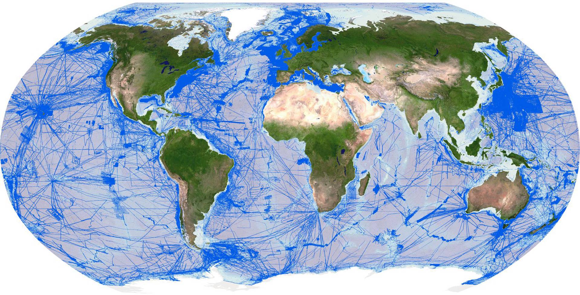
Areas mapped to date
Image courtesy Seabed 2030
From Maritime Magazines by Kira Coley Mars is more than 137 million km from Earth.
And yet, even with this colossal distance between us and the Red Planet, by 2013, nearly 90 percent of its surface had been mapped to some scale by the stereo camera on the European Space Agency's Mars Express.
Back on Earth, only around six percent of the ocean (and therefore only 33 percent of our own planet) had been mapped.
Fast forward ten years to 2023, and the majority of our planet’s surface still remains a complete mystery.
Of the 71 percent of Earth that is underwater, less than a quarter has been mapped to an adequate resolution.
And so as we continue to launch telescopes to view the furthest reaches of our galaxy and send tourists into space, more than half of our planet's topography remains hidden beneath the waves.
The recent words of Bill Gates come to mind:
‘Space? We have a lot to do here on earth.’
That said, we have not been idle in this regard.
Seafloor mapping activities have been occurring for more than a century through the General Bathymetric Chart of the Oceans (GEBCO).
Initiated in 1903 by Prince Albert I of Monaco and Professor Julien Thoulet of The University of Nancy, GEBCO has the vision of providing authoritative, publicly available ocean depth data (also known as bathymetry data) for the planet.
The GEBCO community, mostly made from a dedicated group of international volunteers, is celebrating its 120th anniversary in May at the International Hydrographic Organization (IHO) Assembly in Monaco.
Yet, despite many years of mapping efforts, only a tiny fraction of the ocean’s depth has been recorded, significantly limiting humankind’s ability to explore and understand the critical processes that support all life on Earth.
The importance of an ocean map goes far beyond the need to survey underwater foundations for the development of coastal infrastructure.
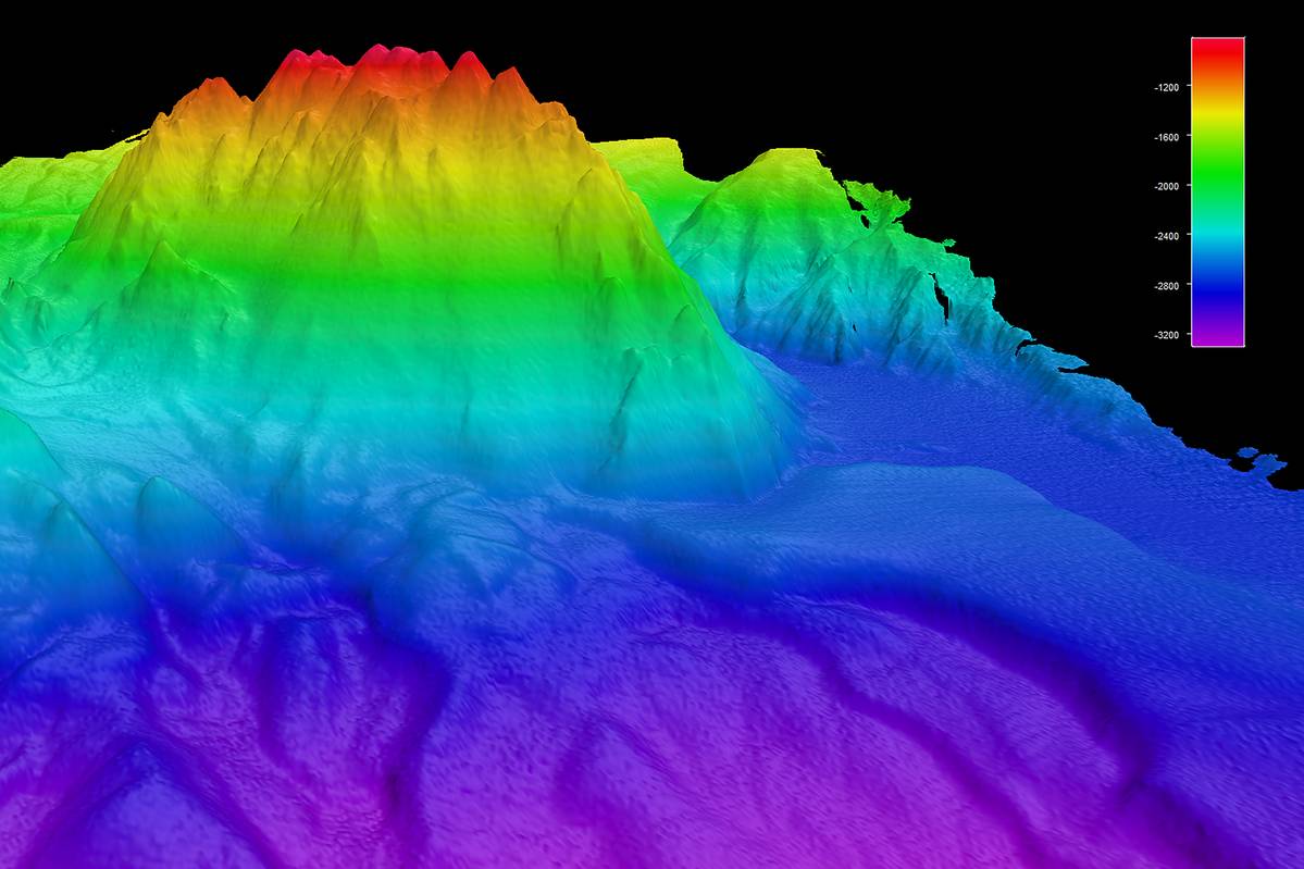
Knowing the seafloor's shape is fundamental for understanding ocean circulation, tsunami forecasting, fishing resources, sediment transportation, the safety of navigation, environmental change, underwater geo-hazards, cable and pipeline routing, and much more.
It is also vital information which will enable the realization of the UN Decade of Ocean Science for Sustainable Development's outcomes, including, among others, a healthy and resilient ocean.
A complete ocean map will lead to a boundless number of discoveries, some of which will be important enough to reshape what we think we know today about Earth and oceanic processes.
An apt example was demonstrated when Bruce Heezen and Marie Tharpe used early echo-sounding profiles across the Atlantic Ocean, enabling them, and subsequently others, to understand the relationship between mid-ocean ridges and earthquake seismicity.
As a result, they played an essential part in formulating one of the most significant paradigm shifts in science—developing the hypothesis of seafloor spreading and plate tectonics.
The lack of a complete world map and the critical role such knowledge plays in understanding and maintaining our planet brought together several individuals in pursuit of a radical solution.
Yohei Sasakawa and Mitsuyuki Unno of The Nippon Foundation, Robin Falconer of Robin Falconer Associates Ltd, Martin Jakobsson of Stockholm University, and Graham Allen of the British Oceanographic Data Centre conceived a global initiative which would act as an accelerator for GEBCO's long-standing endeavor.
And in 2017, Japan's largest philanthropic organization formally joined forces with GEBCO to launch The Nippon Foundation-GEBCO Seabed 2030 Project (Seabed 2030) at the first-ever United Nations Ocean conference in New York.
Six years later, Seabed 2030, together with its fast-growing list of partners, is an impressive global collective relentlessly pursuing a complete ocean floor map by 2030.
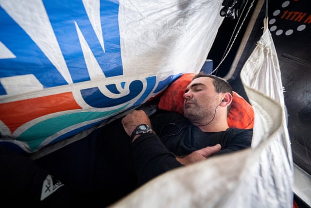
Martin Jakobsson onboard RV Skidbladner.
IMAGE COURTESY LARRY MAYER
From Ripples to Waves: Creating a Mapping Movement
With just over 75 percent of the seabed yet to be mapped, an ambitious task looms.
‘It is entirely achievable if we can further mobilize governments and industries to increase their support for seabed mapping,’ says Jamie McMichael-Phillips, director of Seabed 2030.
‘But it must be a global effort.’
Seabed 2030 is undoubtedly a heroic and ambitious call to action.
The project actively seeks partnerships to collate all existing data into the GEBCO map and to identify areas where there is no data to inform future mapping expeditions.
Today, the project has over 220 partners, data contributors, and supporters in more than 50 countries.
But there is still room, and a need, for growth.
Almost anyone in the private sector, industry, governments, NGOs, research institutes, as well as boat-owning individuals, can join Seabed 2030 and contribute towards achieving its critical mission in several capacities, from supporting outreach and advocacy efforts to solving the many technological or regulatory challenges limiting progress.
Of course, for a project of this grand scale, there are many challenges.
Beyond the technical issues of mapping a vast ocean from its coastal waters to its deepest depths, crowdsourcing has occasionally been difficult, with some nations hesitant to share seabed data within their exclusive economic zones.
The severe restrictions on human movement brought about during the height of the COVID-19 pandemic had a significant impact on academic scheduling of seabed mapping expeditions, in some cases delaying data collection efforts by years.
The need to map the ocean floor also competes for funding and resources against other pressing issues, such as tackling plastic pollution or marine biodiversity loss.
But with all its challenges, progress is being made.
In the last two years alone, the project has realized several important achievements.
In 2021, Seabed 2030 celebrated a major milestone by welcoming New Zealand as the first country to sign up for the ocean mapping initiative.
This was followed by the United Kingdom, the United States, the Philippines, and Kiribati, as well as over 20 additional MOU partners across academic and private sectors.
These partnerships are essential to the success of the mission.
In December 2021, the project marked a further milestone with partner Fugro: more than 2 million square km of high-resolution, in-transit bathymetry collected by Fugro vessels were delivered to the Seabed 2030 project.
Combined, this data coverage is roughly equivalent to the size of Mexico.
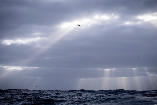
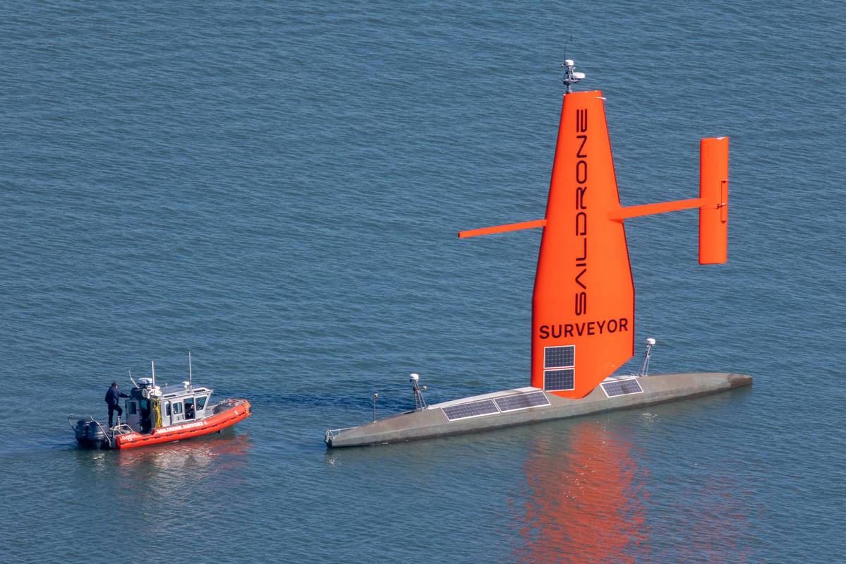
Clarity of data collected with the Saildrone.
IMAGE COURTESY SAILDRONE
The latest GEBCO figure was announced by Mitsuyuki Unno, Executive Director of The Nippon Foundation, at the second UN Ocean Conference held in Lisbon last year.
As of June 2022, ocean mapping coverage had increased to 23.4 percent following an increase of 10.1 million square km of new bathymetric data in just 12 months, equivalent to an area around the size of Europe and slightly larger than the Sahara ¬desert.
Seabed 2030 estimates that an additional 20 percent of the ocean map is gathering dust in long-forgotten or restricted archives.
‘A big part of achieving our mission is encouraging everyone to check past survey missions for shareable data that can be added to the GEBCO map, at a resolution of their choice, and help further our knowledge of our planet,’ says McMichael-Phillips.
And there are plenty of old archives yet to be discovered.
In October 2021, the results of an influential survey were released.
Out of 800 respondents, 154 potential sources of new data have been found.
As we make headway with a new year, Seabed 2030 comes one step closer to the end of the decade, and 2023 is already shaping up to be another significant year for the project.
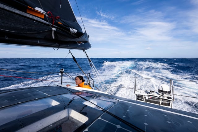
Crowdsourced data is paramount to Seabed 2030’s endeavor and it, therefore, hopes to further mobilize communities across the world to play a part in advancing our ocean knowledge, by humanity, for humanity.
In February last year, the International SeaKeepers Society - an organization which promotes oceanographic research through direct involvement with the yachting community, officially joined the project.
This was a welcome boost for crowdsourcing activities.
By enabling vessel owners to get directly involved in research initiatives, opportunities for ocean mapping are not only multiplied, but also expanded to uncharted areas as yachts often explore areas of the world’s ocean where data is sparse.
Such contributions can therefore have a significant impact on the global seafloor mapping effort.
But citizen science is not exclusive to yacht-owners.
Seafarers, including small boat owners, also have the potential to advance marine sciences.
To support this, Seabed 2030 makes uncomplicated data loggers available to ocean-going vessels as part of a wider IHO-led initiative at its Data Centre for Digital Bathymetry (IHO DCDB).
Established in 1990, the center supports worldwide data collection by mariners, which it archives and shares freely.
The center is currently hosted by the National Oceanographic and Atmospheric Administration (NOAA), a US government agency and, as of last year, official Seabed 2030 partner.
In addition to continuing this ongoing field of ocean research and science, Seabed 2030 is also committed to capacity building, particularly in Small Island Developing States (SIDS).
A priority for 2023 is supporting SIDs which, as island countries, are integral to the global collective Seabed 2030 hopes to inspire, as well as being key beneficiaries of the sustainable outcomes which a complete ocean map will help achieve.
Also worth mentioning is the launch of Empowering Women in Hydrography last year - an IHO project aimed at enabling more women to participate in the field of hydrography and to reach more leadership roles.
Currently less than ten percent of national hydrographers are women.
The project will, amongst other things, coordinate training opportunities and oversee the establishment of a mentoring network, and it has already received support from countries including the UK, Canada and Norway.
A Catalyst for Technological Innovation
Scientists have told us that we have less than ten years to prevent irreversible damage from climate change.
To succeed in this global ‘duty of care’ we need a complete map of the seabed – from the inshore drying line to the deepest regions and below the floating extensions of ice sheets.
Thus, we are at a critical point in history where we no longer have the luxury of measuring progress in decades, but years.
Although the space sector is making enormous strides toward mapping the planets and moons in our solar system, the ocean adds a layer of complexity to mapping efforts here on Earth.
In the ocean, light does not penetrate very far through the water column - particularly in the deep sea, where we mostly rely on power-hungry, ship-based echo sounder systems for data gathering, which is a slow and expensive process.
In order to meet Seabed 2030’s ambitious but critical goal, ocean innovation and capacity building within our sector will need to be augmented beyond anything we have ever seen before.
Seabed 2030 offers a new vision and audacious goals for the ocean technology community.
Alongside the Ocean Decade, the drive towards a complete ocean map could be the catalyst we need to propel innovation forward.
‘The primary challenge is capacity,’ says Guy Noll, department manager for Mapping Systems Products at Esri.
‘There are simply not enough observational tools available to meet high-resolution requirements for Seabed 2030.
The Southern Ocean, and southern oceanic areas in general, are most at-risk of not meeting the objective due to long distances and cost of mobilization of resources.
That said, there are multiple new platforms, such as our partner and co-supporter of Seabed 2030, Saildrone, who are making rapid progress in building new capacity.’
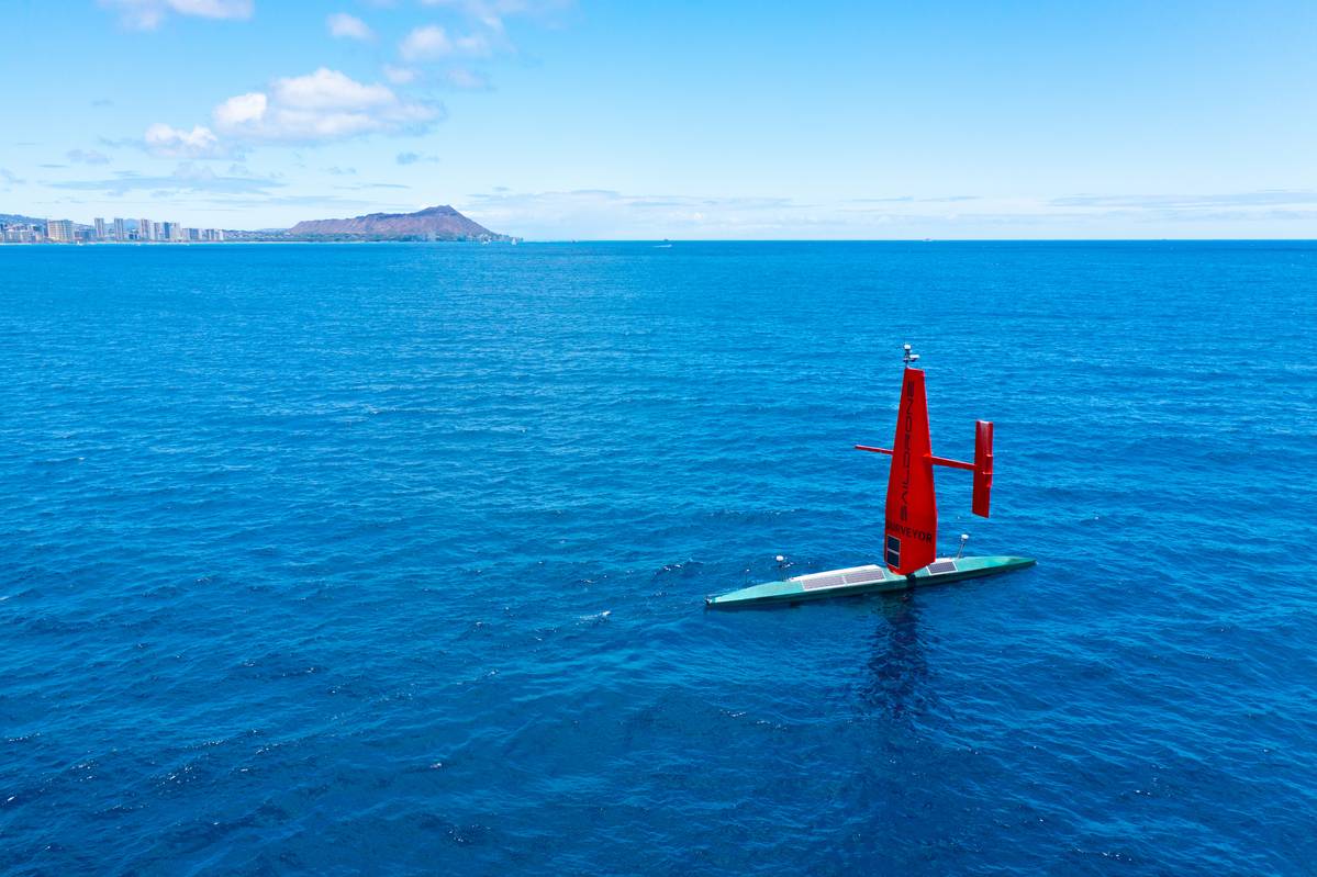
Saildrone’s Surveyor is an uncrewed surface vehicle (USV) propelled by the wind but primarily powered by solar energy.
It has a small diesel engine on board, primarily to charge sensor batteries but can provide propulsion, reducing the need to regularly return to port.
As a result, Saildrone’s Surveyor has long endurance and can collect high-resolution shallow and deep-water ocean mapping data that meets - or even exceeds - standards set by the IHO.
Over the last few years, the USV has collected ocean mapping data in the US Exclusive Economic Zone mapping, including areas in Hawaii, Alaska, and California.
Future efforts will support storm surge modeling efforts and emergency response, as well as coastal resiliency and hazard studies, resource management, restoration projects, habitat mapping, and infrastructure for renewable energy generation.
‘We can produce these vehicles a lot faster than you can build a new survey ship, and there aren't many new survey ships being built,’ says Brian Connon, vice president of Ocean Mapping at Saildrone.
‘And so, what the USV market brings is that ability to scale up and meet the demand very quickly.
And what we get as a Seabed 2030 partner is a goal to strive for and the opportunity to demonstrate our technology’s capability through joint projects.
We're starting construction of five new Surveyors equipped with new deep water multibeam mapping systems, which will be brought to bear against the challenge of Seabed 2030.
In the near future, we envision building ten, 20, or 30 of these surveyor platforms, having them in every ocean around the world, and collecting bathymetry for our customers.
For Seabed 2030, data discovery was the big first piece, and the next step has to be getting more assets, such as USVs, Autonomous Underwater Vehicles, Gliders and Profilers, in the ocean for mapping.’
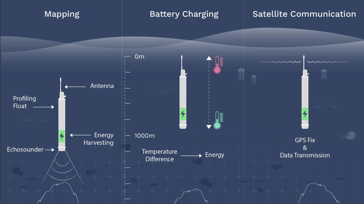
Seatrec’s InfiniTE Float platform is powered by a pioneering energy harvesting system that generates electricity from the ocean’s temperature differences.
Echosounders - previously impossible to mount on a float because of power limitations - are now able to conduct bathymetry surveys at depth, autonomously, and without expensive ship support.PHOTO CREDIT: SEATREC
With seven years remaining, achieving the project’s goal in the relatively short time frame will be a momentous challenge for the ocean sector.
‘The ocean is a very challenging place to work, especially when developing hardware,’ says Yi Chao, founder and CEO of Seatrec.
‘Because of this, the development cycle takes much longer than for systems used on land or in the air.
As a result, one of the biggest challenges put forward by Seabed 2030 for the ocean technology community is how can we speed up the innovation process? It takes a long time for new technology to hit the market and to scale up on the global level, and time is not on our side.
Clearly, we need all hands on deck.
It will take the whole community to reach that objective.
At Seatrec, we want to be part of this international effort and make our unique contribution.’
Chao pioneered the ocean thermal energy harvesting project at NASA JPL in collaboration with his co-inventors, Jack Jones and Thomas Valdez.
Now he supports Seabed 2030 by developing his technology to power micro echosounders on thousands of profiling floats.
He adds, ‘There are currently 4,000 Argo floats in the ocean measuring temperature and salinity.
If we can harvest energy from the ocean to power additional sensors such as echosounders, then we can mobilize all these existing platforms to measure not only oceanography but also map the bathymetry.
Imagine if we suddenly had 4,000 echo sounders moving around the globe; we’d automatically have global coverage.
Seabed 2030 has this incredible data management system distribution network, in the form of its regional and global centers, which we can leverage so we can just focus on data collection.’
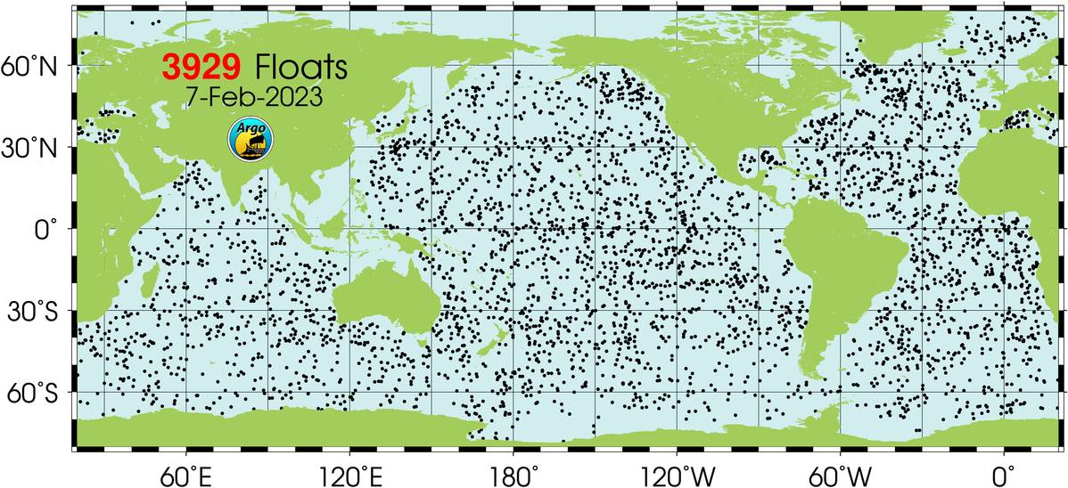
There are currently 4,000 Argo floats in the ocean measuring temperature and salinity.
IMAGE COURTESY SEABED 2030
With funding secured from the Eric and Wendy Schmidt Family Foundation, Seatrec is in the final stages of getting the first two prototypes ready for demonstration.
The systems are being built in collaboration with Larry Mayer from the University of New Hampshire and David Sandwell from Scripps Institute of Oceanography.
Mayer is also the co-head of Seabed 2030’s Arctic and North Pacific Regional Center, along with Martin Jakobsson.
‘Through Seabed 2030’s regional centers and global network, we can get access to bathymetric experts to help validate and further develop our technology,’ says Chao.
‘We're going to verify our technology this summer and expand the floats’ capabilities beyond oceanography to bathymetric mapping.
Then, by working with people within Seabed 2030’s community, we will get ready for the next step, which is scaling up for global distribution.’
Saildrone has also been working closely with Mayer.
Connon added, ‘It's great to have Professor Mayer on board.
His program is particularly helpful when giving us a route from A to B and guiding us over unmapped areas.
The entire Seabed 2030 community is a fantastic asset.
And that's how we will get things done, by these relationships and working together to map the ocean.
I'm excited because I now think that in my lifetime, we could do this.’
Seabed 2030 has also supported a number of ground-breaking ocean mapping expeditions.
A recent example is the Tonga Eruption Seabed Mapping Project (TESMaP), formed in response to the eruption of the Hunga Tonga-Hunga Haʻapai (HT-HH) volcano in January 2022.
The eruption of the underwater volcano caused a tsunami that devastated the island and spread throughout the Pacific.
The shape of the seabed greatly influenced the speed and size of the tsunami.
Waves hit Australia, New Zealand and Japan and even touched the shores of California, Alaska, and Chile.
New Zealand's National Institute of Water and Atmospheric Research (NIWA) and The Nippon Foundation - supported by Seabed 2030 - came together to examine the undersea impacts of the eruption, which was subsequently confirmed to be the largest ever recorded.
SEA-KIT International also played a critical data-gathering role.
Remotely operated from the UK, a SEA-KIT USV surveyed the site of the Tonga volcano eruption.
The uncrewed vessel was able to survey across areas considered too dangerous for NIWA’s scientists, gathering further evidence from the caldera that the HT-HH was still erupting.
‘This mission was a great example of international coordination.
When we have the opportunity to test equipment in such dangerous locations, we learn a huge amount about how to overcome technical challenges in remote regions and it allows us to demonstrate the capabilities of the vessel’, says Peter Walker, SEA-KIT’s Director of Technology.
‘The biggest challenge we're finding now is the more remote the technology is, the more difficult it is to obtain good quality data, especially at deeper depths.
Satellites are one of the key things here.
Connectivity is important for the quality control of data acquisition, navigation, and safety of navigation.
Connectivity also helps with regulation.
The classification societies don't want a robot in the ocean doing its own thing without some kind of control or a higher level of supervision.’
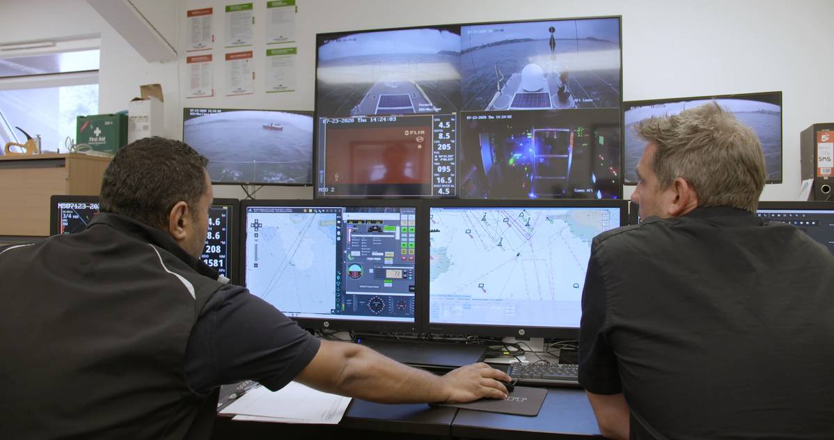
SEA-KIT control panel: Members of the SEA-KIT International team controlling the ship from their office in Essex.
IMAGE COURTESY SEA-KIT
‘As an industry, we need to change how we work together so we can benefit from each other's strengths to accelerate the process,’ adds Walker.
‘At SEA-KIT, we’ve always been focused on changing the way we do things offshore and becoming better stewards of the ocean.
That’s why the fit with Seabed 2030 is so snug because as well as being a commercial business, there is also a mutual drive to want to develop that understanding and try to meet the ultimate goal of Seabed 2030.
And that can only come with continued collaboration and involvement from countries all around the world.’
A partnership with Seabed 2030 is a good measure of the commitment we all have to mapping our ocean, says Connon.
‘Saildrone believes that the ocean is the key to everything, and we want to make sure it's healthy and secure.
But we've got to understand it first.
And the basis of understanding is knowing what's at the bottom of the seafloor.
We also need to help Seabed 2030 tell the story about why ocean mapping is important so we can help convince funders to actually invest in our technology.
Or is there a new avenue we’ve yet to explore? How do we make vehicles like ours available for carbon credits, for example? There's currently no mechanism for that.
If there's an advantage to using low carbon surveying platforms, then more companies might be willing to invest.’
Chao adds, ‘If we want to reach the goal by 2030, we cannot duplicate efforts and waste resources.
I'm optimistic we can do it.
It just needs a community, the whole sector to work together and to coordinate.
And it's not about my technology, about your technology, it's about how we are leveraging all the existing technology and developing new ones in synergy so they complement these efforts.
‘By 2030, I hope we can no longer say that we know more about the surface of the moon and Mars than we do our own planet.
It would be nice if we could finally retire that statement.’
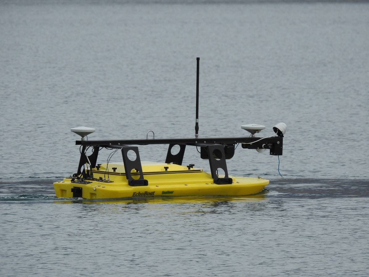
The EchoBoat is a remote-control scanning device used by scientific expeditions capable of housing a variety of scanners.
Here it is scanning one of the shallower inland lakes in Greenland: Pink Foot Lake.
IMAGE COURTESY LARRY MAYER
Links :


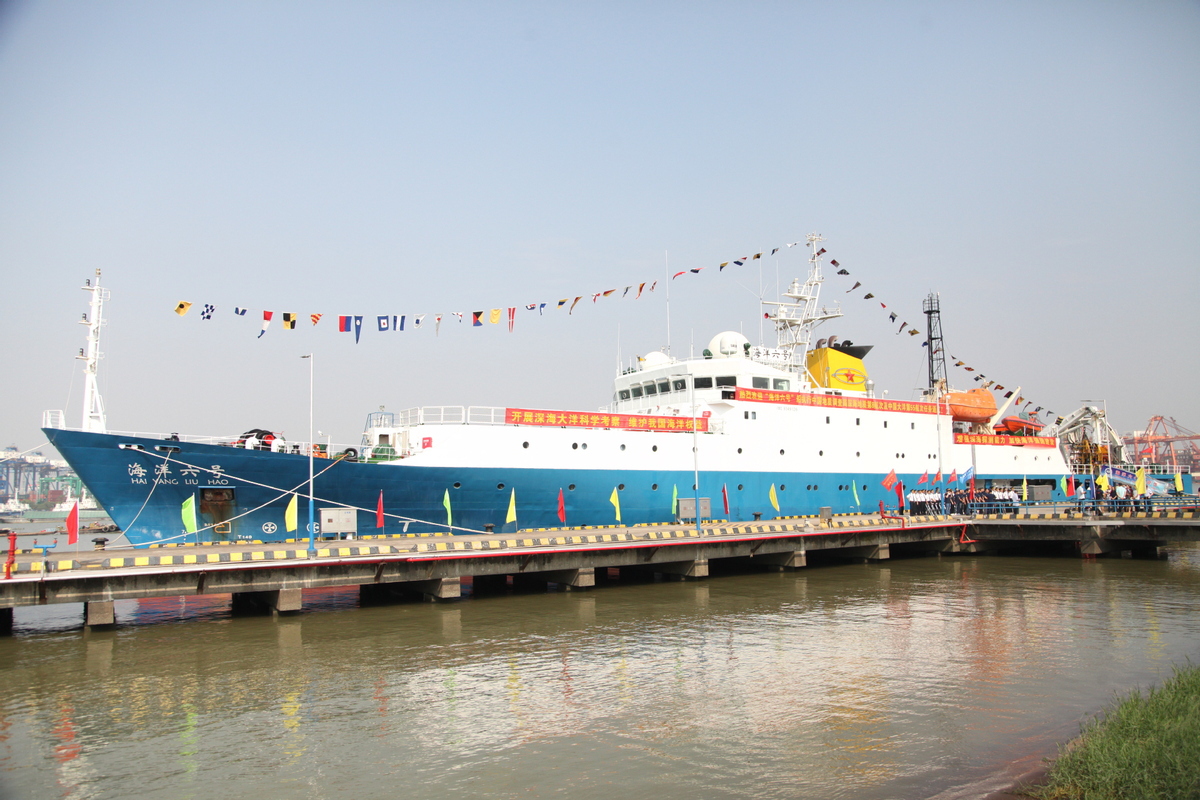 Chinese scientific research ship Haiyang 6 returns to Guangzhou, Guangdong province, after completing its deep sea exploration on Oct 23, 2019.