Saturday, May 22, 2021

Navygatio : Weather4D/SailGrib's 5th dimension


Navygatio – web home page

From NavigationMac by Francis Fustier


The latest update of Weather4D Routing & Navigation brings a major novelty : Navygatio (¹), a web interface which will allow to record the navigations on a server as time goes by, to add photos, to share own page with relatives, to compare the tracks, to analyze performance, and many more things to come.
A real " cloud at the unique service of Weather4D Routing & Navigation users with iOS and SailGrib WR with Android.

Developed for over a year jointly by Henri Laurent (SailGrib) and Olivier Bouyssou (Weather4D) this new interface already allows the recording of all navigation data, either in cellular connection (real and / or deferred time), either in satellite connection with Iridium GO! (deferred) (²).
Tracks, data from connected instruments, and, icing on the cake : automatic data recording in alogbook !


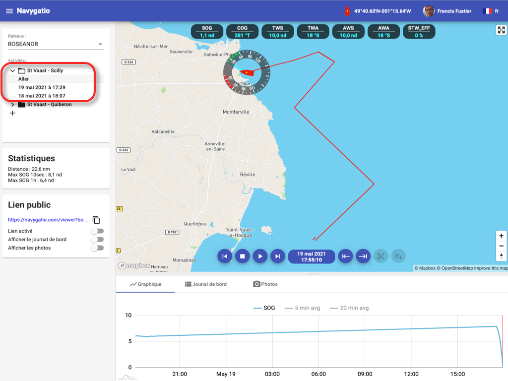
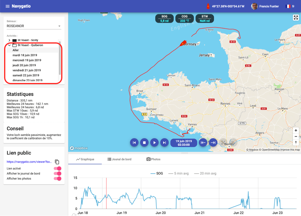
Several trips grouped together in the outbound journey 

Implementation

In Navygatio website we create an account, exclusively with a Google email address (Gmail) or Apple (Apple Store account address).
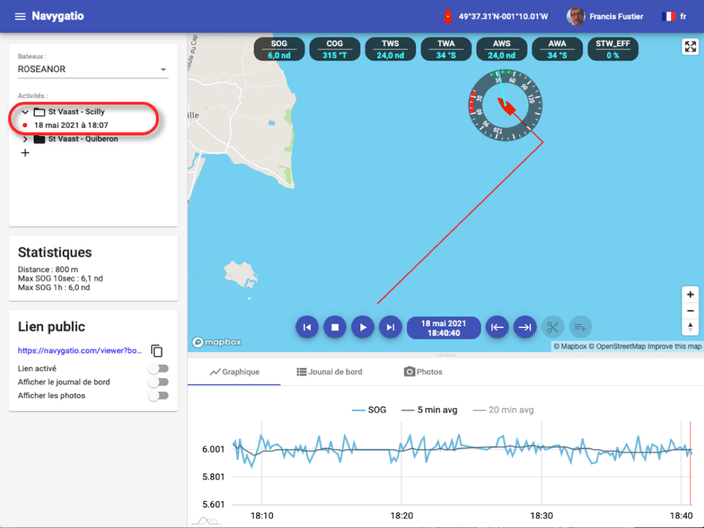
We enter the information about the boat, then we create an activity.
It can be a cruising voyage, a training, a regatta, etc.

We can create as many activities as we have navigations, cruises or regattas, to perform.
In the same activity, several trips can be recorded if necessary.
We can then group the trips together in a single journey to replay it on the screen.

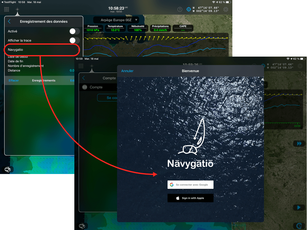
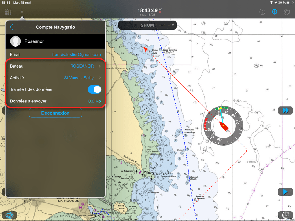
Once the account has been created on the website Navygatio, we connect to it in Weather4D Routing & Navigation via a new entry in the "Navigation" menu.


Connection with Weather4D Routing & Navigation

Select the email address used in Navygatio, the name of the boat, and the current activity to choose from a list of activities.
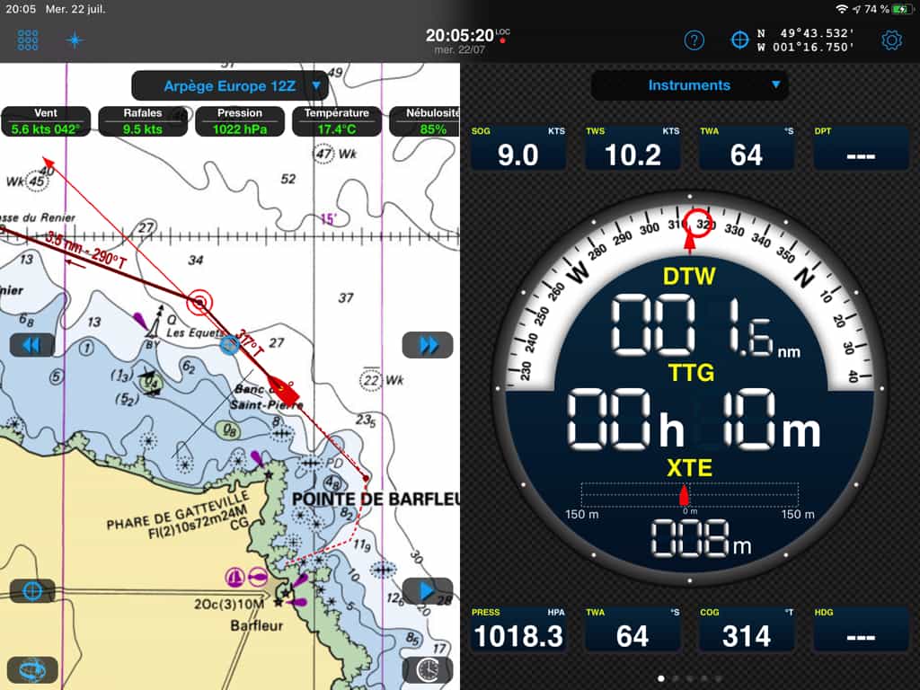
When leaving, after activating the navigation mode in Weather4D, just activate "Data transfer".
They will be synchronized, either in real time with an internet connection (cellular connection near the coast), either deferred as soon as a connection is available (cellular or satellite) (²).


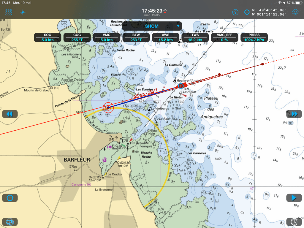
We see the track and the transferred data displayed on the screen, all available data attached to the route is recorded.


By clicking on a data label in Navygatio, a graph traces its evolution over time.
We can move forward or back in time, you can also click anywhere on the track line to bring the boat back to it and read the data at that point in time, for example when tacking.
You can also display average values ​​over time.

At the end of a course, just turn off data transfer to stop recording.
Like this, several successive tracks can be recorded for the same cruise, or several stages of the same regatta, by reactivating the transfer at each new start.


A new trip begins… 


… registered in Navygatio

You can share a public link with your loved ones to your Navygatio page for a single course, and better, you can invite " followers ", or other users registered in Navygatio, who will be able to access all your journeys.
Your competitor-friends will be able to analyze your performance data, compare with theirs, and many other things.

Other important feature, functionlogbook will evolve in the near future.
In addition to data transfer in the "Logbook" tab of the web interface, input fields will allow you to add textual notes.
Thereafter, a real Logbook interface will be available, in the same way as the Instruments page, in half screen.
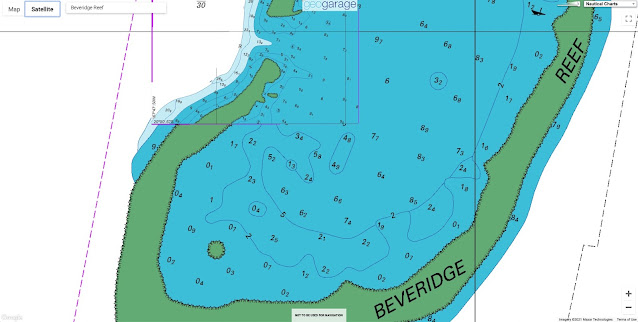
Also, the possibility will be offered to subscribers to GeoGarage maps to display the nautical charts on the screen Navygatio, to see more precisely the journeys made.
Finally, the identifiers of the Navygatio account should soon be unified for the weather subscription account and the GeoGarage account., in order to simplify its use.

It goes without saying that access to Navygatio is free for all Weather4D Routage users.
& Navigation with iOS and SailGrib WR with Android.
It also provides them with a real free tracking solution thanks to the "Public link" function for the attention of relatives.

Other more advanced functions will be added later, mainly for the attention of racers, race and rally organizers.

Note :

The function data transfer to Navygatio is completely independent of the function AIS data sharing that can be activated in the General Settings > Navigation > AIS settings.
This last, when activated, only feeds information from AIS targets, voluntarily shared by Weather4D users, displayed on the application (light blue ship icons) (³).
Simultaneous broadcasting of the two streams is not incompatible.

Pending the update of User Guide, the Navygatio user manual is available at this link in PDF format : NAVYGATIO.
To download without moderation.

–––
(¹) Domain name, anglicized (Navy instead of Navi), from Navigatio which means "Navigation" in… Latin ! Comes from the wordnāvigō‎ (navigate), formed withnāvis‎ (ship) andagō‎ (make).
(²) Function awaiting validation.
(³) See User Guide Weather4D Routing & Navigation pages 131-132.
 
Links :

New Zealand (Linz) update in the GeoGarage platform

 
4 nautical raster charts updated & 1 new chart added

Deep-sea fish with lightbulb on its head mysteriously washes ashore in California


From LiveSciences by Rachael Rettner

The nightmarish fish is rarely seen outside of the deep ocean.

A nightmarish fish that typically dwells thousands of feet below the ocean's surface recently washed ashore on a California beach, according to news reports.

If you've seen 'Finding Nemo', you will know exactly what an anglerfish looks like 

The deep-sea fish, known as an anglerfish, is rather elusive and rarely seen outside of the deep ocean, according to The Guardian.
But earlier this month, the intact body of an anglerfish was spotted at Crystal Cove State Park in Orange County, California, by beachgoer and fisherman Ben Estes, The Guardian reported.

Exactly how the fish got there is a mystery.
"To see an actual anglerfish intact is very rare, and it is unknown how or why the fish ended up on the shore," staff at the Crystal Cove State Park wrote in a post on their Facebook page.


The bizarre creature is normally found at ocean depths of around 3,000 feet (914 meters), the post said.
More than 200 species of anglerfish are found worldwide, and park officials determined that the specimen in this case is most likely a Pacific football fish.

The fish's mouth sports a number of sharp, pointy teeth; and the top of its head features a long, protruding stalk with a bioluminescent bulb at the end, which is used "as a lure to entice prey in the darkness" of the deep ocean, the Crystal Cove State Park post said.
(A depiction of the creepy fish makes a memorable appearance in the 2003 movie “Finding Nemo.”)

Female football fish can grow up to 2 feet (0.6 meters) long, while male football fish are only about an inch long, park officials said.
And the fish's method of reproduction is unusual to say the least.
"Males latch onto the female with their teeth and become 'sexual parasites,' eventually coalescing with the female until nothing is left of their form but their testes for reproduction," staff said on Facebook.

The unusual specimen in this case may be transferred to the Natural History Museum of Los Angeles to become part of the museum's collection, according to The Guardian.
It is currently being held by officials with the California Department of Fish & Wildlife, according to CNN.

"Seeing this strange and fascinating fish is a testament to the diversity of marine life lurking below the water's surface in California's MPAs [marine protected areas]," the Crystal Cove State Park post said.
"And as scientists continue to learn more about these deep-sea creatures, it's important to reflect on how much is still to be learned from our wonderful ocean."
 
Links :

Friday, May 21, 2021

What is GNSS spoofing?

Figure 3: European Galileo satellites provide an open authentication service on the E1 signal and a commercial authentication service on the E6 signal. (Image courtesy: European Space Agency)

From GIM Int by Gustavo Lopez, Maria Simsky
 
How Spoofing Affects Survey and Mapping

With spoofing attacks on the rise, survey-grade GNSS receivers need to be protected by interference mitigation technology utilizing the latest security techniques to ensure reliable positioning.

The survey and mapping industry has been benefiting for years from GPS/GNSS precise positioning technology.
While GNSS spoofing is recognized as a real threat for unmanned aerial vehicles (UAVs or ‘drones’), its influence on survey and mapping equipment is still underestimated.
Reliable data capture is important across various mapping use cases, from man-based surveying and mobile mapping all the way to UAV photogrammetry.
Ensuring dependable positioning requires the use of robust equipment, designed in such a way that alleviates all possible vulnerabilities.
The use of GNSS receivers which are robust against jamming and spoofing is key to trustworthy data capture anytime, anywhere. 

GPS/GNSS Spoofing vs Jamming

Both jamming and spoofing are a type of GNSS radio interference that happens when weak GNSS signals are overpowered by stronger radio signals on the same frequency.
Jamming is a kind of ‘white noise’ interference, causing loss of accuracy and potentially loss of positioning.
This type of interference can come from adjacent electronic devices or external sources such as radio amateurs in the area.
Spoofing is an intelligent form of interference which fools the user into thinking that he/she is in a false location.
During a spoofing attack, a radio transmitter located nearby sends fake GPS signals into the target receiver.
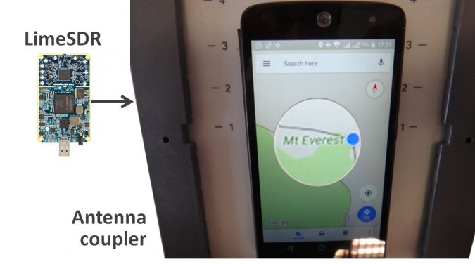
For example, even a cheap software-defined radio (SDR) can make a smartphone believe it’s on Mount Everest (see Figure 1)!

GNSS users are experiencing ever-more cases of jamming, and spoofing events are on the rise too – especially in recent years since it has become easier and more affordable to create malicious spoofing systems.
There are plenty of examples, from Finland – which experienced a week-long spoofing attack in 2019 – to China where multiple vessels have been the target of a spoofing attack.
Hence, jamming and spoofing protection is no longer a ‘nice to have’ feature but a critical component of a GNSS receiver.

Spoofing Incidents are On the Rise

C4ADS, an NGO conducting data-driven analysis of conflict and security matters, concluded that Russia has been extensively using spoofing to divert aerial drones from entering airspace in the vicinity of governmental figures, airports and ports.
And some of the most enthusiastic spoofers are fans of the augmented reality mobile game ‘Pokémon Go’, who use SDRs to spoof their GPS position and catch elusive Pokémon without having to leave their rooms.

Such attacks usually target a specific receiver.
However, the spoofing transmission will actually affect all GPS receivers in the vicinity.
For example, an SDR can affect all GPS receivers within a 1km radius of the spoofing source, and the signal can be amplified for further propagation.
This means that survey or mapping jobs in densely populated areas are at a higher risk of such ‘indirect’ spoofing attacks.
 
Figure 1: Even a cheap SDR can overpower GNSS signals and spoof a single-frequency smartphone GPS into believing it is on Mount Everest.

How to Spoof-proof a Receiver


A spoofer can either rebroadcast GNSS signals recorded at another place and time, or generate and transmit modified satellite signals.
Therefore, to combat spoofing, GNSS receivers need to be able to distinguish spoofed signals from authentic signals.
Once a satellite signal is flagged as spoofed, it can be excluded from positioning calculations.

There are various levels of spoofing protection that a receiver can offer. Using the analogy of a home intrusion detection system, it can be based on a simple entry alarm system or a more complex movement detection system.
For added security, the home owner could decide to install video image recognition, breaking-glass sound detection or a combination of the above.
An unprotected GNSS receiver is like a house with an unlocked door; it is vulnerable to even the simplest forms of spoofing.
Secured receivers, on the other hand, can detect spoofing by looking for signal anomalies or by using signals designed to prevent spoofing, such as Galileo OSNMA and E6 or the GPS military code.

Advanced interference mitigation technologies, such as the Septentrio AIM+, use sophisticated signal-processing algorithms to mitigate jamming and flag spoofing.
For spoofing detection, AIM+ checks for various anomalies in the GNSS signal, such as unusually high signal power.
It also works together with RAIM+ integrity algorithms to ensure range (distance to satellite) validity by comparing range information from various satellites.
AIM+ won’t even be fooled by an advanced GNSS signal generator, Spirent GSS9000.
Even with realistic power levels and actual navigation data within the signal, it can still identify it as a ‘non-authentic’ signal.
Other advanced anti-spoofing techniques such as using a dual-polarized antenna are currently being researched.
 
Figure 2: GNSS spoofing could be used to manipulate movement of aerial drones.
Satellite Navigation Data Authentication


Various countries are investing in spoofing resilience by building security directly into their GNSS satellites.
With Open Service Navigation Message Authentication (OSNMA), the European Galileo is the first satellite system to introduce an anti-spoofing service directly on a civil GNSS signal.

OSNMA is a free service on the Galileo E1 frequency that enables authentication of the navigation data on Galileo. Such navigation data carries information about satellite location and, if altered, will result in wrong receiver positioning computation.
As a close partner of ESA, the European GNSS manufacturer Septentrio has been contributing to the design and testing of the Galileo system since its inception.
Today, as the OSNMA system is entering its testing phase, Septentrio receivers have successfully been used to test the OSNMA signals.
The US GPS system is also experimenting with satellite-based anti-spoofing for civil users with its recent authentication system called Chimera.

Advanced Interference Mitigation Technology

OSNMA is a part of the puzzle comprising the AIM+ interference defence system.
The anti-jamming component suppresses the widest variety of interferers, from simple, continuous narrow-band signals to the most complex, wideband and pulsed transmissions.
The anti-spoofing component consists of signal anomaly detection, OSNMA, RAIM+ as well as other algorithms. 

Future-proof GNSS Receivers


Interference mitigation technology such as AIM+ protects accurate positioning today.
To ensure the best protection for tomorrow too, GNSS manufacturers are offering future-proof technology which allows users to take advantage of new GNSS security services like ONSMA and Chimera as soon as they become available.
Utilizing future-proof GNSS receivers in survey, mapping and UAV equipment enables integrators to reduce their time to market with resilient products.
Secured GNSS means trustworthy precise positioning and peace of mind for everyone who relies on this technology.

Thursday, May 20, 2021

Imray layers update in the GeoGarage platform

64 nautical raster charts added

Securing safe sea routes in the Antarctic


From LinkedIn by KHOA

Second hydrographic survey completed near the King Sejong Station and an up-to-date nautical chart to be published

The Korea Hydrographic and Oceanographic Agency (KHOA) of the Ministry of Oceans and Fisheries successfully completed a second hydrographic survey at the Maxwell Bay, King George Island, Antarctica this year.

Localization with the GeoGarage platform (UKHO nautical raster chart)

Localization with the GeoGarage platform (NGA nautical raster chart)

The King Sejong Station, where the hydrographic survey was conducted, is the first Antarctic station of the Republic of Korea and various research activities have been carried out since its establishment in 1988.King George Island, where the Station is located, has recently been in the spotlight as a tourist destination thus has seen a rapid increase in maritime traffic, but as mariners have had to rely on outdated nautical charts dated between 1983 and 2006, there have been many difficulties in safe navigation and smooth research.

In response to such need, a first comprehensive hydrographic survey was conducted from 2019 to August 2020 to research the bathymetry, coastline and others near the King Sejong Station. Consecutively, KHOA carried out a second high-resolution survey in January this year for 15 days onboard RV Araon.
 
The second survey found that the depths ranged from 0.46m to 400m and the seafloor mostly consisted of mudflats containing gravel.
In addition, we discovered traces of glacier caused by massive floating ice trapped on the seafloor, as well as waterways and a fjord created by the melting and erosion of glaciers.
 
 
On this survey a new undersea feature at 400m in height was also found 274km north-northwest from the King Sejong Station and a naming proposal in Korean will be submitted for international recognition.
Since the first international recognition of Anyongbok Seamount and Ulleung Plateau and eight others in 2007, we have listed so far a total of 61 undersea features in Korean around the world.
 
KHOA is currently producing a nautical chart with a scale of 1:10,000 using the acquired bathymetric data.
As soon as it is finished, it will be released in May through our Polar Navigational Safety Service at https://khoa.go.kr/polar to support the safety of vessels navigating in the Antarctic.


“We hope to support research activities and navigational safety in the Antarctic through the up-to-date nautical chart,” said Dr Lae Hyung Hong, Director General of KHOA. 
“KHOA plans to conduct a third hydrographic survey at the end of the year to supplement the data from the first and second surveys with more accuracy.”


Wednesday, May 19, 2021

Essential knots: how to tie the 20 knots you need to know


From Popular Science by Tim MacWelch

One of these knots could save your life one day.

 
Knot tying has always been one of those key outdoor skills that the inexperienced take for granted. 
The experienced outdoorsman, however, has had enough success and failure to know that there are right and wrong knots for certain jobs.

But first, it helps to know a few strange terms.
Put it simply, a knot is some kind of fastening or splice made by intertwining one or more ropes or some other flexible material.
After tightening a knot, it should hold on its own.
A hitch is a little bit different.
It’s like a knot, but it generally involves another object like a stick, a post, a ring, or occasionally another rope.
Properly tied, hitches can hold their place, or they may be able to slide, depending on the hitch you choose.
A lashing is like a hitch, but slightly more complex.
Lashings involve the use of a rope or similar material to secure two or more objects together.
To grossly oversimplify all this, the knot is just rope fastened together; the hitch is a rope fastened to an object; and a lashing is a rope fastening multiple objects together.

A good knot can save lives when you’re dealing with a survival situation, performing first aid, and when working over heights or water.
But, you have to know how to tie it.
So make sure you know what to do with your rope the next time you head into the wild by learning these 20 essential knots.

1. Square knot
 
 
Use a square knot to join a cut rope back together, or to create a loop of rope around something
(like a bundle of sticks).

The square knot is a classic for connecting lines and tying knots.
Whether you are tying two ropes together to make a longer rope, or you are tying up a bundle of firewood to carry, the square knot is a winner.
It’s much more secure and stable than its cousin the granny knot, which everyone is probably familiar with as part of tying their shoes.

How to tie a square knot:

You can tie a solid square knot by lapping one rope right over left, then underneath the other, and then tying the same again in the reverse direction—left over right and then underneath.
You’ll know you did it right when the working end and standing end of each rope is side by side (not making a “cross” like a granny knot).
 
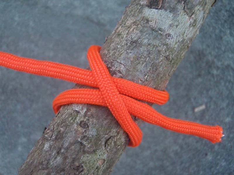
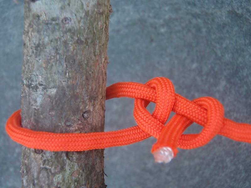
2. Clove hitch
 
 
The clove hitch.

The clove hitch is an easy knot to tie, and it secures a line to a tree or post quickly, but it does slip when used alone, without any other knots as a backup.

How to tie a clove hitch:

To create a clove hitch on a tree, make a loop of rope around the tree.
Then make another loop and pass the free end of the rope under the second loop before tightening.
To tie this one over a post or stake, just create a loop in the free end of the rope and slide it over the post.
Then make another loop the same as the first.
Put the second loop over the post (just above the first loop) and tighten the hitch.

3. The bowline
 
 
My greatest mentor once told me, “When you get to the end of your rope, tie a bowline and hang on!” 

The bowline creates a loop at the end of a rope that cannot shrink or expand.
This knot is often taught and illustrated with a poem of a rabbit coming out of the hole, hopping in front of a tree, going behind the tree, and back down his original hole.

How to tie a bowline:

Form a loop on top of the long end of the line.
Pass the working end of the line up through the loop and around behind the line.
Then pass the working end down through the original loop, all while maintaining the shape of the second loop you create, which becomes your bowline loop.
Once the “rabbit” is back down its hole, pull the “tree” up to tighten the bowline.

4. The figure eight
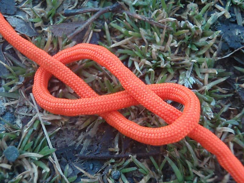
 
Often used in climbing and sailing, the figure eight is a handy single-strand “stopper” knot that prevents rope from sliding through something like a grommet.

The figure eight knot creates a stopper wherever you need one on a rope, though the steps are also steps you take to create several other knots.

How to tie a figure eight:

To tie a figure eight, also known as a Flemish bend, simply pass the free end of a line over itself to form a loop.
Continue under and around the line, and finish the knot by passing the working end down through the original loop.

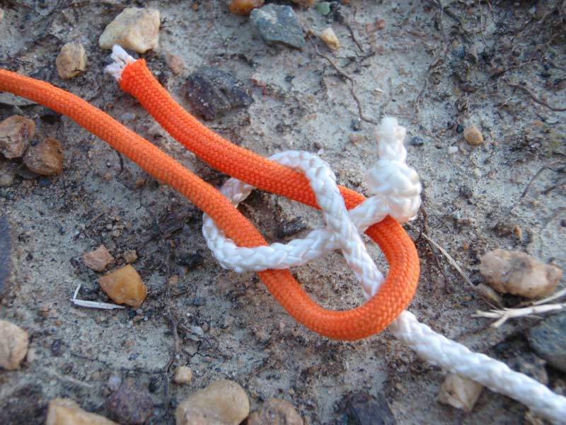
5. The sheet bend
 
 
Need to connect a fat rope to a skinny one? Do you need to connect a rope to the corner of a tarp that lacks a grommet? The sheet bend is one of the best choices to join dissimilar materials together.

The sheet bend is my favorite one of all, even though technically it’s a “bend”—a type of knot that connects one rope to another.
I like it because it’s the best bend for tying different types of material together or joining different thicknesses of rope.
This knot even joins together lines or materials that normally couldn’t be joined together because of differences in diameter.

How to tie a sheet bend:

To create a sheet bend, bend the thicker or more slippery rope into a “J” shape (like a fish hook).
Then pass the other rope through the hook shape from behind, wrap it around the entire fishhook once and then tuck the smaller line between itself and the other rope.
If the ropes are the same diameter and texture, the sheet bend actually resembles a square knot.
To tie a sheet bend with fabric or a tarp, collect, squeeze, and shape the material into a “J” shape, and then run your rope through and around the “J.”

6. Two half hitches
 
 
To secure shelter lines or hang up gear, you can tie (or untie) two half hitches in a hurry.

You can use two half hitches to secure a line to trees or poles, or to secure the line to itself like you would tying a trucker’s hitch.
A half hitch is fairly easy to tie, and I use it often to tie tarps up for shelters, or to hang up hammocks.

How to tie two half hitches:


After you wrap the rope around the standing end and through the inside of the loop created to make the first half hitch, wrap around the line the same way again to make the second half hitch.
Pull it tight and you should have two half hitches, one seated next to the other.
If you want added insurance, you can tie an overhand knot with the tag end of the line to keep the two half hitches from slipping.

7. Taut line hitch
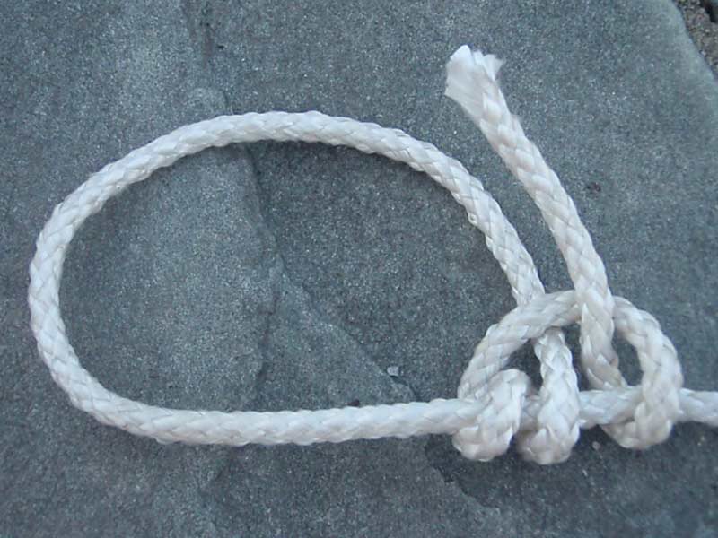
 
Make your adjustments as needed when you slide a taut line hitch back and forth on a tightened line.

The taut line hitch takes the place of a slide to tighten or loosen a loop in a line (like a tent guy line).
This knot grips well as long as there is tension on the “taut” side of the loop.

How to tie a taut line hitch:


To tie the taut line hitch, create a loop by wrapping around a solid, unmoving object like a tree or tent stake.
With the free end of the rope, wrap around the main line twice on the inside of the loop.
Then lay the free end of the rope over the two wraps, wrap it around the main line, and draw the tag end through the loop you just created.
Cinch the wraps until tight.
Pull on the standing line and the taut line hitch should grip the loaded line.

8. Fisherman’s knot
 
 
The fisherman’s knot.

True to its name, the fisherman’s knot is pretty much only good for using with fishing line.

How to tie a fisherman’s knot:

Pass the free end of the line through or around the object to be secured, for example, through the eye of a fishhook.
Then, wrap the free end of the line around the other side of the line about five or six times.
Pass the free end of the line through the triangular opening next to the object being secured, and then pass the free end of the line through the large loop you just created by going through the small triangle.
If you are tying this one with fishing line, spit on the line before tightening to lubricate it so that the friction does not cause heat damage to the line.
Tighten the knot, trim off any extra line and enjoy your day fishing.

9. Water knot
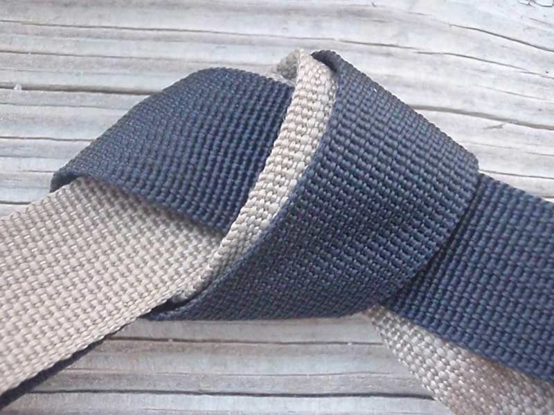
 
Belts, straps, webbing, and other flat ribbon-like materials are notoriously tricky to connect unless you know how to tie the water knot.

The water knot safely secures webbing, flat belts, and most types of straps together.

How to tie a water knot:

To tie the water knot, start with a loose overhand knot in the end of one strap.
Pass the other strap in the opposite direction so it mirrors the route of the overhand knot on the first strap.
Take the ends of the two straps and pull the knot tight.
That’s it—it’s very simple and very strong.

10. Rolling hitch
 
 
The rolling hitch.

The rolling hitch adds a leg to an existing line.
This hitch is the basic knot behind a taut line hitch, but it can be added to any existing line.
The rolling hitch was often used historically to hook more dogs to a dog sled main line.

How to tie a rolling hitch:


Wrap the free end of one rope around the main rope to create a half hitch.
Make a second half hitch and then wrap over the entire knot to finish with a final half hitch to the other side from your starting place.

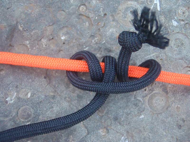
11. Prusik knot
 
 
The Prusik knot.

The Prusik knot creates a loop that can be used as an ascender or decender.
This “slide and grip” knot can also be handy for adding a loop to a rope when neither end of the rope is free.

How to tie a Prusik knot


To tie a Prusik, you’ll need a short rope and a separate long rope.
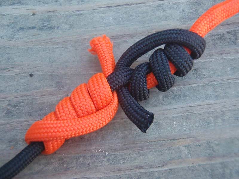
Tie a loop in the short rope that is secured with a solid knot like a square knot.
Now, wrap the loop around the long rope three times, making certain that each wrap lies flat against the long rope.
Pass the loop of short rope under itself and pull it tight.
As long as there is weight on the loop, the Prusik will grip the long rope.
You can also slide the Prusik up or down the long rope by taking the weight off the loop and pushing the wraps up or down the long rope.

12. Timber hitch
 
 
The timber hitch grabs tightly around rough, cylindrical objects like posts and logs and it’s also easy to untie when you’re done.

The timber hitch secures a rope to an object for hauling or to act as a support.

How to tie a timber hitch:


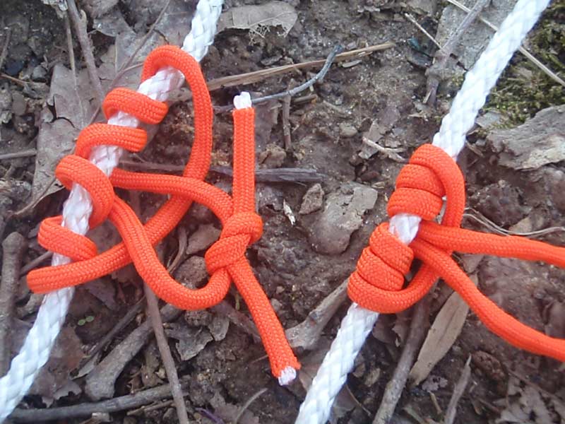
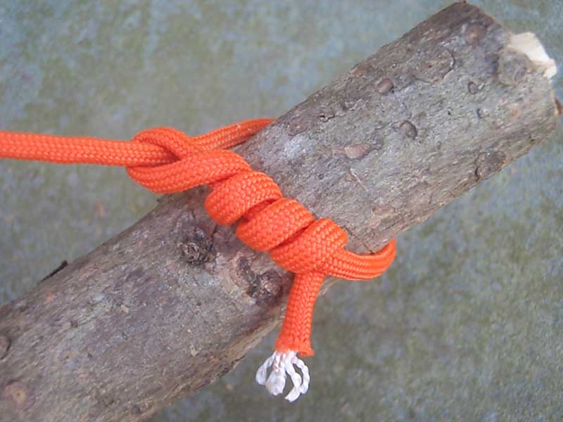
To create a timber hitch, all you need to do is run the free end of the rope around the object, like a log, that you intend to pull.
Then wrap the tag end of the rope around the inside of the loop you created four or five times.
After you tighten the timber hitch so the four or five wraps are tight against the object, the constant tension will keep the hitch seated.
 
13. Blood knot
 
 
The blood knot.

This little gem of a knot is used on fishing line to secure two lines together (mends a broken line or attaches leaders and tippets).

How to tie a blood knot:

You’ll start the blood knot by overlapping the two lines, and wrapping one free end around the other line five or six times.
Pass the free end between the two lines.
Wrap the other line the same number of times (five or six), and tuck the free end back between the two lines in the opposite direction of the other free end of the line.
If using fishing line, spit on it to reduce friction damage.

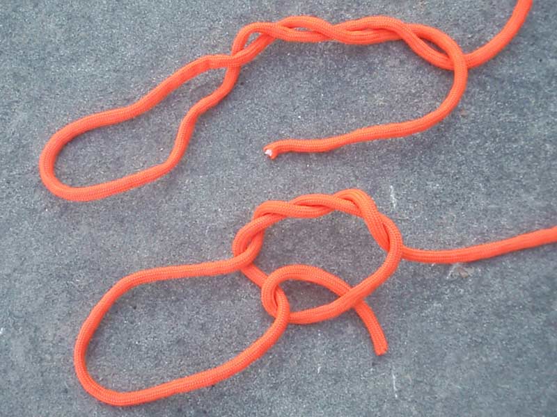
14. Man harness
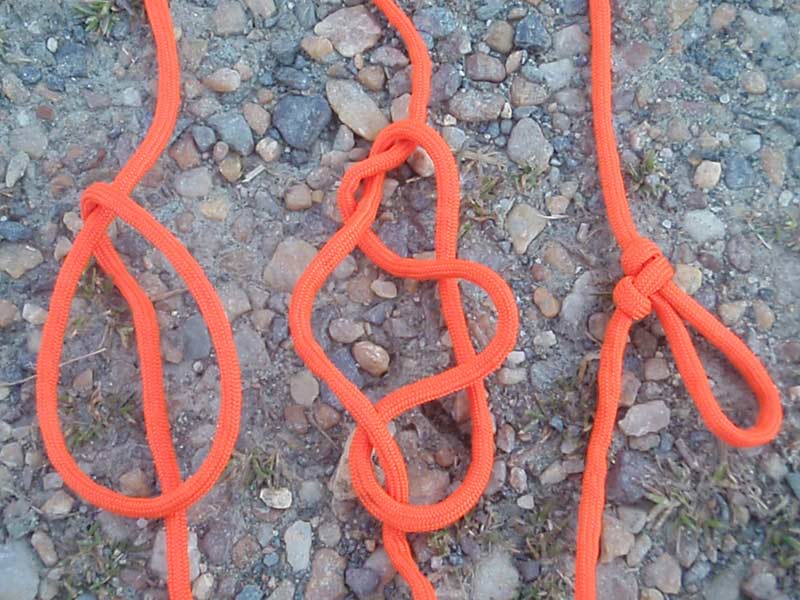
 
Need a loop in a line when neither end is free?
The man harness can create strong loops in a rope or cord, which can be used for a variety of purposes.

This crafty knot allows you to put a loop in a line anywhere along the length of a rope when neither end of the line is free to tie a loop—and you didn’t hear it from me, but a man harness is great for cheating at tug of war.

How to tie a man harness:


Gather some slack in the line and make a loop so part of the line runs through the middle of the loop.
Grab the side of the loop and pull it through the gap between the line in the middle and the other side of the loop.
Pull the new loop tight, and then pull the line to cinch the man harness knot.
This knot can slip if there isn’t constant tension on the newly created loop, so keep something in the loop to hold it.
 
15. Carrick bend
 
 
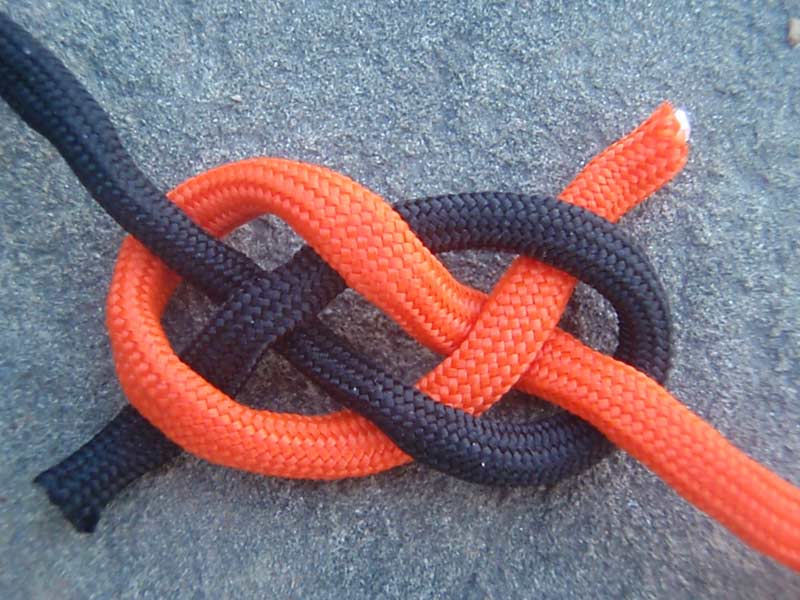
The carrick bend.

This square knot alternate joins two ropes together securely, and is easier to untie than a square knot.

How to tie a carrick bend:

To tie the carrick bend, form a loop with the free end of one rope.
Pass the other rope’s free end under the first loop, and then over then under as seen in the picture.
Thread the free end across the loop passing under itself, and pull on both standing ends to tighten.
 
16. Trucker’s hitch
 
 
Tie this hitch down tightly and you’ll create a mechanical advantage that acts like a pulley.

You don’t have to be a truck driver to have a use for this rugged hitch.
The unique feature of the trucker’s hitch is it gives you a unique mechanical advantage for tightening up a line.
While tying this hitch is a little complex, it’s worth the trouble if you need to tighten lines as much as possible before securing them—I use it all the time to tie down tarps or secure shifting payloads.

How to tie a trucker’s hitch:

Start off by tying a figure eight knot with a loop of the line.
Then pass the free end of the line around or through whatever you’re attaching the rope to, before passing the line through the loop.
Next, pull the working end tight, and secure the free end with two half hitches, just below the loop.

17. Barrel hitch
 
 
The barrel hitch.

The barrel hitch has been used in sailing and construction work for centuries.
It allows you to secure a bucket, barrel or other cylindrical object to lift it in a well-balanced position.

How to tie a barrel hitch:

Place your barrel or other object to be lifted on top of your rope.
Then tie an overhand knot across the top of the barrel.
Open up the overhand knot until it wraps around the top sides of the barrel.
Tie the ends of the rope together with a square knot and then then lift.
This knot makes a fine bucket handle when the wire handle finally breaks off.

Safety warning: For safety and stability while hoisting barrels, the rope around the barrel needs to be high above the center of gravity on the barrel, but pose no danger of slipping off the top of the barrel.
FYI, beer has an excellent center of gravity.

18. Sheepshank
 
 
The sheepshank knot.

This knot seems half magic trick, half practical knot, but it shortens a line without cutting the line.
This knot keeps our long ropes in one piece, despite our miscalculations in the field.
I will use this one on bear bags, when the line is too long, but I don’t want to cut it.

How to tie a sheepshank:

To tie a sheepshank, fold the rope to the new length you need.
Create a half hitch in one end of the continuing rope, and drop it over the nearby loop.
Make a half hitch in the other standing end, drop it over its adjacent loop, and then tighten the whole thing slowly.

19.Tripod lashing
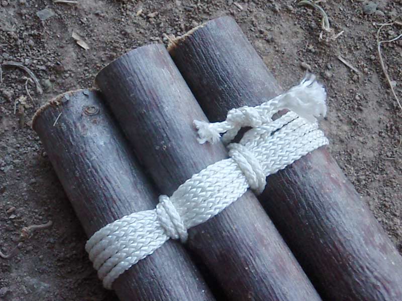
 
Three legs are sturdier than two, and the tripod is a versatile piece of camp equipment you will definitely want to learn how to build.
You can use the tripod lashing to create shelters, jerky racks, water filters, and a host of other camp fixtures.


The tripod lashing is commonly used for shelters and to support camp items, like a cooking pot over a fire.

How to tie a tripod lashing:

Start by collecting three poles that of almost identical length and thickness and lay them on the ground side-by-side.
Tie a clove hitch to one of the end poles, and then wrap around all of the poles four, five, or six times.
Now, wrap line between the poles–twice between each one–working back toward the original knot or hitch you tied.
Finish the lashing by tying the tag end of the line to the tag end of your original knot.
Spread the legs of the tripod and use it in your camp for something handy.

20. Square lashing
 
 
The square lashing.

The square lashing has been used to build everything from camp chairs to towers and bridges – but you can also use it to secure two poles together.

How to tie a square lashing:


Tie a clove hitch to one of the poles, near the place where the two poles cross.

Then wrap your line around the junction of the two poles, going under the lower pole and over the top pole.
Spiral outward with these wraps five or six times.
Next, wrap between the poles, biting onto the previous wrappings to tighten them.
Finally, use a square snot to tie the free end of the rope to the free end from the clove hitch that started this whole lashing.
Easy, right?
 
Links :
Tuesday, May 18, 2021

Solving Longitude: Jupiter's Moons


Corrected map of France: showing the coastline of France after scientifically mapping it in the late 17th century
This map compares France’s coastline mapped using Jupiter’s moons with those previously drawn. It is said the French king complained that the astronomers had taken more territory from him than his enemies.
Corrected on the order of the King, according to the observations of the Master of the Academy of Sciences
This is how Louis XIV would have declared that his geographers had made him lose more territories than all his enemies ...

From RMG

There were many proposed solutions to the Longitude problem, as discussed in Ships, Clocks & Stars.
One of the main contenders was using Jupiter's Moons as a celestial clock - though particular problems arose when attempting this at sea.

Last week, I explored how a celestial ‘clock’, the moon, could be used to find longitude at sea.
This week I want to look at another ‘celestial clock’: the four moons of Jupiter.
In the early 17th century the Italian astronomer, Galileo Galilei, made the startling discovery that several moons orbited Jupiter.
Noting that the motion of these satellites was easy to predict, Galileo suggested devices for using Jupiter’s moons for finding longitude at sea.

The method worked well on land and was being used for surveying and mapping by the late 17th century.
However, observing such small and distant objects with a telescope was very difficult from a moving ship. 


One longitude projector, Christopher Irwin, attempted to create a marine chair as a way of counteracting this difficulty.
However, when Nevil Maskelyne tested it on his voyage to St Helena in 1761, he wrote back to the Board, 'Mr Irwin's marine chair affords no convenience or advantage to an observer in using a telescope for observing the celestial phenomena but sea, but rather the contrary'.

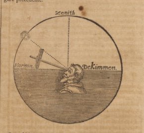
If you get lost at sea after a shipwreck, simply balance the sector on your nose and measure the angle between the sun and the horizon. Then you'll know where you are!
 
By the early 1800s longitude-finding by timekeeper and lunar distances was proving successful and commercially viable.However, the search for other methods went on and the Board considered proposals for finding longitude from Jupiter's satellites right through to its demise in 1828.

One such proposal came from Samuel Parlour, who wrote to the Board in 1824 from the East India Military Seminary in Surrey, enclosing his sketch and description of a device incorporating a telescope with a magnifying power of 80 times.


Having tested it at sea between London and Lyme Regis, Parlour believed that it would be steady enough for observing Jupiter’s satellites or the conjunction of the Moon with other stars, ‘even in a rough sea, and heavy swell’.
These were grand claims, but the Board took Parlour's ideas seriously enough to organise a sea trial the following year.

Sadly, the resulting report found that the apparatus was too difficult to manage.

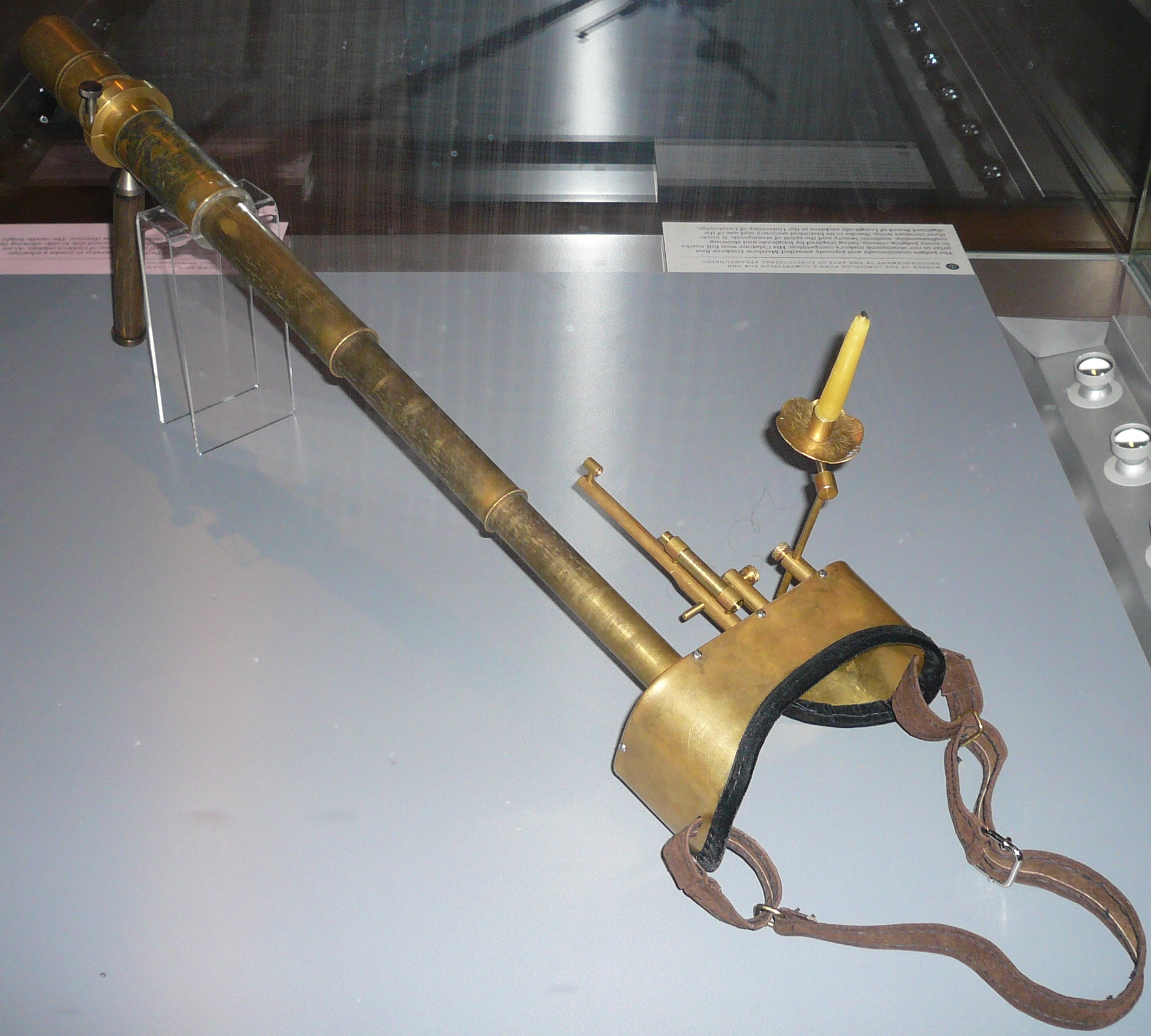
 Celatone by Matthew Dockrey
 
Despite the ultimate failure of Parlour’s proposal, his design has continued to inspire.
It was the inspiration for Longitude Punk’d competition winner, Celatone by Matthew Dockrey
 
Links :