Saturday, September 27, 2025

1968 Tharp and Heezen Map of the North Atlantic Ocean Floor

courtesy of Geographicus
 
A visually striking and scientifically significant 1968 Marie Tharp and Bruce C. Heezen physiographic map of the North Atlantic detailing the submarine topography. It is a revolutionary work.
The massive map combines the genuine scientific work of interpreting and compiling thousands of sonar images with accomplished artistry.
This work represents the culmination of over 30 years of collaboration between Tharp and Heezen, led by Tharp, to produce a meticulous sonar map of the ocean's floors.
Among other accomplishments, their work led to the discovery of the Mid-Atlantic Rift, the Mid-Atlantic Ridge (as depicted here), and redefined both submarine geology and our understanding of plate tectonics.
Moreover, Tharp's work was pioneering in elevating the role of women in the sciences.
The map offers a striking axonometric view of the terrain throughout, with a focus on the seabed. Coverage extends from the Great Lakes to France and from the St. Lawrence River and Newfoundland to the Greater Antilles and the Cape Verde Islands.
The spine-like Mid-Atlantic Ridge is prominent. Most of the subterranean peaks and valleys are labeled with a numerical system running into the thousands - likely references in a supplementary work not included here.
 
SRTM Global Bathymetry and Topography

 Links :


Friday, September 26, 2025

New footage sheds light on Scott’s legendary polar vessel

 
New footage sheds light on Scott’s legendary polar vessel
(Image courtesy: Schmidt Ocean Institute) 

From Hydro

For the first time, detailed footage has been released of the Terra Nova, the iconic polar vessel that carried Captain Robert Falcon Scott and his team on their ill-fated South Pole expedition more than a century ago.
Resting 170 metres below the surface off the coast of Greenland, the Terra Nova has a history that extends well beyond its role in Antarctic exploration.
After Scott’s expedition, the ship remained in service until 1943, when it sank while transporting supplies to US bases during World War II.
Although the wreck was discovered in 2012 by the Schmidt Ocean Institute, this latest mission provided the first opportunity to film it in detail.


The expedition, years in the planning due to the site’s remoteness, was carried out under international maritime heritage protocols.
Initial findings reveal the Terra Nova sustained major damage during its sinking.
After the crew was rescued, the ship caught fire and was scuttled by coastguard vessels to prevent it from drifting.
Today, the stern shows extensive damage, while the bow has split in two.
Still, many of the ship’s defining features remain recognizable.

The vessel’s most famous chapter came during the British Antarctic Expedition of 1910–1913, better known as the Terra Nova Expedition.
Scott’s team reached the South Pole in January 1912, only to discover that Norwegian explorer Roald Amundsen had beaten them by 34 days.
Scott and four companions perished on the return journey, cementing the expedition’s tragic place in history.

Despite its condition, maritime historians say the new footage offers a rare and invaluable record of one of exploration’s most enduring symbols.
Sonar surveys conducted in 2012 by the Schmidt Ocean Institute pinpointed the wreck’s location. 
 
Links :

Thursday, September 25, 2025

No, Russia is not building a new Arctic military base on American land

 
The shores of Wrangel Island (Source: Wikimedia Commons)

From ArcticToday y Lukas Wahden
This is a reproduction of an article that first appeared on 66° North. 

The ‘National Interest’ resuscitates a fringe 1980s conspiracy theory on Wrangel Island
 
On September 3, Brandon J. Weichert published the article “Russia Is Quietly Building a New Arctic Military Base—on American Land” in the National Interest.
The piece quickly proliferated across national security platforms, and was republished in a modified version by Arctic Today.

Mr Weichert’s essay recycles decade-old reports about Russian military facilities on Wrangel Island and inflates them into a supposedly new threat.
By presenting these facilities as something novel, Mr Weichert manufactures a sense of urgency to justify reviving an alleged U.S. claim to the island.
In doing so, he distorts both the history and the legal realities of that claim, echoing a long-running conspiracy theory promoted by fringe groups – one that successive American administrations of both parties have consistently dismissed.

Several of the claims made by Mr Weichert in his article are inaccurate.
His essay misquotes source materials, contains demonstrable falsehoods and violates basic standards of journalistic and academic integrity.

If implemented, Mr Weichert’s recommendation for the U.S. to assert a territorial claim on Wrangel Island would further undermine the complex, yet robust territorial and maritime sovereignty regimes of the Arctic.
Instead of challenging Russia’s imperialist pretensions and militarisation of the Arctic, a U.S. territorial claim on Wrangel Island would essentially replicate the Russian behaviours decried in Mr Weichert’s article.

Alternative:

A ‘new’ Russian base?

The headline to Mr Weichert’s article states that Russia is “quietly” building a “new” base on Wrangel.
Both of these claims are misleading.
The Russian military base in question, Ushakovskoye (Ушаковское), has been in place for more than a decade.
It was established as an expansion to a border guard post in 2014, as is acknowledged in this High North News article referenced by Mr Weichert’s piece.
The Sopka-2 radar system mentioned by Mr Weichert was set up in 2016, and has been an acknowledged and widely known feature of military installations on Wrangel Island for ten years.
Russian media outlets have been reporting on the system since 2014.
These reports were reviewed for an English-speaking audience by Sergey Sukhanin in a 2020 piece, which is also referenced in Mr Weichert’s article.

Arctic security experts have also extensively discussed the rule of Ushakovskoye for close to a decade, as part of Russia’s 2007-2015 remilitarisation of its Arctic territories, which included the establishment and modernisation of military bases.
Nowhere in Mr Weichert’s text is his claim of a “new” base on Wrangel, or even any planned expansions or modifications of the existing base, substantiated by appropriate references or additional information.

UNCLOS, the Baker-Shevardnatse line, and the 1980s debate on Wrangel Island

But Mr Weichert’s article also understates, and at times misrepresents, the legal and historical complexities underlying historical disputes over Wrangel Island.
Sovereignty rights over the island have been subject to a long and inconclusive scholarly debate.
The only reference to this literature provided by Mr Weichert is an 1981 paper constructing a case for a U.S. claim, which presents a 1881 U.S. Coast Guard landing on Wrangel Island as grounds for an assertion of U.S. sovereignty.
 
Wrangel Island in the GeoGarage platform (NGA nautical raster chart)
 

Wrangel Island in the GeoGarage platform (NGA nautical raster chart)

But prior to the early 1980s, the time of publication of the paper in question, the American public was still largely indifferent to the fate of Wrangel Island.
Debates around a potential claim only heated up when the U.S. State Department entered into the first round of preparatory negotiations over an official delineation agreement for the maritime boundary between Alaska and the USSR in 1981.
Before then, the international legal basis for the boundary had been the 1867 “United States-Russia Convention providing for the U.S. purchase of Alaska”.
The original maps of this 1867 agreement had by 1981 been lost by both sides, however.
During most of the Cold War, the U.S. and USSR saw no need to negotiate precise delimitations between the sparsely populated and militarised islands around the Bering Strait.

The looming entry into force of the U.N. Convention on the Law of the Sea in 1982 – and its provisions for extraction rights awarded within 200-mile Exclusive Economic Zones – made it necessary for Washington and Moscow to hash out a modern, and more sophisticated, agreement on a shared maritime boundary.
As a technical matter, these negotiations were entrusted to professionals in the U.S. State Department.
Anticipating the likely Soviet position, the State Department decided to base its negotiating position on the rough demarcation lines inherited from the 1867 agreement, excluding Wrangel and four other historically disputed islands occupied by the USSR.

A conspiracy theory that won’t succumb

This decision by the U.S. government inspired the resistance of Carl Olson, a teacher from Los Angeles, and Mark Seidenberg, an employee of the U.S. Agriculture Department.
Seidenberg had been friends with the Alaskan businessman Carl Lomen, who had attempted to purchase Wrangel Island in 1924, and sought reparations for the “loss” of the island to the USSR until his death in 1965.

Olson and Seidenberg were convinced that the U.S. held a valid legal claim to the island, and that Washington was about to surrender oil and gas deposits worth billions of dollars to the USSR, should a maritime boundary agreement be signed.
The two men partnered to found the NGO “State Department Watch”, which organised its members to lobby high-ranking politicians to challenge the State Department’s executive authority on the issue.
Olson also claimed that Wrangel Island harboured a gigantic, secret Soviet prison, in which he believed the Swedish wartime hero Raoul Wallenberg had been imprisoned, a claim that was never substantiated after the fall of the USSR.
 
 
A letterhead of the NGO “State Department Watch” from 1988

The Reagan administration responded to requests and letters by Olson and Seidenberg, as well as “State Department Watch”, on multiple occasions.
The Reagan Presidential Library holds a collection of the exchanges, as well as relevant articles published in the U.S. media at the time.
In 1988, the National Security Council prepared a dedicated Fact Sheet for “State Department Watch”.
In the Fact Sheet, U.S. diplomats described the American government position as follows:

“Allegations that the United States is engaged in a “give-away” of [Wrangel and other islands] are unfounded.
Each of the islands was formally claimed by Russia in 1916 and by the U.S.S.R. in 1924 and 1926.
Wrangel, the largest, has been occupied by the Soviets since 1924.
Extensive research has produced no evidence of U.S. protests of the Russian or Soviet claims to the islands or of the Soviets’ occupation of Wrangel since 1924.
Although American citizens were involved in the discovery and exploration of several of the islands and attempted to claim them for the United States — and despite the listing of several of the islands in some early publications such as the U.S. Geological Survey’ s 1906 Dictionary of Alaska — there is no evidence that the Government of the United States ever formally asserted a claim to any of these islands.”

The Fact Sheet also argued, correctly, that “under international law, mere discovery is not sufficient to establish a right to sovereignty”, and pointed out that “[…] to establish definitive territorial sovereignty, discovery must be combined with effective occupation by which the claimant nation exercises the actual, continuous, and peaceful display of the functions of a state over the territory.”
The U.S. never exercised effective control over Wrangel Island, and therefore never established a legal basis for later sovereignty claims.

 
A letter attached to the Fact Sheet sent to Carl Olson by the NSC in 1988
(Source: Reagan Presidential Library)

Undeterred, Olson and Seidenberg continued to contradict the official U.S. government position, at least until “State Department Watch” seized its operations around the time of Olson’s passing in 2015.
The conspiracy theory of a “giveaway of Arctic islands” briefly resurfaced in 2012, when it was peddled by the Republican Texas House candidate Wes Riddle as potential grounds for an impeachment of Barack Obama.
In the same year, a Republican U.S. Senate nominee, Joe Miller, also proliferated the theory in an article.
Miller later acknowledged having written the piece with the assistance of “State Department Watch.”

But from the official American point of view, the U.S. has never staked a claim to Wrangel Island.
Russian sovereign control over the island was, moreover, solidified de facto in the 1991 Baker-Shevardnatse line agreement, which established a maritime boundary between the U.S. and Russian Federation.

Legal arguments over Russia’s sovereignty over Wrangel Island may want to address not the fictional past U.S. claims, but the ongoing lack of approval of the agreement by the Russian Duma.
While fringe voices in Russia have criticised the Baker-Shevardnatse agreement for “giving away Russian lands to the United States”, the Russian government provisionally applies the agreement and has defended it publicly, for the last time in 2024.
Mr Weichert’s decision to root his argument for the “validity” of a U.S. claim on Wrangel Island not in these considerations – but in false assertions long disputed by the U.S. government – should be viewed as an effective restatement of Olson’s and Seidenberg’s conspiracy theory.

American land?

Mr Weichert’s arguments are not only flawed in a legal sense, however.
His article also misrepresents the history of explorations, attempts at settlements, and political claims to the island.
In particular, Mr Weichert distorts the chaotic history of attempts by the Canadian explorer Vihjalmur Stefansson to explore and claim Wrangel Island in the first two decades of the 20th century.

In 1914, Stefansson had organised a maverick expedition to Wrangel and other Siberian islands with the goal to claim them for Canada.
The operation turned into an unabashed disaster.
Stefansson’s flagship, the Karluk, was crushed by the treacherous waves of the East Siberian Sea.
Survivors of the expedition made it to Wrangel Island, where they survived until being rescued by two American vessels.
When Stefansson resolved to relaunch his mission to colonise Wrangel Island in 1921, Canada refused to fund it in light of Stefansson’s prior incompetence.
Stefansson remained stubborn, and raised his own funds to dispatch four young men and a young Inuit woman to the island.

 
An ice party in the Canadian Arctic led by Vilhjalmur Stefansson, “the greatest humbug alive” according to Roald Amundsen (Source: Wikimedia Commons)

Mr Weichert writes about this doomed adventure that “America’s claim on [Wrangel] island was bolstered by American expeditions to the island, including Vihjalmur Stefansson’s 1921 venture, which established a provisional government and raised the US flag.” This statement is demonstrably false.
Firstly, the 1962 New York Times obituary referenced by Mr Weichert makes no mention of the planting of a U.S. flag by Stefansson’s 1921 expedition.
That is because no such planting occurred at that time.
The flag raised in 1921 by Stefansson was that of the British Empire, an instance in response to which the American State Department issued the following protest statement: “Wrangel Island, claimed by the explorer Stefansson for Canada, is in reality the property of Russia.” And even the British government, whose flag had been raised by Stefansson’s crew, protested the action, keen to avoid an international incident with Russia.

And secondly, nothing resembling a “provisional government” was established on Wrangel Island in 1921.
Out of the five members of the second crew dispatched by Stefansson, only Ada Blackjack, the Inuit woman, survived.
To rescue her, Stefansson again raised funds from private British donors to dispatch a mission to Wrangel Island in 1923.
The ship collected the lone survivor, and in turn left twelve Alaskan Inuit and one white U.S.
person behind on the island.
Outraged by the settlement, Moscow dispatched a gunboat to Wrangel in 1924, arrested the settlers, and deported them to the USSR.

Mr Weichert decries this expulsion by the Soviets of “American and British settlers” on the island as an “illegal act of aggression”, but without mentioning the facts that the U.S. and British governments did not recognise the settlement as theirs at the time, and that the presence of the settlers had been sponsored by private individuals from Canada and Britain.
The Americans in question, and in particular the Alaskan Inuit, were further also abandoned by the U.S.
government after their abduction to prisons in the USSR.
The U.S. didn’t deem it necessary to provide funds for the repatriation of imprisoned indigenous folks, none of which it recognised as U.S. citizens.
It relied instead on the Red Cross to do so.

To recover the costs of his doomed missions, Stefansson eventually resolved to try and “sell” Wrangel Island.
He offered it first to the Canadian government, which ignored the offer, and then to the United States government, which also did not respond.
Stefansson was given the cold shoulder by both governments because he was in no position to sell Wrangel, as the island was not his personal property.
Nonetheless, the Alaskan businessman and reindeer magnate Carl Lomen eventually agreed to “buy” the island off Stefansson.
Unable to convince the U.S. government to assert his “property claim” against Russia, Lomen eventually tried to gift Wrangel Island to his friend, Mark Seidenberg, before his death.
Seidenberg, in turn, went on to co-found “State Department Watch” following Lomen’s death, and constructed the conspiracy theory that is now being resuscitated by Mr Weichert.

 Sopka-2 radar installation, Ushakovskiy base
 
Time to bury the Wrangel Island dispute

There are therefore no historical or legal grounds for Mr Weichert’s argument, which instead represents the woeful continuation of a longstanding conspiracy theory rooted in a private U.S. citizen’s efforts to establish property rights over Wrangel Island.

As has been pointed out regularly by the State Department since 1988, neither Stefansson’s explorations, nor the U.S. geographical explorations that preceded it, ever sufficed as a legal basis for an American sovereignty claim.
This is in spite of Mr Weichert’s assertion that such a claim exists and is “[…] valid, unextinguished by time or acquiescence.” Ironically, Mr Weichert backs up this statement with a reference to a 2003 State Department Fact Sheet, which states clearly that Wrangel Island has “never been claimed by the United States.”

It is difficult to determine the degree to which the conspiracy theory created by “State Department Watch” has shaped perceptions of Wrangel Island among the American public.
But for context, here is an excerpt from a 1967 article by the U.S. Naval Institute, which illustrates how U.S. military analysts viewed the 1924 Soviet takeover of the island before the debates of the 1980s:

“In 1921, Canada had tried to colonize Wrangel Island in the East Siberian Sea, with Canadian Eskimos, but they had died of starvation on the 2,000-square-mile island.
In 1923, new attempts to colonize were made by the Canadians.
Canada claimed sovereignty over the island in 1924.
The Soviet Union responded quickly by (1) informing Canada that the Czar’s 1916 decree remained very much in force, and (2) dispatching an icebreaker from Vladivostok to Wrangel to evacuate the Canadian Eskimos and hoist the Soviet flag on the island.
So ended the Wrangel dispute.”

It is high time for public discourse to return to a clearer understanding of Wrangel Island’s history and legal status and to lay to rest the conspiracy theory promoted by “State Department Watch” and recently revived by The National Interest.
Russia holds sovereignty over the island; and even if that control were somehow questioned, any hypothetical U.S. claim would be weaker than those that could conceivably be advanced by either the United Kingdom or Canada.
American public figures should therefore cease urging the U.S. government to assert a claim to Wrangel Island.

Such a decision would, of course, not be about appeasing the Russian government or accepting the militarisation of the Pacific Arctic.
Russia has repeatedly spread conspiracy theories about Arctic sovereignty arrangements and proclaimed supposed “historical rights” over places that belong to others, such as Norway’s Svalbard archipelago.
While not “illegal” in the strict sense, the Ushakovskoye base sits inside a UNESCO-protected nature reserve and breaches the spirit and procedural requirements of the World Heritage Convention, as Russia has failed to provide assessments of its environmental impact.
The base also contributes to the militarisation of the entry point to the Northern Sea Route, which several countries, including the United States, do not recognise as Russian internal waters.
These developments warrant criticism and, where appropriate, opposition.

But rather than fighting fire with fire, the United States would do better to issue an explicit confirmation that it does not claim Wrangel Island.
Such a statement would strengthen the Arctic governance system and help preserve regional peace and stability in the region.
The Arctic’s sovereignty landscape is complex yet remarkably effective: there are no unresolved territorial disputes, and maritime boundaries are typically settled peacefully.
This framework has underpinned decades of stability.
Neither Russia nor the United States should jeopardise it by resurrecting nineteenth- or twentieth-century claims to territory.
Arctic lands may be remote, but they are not up for grabs – whether on Greenland, a U.S. ally, or on Wrangel Island, the territory of a U.S. adversary.

Links :

Wednesday, September 24, 2025

Pacific island nations tap indigenous know-how to safeguard ocean health


From SCMP by Nicole Cheah
 
Among the measures being taken are a ban on fishing and mining activities in vast marine protected areas 

Pacific island nations are racing to enhance marine conservation, establishing sweeping “no-take” zones and pledging to sustainably manage vast swathes of their territorial waters despite facing limited resources and geopolitical pressure.
Among them, Samoa last month unveiled a ban on fishing, mining and other extractive activities over 30 per cent of its ocean territory by 2027.
The move will create 36,000 sq km (13,900 square miles) of marine protected areas (MPAs) – more than 12 times the country’s land size.

“Like other Pacific island nations, challenges like marine habitat destruction, overfishing, and pollution threaten the health of Samoa’s ocean, which endanger the well-being of our people,” Toeolesulusulu Cedric Pose Salesa Schuster, Samoa’s natural resources and environment minister, told This Week in Asia.
“Samoa’s marine spatial plan addresses these urgent issues and offers solutions to sustain the ocean and what it provides for us now and for future generations.”

Such planning has become increasingly common across the Pacific, even as global progress on the so-called “30x30” pledge – to protect 30 per cent of Earth’s land and ocean area by 2030 – has slowed.
French Polynesia has committed to fully protect more than 1 million sq km (390,000 square miles) of its waters.
Tonga, Niue and New Caledonia have already enacted expansive MPAs.
At the UN Ocean Conference (UNOC) in Nice held earlier this month, the Solomon Islands and Vanuatu announced plans for a Melanesian Ocean Reserve that – once formalised – would safeguard over 6 million sq km of ocean by tapping indigenous knowledge.

 
A coral reef in Teahupo’o, Tahiti.
French Polynesia aims to protect more than 1 million sq km of its waters. 
Photo: Reuters

Together, Pacific island nations control over an ocean area roughly the size of Africa.
While they contribute relatively little to global emissions, they are on the front lines of climate change – increasingly vulnerable to extreme weather, rising sea levels and the economic fallout of environmental degradation.

“The nations of the southwest Pacific have produced a stunning example of the potential for multi-country agreements to accelerate meaningful ocean protections,” said Barbara Quimby, an assistant professor of marine science and policy at Hawaii Pacific University.
Quimby credited the region with pioneering a hybrid approach integrating traditional values and village-based governance with scientific data and national policy.
“For decades, efforts in Samoa, Solomon Islands, Fiji and other locations have demonstrated the power of hybridised management,” she said.

Samoa’s new plan includes a 24-nautical mile (45km) zone reserved for traditional Alia tuna fishing vessels to reduce competition from industrial fleets and is part of a broader commitment to sustainably manage its 120,000 sq km (46,300 square-mile) ocean territory.

But marine conservation experts have warned that the implementation of such measures in the Pacific remains a formidable challenge.

Only 8 per cent of the global ocean is designated as an MPA and less than 3 per cent is classified as fully or highly protected, according to an assessment by Dynamic Planet and National Geographic’s Pristine Seas project in May.
The latter is widely considered the minimum level needed for marine life to effectively recover the damage caused by overfishing, pollution, habitat destruction, and global warming.

“So far we haven’t been very successful in using the ocean in a way that meets the needs of the present without compromising the ability of future generations to meet their own needs,” said Enric Sala, a co-author of the study and founder of National Geographic’s Pristine Seas project.

People gather at a market in Port Vila in Vanuatu.
Pacific island economies such as Vanuatu are vulnerable to the effects of climate change.
Photo: Shutterstock


The only notable exception was the no-take MPAs, where marine life could restore itself to levels that were on average five times greater than in nearby unprotected areas, he added.

But the commitment towards creating MPAs has been uneven across regions.

“Most of the new MPA designations and firm commitments to create more MPAs came from Pacific nations.
Very little came from the rest of the world in comparison,” Sala said of this month’s UNOC, calling on countries that backed 30x30 to implement their plans.

To meet the 2030 goal, roughly 1,000 sq km (386 square miles) of marine areas would need to be protected every day, according to the study by Dynamic Planet and Pristine Seas.
This is an undertaking that requires money and manpower, according to Fanny Douvere of Unesco’s Intergovernmental Oceanographic Commission.

Financial resources required for MPAs are in short supply for many Pacific island nations, where small populations are spread across widely dispersed islands.
Insufficient data, uncertainty and capacity constraints severely limit the region’s capacity to plan for and react to climate risks, threatening its long-term development efforts, the Asian Development Bank has warned in a report.

The importance of initiatives such as the creation of MPAs to bolster the economic well-being of these nations amid climate change cannot be underestimated.
A World Bank report released earlier this month shows that growth in the region might have fallen to 2.6 per cent in 2024 due to climate-related shocks and global economic uncertainty.

Marine monitoring remained labour-intensive and costly and without proper enforcement, “MPAs are just lines on a map”, Douvere said.

Many Pacific island nations have begun using drones and satellites to monitor illegal fishing, and some are also exploring the use of artificial intelligence, Quimby said.
But sustainable management requires sustained human investment and international cooperation, especially across migratory corridors and overlapping exclusive economic zones, according to Douvere.

 
The tiny island of Niue has enacted expansive marine protected areas.
Photo: Handout


“As exemplified by the US’ recent reversal on fishing protections for the Pacific Islands National Marine Monument, all state-based MPAs are dependent on the will and policies of the governing nation,” Quimby said, referring to US President Donald Trump’s decision in April to reopen the vast marine reserve, located southwest of Hawaii, to commercial fishing.

Sustainable MPAs must take into account local interests and the relationships between fishers, officials, and community leaders, Quimby added.

The urgency is mounting for Pacific countries to carry out their marine conservation plans as global warming accelerates.

According to the World Meteorological Organization, 2024 was the hottest year on record in the southwest Pacific.
Rising sea temperatures, acidification and coastal run-off are damaging coral reefs and threatening the region’s food security.

Many Pacific economies depend heavily on fishing and tourism – sectors that are climate-sensitive and resource-intensive.
Such reliance on ocean-based industries, while central to these nations’ development, makes them acutely vulnerable to marine ecosystem collapse, the International Monetary Fund has warned.

Global funding for marine protection remains another obstacle as only US$1.2 billion has been invested annually, far short of the US$15.8 billion required each year to meet 30x30, according to a report by a group of nature NGOs and funders, including the Bloomberg Ocean Fund and WWF International, released in June.

“That’s less than the over US$20 billion that governments spend every year on harmful fisheries subsidies – that is, subsidising overfishing,” Sala said.
“The money is there, only that governments decide to use it for depletion instead of regeneration.”

Strategic competition among more powerful nations looking to expand their foothold in the Pacific could complicate marine conservation plans.

 
Chinese Foreign Minister Wang Yi meets Cook Islands Foreign Minister Tingika Elikana in Xiamen in May.
Photo: Xinhua


As of 2022, Australia remained the region’s largest provider of official development assistance, accounting for around 40 per cent of total aid, worth US$1.5 billion, while China and the US were the second- and third-largest donors at US$256 million and US$249 million, respectively, according to a report by the Lowy Institute.
Tensions have risen in the Oceania region recently due to steps taken by some Pacific island nations, such as the Cook Islands, to deepen ties with China.

In February, Cook Islands Prime Minister Mark Brown signed a US$4 million partnership agreement with China covering seabed mining and infrastructure.
New Zealand responded last week by suspending NZ$18.2 million (US$11 million) in core development funding for the Cook Islands, citing a breach of trust and lack of transparency.

The Cook Islands is in ‘free association’ with its former colonial ruler New Zealand and has the autonomy to establish diplomatic relationships with other countries.
In 2001, New Zealand and the Cook Islands signed a joint declaration requiring both sides to “consult regularly on defence and security issues”.

New Zealand was the Cook Islands’ biggest financial backer from 2008 to 2022, according to a report by the Lowy Institute.

Last month, China hosted leaders and officials from 11 Pacific island nations at a summit in which it pledged a US$2 million climate fund to support 100 “small but beautiful” environmental projects.

Tuesday, September 23, 2025

Navigating a contested sea: ASEAN, Indonesia, and the future of the South China Sea

Detail of map showing maritime claims in South China Sea

From Eurasiareview by Simon Hutagalung

The South China Sea dispute poses an enormous obstacle to regional peace.
The competing maritime claims have transformed this strategic area into a major geopolitical conflict, challenging all diplomatic processes, legal systems, and regional frameworks for conflict resolution.

The dispute between China and Southeast Asian countries necessitates a thorough assessment of ASEAN’s institutional capabilities, as well as Indonesia’s position as a non-claimant state that faces significant consequences from the situation.
ASEAN stands essential for maintaining dialogue, yet its internal disagreements restrict its capabilities.
Indonesia can effectively mediate because it does not claim any territorial rights in the South China Sea.
The preservation of the UNCLOS-based rules-based order demands both regional unity and enforceable legal instruments.

The historical origins of this maritime dispute remain disputed, yet several fundamental aspects remain undisputed.
China presents maritime claims through the “nine-dash line”, which extends from mid-20th-century Chinese maps to encroach upon exclusive economic zones (EEZs) and continental shelves of various Southeast Asian nations.
The Permanent Court of Arbitration in The Hague declared in 2016 that China’s nine-dash line historic rights claims violated UNCLOS regulations.
The Chinese government rejected the legal decision while maintaining its maritime expansion through island creation and infrastructure expansion, and naval vessel intimidation, which intensified the difference between maritime regulations and actual ocean activities.

The unilateral actions of China have established a lasting power imbalance between China and other nations.
China possesses economic dominance and is developing maritime capabilities, which provide advantages that Vietnam and the Philippines and Malaysia, and Brunei lack.
The uneven power balance enables China to use coercive methods, which create excessive political and economic burdens for opposing nations.
ASEAN’s consensus-based approach creates difficulties for collective action because its member states maintain different threat assessments while depending on China to varying degrees economically.
ASEAN faces a “divide and conquer” situation because its member states have different positions, which hinders the organisation from playing its central role and hampers diplomatic unity.

Indonesia occupies a distinctive position because of its neutral status in the South China Sea dispute.
As a non-claimant state in the Spratly and Paracel archipelagos, Jakarta deals with Chinese intrusions into its EEZ surrounding the Natuna Islands, where Indonesian waters and Chinese claims intersect.
Chinese fishing vessels, together with coast guard ships, have operated inside or near Indonesia’s Exclusive Economic Zone, prompting both diplomatic protests from Jakarta and Indonesian military actions to protect resources and territorial sovereignty.
Indonesia maintains its position as a non-claimant nation, which enables it to pursue lawful actions, yet it needs to protect its maritime territory without sacrificing essential principles for immediate bilateral benefits.

The current evolution of mapmaking practices has raised new security concerns.
The reported ten-dash extension of Chinese claims toward the east makes it difficult for nations to develop effective legal counterarguments while increasing tension in the region.
The 2024 maritime cooperation agreement between Jakarta and Beijing received criticism for its ambiguous terms regarding “joint development” despite being presented as a technical fisheries and resource management partnership.
All cooperative agreements need to include specific legal protections to prevent joint development initiatives from leading to sovereignty concessions.

The strategic rivalry between the United States and China creates more challenges for diplomatic efforts throughout the region.
The involvement of external actors helps prevent coercive behaviour and supports free navigation, but simultaneously introduces great-power competition into regional territorial disputes.
Regular US naval operations alongside expanding trilateral and quadrilateral security initiatives and defence partnerships between claimants and external nations raise the risks of conflict and miscalculations.
The external engagement must receive precise balancing to prevent coercion while staying clear of measures which could increase tensions or diminish ASEAN’s political authority.

A long-term resolution depends on achieving both legal precision and practical confidence-building actions.
The creation of a strong legal Code of Conduct (COC) between ASEAN and China remains the key to progress.
The ongoing negotiations have continued for an extended period with unclear terms for enforcement, so a non-binding instrument faces the risk of remaining symbolic only.
A substantial COC needs to incorporate specific provisions from UNCLOS together with an impartial dispute-resolution process and precise guidelines for maritime encounters, as well as systems to monitor and report, and enforce compliance.
Such provisions would foster predictable behaviour, minimise the risks of dangerous misinterpretation, and enhance legal recourse.

Revitalising ASEAN’s internal cohesion is equally crucial.
All member states need to show political commitment toward maintaining regional stability rather than following individual bilateral agendas.
ASEAN’s crisis management procedures need enhancement for better information sharing of maritime incidents and the development of joint measures to stop escalation.
The non-claimant status of Indonesia enables the country to reduce tensions through back-channel diplomacy and informal dialogues while upholding the defence of sovereign rights.

Practical non-political cooperation provides an immediate method to build confidence.
All parties can obtain benefits through joint environmental protection efforts, along with coordinated fisheries management and scientific research and search-and-rescue operations and illegal fishing, and transnational crime prevention initiatives.
Such projects promote maritime resource stewardship through incentives that transition from coercive measures to cooperative ones.

The international community needs to fulfil its part in this process.
The United States and Japan and Australia, and the European Union continue to support freedom of navigation and overflight while upholding the UNCLOS normative framework.
The provision of practical assistance should focus on strengthening ASEAN’s central position in the region instead of replacing its role.
The best results will emerge from constructive external involvement that supports diplomatic efforts in the region.

The verification process needs to become a top priority to prevent any misunderstandings or incorrect assessments.
The implementation of neutral observers together with transparent incident-reporting systems and mutual monitoring systems will reduce the chances of escalation.
A COC that includes provisions for verification and graduated responses to violations and agreed consequences for serious breaches will create measurable compliance and enhance deterrence.

The South China Sea dispute requires solutions beyond military posturing and diplomatic initiatives alone to achieve a resolution.
Long-term stability demands ongoing dedication to international law, together with institutional development and practical collaboration on common problems and political determination for rule enforcement.
ASEAN stands as the most appropriate institutional framework for joint action, and Indonesia’s status as an honest broker becomes crucial if the country maintains diplomatic relations with pragmatism while protecting national sovereignty.
The enduring settlement will demonstrate the durability of multilateral organisations and the power of the rules-based system.
 
Links :

Monday, September 22, 2025

A new catalogue of Antarctic submarine canyons


From Hydro by Riccardo Arosio, David Amblas

Mapping the Antarctic continental slopes to understand shelf to abyss connectivity

Submarine canyons, carved into continental margins worldwide, play a key role in ocean circulation, sediment transport and marine biodiversity.
Around Antarctica, their influence extends to global thermoregulation and ecosystem functioning, yet detailed knowledge remains limited.
Using the new International Bathymetric Chart of the Southern Ocean v2 and semi-automatic hydrological techniques, a new study (Arosio and Amblas, 2025) delivers the most comprehensive inventory to date: 332 drainage networks and 3,291 canyon streams, revealing striking regional contrasts shaped by differing glacial histories between East and West Antarctica.

Submarine canyons are widespread geomorphic features found along all continental margins.
Typically steep-sided and sinuous, they form narrow, V-shaped valleys with rugged slopes that begin at the continental shelf or slope and extend down to the rise or abyssal plain.
Antarctic canyons resemble those elsewhere but are generally larger and deeper, shaped by prolonged glacial activity and the vast quantities of sediment delivered to the shelf by ice.
Their development is driven primarily by turbidity currents, which transport suspended sediments downslope at high velocity, scouring the valleys they traverse.

In Antarctica, the combination of steep submarine topography and abundant glacial input intensifies these processes, resulting in exceptionally large canyon systems.
These canyons are increasingly recognized as critical to understanding climate impacts, as they enhance mixing and channel focused flows, thereby facilitating exchange between continental shelves and deep ocean basins.
Because of their role in water mass dynamics and the climate system, detailed mapping and characterization are essential.
Without such knowledge, it is difficult to assess how Antarctic oceanography and the global climate will respond to ongoing and future change.

The release of version 2 of the International Bathymetric Chart of the Southern Ocean (IBCSO v2) in June 2022 (Dorschel et al., 2022) provides the most complete and high-resolution regional bathymetry to date, offering an opportunity to update and refine the Antarctic canyon inventory since the work of Harris et al. (2014).
The aim of this study was to identify, map and characterize Antarctic submarine canyons on the continental slope using a tailored semi-automatic approach that enables efficient extraction of submarine drainage networks.
 

A protocol for canyon mapping


Isolated or dendritic valley-like features on the continental slope, up to the detail of the resolution of the bathymetry data, were identified, extracting the main and tributary thalwegs.
To achieve this objective, a semi-automatic procedure using ArcGIS Pro was adopted that included the application of filtering and hydrological tools (Figure 1).
Once the thalwegs were extracted, a custom-made Python toolbox – Canyon Metrics – was written to geomorphometrically describe the canyons.
The toolbox creates sets of ten equally spaced perpendicular transects to each thalweg polyline and automatically extracts canyon profiles and depth values.
The script identifies the lowest point in the profile (real thalweg) and searches for the two closest valley shoulders.
Thalweg and shoulders (Figure 2) are then used to calculate the rest of the statistics.
Owing to limitations in the multisource bathymetric dataset, shoulder detection was not always successful, particularly in areas of low resolution or with data artefacts.
A ‘success rate’ was therefore calculated to quantify the proportion of profiles successfully extracted.

 
Figure 1: Visual representation of the methodology applied for stream extraction.
A) Hillshaded bathymetry with Feature-preserve smoothing applied.
B) Result of the D8 Flow direction tool on the bathymetry data.
C) Result of the D8 Flow Accumulation.
D) Result of the Strahler Stream Order tool, which determines the order of the different segments of the drainage network.


Among the other statistics such as depth, width and slope, canyon cross-sectional shapes were also analysed using curve-fitting methods.
These shape metrics are important because they provide quantitative measures of valley form, allowing distinctions to be made between V-shaped, U-shaped and more complex cross sections.
Such information is critical for understanding canyon evolution, sediment transport pathways and the interaction between submarine morphology and hydrodynamic processes.
Quadratic fits describe parabolic forms, where the curvature coefficient indicates whether the canyon is narrow and V-shaped or broad and U-shaped.
The General Power Law method provides an additional, more reliable shape descriptor, with the exponent (b) also defining profile values near one to represent V-shapes, values of two or greater to indicate U-shaped cross sections, and values outside this range to capture convex or box-shaped morphologies.
As these curve-fitting approaches assume smooth profiles and perform poorly in irregular terrains, the V-index was also applied.
This metric compares the observed valley cross-sectional area with that of an ideal V-shape.
A value of zero indicates a perfect V, positive values reflect U-shaped profiles, and negative values correspond to convex valley walls.

The geomorphometry of Antarctic canyons


Despite the expanded database underpinning IBCSO v2, bathymetric coverage across Antarctica remains uneven, constraining regional geomorphic comparisons.
Nonetheless, analysis of submarine drainage networks and canyons along the continental margin reveals marked contrasts between East and West Antarctica (WA).
West Antarctica is characterized by short, simple networks, whereas East Antarctica (EA) hosts dense, dendritic systems (Figure 3).
These differences are not attributable to data gaps: 33.7% of WA is mapped at high resolution compared with only 13.8% in EA.
Instead, they reflect contrasting shelf geometries and glacial histories.
In WA, broad shelves and major drainage basins (e.g. Ross and Weddell Seas) channel convergent ice streams, generating erosive flows that carve deep troughs and deposit large trough-mouth fans at the shelf edge.
These fans promoted slope instability and canyon initiation but were later infilled by subsequent glaciations, limiting canyon growth.

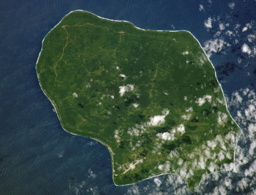
Figure 2: Diagram showing the procedure of transects creation for each canyon profile and the parameters extracted.
The canyon depth is calculated from the height of the lowest shoulder to the thalweg.
The GPL and quadratic fits give the coefficients of the curves fitted in the canyon transects, while the V-index is the deviation from an ideal V-shaped valley.


By contrast, EA’s narrower shelves and smaller basins supported weaker, isolated ice streams, leading to lower sediment flux and allowing canyon systems to persist and evolve into more complex, longer structures.
The Prydz Bay margin is a notable exception, dominated by a large trough-mouth fan and lacking canyons directly downslope.
The persistence of East Antarctic canyon systems likely reflects both this lower sediment burial and the longer-lived East Antarctic Ice Sheet (EAIS), which sustained prolonged erosion and sediment delivery.
The Antarctic Peninsula shows the strongest tectonic imprint, influenced by the South Shetland Trench.
Here, steep gradients produce highly incised, short canyons and numerous simple networks.
Elsewhere, oceanographic processes further shape canyon morphology.

During glacial maxima, turbidity currents were deflected westward by gravity, contour currents and Coriolis forcing, forming sediment drifts alongside canyon systems (e.g.
Bellingshausen region).
In interglacial periods, canyons channel dense shelf water cascades, preventing canyon infill and contributing to downslope levee development, though their erosional role remains unclear.
Unfortunately, current IBCSO v2 resolution is insufficient to fully resolve these oceanographic imprints.
Targeted high-resolution AUV or ROV surveys are required to capture fine-scale seafloor signatures and improve understanding of canyon evolution and sediment dynamics across the Antarctic margin.
Impact on ocean circulation

Antarctic canyons facilitate water exchange between the deep ocean and the continental shelf, allowing cold, dense water formed near ice shelves to flow into the deep ocean, mix with the surrounding water and form what is known as Antarctic Bottom Water (AABW), the coldest and densest water in the world that plays a fundamental role in ocean circulation and global climate.
These canyons can also channel warmer waters from the open sea towards the coastline, such as the Circumpolar Deep Water (CDW).
This process is one of the main mechanisms that drives the basal melting and thinning of floating ice shelves, which are themselves critical for maintaining the stability of Antarctica’s interior glaciers.
When the shelves weaken or collapse, continental ice flows more rapidly into the sea and directly contributes to the rise in global sea level.
This study highlights the fact that current ocean circulation models such as those used by the Intergovernmental Panel on Climate Change (IPCC) do not accurately reproduce the physical processes that occur at local scales between water masses and complex topographies such as canyons.
These processes, which include current channelling, vertical mixing and deep-water ventilation, are essential for the formation and transformation of cold, dense water masses such as AABW.
Omitting these local mechanisms limits the ability of models to predict changes in ocean and climate dynamics.

Conclusion

This study delivers the most detailed geomorphic characterization of Antarctic submarine canyons to date, highlighting fundamental contrasts between East and West Antarctica.
East Antarctic canyons are longer, dendritic and more depositional in character, reflecting the earlier onset and persistence of the EAIS.
West Antarctic canyons are shorter, steeper and more erosional, shaped by convergent ice streams and broad shelves.
Beyond their morphology, canyons are critical conduits for ocean–ice interactions, influencing CDW inflow, dense water export, basal melt and AABW formation.
The density of EA canyons suggests a stronger role in ice-sheet stability than previously recognized.
Advancing this understanding requires expanded bathymetric coverage in poorly surveyed regions and targeted high-resolution observations to resolve canyon-scale processes with system-wide implications.

Figure 3: Overview of the results of the drainage mapping.

Acknowledgements

The authors would like to thank Marta Bono Garcia for her work on the initial phases of the project and part of the mapping.
Luca Biffi is thanked for his support in developing a version of Pattyn’s GPL script that allows for batch processing.
Riccardo Arosio received funding from the Irish Marine Institute’s research grant PDOC 19/08/03.
David Amblas acknowledges the support from the Spanish government through grant no.
PID2020-114322RBI00 funded by MICIU/AEI/10.13039/501100011033 and from the Catalan Government Excellent Research Groups grant no. 2021-SGR-01195.

IBCSO is a regional mapping project of GEBCO, the General Bathymetric Chart of the Oceans, which is conducted under the International Hydrographic Organization (IHO) and the Intergovernmental Oceanographic Commission (IOC) to produce the authoritative map of the world’s oceans.
It is supported by the Nippon Foundation–GEBCO Seabed 2030 Project, launched in 2017, and is also part of the Antarctic research community and an expert group of the Scientific Committee on Antarctic Research (SCAR).

Links :

Arosio, R. & Amblas, D., 2025.
The geomorphometry of Antarctic submarine canyons, Mar. Geol., 488, 107608, https://doi.org/10.1016/j.margeo.2025.107608.

Dorschel, B., Hehemann, L., Viquerat, S., Warnke, F., Dreutter, S., Schulze Tenberge, Y., et al, 2022.
The International Bathymetric Chart of the Southern Ocean Version 2 (IBCSO v2) [dataset].
PANGAEA, https://doi.org/10.1594/PANGAEA.937574

Harris, P.T., Macmillan-Lawler, M., Rupp, J., Baker, E.K., 2014.
Geomorphology of the oceans, Mar. Geol., 352, pp. 4-24, https://doi-org.sire.ub.edu/10.1016/j.margeo.2014.01.011

Sunday, September 21, 2025

Arctic sea ice reaches annual low

Daily images of ice cover in the Arctic Ocean (left) and around Antarctica reveal sea ice formation
and melting at the poles over the course of two years (Sept 14, 2023 to Sept. 13, 2025).
Trent Schindler/NASA’s Scientific Visualization Studio 
 
 
With the end of summer approaching in the Northern Hemisphere, the extent of sea ice in the Arctic shrank to its annual minimum on Sept. 10, according to NASA and the National Snow and Ice Data Center.
The total sea ice coverage was tied with 2008 for the 10th-lowest on record at 1.78 million square miles (4.60 million square kilometers).
In the Southern Hemisphere, where winter is ending, Antarctic ice is still accumulating but remains relatively low compared to ice levels recorded before 2016.

The areas of ice covering the oceans at the poles fluctuate through the seasons.
Ice accumulates as seawater freezes during colder months and melts away during the warmer months.
But the ice never quite disappears entirely at the poles.
In the Arctic Ocean, the area the ice covers typically reaches its yearly minimum in September.
Since scientists at NASA and the National Oceanic and Atmospheric Administration (NOAA) began tracking sea ice at the poles in 1978, sea ice extent has generally been declining as global temperatures have risen.

“While this year’s Arctic sea ice area did not set a record low, it’s consistent with the downward trend,” said Nathan Kurtz, chief of the Cryospheric Sciences Laboratory at NASA’s Goddard Space Flight Center in Greenbelt, Maryland.

Arctic ice reached its lowest recorded extent in 2012.
Ice scientist Walt Meier of the National Snow and Ice Data Center at the University of Colorado, Boulder, attributes that record low to a combination of a warming atmosphere and unusual weather patterns.
This year, the annual decline in ice initially resembled the changes in 2012.
Although the melting tapered off in early August, it wasn’t enough to change the year-over-year downward trend.
“For the past 19 years, the minimum ice coverage in the Arctic Ocean has fallen below the levels prior to 2007,” Meier said.
“That continues in 2025.”

Antarctic sea ice nearing annual maximum

As ice in the Arctic reaches its annual minimum, sea ice around the Antarctic is approaching its annual maximum.
Until recently, ice in the ocean around the Southern pole has been more resilient than sea ice in the North, with maximum coverage increasing slightly in the years before 2015.
“This year looks lower than average,” Kurtz said.
“But the Antarctic system as a whole is more complicated,” which makes predicting and understanding sea ice trends in the Antarctic more difficult.

It’s not yet clear whether lower ice coverage in the Antarctic will persist, Meier said.
“For now, we’re keeping an eye on it” to see if the lower sea ice levels around the South Pole are here to stay or only part of a passing phase.

A history of tracking global ice

For nearly five decades, NASA and NOAA have relied on a variety of satellites to build a continuous sea ice record, beginning with the NASA Nimbus-7 satellite (1978–1987) and continuing with the Special Sensor Microwave/Imager and the Special Sensor Microwave Imager Sounder on Defense Meteorological Satellite Program satellites that began in 1987.
The Advanced Microwave Scanning Radiometer–for EOS on NASA’s Aqua satellite also contributed data from 2002 to 2011.
Scientists have extended data collection with the 2012 launch of the Advanced Microwave Scanning Radiometer 2 aboard a JAXA (Japan Aerospace Exploration Agency) satellite.

With the launch of ICESat-2 in 2018, NASA has added the continuous observation of ice thickness to its recording.
The ICESat-2 satellite measures ice height by recording the time it takes for laser light from the satellite to reflect from the surface and travel back to detectors on board.

“We’ve hit 47 years of continuous monitoring of the global sea ice extent from satellites,” said Angela Bliss, assistant chief of NASA’s Cryospheric Sciences Laboratory.
“This data record is one of the longest, most consistent satellite data records in existence, where every single day we have a look at the sea ice in the Arctic and the Antarctic.”