Saturday, July 22, 2023

Arnaud Jerald exploring the legendary wave of Teahupoo


Shot by Tim McKenna & filmed in Teahupoo, French Polynesia.
This Thursday in the Bahamas, French freediver Arnaud Jerald broke his own world record at the Vertical Blue, with a dive to 122 metres during 3 mn and 35 s in his weight category, in constant twin fins.

Friday, July 21, 2023

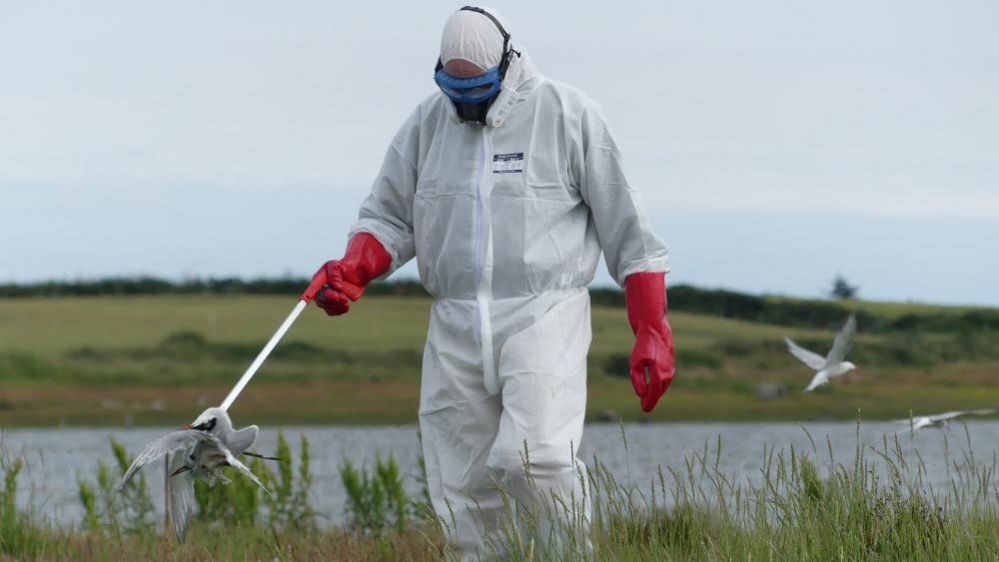
'Alarming and unprecedented' Irish bird flu warning

Concerns have been raised as thousands of seabirds congregate to breed on Irish coasts
BirdWatch fieldworkers have collected hundreds of dead birds in recent weeks 
Image Birdwatch Ireland 

From BBC by Matt Fox

A conservation group in the Republic of Ireland has warned of "alarming and unprecedented outbreaks" of avian influenza.

BirdWatch Ireland said the highly pathogenic H5N1 strain of the virus is devastating key Irish seabird colonies.

The group manages the four most important tern colonies in Ireland.

Hundreds of dead birds have been discovered in recent weeks with carcasses testing positive for bird flu.

In a recent statement, external the group said while it was early to assess the full impact, more than 160 adult common terns and 450 chicks were found dead at a breeding colony at Lady's Island Lake in County Wexford.
It also said the disease was threatening sandwich terns and roseate terns nesting there.

BirdWatch added it is concerned by the long-term consequences of an avian flu outbreak on Irish seabirds.
"A poor breeding season at a tern colony, with few chicks surviving, is unfortunate, but can be compensated for by better breeding success in subsequent years.
"However, the deaths of large numbers of adult terns of breeding age has a much bigger impact, and recovery will take a long time."

The Department of Agriculture, Food and the Marine eased specific biosecurity measures to mitigate the spread of avian influenza on 1 June.
The department has been contacted for an update on bird flu in the Republic of Ireland.


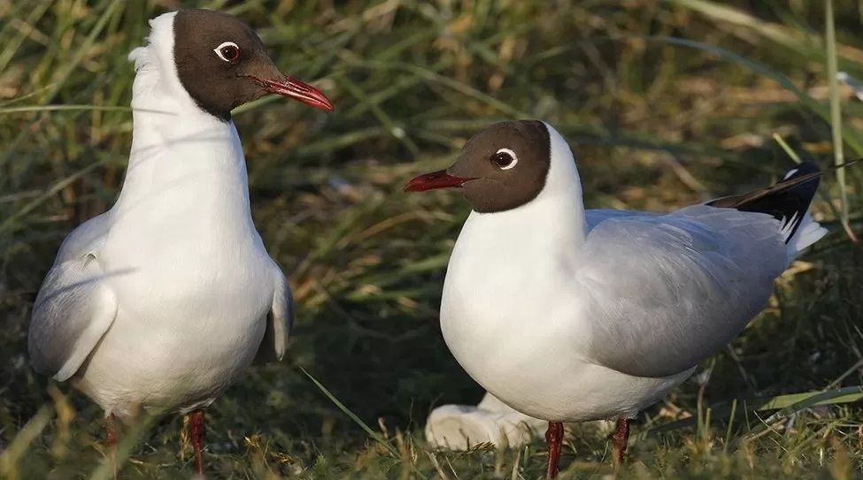
A number of black-headed gulls tested positive for the virus in Northern Ireland last month
Getty images

Belfast's Window on Wildlife nature reserve was closed to the public last month after a number of gulls were found to have died from the virus.

Further infections were detected in Comber, Coalisland, and Magherafelt.

Northern Ireland’s chief vet, Dr Robert Huey, called on all bird and poultry keepers to immediately step up their biosecurity measures and remain vigilant against the latest threat of avian flu.
He said the latest findings are a "stark warning to all of us" that avian influenza is a "constant and dynamic threat".

A recent update from the Department of Agriculture, Enviornment and Rural Affairs (DAERA) said there is now an now an increasing likelihood of incursion into kept flocks.
"The findings at locations near Lough Neagh present the greatest concern, as they are in close proximity to high-density areas of commercial poultry premises."

If members of the public find dead waterfowl or other wild birds, DAERA advises they should not touch the carcasses but take immediate action to report them to the department.

DAERA has been contacted for an update on avian influenza in Northern Ireland.
Health services in the Republic of Ireland and Northern Ireland took part in an exercise in County Louth last month to enhance cross-border preparation for future incidents of bird flu.

What is bird flu?


Bird flu is an infectious disease of poultry and wild birds that has been around for a century. It usually flares up in autumn before fading away in spring and summer

The H5N1 virus, which is the most prevalent strain now, was first reported in China in 1996

It can spread through entire flocks of domestic birds within a matter of days

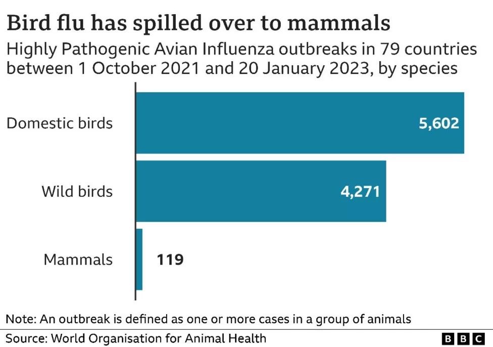
Last year saw the biggest ever outbreak of bird flu in the UK and the world

Dozens of different species of wild birds were hit, including golden eagles, buzzards, herring gulls and gannets

Bird flu restrictions, which were imposed across most of the UK this year, were eased in April but experts have advised the H5N1 virus is still circulating, posing an ongoing risk to wild birds

In the UK, a number of wild mammals have died, external after being infected with H5N1

The World Health Organization (WHO) says H5N1 outbreaks have led to several hundred human cases, and many human deaths, since 1997

The further spread of the H5N1 virus will have to be monitored closely to see whether it is mutating into a form which can spread amongst humans


Links :

Thursday, July 20, 2023

Next-generation underwater lidar technology aims to map the ocean floor in remarkable detail

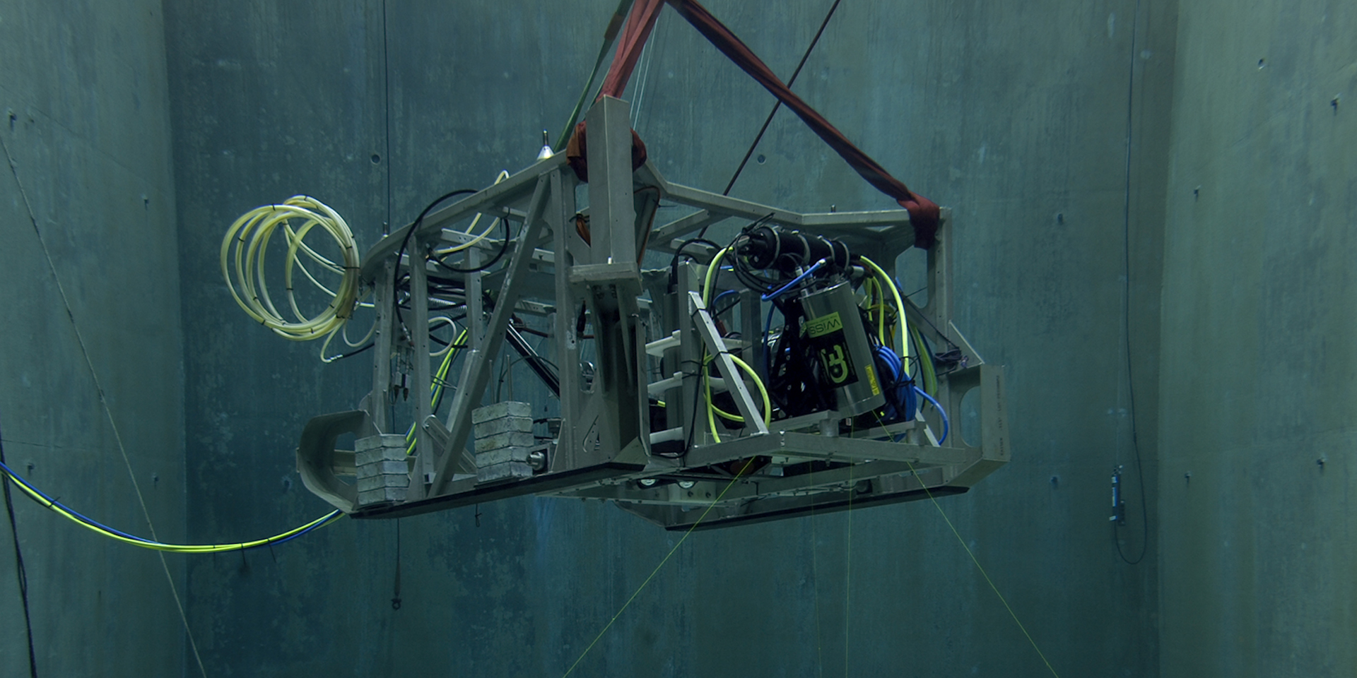
MBARI uses lidar technology from 3D at Depth to visualize the deep seafloor at high resolution.
This year, MBARI and 3D at Depth will build and test a more portable lidar system designed for seafloor mapping.
Image: Todd Walsh © 2018 MBARI


From MBARI

Next-generation underwater lidar technology aims to map the ocean floor in remarkable detail

Imaging the structure of the deep seafloor is critical to understanding the biology and ecology of the largest living space on our planet.
But to date, only about 20 percent of the ocean floor has been mapped at a resolution useful for scientific study.

For the past 10 years, MBARI has worked with 3D at Depth to develop innovative tools to map the seafloor using lidar technology.
Now, this partnership aims to create the next generation of subsea lidar technology that can generate detailed high-resolution maps of underwater features.

“To meet our goal of surveying the complex and rugged terrain of the deep seafloor at one-centimeter resolution, we’re working closely with 3D at Depth to develop enhanced lidar technology that will be smaller in size and weight and require less power, making it ideal for deployment on MBARI’s robotic submersibles and eventually, our autonomous robots too,” said Dave Caress, a principal engineer at MBARI and the principal investigator of MBARI’s Seafloor Mapping Lab.

“We’re excited that a research organization such as MBARI continues to use and invest in our technology to meet one of their strategic goals.
These projects are truly a win-win for both organizations as it provides MBARI with a tool to meet their scientific goals and helps us improve our subsea lidar systems for diverse robotic platforms,” said 3D at Depth CEO Carl Embry.

The ocean covers roughly 70 percent of Earth’s surface.
Beneath its sapphire surface lies a complex terrain—expansive plains, towering seamounts, deep submarine canyons, and chasm-like trenches.
Blending multi-scale seafloor mapping, imaging, targeted sampling, and novel sensors with precision navigation, MBARI has developed the capability to conduct efficient, high-resolution, and repeatable surveys of deep-sea research sites off Central California and beyond.

MBARI’s efforts to develop seafloor mapping technology first began more than 20 years ago.
In 2006, MBARI started using Dorado-class autonomous underwater vehicles (AUVs) to map the ocean floor to one-meter (3.3-feet) resolution.
In 2011, the seafloor mapping team began using remotely operated vehicles (ROVs) as platforms for high-resolution low-altitude surveys of the seafloor.
The ROVs use sound (sonar), lasers (lidar), stereo photography, and inertial navigation systems to produce maps of the seafloor in incredibly detailed one-centimeter (0.4-inch) resolution.

MBARI’s partnership with 3D at Depth, a global expert in commercial subsea lidar technology, has been critical to this effort.
 

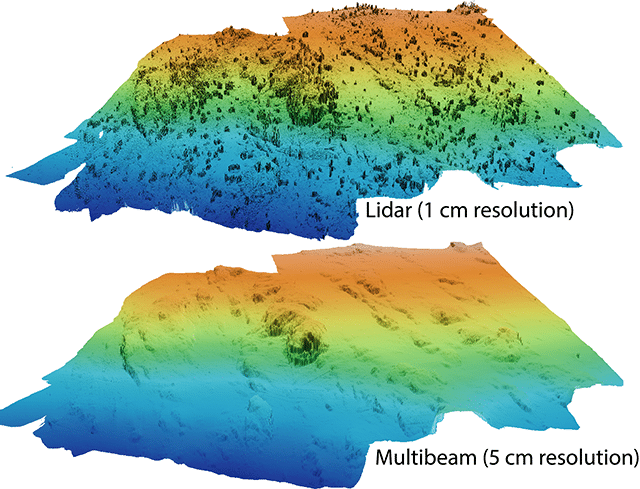
 Lidar uses laser light to allow researchers to build a high-resolution three-dimensional model of the deep seafloor (top) that is more detailed than bathymetric maps collected by traditional multibeam sonar (bottom).
3D at Depth’s lidar technology can resolve the seafloor to one-centimeter resolution, even revealing the soft tissues of animals living on the ocean floor.
Image: © 2019 MBARI


Lidar, or light detection and ranging, uses a laser to reconstruct three-dimensional terrain.
Subsea lidar uses pulses of high-intensity green laser light to collect incredibly precise information about seafloor characteristics, allowing researchers to generate detailed bathymetric maps.

In 2013, MBARI began testing 3D at Depth’s technology with the first-generation subsea lidar system, the SL1.
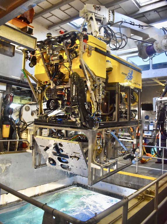
This sensor was incorporated into the low-altitude survey system on MBARI’s ROV Doc Ricketts.

The SL1 was originally designed for surveying underwater infrastructure for the oil and gas industry.
It projects a two-dimensional 30-degree by 30-degree field of view, which is ideal for detailed sideways scans of wellheads and pipelines.
However, this narrow coverage is not useful for down-looking, “mow-the-lawn” surveys of the seafloor. 
 
The Low-Altitude Survey System is a toolsled that MBARI can install on its ROVs to collect detailed information about the deep seafloor.
The toolsled includes stereo cameras as well as lidar technology from 3D at Depth.
Image: Dave Caress © MBARI


For the past seven years, MBARI and 3D at Depth have been developing a next-generation Wide Swath Subsea LiDAR (WiSSL) optimized for seafloor mapping.

In 2017, 3D at Depth delivered a WiSSL rated to 4,000 meters (13,100 feet) to meet the custom requirements for MBARI’s seabed mapping campaigns, including a 90-degree field of view that covers a seafloor swath twice as wide as the distance to the seafloor.
MBARI’s Seafloor Mapping Lab has used the WiSSL to map a variety of seafloor features and habitats at centimeter scale, including methane gas seeps, faults, submarine canyons, deep-sea coral and sponge communities, octopus brooding sites, and high-temperature hydrothermal vents.

After completing extensive design reviews and field trials, the team now aims to build and test the next-generation subsea lidar system this year.

The next-generation WiSSL will be more portable and draw less power.
The lighter system will be well suited for autonomous platforms, bringing MBARI engineers closer to their vision of integrating the low-altitude survey capability on smaller AUVs in order to flexibly scale their seafloor mapping efforts.

The new system will open up further possibilities beyond mapping the seafloor.
The next-generation WiSSL will have a 360-degree field of view and be able to conduct three-dimensional scans in open water, over complex terrain, and even on vertical terrain.

Repeated mapping of the deep seafloor is essential for understanding the complexity of its landscapes, the processes that create and disrupt them, and their functions as habitat.
The deep sea is critical to the health of our planet.
Scientists are racing to understand the deep sea before it is forever altered by climate change, pollution, and overfishing.
Working with 3D at Depth to advance lidar technologies to improve and expand seafloor mapping efforts will allow MBARI scientists to study seafloor geology and biology over large areas, particularly in areas of societal and ecological significance.

Links :

Wednesday, July 19, 2023

Stranded Australian sailor and dog rescued following months surviving on raw fish and rainwater

Aussie sailor and his dog have been rescued after months lost at sea

From The Guardian by Cait Kelly

Tim Shaddock, 51, and pet, Bella, were found floating in the Pacific Ocean after his catamaran was damaged in a storm

A Sydney man, 51, and his dog have been rescued after being stranded at sea for months, surviving on a diet of raw fish and rainwater.
 
Surviving by drinking rain water and eating raw fish for months
 
Tim Shaddock and his dog Bella had been floating in the Pacific Ocean for two months after a storm damaged his catamaran’s electronics and communication system, just weeks after they had set off.
 
La Paz (Mexico) with the GeoGarage platform (SEMAR nautical raster chart)

Shaddock left La Paz in Mexico in April and was attempting to reach French Polynesia, more than 5,000km away, when his boat was damaged by the storm.

The pair were rescued after a helicopter conducting surveillance for a Mexican fishing trawler found them on 12 July.
 
Shaddock said he was in "good health" but needed "rest and good food" after his long ordeal.
Grupomar/Atun Tuny via AP

A picture of Shaddock, posted by the trawler after the rescue, showed he had grown a long beard during his time at sea.
“The tuna boat ‘MARÍA DELIA’ of the marindustrias company has just rescued a castaway after three months adrift. There is no doubt God is great,” the post said.
Shaddock survived for two months by eating raw fish, drinking rainwater and hiding from the sun under a canopy in the small vessel.

Footage of Shaddock after his rescue, which was obtained by 9News, showed him explaining that despite his ordeal he was in good health.
“I’ve just got fishing gear, survival gear,” he said.
“I’ve been through a very difficult ordeal at sea and I’m just needing rest and good food because I’ve been alone at sea for a long time … I have not had enough food for a long time. … I have very good medicine, I’m being looked after very well.”

The tuna trawler is now heading back to Mexico where Shaddock will undergo medical tests and receive more treatment if needed.
 
Links :

Tuesday, July 18, 2023

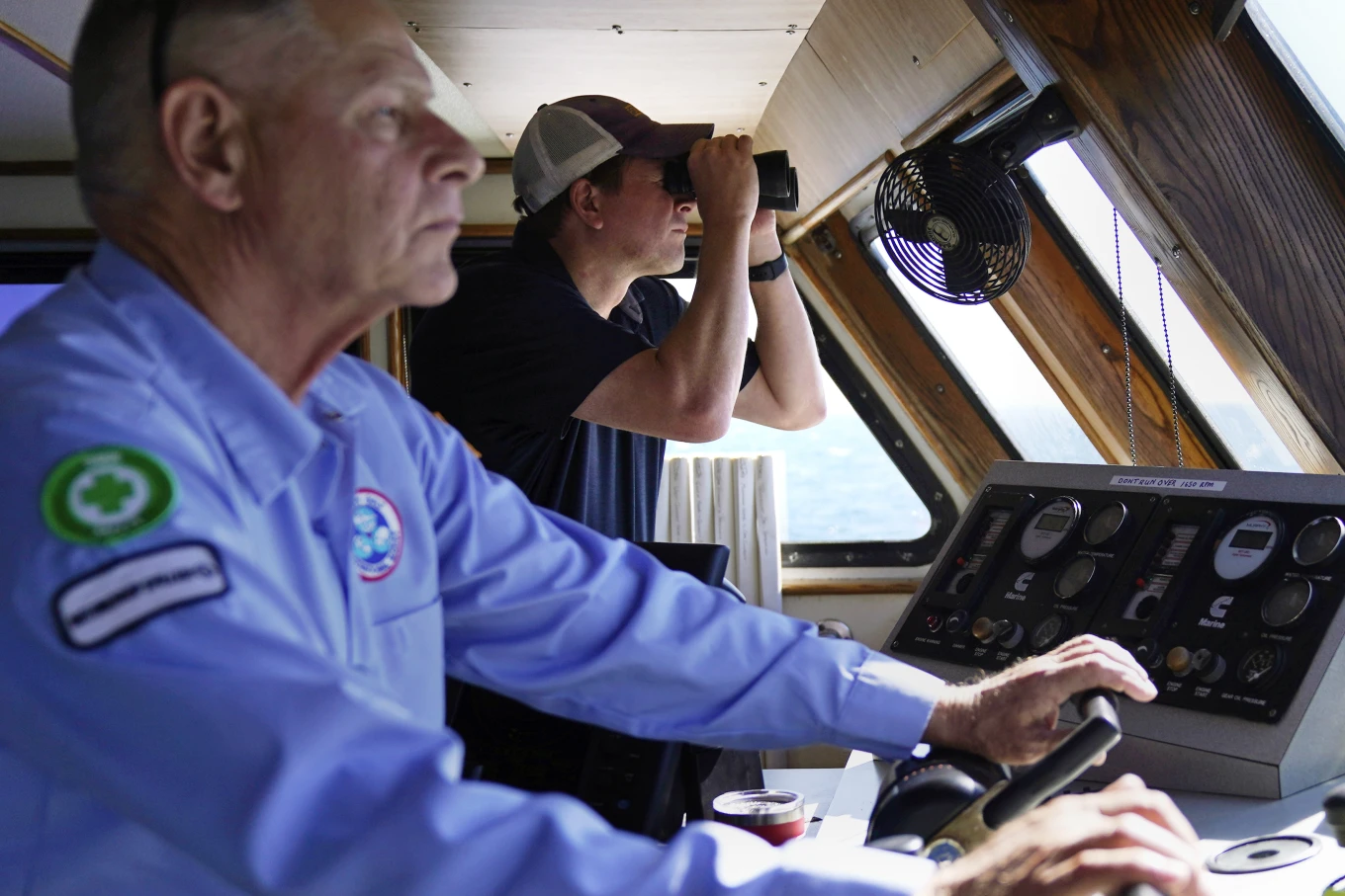
American boat patrols waters around new offshore wind farms to protect jobs


Aaron Smith, President and CEO of the Offshore Marine Service Association, center, peers through binoculars at ships installing the South Fork Wind project, as Capt.
Rick Spaid, left, pilots the vessel Jones Act Enforcer, Tuesday, July 11, 2023, off the coast of Rhode Island.
(AP Photo/Charles Krupa)


From APNews by Jennifer McDermott
 
One early morning this week in ocean waters off the coasts of Rhode Island and New York, signs of the nascent wind industry were all around.
Giant upright steel tubes poked from the water, waiting for ships to hoist up turbines that will make electricity driven by wind.
 
courtesy of 4Offshore 
 
 
courtsey of ESRI 

A battleship-gray vessel was on the prowl.
In this ramp-up for U.S. offshore wind, American marine companies and mariners fear they’ll be left behind.
So Aaron Smith, president of the Offshore Marine Service Association, was looking through binoculars to see whether ships servicing the new wind farms were using foreign-flagged vessels instead of U.S.-made ships with American crews.

“It really makes me upset when I think about the men and women I know who can do this work.
American citizens, fully capable, sitting at home while foreign nationals go to work in U.S.
waters,” Smith said.
“It’s unfair.”

The ship is named the Jones Act Enforcer, after the century-old law that says the transport of merchandise between U.S. points is reserved for U.S.-built, owned and documented vessels.
The motto: “We’ll be watching.” Smith was documenting operations to show to federal law enforcement officials and members of Congress.

A monopile, left, sits above the waterline awaiting its tower, blades and turbine sections, Tuesday, July 11, 2023, off the coast of Rhode Island.
(AP Photo/Charles Krupa)


A nautical chart for the South Fork Wind project area is displayed on the vessel Jones Act Enforcer, Tuesday, July 11, 2023, off the coast of Rhode Island.
(AP Photo/Charles Krupa) –
Charles Krupa/AP
 

Aaron Smith, President and CEO of the Offshore Marine Service Association, photographs ships installing portions of a wind farm, Tuesday, July 11, 2023, off the coast of Rhode Island.
(AP Photo/Charles Krupa) –
Charles Krupa/AP


The fishing vessel New Horizon motors, with outriggers out for balance, past a monopile structure for an offshore wind farm project, while working with foreign ships, Tuesday, July 11, 2023, off the coast of Rhode Island.
(AP Photo/Charles Krupa)


The Offshore Marine Service Association says it strongly supports the offshore wind industry.
Many of its member companies are already working in it.
Smith said this effort is about securing their future — decades of jobs and investments.
The U.S.
could need roughly 2,000 of the most powerful turbines to meet its goals to ramp up offshore wind to dramatically cut its use of fossil fuels to protect the atmosphere and reduce climate change.

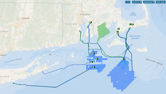
The Enforcer made several trips to where Danish energy company Ørsted is developing the South Fork Wind project with the utility Eversource.
This will likely be the first U.S. commercial-scale wind farm to open.

Approaching the site Tuesday, Smith saw a large crane ship sailing under the Cyprus flag, smaller Belgian-flagged vessels, and U.S.
fishing and offshore supply vessels near the turbine bases.
The Associated Press was the only media outlet aboard.

A boat passes the vessel Jones Act Enforcer, along the waterfront, Tuesday, July 11, 2023, in New Bedford, Mass.
(AP Photo/Charles Krupa)–


The U.S. fleet doesn’t yet have massive ships specialized for offshore wind to install foundations and turbines.
But some of the foreign-flagged vessels working in wind development areas along the East Coast are tugs and smaller supply ships.
U.S. ship operators told the AP they have similar vessels that can do this work.

Giant wind turbine blades for the Vineyard Winds project are stacked on racks in the harbor, Tuesday, July 11, 2023, in New Bedford, Mass.
(AP Photo/Charles Krupa)
 
Ørsted responded that 75% of the vessels supporting South Fork Wind’s offshore construction are U.S.-flagged, including barges, tugs, crew transport vessels and fishing vessels that monitor for safety and marine mammals.
But the larger U.S.-flagged offshore wind vessels aren’t built yet.
Even so, the installation vessels for South Fork Wind have American union workers on board, the company told the AP.

“While the U.S. industry continues to mature, we’re designing our projects to tap as many American workers, contractors, suppliers and vessels as possible.
We’re proud that South Fork Wind is putting hundreds of American mariners and union workers to work at sea in a wide range of roles,” Bryan Stockton, head of regulatory affairs for Ørsted, said in a statement Thursday.

Ørsted’s offshore work is complying with Jones Act provisions, Stockton added.
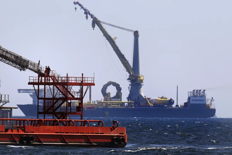
Workers exit a gangway on the C Rambler, an offshore supply ship based in the United States, while shadowing the crane ship Bokalift 2, which is flagged in Cyprus, Tuesday, July 11, 2023, off the coast of Rhode Island.
(AP Photo/Charles Krupa)


On this day, Smith said he could see no clear violations of the Jones Act, no “smoking gun.” In order to make a Jones Act case to Customs and Border Protection, the association would need to see several stages of activity, observing a ship for weeks if not months.
It would need to show loading merchandise onto a ship in port, transporting it to an offshore site and returning empty.

In the past, the association has also checked oil and gas sites for foreign vessels.
It first chartered the Enforcer from Harvey Gulf International Marine in late 2021.

Both wind and oil and gas companies can seek waivers to the Jones Act, citing national defense and unavailability of U.S. vessels, or get a ruling from Customs that a specific transaction is permitted using a foreign vessel.

But Smith said he feels that offshore wind developers are violating the spirit of the act.
He said he worries investors won’t finance the building of offshore ships if they’re going to compete against foreign vessels with cheaper day rates, largely because foreign crews can be paid less.
That would create a cycle where developers keep using foreign vessels because no U.S. vessels are available.

An installed monopile rises from the ocean at the South Fork Wind project, awaiting tower, turbine and blade sections, Tuesday, July 11, 2023, off the coast of Rhode Island.
(AP Photo/Charles Krupa)


The association wants to break that cycle as the industry takes off, Smith said.
Federal officials expect to review at least 16 construction and operations plans for commercial, offshore wind energy facilities by 2025.
“That’s a ton of work we could be doing,” Smith said, “and a ton of good-paying jobs.”

Randy Adams owns Sea Support Ventures in Cut Off, Louisiana.
His vessels do geological surveys for oil and gas.
He wants to do the same for the clean energy transition, but hasn’t yet.
“I’m just concerned that our industry is going to miss the boat on the wind farm work,” he said.
“I can’t say we’re being shut out of it, but we’re sure not on the top of the totem pole.”

As for the Jones Act Enforcer, Smith plans to keep it berthed at the port of New Bedford, Massachusetts into August, visiting the two commercial-scale wind farm sites.
Ørsted is installing 12 turbines.
The other developer, Vineyard Wind, is building a 62-turbine wind farm 15 miles (24 kilometers) off the Massachusetts coast.

Vineyard Wind said in a statement Thursday that its project complies with all U.S. laws, including the Jones Act, and it fully supports the American maritime and shipbuilding industry.

Before arriving in Massachusetts, the Enforcer was off the coast of Virginia where Dominion Energy plans an offshore wind farm.
Smith was seeing if foreign vessels were surveying the area for unexploded ordnance, and he said they were, despite at least four of his member companies bidding on the job.

The sun is reflected in the waters of the South Fork Wind project, seen from the deck of the vessel Jones Act Enforcer, Tuesday, July 11, 2023, off the coast of Rhode Island.
(AP Photo/Charles Krupa)


Dominion told the AP those vessels are not transporting merchandise between U.S. points, so they’re compliant.
The company said U.S. vessels got the work surveying, scouting, hauling equipment and transporting technicians.

In Texas, Dominion is also currently building the Charybdis, the first Jones Act-compliant offshore wind-installation vessel and says it strongly supports the Act.
Ørsted will charter that ship.

Ørsted is also investing in the Eco Edison, the first American-made offshore wind service operations vessel, now under construction in Louisiana, and in five more crew transfer vessels being built in Rhode Island.

Sam Giberga is executive vice president and general counsel at Hornbeck Offshore Services in Covington, Louisiana.
Its supply vessels and multi-purpose support ships are primarily used by the oil and gas industry in the Gulf of Mexico.
He said at first they were excited by the promise of offshore wind because it’s clean energy that will create jobs and business.
But for him, it’s starting to feel like a broken promise.
The company recently lost a bid to a foreign vessel.

“We are a maritime nation. Always have been. This is the next great maritime frontier and we’re not going to get to do it,” Giberga asked.
“Why would we allow that?”

Links :
Monday, July 17, 2023

NOAA launches new hurricane forecast model

The Hurricane Analysis and Forecast System (HAFS) “moving nest" Model.
Global map showcasing land mass in green and water in black, clouds in white and tropical storms outlined in a green boxes representing the moving nest model.
The HAFS model is now operational.
Compared to NOAA’s existing hurricane models, the experimental version of HAFS 2019-2022 showed a 10-15% improvement in track predictions, did about the same for intensity, did better at rapid intensification.
(Image credit: NOAA)

From Meteorological Technology Int by Dan Symonds

NOAA’s National Hurricane Center, a division of the US National Weather Service, has a new model to help produce hurricane forecasts this season.
The Hurricane Analysis and Forecast System (HAFS) will run alongside existing models for the 2023 season before replacing them as NOAA’s premier hurricane forecasting model.

Rick Spinrad, NOAA Administrator, said, “The quick deployment of HAFS marks a milestone in NOAA’s commitment to advancing our hurricane forecasting capabilities and ensuring continued improvement of services to the American public.
Development, testing and evaluations were jointly carried out between scientists at NOAA Research and the National Weather Service, marking a seamless transition from development to operations.”
 
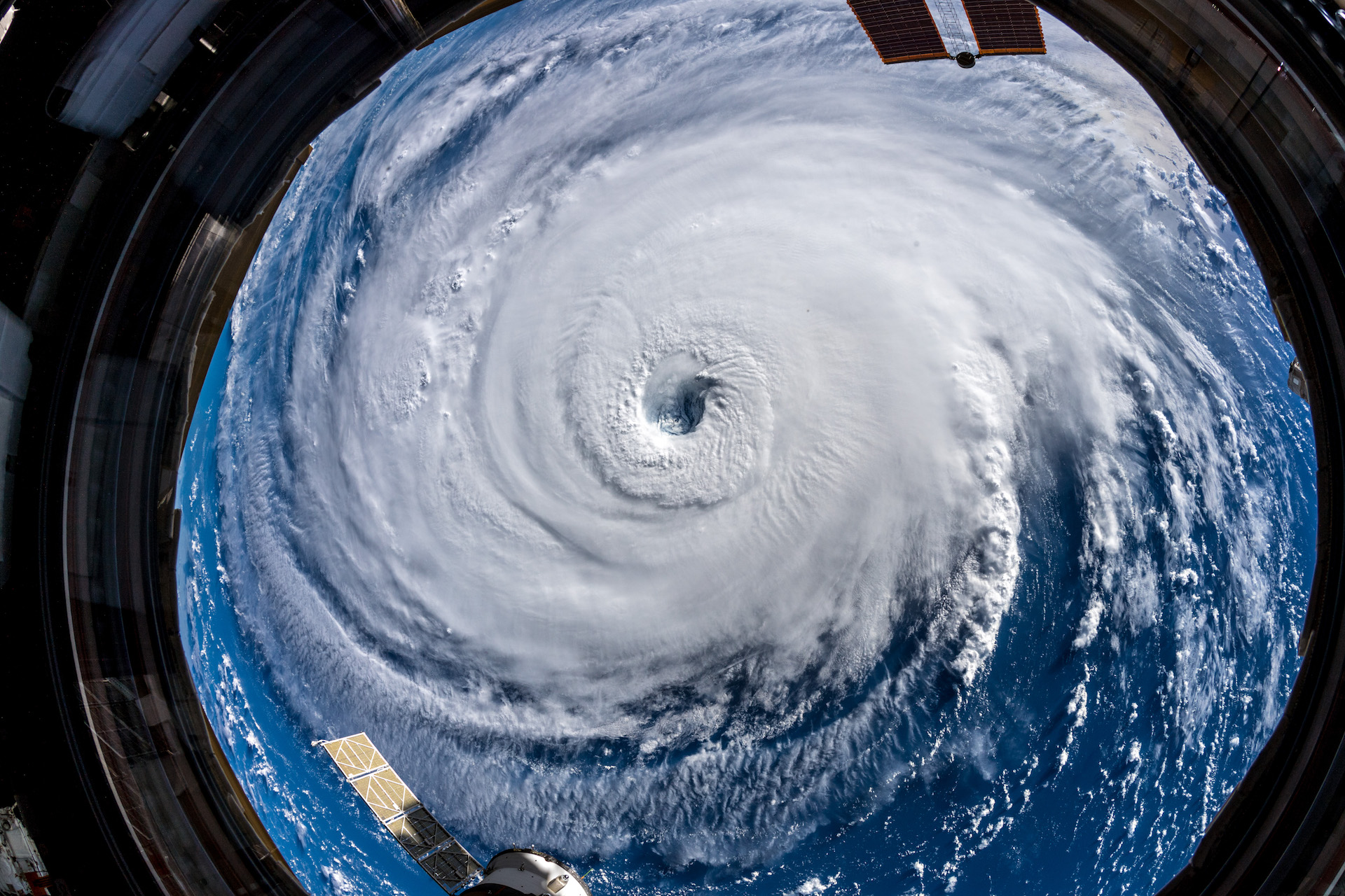
Hurricane Florence, from space.
courtesy of Alexander Gerst / Flickr
 

Running the experimental version of HAFS from 2019 to 2022 showed a 10-15% improvement in track predictions compared with NOAA’s existing hurricane models.
HAFS is expected to continue increasing forecast accuracy, thereby reducing the impact of storms on lives and property.

HAFS is as good as NOAA’s existing hurricane models when forecasting storm intensity and is better at predicting rapid intensification.
HAFS was the first model last year to accurately predict that Hurricane Ian would undergo secondary rapid intensification as the storm moved off the coast of Cuba and barreled toward southwest Florida.

Over the next four years, HAFS will undergo several major upgrades, ultimately increasing the accuracy of forecasts, warnings and life-saving information.
By 2027, the NOAA Hurricane Forecast Improvement Program (HFIP) aims to reduce all model forecast errors by nearly half compared with 2017.

An example of the Hurricane Analysis and Forecast System or HAFS
running for Hurricane Ian in 2022.
 
An example of the Hurricane Analysis and Forecast System or HAFS
running for Hurricane Ian in 2022.

HAFS provides more accurate, higher-resolution forecast information over land and ocean and is comprised of five major components: a high-resolution moving nest; high-resolution physics; multi-scale data assimilation that allows for vortex initialization and vortex cycling; 3D ocean coupling; and improved assimilation techniques that allow for the assimilation of novel observations.
The foundational component is the moving nest, which allows the model to zoom in with a resolution of 1.9km on areas of a hurricane that are key to improving forecasts of wind intensity and rain.

Ken Graham, director of NOAA’s National Weather Service, said, “With the introduction of the HAFS forecast model into our suite of tropical forecasting tools, our forecasters are better equipped than ever to safeguard lives and property with enhanced accuracy and timely warnings.
HAFS is the result of strong collaborative efforts throughout the science community and marks significant progress in hurricane prediction.”

HAFS, the first regional coupled model to go into operation under the Unified Forecast System (UFS), was developed through community-based collaboration and the streamlining of the operational transition process.
As HAFS uses the FV3 — the same dynamic core as the US Global Forecast System — it will have a unified starting point when initiated for hurricane prediction and will also integrate with ocean and wave models as underlying inputs.
The current standalone regional hurricane models – HWRF and HMON – each have their own starting point for modeling the atmosphere.
Leveraging the FV3 in HAFS reduces overlapping efforts, making the NOAA modeling portfolio more consistent and efficient.

HAFS is the first new major forecast model implementation using NOAA’s updated weather and climate supercomputers, which were installed last summer.
HAFS would not be possible without the speed and power of these new supercomputers, called the Weather and Climate Operational Supercomputing System 2 (WCOSS2).
 

Sunday, July 16, 2023

Marine Emergency Response - Marine Safety Information


How do National Meteorological and Hydrological Services, and WMO,
support Marine Emergency Response?
 

The importance of marine meteorology to ensure safety at sea is showcased in a new publication on Maritime Forecasting, Meteorology and WMO: History and Evolution which traces nearly 150 years of dedicated commitment