Saturday, November 26, 2011

Australia plans huge marine reserve in Coral Sea

From BBC

The Australian government says it plans to establish the world's largest marine reserve in the Coral Sea.

Environment Minister Tony Burke said the protected zone would cover an area more than one-and-a-half times the size of France.

New fishing limits would be imposed and and exploration for oil and gas banned.

The proposal is subject to a 90-day consultation, but Mr Burke said the Coral Sea's biodiversity was at the heart of the plan.


"There is no other part of Australia's territory where so much comes together - pristine oceans, magnificent coral, a military history which has helped define us and now a clear proposal for permanent protection," he said.

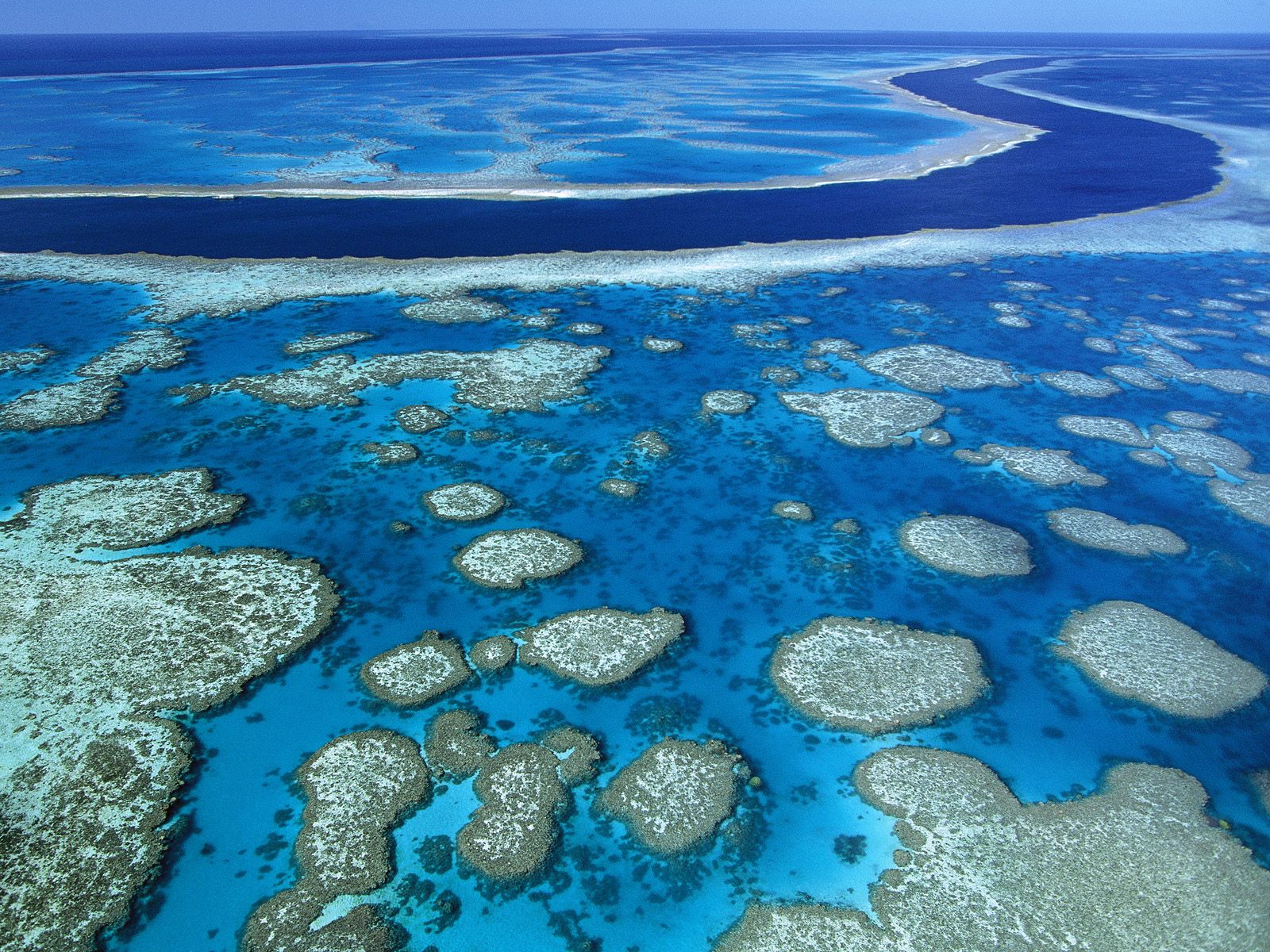
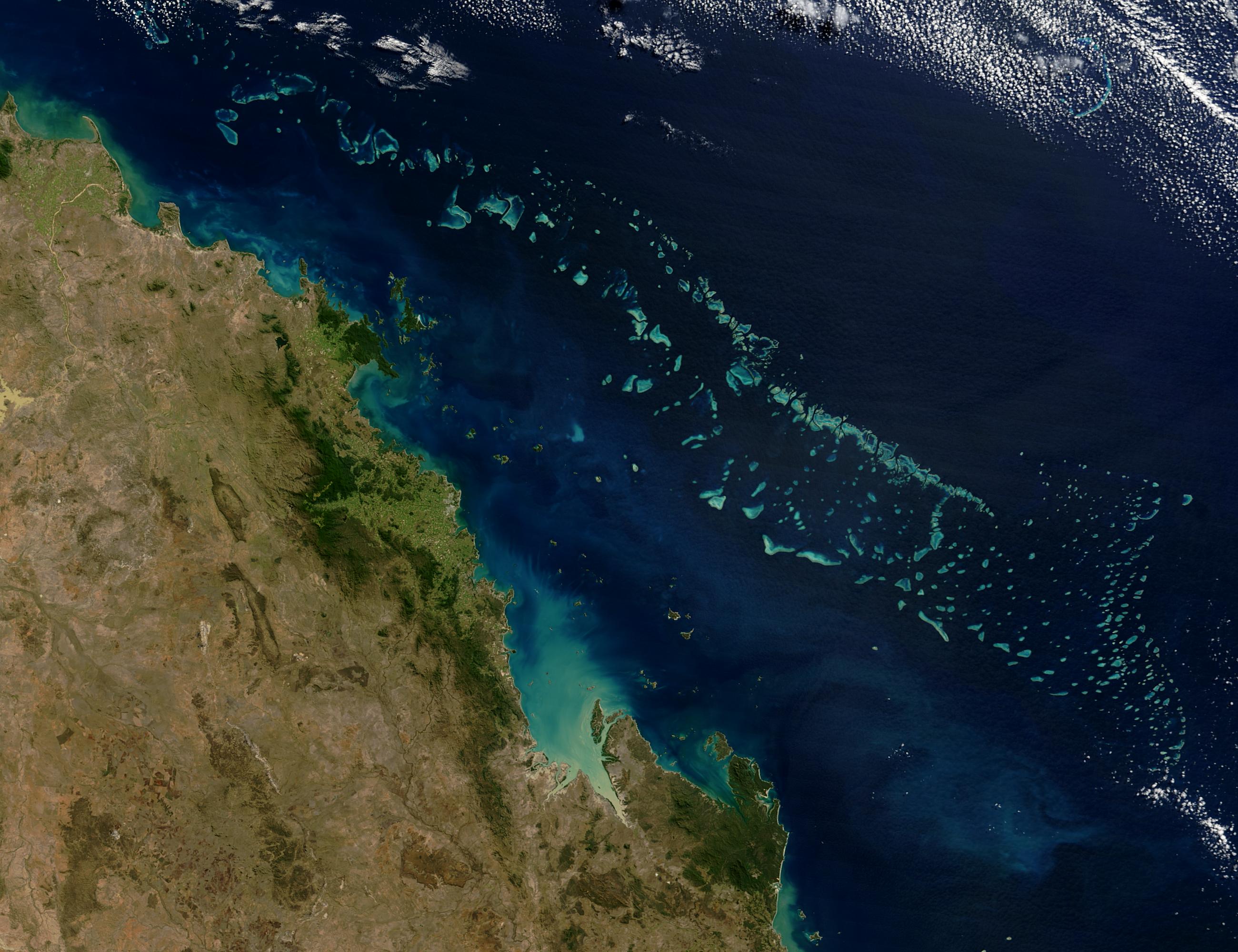
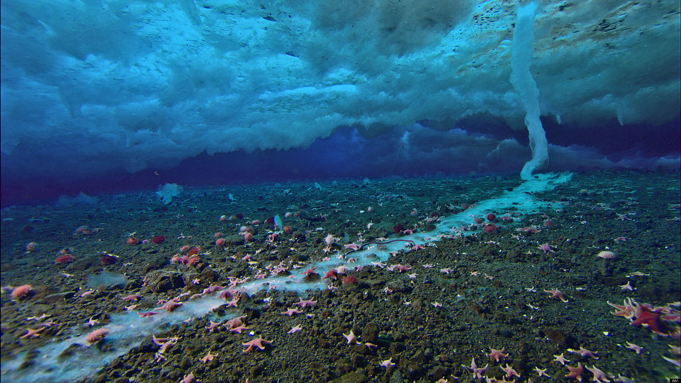
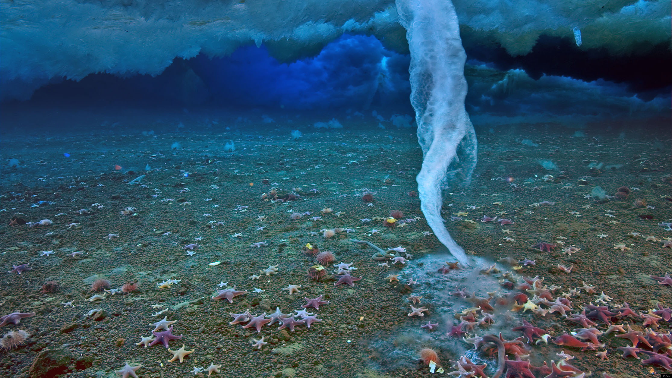
The sea - off the Queensland coast in north-east Australia - is home to sharks and tuna, isolated tropical reefs and deep sea canyons.
It is also the resting place of three US navy ships sunk in the Battle of the Coral Sea in 1942.

'World leader'

Under the plans, fishing - commercial and recreational - would be allowed in some areas of the reserve, which at its closest point would start 60km (37 miles) from the coast and it extends out to 1,100km.

President of the Queensland Seafood Industry Association Geoff Tilton said a larger area was needed for commercial fishing.

But Professor Terry Hughes, director of coral reef studies at James Cook University, called the proposal a "welcome step" that "cements Australia's reputation as a world leader in marine resource management".


"The proposed Coral Sea no-take area is hundreds of kilometres offshore, and will have no impact on recreational fishing. There is very, very little commercial fishing currently operating legally in the Coral Sea today," he said.

Activists called the plan a good start but said key reefs and spawning grounds lay outside the fully protected area.

Currently the world's largest marine reserve is a 545,000-sq-km area (210,425 sq miles) established by the UK around the Chagos Islands in the Indian Ocean.

The Coral Sea reserve, if approved, would be approximately 989,842 sq km.

Links :

Friday, November 25, 2011

Whaling in Faroe Islands, grindadrap


From MSNBC

Dozens of boats herded a group of pilot whales into a bay for slaughter in the Faroe Islands on Tuesday as local residents took part in a traditional 'Grindadrap' whale hunt.


Inhabitants of the Faroe Islands round up pilot whales (Globicephala melaena) during the traditional 'Grindadrap' ('whale hunting' in Faroese) near the capital Torshavn on November 22.
Andrija Ilic / Reuters

The meat and blubber of pilot whales have long been a part of the islanders' national diet, according to Reuters, which reports that the whaling is not done for commercial purposes.
Nevertheless, the Whale and Dolphin Conservation Society, a pressure group, says that the techniques used to kill the whales are "intensely stressful and cruel."
In a statement posted on a government-run website, the Faroe Islands' Ministry of Foreign Affairs said that they were committed to "internationally adopted principles for the conservation and sustainable use of living marine resources."


Viking tradition: the blood of slaughtered pilot whales turns the sea red near Torshavn
on November 22.

There were 5 whale drives between January and September this year, with a total catch of 406 pilot whales, according to the Faroese government statement.

More than 120 pilot whales, slaughtered on July 23, 2010, are pictured on docks in the harbor of Torshavn, Faroe Islands, an autonomous province of Denmark.
Every year, herds of pilot whales (Globicephala melaena) pass by the shores of the Faroe Islands.
In the past fishermen used spears and harpoons, but today the whale hunting equipment is legally restricted to special knives, ropes, and assessing-poles for measurement.
(REUTERS/Andrija Ilic)

The American Cetacean Society says that pilot whales are not considered to be endangered, but that there has been a noticeable decrease in their numbers around the Faroe Islands.

Thursday, November 24, 2011

'Brinicle' ice finger of death filmed in Antarctic


In this clip, Sir David Attenborough describes the first ever footage of the unusual formation.
HD pictures : I / II

From BBC

A bizarre underwater "icicle of death" has been filmed by a BBC crew.

With timelapse cameras, specialists recorded salt water being excluded from the sea ice and sinking.
The temperature of this sinking brine, which was well below 0°C, caused the water to freeze in an icy sheath around it.
Where the so-called "brinicle" met the sea bed, a web of ice formed that froze everything it touched, including sea urchins and starfish.

The unusual phenomenon was filmed for the first time by cameramen Hugh Miller and Doug Anderson for the BBC One series Frozen Planet.

Creeping ice

The icy phenomenon is caused by cold, sinking brine, which is more dense than the rest of the sea water.
It forms a brinicle as it contacts warmer water below the surface.

Mr Miller set up the rig of timelapse equipment to capture the growing brinicle under the ice at Little Razorback Island, near Antarctica's Ross Archipelago.
>>> geolocalization with the Marine GeoGarage <<<

"When we were exploring around that island we came across an area where there had been three or four [brinicles] previously and there was one actually happening," Mr Miller told BBC Nature.

The diving specialists noted the temperature and returned to the area as soon as the same conditions were repeated.
"It was a bit of a race against time because no-one really knew how fast they formed," said Mr Miller.
"The one we'd seen a week before was getting longer in front of our eyes... the whole thing only took five, six hours."


Against the odds

The location - beneath the ice off the foothills of the volcano Mount Erebus, in water as cold as -2°C - was not easy to access.

"That particular patch was difficult to get to. It was a long way from the hole and it was quite narrow at times between the sea bed and the ice," explained Mr Miller.
"I do remember it being a struggle... All the kit is very heavy because it has to sit on the sea bed and not move for long periods of time."

As well as the practicalities of setting up the equipment, the filmmakers had to contend with interference from the local wildlife.

The large weddell seals in the area had no problems barging past and breaking off brinicles as well as the filming equipment.
"The first time I did a timelapse at the spot a seal knocked it over," said Mr Miller.
But the team's efforts were eventually rewarded with the first ever footage of a brinicle forming.


HOW DOES A BRINICLE FORM?
Dr Mark Brandon Polar oceanographer, The Open University

Freezing sea water doesn't make ice like the stuff you grow in your freezer.
Instead of a solid dense lump, it is more like a seawater-soaked sponge with a tiny network of brine channels within it.

In winter, the air temperature above the sea ice can be below -20°C, whereas the sea water is only about -1.9°C.
Heat flows from the warmer sea up to the very cold air, forming new ice from the bottom.
The salt in this newly formed ice is concentrated and pushed into the brine channels.
And because it is very cold and salty, it is denser than the water beneath.

The result is the brine sinks in a descending plume.
But as this extremely cold brine leaves the sea ice, it freezes the relatively fresh seawater it comes in contact with.
This forms a fragile tube of ice around the descending plume, which grows into what has been called a brinicle.

Brinicles are found in both the Arctic and the Antarctic, but it has to be relatively calm for them to grow as long as the ones the Frozen Planet team observed.

Wednesday, November 23, 2011

GeoGarage : 7800 nautical charts onboard


With Germany, the 10th layer displayed in the Marine GeoGarage,
a total of 4168 charts (7797 including sub-charts)
are now integrated in our Cloud computing solution.


More to come...

Jeju island grannies of the sea

This is the cover photo that introduced me to the book
“Moon Tides: Jeju Island Grannies of the Sea.”
Written by Brenda Paik Sunoo with Young Sook Han, the book is divided into seven chapters: Survival, Shamans, Suffering, Aging, Compassion, Family, and Future.
see JejuWeekly

From JejuWeekly

The Jeju Special Self-Governing Provincial Council’s Special Committee on Women has gathered the first public opinion regarding the Jeju haenyeo [diver] culture.
In particular, I spoke on “What is the Jeju women’s culture, and what content would make it a leading world brand.”
Bearing that in mind, on Sept. 23 a policy debate was held regarding the divers cultural globalization plan and ways to obtain listing as a UNESCO Intangible Cultural Heritage of Humanity.

>>> geolocalization with the Marine GeoGarage <<<

Due to the unique “muljil” [substantive customs] of labor and the ecological way of life of the Jeju women divers, and a ‘strong woman’ as a cultural anthropological figure, these women have already received considerable attention in the cultural anthropology field.
Of particular note are their collaborative work while retaining an autonomous mentoring system to train juniors, their equitable distribution of ecological methods and collaborative resource management.
Of equal note is their active “bulteok” communication among divers, and positive traditions and rites of community, all of which serve to identify them as eco-cultural treasures of modern humankind.
This has brought additional reviews and new attention to the diving women as an example of feminist governance.

In reality however, the number of Jeju divers has been shrinking.
From a registered 14,143 in 1970, the population has been reduced to approximately one-third with only 5,095 members registered in 2009, and was reduced by another 100 people one year later, to just 4,995 people in 2010.

Clearly, the community is declining.
There are only two members in their 30s.
Of note, female children now receive a higher education and rural employment is no longer favored, so the subsequent generations are not becoming divers and at stake is the sustainability of this society.
To increase this diminishing number of divers is important but even more is the enhancement of their self-esteem, and there is an urgent need to raise awareness of Jeju society and change the approach of policy.

About four years ago, Jeju women divers on Udo were represented on video by Sumbi Pictures, representative Ko Hee-Young, but it was a pity for the Jeju women divers, inadvertently or not, that it had a small showing and only interactively.

If you try to approach divers from Udo and are not their brother or sister, it is difficult to get into the intimate confessions of their lives.
An Israeli documentary director, Dahlia, came and learned Korean language, Jeju dialect, and local gestures, and began filming.
When leaving Jeju after six months of grueling labor she was sad, as she divided her gosari tablets among the divers, to note that they were more diseased.
The documentary was taken to Europe to introduce the Jeju women divers’ lifestyle.
In the end, the basics of good work is a deep affection for the destination.


Jeju must notify the world that we’re losing something very significant.
No matter how nicely we are setting up agendas and advertising slogans, even if they work in unison like a scene out of a movie... it’s hard not to have a dream.
Rather than a mere task, we must aim to go beyond with creativity and passion.


Rare breed: A Haenyo diver at Seongsan Beach. Picture: David May

Jeju women divers cultural globalization, a five-year plan, has yielded a successful local festival which Jeju women divers promoted.
In particular, the chance for Japan’s Ama women divers and the divers of Jeju to mingle, dance, and know each other’s cultures was very meaningful.
A program was also launched to encourage foreigners to systematically promote Jeju women divers, giving them an opportunity to learn the culture well in order to promote it.

To go beyond this, we must not miss the chance to have the divers listed as a UNESCO Intangible Cultural Heritage of Humanity, as a symbol of the truly great minds of mothers contained in the sonorous “sumbisori” [sound made by divers] and to identify to the world what is happening to them.

In this whirlwind of modernization, we must arrange interviews of the 4,995 remaining divers and, in a reverent spirit, learn of the lives of these elderly women and those divers already departed.
It is critical that we advertise this to the world.
This work with them must begin as early as possible before these experts leave our world, an important task which must be done responsibly.

Links :
  • OpenDemocracy : South Korea, destroying the lives of the Haenyo ‘sea women’
  • News.com.au : Korean island is a new natural won
  • TheKoreaHerald : Beyond tangerines and beaches: Jeju’s unique culture
  • KoreaBrand : Haenyeo of Jeju, resilient strenght and life
  • Kuriositas : Haenyo – The indomitable diving grandmas of Jeju Island

Tuesday, November 22, 2011

Coral reefs yield antibiotic helper medication


Drug-resistant bacteria present a tough challenge.
But the great biodiversity of marine organisms is offering strategies to beat these bad “bugs.
Infection-fighting chemicals from sponges can be mass-produced in labs to conserve wild ocean reefs

From NOAA OceanToday

When you've got a bacterial infection like pink eye or strep throat, your doctor will usually write a prescription for antibiotics to make you feel better.
But have you ever wondered where these medicines come from?

Most drugs come from flowers and plants on land, but finding new sources is difficult.
And some bacteria have become resistant to a few of these drugs - so much in fact that these drugs don't work any more.
The ocean - with its amazing biodiversity - offers many more organisms for scientists to discover and develop new medicines.

NOAA scientists have been collecting and studying sponges, corals, and other marine organisms.
They and their partners discovered a chemical that breaks down the shield that bacteria use to protect themselves from antibiotics.
Used as a helper drug, antibiotics that are no longer effective would once again be able to fight off these resistant bacteria.

NOAA scientists have also extracted chemicals from corals and sponges that fight some of the worst infectious bacteria.
In order to make these new antibiotics, scientists make copies of these chemicals in a laboratory.
This way they won't have to constantly harvest corals from the ocean, leaving our marine ecosystems healthy and intact.

The ocean may hold the key for finding new medicines, but not if we don't keep it - and everything that lives there - healthy and pollution free.
Do your part to protect coral reefs.
Do not buy coral jewelry or home décor.
And when snorkeling, fishing, or scuba diving, be careful to not touch or disrupt coral beds or the sea floor.
The next cure could be hidden there.

Links :
  • ScientificAmerican : Coral fights antibiotic resistance
  • NOAA : Antibiotic resistance, a rising concern in marine ecosystems
  • FoxNews : The importance of drugs from the sea

Monday, November 21, 2011

Germany BSH, a new chart layer in the Marine GeoGarage


Marine GeoGarage is glad to announce a new chart layer with Germany nautical maps coming from BSH (Bundesamt für Seeschifffahrt und Hydrographie).

52 charts (207 including sub-charts) are reproduced with the permission of the Federal Maritime and Hydrographic Agency.

Note : 24 charts (55 including sub-charts) of the complete set are not displayed due to cross-copyrights with Danish, Polish, Swedish, Dutch, Belgian, Russian, Lithuanian, Estonian, Norwegian, Finnish, French, UK Hydrographic Offices


  • D2-1 Mündungen der Jade und Weser
  • D2-2 Plan: Dove-Harle
  • D3-1 Ansteuerung von Helgoland
  • D4-1 Die Weser von Robbennordsteert bis Bremerhaven und Nordenham
  • D4-2 Plan, part1: Häfen von Bremerhaven
  • D4-3 Plan, part2: Häfen von Bremerhaven
  • D5-1 Die Weser von Nordenham bis Farge, part 1
  • D5-2 Die Weser von Nordenham bis Farge, part 2
  • D5-3 Plan A: Hafen von Brake
  • D5-4 Plan B: Hafen von Elsfleth
  • D5-5 Plan C, part1: Die Hunte von Huntebrück bis Oldenburg
  • D5-6 Plan C, part2: Die Hunte von Huntebrück bis Oldenburg
  • D5-7 Plan D: Hafen von Oldenburg
  • D5-8 Plan E: Huntemündung
  • D6-1 Die Weser von Farge bis Bremen. Nur Pläne. Plan A: Farge bis Osterort
  • D6-2 Plan B: Vegesacker Kurve
  • D6-3 Plan C: Häfen von Bremen
  • D6-4 Plan D: Stephanibrücke bis Hemelingen
  • D7-1 Die Jade, innerer Teil
  • D7-2 Plan: Wilhelmshaven
  • D26-2 Plan A: Hafen von Flensburg
  • D26-3 Plan B: Sporthafen Farensodde
  • D26-4 Plan C: Sporthafen Glücksburg
  • D26-5 Plan D: Sporthafen Schausende
  • D26-6 Plan E: Holnisenge und Egernsund
  • D26-7 Plan F: Hafen von Langballigau
  • D30-2 Plan A: Sporthafen Damp
  • D30-3 Plan B: Hafen von Eckernförde
  • D30-4 Plan C: Olympiahafen Schilksee und Hafen von Strande
  • D30-5 Plan D: Sporthafen Wendtorf
  • D30-6 Plan E: Hafen von Lippe
  • D30-7 Plan F: Einfahrt nach Heiligenhafen
  • D31-2 Plan A: Einfahrt und Hafen von Burgstaaken
  • D31-3 Plan B: Fehmarnsund-Brücke
  • D32-1 Falshöft bis Holtenau
  • D32-2 Plan A: Hafen von Schleimünde
  • D32-3 Plan B: Schleimünde und Hafen von Olpenitz
  • D32-4 Plan C: Sporthafen Damp
  • D32-5 Plan D: Reede von Eckernförde
  • D32-6 Plan E: Häfen von Eckenförde
  • D32-7 Plan F: Kranzfelder Hafen
  • D32-8 Plan G: Sporthafen Wendtorf
  • D33-1 Ansteuerung der Kieler Förde
  • D33-2 Plan A: Olympiahafen Schilksee und Hafen von Strande
  • D33-3 Plan B: Hafen von Laboe
  • D34-1 Häfen von Kiel
  • D34-2 Plan A: Plüschowhafen
  • D34-3 Plan B: Sporthafen Wik
  • D34-4 Plan C: Sporthafen Düsternbrook
  • D34-5 Plan D: Hafen von Möltenort
  • D34-6 Plan E:Sporthafen Mönkeberg
  • D34-7 Plan F: Ostuferhafen
  • D34-8 Plan G: Ostseekai bis Bahnhofskai
  • D35-1 Neustädter Bucht
  • D35-2 Plan A: Hafen von Neustadt
  • D35-3 Plan B: Jachthafen von Grömitz
  • D35-4 Plan C: Hafen von Niendorf
  • D36-2 Plan A: Großenbroder Binnensee
  • D36-3 Plan B: Sporthafen Großenbroder Binnensee
  • D37-1 Dameshöved bis Wismar
  • D37-2 Plan A: Hafen von Neustadt
  • D37-3 Plan B: Jachthafen von Grömitz
  • D37-4 Plan C: Hafen von Niendorf
  • D41-1 Die Schlei von Schleimünde bis Schleswig, part 1
  • D41-2 Die Schlei von Schleimünde bis Schleswig, part 2
  • D41-3 Plan A: Hafen von Schleimünde
  • D41-4 Plan B: Häfen von Maasholm
  • D41-5 Plan C: Hafen von Kappeln
  • D41-6 Plan D: Hafen von Arnis
  • D41-7 Plan E: Lindaunis Brücke
  • D41-8 Plan F: Missunder Enge
  • D41-9 Plan G: Sporthafen Fleckeby
  • D41-10 Plan H: Stexwiger Enge
  • D41-11 Plan J: Hafen von Schleswig
  • D42-1 Nord-Ostsee-Kanal, part 1
  • D42-2 Nord-Ostsee-Kanal, part 2
  • D42-3 Plan A: Hafenanlagen von Rendsburg
  • D42-4 Plan B: Hafen- und Schleusenanlagen von Kiel-Holtenau
  • D42-5 Plan C: Hafen- und Schleusenanlagen von Brunsbüttel
  • D43-2 Plan A: Häfen von Heiligenhafen
  • D43-3 Plan B: Einfahrt nach Heiligenhafen
  • D43-4 Plan C: Hafen von Lippe
  • D43-5 Plan D:Einfahrten nach Orth und Lemkenhafen
  • D44-1 Elbmündung
  • D44-2 Plan: Cuxhaven
  • D46-1 Die Elbe von der Oste bis Brunsbüttel und Krautsand
  • D46-2 Plan A: Die Oste von Geversdorf bis Osten
  • D46-3 Plan B: Hafen- und Schleusenanlagen von Brunsbüttel
  • D46-4 Plan C: Hafen von Glückstadt
  • D46-5 Plan D: Dornbusch
  • D46-6 Plan E: Die Stör von Wewelsfleth bis Itzehoe, part 1
  • D46-7 Plan E: Die Stör von Wewelsfleth bis Itzehoe, part 2
  • D47-1 Die Elbe von Krautsand bis Schulau
  • D47-2 Plan: Stadersand
  • D48-1 Die Elbe von Schulau bis Hamburg. Nur Pläne. Plan A: Die Elbe von Schulau bis Teufelsbrück
  • D48-2 Plan B: Häfen von Hamburg
  • D49-1 Mündungen der Jade, Weser und Elbe
  • D51-1 Die Trave von Travemünde bis Große Holzwiek und Dassower See
  • D51-2 Plan: Hafenanlagen von Lübeck-Travemünde
  • D52-1 Die Trave von Große Holzwiek bis Lübeck
  • D52-2 Plan A: Sporthafen Kattegat
  • D52-3 Plan B: Sporthäfen am Stau
  • D54-1 Beltsee
  • D88-1 Helgoland
  • D89-1 Juist bis Wangerooge
  • D89-2 Plan A: Leybucht
  • D89-3 Plan B: Hafen von Norddeich
  • D89-4 Plan C: Hafen von Norderney
  • D89-5 Plan D: Hafen von Langeoog
  • D89-6 Plan E: Hafen von Bensersiel
  • D89-7 Plan F: Dove Harle
  • D90-2 Plan A: Fischerbalje und Hafen von Borkum
  • D91-2 Plan A: Hafenanlagen von Emden
  • D91-3 Plan B: Dollard (Dollart)
  • D92-1 Die Ems von Pogum bis Papenburg, part 1
  • D92-2 Die Ems von Pogum bis Papenburg, part 2
  • D100-2 Plan: Sporthäfen Gelting und Wackerballig
  • D104-1 Die Eider von Eiderdamm bis Lexfähre. Nur Pläne. Plan A: Eiderdamm bis Nordfeld
  • D104-2 Plan B: Eidersperrwerk
  • D104-3 Plan C: Hafen von Tönning
  • D104-4 Plan D: Hafen von Friedrichstadt
  • D104-5 Plan E: Nordfeld bis Lexfähre
  • D105-1 Die Eider, Norder- und Süderpiep
  • D105-2 Plan A: Hafen von Büsum
  • D105-3 Plan B: Fahrwasser nach Friedrichskoog
  • D105-4 Plan C: Sporthafen Meldorf
  • D106-1 Hever und Schmaltief
  • D106-2 Plan A: Einfahrt nach Husum
  • D106-3 Plan B. Hafen von Husum
  • D106-4 Plan C: Hafen von Pellworm
  • D106-5 Plan D: Strucklahnungshörn
  • D107-1 Vortrapptief, Norder- und Süderaue
  • D107-2 Plan A: Hafen von Hörnum
  • D107-3 Plan B: Hafen von Amrum
  • D107-4 Plan C: Hafen von Dagebüll
  • D107-5 Plan D: Hafen von Wyk
  • D107-6 Plan E: Schlüttsiel
  • D108-3 Plan B: Hafen von List
  • D162-2 Plan A: Nothafen Darßer Ort
  • D162-3 Plan B: Hafen von Glowe
  • D162-4 Plan C: Hafen von Lohme
  • D1511-1 Greifswalder Bodden
  • D1511-2 Plan A: Anleger von Vierow
  • D1511-3 Plan B: Hafen von Greifswald-Ladebow
  • D1511-4 Plan C: Hafen von Greifswald-Wieck
  • D1512-1 Peenestrom, nördlicher Teil
  • D1512-2 Plan A: Hafen von Ruden
  • D1512-3 Plan B: Hafen von Peenemünde
  • D1512-4 Plan C: Hafen von Wolgast
  • D1512-5 Plan D: Hafen von Kröslin
  • D1513-2 Plan A: Peenestrom südlich Wolgast
  • D1513-3 Plan B: Klotzow bis Mönchow
  • D1513-4 Plan C: Die Peene östlich Anklam
  • D1513-5 Plan D: Die Uecker, nördlicher Teil
  • D1513-6 Plan E: Die Uecker, südlicher Teil
  • D1513-8 Plan G: Ansteuerung von Berndshof
  • D1513-9 Plan H: Kamp bis Karnin
  • D1516-1 Prorer Wiek
  • D1516-2 Plan A: Stadthafen von Sassnitz
  • D1516-3 Plan B: Fährhafen von Sassnitz
  • D1578-1 Greifswalder Bodden, nördlicher Teil
  • D1578-2 Plan A: Hafen von Lauterbach
  • D1578-3 Plan B: Hafen von Gager
  • D1579-1 Der Strelasund von Palmerort bis Stralsund
  • D1579-2 Plan A. Anleger von Glewitzer Fähre
  • D1579-3 Plan B: Hafen von Stahlbrode
  • D1579-4 Plan C: Hafen von Puddemin
  • D1579-5 Plan D: Anleger von Gustow
  • D1579-6 Plan E: Anleger von Neuhof
  • D1579-7 Plan F: Hafen von Stralsund
  • D1621-1 Nördliche Rügensche Bodden
  • D1621-2 Plan A: Hafen von Kloster
  • D1621-3 Plan B: Hafen von Vitte
  • D1621-4 Plan C: Hafen von Neuendorf
  • D1621-5 Plan D: Hafen von Schaprode
  • D1621-6 Plan E: Anleger von Wittower Fähre
  • D1621-7 Plan F: Hafen von Wiek
  • D1621-8 Plan G: Hafen von Breege
  • D1621-9 Plan H: Martinshafen
  • D1621-10 Plan J: Anleger von Ralswiek
  • D1621-11 Plan K: Anleger von Vieregge
  • D1622-1 Nordansteuerung von Stralsund
  • D1622-2 Plan A: Hafen von Barhöft
  • D1622-3 Plan B: Hafen von Parow
  • D1622-4 Plan C: Hafen von Stralsund
  • D1622-5 Plan D: Hafen von Schaprode
  • D1623-1 Boddengewässer von Barhöft bis Bodstedt
  • D1623-2 Plan A: Hafen von Barth
  • D1623-3 Plan B: Hafen von Zingst
  • D1623-4 Plan C: Hafen von Bodstedt
  • D1624-1 Boddengewässer von Bodstedt bis Ribnitz-Damgarten
  • D1624-2 Plan A: Hafen von Prerow
  • D1624-3 Plan B: Hafen von Althagen
  • D1624-4 Plan C: Hafen von Wustrow
  • D1624-5 Plan D: Hafen von Dierhagen
  • D1624-6 Plan E: Hafen von Ribnitz
  • D1641-1 Ansteuerung von Wismar
  • D1641-2 Plan A: Hafen von Timmendorf
  • D1641-3 Plan B: Hafen von Kirchdorf
  • D1641-4 Plan C: Hafen von Wismar
  • D1641-5 Plan D: Hafen von Boltenhagen
  • D1671-2 Plan: Hafen von Kühlungsborn
  • D1672-1 Hafen von Rostock
  • D1672-2 Plan A: Warnemünde
  • D1672-3 Plan B: Marienehe bis Stadthafen
  • D1683-1 Salzhaff


Don't forget to visit the Notices to Mariners published by BSH for corrections on German nautical charts.

NZ Linz update in the Marine GeoGarage

NZ5227 Goat Island to Waiwera River

5
charts have been updated in the Marine GeoGarage
(Linz September update published 13 October, 2011) :

  • NZ21 Norfolk Island to Cape Egmont
  • NZ23 New Zealand, North Island
  • NZ43 Manukau Harbour to Cape Egmont
  • NZ533 Firth of Thames
  • NZ5227 Goat Island to Waiwera River
Today NZ Linz charts (178 charts / 340 including sub-charts) are displayed in the Marine GeoGarage.

Note : LINZ produces official nautical charts to aid safe navigation in New Zealand waters and certain areas of Antarctica and the South-West Pacific.
Using charts safely involves keeping them up-to-date using Notices to Mariners

Fukushima nuclear fallout spread through oceans, researchers say


The dispersal model is ASR's Pol3DD.
The model is forced by hydrodynamic data from the HYCOM/NCODA system which provides on a weekly basis, daily oceanic current in the world ocean.
The resolution in this part of the Pacific Ocean is around 8km x 8km cells.
We are treating only the sea surface currents.
Particles in the model are continuously released near the Fukushima Daiichi power plant since March 11th.
The dispersal model keeps a trace of their visits in the model cells.
The results here are expressed in number of visit per surface area of material which has been in contact at least once with the highly concentrated radioactive water.

From HeraldSun

MOST of the radioactive fallout from the disaster at the Fukushima nuclear plant dropped into the ocean and began circling the planet, Japanese researchers say.

Up to 80 per cent of the caesium released by the Fukushima Daiichi power plant after the March 11 disaster landed in the Pacific and made its way into other oceans around the world, scientists at the Meteorological Research Institute said.

"The rest has fallen on land" in and around Fukushima, said Hiroshi Takahashi, a researcher at the institute in Ibaraki, northeast of Tokyo.

"The results mean the ocean was more contaminated than land, although recent data have shown that ocean pollution resulting from the accident was well below levels affecting humans," Takahashi said.

Researchers said the radioactive materials, including caesium-137, an isotope with a half-life of more than 30 years, were widely dispersed when they entered the oceans and each particle would measure less than one micrometre - one seventh the size of a human red blood cell.

Using computer simulations, they calculated the material was first blown northeast over eastern Russia and Alaska, before falling into the Pacific and reaching the western coast of mainland US around March 17, Takahashi said.

The materials were believed to have completed their first around-the-globe trip by March 24, he said, adding that the results would be presented to an academic meeting in Nagoya, central Japan.

Several previous studies, including one produced in France last month, have concluded the fallout had been hugely diluted by ocean currents and, except for near-shore species, posed no discernible threat.

Japan has been on alert for the impact of radiation since an earthquake and resulting tsunami struck the northeast of the country on March 11, crippling the Fukushima Daiichi nuclear power plant.

Its cooling systems were knocked offline and reactors were sent into meltdown, resulting in the leaking of radiation into the air, oceans and food chain.

Links :
  • ASR : Floating tsunami debris tracking system
  • JapanToday : Fukushima radioactive fallout mostly dropped into sea: study

Sunday, November 20, 2011

Super Yacht racing


A video showing some great superyacht racing footage