Saturday, October 29, 2016

Windsurfing in extreme hurricane conditions


The toughest windusrfing contest in the world, Red Bull Storm Chase, is back for 2017!
Eight of the world's top windsurfers will be pitted against windspeeds up to Force 10 (89-102kmh), huge waves and intense hurricane conditions, making for an epic battle of Man VS Nature.
The waiting period begins January 9th and the contest will hold until the strongest storm of the winter hits the Northern Hemisphere.
In anticipation for the event, take a look back at the best action highlights from the last contest.

Friday, October 28, 2016

World on track to lose two-thirds of wild animals by 2020, major report warns

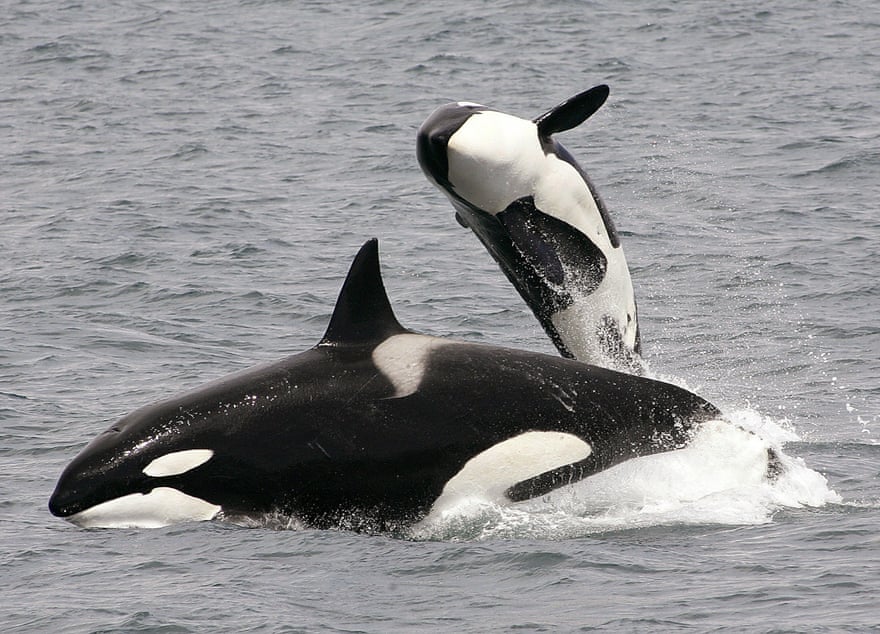
Killer whale populations in European waters are under threat from persistent organic pollutants (POPs).
Despite legislative restrictions on their use, these pollutants are still present in orcas’ blubber at levels that exceed all known marine mammal toxicity thresholds.
Photograph: Robert Pitman/NOAA/AP

From The Guardian by Damian Carrington

The number of wild animals living on Earth is set to fall by two-thirds by 2020, according to a new report, part of a mass extinction that is destroying the natural world upon which humanity depends.
The analysis, the most comprehensive to date, indicates that animal populations plummeted by 58% between 1970 and 2012, with losses on track to reach 67% by 2020.
Researchers from WWF and the Zoological Society of London compiled the report from scientific data and found that the destruction of wild habitats, hunting and pollution were to blame.
The creatures being lost range from mountains to forests to rivers and the seas and include well-known endangered species such as elephants and gorillas and lesser known creatures such as vultures and salamanders.

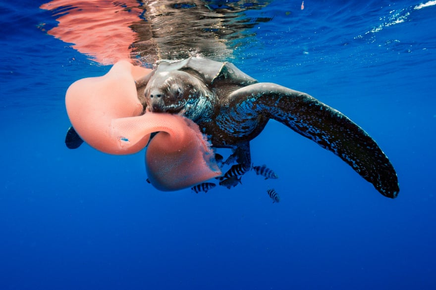
 The leatherback turtle, feeding here on a pyrosome, has become increasingly rare in both the tropical Atlantic and Pacific.
It declined by 95% between 1989 and 2002 in Las Baulas national park in Costa Rica, mainly caused by mortality at sea due to individuals being caught as bycatch and by development around nesting beaches.
Similar trends have been observed throughout the species’ range.
Photograph: Brian J. Skerry/NG/Getty Images

The collapse of wildlife is, with climate change, the most striking sign of the Anthropocene, a proposed new geological era in which humans dominate the planet.
“We are no longer a small world on a big planet.
We are now a big world on a small planet, where we have reached a saturation point,” said Prof Johan Rockström, executive director of the Stockholm Resilience Centre, in a foreword for the report.
Marco Lambertini, director general of WWF, said: “The richness and diversity of life on Earth is fundamental to the complex life systems that underpin it.
Life supports life itself and we are part of the same equation.
Lose biodiversity and the natural world and the life support systems, as we know them today, will collapse.”
He said humanity was completely dependent on nature for clean air and water, food and materials, as well as inspiration and happiness.

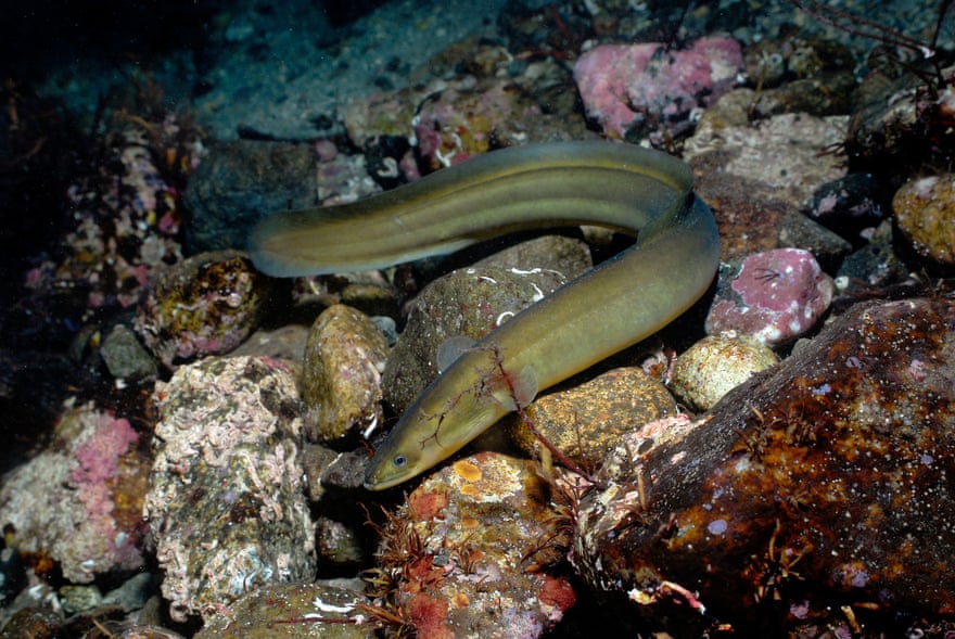
 The European eel is declining due to disease, overfishing and changes to its freshwater habitat that impede its migration to the sea to breed.
Photograph: Erling Svensen/WWF/PA

The report analysed the changing abundance of more than 14,000 monitored populations of the 3,700 vertebrate species for which good data is available.
This produced a measure akin to a stock market index that indicates the state of the world’s 64,000 animal species and is used by scientists to measure the progress of conservation efforts.
The biggest cause of tumbling animal numbers is the destruction of wild areas for farming and logging: the majority of the Earth’s land area has now been impacted by humans, with just 15% protected for nature.
Poaching and exploitation for food is another major factor, due to unsustainable fishing and hunting: more than 300 mammal species are being eaten into extinction, according to recent research.
Pollution is also a significant problem with, for example, killer whales and dolphins in European seas being seriously harmed by long-lived industrial pollutants.
Vultures in south-east Asia have been decimated over the last 20 years, dying after eating the carcasses of cattle dosed with an anti-inflammatory drug.
Amphibians have suffered one of the greatest declines of all animals due to a fungal disease thought to be spread around the world by the trade in frogs and newts.

 Desert Seas narrated by David Attenborough tells the story of how the peninsula of Arabia transformed from an ocean millions of years ago to the desert it is today.
The Gulf is now home to a myriad of sea creatures but, just as Arabia was once ocean, a mere 10,000 years ago this expanse of water was a swampy flood plain.
Since it drowned as sea levels rose, the Gulf is now the world's hottest and saltiest open sea.
The Red Sea, on the other hand, is a far older coral-fringed chasm formed as plate tectonics pulled Africa and Arabia apart; its reefs are prowled by huge moray eels and their shrimp entourages.
Splash into the waves that line this desert land and join us as we explore these waters in stunning HD and see what other treasures hide within these mysterious and little-studied seas.

Rivers and lakes are the hardest hit habitats, with animals populations down by 81% since 1970, due to excessive water extraction, pollution and dams.
All the pressures are magnified by global warming, which shifts the ranges in which animals are able to live, said WWF’s director of science, Mike Barrett.
Some researchers have reservations about the report’s approach, which summarises many different studies into a headline number.
“It is broadly right, but the whole is less than the sum of the parts,” said Prof Stuart Pimm, at Duke University in the US, adding that looking at particular groups, such as birds, is more precise.
The report warns that losses of wildlife will impact on people and could even provoke conflicts: “Increased human pressure threatens the natural resources that humanity depends upon, increasing the risk of water and food insecurity and competition over natural resources.”
However, some species are starting to recover, suggesting swift action could tackle the crisis.
Tiger numbers are thought to be increasing and the giant panda has recently been removed from the list of endangered species.

 Ocean Animals - Life Under the Sea (National Geographic)

In Europe, protection of the habitat of the Eurasian lynx and controls on hunting have seen its population rise fivefold since the 1960s.
A recent global wildlife summit also introduced new protection for pangolins, the world’s most trafficked mammals, and rosewoods, the most trafficked wild product of all.
But stemming the overall losses of animals and habitats requires systemic change in how society consumes resources, said Barrett.
People can choose to eat less meat, which is often fed on grain grown on deforested land, and businesses should ensure their supply chains, such as for timber, are sustainable, he said.

“You’d like to think that was a no-brainer in that if a business is consuming the raw materials for its products in a way that is not sustainable, then inevitably it will eventually put itself out of business,” Barrett said.
Politicians must also ensure all their policies - not just environmental ones - are sustainable, he added.
“The report is certainly a pretty shocking snapshot of where we are,” said Barrett.
“My hope though is that we don’t throw our hands up in despair - there is no time for despair, we have to crack on and act.
I do remain convinced we can find our sustainable course through the Anthropocene, but the will has to be there to do it.”

Links :

Thursday, October 27, 2016

Mediterranean migrant deaths reach record level in 2016

Refugees and migrants get off a fishing boat at the Greek island of Lesbos after crossing the Aegean Sea from Turkey in October 2015. More than 1 million refugees and migrants escaped to Europe in 2015, the UN refugee agency said.

From CNN by Laura Smith-Spark

This year has become the deadliest for migrants crossing the Mediterranean bound for Europe, the UN refugee agency said Wednesday, with those seeking to make the journey from Libya at greatest risk.
"We can now confirm that at least 3,800 people have died, making 2016 the deadliest ever," William Spindler, a spokesman for the UN High Commissioner for Refugees, wrote on Twitter.


According to UN Radio, 3,771 lives were lost during 2015, the previous highest number.
"This is the worst we have seen," Spindler told journalists at a briefing Tuesday in Geneva, Switzerland, as the grim record for 2016 loomed.

 Migrants, most of them from Eritrea, jump into the Mediterranean from a crowded wooden boat during a rescue operation about 13 miles north of Sabratha, Libya, on Monday, August 29

"The high loss of life comes despite a large overall fall this year in the number of people seeking to cross the Mediterranean to Europe."
He said at least 1.02 million made the crossing in 2015, while 327,800 have so far this year.
"From one death for every 269 arrivals last year, in 2016 the likelihood of dying has spiraled to one in 88," Spindler said.
On what's known as the Central Mediterranean route between Libya and Italy, "the likelihood of dying is even higher, at one death for every 47 arrivals," he said.

A ship crowed with migrants flips onto its side Wednesday, May 25, as an Italian navy ship approaches oof the cast of Libya. Passengers had rushed to the port side, as shift in weight that proved too much. Five people died and more than 500 were rescued

Libya is a popular jumping-off point for migrants seeking to reach Europe from North Africa. Smuggling networks are well established there, and the lack of an effective central government makes the job of traffickers easier.
But the crossing can be treacherous, with too many migrants -- some fleeing war or persecution, others seeking a better life -- crammed into what are often barely seaworthy boats.


The Turkish coast guard helps refugees near Aydin, Turkey, after their boat topped en route to Greece on Friday January 22

The UN refugee agency considers the route "extremely dangerous due to the open sea, strong currents and grim weather," UN Radio said.
This year, about half those attempting the journey have taken the Central Mediterranean route, Spindler said.
He also attributed the higher death toll to people smugglers "using lower-quality vessels -- flimsy inflatable rafts that often do not last the journey."
Bad weather during the crossings may also have played a role, and he said smugglers have changed tactics so "there have been mass embarkations of thousands of people at a time," making rescuers' work more difficult.
An agreement in March between the European Union and Turkey resulted in a big reduction in the numbers setting off from Turkey for Greece, a much shorter and less treacherous route, Spindler told UN Radio.

Links :

Wednesday, October 26, 2016

CO2 levels mark 'new era' in the world's changing climate

 An ultra-high-resolution NASA computer model has given scientists a stunning new look at how carbon dioxide in the atmosphere travels around the globe.

From BBC by

Levels of CO2 in the atmosphere have surged past an important threshold and may not dip below it for "many generations".
The 400 parts per million benchmark was broken globally for the first time in recorded history in 2015.
But according to the World Meteorological Organisation (WMO), 2016 will likely be the first full year to exceed the mark.
The high levels can be partly attributed to a strong El Niño event.

 This animation shows a seven month time lapse animation of CO2 surface concentrations from July 2015 until Feb 2016. The data comes from NASA's GEOS-5 numerical weather model.

Gas spike

While human emissions of CO2 remained fairly static between 2014 and 2015, the onset of a strong El Niño weather phenomenon caused a spike in levels of the gas in the atmosphere.
That's because the drought conditions in tropical regions produced by El Niño meant that vegetation was less able to absorb CO2. There were also extra emissions from fires, sparked by the drier conditions.
In its annual Greenhouse Gas Bulletin, the World Meteorological Organisation says the conditions helped push the growth in the levels of CO2 in the atmosphere above the average for the last ten years.

Greenhouse gases are vital to life on Earth, but the growing concentration of certain gases, such as carbon dioxide, is throwing the planet's delicate balance out of whack.
NASA is on the case, studying carbon dioxide on a global scale and its effects on our weather and climate.

At the atmospheric monitoring station in Mauna Loa, Hawaii, levels of CO2 broke through 400 parts per million (ppm), meaning 400 molecules of CO2 for every one million molecules in the atmosphere.
The last time CO2 was regularly above 400ppm was three to five million years ago, say experts.
Prior to 1800 atmospheric levels were around 280ppm, according to the US National Oceanic And Atmospheric Administration (Noaa).
The WMO says that the rise through the 400ppm barrier has persisted and it's likely that 2016 will be the first full year when the measurements show CO2 above that benchmark, and "hence for many generations".
While the El Niño factor has now disappeared, the human impact on climate change has not, the WMO argues.
"The year 2015 ushered in a new era of optimism and climate action with the Paris climate change agreement," said WMO Secretary-General Petteri Taalas.

The air sampling station at Mauna Loa observatory in Hawaii which recorded CO2 levels going through 400ppm 

"But it will also make history as marking a new era of climate change reality with record high greenhouse gas concentrations."
The report also details the growth in other greenhouse gases, including methane and nitrous oxide.
In 2015, levels of methane were 2.5 times greater than in the pre-industrial era, while nitrous oxide was 1.2 times above the historic measure.
The study also points to the impact of these increased concentrations of warming gases on the world's climate.

From a quarter to half of Earth’s vegetated lands has shown significant greening over the last 35 years largely due to rising levels of atmospheric carbon dioxide, according to a new study published in the journal Nature Climate Change on April 25.
The greening represents an increase in leaves on plants and trees equivalent in area to two times the continental United States.

Between 1990 and 2015 there was a 37% increase in radiative forcing or warming effect, caused by a build up of these substances, from industrial, agricultural and domestic activities.
While welcoming new initiatives like the global agreement to phase out HFC gases agreed recently in Rwanda, the WMO argues that nations must retain their focus on cutting CO2.
"Without tackling CO2 emissions, we cannot tackle climate change and keep temperature increases to below 2 degrees C above the pre-industrial era," said Petteri Taalas.
"It is therefore of the utmost importance that the Paris Agreement does indeed enter into force well ahead of schedule on 4 November and that we fast-track its implementation."
Around 200 nations who signed the Paris climate agreement will meet in Morocco in November to decide on the next steps forward.

Links :

Tuesday, October 25, 2016

The biggest threat to NASA's future is the ocean


From Gizmodo by Maddie Stone
 
In October 2012, just a few days before Hurricane Sandy slammed into New Jersey, it was churning north past the narrow strip of white sand beach separating NASA’s most celebrated spaceport from the sea.
For several days and nights, heavy storm surge pounded the shoreline, flattening dunes and blowing sand right up to the launchpads.
A stone’s throw away from the spot where a Saturn V rocket sent the first humans to the Moon, the ocean took a 100-foot bite out of the beach.
“I think the telling story is that the storm was almost 230 miles offshore, and it still had an impact,” Don Dankert, an environmental scientist at NASA, tells me as we stand with ecologist Carlton Hall atop a rickety metal security tower overlooking Space Coast.
It is a hot, breathless day, and the surf laps gently at the deserted shore.
“It makes you wonder what would happen if a storm like that came in much closer, or collided with the coast,” Dankert adds.

 Space Coast with the GeoGarage platform (NOAA chart)

That’s a troubling question for NASA, an agency whose most valuable piece of real estate—the $10.9 billion sandbar called Kennedy Space Center—is also its most threatened.
The beating heart of American spaceflight since the Apollo program, Kennedy was, and still is, the only place on US soil where humans can launch into orbit.
Today, the center is enjoying a revival, following a few dark years after the space shuttle program was mothballed and crewed launches were outsourced to Russia.
The shuttle’s former digs, Launch Pad 39A, is being renovated by commercial spaceflight company SpaceX for the Falcon Heavy, a beast of a rocket designed to ferry astronauts into orbit and beyond.
A few miles up the road, Launch Pad 39B is being modified for the SLS rocket, which NASA hopes will send the first humans to Mars.
But a glorious future of bigger and badder rockets is by no means assured. In fact, that future is gravely threatened, not by the budget cuts that NASA speaks speaks often and candidly about, but by climate change.
If humans keep putting carbon in the atmosphere, eventually, Kennedy won’t be sending anybody into space.
It’ll be underwater.

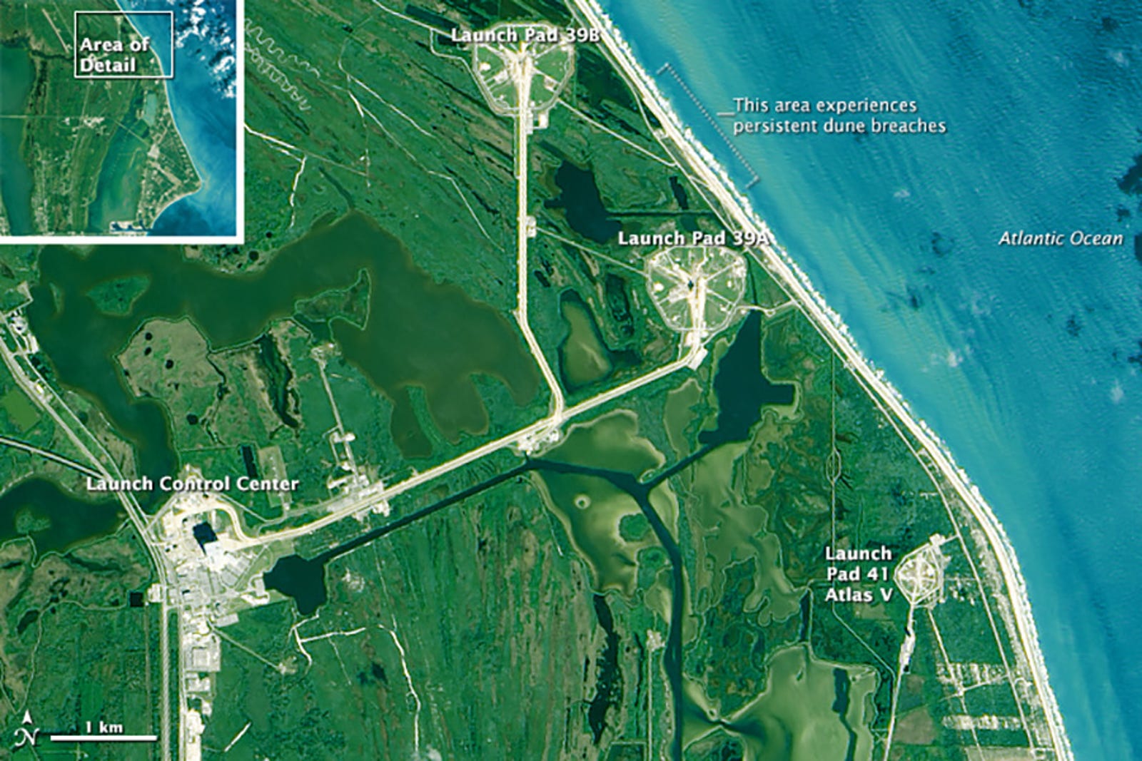
Aerial view of Kennedy Space Center’s two Launch Pads, 39A and 39B, along with the Launch Control Center, which includes the Vehicle Assembly Building. Launch Pad 41b is located at Cape Canaveral Air Force Station.
Image: Josh Stevens/NASA Earth Observatory/USGS

“We are acutely aware that, in the long-term sense, the viability of our presence at Space Coast is in question,” says Kim Toufectis, a facilities planner in NASA’s Office of Strategic Infrastructure.
There’s a very good reason NASA built Kennedy Space Center, along with four other launch and research facilities, on the edge of the sea. If rockets are going to explode (and in 2016, they still do), we’d rather them explode over water than over people. “To launch to space safely, you have to be at the coast,” says Caroline Massey, assistant director for management operations at Wallops Flight Facility in Virginia.
Kennedy’s location, at the southern end of the Merritt Island wildlife refuge and just northwest of Cape Canaveral Air Force Station, has a few other perks.
Launch pads and other resources are shared with the Air Force, and weather conditions are good year-round.
Being close to the equator allows rockets to snag a bigger velocity boost from the rotation of the Earth.
And yet, even as architects were drawing up plans for Kennedy in the early 1960s, NASA knew the spaceport’s exposure—to rising sea levels, hurricanes, and the general wear and tear of the ocean—might one day cause catastrophic damage.
“They were absolutely concerned about it,” says Roger Launius, associate director at the Smithsonian National Air and Space Museum and former chief historian for NASA.
“But they wanted to launch over water. You don’t want to drop first stages over cities.”

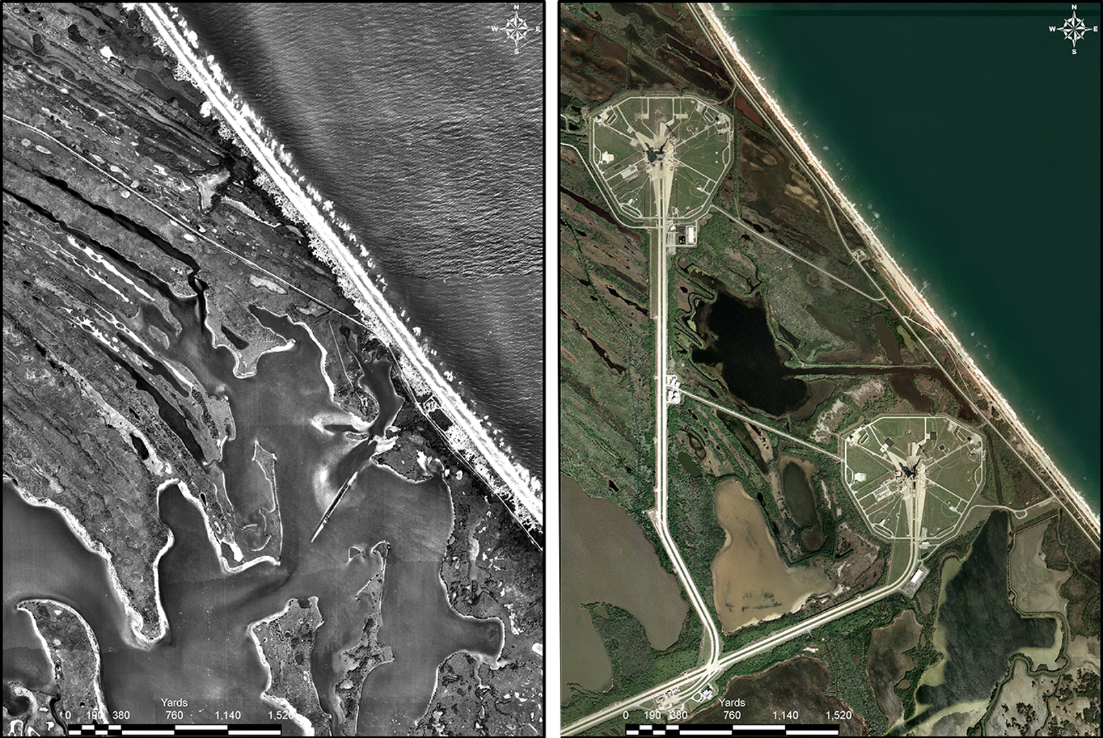
 Aerial view of Kennedy Space Center’s shoreline before any launchpads were installed, left (1943) and in modern history (2007).
Photos Courtesy John Jaeger.

Now, that water is rising.
Globally, sea levels have gone up about eight inches since the early 1900s.
For the past two decades, the pace of rise has been quickening, in step with accelerated melting on the Greenland ice sheet.
At Kennedy, conservative climate models project 5 to 8 inches of sea level rise by mid-century, and up to 15 inches by the 2080s.
Models that take changing ice sheet dynamics into account predict as much as fifty inches (4.2 feet) of rise by the 2080s.
In an even more dire scenario, Space Coast sees over six feet of rise by the end of the century, causing many of the roads and launchpads, not to mention sewers and buried electrical infrastructure, to become swamped.
“I hope we don’t go there,” Hall said.
On top of rising seas, Kennedy faces a stormier future—more extreme hurricanes in the summer and nor’easters in the winter.
“We started to notice a real issue with coastal erosion following the 2004 hurricanes,” says John Jaeger, a coastal geologist at the University of Florida.
Jaeger is part of a team of scientists who’ve been studying long-term shoreline recession at Space Coast, which can be traced back to the 1940s through aerial photographs.
But while natural erosion has been reshaping Kennedy’s sandy fringes for decades, a recent uptick in powerful storms has Jaeger worried for the future.
“As geologists, we know it’s these big events that do all the work,” he says.

NASA’s Climate Adaptation Sciences Investigators Workgroup (CASI) shares this concern.
In a recent review of the space agency’s climate vulnerability, this team of in-house Earth scientists and facilities managers cited extreme weather and flooding as major hazards to future operations at Kennedy.
Even under modest sea level rise scenarios, ten-year flood events are expected to occur two to three times as often by mid-century.
And the more the ocean rises, the easier it’ll be for storms to cause flooding.
“I use the metaphor that a small change in the average can lead to a big change in extremes,” says Ben Strauss, vice president for sea level rise and climate impacts at Climate Central.
“In basketball, it’s pretty hard to get a slam dunk, but if you raised the floor a foot, they would happen all the time.”
In other words, the coastal damage caused by Sandy may be a small taste of what Kennedy Space Center is in for.
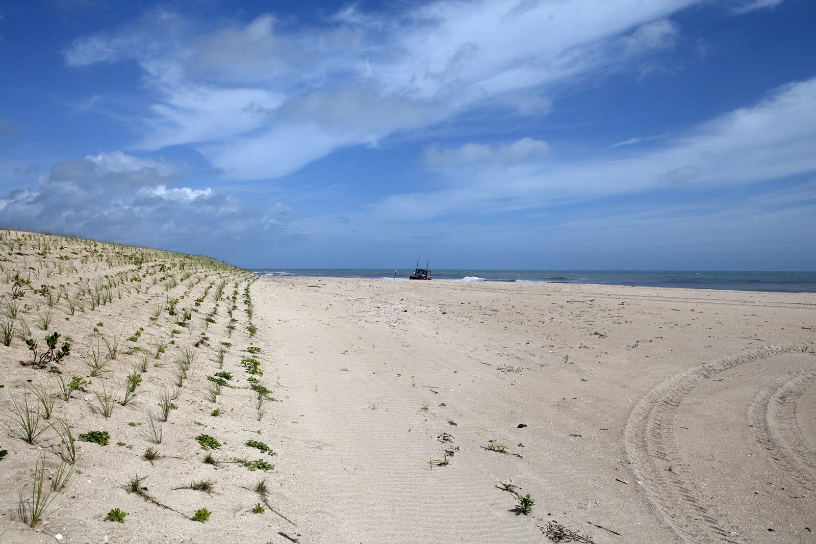
After soaking in the view for a few moments, Dankert, Hall and I climb down from the watchtower and drive south to Kennedy’s dune restoration site, which was completed in 2014 with federal Hurricane Sandy relief funds.
Stretching a little over a mile between Launch Complexes 39A and 39B, the dune’s grassy slopes rise like lightly yeasted bread over the sprawling beach.
If you didn’t know better, you might think the shoreline had looked this way for centuries.

 View along the beach of Kennedy Space Center’s dune restoration site in 2014.
Photo Courtesy Dan Casper/NASA.

“We’re drawing a line in the sand,” Dankert says.
“The dune not only prevents storm surge from plowing inland, it’s a sand source that replenishes the beach.”
It’s an astonishingly low-tech barrier when you consider the artificial pumping systems installed at Miami Beach to keep the ocean at bay, or the enormous seawalls some experts think we’ll need to save Manhattan.
But in protecting its shoreline, NASA is trying to be considerate of all of its residents.
In addition to rockets, Kennedy is home to a stunning array of wildlife, from bobcats and coyotes to southeastern beach mice, scrub jays, and gopher tortoises.
It’s a major nesting site for protected leatherback, green, and loggerhead sea turtles, with thousands of baby turtles born on this small stretch of beach each year.
“We are a wildlife refuge—that is a huge part of our program,” Dankert says, adding that in addition to maintaining the shoreline, Kennedy’s newly-restored dune blocks artificial light from the launch pads, which can disorient female sea turtles as they’re coming ashore to nest.
For the past few years, the dune has held strong, preventing the ocean from spilling over onto the historic shuttle railroad that traces along the coast.
Eventually, NASA would like to put in another two miles of dune, fortifying the entire shoreline between Launch Complexes 39A and 39B.
As with all government projects, the hang-up is funding.
The post-Sandy dune reconstruction was completed for a cool $3 million, using beach-quality sand trucked up from Cape Canaveral.
“We got really lucky—that sand was a big cost-saver,” Hall says, noting that the bill might have run in the tens of millions had NASA been forced to dredge sand from offshore.

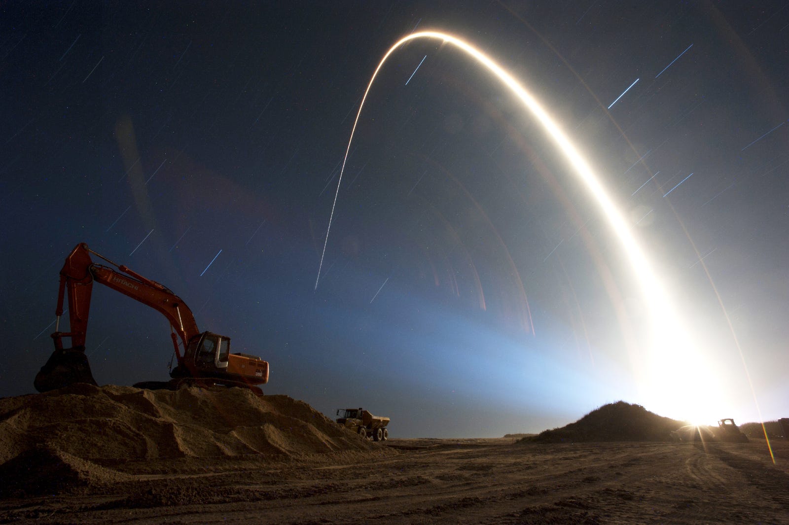
 An Atlas V rocket lifts off from Cape Canaveral Air Force Station’s Launch Complex 41, illumining nearby Kennedy Space Center’s dune restoration site.
Photo Courtesy Tony Gray/NASA.

Still, ten, twenty, or even fifty million dollars pales in comparison to the value of the launchpads that sit just a quarter mile inland.
“To rebuild a pad is a few billion dollars,” Hall says.
“To spend a few million every few years instead is a pretty good investment.”
Although Kennedy is NASA’s most threatened asset, all of the space agency’s properties—some $32 billion worth of infrastructure used for scientific research, aeronautics testing, astronaut training, deep space missions, and vehicle assembly—face challenges in a changing climate.
Sea levels at the Johnson Research Center in Texas are rising at a whopping 2.5 inches (6.4 centimeters) per decade, faster than any other coastal center by a factor of two or three.
The Michoud Assembly Facility in New Orleans sits below sea level, surrounded by 19 foot-high levees, on rapidly-sinking ground. Inland facilities are bracing for more excessively hot days, and the Ames Research Center in Silicon Valley is preparing for a future of drought.
“This is a very large concern for our agency as a whole,” Toufectis says.
And given our growing need to go into space, not just for scientific research, but to harness new resources, colonize other worlds, and monitor and study the one overburdened biosphere we’ve got, anything that threatens future operations and NASA threatens the entire nation.
At Wallops Flight Facility on Virginia’s eastern shore, climate change isn’t some existential problem for the future—it’s reality.
The center’s sounding rocket launch pads, which have sent countless aircraft models and science experiments into suborbital space, sit on a six square-mile barrier island just a few hundred feet from the ocean, alongside two Virginia-owned pads used for satellite launches and ISS resupply runs.
Sea levels are rising, storms are getting fiercer, and protective beaches are eroding rapidly.
“We live with climate change every day,” Massey says.

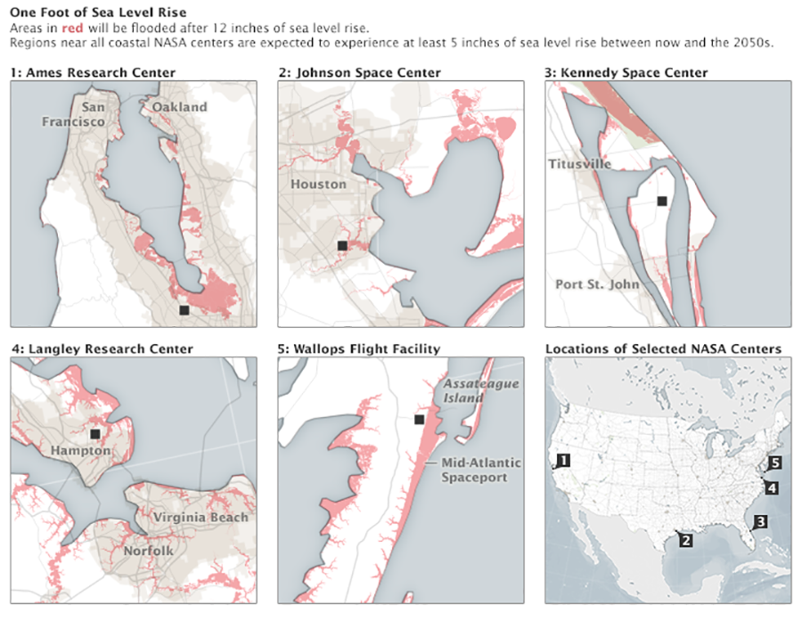
 Areas around five coastal NASA centers that would be inundated by 12 inches (30 cm) of sea level rise (red).
Image: Josh Stevens/NASA Earth Observatory

Wallops Island started hardening its defenses in earnest in the ‘90s, when NASA erected a 3.5 mile stone seawall in front of the launch pads.
But while the wall initially helped to reduce storm damage, the beach beyond it was soon worn to shreds.
By the mid 2000s, storm waves were breaking directly against the wall, causing sections to crumble into the sea.
And so, in the spring of 2012 and the summer of 2014, with a $54 million investment from Congress, NASA and the US Army Corps of Engineers dredged almost 4 million cubic yards of sand from offshore, and a new beach was built beyond the wall.
The impact was sudden and dramatic.
“When Hurricane Irene hit in 2011, Wallops [Island] was flooded, we had $3.8 million in storm damage, and we couldn’t work there for a few weeks,” Massey says.
But when Sandy, virtually the same strength as Irene, blew past Virginia’s coastline a year later?
“There was no island flooding to speak of, and we could have kept the power on the entire time,” Massey says.
“The only difference was our shoreline protection program.”

At Wallops as at Kennedy, shoring up the shoreline every few years is considered an economical way to manage the risk right now.
But looking out toward the late 21st century and beyond, NASA may be forced to leave some of these launchpads behind.
“In the long-term, I would be shocked if we don’t see more than six feet of sea level rise,” Strauss says.
“That amount may simply be incompatible with a lot of NASA’s coastal infrastructure.”
Picking up and moving inland, or “managed retreat” in the urban planning parlance, is the last thing the space agency wants to do.
Ironically, it probably won’t be a major storm or flood that forces NASA’s hand.
It’ll be its employees.
You can’t have rocket launches on Space Coast if you can’t find engineers, mission directors and launch personnel willing to run them—which is to say, people willing to live and work in an increasingly hostile environment.
“The point at which we get serious about moving is the point at which the community is no longer viable,” Toufectis said.

Full-scale withdrawal at any of NASA’s centers is probably decades away.
But at Wallops, the seeds of a managed retreat mentality are already starting to sink in.
There’s now an intensive screening process for what can be built on the island: “It has to be something we can only do safely over water,” says Josh Bundick, program manager for management operations at Wallops.
Newer buildings are placed on elevated pilings or raised floors, with all critical electrical infrastructure installed above the flood line.
Island operations are run by a skeleton crew, while the vast majority of Wallops employees work at the facility’s main base a few miles inland.
NASA hasn’t broken off its relationship with Wallops Island, but it is creating distance.

As I head back to Kennedy’s visitor center, ogling the tremendous Vehicle Assembly Building where the Saturn V rocket was put together, I can’t help but feel a strange sense of cognitive dissonance.
Here I am, at a place that radiates optimism, that flaunts the raw power of human technology that was built to explore the infinite, only to learn of man’s essential helplessness in the face of nature.
The sense of two parallel realities grows stronger as I return to my hotel in Titusville, where gaggles of tourists take selfies with replica astronaut suits and locals share beers over the latest SpaceX gossip.
This isn’t a community with any intention of going anywhere.
But no matter what the future holds for Space Coast, one thing is clear: defending this shoreline now isn’t a waste.
Places on the front lines of climate change have lessons to teach us about standing one’s ground, and deciding when the ground can no longer stand.
And those lessons may wind up being more valuable than a hundred launchpads.
“Look, human beings are all mortals,” Strauss says.
“But that doesn’t stop us from leading meaningful lives. I could tell you that the barrier islands on the Atlantic coast may not survive this century and almost certainly won’t survive the next, but that doesn’t mean we can’t make good use of them now. We just have to keep our eyes open.”

Links :
Monday, October 24, 2016

Canada CHS update in the GeoGarage platform

1 nautical raster chart withdrawn & 73 charts updated

Mystery of the Bermuda Triangle solved?


National Geographic documentary

From BigThink by Paul Ratner

One of life’s great mysteries, the Bermuda Triangle might have finally found an explanation.
This strange region, that lies in the North Atlantic Ocean between Bermuda, Miami and San Juan, Puerto Rico, has been the presumed cause of dozens and dozens of mind-boggling disappearances of ships and planes.

The Bermuda Triangle lore includes such stories as that of Flight 19, a group of 5 U.S. torpedo bombers that vanished in the Triangle in 1945.
A rescue plane sent to look for them also disappeared. Other stories include the mystery of USS Cyclops, resulting in the largest non-combat loss of life in U.S. Navy’s history.
The ship with a crew of 309 went missing in 1918.
Even as recently as 2015, El Faro, a cargo ship with 33 on board vanished in the area.


Altogether, as far as we know, 75 planes and hundreds of ships met their demise in the Bermuda Triangle.
Possible causes for the catastrophes have been proposed over time, ranging from the paranormal, electromagnetic interference that causes compass problems, bad weather, the gulf stream, and large undersea fields of methane.
Now, a new theory has been proposed by meteorologists that claims that the reason for the mysteries pervading the Bermuda Triangle area are unusual hexagonal clouds creating 170 mph air bombs full of wind.
These air pockets cause all the mischief, sinking ships and downing planes.

courtesy of Science Channel

By studying imagery from a NASA satellite, the scientists concluded that some of these clouds reach 20 to 55 miles across.
Waves inside these wind monsters can reach as high as 45 feet.
What’s more - the clouds have straight edges. 
As told by Colorado State University’s satellite meteorologist Dr. Steve Miller to Science Channel’s “What on Earth”: “You don’t typically see straight edges with clouds. Most of the time, clouds are random in their distribution."
What’s special about that?
Meteorologist Randy Cerveny added: “The satellite imagery is really bizarre… These types of hexagonal shapes over the ocean are in essence air bombs. They are formed by what are called microbursts and they’re blasts of air that come down out of the bottom of a cloud and then hit the ocean and then create waves that can sometimes be massive in size as they start to interact with each other.”
Anything caught inside one of these air bombs could be very well knocked out of the air, flipped over, sunk.
More observation is needed to confirm this theory that could finally explain many of the infamous Bermuda Triangle events.
Scientists are pouring over satellite imagery to confirm.

Here’s the Science Channel interview:

Sunday, October 23, 2016

Jean-Michel Cousteau’s Secret Ocean

secretocean-thefilm.com
Narrated by renowned oceanographer Dr. Sylvia Earle, “Jean-Michel Cousteau’s Secret Ocean 3D” offers a breakthrough look at a secret world within the ocean that is perhaps the biggest story of all—that the smallest life in the sea is the mightiest force on which we all depend.
Alongside marine biologist Holly Lohuis, Jean-Michel Cousteau invites audiences to dive into this whole new world that will leave them in awe of the beauty and diversity of the oceans – the source of all life on our planet – and inspire an even stronger desire to protect what they have either seen for the first time or perhaps re-discovered along the journey. 

Filmed over 3 years in vibrant marine environments from the Bahamas to Fiji, the first giant screen film directed by Jean-Michel Cousteau provides a compelling, breakthrough look at a secret world within the ocean that is perhaps the biggest story of all—that the smallest life in the sea is the mightiest force on which we all depend.

"Secret Ocean 3D" engages audiences of all ages to experience the ocean as never before.
With breathtaking underwater sequences, viewers are introduced to over 30 species — some no bigger than one inch — and will discover behaviors captured for the very first time thanks to the development of new filming technologies in ultra-HD 5K, slow motion, macro, and with motion control.

"Since the 1940s, the Cousteau family has been deeply connected to the water. Millions of people have grown up with our Calypso adventures, which revealed to the public what was a totally unknown world at that time," said Jean-Michel Cousteau.
"Thanks to the new technology developed specifically for us, I immediately understood that this was a revolution in underwater filming that would allow us to capture a whole new range of behaviors I had never before witnessed in my 71 years of diving. 'Secret Ocean 3D' takes us one step further in the discovery of the ocean in a way my father, Jacques Cousteau, could have only imagined."

"From the time of my very first dive, I've had the frustration of knowing that there was always more beyond what I could see, but technology is key to being able to see the ocean with new eyes," said narrator Dr. Sylvia Earle.
"Thanks to the stunning giant screen format, 'Secret Ocean' allows us a deeper understanding of all life in the sea, the heart of our planet, and encourages us to take care of not only the large creatures, such as whales and dolphins, but also the tiny creatures that make the rest of life possible. With knowing comes caring, but first we need to know."

Alongside marine biologist Holly Lohuis, Jean-Michel Cousteau provides a brand new view of the underwater world that will leave audiences in awe of the beauty and diversity of the oceans – the source of all life on our planet – and inspire an even stronger desire to protect what they have seen for the first time, or re-discovered along the journey.