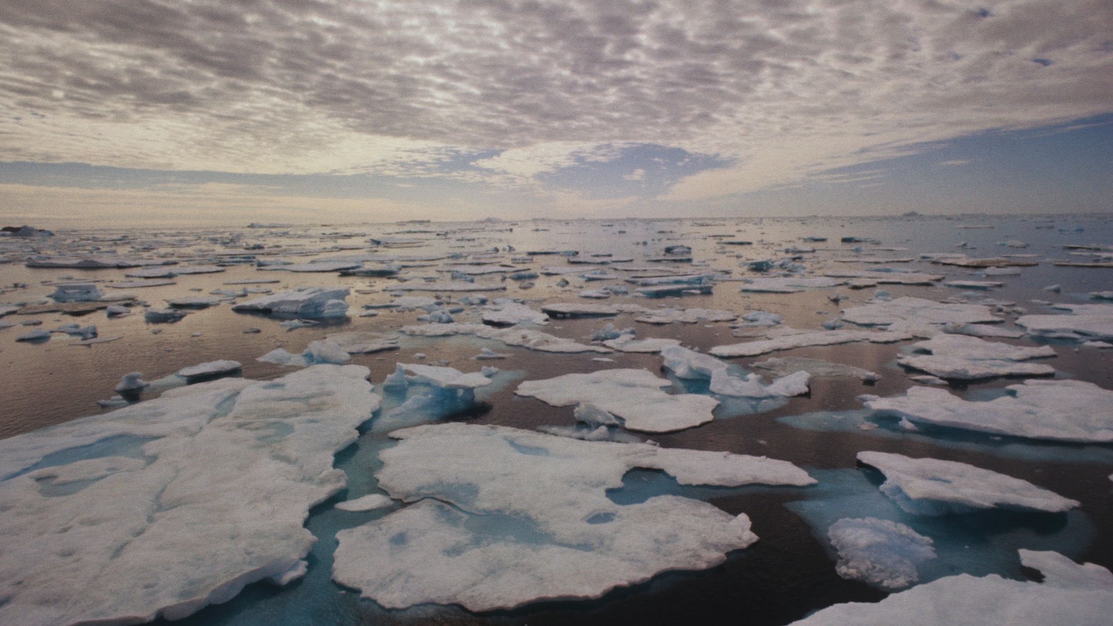
When marine biologist Mads Peter Heide-Jørgensen began studying the boreal waters that surround Greenland 40 years ago, an inflatable raft carried him through vast expanses of polar pack ice, with narwhals and walruses frequently passing by.
The astounding blue sea ice seemed almost inviolable in its grandeur.
But with Greenland reaching its
highest temperatures in the past 1,000 years, the scene is changing.
Arctic sea ice, which is responsible for maintaining cool polar temperatures, is
dwindling rapidly.
The oldest and thickest of it has
declined by 95 percentduring three decades of global warming.
“There’s a whole beautiful landscape that used to be there,” said Heide-Jørgensen, a researcher at Greenland Institute of Natural Resources.
“Nowadays, we can see that all the ice is gone.”
So too are a growing number of the creatures that lived among it.
Inuit communities are seeing little to no evidence of endemic species like the narwhals and walruses that Heide-Jørgensen grew familiar with.
Instead, they are finding animals native to more southerly waters, including mackerel, bluefin tuna, and many kinds of cetaceans, all of them drawn to the warming waters and abundant prey.
Visual observation and remote sensing leave Heide-Jørgensen and fisheries biologist Brian Mackenzie
with little doubt that a potentially irreversible regime shift – a change from one stable ecological condition to another – is occurring.
Unprecedented numbers of dolphins and fin and humpback whales suggest
a tipping point in the marine ecosystem off the east coast of the world’s largest island.
This climate-driven shift means not only that meteorological and climatological phenomena thousands of miles away can affect local conditions in unexpected ways, but they create the potential for cascading effects throughout entire ecosystems.
“It has a very specific driving force for the tipping element, which is the sea ice.” said Heide-Jørgensen, who attributes the regime shift primarily to a significant decrease in summer sea ice arriving from the Beaufort Sea.
That body of water, located along the northernmost seaboard of Alaska, generates the pack ice found off the coast of eastern Greenland.
It is carried there over the course of several years by winds and currents.
For native marine species in Greenland, the ice regulates temperatures by reflecting sunlight and provides critical habitat and nursery grounds for animals, invertebrates, and algae.
As the
tern flies, the Beaufort Sea is about as far from these waters as Anchorage, Alaska, is from Portland, Oregon.
“It’s a huge distance,” said Heide-Jørgensen.
He noted that the scope of what’s happening in Greenland shows that the effects of climate change are certain and long-ranging, impacting ecosystems across thousands of miles.
“It goes far beyond what we had originally thought.
Local systems can be severely affected by something so far away, which is a lesson learned.”
While many studies have shown regime shifts in other marine ecosystems across the globe, there has been little revealed on such shifts in the Arctic until now.
The researchers note that the process that spurred the radical change likely began 10 to 20 years ago when
temperatures started to increase more dramatically.
Thanks to 19th-century explorers, records of ice throughout Greenland date to 1820 and help reveal climatological patterns and effects.
“It contributes to the general evidence basis for how climate change is affecting life in the oceans,” said Mackenzie, a professor at Technical University of Denmark.
“There’s now many studies showing changes in distributions, changes in food webs, and so on.
Not many for the Arctic or in sort of remote places like this.
And so it’s contributing to the pattern that we’ve been seeing in the scientific community.”
Humpback whales, usually found off the coast of New England and Newfoundland and in the waters north of Scandinavia, are now migrating by the thousands along the east coast of Greenland.
Fin whales, also usually seen offshore in the North Atlantic, are increasingly common as well.
And while this shift isn’t necessarily bad for the opportunistic cetaceans, which can adapt to a certain threshold of oceanic shifts, it places immense stress on endemic species like narwhal.
The researchers suspect the native creatures are moving north as the water warms and interlopers arrive.
Newcomers like the whales, which require a lot of food to sustain themselves and migrate thousands of miles, are now consuming more than 1 million tons of food per year, outcompeting other animals.
“There are big ecological implications for local biodiversity and the interactions among species,” said Mackenzie.
“Particularly in predator to prey competition relationships.”
Marine species aren’t the only ones who will experience these ramifications.
Changes in species distributions, especially fish, could reshape commercial fisheries.
Bluefin tuna had never been recorded off the eastern shore of Greenland prior to 2012, but have been recorded every year since.
“We got some reports from Greenlandic fishing crews that they had caught some bluefin tuna as bycatch,” said Mackenzie.
“And we could see that the temperature in the area had
increased quite a bit compared to previous years. The thermal habitat expanded, and that’s one of the reasons why we think the tuna started to show up.
Mackerel itself had not been seen in Greenland waters before 2011, and we think that the tuna more or less followed the mackerel.
With changes like this, it’s likely that there’s multiple effects throughout the entire food web, especially at lower trophic levels.”
Unless ice export from the north increases and temperatures cool, it is very likely that this new regime will become permanent.
“It would require the unlikely and substantial reversal of current warming, and several years to reverse the trend with little multiyear ice in the Arctic Ocean,” said Heide-Jørgensen.
“No climate deals seem to cover that at the moment.”
Given the pace of global climate change, the Arctic Ocean could within our lifetimes record its first summer without ice.
Some studies suggest that may happen within a few decades.
“Forty or 50 years ago, that concept would be unthinkable,” Mackenzie said.
“But it looks like it’s going to happen.
And if that does happen, it would mean even more major changes on the food web and ecosystems up there.”


 Wolfgang Kaehler/LightRocket via Getty Images
/https://tf-cmsv2-smithsonianmag-media.s3.amazonaws.com/filer_public/98/81/98815c07-336f-4f17-bb5a-72da962c3999/fkt231202-s0624-20231207t172847z-120-scicam-octopuslandscape-ss.jpg)


