Saturday, September 23, 2023

Why meteorological and astronomical fall start on 2 different dates

 
Tomorrow at 2:50 am ET, astronomical autumn officially begins in the Northern Hemisphere
time-lapse from NOAA's GOESEast - showing the change in the angle of the sun from last year’s equinox through today.
On this equinox day, the length of day and night is the same all over the world.
For half of the year, as the earth is tilted in its orbit, the sun shines brighter on one hemisphere than the other.
From today onwards, the southern hemisphere will be brighter.
 
From AccuWeather by Brian Lada
 
Many people consider the September equinox to be the official start of autumn, but for meteorologists, the new season kicks off weeks before the astronomical event.

The autumnal equinox marks the start of fall across the Northern Hemisphere, but meteorologists commonly consider a different date to mark the start of the new season.

Equinox comes from the Latin words aequi, which means equal, and nox, which means night. On the day of the equinox, the sun’s rays are most direct over the equator. No matter the location around the globe, the sun will rise exactly due east and set exactly due west. 


Astronomical fall starts on the autumnal equinox, between Sept. 21 and Sept. 23, and ends on the winter solstice, between Dec. 20 and Dec. 22.

These dates vary from year to year due to leap years and the elliptical shape of Earth's orbit around the Sun, with the autumnal equinox in 2023 falling on Saturday, Sept. 23 at 2:50 a.m. EDT.

While this equinox signals the start of astronomical fall across the Northern Hemisphere, those in the Southern Hemisphere recognize it as the first day of spring.

Traditionally, astronomical seasons last between 89 and 93 days due to the elliptical shape of the Earth’s orbit around the sun, according to the National Centers for Environmental Information (NCEI).
 
This variability can make it difficult for experts to compare statistics from one year to another.

Meanwhile, meteorological seasons are more consistent, with the four seasons being broken into groups of three months.

Meteorological fall lasts for 91 days every year, starting on Sept. 1 and lasting through Nov. 30.
Meteorological spring is March, April and May.
Meteorological summer is June, July and August.
Meteorological fall is September, October and November.
Meteorological winter is December, January and February.

“By following the civil calendar and having less variation in season length and season start, it becomes much easier to calculate seasonal statistics from the monthly statistics, both of which are very useful for agriculture, commerce and a variety of other purposes,” NCEI said.

One common misconception is that the equinox is the only time of the year that it is possible to balance an egg on its end.

"The origins of this myth are attributed to stories that the ancient Chinese would create displays of eggs standing on end during the first day of spring," John Millis, assistant professor of physics and astronomy at Anderson University said.

Although it is possible to stand an egg on end on the equinox, the trick is also able to be accomplished every other day of the year.

While autumn is known for its shorter days and cooler conditions, it also brings a heightened risk of severe weather.

The renewed severe weather risk is caused by a southern shift in the jet stream that directs powerful storm systems across the central and eastern United States.
The severe weather is not typically as widespread as it is during the spring months, but storms in autumn can still spawn damaging wind, hail and tornadoes.

The frequency of severe thunderstorms gradually decreases near the end of the season as the Northern Hemisphere begins to transition to winter.
 
Links :

Friday, September 22, 2023

Deep and dangerous: Is AI the future of ocean exploration?

[Nataliia Shulga/Al Jazeera]
 
From Aljazeera by Tom Cassauwers

The Titan implosion has cast focus on autonomous, unmanned submersibles as the way to uncovering the ocean’s secrets.


When the Titan submersible, carrying five sightseers to the wreck of the Titanic, blew up thousands of metres under the ocean surface in June, it underscored why humanity knows more about the surface of some other planets than about the depths of the Earth’s oceans.

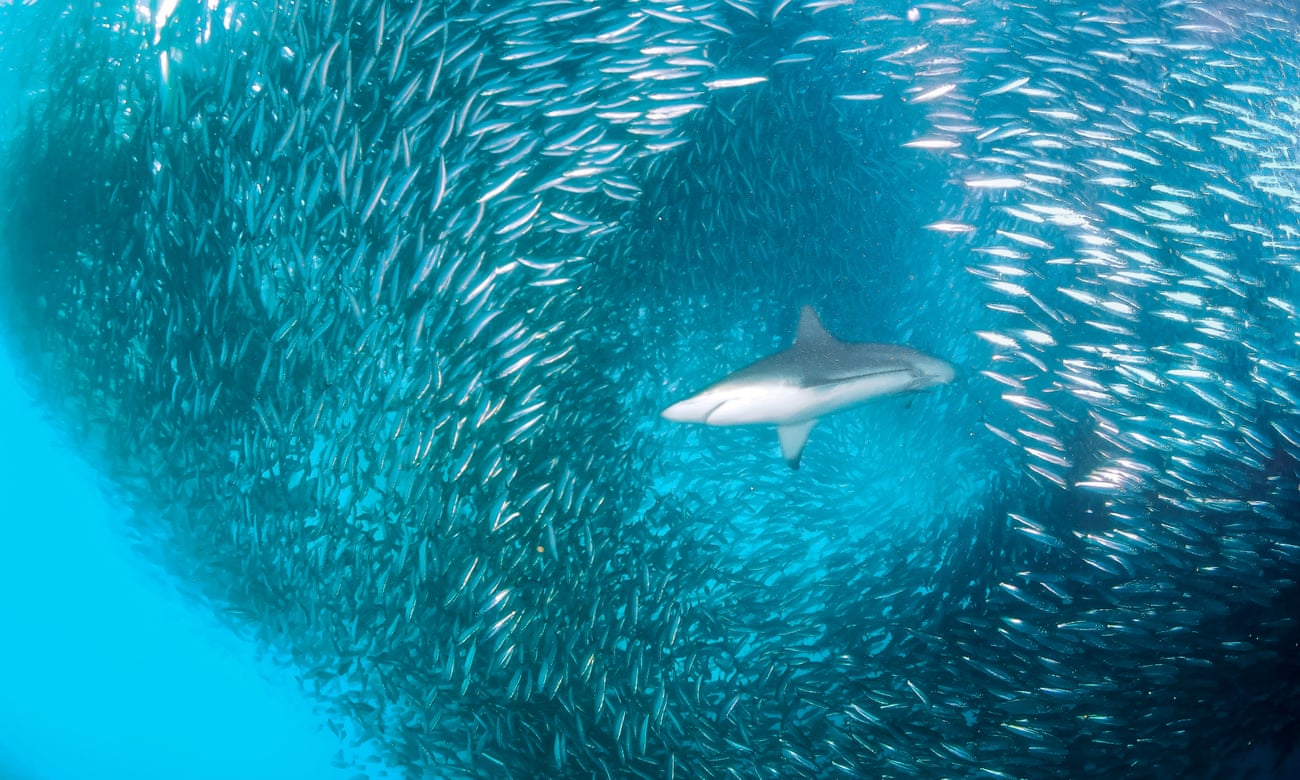
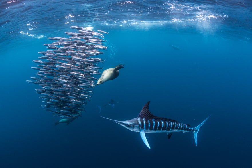
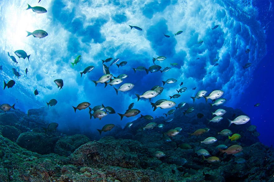
Oceans cover more than 70 percent of the earth’s surface.
Yet, this underwater world is a challenging place to explore, as the Titan disaster showed.
It’s a vast space.
The deepest point under water, the Challenger Deep in the Pacific Ocean, is 11,000 metres deep, more than the height of Mount Everest.

The light doesn’t penetrate to such depths.
Still, that little-known world is crucial for the future of the planet.
The oceans interact heavily with the earth’s climate and understanding them better could offer potential solutions to climate change.
New animal and plant species are also constantly being discovered in the great deep.

The ocean bed is also home to battery metals such as cobalt, copper and manganese which are critical for the planet’s clean energy transition.
And a race to the deep sea is on, with companies and countries eyeing resource deposits on the seabed to mine, even as environmentalists have warned of damage to vulnerable ocean ecosystems.

Norway’s government wants to open up an area of the ocean floor larger than Germany for mining.
India, which in August became the first nation to land a spacecraft near the moon’s South Pole, has announced a mission called Samudrayaan – sea vehicle in Sanskrit – for a submersible with three people to travel to a depth of 6,000 metres by 2026.
China is building an icebreaker with a submersible that aims to reach and explore the Arctic seabed.

Is it too dangerous to explore these depths?
Where does the technology stand?
And what’s next for submersibles?

The short answer: Underwater exploration will most likely continue, even after the Titan debacle.
However, small submersibles, often uncrewed and driven by artificial intelligence (AI), might be the future, using novel technology to recharge under water and operate for months – even years – on end.
Before we accomplish that, though, some technological hurdles still remain.
 
 
A view of OceanGate equipment within the boatyard near the headquarters at the Port of Everett complex in Everett, Washington, US, June 22, 2023.
OceanGate owned and operated the Titan submersible that imploded in June 2023 [File: Matt Mills McKnight/Reuters]

Unmapped depths

While decades of scientific and technological advances have allowed humans to send exploratory missions to distant planets, only about 25 percent of the Earth’s ocean floors have been mapped to date.

Still, that too represents a major shift: By 2017, only 6 percent of the ocean floor had been charted.

“So, the last few years we have seen a huge acceleration.
Nevertheless, there’s still a long way to go,” said Jamie McMichael-Phillips, director of Seabed 2030, an initiative that aims to map the entire seabed by 2030.

Seabed 2030 doesn’t usually do this mapping itself.
It scours archives of governments, research institutes and companies looking for seabed maps that haven’t been published yet.
Besides that, it tries to convince other ships to use their sonar systems to map the seafloor and share that data with them.

Sonar is an old technology, first invented in the 1910s.
It uses sound waves to determine what is under water and what the seabed looks like.
With this technology, a surface vessel can roughly map even the deepest points of the ocean.
Seabed 2030 turns data like this into a map and makes it public.

“There are a range of ocean processes that depend on the shape of the ocean floor,” said McMichael-Phillips.
“We need this information to better understand climate change and issues of biodiversity.”

What is challenging about the process is that it is slow and time-consuming.
Fully crewed ships need to sail across the world and use their sonar to scan the ocean floor.

“It’s a slow, slow process”, said McMichael-Phillips.
“The game changer will be uncrewed technology, where you can operate a vessel almost 24/7, without any people on board.”
 
RoboSea’s Robo-Shark, a multi-joint bionic robot fish for underwater exploration, is displayed during the 2020 Consumer Electronics Show in Las Vegas, Nevada, US, January 8, 2020 [File: Steve Marcus/Reuters]

AI is ‘the future’

This is why ocean researchers have big hopes for artificial intelligence.
Seacraft, such as submersibles, that operate autonomously by themselves, could take away a lot of the manpower needed to explore the vast reaches of our oceans.

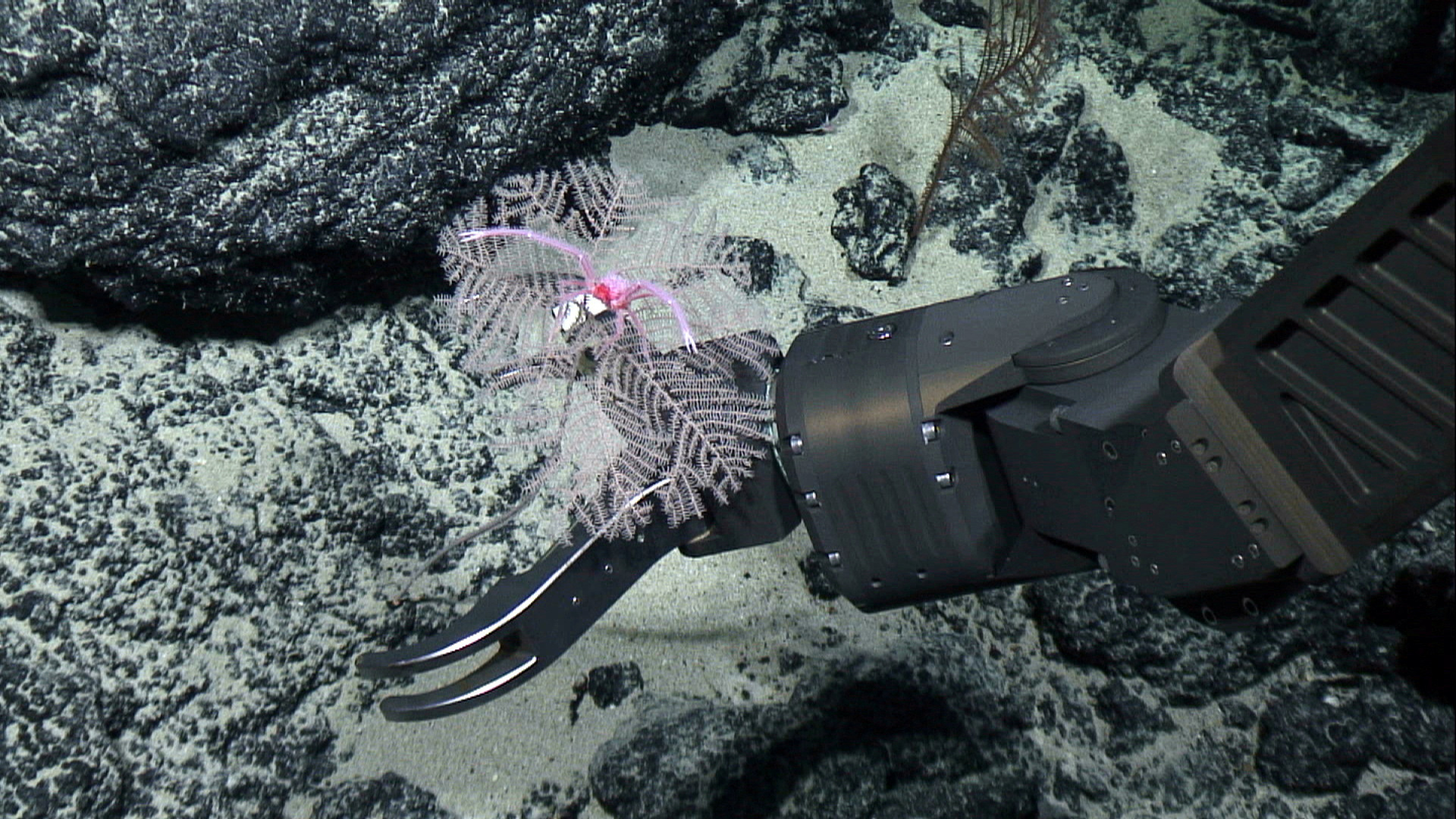
“A remotely operated underwater vehicle, controlled from a distance by a human pilot, works well when you need to inspect a specific object, like the base of an offshore wind turbine,” said Helge Renkewitz, a researcher at the German research institute Fraunhofer working on underwater robotics.
“But if you want to explore large stretches of the seafloor, autonomous vehicles are the future.”

Autonomous, AI-powered submersibles would minimise the risks to human lives from deep-sea exploration and would allow faster mapping of ocean floors.
But what researchers ideally want is to go one step further: build submersibles that can explore for indefinite stretches of time, thereby speeding up the process of scanning the planet’s deepest spots.

That, according to Renkewitz, is difficult because the deep sea comes with several engineering challenges.

First, there’s the corrosiveness of salt water, which makes it hard for submersibles to survive undamaged for long unless they are made of high-tech materials like titanium steel.
Then there’s the pressure.
The deeper you go under water, the more pressure is directed at an object.
This proved fatal for the Titan submersible.

“At the depth of the Titanic wreck, almost 4,000 metres deep, a craft experiences 5,689 pounds [2,580kg] of pressure per square inch,” said Renkewitz.
That’s 400 times the average pressure we experience at sea level.

And then there are the challenges that autonomous vehicles face in navigating the terrain deep under water.

On the surface, a self-driving car can use sensors to look around and recognise things.
It can also rely on precise satellite positioning systems like GPS.
An autonomous submersible doesn’t have these luxuries.

Because of negligible light deep in the ocean, it can only see very close to itself.
Sonar can help it see further, but it can only detect objects in a very specific direction.
On top of that, finding its own position is very difficult for a submersible because of the lack of satellite connections under water.
Researchers use complex calculations to keep track of where a craft is, but those aren’t always accurate.

“There’s always an error rate in these position estimation algorithms,” said Renkewitz.
“And the longer you spend under water, the worse the error gets.
After only a few hours, you can be hundreds of metres away from where you think you are depending on the quality of your sensors.”
 
 
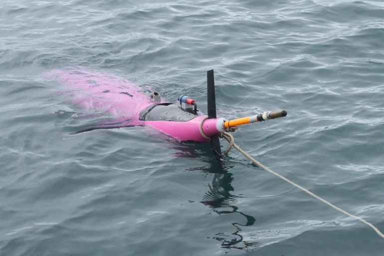
This May 4, 2022, photo shows an underwater glider bobbing in the Gulf of Alaska.
Gliders can steer themselves under water using their wings and can bob up and down across the ocean for months.
But eventually, they too run up against a major challenge that confronts submersibles: sourcing energy to power them [File: Mark Thiessen/AP Photo]

Perpetual exploration

Another challenge for long-term submersibles is energy.
These craft need electricity to operate, yet under water, there’s no obvious source of power to use.
According to Paul Koola, professor of ocean engineering at Texas A&M University, solving this issue will be one of the keys to exploring the deep sea more intensely.

“The dream would be to have a perpetually operating vehicle that uses renewable energy to monitor the ocean and continuously inform us of any changes,” he said.

Some submersibles have taken steps towards this vision.
Underwater gliders absorb water to make them glide downwards and release it again to go up, steering themselves with wings.
In this way, they can bob up and down across the ocean for months.
But even they are eventually limited by their battery life.

To move past this, several options are available.
Even though the sun doesn’t penetrate far under the surface, an autonomous submersible could surface regularly to stock up on energy before it goes down again.
But the small size of a submersible would limit the amount of solar power it can gather, according to Koola.

Floating charging stations across the ocean, where submersibles could dock and recharge, are another scenario researchers are considering.
The problem? This would need a high start-up investment.

“The initial ramp-up is very slow,” said Koola.
“You need an Elon Musk-type character to make this happen and standardise power charging connectors at sea.”

Another option could be to use ocean currents or hydrothermal vents on the seabed, although these are not always available everywhere.
Koola is also working on a system to generate energy from the heat differences between water at different depths.
A craft could, in this way, go down and up in the water and generate the power needed to sustain itself.

Making any such mechanism work in the harsh conditions of the ocean won’t be easy.
Nevertheless, Koola is optimistic.

“The time seems to be right,” he said.
“Interest and funding is increasing, and technology is advancing.
That being said, if we would fund deep-sea exploration like we fund space, we would be much farther already.”
 
 
A blue whale swims in the deep blue sea off the coast of Mirissa, in southern Sri Lanka, April 5, 2013.
Scientists are studying whether sea creatures, including shrimp and krill, can teach them how to build submersibles that can successfully manoeuvre, accelerate and brake undersea
[File: Joshua Barton/Reuters]

Shrimp saviour?


What these future, autonomous submersibles might look like is changing as well.
At Brown University, a team is now looking at how some sea animals, such as shrimp and krill, might serve as an inspiration for future swarms of underwater craft.

“We want to understand why krill and shrimp are so good at manoeuvring, accelerating and braking,” said Sara Oliveira Pedro Dos Santos, a PhD student who is part of the team.
“These are all qualities we want in a submersible to explore the ocean, but so far we don’t know how these animals move like this.”

Brown is bringing together a team to make new, shrimp-like prototypes of submersibles, moved around by gears for now, but maybe utilising pulleys in the future.
The craft could reach up to the size of a large lobster.

“Even though the mechanisms are simple, we don’t know how to reproduce the movement of these little animals,” said Nils Tack, a postdoctoral research candidate at Brown University.
“That is the main challenge for us now.”

The shrimp submersibles will face some of the problems all underwater craft deal with – from finding enough energy to communicating with the surface.
Since these machines are particularly small, they will need even smaller batteries than other submersibles.

Still, the team at Brown hopes to find answers to these questions in the next five years.
And their dreams are bigger than just this research project.

“We haven’t explored much of the ocean,” said Oliveira Pedro Dos Santos.
“There’s so much for us to learn from it if we managed to explore it more.

“We don’t fully understand yet what the ocean can offer us.”
 
Links :

Thursday, September 21, 2023

‘The Deepest Map’ explores the thrills — and dangers — of charting the ocean


The seafloor is well mapped in some places, but for the majority of the ocean, scientists have only a basic sketch of deep-sea topography.
Michael Schmeling/Alamy Stock Photo

From ScienceNews by Alka Tripathy-Lang


The Deepest Map
Laura Trethewey
Harper Wave, $32


In 2019, the multimillionaire and explorer Victor Vescovo made headlines when he became the first person to visit the deepest parts of all five of Earth’s oceans.
But arguably the real star of the expedition was marine geologist Cassie Bongiovanni, the lead ocean mapper who ensured Vescovo piloted his submersible to the actual deepest depths.

Today, only 25 percent of the seafloor is well mapped.
When Vescovo set out to score his record, the exact deepest location in each ocean was unknown.
Bongiovanni, Vescovo and their crew had to chart these regions in detail before each dive.

“Traditionally, captains never cared about the seafloor as long as it stayed far enough away from the hulls of their ships,” journalist Laura Trethewey writes in The Deepest Map.
The book explores humankind’s quest to map the seafloor, framed around Bongiovanni’s adventures.

Seafloor topography has been a big concern for militaries patrolling Neptunian frontiers with nuclear submarines and companies facilitating intercontinental communication via subsea cables (SN: 4/10/21, p. 28).
In recent decades, seafloor data have become crucial to the deep-sea mining industries searching for metals needed to produce green technology.

Satellites have revealed many of the knobs and crevices visible in the deep blue of Google Maps.
But with that relatively coarse information, entire mountains can be missed.
To see the seafloor in high resolution requires a sophisticated sonar system aboard a big ship that sends sound signals from the sea surface into the abyss.

Mappers like Bongiovanni calculate depth from the time it takes for the signal to travel down and bounce back to the surface.
These state-of-the-art sonar systems transform “the satellite-predicted blur into a sharp three-dimensional terrain of ripples, cracks and tears in the seafloor,” Trethewey writes.
“The seafloor is ‘heard,’ rather than seen.”

Through Trethewey’s tale, she twines stories of tagging along with scientists and ocean mappers.
That includes her inaugural adventure at sea, which a crew member noted was “pretty rough for a first-timer,” as he and Trethewey clung to a doorframe in near gale force winds.
On this cruise aboard research vessel E/V Nautilus, which was surveying a poorly mapped stretch of California’s coast, Trethewey (and readers) are introduced to the art and science of seafloor mapping.
On this day, Trethewey learned that mapping is especially difficult — and sometimes impossible — when the ocean is angry.

Trethewey’s insightful writing helps readers understand just why mapping the ocean — even in shallow coastal waters — is crucial to so many endeavors.
She visits a remote Inuit village on the western bank of Canada’s Hudson Bay, where she joins hunters who map ever-changing coastlines for their own safety.
Later, she scuba dives with archaeologists in Florida who use underwater maps to explore remnants of early human history that have been submerged for thousands of years.

A distant, possibly unreachable goal envisions creating a complete map of the entire seafloor by the end of this decade, an effort known as Seabed 2030.
Because the oceans are vast and replete with remote and dangerous places that people simply can’t or shouldn’t go, this effort will almost certainly require autonomous surface vehicles armed with sonar.
Such devices are already probing the depths and sending back data.

Staring at computer screens in a sun-filled conference room, Trethewey watches as a drone outfitted with cameras, environmental sensors and a sonar system maps a bit of seafloor off California as she sips her coffee.
“The future of ocean mapping weirdly felt a lot like checking social media or doing anything else on your phone these days,” she wryly observes.

Trethewey’s book is about more than just mapping the oceans.
It’s also about what can go wrong when explorers explore.
It’s hard to read The Deepest Map without being reminded of the recent implosion of the Titan submersible in the North Atlantic that killed everyone on board in June.
Indeed, Trethewey describes how, during Vescovo’s first solo dive, his colleagues endured 25 minutes of apprehension-turned-alarm when they didn’t hear from him.

She also reminds us how easily exploration can turn into exploitation.
In the not-so-distant past, Europeans “discovered” the so-called New World and mapped it, Trethewey writes.
Exploitation followed.
Scientists and environmentalists alike are now concerned that a full, detailed map of the ocean floor might lead to the destruction of delicate, mostly unknown habitats if deep-sea miners are allowed to extract metals.

Trethewey envisions a different outcome.
Seabed 2030’s mapping effort may help people see that “the weird, wonderful deep-sea world is not a blank space, another frontier to use up and throw away,” and should be safeguarded for scientists “to uncover our past and protect our future.”

Buy The Deepest Map from Bookshop.org.
Science News is a Bookshop.org affiliate and will earn a commission on purchases made from links in this article.
 
Links :

Wednesday, September 20, 2023

Five amazing ocean sites to make the first protected high seas areas

A bronze whaler shark swims through a giant ball of sardines off the east coast of South Africa.
Photograph: Wildestanimal/Getty Images

From The Guardian by Yvonne Gordon

From the Sargasso Sea to the Costa Rica thermal dome, scientists are identifying key diversity hotspots to safeguard under a new UN treaty

From 20 September, the UN’s high seas treaty will at last be open for signatures – an important moment that starts the process for nations to ratify it into their own laws.
At least 60 countries must do so for the treaty to come into force.
Scientists hope that it will finally allow marine protected areas (MPAs) in the high seas to be established.

Conservationists are urging governments to act quickly.
Fishing hours on the high seas rose by about 8.5% between 2018 and 2022, according to estimates published this week by Greenpeace using data from Global Fishing Watch.
The high seas are areas of the ocean that lie beyond any national jurisdictions and, as such, have no legal protections.
They cover nearly 50% of the planet and house a variety of unique ecosystems.
Yet many high seas areas are under threat not just from overfishing, but also pollution, the climate crisis and damage from shipping and deep-sea mining.

“The high seas make up two-thirds of the world’s ocean so it’s absolutely critical that we start establishing MPAs,” says Rebecca Hubbard, director of the High Seas Alliance.
The alliance is a partnership of 52 NGOs, plus the International Union for the Conservation of Nature, that has done a lot of work identifying some of the biodiversity hotspots on the high seas that need priority protection.

It has some ideas on where to begin.

The Costa Rica thermal dome

Striped marlin hunting mackerel and sardines, with a sea lion joining the chase in the warm waters off Costa Rica.
Photograph: Rodrigo Friscione/Getty Images/Image Source

The Costa Rica Thermal Dome in the eastern Pacific Ocean is a diversity hotspot.
The “dome” forms when warm waters from the coast meet cooler waters carried by ocean currents, causing an upswell.
This brings nutrient-rich waters from the sea’s depths to its surface, creating the perfect conditions for a blue green algae to grow.

The phytoplankton that feed on the algae are the start of a rich marine food web, supporting species such as marlins, sea turtles and blue whales, which breed and raise their young in these waters.

The area is under threat particularly from overfishing, plastic pollution and shipping on its way to the Panama Canal.

White shark cafe
 
Great white sharks.
Photograph: Brad Leue/Alamy

In the Pacific Ocean, about halfway between Hawaii and the North American mainland, is the only known meeting spot for north Pacific white sharks, known as the white shark cafe.

These predators make a “winter pilgrimage” to the area from breeding grounds along the North America coast, to feed and loiter.
Scientists observe tagged sharks in the area, including doing rapid dives up to 450 metres deep before returning quickly to the surface.

Sargasso Sea
 
Jacks take shelter under sargassum seaweed in the Sargasso Sea, the ‘golden rainforest of the high seas’.
Photograph: Shane Gross/Greenpeace

This area of the Atlantic Ocean, known for its clumps and mats of sargassum seaweed, is about 3,200km long and 1,100km wide.
It is nicknamed the “golden rainforest of the high seas” thanks to its rich biodiversity and because it acts as a carbon store.

The seaweed here is home to more than 120 species of fish, 145 invertebrate species, 26 seabird species and other unique animals such as the sargassum frog fish.
Marlins and dolphinfish spawn here; white sharks breed here; endangered turtles such as the hawksbill and loggerhead live here; and all American and European eels start life here.

But the area is at risk of overfishing, pollution, shipping traffic and a garbage patch.

“The Sargasso Sea is also experiencing significant effects from the climate crisis, with a 5,000-mile belt of free-floating sargassum seaweed – dubbed the Great Atlantic Sargassum Belt – which risks impacting the Sargasso Sea and wreaking havoc on coastal ecosystems and tourism,” says Dr Simon Walmsley, chief marine adviser to the World Wide Fund for Nature (WWF) UK.

The Lost City hydrothermal field
 
A deep-sea jelly fish near the Imax vent in the Lost City – ‘unlike any other ecosystem’ on Earth.Photograph: National Oceanic and Atmospheric Administration (NOAA), US Department of Commerce

“The Lost City hydrothermal field is a remarkable geobiological feature … in the deep sea (700-800 metre water depth) that is unlike any other ecosystem yet known on Earth,” according to a 2016 report by Unesco.
But it is under threat, particularly from deep-sea mining.

The site was discovered in 2000 during a dive in the mid-Atlantic ridge.
There are 30 huge hydrothermal vent chimneys rising from the seafloor.
The largest, known as Poseidon, is 60m high.

The chimneys are formed when seawater reacts with rock in the Earth’s mantle and is heated by magma.
As the water warms and the pressure rises, minerals begin to dissolve in it.
The water then rises and exits into the ocean.
When the hot water meets cold sea water, it cools, forming mineral deposits that build the chimney-like structures.
 
A hydrothermal vent field in the mid-Atlantic ridge.
Photograph: ROV SuBastian/Schmidt Ocean Institute

Although it’s a harsh environment, the area is teeming with everything from microorganisms and snails to crabs and jellyfish.

The site has already been recognised as an ecologically or biologically significant marine area under the convention on biological diversity, a Mission Blue “hope spot”, and a high seas gem by the Marine Conservation Institute.

The Salas y Gómez and Nazca ridges
 
A school of Pacific rudderfish on the biodiverse Nazca ridge off Peru.
Photograph: Eduardo Sorensen/Oceana

These two chains of underwater mountain ridges sit deep in the clear waters of the south-east Pacific.
They contain many species of ecological importance – from rare turtles to commercial food sources such as swordfish and jack mackerel – and are migration corridors for at least 82 endangered species.

The ridges’ biodiversity is threatened by everything from deep-water trawling to damage from floating plastic debris in the South Pacific gyre and possible future mining exploration.

However creating MPAs needs careful thought, according to experts.
The establishment, governance and management of such areas should be “inclusive, equitable and human rights-based … underpinned by broad community and stakeholder support,” says Walmsley.
This includes balancing ecological benefits and local social and economic circumstances, he adds.

Alexander Killion, managing director of the Centre for Biodiversity and Global Change at Yale University, says: “It is important that new protected areas are prioritised to serve the species that we know are most in need of protection,” while also helping to meet carbon and climate goals, which can prevent further loss of habitat.

There is also significant work to do to map the distributions of marine species that are underrepresented – and their habitats – to prevent future extinctions, he adds.

Walmsley recommends designing a network of MPAs – an idea also noted in the Greenpeace report – that protect a representative range of marine habitats, species and ecological processes (including migration corridors).

“Marine species know no borders,” he says.
“So a network of MPAs that aid ecological connectivity and protect transboundary and migratory species – such as whales, turtles, sharks and tuna – is going to be essential for effective long-term protection, especially when trying to adapt to the climate crisis.”
 
Links :

Tuesday, September 19, 2023

Fixing deep-sea mining damage would be double the cost of extraction, study says

 
New Black Coral species Umbellapathes litocrada is seen in this handout photo from 2015 obtained by Reuters on October 28, 2020. NOAA Office of Ocean Exploration/Handout via REUTERS/File Photo

From Reuters by Clara Denina; Additional reporting by David Stanway; Editing by Emma Rumney and Aurora Ellis
 
Extracting minerals from the ocean floor could negatively impact biodiversity on a scale of up to 25 times greater than land-based mining, and fixing the damage would cost twice as much as extraction, a new report said.

A search for alternatives to fossil fuels has driven demand for materials that go into batteries, some of which can be found on the seabed where ecosystems have yet to be fully explored.

Deep-sea mining would extract cobalt, copper, nickel, and manganese from potato-sized nodules which pepper the sea floor at depths of 4-6 kilometres.
The nodules are an essential habitat for many species.

The total biosphere impacted by this mining in international waters alone would be up to 75 million cubic kilometres, a greater volume than all the freshwater in the world, according to the report by non-profit Planet Tracker.
"Sadly, the nodules... take millions of years to form," said François Mosnier, head of Oceans Programme at Planet Tracker, which warned resulting biodiversity loss could be permanent.

Advocates say deep sea ecosystem restoration, such as installing artificial clay nodules to replace those lost, could mitigate these impacts.

But this would cost between $5.3 - $5.7 million per square kilometre, compared with $2.7 million price per square kilometre to mine them, according to the report.

Seabed mining in international waters cannot start until the International Seabed Authority (ISA), a Jamaica-based U.N. body, decides on regulations expected by July.

Several countries, including Germany, and companies, such as Google, AB Volvo Group, and Samsung SDI are calling for a moratorium on the start of the practice.

Others are supporting it. Norway in June proposed opening parts of its extended continental shelf in the North Atlantic for mineral exploration.

"Any deep sea activity is hugely expensive. In Norway, we're also talking the High Arctic. You have ice sheets floating around... really difficult weather conditions... there is a huge issue about the technological development and the funding needed for that," said Kaja Loenne Fjaertoft a senior advisor at Sustainable Oceans with the World Wide Fund for Nature (WWF).

Links :

Monday, September 18, 2023

Lost and found: the fascinating tale of Sarong Island and the power of archival research

Detail from a 1992 nautical chart shows that both Sarong Island and Pulau Selegu are now part of Sentosa.
The two islands were reclaimed in the late 1970s. Singapore. 
Nautical Chart 60 “Keppel Harbour and Cruise Bay”, 18/03/1992, HC000490, Maritime and Port Authority of Singapore, courtesy of National Archives of Singapore.
 
Raster chart for Small Craft Singapore Strait And Adjacent Waterways, 2011/2012  
 

SG5C4035 MPA ENC in the GeoGarage platform

From Medium by National Library Singapore

Not many people know this, but there was once an island off the northwestern coast of Sentosa named Sarong Island.
It no longer exists now, having been merged with the larger island of Sentosa.
 
Navigational chart produced by Captain Wilde c.1680.
Blakang Mati is the land mass depicted in the lower half of the chart.
From left to right just north of Blakang Mati are Pulau Renggis (a reef), Pulau Selegu (large round island), and Pulau Sarong.
(British Library) 
 
Sarong Island ( P. Selugu in the map) is part of Sentosa now, after Sarong island was joined with Pulau Blakang Mati in 1980.
 
 
 However, back in the late 1950s, well-known socialite Christina Lee (the ex-wife of cinema magnate Loke Wan Tho), purchased the island, and in the 1960s, marketed it as the “First Tourist Isle of Singapore”.
It was a place where visitors could “dine, dance, watch floor shows, or just sip a drink and watch a breathtaking view of Singapore harbour” from the so-called “White House”.¹
 
This “White House” was the only known structure on Sarong Island at the time.
A bungalow built by Frank Blackwood Sewell, who served as Senior Superintendent of Surveys of the Straits Settlements from 1927 to 1932, it was where Lee stayed after she bought the island.
She later turned the house into a restaurant that served the visitors of Sarong Island “curry buffet with added European dishes” for lunch on Sundays and “air-flown steaks, imported capon chicken, and whole rock lobster” for Saturday-night dinners amid music and dance performances by local groups.²

Perhaps due to the novelty of the concept of having a “tourist isle” in Singapore or the star power of Lee, this part of the island’s history is well-documented in newspapers of the period.
However, by delving deeper, I was able to uncover a lesser-known part of the island’s history that has been either misunderstood or largely unknown.

 
All set for opening of Sarong Island, Source: The Straits Times, 20 September 1967 © SPH Media Limited.
Permission required for reproduction.


While it had a nice ring to it, Sarong Island was not its original name.
It was one that Lee and her then husband, Jeffrey Stone, came up with because it was easy to remember.³ Press reports widely referred to the island as “Pulau Selegu.” However, with the aid of library and archival resources, I discovered that “Pulau Selegu” was in fact the name of a different, though nearby island.⁴

This intriguing truth about Sarong Island’s name was uncovered when I came across a 1966 map of Singapore from the collections of the National Archives of Singapore.
The “Topographical Map of Central and Southern Singapore, and Singapore City” showed that there was a “Pulau Selegu” located just off the northwestern coast of Sentosa.
However, the “White House” was not indicated on it; instead it was on an unnamed island to the southwest of Pulau Selegu.⁵

 
Detail from a 1966 topographical map shows the White House on a green patch of land off the northern coast of Pulau Blakang Mati (now Sentosa).
Pulau Selegu is shown northwest of the White House.
Singapore, 1966, M2016_000173_SD, Survey Department, Singapore, courtesy of National Archives of Singapore.


This unnamed island also shows up in an aerial photograph taken in 1949 by the British Royal Air Force.
The photo shows an island with a structure (the White House) and a footbridge linking the island to Sentosa.
This was mentioned in a sale notice for the island that appeared in The Straits Times on 16 March 1967.⁶

 
A sale notice for the island, Source: The Straits Times, 16 March 1957 © SPH Media Limited.
Permission required for reproduction.

 
An aerial photograph taken by the British Royal Air Force showing Pulau Selegu (1), Sarong Island (2) and Sentosa (3).
The White House on Pulau Selegu has been marked out in the photograph in red, while a footbridge linking the island to Sentosa can also be seen south of the White House.
Part of a series of aerial photographs from south-east to north-east showing: Pulau Blakang Mati, Pasir Panjang Wharf, 1949, 258513, Aerial photographs by the British Royal Air Force between 1940 to 1970s, from a collection held by the National Archives of Singapore.
Crown copyright.


The most definitive source for verifying that Sarong Island and Pulau Selugu were different islands is a 1979 map by the Survey Department that reveals that the lot number of Sarong Island and Pulau Selegu were different.
Sarong Island was “Lot 52 Mukim XXXIV”, while Pulau Selegu was “Lot 196 Mukim XXXIV”.
Assigned by the government, lot numbers are unique identifiers or “barcodes” of every land parcel in Singapore.
So, it is near impossible that two pieces of land would share a similar number.⁷

Left: Circled “Lot 196 Mukim XXXIV” from Mukim Number XXXIV: Other Islands; and Right: Circled “Lot 52 Mukim XXXIV” Mukim Number 1: Telok Blangah, 1979, Survey Department, Singapore.
Singapore Land Authority collection, courtesy of National Archives of Singapore.


These findings provide strong evidence that Sarong Island and Pulau Selegu were not the same island.
However, I still do not know the original name of what was subsequently known as Sarong Island, even though I have scoured through the collections of both the National Library and National Archives of Singapore.

One possible explanation could be that Sarong Island did not have a name originally because it was a tidal island.
This means that it was a landmass that had a sort of land bridge to the mainland at low tide that was submerged at high tide.
As such, it was not given a name and could have been seen by surveyors as belonging to the bigger Sentosa Island.
In a parliamentary speech delivered by Law, Environment, and Science and Technology Minister E.W.
Barker on 27 February 1971, he described the coastal area between Sarong Island and Sentosa Island during low tide as being surrounded by “muddy flats, mangrove swamps, and flotsam”.⁸

The discovery that Sarong Island is not Pulau Selugu highlights the value of library and archival resources in providing invaluable insights into the past and uncovering little-known facts and stories.
Without access to historical maps, aerial photographs and newspaper articles, the truth about the island’s history might have remained hidden forever.

To learn more about the history of Sarong Island and relive its days as Singapore’s first tourist isle, check out the Biblioasia article “From Sarong with Love” or listen to the podcast episode, Sarong Island on the Biblioasia+ podcast.

Senior Librarian Lim Tin Seng works at the Singapore and Southeast Asian Collections of the National Library, Singapore.
A big fan of city building games since the days of SimCity, it is no surprise his passion and focus in research lies in the fascinating topic of urban planning.

Links :
 

[1]A Many Splendoured Island,” Eastern Sun, 23 September 1967, 5; R.
Chandran, “Christina’s Isle of Joy to Be Opened on Thursday,” Straits Times, 16 September 1967, 7.
(From NewspaperSG); Mrs Christina Balsara, oral history interview by Patricia Lee, 18 July 2001, MP3 audio, Reel/Disc 4 of 9, 30:28, National Archives of Singapore (accession no. 002542)

[2] R.Chandran, “All Set for Opening of Sarong Island,” Straits Times, 20 September 1967, 7; “Page 6 Advertisements Column 2,” Straits Times, 18 November 1967, 6 (From NewspaperSG); “Brilliant Backdrop Sets Mood,” Straits Times, 23 September 1967, 9.
(From NewspaperSG)

[3] Mrs Christina Balsara, oral history interview, 18 July 2001; “Christina’s Isle of Joy to Be Opened on Thursday,” Straits Times, 16 September 1967, 7.
(From NewspaperSG)

[4]For Sale: Isle Dream Home,” Straits Times, 16 March 1957, 5 (From NewspaperSG)

[5] Survey Department, Singapore, Topographical Map of Central and Southern Singapore, and Singapore City, 1966, map.
(From National Archives of Singapore, accession no. M2016_000173_SD)

[6] Dunlop, Peter K.G. British Royal Air Force, Aerial Photographs from South-east to North-west Showing Pulau Blakang Mati, Pasir Panjang Wharf, 22 November 1949, photograph.
(From British Royal Air Force Collection, National Archives of Singapore, accession no. 258513); “For Sale: Isle Dream Home,” Straits Times, 16 March 1957, 5 (From NewspaperSG)

[7] See Survey Department, Singapore, Mukim Number XXXIV: Other Islands, and Mukim Number 1: Telok Blangah, 19 June 1979, map.
(From National Archives of Singapore, accession no. SP004294); Survey Department, Singapore, Mukim Number XXXIV: Other Islands, 19 June 1979, map.
(From National Archives of Singapore, accession no. SP004295)

[8] Parliament of Singapore, Reclamation at Sentosa Island, vol.
37 of Parliamentary Debates: Official Report, 31 January 1978, cols. 254–55.
(From National Library, Singapore, call no. RCLOS 328.5957 SIN)