Saturday, October 30, 2021

Friday, October 29, 2021

How a Chinese sailboat became a microcosm for Arctic geopolitics

The Zhai Mo 1 departing Shanghai on June 30, 2021.Credit: FleetMon
 
From The Diplomat By Trym Eiterjord
 
A Chinese sailor’s attempted journey through the Arctic Ocean ran aground on disputed sovereignty complaints.
 
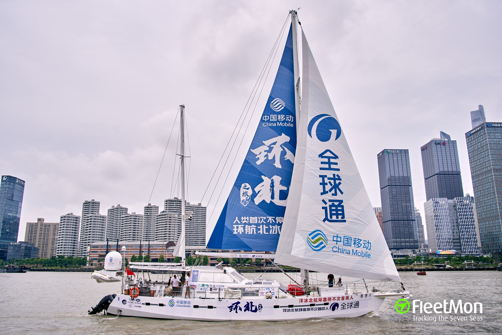
On June 30, Zhai Mo, a Chinese painter-turned-adventurer, set sail from Shanghai on what was supposed to be, in his own words, the first-ever non-stop circumnavigation of the Arctic Ocean.
Zhai, whose earlier nautical achievements include a two-year solo circumnavigation of the Earth, was now embarking on a four-month journey along the shores of the world’s northernmost ocean, ostensibly to bring attention to the effects of climate change in the Arctic.

Yet there was more to the northbound odyssey than the environment.
“This voyage will help implement the Belt and Road Initiative,” the China Daily declared as the modestly named Zhai Mo 1 departed Shanghai.

As climate change thaws open previously iced-over waterways in the circumpolar north, Beijing has begun using the term “Polar Silk Road” to refer to the Arctic Ocean and the various sea routes that crisscross it, including the Northern Sea Route along Russia’s northern coast, the Northwest Passage via Canada, and, pending further sea ice decline, a possible transpolar route cutting across the North Pole.
The Polar Silk Road, as with the Belt and Road Initiative more broadly, has become shorthand for the geoeconomic goals that Beijing endeavors to realize in the region, with shipping forming a key interest.

But as the Arctic sea ice continues to diminish and its waters become more navigable, disputes over the legal status of various channels and straits are re-surfacing.
And Beijing, which only a decade ago paid little attention to maritime affairs in the Arctic, has begun to take a more active interest in the governance of these northern waters with an eye toward securing access to Arctic sea routes.
These aspirations put the country at odds with the region’s coastal states.

Whether by accident or by design, Zhai’s polar peregrinations expose these tensions.

The geopolitical undertones of Zhai’s sailing were made more overt by the plethora of state-owned companies and government agencies that have lined up to sponsor and support the voyage.
Telecom major China Mobile is using the voyage as a branding opportunity, having partnered with Zhai to emblazon the state-owned company’s logo across the ship’s hull and sail.
Other state-owned sponsors include shipping giant COSCO, which started sending commercial voyages through the Northern Sea Route in 2013.
China Global Television Network (CGTN), the international division of CCTV, the country’s state-controlled broadcaster, is also heavily involved in Zhai’s voyage, hosting regular hour-long live streams featuring the captain discussing his day-to-day experiences navigating the Arctic.
Another sponsor, China Institution of Navigation, which recently began working more closely with the country’s polar research community and shipping industry in an effort to improve China’s polar seafaring capabilities, sent high-ranking representatives to Zhai Mo 1’s launch in Shanghai.

A month after setting sail, Zhai and his crew of two reached the Bering Strait, the Pacific gateway to the Arctic Ocean, to commence their polar circumnavigation.
They hung west toward the north coast of Russia, intending to sail via the Northeast Passage.
In early August, however, the crew encountered problems as they were nearing the Vil’kitskii Strait, located at the western entrance to the Northern Sea Route – part of the passage that Russia claims as internal waters.
Unable to produce the necessary paperwork to enter the strait, which is subject to Russian laws, the Russian Coast Guard denied the vessel passage.
 
A photo of Zhai Mo working on a boat, posted on his personal blog in 2015. (blog.sina.com.cn/zhaimo)

In response, Zhai tried sailing north in an attempt to navigate around the strait but was stopped there as well, this time by heavy sea ice.
Blocked in, Zhai sent word to the ship’s owner in China, which, on August 9, filed an application with the Russian authorities.
Two days later, they granted Zhai permission to pass through the strait and continue his voyage westward.

Having overcome his brush with Russian maritime law enforcement in the Arctic, in mid-September, Zhai prepared to enter the Northwest Passage.
Much as how Russia exercises sovereignty over the Northern Sea Route, Canada claims the Northwest Passage as internal waters and mandates that foreign-flagged ships may only enter at their discretion.
Typically, foreign vessels have only needed to notify Canadian authorities before entering the Northwest Passage.
Last year, however, Ottawa issued a ban on pleasure crafts operating in its Arctic waters, including sailboats, to protect vulnerable communities in the area, which are largely Indigenous and lacking in medical facilities, from the spread of COVID-19.
The ban remains in effect today.
While international crafts “exercising their right of innocent passage” can be exempted, they are required to notify Canadian authorities at least 60 days before entering the country’s northern waters.

It seems, however, that Zhai did nothing of the sort.
The day before his planned entrance to the passage, the Chinese sailor proclaimed, “The international community views the passage as a sea route for international navigation.” Canada does not share this view: On September 16, Chinese media reported that Zhai had been “illegally stopped,” this time by the Canadian Coast Guard, as he was making his way from the North Atlantic Ocean into Lancaster Sound, the eastern opening of the Northwest Passage.

Transport Canada, the government agency responsible for regulating Canadian waterways, quickly refuted the claim that Zhai had been turned away when trying to enter the Northwest Passage, stating instead that Zhai had “not entered Canada’s Arctic Waters” and that they had been monitoring his vessel and had informed him of the ban on pleasure crafts.

Chinese state media judging the ban to be illegal is significant, as it would – assuming editorial decisions are sanctioned by Beijing – imply opposition to Canada’s sovereignty over the Northwest Passage.
If so, this would signal that China has grown bolder when it comes to asserting itself in the Arctic.

So far, Beijing has not taken a clear official position on the legal status of either the Northeast or the Northwest Passage.
In 2012, when the Chinese-flagged research icebreaker Xuelong completed its first voyage through the Northern Sea Route, state media noted that disagreement existed over whether certain segments of the route constituted “waters for international navigation.” 
Then, when asked at a press conference in 2016 about China’s position on the legal status of the Northwest Passage, a foreign ministry spokesperson gave a non-answer, noting, “Canada considered that the route crosses its waters, although some countries believed it was open to international navigation.” 
In its first Arctic policy, released in 2018, Beijing tip-toed around these issues again with a sweeping statement that it “respect[s] the sovereignty, sovereign rights, and jurisdiction enjoyed by the Arctic States.” 
The policy also stressed, however, that “the freedom of navigation enjoyed by all countries in accordance with the law [of the sea] and their rights to use the Arctic shipping routes should be ensured.”

A prerequisite for observer status at the Arctic Council, the region’s main inter-governmental forum, is recognition of Arctic states’ sovereign rights and jurisdiction in the region.
China has been an Arctic Council observer since 2013.
A break with the status quo would inevitably strain relations with Canada and Russia, as well as with the other Arctic Council member states.
China will “not overstep its position, nor will it be absent” from Arctic affairs, the 2018 policy paper states; but Beijing’s ability to balance what it sees as its rights in the Arctic with what its circumpolar counterparts consider diplomatically palatable is likely to become trickier if the country’s maritime activities in the region continue to grow.

Although China has yet to articulate an unequivocal position on these matters, the government’s views can be gleaned from not only the actions of Zhai Mo, but what its Arctic experts are saying, too.
While Chinese diplomats have largely toed the line of respecting Arctic states’ sovereignty, domestic academic discussions take a more belligerent stance.
In a follow-up article, CGTN interviewed Wang Zelin, an associate professor of political science at Northwest University of Politics and Law in Xi’an, who has published extensively on international law and Arctic shipping.
He, too, called the alleged actions by Canada illegal, asserting that “the Northwest Passage is an important sea route between the Atlantic and Pacific Oceans,” which should be considered a strait used for international navigation.

In many ways, Wang’s conclusion represents the position taken by most legal scholars in China studying the Arctic.
They tend to emphasize ensuring unfettered access to Arctic waters, by, as one recently published paper puts it, working toward “defining Arctic sea routes as international straits.”

China would not be alone in protesting the Canadian position.
The United States and the European Union similarly maintain that the Northwest Passage constitutes a strait used for international navigation.
Nor is this the first time a Chinese-flagged vessel has attempted to navigate the Northwest Passage.
In 2017, the research icebreaker Xuelong became the first Chinese-flagged vessel to navigate through the passage during the country’s eighth Arctic research expedition.
While that voyage prompted some critics to declare that the presence of a Chinese vessel was eroding Canada’s sovereignty over its waters, Xuelong’s transit was completed amicably and by the book.

It should be noted, however, that Sino-Canadian relations have taken a nosedive since then as a result of Huawei executive Meng Wanzhou’s detention in late 2018 and Beijing’s retaliatory imprisonment of two Canadian nationals.
In a separate op-ed to CGTN, Hong Nong, a political scientist and director of the Washington-based Institute for China-America Studies think tank, alluded to the two countries’ fraying relations.
She insisted that Zhai’s voyage did “not challenge Canada’s sovereignty or legal status over the Northwest Passage,” and that his voyage “should not be interpreted as carrying any political agenda.” Instead, she suggested that “given the current efforts by both states to resume or warm up bilateral relations,” Canadian authorities could exempt Zhai from the aforementioned ban as a gesture of diplomatic good will.
If the voyage did not initially bear an agenda, Hong seems set on giving it one.
 

Regardless of whether Canadian authorities stopped Zhai, the artist-cum-sailor has decided to re-route his voyage through the Panama Canal.
In a video posted to CGTN’s Twitter account on September 24, Zhai announced that his boat would now turn southward, sailing down the eastern coast of North America, through the Panama Canal, and across the Pacific, in order to return to Shanghai, turning what was originally a four-month voyage into an eight-month odyssey.
The detour ironically reveals the benefits of navigating through the much shorter, if icier, Northwest Passage.

One could chalk up Zhai’s incomplete circumpolar navigation to poor planning, regulatory ignorance, or a maritime maverick coming face-to-face with the bureaucratic realities of maritime law enforcement in the Arctic.
Or it could be something more deliberate.
After all, this would not be the first time that Zhai tried to make a geopolitical statement with one of his voyages.
When the territorial dispute over the Senkaku Islands flared up between China and Japan in 2012, Zhai dutifully set sail toward the islands.
There, he, and his crew of nine scattered miniature Chinese flags in the surrounding waters.

“It was rather more of a free and personal voyage,” Zhai, whose sailboat was escorted by the Chinese Coast Guard, told the Global Times at the time.
“A Chinese man who sails for sport can’t make that much trouble.
This approach to maintaining sovereignty is a lot more peaceful.”
 
Links :

ECDIS: is your system updated to the latest IHO Presentation Library?


From Pulse by Emiliano Caroletti, Senior Nautical Instructor, Master Mariner, CertHE (Open),MNI.
 
It has been already four years since the introduction of the new IHO S-52 Presentation Library, so this topic is well known among the insiders.
I wrote this article with one sole aim in mind, to give clear and simple explanations to a specific audience on a very specific topic.
The targeted audience are young Deck Officers, especially Deck Cadets and Third Mates.
The reason is that they will sooner or later experience a Port State Control inspection, so I tried to give them as much information as possible.
The topic is also quite interesting, one of the first questions asked by PSC officers refers to the ECDIS software update status, a function not used every day by the operators.
I believe that I kept the theory to an acceptable level.
All the resources are referenced with hyperlinks to official sources.
I hope that my effort will be appreciated by the “Captains of the future”.


“Is your ECDIS updated to the latest IHO Presentation Library?”
This is one of the most common question asked during a Port State Control inspection.
Why is it so important to have the latest version of the Presentation Library installed on board?
And what is the correct answer to the aforementioned question? 
 

The IHO Publication S-52 “Specifications for Chart Content and Display Aspects of ECDIS” provides specifications and guidance regarding Electronic Navigational Charts (ENC) updates and the display of symbols and colours on the ECDIS.
The Annex A of the S-52 is the Presentation Library, this document gives a full detail of colours, symbols and instructions on how ENC database should be displayed on the ECDIS.

In the example below, a cardinal buoy will be coded following the IHO S-57 standard and added to the ENC database.
The Presentation Library installed into the ECDIS will read the code for the cardinal buoy and will search the right symbol to be depicted on the ECDIS.
This process happens for all the objects, lines and areas encoded into the ENC database in real time and at any scale.
Amazing, isn’t it? 


In other words, the Presentation Library embedded into the ECDIS is in charge of transforming a series of coded objects and attributes compiled in the ENC database into objects, lines and areas displayed on the screen.
The Presentation Library also describes how chart updates are displayed and how alerts from the Look-ahead sector and Route Corridor must be visualised.
With an outdated version of the PL installed, the ECDIS is unable to correctly visualise the ENC database, with the result that some symbols and/or areas are not displayed at all.

As stated in the IMO MSC.1/Circ.1503 “ECDIS – GUIDANCE FOR GOOD PRACTICE”; “ECDIS that is not updated to the latest version of the IHO Standards may not meet the chart carriage requirements as set out in SOLAS regulation V/19.2.1.4.
Any ECDIS which is not upgraded to be compatible with the latest version of the IHO ENC Product Specification or the Presentation Library may be unable to correctly display the latest charted features.
Additionally, the appropriate alarms and indications may not be activated even though the features have been included in the ENC.” (IMO, 2017)

The last sentence is very important because highlight the fact that even if the ENC cell is updated to the latest Notice to Mariners this does not necessarily mean that ECDIS is able to correctly display the objects contained in the ENC database.
The current version of the IHO Presentation Library is the 4.0 issued by the IHO in 2014 and entered into force 1st September 2017, the new PL supersedes the old 3.4 version.

Why has the PresLib been updated?
 
Between 2011 and 2014 , the IHO was collecting feedback from mariners on display anomalies present in the system.
After 4 years of study, the IHO released the new PL 4.0 and as stated by the IHO; “To address the display anomalies and improve the ECDIS user experience the IHO issued S-52 Presentation Library edition 4.0 in September 2014.
One of the principal benefits of upgrading ECDIS systems to the latest IHO Presentation Library is the reduction in audible alarms, which will ease the issue of alarm fatigue on the bridge whilst maintaining safety at sea.
The introduction of an alert model based on the requirements in the IMO ECDIS Performance Standard will also harmonise ECDIS alarm and indication behaviour across different manufacturers systems.
A few new symbols have also been added to the IHO Presentation Library.
These symbols will identify features that require an indication highlight; the location of automatic ENC updates; and ENC features that have a temporal attribute.” (IHO, 2017).

The new symbols introduced in IHO Presentation Library edition 4.0 are shown below.


What is the impact on shipping companies and mariners?
 
A clear answer can be found in a document written in 2017 by the Dutch Ministry of Infrastructure and Environment; “From 31 August 2017, IHO Standards S-52 Edition 6.0 – Chart Content and Display Aspects, Presentation Library Edition 3.4 and Standard S-64 – Test Data Sets Ed. 2.0, are no longer valid for existing systems.
From 1 September 2017 ECDIS systems which do not fulfil hardware and software requirements, and subsequently cannot present ENC’s according to the latest IHO standards, cannot be considered as meeting the chart carriage requirements of SOLAS V reg. 19.2.1.4, nor as meeting the qualification of “up to date” nautical charts referred to in SOLAS V reg. 27.
It is the responsibility of the company and the master to ensure compliance with V/27 and the ensure that the ECDIS application software, and hardware if necessary, is updated before 31 August 2017.
All ECDIS on board, including those, which are not use for primary navigation, shall comply with the latest IHO standards”.

The new IHO ECDIS Presentation Library edition 4.0 clause 19.1 states: “The edition number of the PresLib installed must be available to the Mariner on request”.
This requirement is tested in the standard IEC 61174 edition 4 clause 5.5.1, Presentation library (S 52/Annex A, Part I/19.1) “The edition number of the PresLib installed shall be available to the Mariner on request”.

All Mariners must familiarise themselves with the function in their ECDIS that displays the edition number of the IHO Presentation Library, as this varies across ECDIS manufactures.
This function will be required when Port State Control officers want evidence that the ECDIS is up to date to the latest IHO standards.
MSC.1/Circ.1503 as amended: “Additionally, ECDIS software should be kept up to date such that it can display up-to-date electronic charts correctly according to the latest version of IHO’s chart content and display standards” (IMO, 2017).

There are several ways to access the information regarding the Presentation Library installed in the system.
Each manufacturer has its own way to do it, what all the ECDIS have in common is the possibility to display the ECDIS Chart 1 on the screen.
The ECDIS chart 1 is a legend of symbols used in ENCs and should be installed on all type approved ECDIS.Viewing ECDIS Chart 1, “Information about chart display (A, B)” within the ECDIS will only display the new symbols if the IHO Presentation Library edition 4.0 is installed.

The beacon and buoy features here below display the date dependent magenta ‘d’ symbol when the ECDIS date range is set between 01.04.2014 and 27.08.2014.
It will not be possible to view the new symbols if the ECDIS software has not been updated to use the S-52 Presentation Library Edition 4.0.


This is the method recommended by IHO for checking whether the ECDIS system can correctly display the new symbols.

There is no intention for the IHO to issue a check data set for IHO Presentation Library edition 4.0.

Here we have our answer: each type approved ECDIS is capable to display the ECDIS Chart 1, and if the system is updated to the latest Presentation Library the symbols highlighted in the red circles are displayed.
This is a small but very important piece of the "ECDIS puzzle", the PL is not just an obscure computer program running in the background.
These few Megabyte are controlling if, how and when cartographic information is displayed on the ECDIS, especially dangers and hazards to navigation, therefore the mariner must be aware of its function.

References:

All the screenshots and pictures were taken by the author using a Wärtsilä NACOS Platinum version 2.1.14.02.
Disclaimer: the views expressed herein belong to the writer; they do not necessarily reflect the views of CSMART or Carnival Corporation & Plc.
 
Links :

Thursday, October 28, 2021

Where is Earth’s largest waterfall?

The world's largest waterfall is in the ocean

From NOAA

The world’s largest waterfall is in the ocean beneath the Denmark Strait. 

In the Denmark Strait, southward-flowing frigid water from the Nordic Seas meets warmer water from the Irminger Sea.
The cold, dense water quickly sinks below the warmer water and flows over the huge drop in the ocean floor, creating a downward flow estimated over 123 million cubic feet per second. 

Rivers flowing over Earth’s gorges create waterfalls that are natural wonders, drawing millions of visitors to their breathtaking beauty, grandeur, and power.
But no waterfall is larger or more powerful than those that lie beneath the ocean, cascading over immense cataracts hidden from our view. 
 
Localization with the GeoGarage platform (DGA nautical raster chart)

Indeed, the world’s largest waterfall lies beneath the Denmark Strait, which separates Iceland and Greenland.
At the bottom of the strait are a series of cataracts that begin 2,000 feet under the strait’s surface and plunge to a depth of 10,000 feet at the southern tip of Greenland—nearly a two-mile drop.

But how can there be waterfalls in the ocean?
It’s because cold water is denser than warm water, and in the Denmark Strait, southward-flowing frigid water from the Nordic Seas meets warmer water from the Irminger Sea.
The cold, dense water quickly sinks below the warmer water and flows over the huge drop in the ocean floor, creating a downward flow estimated at well over 123 million cubic feet per second.
Because it flows beneath the ocean surface, however, the massive turbulence of the Denmark Strait goes completely undetected without the aid of scientific instruments.

This infographic illustrates how a large underwater cataract (waterfall) naturally forms underneath the waves within the Denmark Strait.
A map in the upper right of the graphic shows the location of Denmark Strait, between Greenland and Iceland. Warmer surface waters flow northward.
These warmer waters gradually lose heat to the atmosphere and sink.
Denser, cold water flows southward in a deep current along the sea floor over an undersea ridge in the Strait.
The height of the Denmark Strait cataract is approximately 11,500 feet.
By comparison, the largest waterfall on land is 3,212 feet.

Wednesday, October 27, 2021

Plastic rafting: the invasive species hitching a ride on ocean litter

Some of the debris washed out to sea by Japan’s 2011 tsunami.
Some of it came ashore the following year in the US.
Photograph: Science History Images/Alamy

From The Guardian by Russell Thomas


Ocean plastic has become a route for invasive species that threaten native animals with extinction, with Japan’s tsunami sending nearly 300 species ‘rafting’ across the Pacific

Japan’s 2011 tsunami was catastrophic, killing nearly 16,000 people, destroying homes and infrastructure, and sweeping an estimated 5m tons of debris out to sea.

That debris did not disappear, however. Some of it drifted all the way across the Pacific, reaching the shores of Hawaii, Alaska and California – and with it came hitchhikers.

Nearly 300 different non-native species caught a lift across the ocean in what can be thought of as a “mass rafting” event.
The Smithsonian Environmental Research Center in 2017 counted 289 Japanese marine species that were carried to distant shores after the tsunami, including sea snails, sea anemones and isopods, a type of crustacean.

 
A striped beakfish swims in a water-filled box onboard a Japanese boat that washed ashore in Washington state, US. Five of the fish survived hitching a ride across the Pacific. Photograph: Allen Pleus/AP

Plastic rafting poses a huge and mostly unknown danger.
Invasive species that ride plastic litter to new shores can reduce habitats for native species, carry disease (micro-algae is a particular threat), and put further strain on ecosystems already pressured by overfishing and pollution.
According to David Barnes, marine benthic ecologist at the British Antarctic Survey and visiting lecturer at Cambridge University, rafting increases “extinction risk [while] reducing biodiversity, ecosystem function and resilience”.

The tsunami also showed something new: many of the animals survived more than six years adrift, longer than previously thought possible.

Rafting – or oceanic dispersal – is a natural phenomenon.
Marine organisms attach themselves to marine litter and travel hundreds of kilometres.
Free-floating clumps of seaweed such as sargassum, sometimes 3 metres thick, provides a home for certain “rafting species” in the Atlantic, such as reef fish, or pipefishes and seahorses, which are both poor swimmers.
 
 
A 2018 estimate of the Great Pacific Garbage Patch, which disperses plastic litter to the remotest corners of the planet.
Graphic: Guardian

Prof Bella Galil, curator at Steinhardt Museum of Natural History, Tel Aviv University, said: “Transoceanic rafting is a fundamental feature of marine evolutionary biogeography and ecology, often invoked to explain the origins of global patterns of species distributions.”

But while it is relatively rare for a non-native species to successfully survive in a new environment, she says, the huge increase in waste being dumped at sea, as well as abandoned fishing gear, enables biofouling: aquatic organisms attaching themselves where they are not wanted.

This turns “a rare, sporadic evolutionary process into a quotidian one”, she says. Invasive species can threaten biological diversity, food security and human wellbeing.
Sea grapes from Australia arriving in the Mediterranean in 1990, for example, displaced other marine algae – setting off a domino effect that ultimately led to a reduction in native gastropods and crustaceans.

One of the most potent corridors for marine invasions is from the Red Sea, via the Suez canal, into the Mediterranean.
Galil notes that of 455 marine alien species currently listed in the eastern Mediterranean, most are thought to have come through the canal, thanks to the prevailing northward current or via ballast water, hitching a ride mostly on plastics.

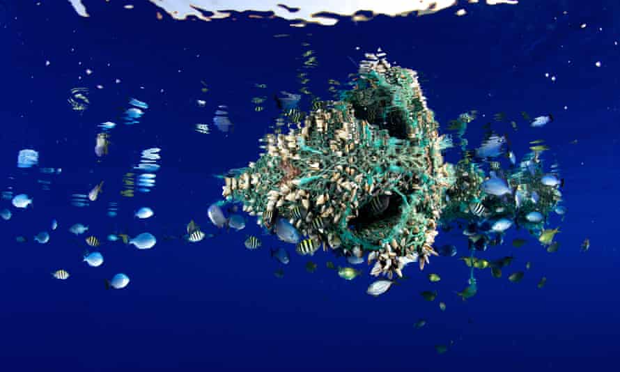
Ocean debris floating off Hawaii has become home to many fish and invertebrates. Photograph: Bryce Groark/Alamy
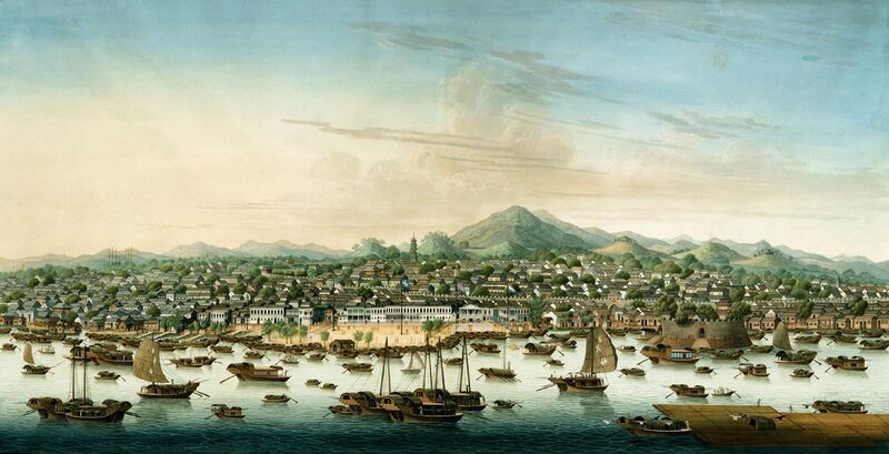
These invasive species do not just hang around. Many have spread into the central and western Mediterranean, again often colonising floating litter.
As well as adversely affecting critical habitats, Galil says, some are “noxious, poisonous, or venomous and pose clear threats to human health”.
Long-spined sea urchins and nomad jellyfish, both venomous and both native to the Indian Ocean, are just two examples now causing damage in the Mediterranean.

The route is likely to become even more popular after the widening of the canal, Egypt’s response to the grounding of the container ship Ever Given earlier this year. 
“Larger canal, larger vessels [will mean] likely larger volume of Red Sea species arriving in the Mediterranean,” Galil says.

Plastic rafting is far from limited to the Mediterranean. There has been a hundredfold increase in marine plastics in the past two decades, which Barnes calls an “ecosystem changer”.

“Plastic, particularly, has massively increased the transport possibilities in terms of how much flotsam there is, its variety (in size and structure), where it goes and how long it floats for,” he says. “Furthermore, plastic can increase local spread of invader species when they do arrive and establish.” One compilation from 2015 listed 387 species, from micro-organisms to seaweeds and invertebrates, found to have rafted on marine litter, in “all major oceanic regions”.

Barnes has even found plastic raft invaders in the Southern Ocean, disproving the idea that Antarctica’s freezing temperatures would keep them at bay. 
The Antarctic may be particularly sensitive to such invasions, with its endemic species having evolved in near isolation, and within a very narrow range of environmental conditions. 
“Any species lost here is a loss of global biodiversity: they only live around Antarctica, and the blue carbon [CO2 held in oceans] they store provides some powerful fightbacks against climate change,” he says – blue carbon referring to the carbon held by ocean life, such as kelp and coral polyps.

With the surface of the ocean now dotted with plastic, there is no limit to where it can travel, taking invaders with it.
Tens of thousands of species can migrate from “anywhere to anywhere, on durations of days to decades”, Barnes says.

One of the key interchanges on this marine expressway network is the North Pacific Gyre, home to the Great Pacific Garbage Patch, the largest concentration of plastic in our oceans.
Here, currents and marine debris converge, and the currents then disperse the litter to the remotest corners of the planet. Similarly, the South Pacific Gyre is thought to be responsible for the (mainly plastic) litter on beaches on Rapa Nui (Easter Island).

According to a 2018 study in Marine Pollution Bulletin by researchers at Spain’s University of Oviedo, 34% of debris examined on Easter Island carried organisms from elsewhere.
These included water striders, a stony coral called Pocillopora and Planes major, a species of crab.
Another study by the same authors found plastic rafting along about 120 miles (200km) of coastline on the Bay of Biscay, with plastic fishing, leisure and household goods carrying non-native invasive species such as the giant Pacific oysterand the Australian barnacle.

 
Burning marine organisms off a Japanese dock that broke free during the tsunami and came ashore in Oregon the following year.
Photograph: Reuters

Some of the world’s most precious environments could be threatened, including the Galápagos Islands.
With a plastic crisis so bad that 400 plastic particles have been found per square metre on the islands’ worst-affected beaches, and some of that plastic already known to host non-native species, it is not hard to imagine an invasive species soon threatening the islands’ famously unique wildlife.
Other remote islands such as Saint Helena, Ascension and Tristan da Cunha are also “highly vulnerable to invasion”, Barnes has reported, due to “little marine traffic and intact endemic species”.

In 2018, Barnes went a step further, describing marine plastic as an ecosystem in itself, in which the only winners are the colonising fauna, what he referred to as the “plastisphere”.

So what can be done about the plastisphere and who is responsible? In the context of the Suez canal, Galil says: “If we adhere to the ‘polluter pays’ principle, Europe is complicit – the canal mainly serves Europe.”
But she also argues for an immediate reduction in the amount of plastics in the environment – and “until then, a strictly enforced prohibition of ocean dumping”.

Tracking technology may also help, such as the Integrated Marine Debris Observing System (IMDOS), a proposed – though not yet implemented – system that would combine satellite imagery, trawl surveys, observations from ships, and data submitted to various organisations to keep track of marine litter.

 
Inspecting a Japanese vessel on Long Beach, Washington state. Nearly 300 species of marine fauna are reported to have been carried across the Pacific on debris from the tsunami.
Photograph: Russ Lewis/AP

Another effort to standardise the monitoring of marine plastic is Floating Ocean Ecosystems (FloatEco), a multidisciplinary project, partly funded by Nasa, to “better understand dynamics of floating plastics in open ocean environments”.
And there are organisations such as Ospar, which brings together 15 governments and the European Union to cooperate in the environmental protection of the north-east Atlantic Ocean.

“A global problem like marine plastic litter, and all the challenges it creates, is impossible to solve without collaboration,” says Eva Blidberg, former project leader for Blastic, a recent EU initiative to map and monitor marine plastics in the Baltic Sea.

But with the pandemic leading to an estimated 1.6m tonnes of single-use PPE being discarded daily, some of it ending up in the ocean, the problem is only worsening.
When Barnes first flagged the threat of plastic rafting in 2002, he found it hard to convince people that it was a cause for concern.
“Now society is so rabbit-in-headlights in a blizzard of climate and biodiversity problems that it is still difficult to convince folk that it is worth worrying about,” he says.

Given it is impossible to stop organisms from doing what they will, the only real way to repel the raft invaders is to take away their rafts.
Monitoring and collaboration are important, says Blidberg, but she adds: “The most important thing is to plug the marine litter tap.”

Tuesday, October 26, 2021

Spain (IHM) nautical chart update in the GeoGarage platform


The Chinese female pirate who commanded 80,000 outlaws


A painting of the city of Canton c. 1800, where Ching Shih lived before she became a pirate.

From Atlas Obscura by Ching Shih

Ching Shih, who lived and pillaged during the Qing Dynasty, has been called the most successful pirate in history.

AT THE DAWN OF THE 19th century, a former prostitute from a floating brothel in the city of Canton was wed to Cheng I, a fearsome pirate who operated in the South China Sea in the Qing dynasty. 
 

Though the name under which we now know her, Ching Shih, simply means “Cheng’s widow,” the legacy she left behind far exceeded that of her husband’s.
Following his death, she succeeded him and commanded over 1,800 pirate ships, and an estimated 80,000 men.
In comparison, the famed Blackbeard commanded four ships and 300 pirates within the same century.
As a result, Ching Shih is known as one of the most successful pirates in known history.

Her husband, Cheng I, was the formidable commander of the Red Flag Fleet of pirate ships.
He had managed to unite many rival Chinese pirate organizations.
He married a 26-year-old Ching Shih in 1801, “who participated fully in her husband’s piracy,” writes Dian H. Murray in Pirates of the South China Coast, 1790-1810.


A photograph of junks in Canton c. 1880.
It is estimated that Ching Shih commanded around 1,800 of these pirate ships at the peak of her power.

The story goes that Cheng sought his bride out due to her reputation as a shrewd businesswoman: Ching Shih apparently used the secrets she learned as a prostitute to wield power over her wealthy and politically connected clients.
There are no primary Chinese sources to support this tale, but Ching Shih’s financial savvy certainly became undeniable over the course of her career in piracy.

It is rumored that Ching Shih demanded equal control of the pirate fleet as a condition of her marriage to Cheng I in 1801. 
“Where business acumen starts to display itself is in the way she became the overall head of the entire confederation,” says Murray.
Female pirate leaders were a rare phenomenon, and Murray is only aware of one other woman commander, a Mrs. Hon-cho-lo, who was active in Hong Kong in the first half of the 20th century.

Six years into their marriage, Cheng I died at the age of 42. Not much is known about how he passed away.
Some accounts indicate that he was killed at sea by a tsunami, while others insinuate that he was murdered in Vietnam.
Regardless of the circumstances, his death left Ching Shih in a precarious position.
 
 
A sketch from the 1800s depicts Ching Shih (right) in battle. (Photo: Unknown/Public Domain)

Her husband’s adoptive son and heir, Cheung Po Tsai, was originally the one to inherit control of the Red Flag Fleet.
Cheung Po Tsai, however, was more than just Ching Shih’s stepson–the young fisherman had also been her husband’s lover.
Though a sexual relationship between an adoptive son and his father may seem unusual, the adoption itself was not entirely out of place.

“Unlike in the West, ‘adult’ adoption was often practiced in China in order to establish a kinship basis for further interaction, particularly of a business or discipleship sort,” says Murray. 
“Cheng I adopting an adolescent fisherman’s son was not too out of the ordinary.”’

Within weeks of Cheng I’s death, Ching Shih had taken Cheung Po as her lover as well, eventually solidifying the relationship through marriage.
Soon, she managed to maneuver herself back into power, and obtained leadership of the Red Flag Fleet.

As a woman in command of a huge pirate fleet, Ching Shih had her work cut out for her.
“Pirate vessels often had a few women on board, but it is not clear to what extent they were or were not practicing pirates,” says Murray. Unlike in the West, in South China there was no stigma attached to women being on board a ship, or being bad luck for the ship.
Nevertheless, it wouldn’t have been easy for anyone, much less a pirate’s widow, to control so many outlaws.

An East India Company employee named Richard Glasspoole was captured by Ching Shih’s pirates in September 1809, and held until December of that year.
In his account of the ordeal, he estimated that there were 80,000 pirates under Ching Shih’s command, and some 1,000 large junks and 800 smaller junks and rowboats.
 

Cheung Po Tsai Cave, named for Ching Shih’s adopted son and lover, and the rumored location where he stashed his loot.

Ching Shih unified her enormous fleet of pirates using a code of laws.
The code was strict, and stated that any pirate giving his own orders or disobeying those of a superior was to be beheaded on the spot.
The code was particularly unusual in its laws regarding female captives. If a pirate raped a female captive, he would be put to death.
If the sex between the two was consensual, both would be put to death.

There are further accounts of Ching Shih’s code that state that if a pirate took a captive as his wife, he was required to be faithful to her (although others say that captains would have multiple wives). “Whatever they thought about her, it does seem clear that the pirates respected and obeyed her authority,” says Murray.

The Red Flag Fleet under Ching Shih’s rule went undefeated, despite attempts by Qing dynasty officials, the Portuguese navy, and the East India Company to vanquish it.
After three years of notoriety on the high seas, Ching Shih finally retired in 1810 by accepting an offer of amnesty from the Chinese government.

“What precipitated the surrender seems to have been an internecine conflict between the Black and Red Fleets and their leaders, which first led to the surrender of the Black Flag Fleet and then ultimately, to the Red Flag fleet,” says Murray. 
“I imagine that given mounting pressure from the outside for their suppression and internal loss of cohesion, that she realized the time had come to give up.”

Ching Shih died in 1844, at the ripe old age of 69.
The legacy she left behind from the time of her rule has penetrated popular culture.
She even inspired a character in the The Pirates of the Caribbean franchise: the powerful Mistress Ching, one of the nine Pirate Lords.
While nothing is known about the years she spent following her retirement, one can only hope she spent her last days in peace and anonymity, away from the harrowing life on the seas where she made her name.
 
Links :

Monday, October 25, 2021

Ships waiting to unload


NASA Earth Observatory image by Joshua Stevens, using Landsat data from the U.S.
Geological Survey
.
Recent satellite imagery showing 87 ships still waiting to unload off California coast. 
 
From NASA by Adam Voiland

Booming demand for consumer and goods, labor shortages, bad weather, and an array of COVID-related supply chain snarls are contributing to backlogs of cargo ships at ports around the world.

Among those seaports are the Port of Los Angeles and Port of Long Beach in Southern California, the two busiest container ports in the United States.
On October 10, 2021, the Operational Land Imager (OLI) on Landsat 8 captured this natural-color image of dozens of cargo ships waiting offshore for their turn to unload goods.
On the same day, the Advanced Spaceborne Thermal Emission and Reflection Radiometer (ASTER) on NASA’s Terra satellite acquired similar imagery.
 

A record number of ships sit idle as they wait to enter the ports of Los Angeles and Long Beach amid major disruptions to the global supply chain.
Captured by a Planet SkySat on October 19, 2021.
 
There are now 72 container ships at anchor waiting to unload at the port of LA-Long Beach.
Carriers are cancelling upcoming sailings to allow the backlog to clear.
Of course, that just means goods will pile up on loading docks at origin.
Bullwhip effect in full effect. 


According to data released by the Marine Exchange of Southern California, there were 87 container ships in the vicinity of the two ports on that day.
Twenty-seven ships were in berths and 60 were waiting (either anchored or floating in drift zones) offshore.
The number of ships waiting was down from a record-high of 73 on September 19, 2021.
The two ports have had unusually large numbers of waiting ships since June 2020.
Before then, cargo ships rarely waited to unload.

Ship backlogs at ports are not limited to Los Angeles.
Elsewhere in the United States, ports in New York, New Jersey, Georgia, and Texas have faced similar challenges, according to news reports.
Meanwhile, China’s Yantian port in Shenzhen has more than 67 container ships waiting, partly because tropical cyclone Kompasu caused the port to temporarily close.
Ports in Malaysia, Singapore, Hong Kong, and Shanghai all had 10 or more container ships waiting in mid-October, according to Bloomberg.

NASA-funded researchers have used satellites and other tools to track different ways that the COVID-19 pandemic has changed aspects of human activity and its impact on the environment.
Researchers have tracked indicators ranging from air pollution and night time light activity and shipping.
In particular, the Interagency Implementation and Advanced Concepts Team (IMPACT) at NASA’s Marshall Space Flight Center has been using artificial intelligence technology and high-resolution satellite imagery to track shipping activity at major U.S. ports.

Links :

Sunday, October 24, 2021

Diver discovers 900-year-old sword dating to the Crusades

 
Diver Discovers 900-Year-Old Sword Off Israeli Coast
A four-foot-long sword dating back to the Third Crusade was found on the floor of the Mediterranean Sea.
 
From NYTimes By Eduardo Medina

Diver Discovers 900-Year-Old Sword Dating to the Crusades

The sword, recovered off the coast of Israel, most likely belonged to a knight who fell into the sea or lost the weapon in battle, experts said. 


It was amazing, amazing to see a beautiful sword like this.
That means that behind all the conglomerate shells and the stones that we have under the — we have under the — underneath, there is a real good preservation sword made of iron, most of it made of iron, except probably the handle, which usually were made of wood or any other material.
We also assuming that this Crusader knight was belong to the community of knights that were sitting on the citadel of Atlit, because it’s not so far from there.
And we assuming right now, because it’s the beginning of the research, we have to clean it, we have to do a X-ray before that, and then we will get some more information about the sword.

 
A four-foot-long sword dating back to the Third Crusade was found on the floor of the Mediterranean Sea.CreditCredit...Shlomi Katzin

Shlomi Katzin attached a GoPro camera to his forehead, slipped on his diving fins and jumped into the waters off the Carmel coast of Israel, eager to go exploring.

On the sandy floor of the Mediterranean Sea, he found a sword.

Archaeologists would later determine that it was about 900 years old.

It weighed four pounds, measured about four feet long and originated from the Third Crusade, experts said.

Links :