Saturday, October 26, 2013

Dolphins use blue whale to surf !

Whale watching passengers and crew aboard Captain Dave's Dolphin and Whale Watching Safari
off Dana Point, California saw something even rarer than a blue whale.
"The crew caught on tape an amazing interspecies encounter of a small pod of bottlenose dolphins catching a ride, actually surfing, on the front of a giant blue whale," said Captain Dave Anderson.
"This kind of a free ride is possible for these dolphins by positioning themselves in front of this rare and endangered whale and riding the pressure wave created by the force of this giant moving through the water."

From Treehugger

The ocean might seem solely a perilous place, where countless marine creatures are endlessly fighting for survival in the dark depths.
But as it turns out, for our seagoing mammalian counterparts at least, life among the waves isn't harsh enough to keep from having a good time.

Recently, Dolphin Safari tour operator Captain Dave Anderson and his crew filmed a remarkable sight off the coast of Dana Point, California -- a pod of wild bottlenose dolphins engaged in a bit of playtime with a massive blue whale.

 Dana Point, California
>>> geolocalization with the Marine GeoGarage <<<

It may be a little hard to see in the video, but Anderson tells the Dana Point Patch that the dolphins appeared to be, in effect, 'surfing' on the wave generated by the 80-foot whale swimming along the surface of the water.

"This type of surfing behavior is usually seen when dolphins ride the pressure wave created in front of a boat. However, this time the dolphins were having fun and “surfing” the largest animal in the world, a blue whale," says Anderson, noting that such interspecies interaction -- particularly for amusement is extremely rare.
"Even though blue whales and bottlenose dolphins coexist in some of the same oceans, they do not run in the same social circles and are not typically seen together, making this a unique and memorable whale watching encounter for all."

Interestingly, this isn't the first time that dolphins and whales have been caught horsing around together in the wild.
On a least two separate occasions, dolphins were been observed playing with humpbacks whales in a slip-and-slide sort of game they appear to have invented.


Many species interact in the wild, most often as predator and prey.
But recent encounters between humpback whales and bottlenose dolphins reveal a playful side to interspecies interaction.
In two different locations in Hawaii, scientists watched as dolphins "rode" the heads of whales: the whales lifted the dolphins up and out of the water, and then the dolphins slid back down.
The two species seemed to cooperate in the activity, and neither displayed signs of aggression or distress.
Whales and dolphins in Hawaiian waters often interact, but playful social activity such as this is extremely rare between species.

It is less clear in this recent incident if the blue whale was a happy participant, or merely trying to move on its way -- but a playful encounter with dolphins seems an opportunity worth relishing.

Friday, October 25, 2013

The making of a mysterious Renaissance map

The Carta Marina, made in 1516, relied on detailed knowledge from nautical charts and books.
Martin Waldseemüller's 1516 Carta Marina sought to present the most up–to–date conception of the world at that time.
Equal in size to his 1507 map, the Carta Marina is markedly superior to the earlier map in artistic detail,
possibly reflecting the hand of the artist Albrecht Dürer (1471–1528).
It incorporates greatly expanded and corrected geographical information.
The Carta Marina could be considered the first printed nautical map of the entire world. 
However, in part because of the controversies surrounding his earlier naming of the Western Hemisphere “America,” Waldseemüller omits the word from the Carta Marina, and indicates that North America is joined with Asia.
Credit: Courtesy of the Library of Congress and the Jay I Kislak Foundation.

From LiveScience (by Tanya Lewis)

Not much is known about how Renaissance cartographer Martin Waldseemüller created his 1516 "Carta marina" world map, possibly the most up-to-date conception of the world at the time.

But scholar Chet Van Duzer offered a rare peek into Waldseemüller's process Tuesday night (Oct. 22) during a talk here at the New York Public Library.
"A careful analysis of his sources allows us to go inside his workshop in Saint-Dié [in France] and essentially watch him at work as he made the Carta marina," Van Duzer, who is based at the Library of Congress, said in his talk.
[See Photos of the Mysterious Carta Marina Map]

Van Duzer and his colleague John Hessler recently published a book on Waldseemüller's works entitled "Seeing the World Anew: The Radical Vision of Martin Waldseemüller's 1507 & 1516 World Maps," (Levenger Press, 2012).

 Atlantic Ocean and surrounding lands, from Waldseemüller's edition of Ptolemy, published in 1513.
Note the name of the land mass on the left.
What famous name has been removed from this map?

Waldseemüller is best known for his 1507 world map, the first to call the New World "America."
The cartographer began his career, Van Duzer said, by basing his maps on those of the Alexandrine geographer Claudius Ptolemy from the second century A.D.
These maps were based on geographic descriptions in books, rather than direct maritime knowledge.

Martin Waldseemüller's Carta marina of 1516 has always remained in the shadow of his 1507 map--less famous and less studied.
In fact the Carta marina is in several ways more interesting than the 1507 map: it is the result of Waldseemüller's radical re-evaluation of what a world map should be.
Waldseemüller essentially started from scratch in creating the Carta marina, rejecting the Ptolemaic model and other sources he had used in creating the 1507 map, and adding more descriptive text and a rich program of illustration.
In this talk Van Duzer examines the differences between the two maps and discuss the new sources that Waldseemüller used, placing particular emphasis on his iconographical sources.

But in making the Carta marina, printed just nine years later, Waldseemüller abandoned his older sources in favor of contemporary nautical charts, maps of maritime regions and coastlines that seafaring explorers of the time would have used.
"When he came to create his new monumental world map, the Carta marina, Waldseemüller made a choice between these two competing cartographic systems, the Ptolemaic tradition and the nautical chart tradition," Van Duzer said — "and he based his map on nautical charts."

Waldseemüller based the Carta marina's coastlines on a nautical chart made by Nicolo de Caverio of Genoa in about 1503.
The two maps have similar coastal place names and layouts.
For example, the shapes of Greenland, the eastern coast of South America and Africa are nearly identical.

One major difference is that the Carta marina omits a large part of northeast Asia and Japan — probably because these regions were relatively unknown to European explorers, Van Duzer said.
Unlike the Caverio map, Waldseemüller's map is crowded with descriptive texts and illustrations of royal rulers.

The Carta marina depicts King Manuel of Portugal riding a sea monster near the southern tip of Africa, symbolizing Portugal's control of the sea route between Africa and India.
The image was most likely inspired by an image of Neptune riding a sea monster in Italian printmaker Jacopo de’ Barbari’s print of Venice, Van Duzer said.

The map also includes an image of Noah's Ark resting in the mountains of Armenia, probably based on similar images in other nautical charts of the time, Van Duzer said.

The Carta marina depicts India as a land of animalistic people and barbarism.
For instance, there's an image of "suttee," the Hindu practice of a widow burning herself to death on the funeral pyre of her husband.
Other less well-known areas, such as America, contain images of cannibalism.

Carta Marina: the title continues with the explanation:
"A Portuguese Navigational Sea-chart of the known Earth and Oceans."
As stated by Peter Whitfield "This map is in fact the first and only printed version of the world charts previously known only to Spanish and Portuguese explorers and their patrons" (Whitfield 1994, 54-55). Waldseemüller’s debt to the Cantino map is clear in his 1516 map.
Two years after publishing the great "Carta Marina" Waldseemüller died, leaving a legacy of maps and a book, and the name "America" on maps.
 -page of the book showing Florida (see with zoom)

Despite these seemingly outdated images, the Carta marina still represents a leap forward in cartography, because Waldseemüller relied on much more updated sources than he did for his earlier 1507 map.
In addition to nautical charts, Van Duzer's analysis reveals, the Renaissance cartographer relied on books written by recent explorers.
"The Carta marina is Waldseemüller’s most original creation," Van Duzer said.
"He began his cartographic career by redrawing Ptolemy, but ended it by creating something entirely new, a mosaic image of the world with each stone of his own careful choosing."

Links :
  • LOC : Compare 1507 map and Carta Marina 1516
  • MapHist : Legends on Martin Waldseemüller's Carta Marina of 1516, with comments from Joaquim Alves Gaspar, CIUHCT, University of Lisboni)
    1/ The Carta Marina is indeed very similar to the Caverio planisphere (1505) and was most probably based on it. But the Caverio itself is copied from the Cantino planisphere (1502) and from other unknown Portuguese sources of the time.
    2) The only signs that Columbus conception of the world was adopted are in the legends, not in the geometry of the chart, which is identical to Cantino's. In the Cantino, the separation between Asia and America seems clear: there is a legend near the eastern margin reading "Oceanus occideroriêntalis" which probably means "an ocean eastward of China and westward of America";
    3) If the geometry of the chart is identical to Cantino's, which was based on latitudes, magnetic courses and estimated distances, why the square mesh? Apparently Waldseemuller was also convinced (like many others) that this was a "square chart". It is interesting to notice that this kind of explicit mistake (i.e., the square grid) is not shown in any pre-Mercator chart of Portuguese (and Spanish, I presume) origin.
  • GeoGarage blog :  Worlds upon worlds : about the Waldseemüller world map (1507) / A world redrawn : when America showed up on a map, it was the universe that got transformed
  • Google's Michael Jones-need Apollo mission for the Ocean

Thursday, October 24, 2013

UK & misc. update in the Marine GeoGarage

Today 954 charts (1825 including sub-charts) from UKHO
are available in the 'UK & misc.' chart layer
regrouping charts for different countries :
  1. UK
  2. Argentina
  3. Belgium
  4. Netherlands
  5. Croatia
  6. Oman
  7. Portugal
  8. Spain
  9. Iceland
  10. South Africa
  11. Malta

635 charts for UK
(3662 Aden Oil Harbour & 3722 Approaches to Muhammad Qol
withdrawn  from previous update  
434 Balhaf Terminal and Little Aden Oli Harbour
added  from previous update  )

24 charts for Argentina :

  • 226    International Chart Series, Antarctica - South Shetlands Islands, Deception Island.
  • 227    Church Point to Cape Longing including James Ross Island
  • 531    Plans on the Coast of Argentina
  • 552    Plans on the Coast of Argentina
  • 557    Mar del Plata to Comodoro Rivadavia
  • 1302    Cabo Guardian to Punta Nava
  • 1331    Argentina, Approaches to Bahia Blanca
  • 1332    Isla de los Estados and Estrecho de le Maire
  • 1751    Puerto de Buenos Aires
  • 1982B    Rio Parana - Rosario to Parana
  • 2505    Approaches to the Falkland Islands
  • 2517    North-Western Approaches to the Falkland Islands
  • 2519    South-Western Approaches to the Falkland Islands
  • 3065    Punta Piedras to Quequen
  • 3066    Quequen to Rio Negro
  • 3067    Rio Negro to Isla Leones
  • 3106    Isla Leones to Pto San Julian
  • 3213    Plans in Graham Land
  • 3560    Gerlache Strait  Northern Part
  • 3566    Gerlache Strait  Southern Part
  • 3755    Bahia Blanca
  • 4063    Bellingshausen Sea to Valdivia
  • 4200    Rio de la Plata to Cabo de Hornos
  • 4207    Falkland Islands to Cabo Corrientes and Northeast Georgia Rise
27 charts for Belgium & Nederlands :

  • 99 Entrances to Rivers in Guyana and Suriname
  • 110 Westkapelle to Stellendam and Maasvlakte
  • 112 Terschellinger Gronden to Harlingen
  • 120 Westerschelde - Vlissingen to Baalhoek and Gent - Terneuzen Canal
  • 122 Approaches to Europoort and Hoek van Holland
  • 124 Noordzeekanaal including Ijmuiden, Zaandam and Amsterdam
  • 125 North Sea Netherlands - Approaches to Scheveningen and Ijmuiden
  • 126 North Sea, Netherlands, Approaches to Den Helder
  • 128 Westerschelde, Valkenisse to Wintam
  • 207 Hoek Van Holland to Vlaardingen
  • 208 Rotterdam, Nieuwe Maas and Oude Maas
  • 209 Krimpen a/d Lek to Moerdijk
  • 266 North Sea Offshore Charts Sheet 11
  • 572 Essequibo River to Corentyn River
  • 702 Nederlandse Antillen, Aruba and Curacao
  • 1187 Outer Silver Pit
  • 1408 North Sea, Harwich and Rotterdam to Cromer and Terschelling.
  • 1412 Caribbean Sea - Nederlandse Antillen, Ports in Aruba and Curacao
  • 1414 Bonaire
  • 1503 Outer Dowsing to Smiths Knoll including Indefatigable Banks.
  • 1504 Cromer to Orford Ness
  • 1546 Zeegat van Texel and Den Helder Roads
  • 1630 West Hinder and Outer Gabbard to Vlissingen and Scheveningen
  • 1631 DW Routes to Ijmuiden and Texel
  • 1632 DW Routes and Friesland Junction to Vlieland
  • 1874 North Sea, Westerschelde, Oostende to Westkapelle
  • 2047 Approaches to Anguilla

13 charts for Croatia :
  • 201 Rt Kamenjak to Novigrad
  • 202 Kvarner, Kvarneric and Velebitski Kanal
  • 269 Ploce and Split with Adjacent Harbours, Channels and Anchorages
  • 515 Zadar to Luka Mali Losinj
  • 680 Dubrovnik
  • 1574 Otok Glavat to Ploce and Makarska
  • 1580 Otocic Veliki Skolj to Otocic Glavat
  • 1996 Ports in Rijecki Zaljev
  • 2711 Rogoznica to Zadar
  • 2712 Otok Susac to Split
  • 2719 Rt Marlera to Senj including Approaches to Rijeka
  • 2773 Sibenik, Pasmanski Kanal, Luka Telascica, Sedmovrace, Rijeka Krka
  • 2774 Otok Vis to Sibenik
 7 charts for Oman :

  • 2853 Gulf of Oman, approaches to Sohar       
  • 2854 Northern approaches to Masirah
  • 3171 Southern Approaches to the Strait of Hormuz
  • 3409 Plans in Iran, Oman and the United Arab Emirates
  • 3511 Wudam and Approaches
  • 3518 Ports and Anchorages on the North East Coast of Oman
  • 3762 Oman - South East coast, Ad Duqm


124 charts for Spain & Portugal :

  • 45 Gibraltar Harbour
  • 73 Puerto de Huelva and Approaches
  • 83 Ports on the South Coast of Portugal
  • 85 Spain - south west coast, Rio Guadalquivir
  • 86 Bahia de Cadiz
  • 87 Cabo Finisterre to the Strait of Gibraltar
  • 88 Cadiz
  • 89 Cabo de Sao Vicente to Faro
  • 91 Cabo de Sao Vicente to the Strait of Gibraltar
  • 93 Cabo de Santa Maria to Cabo Trafalgar
  • 142 Strait of Gibraltar
  • 144 Mediterranean Sea, Gibraltar
  • 307 Angola, Cabeca da Cobra to Cabo Ledo
  • 308 Angola, Cabo Ledo to Lobito
  • 309 Lobito to Ponta Grossa
  • 312 Luanda to Baia dos Tigres
  • 366 Arquipelago de Cabo Verde
  • 469 Alicante
  • 473 Approaches to Alicante
  • 518 Spain East Coast, Approaches to Valencia
  • 562 Mediterranean Sea, Spain - East Coast Valencia
  • 580 Al Hoceima, Melilla and Port Nador with Approaches
  • 659 Angola, Port of Soyo and Approache
  • 690 Cabo Delgado to Mikindani Bay
  • 886 Estrecho de la Bocayna and Approaches to Arrecife
  • 1094 Rias de Ferrol, Ares, Betanzos and La Coruna
  • 1096 Ribadeo
  • 1110 La Coruna and Approaches
  • 1111 Punta de la Estaca de Bares to Cabo Finisterre
  • 1113 Harbours on the North-West Coast of Spain
  • 1117 Puerto de Ferrol
  • 1118 Ria de Ferrol
  • 1122 Ports on the North Coast of Spain
  • 1133 Ports on the Western Part of the North Coast of Spain
  • 1142 Ria de Aviles
  • 1145 Spain - North Coast, Santander
  • 1150 Ports on the North Coast of Spain
  • 1153 Approaches to Gijon
  • 1154 Spain, north coast, Gijon
  • 1157 Pasaia (Pasajes) and Approaches
  • 1172 Puertos de Bermeo and Mundaka
  • 1173 Spain - North Coast, Bilbao
  • 1174 Approaches to Bilbao
  • 1180 Barcelona
  • 1189 Approaches to Cartagena
  • 1193 Spain - east coast, Tarragona
  • 1194 Cartagena
  • 1196 Approaches to Barcelona
  • 1197 Plans on the West Coast of Africa
  • 1215 Plans on the Coast of Angola
  • 1216 Baia dos Tigres
  • 1290 Cabo de San Lorenzo to Cabo Ortegal
  • 1291 Santona to Gijon
  • 1448 Gibraltar Bay
  • 1453 Gandia
  • 1455 Algeciras
  • 1460 Sagunto
  • 1514 Spain - East Coast, Castellon
  • 1515 Ports on the East Coast of Spain
  • 1589 Almeria
  • 1595 Ilhas do Principe, de Sao Tome and Isla Pagalu
  • 1684 Ilha da Madeira, Manchico and Canical
  • 1685 Nisis Venetico to Nisos Spetsai including the Channels between Akra Maleas and Kriti
  • 1689 Ports in the Arquipelago da Madeira
  • 1701 Cabo de San Antonio to Vilanova I la Geltru including Islas de Ibiza and Formentera
  • 1703 Mallorca and Menorca
  • 1704 Punta de la Bana to Islas Medas
  • 1724 Canal do Geba and Bissau
  • 1726 Approaches to Canal do Geba and Rio Cacheu
  • 1727 Bolama and Approaches
  • 1730 Spain - West Coast, Ria de Vigo
  • 1731 Vigo
  • 1732 Spain - West Coast, Ria de Pontevedra
  • 1733 Spain - West Coast, Marin and Pontevedra
  • 1734 Approaches to Ria de Arousa
  • 1740 Livingston Island, Bond Point to Brunow Bay including Juan Carlos 1 Base and Half Moon Island
  • 1755 Plans in Ria de Arousa
  • 1756 Ria de Muros
  • 1762 Vilagarcia de Arosa
  • 1764 Ria de Arousa
  • 1831 Arquipelago da Madeira
  • 1847 Santa Cruz de Tenerife
  • 1850 Approaches to Malaga
  • 1851 Malaga
  • 1854 Motril and Adra
  • 1856 Approaches to Puerto de La Luz (Las Palmas)
  • 1858 Approaches to Santa Cruz de Tenerife, Puerto de San Sebastian de la Gomera, Santa Cruz de la Palma and Approaches
  • 1869 Gran Canaria to Hierro
  • 1870 Lanzarote to Gran Canaria
  • 1895 Ilha de Sao Miguel
  • 1950 Arquipelago dos Acores
  • 1956 Arquipelago dos Acores Central Group
  • 1957 Harbours in the Arquipelago Dos Acores (Central Group)
  • 1959 Flores,Corvo and Santa Maria with Banco Das Formigas
  • 2742 Cueta
  • 2761 Menorca
  • 2762 Menorca, Mahon
  • 2831 Punta Salinas to Cabo de Formentor including Canal de Menorca
  • 2832 Punta Salinas to Punta Beca including Isla de Cabrera
  • 2834 Ibiza and Formentera
  • 2932 Cabo de Sao Sebastiao to Beira
  • 2934 Africa - east coast, Mozambique, Beira to Rio Zambeze
  • 2935 Quelimane to Ilha Epidendron
  • 3034 Approaches to Palma
  • 3035 Palma
  • 3220 Entrance to Rio Tejo including Baia de Cascais
  • 3221 Lisboa, Paco de Arcos to Terreiro do Trigo
  • 3222 Lisboa, Alcantara to Canal do Montijo
  • 3224 Approaches to Sines
  • 3227 Aveiro and Approaches
  • 3228 Approaches to Figueira da Foz
  • 3257 Viana do Castelo and Approaches
  • 3258 Approaches to Leixoes and Barra do Rio Douro
  • 3259 Approaches to Setubal
  • 3260 Carraca to Ilha do Cavalo
  • 3448 Plans in Angola
  • 3578 Eastern Approaches to the Strait of Gibraltar
  • 3633 Islas Sisargas to Montedor
  • 3634 Montedor to Cabo Mondego
  • 3635 Cabo Mondego to Cabo Espichel
  • 3636 Cabo Espichel to Cabo de Sao Vicente
  • 3764 Cabo Torinana to Punta Carreiro
  • 4114 Arquipelago dos Acores to Flemish Cap
  • 4115 Arquipelago dos Acores to the Arquipelago de Cabo Verde
  • Ilha de Madeira, Ponta Gorda de Sao Lourenco including the Port of Funchal


14 charts for Iceland :

  • 2733 Dyrholaey to Snaefellsjokull
  • 2734 Approaches to Reykjavik
  • 2735 Iceland - South West Coast, Reykjavik
  • 2897 Iceland
  • 2898 Vestfirdir
  • 2899 Iceland, Noth Coast, Horn to Rauoinupur
  • 2900 Iceland, North East Coast, Rauoinupur to Glettinganes
  • 2901 Iceland, East Coast, Glettinganes to Stokksnes
  • 2902 Stokksnes to Dyrholaey
  • 2955 Iceland, North Coast, Akureyri
  • 2956 Iceland, North Coast, Eyjafjordur
  • 2937 Hlada to Glettinganes
  • 2938 Reydarfjordur
  • 4112 North Atlantic Ocean, Iceland to Greenland


49 charts for South Africa :

  • 578 Cape Columbine to Cape Seal
  • 632 Hollandsbird Island to Cape Columbine
  • 643 Durban Harbour
  • 665 Approaches to Zanzibar
  • 1236 Saldanha Bay
  • 1806 Baia dos Tigres to Conception Bay
  • 1846 Table Bay Docks and Approaches
  • 1922 RSA - Simon's Bay
  • 2078 Port Nolloth to Island Point
  • 2086 East London to Port S Johns
  • 2087 Port St John's to Durban
  • 2088 Durban to Cape Vidal
  • 2095 Cape St Blaize to Port S. John's
  • 3793 Shixini Point to Port S Johns
  • 3794 Port S Johns to Port Shepstone
  • 3795 Port Shepstone to Cooper Light
  • 3797 Green Point to Tongaat Bluff
  • 3859 Cape Cross to Conception Bay
  • 3860 Mutzel Bay to Spencer Bay
  • 3861 Namibia, Approaches to Luderitz
  • 3869 Hottentot Point to Chamais Bay
  • 3870 Chamais Bay to Port Nolloth
  • 4132 Kunene River to Sand Table Hill
  • 4133 Sand Table Hill to Cape Cross
  • 4136 Harbours on the West Coasts of Namibia and South Africa
  • 4141 Island Point to Cape Deseada
  • 4142 Saldanha Bay Harbour
  • 4145 Approaches to Saldanha Bay
  • 4146 Cape Columbine to Table Bay
  • 4148 Approaches to Table Bay
  • 4150 Republic of South Africa, South West Coast, Table Bay to Valsbaai
  • 4151 Cape Deseada to Table Bay
  • 4152 Republic of South Africa, South West Coast, Table Bay to Cape Agulhas
  • 4153 Republic of South Africa, South Coast, Cape Agulhas to Cape St. Blaize
  • 4154 Mossel Bay
  • 4155 Cape St Blaize to Cape St Francis
  • 4156 South Africa, Cape St Francis to Great Fish Point
  • 4157 South Africa, Approaches to Port Elizabeth
  • 4158 Republic of South Africa - South Coast, Plans in Algoa Bay.
  • 4159 Great Fish Point to Mbashe Point
  • 4160 Ngqura Harbour
  • 4162 Approaches to East London
  • 4163 Republic of South Africa, South East Coast, Mbashe Point to Port Shepstone
  • 4170 Approaches to Durban
  • 4172 Tugela River to Ponta do Ouro
  • 4173 Approaches to Richards Bay
  • 4174 Richards Bay Harbour
  • 4205 Agulhas Plateau to Discovery Seamounts
  • 4700 Port Elizabeth to Mauritius


    5 charts for Malta :

    • 36 Marsaxlokk
    • 177 Valletta Harbours
    • 211 Plans in the Maltese Islands
    • 2537 Ghawdex (Gozo), Kemmuna (Comino) and the Northern Part of Malta
    • 2538 Malta

    57 international charts from NGA
     
    • 3 Chagos Archipelago
    • 82 Outer Approaches to Port Sudan
    • 100 Raas Caseyr to Suqutra
    • 255 Eastern Approaches to Jamaica
    • 256 Western Approaches to Jamaica
    • 260 Pedro Bank to the South Coast of Jamaica
    • 333 Offshore Installations in the Gulf of Suez
    • 334 North Atlantic Ocean, Bermuda
    • 386 Yadua Island to Yaqaga Island
    • 390 Bahamas, Grand Bahama Island, Approaches to Freeport
    • 398 Grand Bahama Island, Freeport Roads, Freeport Harbour
    • 457 Portland Bight
    • 462 The Cayman Islands
    • 486 Jamaica and the Pedro Bank
    • 501 South East Approaches to Trinidad
    • 700 Maiana to Marakei
    • 766 Ellice Islands
    • 868 Eastern and Western Approaches to The Narrows including Murray's Anchorage
    • 920 Chagos Archipelago, Diego Garcia
    • 928 Sulu Archipelago
    • 959 Colson Point to Belize City including Lighthouse Reef and Turneffe Islands
    • 1043 Saint Lucia to Grenada and Barbados
    • 1225 Gulf of Campeche
    • 1265 Approaches to Shatt Al 'Arab or Arvand Rud, Khawr Al Amaya and Khawr Al Kafka
    • 1450 Turks and Caicos Islands, Turks Island Passage and Mouchoir Passage
    • 1638 Plans in Northern Vanuatu
    • 2006 West Indies, Virgin Islands, Anegada to Saint Thomas
    • 2009 Sheet 2 From 23 deg 40 min North Latitude to Old Bahama Channel
    • 2065 Northern Antigua
    • 2133 Approaches to Suez Bay (Bahr el Qulzum)
    • 2373 Bahr el Qulzum (Suez Bay) to Ras Sheratib
    • 2374 Ra's Sharatib to Juzur Ashrafi
    • 2658 Outer Approaches to Mina` al Jeddah (Jiddah)
    • 2837 Strait of Hormuz to Qatar
    • 2847 Qatar to Shatt al `Arab
    • 3043 Red Sea, Ports on the coast of Egypt.
    • 3102 Takoradi and Sekondi Bays
    • 3175 Jazirat al Hamra' to Dubai (Dubayy) and Jazireh-ye Sirri
    • 3179 UAE and Qatar, Jazirat Das to Ar Ru' Ays
    • 3310 Africa - east coast, Mafia Island to Pemba Island
    • 3361 Wasin Island to Malindi
    • 3432 Saltpond to Tema
    • 3493 Red Sea - Sudan, Bashayer Oil Terminals and Approaches.
    • 3519 Southern Approaches to Masirah
    • 3520 Khawr Kalba and Dawhat Diba to Gahha Shoal
    • 3522 Approaches to Masqat and Mina' al Fahl
    • 3530 Approaches to Berbera
    • 3709 Gulf of Oman, United Arab Emirates, Port of Fujairah (Fujayrah) and Offshore Terminals.
    • 3723 Gulf of Oman, United Arab Emirates, Approaches to Khawr Fakkan and Fujairah (Fujayrah).
    • 3785 Mina' Raysut to Al Masirah
    • 3907 Bahama Islands and Hispaniola, Passages between Mayaguana Island and Turks and Caicos Islands.
    • 3908 Passages between Turks and Caicos Islands and Dominican Republic
    • 3910 Little Bahama Bank including North West Providence Channel
    • 3912 Bahamas, North East Providence Channel and Tongue of the Ocean
    • 3913 Bahamas, Crooked Island Passage and Exuma Sound
    • 3914 Turks and Caicos Islands and Bahamas, Caicos Passage and Mayaguana Passage
    • 3951 Sir Bani Yas to Khawr al `Udayd


    So today, for a cost of 9.9 € / month ('Premium Charts' subscription), you can have access to 2588 additional updated charts (4332 including sub-charts) coming from 3 international Hydrographic Services (UKHO, CHS, AHS and France).

Three new crowdsourced XPRIZES launched for ocean health


The Wendy Schmidt Ocean Health XPRIZE is a global competition that challenges teams of engineers, scientists and innovators from all over the world to create pH sensor technology that will affordably, accurately and efficiently measure ocean chemistry from its shallowest waters... to its deepest depths.
These break-through sensors are urgently needed for scientists, managers and industry to turn the tide on ocean acidification and begin healing our oceans.

From National Geographic

On October 22, the XPRIZE launched an Ocean Initiative, which aims to give three new global prizes to teams that develop technologies by 2020 that protect ocean health.

In September, the nonprofit group had launched the $2 Million Wendy Schmidt Ocean Health XPRIZE, which challenges teams to create affordable pH sensor technology that will help scientists measure ocean acidification.


The XPRIZE was founded in 1995 as a nonprofit prize program (formerly called the X Prize Foundation) to spur innovation around pressing global problems.
Past XPRIZE efforts have focused on private efforts in suborbital commercial spaceflight, efficient cars, and moon rovers.
In 2004, Burt Rutan’s SpaceShipOne was awarded the $10 million Ansari X-Prize for spaceflight for soaring more than 100 kilometers (62 miles).

National Geographic spoke with Paul Bunje, senior director for oceans at XPRIZE.

What will the new ocean prizes specifically address?

I wish I could tell you but that’s the exciting part about what we’re doing here.
We believe that if we’re going to live by our mantra that anyone can solve a grand challenge, then anyone can also help us identify what the challenge should be.
So we’re opening up the XPRIZE program, and asking the public to help us identify what those next three prizes should be.
It’s a little bit scary as you might imagine.
We know the issues facing the oceans, with pollution, overfishing, acidification, and so on.
But it would be folly for us not to involve as much of the globe as possible in figuring out the solutions.

How will the process work?

[On October 22] we announce three more ocean XPRIZES, making five total over 10 years.
[The Wendy Schmidt Oil Cleanup XCHALLENGE had granted $1.4 million in 2011 for efforts to improve remediation technologies.]
Anyone can submit their idea for the new prizes, but that’s not really sufficient for identifying a grand challenge.
Through our Ocean Ambassador program we want people to join us.
When they sign up they will go through learning, and connect with experts like Sylvia Earle.
We want Ocean Ambassadors who will really commit and join us in the ideation process.
It’s more involved than just tossing up a quick idea on Facebook, we want people who are really going to put some work into this.

Any idea how many Ocean Ambassadors you are looking for?

We’re looking for thousands, maybe hundreds of thousands.
I’d be over the moon if we had 10,000 people who were working a few hours a month on this.

Some conventional wisdom says it’s difficult to get people to contribute a significant amount of work for free.
People are keen to submit a photo or take another quick action, but ask them for something more involved and you tend to get a much lower response rate.
Are you concerned about that?

We’re trying to design the program so it’s like a funnel: in the first instance lots of people will want to give us ideas and maybe some will follow those ideas.
Over time we’ll bring people closer and closer into the funnel, so a smaller and smaller group will become very active.
It’s not enough to simply submit an idea and have people vote on them because there’s a lot more that goes into it for an XPRIZE.
The important thing for us is there are people out there with great ideas that we don’t know of, who are outside the established system of university professors, explorers in residence, and so on.
What we need to figure out is launching the program and letting it be designed by the crowd.

 The Wendy Schmidt Ocean Health XPrize aims at combating ocean acidification

Are the new ocean XPRIZES also supported by Wendy Schmidt [who is president of the Schmidt Family Foundation and is married to Google chair Eric Schmidt]?

Wendy has graciously helped seed our ocean initiative but it is intended to grow with other philanthropists and individual donors.
We’ll have to identify new sponsors.

You have said this is the most ambitious XPRIZE program to date, suggesting it tops the race of private efforts to space supported by the Ansari XPRIZE in 2004. Why?

The oceans are completely underexplored and underfinanced.
We don’t want to give up on space, clearly, but there has been a real abdication in funding ocean exploration by governments, it’s fleetingly small now and getting smaller.
So what the XPRIZE recognizes is that we just haven’t explored them.
It’s our belief that discovery creates great things.
The other side of it is the oceans are the lungs of our planet, so it’s planetary health we’re talking about.
If we’re not willing to address what is happening in our oceans then it’s putting humanity at risk.
The XPRIZEs are about radical breakthroughs for the betterment of humanity.
They will have exponential impact on industries and protect our oceans, so if we want to better humanity there’s no better place to start.

Links :
  • Xprize : press release
  • The Guardian : XPRIZE dives into Earth's final frontier – our oceans and their future health

Wednesday, October 23, 2013

The iPhone’s positioning sensors were never good

Six iPhones tested, and they can't agree on magnetic north

From Tidbits


Much is being made of Gizmodo’s tests showing that the positioning sensors in the iPhone 5s are off. Not just a little off, but off in a non-trivial way.
The gyroscope read 3 degrees off, the compass 8 to 10 degrees off, and even the accelerometer seemed to be inaccurate.

The iPhone 5s may have a motion sensor/compass problem.
ZolloTech puts the iPhone 5s to the test against the iPhone 5, and iPhone 5c, then starts by opening the app
and then calibrating all of the iPhone compass apps.
(recorded using Google Glass)

There was only one problem with Gizmodo’s experiment: they only compared the iPhone 5s against the previous iPhone 5.
That may have seemed reasonable at the time, but it assumes that the iPhone 5’s positioning sensors were accurate.
Testing by TechHive in a variety of locations with an iPhone 4S, 5, 5c, and 5s now shows that the iPhone’s positioning sensors have never been any good.

 When comparing the measurements against an actual compass, neither iPhone's compass points to the same magnetic north as the real tool; however, the iPhone 5 clearly has a more accurate measurement.
 You probably shouldn't be using an iPhone compass to set your course at sea anyway
—but, yeah, don't do that.

While TechHive didn’t find anything wrong with the iPhone’s leveling capabilities, none of the iPhone compasses matched up — to themselves, to each other, or to an inexpensive Suunto A-10 recreation compass.
Some were off as much as 20 degrees, and the worst deviation came in three different iPhone 5 units.
TechHive also tested the compass of the Android-powered LG G2 smartphone and found that it was the closest to the Suunto, off by only 3 to 4 degrees.
(The question this result raises is if the Suunto was itself accurate; a single cheap magnetic compass might not have been the best control.)

While Apple could, and should, make the iPhone positioning sensors more accurate and consistent, the moral of the story is to not rely on smartphone sensors for critical tasks.
As our own Rich Mogull said during our staff discussion, “As a mountain rescue guy, digital compasses make me nervous. I have enough trouble keeping a physical compass calibrated and accurate. You walk out of an office building in a city near power lines, and no compass will be accurate. It’s just physics. Indoors? Not a chance.”

It’s also worth noting that despite the fuss surrounding this story, we’re not hearing from users about losing an orienteering race due to incorrect compass readings (iPhones wouldn’t be allowed anyway), having a woodworking project be tippy because of issues with the iPhone’s level, or even having trouble playing accelerometer-based games.
In short, despite the proven problems, the iPhone’s positioning sensors still work sufficiently well for the uses that most people demand of them.

Links :

Underwater aeroplanes: the new toy for the super rich

Renowned submersible designer Graham Hawkes and co-pilot Lee Behel go on a surreal adventure in the DeepFlight Super Falcon submersible.
Using their hydrophones and their wits, our intrepid explorers cruise the underwater valleys of Hawaii in an attempt to capture a whale song.
The DeepFlight Super Falcon submersible was designed, built and operated by Hawkes Ocean Technologies

From The Telegraph (by Lucy Kinder)

The billionaires who crowded into the Monaco yacht show wanted to see more than just Rupert Murdoch's $29.7m superyacht Rosehearty which was recently announced to be up for sale.
They found a new gadget to play with - the DeepFlight Super Falcon underwater aeroplane.
The founder of Red Bull Dietrich Mateschitz bought one last month at a cost of $1.7 million and he joins venture capitalist Thomas Perkins, once owner of the world's biggest yacht.
Its designer is London-born marine engineer Graham Hawkes who creates submersibles that look like they should come straight out of a James Bond film.
In fact one of his designs, the Mantis, was used in 'For Your Eyes Only'.

 Graham Hawkes, the designer of DeepFlight, cruising and diving with Sir Richard Branson, rear, off Guadalupe Island 
Photo: Amos Nachoum

Hawkes originally built what he describes as "normal" submersibles for the oil and gas industry, and for the military, before realising that he could develop the technology to fly underwater.
Built with 8.8 feet wide wings, and able to go to a depth of 1600 feet the Super Falcon can 'fly' underwater using a "downward lift" motion rather than sinking and rising like traditional submarines.
The craft is able to stay positively buoyant despite travelling at depth at a speed of four to five knots.
If the engines are turned off (or it crashes) it simply floats back up to the surface.
Hawkes says that unlike more conventional submarines the Super Falcon is incredibly quiet so it attracts sea life rather than scares it away.

The Monaco yacht show was the first time the Super Falcons have been marketed to the public and Hawkes said there is already "considerable" interest from potential buyers.
"These are very wealthy individuals getting extraordinary machines that can go and do really cool things."
The Super Falcon takes two people - although Hawkes says potential owners can order a three person model.
Richard Branson has already bought one of Hawkes' creations for his own personal use, as well as taking on the DeepFlight Challenger, a submarine designed to travel to the deepest depths of the ocean.
The Challenger was originally designed for Steve Fossett but after he died in 2007 Branson took on the project.
Ultimately James Cameron beat Branson's team and became the first human to venture to the deepest point of the ocean solo.
For those who don't have enough zeros on the end of their pay packet to buy one Hawkes does charter out the Super Falcon at a cost of $10,000 per day.
King Abdullah II of Jordan hired it for six weeks and invited local dignitaries, as well as schoolchildren, aboard.

 Deepflight's cockpit 
photo David Bush

Pilot training programmes cost $15,000 for three days and it's Hawkes himself who issues the certificates.
He says the fact that underwater flying is such a new enterprise makes it much harder to regulate:
"In the early years of aeroplanes nobody had licenses, nobody knew what the regulations were so we are right in that era of starting up something so new that nobody really knows what needs to be done.
"The rules and regulations are a little bit murky."

When Hawkes and Richard Branson took a dive in it last year they came face to face with a great white shark whose fin was just inches from the Super Falcon's wing.
Hawkes said: "There was some risk, we had discussed that. Nobody really knew what was going to happen.
"When you do things for the first time you really don’t know what to expect."
"She certainly could have chewed off a wing but we didn’t think she could really harm us."

The vehicle is equipped with emergency 'gas bags' to enable it to surface quickly and 24 hours of life support, although the batteries that operate it only have enough energy for eight hours.
Hawkes is hoping, eventually that the underwater plane will be seen at luxury resorts since it does not necessarily require s launch vehicle.
He does concede that the biggest market is among superyacht owners.
Having a giant yacht is apparently no longer enough for the world's wealthiest individuals- they want to do more exciting activities.
Hawkes has some competition.

He may be the only engineer flying underwater but there were three other submarine vendors at the Monaco yacht show this year - all for the first time.

C-Explorer 2 submersible with 100 meter depth-rating diving near Gozo Island.

In July the Netherlands-based U-boat Worx took Russian President Vladimir Putin to sea a shipwreck in the Gulf of Finland using one of their submersibles.
Their models can hold between two and five people and sink to between 100m and 1 000m underwater.


Triton's efforts to complete the Triton 36000/3 Full Ocean Depth Submersible.

Rival Triton is manufacturing similar craft.

But none of these, says Hawkes, resemble aeroplanes and allow their pilots to play with animals.
"The Super Falcon is built for incredible new encounters, and we are having them. Most people have never been able to experience anything like it before."

Links :

Tuesday, October 22, 2013

NOAA to end printing paper nautical charts

Electronic navigational charts are increasingly popular with commercial pilots around the world.
Still, NOAA sells about 60,000 of the old 4-by-3-foot lithographic maps each year
for about $20 apiece, the same amount it costs to print them.

From NOAA (NOAA news)

NOAA's Office of Coast Survey, which creates and maintains the nation's suite of a thousand nautical charts of U.S. coastal waters, has announced major changes ahead for mariners and others who use nautical charts.
Starting April 13, 2014, the federal government (actually the FAA Federal Aviation Administration which took over federal chart-making in 1999) will no longer print traditional lithographic (paper) nautical charts.

 Most mariners now use Print-on-Demand nautical charts
that are up-to-date to the moment of printing.

Since 1862, those lithographic nautical charts—available in marine shops and other stores—have been printed by the U.S. government and sold to the public by commercial vendors.

The decision to stop production is based on several factors:
  • the declining demand for lithographic charts,
  • the increasing use of digital and electronic charts,
  • and federal budget realities. 
"Like most other mariners, I grew up on NOAA lithographic charts and have used them for years," said Rear Admiral Gerd Glang, director of NOAA's Office of Coast Survey.
"We know that changing chart formats and availability will be a difficult change for some mariners who love their traditional paper charts."
"With the end of traditional paper charts, our primary concern continues to be making sure that boaters, fishing vessels, and commercial mariners have access to the most accurate, up-to-date nautical chart in a format that works well for them," said Capt. Shep Smith, chief of Coast Survey's Marine Chart Division.
"Fortunately, advancements in computing and mobile technologies give us many more options than was possible years ago."

Most mariners now use Print-on-Demand nautical charts that are up-to-date to the moment of printing.
These charts will continue to be available from NOAA-certified printers.

It costs NOAA about $100 million a year to survey and chart the nation's waters.
NOAA will still spend the same money but continue to create and maintain other forms of nautical charts, including the increasingly popular Print-on-Demand (POD) charts, updated paper charts available from NOAA-certified printers (through OceanGrafix or East View Geospatial).

NOAA electronic navigational charts (NOAA ENC®) and raster navigational charts (NOAA RNC®), used in a variety of electronic charting systems, are also updated weekly and are available for free download from the Coast Survey website.

NOAA announced a new product as well: full-scale PDF (Portable Digital Format) nautical charts, available for free download on a trial basis.

The world of navigation is benefitting from advances in technology, Smith explained.
He said that NOAA will consult with chart users and private businesses about the future of U.S. navigation, especially exploring the use of NOAA charts as the basis for new products.

Links :

Who is first to go to the Arctic will be a 21st century leader : Russia to apply for extension of Arctic Shelf Boundaries in 2014


From ArcticInfo I / II

Who is first to go to the Arctic will be a 21st century leader. (see Wikipedia : Territorial claims in the Arctic)
This opinion was expressed by Russian Deputy Prime Minister Dmitry Rogozin in Vladivostok at a forum on the protection of Russia’s strategic interests in the Far East.

In his words, civilian ships and marine technology for the development of the Arctic will be built with the use of high technology and with the help of modern robotics.
Rogozin noted the critical importance of production being focused on the Arctic region.

Map of the Arctic or North Pole ('Northern Regions' by Joseph Hutchins Colto, 1855)

“The Arctic has huge resources, which will attract great nations more and more in the face of declining access to energy. Countries that are not going to reduce their consumption level will focus on the Arctic,” the official believes.

According to Rogozin, who is first is not empty words, but machinery, ships, marine systems and platforms in the Arctic will make the 21st century leader.
The Arctic region, according to the Russian Vice Premier, will be occupied by the one who demonstrates “master talent”.

Previously, Rogozin has urged shipbuilders to pay particular attention to civil orders intended for work on the Arctic Shelf.

 Area of the continental shelf of the Russian Federation in the Arctic Ocean
beyond 200-nautical-mile zone (UN)

In 2014, Russia plans to submit an application for extension of the boundaries of the continental Arctic Shelf to the special UN Commission after modifying and reinforcing the application by the results of additional research.

It was announced by Denis Khramov, Deputy Minister of the Ministry of Natural Resources and Ecology of Russia.
The Deputy Minister recalled that Russia had already applied for extension of the territories in the Barents, Bering and Okhotsk seas, as well as in the Central Arctic Ocean.
The Commission generally recognized the application as meeting the requirements but requested the Russian Federation to provide an additional proof that the ranges of Lomonosov and Mendeleev, going beyond the boundaries of our official continental shelf, belong to the Mainland.

 >>> geolocalization with the Marine GeoGarage <<<

"If we are to prove that these ranges are part of the Mainland lower slope, we will be guaranteed by international law the authority to increase the limits of our continental shelf," said the official.

Denis Khramov said that Russia had signed a special Convention on the law of the sea, under which the establishment of the outer boundary of the continental shelf of any state is the main guarantee of securing the rights of the country's natural resources situated within the continental shelf.

After the adoption of the Convention, Russia was the first to submit its application for establishment of the outer boundary on the outside of the standard 200 nautical miles.
So called "baselines" of the boundary, that is, those points on which the land border of any country is fixed, serve as a start for the 200 miles to be measured from, and ownership of the territories beyond them is to be proved by a state concerned in an established order.

Links :

Monday, October 21, 2013

The ocean is broken : a Fukushima reality

Ivan Macfadyen aboard the Funnel Web

From TheHerald

IT was the silence that made this voyage different from all of those before it.
Not the absence of sound, exactly.
The wind still whipped the sails and whistled in the rigging.
The waves still sloshed against the fibreglass hull.
And there were plenty of other noises: muffled thuds and bumps and scrapes as the boat knocked against pieces of debris.
What was missing was the cries of the seabirds which, on all previous similar voyages, had surrounded the boat.
The birds were missing because the fish were missing.


Exactly 10 years before, when Newcastle yachtsman 
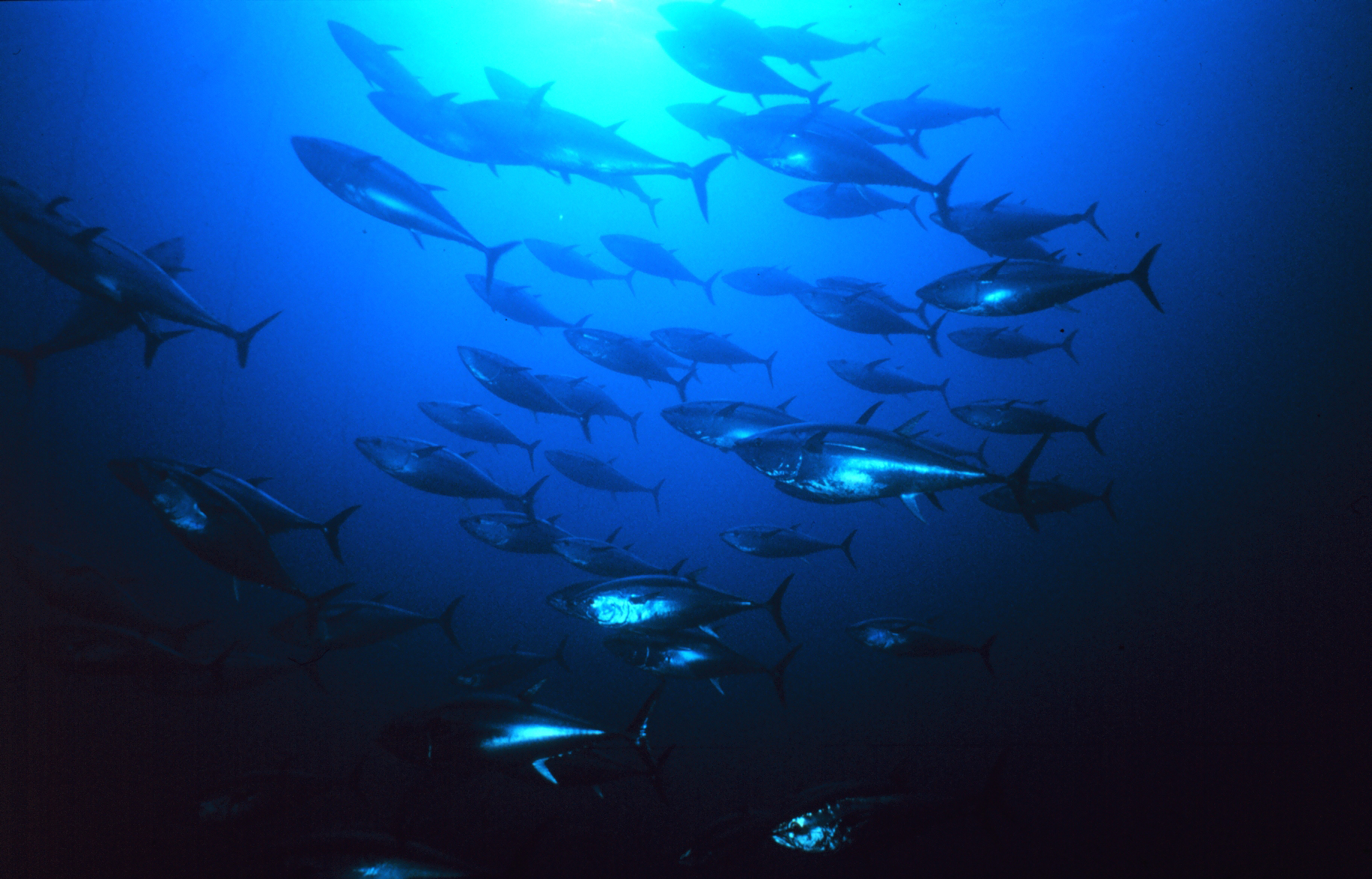
Ivan Macfadyen had sailed exactly the same course from Melbourne to Osaka, all he'd had to do to catch a fish from the ocean between Brisbane and Japan was throw out a baited line.
"There was not one of the 28 days on that portion of the trip when we didn't catch a good-sized fish to cook up and eat with some rice," Macfadyen recalled.
But this time, on that whole long leg of sea journey, the total catch was two.
No fish.
No birds.
Hardly a sign of life at all.
"In years gone by I'd gotten used to all the birds and their noises," he said.
"They'd be following the boat, sometimes resting on the mast before taking off again. You'd see flocks of them wheeling over the surface of the sea in the distance, feeding on pilchards."

McFadyen sets sights on Osaka race finish

But in March and April this year, only silence and desolation surrounded his boat, Funnel Web, as it sped across the surface of a haunted ocean.
North of the equator, up above New Guinea, the ocean-racers saw a big fishing boat working a reef in the distance.
"All day it was there, trawling back and forth. It was a big ship, like a mother-ship," he said.

And all night it worked too, under bright floodlights.
And in the morning Macfadyen was awoken by his crewman calling out, urgently, that the ship had launched a speedboat.
"Obviously I was worried. We were unarmed and pirates are a real worry in those waters. I thought, if these guys had weapons then we were in deep trouble."
But they weren't pirates, not in the conventional sense, at least. The speedboat came alongside and the Melanesian men aboard offered gifts of fruit and jars of jam and preserves.
"And they gave us five big sugar-bags full of fish," he said.
"They were good, big fish, of all kinds. Some were fresh, but others had obviously been in the sun for a while.
"We told them there was no way we could possibly use all those fish. There were just two of us, with no real place to store or keep them. They just shrugged and told us to tip them overboard. That's what they would have done with them anyway, they said.
"They told us that his was just a small fraction of one day's by-catch. That they were only interested in tuna and to them, everything else was rubbish. It was all killed, all dumped. They just trawled that reef day and night and stripped it of every living thing."

Macfadyen felt sick to his heart.
That was one fishing boat among countless more working unseen beyond the horizon, many of them doing exactly the same thing.
No wonder the sea was dead.
No wonder his baited lines caught nothing.
There was nothing to catch.
If that sounds depressing, it only got worse.

NOAA has mapped all marine debris sightings reported to DisasterDebris@noaa.gov
as possible tsunami debris, using NOAA's ERMA® tool.

The next leg of the long voyage was from Osaka to San Francisco and for most of that trip the desolation was tinged with nauseous horror and a degree of fear.
"After we left Japan, it felt as if the ocean itself was dead," Macfadyen said.
"We hardly saw any living things. We saw one whale, sort of rolling helplessly on the surface with what looked like a big tumour on its head. It was pretty sickening."
"I've done a lot of miles on the ocean in my life and I'm used to seeing turtles, dolphins, sharks and big flurries of feeding birds. But this time, for 3000 nautical miles there was nothing alive to be seen."

In place of the missing life was garbage in astounding volumes.
"Part of it was the aftermath of the tsunami that hit Japan a couple of years ago. The wave came in over the land, picked up an unbelievable load of stuff and carried it out to sea. And it's still out there, everywhere you look."

Ivan's brother, Glenn, who boarded at Hawaii for the run into the United States, marvelled at the "thousands on thousands" of yellow plastic buoys.
The huge tangles of synthetic rope, fishing lines and nets. Pieces of polystyrene foam by the million. And slicks of oil and petrol, everywhere.

 The University of Hawaii’s International Pacific Research Center created a graphic showing the projected dispersion of debris from Japan

Countless hundreds of wooden power poles are out there, snapped off by the killer wave and still trailing their wires in the middle of the sea.
"In years gone by, when you were becalmed by lack of wind, you'd just start your engine and motor on," Ivan said.
Not this time.
"In a lot of places we couldn't start our motor for fear of entangling the propeller in the mass of pieces of rope and cable. That's an unheard of situation, out in the ocean.
"If we did decide to motor we couldn't do it at night, only in the daytime with a lookout on the bow, watching for rubbish.
"On the bow, in the waters above Hawaii, you could see right down into the depths. I could see that the debris isn't just on the surface, it's all the way down. And it's all sizes, from a soft-drink bottle to pieces the size of a big car or truck.
"We saw a factory chimney sticking out of the water, with some kind of boiler thing still attached below the surface. We saw a big container-type thing, just rolling over and over on the waves.
"We were weaving around these pieces of debris. It was like sailing through a garbage tip.
"Below decks you were constantly hearing things hitting against the hull, and you were constantly afraid of hitting something really big. As it was, the hull was scratched and dented all over the place from bits and pieces we never saw."

Plastic was ubiquitous.
Bottles, bags and every kind of throwaway domestic item you can imagine, from broken chairs to dustpans, toys and utensils.
And something else.
The boat's vivid yellow paint job, never faded by sun or sea in years gone past, reacted with something in the water off Japan, losing its sheen in a strange and unprecedented way.

 Radioactive water from Fukushima is systematically poisoning the entire Pacific Ocean
On March 30, 2011, the Japan Central News Agency reported the monitored radioactive pollutions that were 4000 times higher than the standard level.
Whether or not these nuclear pollutants will be transported to the Pacific-neighboring countries through oceanic circulations becomes a world-wide concern.
The time scale of the nuclear pollutants reaching the west coast of America is 3.2 years if it is estimated using the surface drifting buoys and 3.9 years if it is estimated using the nuclear pollutant particulate tracers.

The half life of cesium-137 is so long that it produces more damage to human.
Figure above gives the examples of the distribution of the impact strength of Cesium-137
at year 1.5 (panel (a)), year 3.5 (panel (b)), and year 4 (panel (c)).

BACK in Newcastle, Ivan Macfadyen is still coming to terms with the shock and horror of the voyage.
"The ocean is broken," he said, shaking his head in stunned disbelief.
Recognising the problem is vast, and that no organisations or governments appear to have a particular interest in doing anything about it, Macfadyen is looking for ideas.
He plans to lobby government ministers, hoping they might help.
More immediately, he will approach the organisers of Australia's major ocean races, trying to enlist yachties into an international scheme that uses volunteer yachtsmen to monitor debris and marine life.
Macfadyen signed up to this scheme while he was in the US, responding to an approach by US academics who asked yachties to fill in daily survey forms and collect samples for radiation testing - a significant concern in the wake of the tsunami and consequent nuclear power station failure in Japan.
"I asked them why don't we push for a fleet to go and clean up the mess," he said.
"But they said they'd calculated that the environmental damage from burning the fuel to do that job would be worse than just leaving the debris there."

Links :
  • NOAA : Japan tsunami marine debris 
  • RT : Radioactivity level spikes 6,500 times at Fukushima well, radioactive water flowing into Pacific Ocean 
  • National GeoGraphic : Great Pacific garbage patch, Pacific trash vortex 
  • CNES : Fukushima - Forecasting radiation dispersal at sea