Timelapse of a deep sea scene
— Science girl (@gunsnrosesgirl3) September 7, 2025
Nothing is wasted in nature
pic.twitter.com/F5a4CewCUi
Saturday, October 4, 2025
Deep sea scene : nothing is wasted in the nature
Friday, October 3, 2025
Gaza Sumud flotilla: How Israel breaks international maritime law

(Al Jazeera)
From Aljazeera by Hanna Duggal
The Global Sumud Flotilla says its fleet of over 50 ships has entered the ‘high-risk zone.’
A Gaza-bound aid flotilla is currently sailing toward the enclave, entering a high-risk zone where previous missions have faced attacks and interceptions.
On Wednesday, Israel’s public broadcaster Kan reported that the Israeli military is preparing to “take control” of the flotilla with naval commandos and warships. Israel wont tow all 50 vessels however and will sink some at sea, Kan said.
Israel intends to detain hundreds of activists on naval ships, question them then deport them via the port of Ashdod.
The Global Sumud Flotilla, which set sail from Spain on August 31, is the largest maritime mission to Gaza to date.
The Global Sumud Flotilla, which set sail from Spain on August 31, is the largest maritime mission to Gaza to date.
It brings together more than 50 ships and delegations from at least 44 countries, as part of an international effort to challenge Israel’s naval blockade and deliver aid to Gaza.
The map below shows the latest location:
(Al Jazeera)
So, is Israel entitled to board ships that are in international waters?
The answer is no, here’s how territorial and international waters work.
Which waters does a country control?
Coastal countries control the waters closest to their shores, called territorial waters, which extend 12 nautical miles (22km) from the coast.
In this zone, the state has full sovereignty, just like over its land.
Beyond that, they have rights over up to 200 nautical miles (370 km) of ocean, including the water and seafloor.
Beyond that, they have rights over up to 200 nautical miles (370 km) of ocean, including the water and seafloor.
This area is called the Exclusive Economic Zone (EEZ). In the EEZ, countries can regulate activities such as fishing, mining, drilling, and other energy projects, while still allowing other countries freedom of navigation.

France has the largest EEZ, covering approximately 10.7 million square kilometres (4.2 million sq miles), thanks to its overseas territories.
France has the largest EEZ, covering approximately 10.7 million square kilometres (4.2 million sq miles), thanks to its overseas territories.
It is followed by the US, Australia, Russia, and the UK.
Where are international waters?
Covering about 64 percent of the ocean, the high seas lie beyond any country’s territorial waters and economic zones and are not controlled by a single state, with their use governed by international agreements.
Where are international waters?
Covering about 64 percent of the ocean, the high seas lie beyond any country’s territorial waters and economic zones and are not controlled by a single state, with their use governed by international agreements.
What are the laws of the high seas?
The laws of the high seas are governed by the 1982 UN Convention on the Law of the Sea (UNCLOS). It stipulates that all states can enjoy freedom of movement of ships in the high seas and aircraft can fly freely.
Get instant alerts and updates based on your interests.
The laws of the high seas are governed by the 1982 UN Convention on the Law of the Sea (UNCLOS). It stipulates that all states can enjoy freedom of movement of ships in the high seas and aircraft can fly freely.
Get instant alerts and updates based on your interests.
Be the first to know when big stories happen.
Yes, keep me updated
It also allows the laying of subsea cables and pipelines, as well as fishing, scientific research and the construction of islands.
Yes, keep me updated
It also allows the laying of subsea cables and pipelines, as well as fishing, scientific research and the construction of islands.
All three of which are subject to international agreements and laws.
Ships that are on the high seas are subject to the jurisdiction of the flag they fly, except those conducting piracy and other unauthorised activities.
Ships that are on the high seas are subject to the jurisdiction of the flag they fly, except those conducting piracy and other unauthorised activities.
Israel has attacked previous flotillas in international waters
Several Freedom Flotilla vessels have attempted to break the blockade of Gaza since 2010.
All were intercepted or attacked by Israel, mostly in international waters where it has no territorial rights.
The most deadly occurred on May 31, 2010, when Israeli commandos raided the Mavi Marmara in international waters.
The most deadly occurred on May 31, 2010, when Israeli commandos raided the Mavi Marmara in international waters.
The commandos killed 10 activists, most of them Turkish, and injured dozens more, sparking global outrage and severely straining Israel-Turkiye relations.
The map below shows the approximate locations where prominent flotillas were stopped, some encountering deadly Israeli forces.
The map below shows the approximate locations where prominent flotillas were stopped, some encountering deadly Israeli forces.

(Al Jazeera)
In 2024, amid ongoing flotilla missions delivering humanitarian aid to Gaza, UN experts stated that: “The Freedom Flotilla has the right of free passage in international waters, and Israel must not interfere with its freedom of navigation, long recognised under international law.”
The Sumud Flotilla had been sailing through international waters and into Palestinian territorial waters, where it has the legal right to navigate and deliver humanitarian aid.
According to Stephen Cotton, the General Secretary of the International Transport Workers’ Federation (ITF), representing more than 16.5 million transport workers globally, “The law of the sea is clear: attacking or seizing non-violent, humanitarian vessels in international waters is illegal and unacceptable.”
“Such actions endanger lives and undermine the basic principles that keep the seas safe for all.This is not only about seafarers, it’s about the safety of everyone at sea, whether on a commercial ship, a humanitarian vessel, or a fishing boat. States cannot pick and choose when to respect international law. The seas must not be turned into a theatre of war.” Cotton told Al Jazeera.
According to the Freedom Flotilla Coalition, the mission is not only lawful but also protected under a comprehensive set of international legal instruments.
Including:

- The United Nations Convention on the Law of the Sea (UNCLOS) – Guarantees freedom of navigation on the high seas
- San Remo Manual on International Law Applicable to Armed Conflicts at Sea – Prohibits blockades that cause starvation or disproportionate suffering and forbids the targeting of neutral humanitarian missions
- UN Security Council Resolutions 2720 and 2728 – These binding instruments demand unimpeded humanitarian access and the removal of all barriers to aid delivery
- Convention on the Prevention and Punishment of the Crime of Genocide – Includes the prevention of acts deliberately endangering civilians
- Fourth Geneva Convention – Imposes an obligation to permit the free passage of humanitarian aid and prohibit interference with relief operations and the targeting of civilian infrastructure
- Rome Statute of the International Criminal Court – Criminalises the starvation of civilians as a method of warfare and willful obstruction of humanitarian aid.
Links :
- Aljazeera : ‘Unlawful’: Global condemnation as Israel intercepts Gaza aid flotilla
- AP : What to know about the international flotilla seeking to break Israel’s blockade of Gaza
- Reuters : Israeli military boards several aid boats bound for Gaza
- BBC : Activists say Gaza flotilla circled by Israeli warship
- The Maritime Executive : Flotilla Bound for Gaza Reports it is Being Intercepted
- Jurist : Israel military intercepts Gaza-bound Global Sumud Flotilla in international waters
Thursday, October 2, 2025
The Northwest Passage has the potential to disrupt global trade. But there’s a catch

From Arctictoday by Christopher
Thanks to global warming, the Northwest Passage is increasingly being seen as an alternative to traditional trade routes such as the Suez Canal.
While Arctic seas will certainly become more navigable, there will be challenges and limitations on the types of vessel that can reap the benefits.
What exactly is the NWP?
R.K. Headland of the Scott Polar Research Institute in Cambridge defines seven routes or combinations.
While global warming is rapidly eroding sea ice in the Arctic Ocean, all of the routes have variable draft and seasonal access constraints.
That hasn’t stopped Arctic pundits and the media in general from expressing their optimism for a flood of commercial shipping taking a short cut between the Pacific and Atlantic oceans.
These predictions are based solely on perceived sailing distance reductions and the loss of ice cover.
However, in logistics, it is time rather than distance that matters.
The Arctic is not an open water region, where ship speed is up to an operational directive; prudence is essential, given the consistent presence of ice.
The following photograph shows the result of travelling too fast in the Arctic – even when it appears to be open water.
In this case, the damage to the vessel was probably the result of a glancing blow with a growler (a piece of ice about the size of a grand piano that’s usually awash and difficult to see).

Photograph courtesy of Andrew Kendrick
There are many other considerations.
First and foremost are the basic economics of the route.
For many potential cargos, the new Panama Canal has eliminated what opportunities there were for maximizing cargo lift – and thus minimizing freight rates.
Alternative:
The “Nordic Orion“, which sailed the route in 2013 with 73,500 tonnes of coal from Vancouver to Pori in Finland, had about a $6.00/tonne margin compared with routing via the old canal.
With the new canal, the margin is only $2.00/tonne.
The Northern Sea Route (NSR) shows similar margins.
Another complication for both the NWP and the NSR is that there are relatively few bulk commodities for which a viable case can be made for an Arctic routing.
Margins for bulk commodities are usually considered relative to landed cost, rather than transit time.
After all, what is a day here or there with the delivery of a cargo of coal?
The situation is somewhat different for container shipping, where transit time from factory to user does matter.
Hofstra University looked at transit times from Shanghai to key destinations in the U.S. Prince Rupert in British Columbia had the least time to New York: 19 days via ship and rail.
More importantly, it was only 16 days to the Midwest distribution hub of Chicago.
Estimated time via the all-water NWP to New York was 27 days – one day more than via the Panama Canal.
While ice is a constant in any transit of the NWP, seasonality also plays a role.
The route may never be ice free year-round, and at present the window to transit the different choke points is at best six weeks (The most opportune period is probably the first three weeks of September).
It also has to be considered, with climate change, that storms are more frequent and there are ports or other places of refuge.
Temperatures are well below freezing from November through April, and in Lancaster Sound, one can expect three months of continuous darkness.
In the absence of bulk cargoes and container shipping, what traffic can one expect to benefit from the NWP?
Wagenborg, the Dutch project cargo specialist, has been moving quite a few of its ice class vessels east and west via the Arctic.
Eastbound from China, cargoes are primarily carbon anodes for Canadian aluminium smelters; westbound it has been mainly wood pulp from the St Lawrence to the Far East, although they recently shipped several cargoes of lumber from the U.S. Eastern Seaboard to China.
Eight Wagenborg ships used the NWP in 2024, some of which made back-to-back transits.
One tanker delivered a fuel cargo from Washington state to a mine site in the western Arctic, and then continued to the Atlantic.

Map showing the different choke points that have to be negotiated
Drawn by the history of the route, the spectacular scenery and exceptional wildlife, expedition cruise ships have been frequent travellers, and eight ships made transits in 2024.
However, the most consistent sailors in the NWP are small craft.
Last year, 20 “adventurers” made the trip, some of which were quite large and, technically, small cruise ships (there were three of these mega-yachts in 2024).
Is this the future of the NWP?
Or will the route become a genuine game-changer for global trade?
Only time will tell.
Links :
- GeoGarage blog :The Northwest Passage has the potential to disrupt global ... / The Northwest Passage / Cruising the Northwest Passage / In 1845 explorers sought the Northwest Passage—then ... / Sailing the Northwest Passage : A family's adventure into ... / These maps show the epic quest for a Northwest Passage / A brief history of voyages through the Northwest Passage / Alaska to Greenland via the Northwest Passage / Ship found in Arctic 168 years after doomed Northwest ... / 1957 Coast Guard cutters around the continent North West ... / Arctic mapping to make navigating Northwest Passage safer / The future of the Arctic economy
- Arctic Today : Sea Legend launches China-Europe shipping route / Moscow pushes Arctic shipping towards disaster / On thin ice: The hidden costs of Northern Sea Route shipping / Russia needs more resources to handle emergencies on the Northern Sea Route
Wednesday, October 1, 2025
Unique digital connection results in digital nautical chart with accurate terminal and berth information

port of Rotterdam NLHO ENC in the GeoGarage platform
From HellenicShippingNews
The Port of Rotterdam Authority is constantly working on Port Call Optimisation: ensuring that ship visits run as safely and efficiently as possible.
From departure from the previous port until leaving the port of Rotterdam.
An important step in this process is the accurate positioning of terminals and berths.
Thanks to a collaboration between the Port of Rotterdam Authority and the Royal Netherlands Navy Hydrographic Service (Hydrographic Service), the location data for this infrastructure has become much more accurate and accessible to all parties in the maritime chain.
Various port users benefit from this in both the contractual and operational phases.
Previously, location data was based on the names of terminals and berths.
When ownership changed, the name often changed as well, which could lead to confusion.
That is why unique Global Location Numbers (GLNs) have now been assigned to port infrastructure worldwide.
These GLNs are already in use in the logistics sector and have now been integrated into the Harbour Master Management System (HaMIS) and the Port Community System (PCS) Portbase—the core systems of the Port of Rotterdam.
Because the Harbour Master uses this data daily in notifications, the data is highly reliable.
Updates are performed twice daily, during which changes to the datasets are shared.
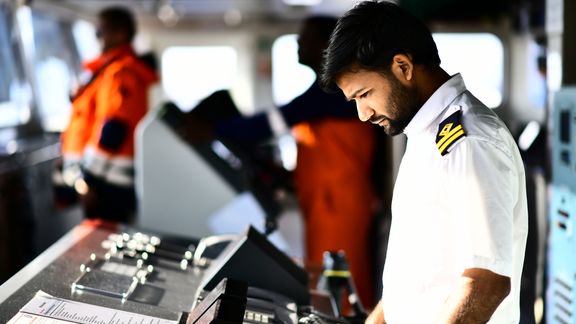
Photo: Danny Cornelissen
Hydrographic Service
Captains of seagoing vessels require detailed information in order to plan their voyages and navigate safely in accordance with IMO Resolution A.893(21).
This data is available in their advanced navigation system ECDIS (Electronic Chart Display and Information System).
An ECDIS uses official Electronic Navigational Charts (ENC).
The Hydrographic Service publishes these ENCs and other nautical products.
Each country has its own Hydrographic Service, which is the only entity authorized to publish ENCs.
Port authorities are not permitted to do this.
To ensure safe shipping traffic, terminals and berths must be accurately indicated in ENCs.
Hydrographic Services collect data from ports in their country.
If the accuracy of this data cannot be guaranteed, it is usually not included in ENCs.
It is therefore crucial that port authorities and Hydrographic Services share location data correctly and in a standardized manner.
The Port of Rotterdam Authority is the first port authority in the world to achieve this.

port of Rotterdam NLHO ENC in the GeoGarage platform
Single Point of Truth
Shippers need precise location data to comply with clauses relating to safe ports and berths.
The ships they deploy must match the berth, and collecting location data from different databases is time-consuming.
Now there is a single point of truth: one platform with validated location data.
Through an Application Programming Interface (API), shippers can link their systems to Portbase and immediately access the correct data.
Thanks to near real-time updates, ships and berths can be matched automatically.
In addition to captains and shippers, nautical service providers such as pilots and linesmen also benefit from standardization.
Pilots use the same data on the nautical chart as captains.
The standardization of location data eliminates any room for differences in interpretation.
Linesmen can determine the mooring configuration in advance based on accurate location data.
Next steps
In addition to location data, the Port Authority also wants to map the depths and restrictions of terminals and berths in a standardized manner.
These three datasets can be used to assess whether a ship is suitable for the Port of Rotterdam in 99% of cases.
The Port of Rotterdam Authority calls on other port authorities to share their location data with their national hydrographic services in the same standardized manner.
The solution is highly scalable and globally applicable.
Tuesday, September 30, 2025
China research ship 'Loitering' near undersea cables
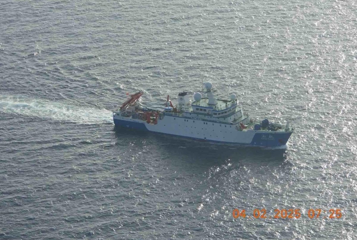 Chinese fisheries research ship the Song Hang operating in the Sulu Sea on April 2.
Philippine Coast Guard
From Newsweek by By Micah McCartney
The irregular movements of a Chinese fishery survey ship in April have raised suspicions that it was collecting data on undersea cables critical to global communications.
The Song Hang "exhibited deliberate loitering patterns directly over critical infrastructure, the kind of movement associated with mapping or surveillance activity, not fishing," maritime analytics firm Windward wrote in a new report.
Why It Matters
The Chinese Communist Party is known to leverage both military and civilian sectors to advance political and economic objectives.
This strategy extends to the maritime domain, where Chinese vessels have been accused of collecting intelligence and of conducting oceanographic research in other countries' maritime zones without permission—an act that violates international law.
The Song Hang's apparent focus on submarine cables is particularly sensitive as these cables carry about 99 percent of intercontinental data traffic.
The Song Hang's apparent focus on submarine cables is particularly sensitive as these cables carry about 99 percent of intercontinental data traffic.
Over the past two years, there have been multiple incidents of Chinese vessels damaging or severing these cables—including one case in February where Taiwanese authorities detained the crew on suspicion of sabotage.
What To Know
Windward, which tracks global vessel behavior using artificial intelligence, on Monday published an analysis of ship-tracking data highlighting an "unmistakable" difference between the Song Hang's movements and the "natural, erratic" ones of known fishing vessels.
The Song Hang's grid-like paths last month, consistent with survey activity, were concentrated directly over and adjacent to Pacific undersea cables east of Japan and east of the Philippines.
Windward also cited other "red flags" linked to the vessel, including "discrepancies between its transmitted and registered IMO, an unclear ownership trail, and a moderate illegal, unreported, and unregulated fishing risk score."
The Song Hang's activities detailed by Windward aren't the only ones to have come under scrutiny in recent weeks.
In early April, the ship attracted the attention of the Philippine Coast Guard as it entered the Sulu Sea, within the country's archipelagic waters.

Responding to radio hails, the crew said it was headed to the Indian Ocean to "catch fish," Philippine Coast Guard spokesperson Jay Tarriela told reporters.
However, observers said the Song Hang was taking a highly indirect route. A National Security Council official said Manila would continue to monitor the vessel "to ensure that it keeps to its track and it does not conduct maritime survey inside our waters."
While innocent passage is permitted through a country's archipelagic waters, conducting survey activity is not, according to the United Nations Convention on the Law of the Sea.
The Song Hang was launched in 2017 as China's first oceangoing fishery survey ship. Operated by Shanghai Ocean University, it is equipped with laboratories and capable of biological, meteorological and hydrological research.
"It has great significance in tapping into China's ocean fishery resources, protecting ocean ecology and transforming China into a maritime power," said Chen Xinjun, the president of the university's College of Marine Sciences, as quoted by China Daily.
What People Have Said
Ray Powell, the director of the Stanford University-affiliated maritime analysis group SeaLight, wrote on X, formerly Twitter: "Remember China's Song Hang research ship? ...
The ship told the Philippine Coast Guard it was on its way to go 'fishing' in the Indian Ocean. Seriously. Now Windward has analyzed its patterns to show how its favorite 'catch' is intelligence on undersea cables."
What Happens Next
Despite complaints from its neighbors, China is likely to continue deploying research ships, including the Song Hang, on intelligence-gathering missions in the region.
Links :
- Newsweek : Satellite Imagery Captures Chinese Aircraft Carrier in Contested Waters / Photos Show Chinese Ship Detected in Waters Claimed by US Ally / South China Sea Convoy Challenges Beijing's Territorial Claims / US Aircraft Carrier Returns to South China Sea
- Global Taiwan : China’s Undersea Cable Sabotage and Taiwan’s Digital Vulnerabilities
Monday, September 29, 2025

Mining the Arctic's precious resources is a fool's errand

LWM/NASA/LANDSAT/Alamy
From The New Scientist
The Arctic is a land of riches – not just in its beauty, wildlife and cultural heritage, but in the kinds of commodities we value most: oil, gas, lithium, cobalt, gold and more.
Yet those treasures are no good to us.
Yet those treasures are no good to us.
As our special report on polar science reveals (see “Why vanishing sea ice at the poles is a crisis for the entire planet”), extracting the abundant resources of the Arctic for commercial gain is tricky.
Trying to haul oil and gas from the region is an expensive business, even with the dubious tailwind of melting sea ice helping to clear new patches of ocean for drilling.
Trying to haul oil and gas from the region is an expensive business, even with the dubious tailwind of melting sea ice helping to clear new patches of ocean for drilling.
As industry and transport gradually shift to electric and hydrogen power, oil demand will fall, making the expense ever harder to justify.
It is a similar story for minerals, too. Greenland is a hotspot for in-demand materials, perhaps one reason why US President Donald Trump is aggressively pursuing its takeover.
It is a similar story for minerals, too. Greenland is a hotspot for in-demand materials, perhaps one reason why US President Donald Trump is aggressively pursuing its takeover.
But even leaving aside Greenland’s lack of infrastructure – roads are hard to come by on this icy island – this is a risky place to invest. The landscape is changing fast as glaciers melt, revealing new, precarious coastlines that threaten landslides and tsunamis.
For a hard-nosed business executive, there are easier, less hazardous places to mine
Across the terrestrial Arctic, melting permafrost is destabilising existing roads, buildings and industrial sites.
For a hard-nosed business executive, there are easier, less hazardous places to mine
Across the terrestrial Arctic, melting permafrost is destabilising existing roads, buildings and industrial sites.
For a hard-nosed business executive, there are easier, less hazardous places to mine.
Viewing the Arctic as a ticket to bountiful economic growth is a fool’s errand.
Viewing the Arctic as a ticket to bountiful economic growth is a fool’s errand.
Instead of seeing it as a region ripe for exploitation, we should treat it as a scientific wonder, while also respecting the people who live there.
After all, as the fastest-changing region on Earth, it is at the vanguard of our climate future.
And there is so much still to learn: how quickly might the ice disappear?
How fast will sea levels rise?
And what happens if and when the ice is gone?
On a more positive note, researchers are pioneering ever more inventive ways to unlock these mysteries, from a new “drifting” laboratory to ultra-deep ice drills and state-of-the-art submarines.
On a more positive note, researchers are pioneering ever more inventive ways to unlock these mysteries, from a new “drifting” laboratory to ultra-deep ice drills and state-of-the-art submarines.
The Arctic is overflowing with opportunities for exploration and discovery.
We just need to let go of the idea of monetising them.
Sunday, September 28, 2025
The hidden world of seamounts
Seamounts are important deep sea ecosystems.
Breaking the flat monotony of the abyssal plains, these underwater mountains emerge from the mud. Those that rise less than 1,000 m (3,000 feet) above the plains are called abyssal hills, while anything taller is a seamount.
And there are at least 100,000 of them, with over half found in the Pacific Ocean near the tectonic plate boundaries. An unsurprising statistic, for Seamounts are formed from volcanism.
The same process responsible for the formation of many island chains.
At mid-ocean ridges, the converging tectonic plates collide at boundaries called subduction zones.
One plate is subducted, or forced down towards the Earth’s molten interior.
As it is subducted, the crust melts and becomes magma, which rises through the rock and erupts to form volcanoes and seamounts.
As it is subducted, the crust melts and becomes magma, which rises through the rock and erupts to form volcanoes and seamounts.
Watch Part 2 - Islands:
• The Hidden World of Islands 00:00 - An Introduction to Seamounts
02:00 - Chapter 1: Mountains in the Deep - How Seamounts Form
03:30 - Chapter 1: Mountains in the Deep - The Pacific Ring of Fire
04:33 - Chapter 2: An Underwater Paradise - The Perfect Ecosystem
06:41 - Chapter 2: An Underwater Paradise - The Life of Seamounts
07:30 - Chapter 2: An Underwater Paradise - The Davidson Seamount
08:23 - Chapter 2: An Underwater Paradise - The Coral Gardens
10:05 - Chapter 2: An Underwater Paradise - The Octopus Garden
11:18 - Chapter 3: The Land of Volcanoes - Hawaii's Island Chains
12:09 - Chapter 3: The Land of Volcanoes - Island Preview

Subscribe to:
Posts (Atom)