Saturday, March 7, 2026

Friday, March 6, 2026

Iraq submits updated maritime boundaries to United Nations; Kuwait lodges protest

The new maritime map includes areas claimed by Kuwait [Getty]

From NewArab by Dana Taib Menmy


Iraq has filed a new map showing its maritime borders and saying that this is in compliance with international law, but this has caused an incident with Kuwait


The Iraqi Ministry of Foreign Affairs on Saturday announced that it had submitted updated geographic coordinates to the United Nations, thereby formally delineating Iraq’s maritime boundaries in accordance with the 1982 United Nations Convention on the Law of the Sea.

This submission prompted an official protest from Kuwait, which contends that elements of Iraq’s filing infringe upon Kuwaiti maritime sovereignty.

In a statement, Iraq's foreign ministry said that the submission was delivered to the UN Secretary-General on 19 January and 9 February 2026. It contains specified geographic coordinates and an illustrative map, as mandated by Articles 16(2), 75(2), and 84(2) of the convention.

The ministry indicated that the submission defines Iraq’s straight baselines and those based on the lowest low-water line for measuring its territorial sea.

It further delineates the boundaries of Iraq’s territorial sea, contiguous zone, exclusive economic zone (EEZ), and continental shelf. The coordinates were prepared using the internationally recognised World Geodetic System 1984 (WGS-84).


The ministry stated that this filing supersedes previous submissions from December 7, 2021, and April 15, 2011. The update aims to align Iraq’s maritime data with international law and to enhance legal clarity regarding its maritime zones.

The coordinates and map are accessible on the official website of the UN Division for Ocean Affairs and the Law of the Sea, under the Office of Legal Affairs, for use by member states and stakeholders.

The Iraqi Foreign Ministry reiterated Iraq’s commitment to international law and its intention to regulate maritime rights within established legal frameworks, thereby promoting regional stability and cooperation.

Kuwait Summons Iraqi ChargĂ© d’Affaires

In response, the Kuwaiti Ministry of Foreign Affairs stated on Saturday that it had expressed concern about Iraq’s submission of maritime coordinates and the accompanying map to the United Nations.

Kuwait asserted that Iraq’s submission includes claims affecting Kuwaiti sovereignty over specific maritime areas and features, such as Fasht Al-Qaid and Fasht Al-Aij, which Kuwait maintains have never been subject to dispute concerning its full sovereignty.

 
The ministry indicated that the submission defines Iraq’s straight baselines and those based on the lowest low-water line for measuring its territorial sea.

The Kuwaiti Foreign Ministry summoned the Iraqi chargĂ© d’affaires and delivered an official protest rejecting what it described as Iraqi claims infringing upon Kuwait’s maritime sovereignty and associated features.

Kuwait urged Iraq to consider the historical relationship between the two countries and to act in accordance with international law, the 1982 United Nations Convention on the Law of the Sea, and existing bilateral agreements and memoranda of understanding.

This development occurs amid ongoing legal and political repercussions arising from Iraq’s maritime arrangements with Kuwait, particularly following the Supreme Federal Court's annulment of the Khor Abdullah maritime agreement in 2023.

The treaty, signed in 2012 and ratified by Iraq’s parliament in 2013 as Law 42, regulated navigation in the Khor Abdullah waterway. The court ruled it unconstitutional because the required two-thirds parliamentary majority for ratifying international agreements was absent.


The ruling initiated debate concerning Iraq’s constitutional obligations, international commitments, and maritime rights in the Gulf. It also raised concerns in Kuwait and further complicated bilateral maritime arrangements.

Some Iraqi lawmakers and legal experts argue that the annulment renders the treaty void and obliges the government to notify the United Nations and the International Maritime Organisation.

In contrast, other government officials maintain that the agreement remains valid until it is replaced or re-ratified through constitutional procedures.

In April, independent MP and former transport minister Amir Abdul Jabbar Ismael filed a complaint against Prime Minister Mohammed Shia al-Sudani under Article 329 of the Iraqi Penal Code, which addresses abuse of power and obstruction of justice.

Ismael alleged that al-Sudani instructed ministries not to forward the court’s ruling to the UN and the International Maritime Organisation, as required by the annulled treaty.

Sheikh Latif Mustafa, a constitutional law expert and former Iraqi MP, stated last year to The New Arab that the treaty cannot be reinstated unless the court reverses its decision or parliament reapproves the agreement with the requisite majority, both of which he considers improbable.

Numerous experts and public figures have instead advocated for renewed negotiations with Kuwait under updated legal and maritime frameworks and the debate has highlighted Iraq’s broader maritime vulnerabilities, as a nearly-landlocked nation.

On July 17, 2025, Iraq and Kuwait held the tenth session of their Joint Technical and Legal Committee on maritime borders. Discussions focused on the area beyond UN marker 162, the final point established under United Nations Security Council Resolution 833 in 1993.

While Kuwait confirmed the meeting, Iraq has not issued a formal statement. Reports of the talks drew criticism from Iraqi lawmakers and former officials, who warned that negotiations beyond marker 162 could undermine Iraq’s sovereignty and affect access to key infrastructure such as the Grand Faw Port.

Thursday, March 5, 2026

At least 1,000 civilian ships in the Persian Gulf are experiencing navigation problems due to electronic warfare


Straight lines indicate interference with satellite navigation
Starboard Maritime Intelligence for The Insider
 
From The Insider 

Since Feb. 28, at least 1,000 civilian ships in the waters of the Persian Gulf have encountered navigation difficulties due to large-scale GPS disruptions.
The development, picked up from maritime monitoring data and sharp “jumps” in the routes depicted on electronic maps, was shared with The Insider by analysts from the Starboard Maritime Intelligence service.

The specialists said there are signs of the substitution of navigation signals, causing vessels to receive incorrect coordinates.
 
Source: EU Sentinel-2
 
In a number of cases, routes on automatic identification systems (AIS) are displayed as straight lines crossing open water — and even land — indicating interference with satellite navigation.

The disruptions are linked to the active use of electronic warfare (EW) systems by coastal states in the region — not necessarily only Iran, but possibly also the United Arab Emirates and Qatar.
Jamming and signal distortion could potentially complicate military strikes carried out using satellite-guided weapons.

Over the past 24 hours, at least two ships in the region have been attacked:
  • SKYLIGHT (IMO 9330020), a tanker flying the flag of Palau, was attacked 5 nautical miles north of Khasab, Oman. The crew was evacuated. Four people were reported injured.
Sanctioned tanker SKYLIGHT (IMO 9330020) has reportedly been struck off the coast of Oman near Duqm Port amid military activity linked to Operation Epic Fury.
Windward Remote Sensing Intelligence captured a SAR image of the vessel earlier today (Sunday, 02:05 UTC), confirming its position in the area prior to the reported strike.

  • MKD VYOM (IMO 9284386), a tanker flying the flag of the Marshall Islands, was hit by a projectile above the waterline. The resulting fire was brought under control.
There were also reports of a possible strike on the tanker SEA LA DONNA (IMO 9380532), but that information was not confirmed.
 

Iran says only Chinese ships can pass through the Strait of Hormuz, calling it a “gesture of thanks” for Beijing’s support.
All other vessels are banned, and Tehran warns any unauthorized crossing will be met with military action.

Threat level: critical

The incidents confirm the continuing threat of missile and drone attacks in the Strait of Hormuz and its approaches.
The Joint Maritime Information Center (JMIC) issued a report (made available to The Insider), assessing the situation in the waters of the Gulf of Oman as “critical,” raising the marker from “severe.” The report was prepared jointly with the UKMTO and MSCIO.

JMIC analysts note that increased vessel clustering is expected near UAE ports, along Omani approaches, and in anchorages of the Strait of Hormuz as operators delay transits pending further clarity.
Higher traffic density may create additional navigation risks, including restricted maneuvering space, anchor dragging, and the risk of collisions.

JMIC also points to significant interference with GNSS.
Positional offsets, AIS anomalies, and intermittent signal degradation have also been observed.

The JMIC forecasts that for the next 24-48 hours:
 

The threat of aerial missile and drone attacks will persist.
The risk of collateral damage remains high.
All merchant vessels, regardless of flag or nationality, are at risk.
No recognized authority has declared a formal closure of the Strait of Hormuz.
The risk of mine deployment remains a key factor.
 
Links :

Wednesday, March 4, 2026

Experience: I was adrift on a raft in the Atlantic for 76 days

 
76 Days Adrift—a profoundly immersive documentary that plunges you into the heart of one man's extraordinary survival story.
Steven Callahan, the author of the New York Times bestseller Adrift: 76 Days Lost at Sea, recounts the night of February 4, 1982, when a catastrophic collision with a whale left his boat sinking in the dead of night.
With the Atlantic Ocean surging into his vessel, Steven had only moments to grab what he could before launching himself into the dark, unforgiving sea in a life raft, clutching a basic emergency kit.
For an astonishing 76 days, that fragile inflatable raft became Steven's entire world as he drifted helplessly across the vast expanse of the Atlantic.
Forced to confront his deepest fears, limitations, and the raw power of nature, he discovered an inner strength he never knew he possessed.
Directed by Joe Wein and set to a haunting score by Fall Out Boy's Patrick Stump, 76 Days Adrift is more than just a survival story—it's a powerful meditation on human endurance, resilience, and the profound connection between man and nature.

From The Guardian by Steven Callahan

Ilove boats and I've spent all my life around them.
By my 20s I was designing and building them, one of which was a 6.5m sloop I named Napoleon Solo.
When I was 29, I sailed her alone across the Atlantic.
I'd been dreaming of doing it since I was 12, and the crossing was exhilarating.
On the return journey, the first week was calm, and when a gale started I wasn't too concerned: I knew the boat and I'd been through much worse.
Late that night, something – probably a whale or a large shark – smashed into the boat with a deafening bang, creating a hole in the hull.
I woke up in my bunk, water thundering over me.
Judging by the level it was coming in, I knew she was sinking fast.

I felt an odd mixture of sensations: fear, panic, even slight amusement at the fact that there was a camera attached to the back of the boat taking these dramatic shots of the storm, and my sinking boat, that no one would ever see.
Then I snapped into autopilot.


Steven Callahan shows how he used pencils to make a rough navigation tool that he used aboard his raft, after his boat sank, leaving him adrift for 76 days
Provided by Robert Sennott/ "76 days adrift" 
 
I started to pack my life-raft but realised that I'd have to dive down into the cabin if I wanted to get essential survival items – water, food, flares, a spear gun and sleeping bag.
The boat was almost completely submerged, but I held my breath and went under again and again.
I remember the water below seemed so peaceful compared with the sea raging outside.
It felt like entering a watery tomb.

I clambered, exhausted, on to the inflatable rubber raft and attached it to the end of a rope that was tied to the boat – to me, it still felt like a lifeline.

That night, I huddled under the canopy of my 6ft circular raft with waves beating the sides, constantly baling out water with an old tin can.
Just before dawn, the rope came free from the boat and I knew I was totally alone.
I was now adrift in the middle of the Atlantic, 800 miles west of the Canaries but heading in the opposite direction.
All I had was a little food and enough water for a few days.


Steve Callahan: 'I woke up in my bunk, water thundering over me.
Judging by the level it was coming in, I knew she was sinking fast.' 
Photograph: Billy Black
 
In the coming days, I had a lot of time to think, and I regretted every mistake I'd ever made – I was divorced, and felt I had failed at human relations generally, at business and now even at sailing.
I desperately wanted to get through it so I could make a better job of my life.

I kept a log, fished with my spear gun and made water with a solar still, a contraption that took me days to get working properly, producing just over a pint a day.

Around day 14 I saw a ship, lit a flare and thought I'd been seen – but it just went right on by.
Every morning came with a bit of hope, but by each afternoon I was in despair.
I did see a handful of ships, but none of them saw me.
After a month at sea, I'd drifted right through the shipping lanes.

As I moved into tropical waters, it became hotter and the dehydration unbearable.
One of the worst parts of being adrift for so long was the physical discomfort, the salt-water sores on my skin, the hunger and constant thirst.

By day 50, I'd been struggling for 10 days to keep the raft afloat with a pump after part of it ripped.
I was at my lowest.
I broke down and gave up.
But then I got scared by the thought I would be dead in a few hours; I found a way to fix the raft and it felt like the biggest victory of my life.


The next phase was just hanging on to life, really, looking at my watch, watching the minutes drag by.
In the last few days, the solar stills packed up and I figured this must be the end.
I had three cans of water left.
My body and mind were shutting down; it was as if I could feel all the people who had ever been lost at sea around me.
I had no more to give.

Soon after, I was spotted by some fishermen off Guadeloupe after they'd seen birds hovering over the raft.
The fish guts that I had thrown back into the sea had attracted both seabirds and fish, and a whole eco-system had sprung up around my raft.
By the time the fishermen reached me, I had lost a third of my body weight, and it was six weeks before I could walk properly again.


I still don't regret my 76 days alone in the raft.
To this day I feel enlightened by what I went through because it changed me for the better.
But would I want to be adrift in the ocean again?
No way.
 
Links :

Tuesday, March 3, 2026

Iraq’s nautical charts and the northern Gulf power struggle

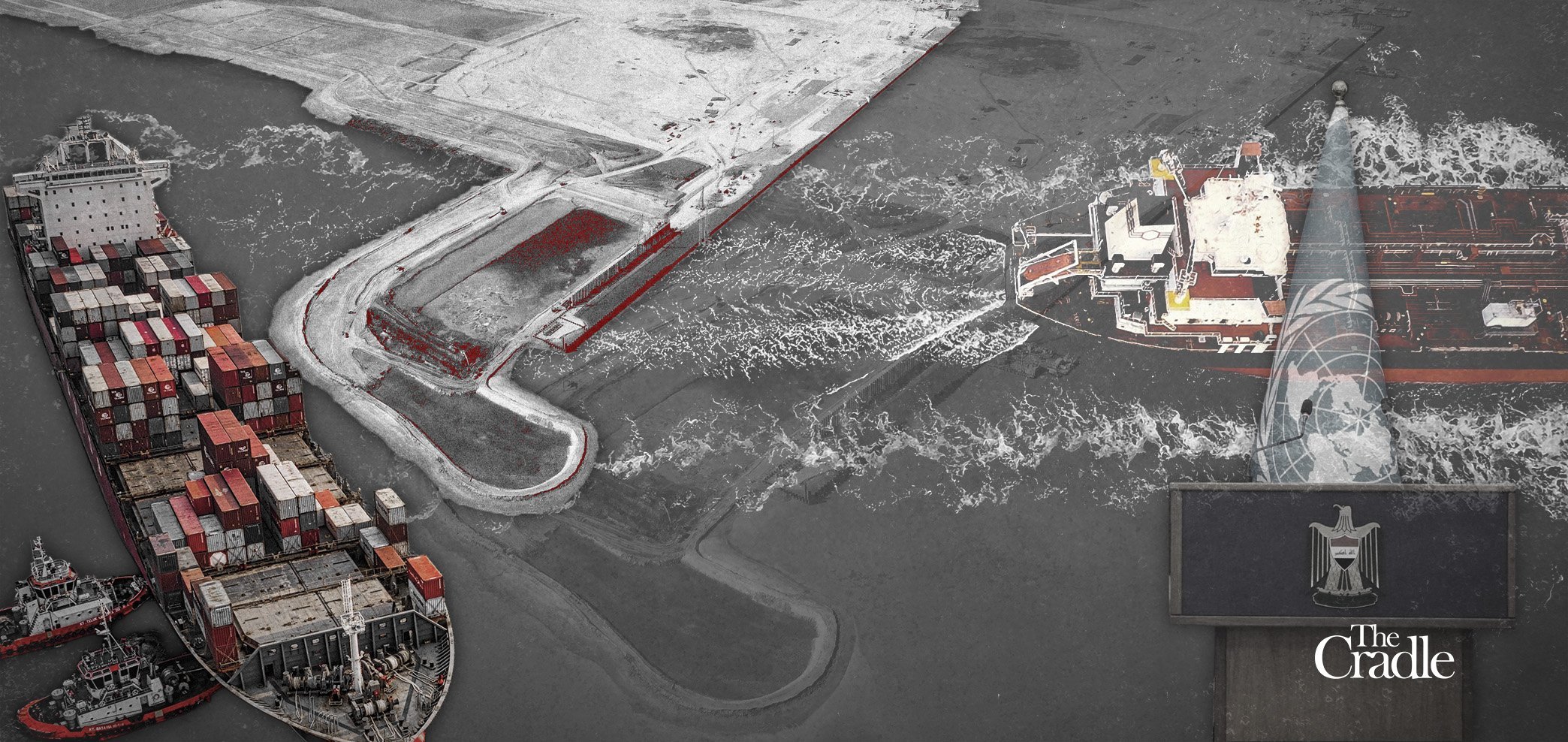
Photo Credit: The Cradle

From The Craddle by Mawada Iskandar

Baghdad’s deposit of new maritime coordinates at the UN reopens a decades-old boundary file and shifts the balance of power across ports, trade corridors, and energy routes in the northern Persian Gulf.

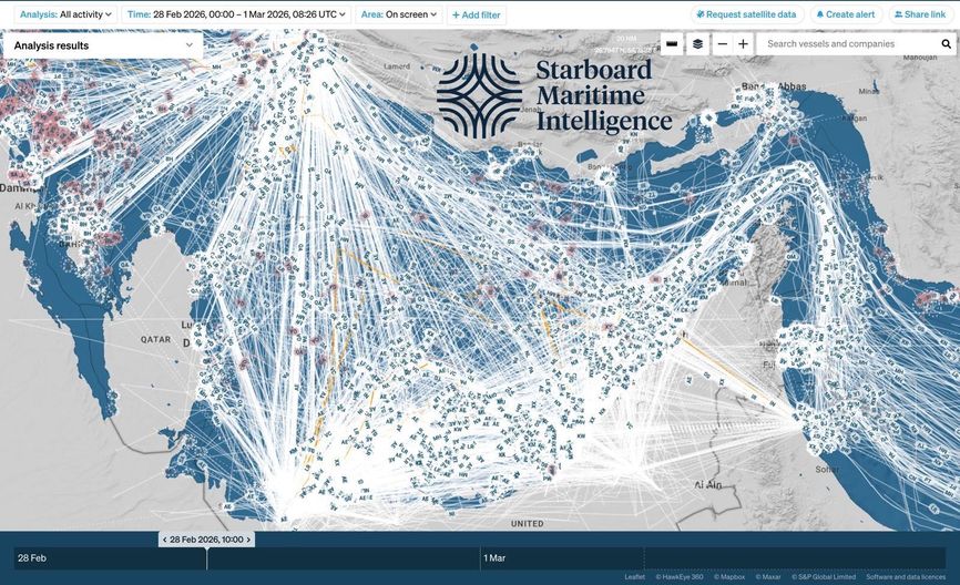
In the northern Persian Gulf, maritime lines have always carried political weight.
What may appear as technical coordinates on a chart often marks the boundary between access and constraint, leverage and vulnerability.

Iraq’s recent deposit of updated nautical charts with the UN – defining its baselines, territorial sea, exclusive economic zone, and continental shelf – has reopened a dispute with Kuwait that traces back to the post-1990 settlement and continues to shape the strategic equilibrium along the Gulf’s northern edge.

On 19 January and 9 February 2026, Iraq formally lodged the coordinates under the UN Convention on the Law of the Sea (UNCLOS), asserting what it describes as its sovereign maritime rights, particularly around Buoy 162 in Khor Abdullah – the narrow artery through which Iraq’s southern ports breathe. The move was framed in Baghdad as long overdue consolidation of national entitlements.

Kuwait responded swiftly, characterizing the step as unilateral and legally contentious, arguing that the Iraqi coordinates intersect with prior arrangements and impinge on Kuwaiti sovereignty in areas including Fasht al-Aij and Fasht al-Qid.
What might appear as cartography has reopened one of the most sensitive files in post-1990 Gulf politics. 
 
Iran-Irak-Kuwait with the GeoGarage platform (UKHO nautical raster chart)

A century-old boundary left unresolved

The maritime dispute between Iraq and Kuwait predates both states in their modern form.
When Kuwait was under British protection following the 1899 agreement, early attempts were made to delineate borders with Ottoman-administered Iraq.
The 1913 Anglo–Ottoman Convention sketched outlines but was never implemented after the outbreak of World War I, leaving Khor Abdullah unresolved.

The 1922 Uqair Conference addressed land boundaries in the region, later formalized in 1932 and acknowledged by Iraq in 1963.
Maritime demarcation, however, remained unsettled.
After Iraq’s 1990 invasion of Kuwait, UN Security Council Resolution 833 (1993) demarcated the land border and divided Khor Abdullah at Buoy 162, leaving deeper maritime areas subject to a bilateral understanding.

Following the 2003 Iraq War and the toppling of Saddam Hussein, Baghdad and Kuwait resumed diplomatic relations and signed the 2012 Khor Abdullah Navigation Agreement, ratified by the Iraqi parliament in 2013 and registered with the UN.

The agreement faced sustained domestic opposition in Iraq.
In September 2023, Iraq’s Federal Supreme Court ruled the ratification unconstitutional due to procedural deficiencies, effectively reopening the maritime file and returning Baghdad to the option of unilateral technical demarcation under international law.
 
The submission defines Iraq’s straight baselines and those based on the lowest low-water line for measuring its territorial sea.
 
What Baghdad’s submission recalibrates

Iraq’s new deposit marks a departure from a maritime status quo that has constrained its access to open waters since 1993.

With only 58 kilometers of coastline and heavy dependence on Khor Abdullah, Iraq has long argued that its maritime depth is structurally limited.
By submitting coordinates consistent with UNCLOS provisions, Baghdad seeks to ground its claims within a formal legal framework rather than rely on provisional understandings.

The coordinates extend into areas where Iraqi interests intersect with those of other Gulf Arab states and Iran.
They also overlap with offshore hydrocarbon prospects, including the Durra/Arash field – contested between Kuwait, Saudi Arabia, and Iran – and areas such as Jamal Tuyina 2.
By formalizing its maritime limits, Iraq positions itself as a recognized stakeholder in any future resource arrangements.

According to Maj. Gen. Jamal al-Halbousi, a member of Iraq’s border demarcation committee, the official objective is regulation of maritime activity, protection of ports, and navigational safety. Strategically, the step strengthens Iraq’s hand in negotiations and signals that Baghdad intends to operate as an equal maritime actor in the northern Persian Gulf rather than a confined littoral state.

Khor Abdullah and the leverage of passage

At the heart of the dispute lies Khor Abdullah, the channel separating Iraq’s Al-Faw Peninsula from Kuwait’s Boubyan and Warba islands.
For Iraq, the waterway connects Umm Qasr and Khor al-Zubair to global trade routes.
Any restriction reverberates immediately through supply chains and revenue streams.

For Kuwait, the same corridor is central to the Mubarak al-Kabir Port project on Boubyan Island. Geography ensures that neither state can ignore the other.
Control over navigation in this narrow passage translates into influence over trade flows in the northern Gulf.

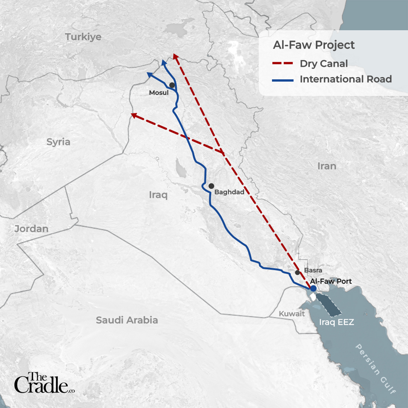
The Development Road and Al-Faw: Iraq’s logistical wager

The maritime recalibration coincides with Iraq’s most ambitious infrastructure undertaking in decades: the Development Road project.
Designed to link Basra to the Turkish border through an integrated network of highways and railways spanning more than 1,200 kilometers, the project aims to position Iraq as a transit corridor connecting Asia to Europe.

At its center stands the Grand Port of Al-Faw, envisioned as a deep-water hub capable of receiving ultra-large container vessels.
The submerged Basra Tunnel beneath the Shatt al-Arab forms a critical component, linking rail and road networks directly to port facilities.

Iraq’s Ministry of Transport has reported advanced completion rates across key segments: the railway link from the tunnel reportedly exceeds 80 percent, the highway component approaches similar levels, and core port infrastructure – including navigation channels and container berths – has progressed significantly.
These figures require independent verification but reflect the government’s narrative of accelerated implementation.

In April 2024, AD Ports Group signed a cooperation agreement with Iraq’s General Company for Ports to support development and operation at Al-Faw.
The same month, Iraq, Turkiye, Qatar, and the UAE signed a memorandum of understanding (MoU) outlining operational frameworks for the Development Road.
The project’s estimated budget stands at approximately $17 billion, structured in phased implementation extending to 2050.

For Baghdad, maritime demarcation and infrastructure expansion are interlinked.
A secure legal maritime footing strengthens investor confidence and reinforces Iraq’s bid to reposition itself as a logistical crossroads within the northern Gulf trade architecture.
 
 
Map of Iraq's Al-Faw Port and Dry Canal projects.

Mubarak Port and Kuwait’s counterweight

Kuwait’s Mubarak al-Kabir Port, launched in 2011 at an estimated initial cost of $1.1 billion, represents its own strategic gambit.
In December 2025, Kuwait signed a contract valued at nearly $4 billion with China State Construction and Transportation Company to complete the first phase.

The port is expected to integrate with regional rail networks, including proposed Gulf railway links and a Kuwait–Saudi line projected between 650 and 700 kilometers.

These developments situate Mubarak within broader connectivity initiatives linked to Belt and Road corridors.
Its geographic proximity to Iraq and Iran gives it potential leverage as a northern Persian Gulf transshipment node.

Internal Kuwaiti debate has intensified, with parliamentarians criticizing delays and warning that Iraq’s Al-Faw project could erode Kuwait’s share of regional maritime traffic.

Sovereignty, escalation, and political pressure

Iraqi officials insist the UN deposit is a sovereign legal act consistent with UNCLOS.
The Council of Ministers has described it as an affirmation of territorial and maritime rights, while the Foreign Ministry emphasized that the submission cannot be nullified, though objections may be lodged through diplomatic channels.

Members of parliament have framed the coordinates as essential groundwork for offshore resource development and future negotiations.

Lawmakers argue that the maps establish a legal basis for investing in marine resources, including transboundary fields, facilitate management of shared reservoirs, and strengthen the Ministry of Oil’s authority to explore and safeguard national entitlements.

Parliamentary sessions are reportedly being scheduled to translate the technical filing into executive action, including potential steps toward offshore oil and gas exploration in areas covered by the new charts.

At the same time, Iraqi authorities handling the Khor Abdullah file are preparing to formally advance the Federal Supreme Court’s 2023 ruling that invalidated the ratification of the 2012 navigation agreement.
Submitting that ruling within international legal channels would reinforce Baghdad’s argument that previous maritime arrangements lack constitutional standing, potentially reopening discussion of the demarcation at Buoy 162 and beyond.

In effect, the deposit of coordinates is paired with a legal and political escalation designed to reassert Iraqi discretion over how its maritime boundary is interpreted and implemented.

Gulf reactions and regional anxieties

Gulf Cooperation Council (GCC) states have urged Iraq to adhere strictly to international law and bilateral understandings, expressing concern that the coordinates affect areas long regarded as sensitive. Saudi Arabia has signaled apprehension that Iraqi claims intersect with portions of the submerged divided zone shared by Riyadh and Kuwait, an area linked to energy reserves.

Some regional actors worry that a fully operational Al-Faw Port could recalibrate northern Persian Gulf trade patterns, challenging established hubs.
Egyptian and Jordanian commentary has linked the project to broader regional transit dynamics, including implications for the Suez Canal and overland pipelines.

Within Iraq, political figures and activists have rejected what they describe as external pressure.
MP Ali al-Fatlawi criticized Jordan’s alignment with Kuwait and called for a firm national stance to defend sovereign and economic interests.

Media narratives and geopolitical undercurrents

Segments of Gulf media have portrayed Iraq’s move as politically motivated, suggesting it coincides with internal governance uncertainties.
Separately, the Kuwaiti cabinet issued an official statement calling on Iraq to engage in accordance with international law and to take historical relations into account.

Commentators in Kuwait, including the ‎President of the Tarous Center for Studies, Mohammed Al-Thunayan, have speculated about regional power dynamics influencing Baghdad’s decision, including the role of Iran.

On social media platforms, some Kuwaiti voices advanced more assertive positions.
Posts circulated arguing that Kuwait’s maritime facilities extended to Iraq in Khor al‑Zubair in 1993 out of consideration for navigational depth toward Umm Qasr, and that Kuwait should reconsider the balance of regulatory authority within the shared waterway.

Others went further, calling for the quadrilateral Al‑Faw framework – involving Iraq, Turkiye, the UAE, and Qatar – to be linked explicitly to strict compliance with UNCLOS and for a return to the 2012 Khor Abdullah navigation agreement as a precondition for broader cooperation.

These arguments have not been formalized as state policy, but they reveal how rapidly the maritime dispute has become entangled with intra‑Gulf competition.
Debate has also surfaced regarding the participation of Emirati and Qatari entities in Al‑Faw’s development, with some commentators suggesting that regional port rivalries and strategic calculations now intersect with the legal contest over maritime boundaries in the northern Persian Gulf.

What is really at stake in Iraq’s maritime recalibration?
  • Iraq breaking free from post-1990 constraints imposed under exceptional circumstances
  • Kuwait defending a strategic buffer that underpins its northern Gulf leverage
  • A wider Gulf struggle over ports, corridors, and who controls regional trade flows
  • The emergence of a new balance of power in the Persian Gulf shaped by infrastructure, not warships
The legal battleground ahead

Legally, the dispute hinges on methodological principles.

Iraq appears to have relied primarily on the median line approach in defining maritime limits.
Some Iraqi experts argue that Khor Abdullah, as Iraq’s sole deep-water access, justifies consideration of Thalweg principles or geographic necessity doctrines, emphasizing depth and navigational viability.

Resolution 833 remains binding regarding land demarcation, and Iraq’s UN submission does not amend that boundary.
Rather, it establishes coordinates for maritime zones subject to interpretation under UNCLOS.

Article 46 of the Vienna Convention on the Law of Treaties allows states to challenge agreements ratified in violation of constitutional procedures, a provision Baghdad may invoke regarding the 2012 navigation agreement.

Analysts, including commentary published by the Atlantic Council, have suggested that recourse to the International Court of Justice (ICJ) remains a possible avenue should bilateral negotiations stall, pointing to precedents such as the Qatar–Bahrain maritime dispute.

A contest over routes and regional weight

Iraq’s deposit of nautical charts is formally a sovereign administrative act. In practical terms, it forms part of a wider contest over sea lanes, ports, and the economic geography of the northern Persian Gulf.
As Al-Faw and Mubarak advance, maritime lines translate into trade leverage, and infrastructure becomes an instrument of influence.

Baghdad’s decision signals that it does not intend to remain confined by arrangements forged under extraordinary post-war conditions in the early 1990s.
Whether the dispute proceeds through negotiation or international adjudication, the outcome will shape the commercial and strategic architecture of the Gulf for decades.

Maritime coordinates may be measured in degrees and minutes, but their consequences are measured in power.

Links :

Monday, March 2, 2026

What happens if Iran shuts down the Strait of Hormuz?

 
From Wired by Carla Sertin

The Strait of Hormuz is one of the most sensitive pressure points in the global economy. Conflict in Iran could put it at risk indefinitely.

A DISRUPTION IN the Strait of Hormuz—the world’s most critical energy chokepoint—in the aftermath of US-Israeli attacks on Iran would not stay confined to the Gulf.
Analysts say it could trigger a new inflation shock across the global economy, complicating monetary policy and putting pressure on the currencies of energy-importing countries.
The semi-official Tasnim news agency reported that the “Strait of Hormuz is shut down” following the strikes on Iran in the early hours of February 28.
Vessels operating near the strait have also reported VHF radio warnings from Iran’s Revolutionary Guards warning that “no ship is allowed to pass the Strait of Hormuz."
On Sunday morning, authorities in Oman said that an oil tanker was attacked off the country's port of Khasab, which is in the Strait of Hormuz.
It's unclear who conducted the strike.
 

Why the Strait Matters
 
Strait of Hormuz with the GeoGarage platform (UKHO nautical raster chart)

Data from the US Energy Information Administration shows that about 20 million barrels of oil and petroleum products passed through the Strait of Hormuz each day in 2024—roughly one-fifth of global oil consumption.


Infographic showing map of the Gulf with refineries and liquefied natural gas terminals operational in February 2026, as well as maritime tanker traffic in the Gulf region.
INFOGRAPHIC: NALINI LEPETIT-CHELLA AND OMAR KAMAL/GETTY IMAGES

The waterway is also critical for gas markets, with around 20 percent of global liquefied natural gas (LNG) trade moving through the corridor linking the Gulf to the open ocean.

In practical terms, disruption in the strait would remove a significant share of the world’s energy supply from global markets almost immediately.
Legal Status and Market Reactions
The United Kingdom’s maritime monitoring center, United Kingdom Maritime Trade Operations, said radio messages declaring the strait closed are not legally binding under international law.
Under the United Nations Convention on the Law of the Sea, transit through international straits remains protected unless physically prevented.
But markets and shipping companies often react to risk signals long before any formal blockade occurs.
Data cited by S&P Global Commodity Insights showed that vessel traffic in the strait dropped by roughly 40-50 percent within hours on Saturday, as ships rushed to leave the area while new arrivals hesitated to enter.


A motorboat cruises along the shore off the town of Al Jeer on the Strait of Hormuz, with a tanker seen in the background, on February 25, 2026. PHOTOGRAPH: FADEL SENNA/GETTY IMAGES
 
The analysis company's Commodities at Sea monitoring also recorded outbound oil and product flows averaging about 20.4 million barrels per day in February to date, slightly below January levels—evidence that geopolitical tension alone can slow shipments before any physical disruption occurs.
"Hormuz risk is not only about closure but also fleet productivity. If Iran escalates by seizing tankers or using drones to threaten commercial traffic, voyage times and possibly costs for Middle East oil exports would further increase," S&P Global CERA analysts said.
Multiple shipping companies have already reported that they are avoiding the Strait of Hormuz and expect delays and rescheduling of shipments.
 

What Would Closing the Strait Mean?
 
There is no alternative export system at comparable scale. Saudi Arabia and the UAE operate bypass pipelines, but these cover only a portion of Gulf flows, while Iraq, Kuwait, and Qatar lack meaningful alternatives.
If the strait formally closed, most oil exports from the Gulf would be cut off from the world almost immediately
 
How shipping slowed to a stop through the strait of Hormuz
source : The Guardian
 
Even if Saudi Arabia and the UAE pushed their alternative pipelines to the limit, analysts say about two-thirds of Gulf exports would still be stuck.
LNG markets would also be hit.
Qatar, the world’s largest exporter of liquefied natural gas—a super-cooled form of natural gas shipped by tanker—depends almost entirely on the Strait of Hormuz to export its fuel.
If the route were blocked, Asian buyers could lose their key suppliers within days.
Asian economies such as Japan, South Korea, China, and India depend heavily on imported LNG to generate electricity.
Getting oil from elsewhere, like the Atlantic, would mean longer shipping times and higher costs, potentially pushing prices even higher.

 
How It Could Affect Consumers

Historical modeling suggests that sudden loss of Gulf supply could push oil prices sharply higher.
If that happens, the effects would likely reach global consumers quickly: higher gas prices, more expensive airline tickets, and rising transport costs that feed into the price of food and goods.
Financial markets typically react even before physical shortages appear, with oil futures rising, transport-sector equities weakening, and currencies of major energy exporters strengthening as traders price in the risk of disruption.
Strategic petroleum reserves could moderate the shock, but releases take time and cannot fully substitute for Gulf crude grades.
Inside the Gulf, stopping exports would quickly strain government finances.
Countries such as Iraq, Kuwait, and Qatar rely heavily on oil revenues to fund public spending.
If shipments halted, storage facilities could fill rapidly, forcing producers to cut output and lose income.
Shipping effects would extend beyond oil.
Tanker rerouting, insurance repricing, and naval risk zones tend to raise freight rates across bulk commodities and container shipping, impacting worldwide logistics.
 
Links :

Sunday, March 1, 2026

Greenland's Petermann Glacier

 
e-GEOS is monitoring the Petermann Glacier 
since the 2010 using both Modis (optical) and COSMO-SkyMed (RADAR) data.

 
On August 5, 2010, an enormous chunk of ice, roughly 97 square miles in size, broke off the Petermann Glacier, along the northwestern coast of Greenland.
The glacier lost about one-quarter of its 40-mile long floating ice shelf, the Northern Hemisphere's largest.
It's not unusual for large icebergs to calve off the Petermann Glacier, but this new one is the largest to form in the Arctic since 1962.