Saturday, June 11, 2022

America's Cup: Innovations will mark huge year for Team NZ

EMIRATES TEAM NZ 

The new hydrogen-powered chase boat being developed by Team New Zealand for the next America's Cup is set to be launched in March.

 
From Stuff by 
 
Team New Zealand will look to turn a stressful 2021 into a year when their innovation dominates the America’s Cup scene.
 
The defenders had the pressure applied to them by a highly competitive Luna Rossa to retain the Auld Mug in Auckland last March. Within a day of that victory, Team New Zealand were under the pump for their intentions to take the regatta offshore, adamant the funding resources could be found for a home defence.
 
Emirates Team New Zealand COO, Kevin Shoebridge talks to Stuff after the announcement of protocols for the 37th America's Cup


That decision dogged them for the rest of the year as attempts to force them to keep the Cup in Auckland continued against the threat of legal action.

The offshore venues - Cork in Ireland, a multi-city Spanish bid, Jeddah in Saudi Arabia, and a mystery fourth option – remain in play.

Team New Zealand boss Grant Dalton admits the hosting decision could go right down to the wire of their new deadline of March 31.“2021 started stressful for us and ended stressful,” Dalton admitted as he worked to keep the syndicate’s critics at bay.

It’s been a stressful year for Grant Dalton and Team New Zealand as they won the America’s Cup and looked to take the regatta to another level. 
Phil Walter/Getty Images
It’s been a stressful year for Grant Dalton and Team New Zealand as they won the America’s Cup and looked to take the regatta to another level.


The frustration for them is the exciting developments they are achieving with the Cup continue to get swamped by controversies.

Team New Zealand are hoping that can change as the realities of their bold plans come to fruition.

“It’s an innovation year for us,” Dalton says of 2022, when some key dates in the current cycle roll towards the next regatta in 2024.

The venue decision will be vital in several ways and hints of innovation in its destination.

There could be a new feel to the competition if it heads north, as expected, to a neutral venue, a rarity in the history of sport’s oldest trophy that dates back to 1851.

March will also be a month when Team New Zealand’s growing reputation for technological brilliance is on show again.

The prototype of the foiling hydrogen-powered chase boats to be used now sits in Team New Zealand’s base, getting fitted with plans to have it water-tested in March.

The purpose-built catamaran that will carry eight support staff is a futuristic concept - “Think of the Jetsons,” quips Dalton - designed to keep pace with the AC75 yachts that will threaten the 100km/h barrier.

In an era where the environment is everything, it has the ability to be a game-changer for pleasure-boating in a trickle-down effect that is a hallmark of America’s Cup design work.

The current Cup teams can design and build their own, or Team New Zealand are willing to supply them.Team New Zealand have the benefit of the brilliant Te Rehutai to develop their next America’s Cup boat from.

Ricky Wilson/StuffTeam
New Zealand have the benefit of the brilliant Te Rehutai to develop their next America’s Cup boat from. 

Time never sits still in this game and Team New Zealand have 30 designers beavering away in their Auckland base, working on the 40-foot foiling version of the Cup class that enthralled the world from last December to March on the Waitemata Harbour.

These smaller but equally powerful boats will be used for team testing as well as the youth and women’s America’s Cups.

They will be built at a yard in China and Team New Zealand expects to receive the first of them in August, looking to have their sailors in them by September.

The Kiwis will have two, seeing them as essential to developing the match-racing skills they felt weren’t at their best during the successful defence.

DAVID WHITE/STUFF
Key decisions made in 2022 will help decide who drinks from the America’s Cup in 2024.
 
Again, this is an innovation that could have long-term benefits to the sport with the revolutionary auto-pilot system able to manage the boat in flight on its foils, simplifying the requirements of the four-person crew.There are hopes the AC40 could develop into a racing class of its own.

Team New Zealand’s designers are also looking at how they can further improve their Cup-winning design. Te Rehutai was a step ahead of their opposition and will be the platform to launch their next thinking.

With teams allowed to build just one, rather than two, Cup boats in this cycle, the pressure is on to get the design right.
The racing boats aren’t expected to hit the water until late 2023, but with a 10-month build key decisions will be made in 2022.

For new teams - returning Swiss syndicate Alinghi is a “new” team for this cycle with a couple more yet to reveal their intentions - there is the ability to purchase a first generation AC75, and they can sail these from June 17 for a total of 20 days to help get them up to speed with the intricacies of the class.
 
EMIRATES TEAM NZ
The numbers around the next America's Cup.

Entries close on July 22, and it will be interesting to see who else surfaces by then.

There is an allowance for late entries to be accepted up till May 31, 2023 but that late deadline hardly promises a competitive challenge given the complexities involved.

All teams are able to sail their AC75s from September 17 and look for Te Rehutai to be back out on the Auckland waters with a need to get new signing Nathan Outteridge comfortable on the wheel of a full-scaled Cup boat.

By the end of the year the race schedule and the actual racing zone at the new venue will be released.

AT A GLANCE – KEY 2022 DATES FOR AMERICA’S CUP

Early March: Team NZ to launch first hydrogen-powered foiling chase boat.

March 31: Team NZ and Royal New Zealand Yacht Squadron to announce Match venue and approximate event dates.

June 17: New competitors may sail Version 1 AC75’s for 20 sailing days.

July 31: Entry period closes.

Early September: Team NZ to launch first AC40, the smaller-scaled testing boat and youth and women's America’s Cup class.

September 17: Competitors may sail an AC75 yacht.

November 30: Race schedule course areas for the Match and challenger series revealed.

Friday, June 10, 2022

Antarctica: Southern Ocean floor mapped in greatest ever detail


From BBC by Jonathan Amos
 
Scientists have made the most precise map yet of the mountains, canyons and plains that make up the floor of Antarctica's encircling Southern Ocean.

Covering 48 million sq km (18.5 million sq miles), this chart for the first time details a new deepest point - a depression lying 7,432m (24,383ft) down called the Factorian Deep.

Knowledge of the shape of the ocean's bottom is essential to safe navigation, marine conservation, and understanding Earth's climate and geological history.

But we still have much to learn.
Vast tracts of terrain have never been properly surveyed.
 
A close up of the structures seen on the Seabed map released June 7, 2022. Dorschel et al., 2022

The International Bathymetric Chart of the Southern Ocean (IBCSO) has taken five years to compile and updates the first attempt at a comprehensive map, which was published in 2013.

The IBCSO project and others like it around the world are gradually filling in the gaps in our scant knowledge of the bottom of the world's oceans.
Ships and boats are being encouraged to routinely turn on their sonar devices to get depth (bathymetric) measurements; and governments, corporations, and institutions are being urged not to hide away data and put as much as possible into the public domain.
This is paying dividends.
 
IBCSOv2/AWI/Nippon Foundation/Seabed2030
Image caption,
The tracks of surveying ships. Low-resolution satellite measurements must fill in the rest

The new map covers all the Southern Ocean floor poleward of 50 degrees South.
If you divide its 48 million sq km into 500m grid squares, 23% of these cells now have at least one modern depth measurement.
 

Comparaison IBCSO v1 VS v2
 
That's a big improvement on nine years ago.

Back then, IBCSO began only at 60 degrees South, and less than 17% of its grid boxes had a modern measurement.

"You have to realise just what the change from 60 degrees to 50 degrees means; we've more than doubled the area of the chart," said Dr Boris Dorschel from Germany's Alfred Wegener Institute.
"So, we've increased the area coverage, but we've also increased the data density, because, in parallel, we've kept on acquiring new data and knocking on doors to free up existing data," he told BBC News.
 

Much of the information in the chart comes from the ice-strengthened ships that support scientific endeavours in Antarctica, including from the UK's former polar ship, the RRS James Clark Ross.
(In future, this British contribution will come from its successor, the RRS Sir David Attenborough, affectionately known as Boaty McBoatface.)

As these vessels shuttle back and forth between the White Continent and the likes of Chile, South Africa and Tasmania - their echosounders make a habit of surveying the submerged terrain below.

And this activity is increasingly coordinated, with research organisations from different nations working together to try to offset slightly the routes taken by their icebreakers.
 
The UK's new polar ship, the RRS Sir David Attenborough, is equipped to map millions of sq km of ocean bottom over its career.
The above image shows the ship's hull in dry dock.
The yellow rectangle in the centre is a cover made of a synthetic material over the 8m-long array of transmitting transducers for the deep-water multibeam echosounding system.

Better seafloor maps are needed for a host of reasons.

They are essential for safe navigation, obviously, but also for fisheries management and conservation, because it is around the underwater mountains that marine wildlife tends to congregate.
Each seamount is a biodiversity hotspot.

In addition, the rugged seafloor influences the behaviour of ocean currents and the vertical mixing of water.
This is information required to improve the models that forecast future climate change - because it is the oceans that play a pivotal role in moving heat around the planet.

"We can also study how the Antarctic Ice Sheet has changed over thousands of years just by looking at the seafloor," explained Dr Rob Larter from the British Antarctic Survey.
"There's a record of where the ice flowed and where its grounded zones (places in contact with the seafloor) extended. This is beautifully preserved in the shape of the seafloor."

The new map was made possible by financing from Japan's Nippon Foundation and the support from Seabed2030, the international effort to properly chart Earth's ocean floor by the end of the decade.

At the moment, our knowledge of four-fifths of the planet's underwater terrain comes only from low-resolution satellite measurements that have inferred the presence of tall seamounts and deep valleys from the gravitational influence these features have on the sea surface.
Water piles up over the mass of a large submarine mountain and dips slightly where there is a trench. 
 
 
One key finding in the years between the first and second versions of IBCSO is the recognition of the Southern Ocean's deepest point.
It's a depression called Factorian Deep at the far southern end of the South Sandwich Trench.  
It was measured and visited by the Texan adventurer Victor Vescovo in his submarine Limiting Factor in 2019.

The remote and often inhospitable nature of the Southern Ocean means substantial sections of it are unlikely to get mapped unless there is dedicated undertaking.
There's high hope that an emerging class of robotic vessels could be given this task in the years ahead.

The International Bathymetric Chart of the Southern Ocean is published in the journal Scientific Data.

Links :

Thursday, June 9, 2022

Enormous 'rogue waves' can appear out of nowhere. Math is revealing their secrets.

Katsushika Hokusai's iconic woodblock print, Under the Wave off Kanagawa, depicts a large wave many often misidentify as a tsunami.
The large off-shore wave depicted is more likely a rogue wave.
Katsushika Hokusai, The Metropolitan Museum Of Art

From National Geographic by Ally Hirschlag

Once considered a maritime myth, these towering waves can pose serious risks to ships in the open sea.
Now scientists are developing ways to predict them before they strike.


In 1826 Captain Jules Dumont d’Urville, a French scientist and naval officer, was caught in a turbulent storm while crossing the Indian Ocean.
He watched as a wall of water rose some 100 feet above his ship, the Astrolabe.
It was one of several waves more than 80 feet tall that he recorded during the wild storm.
One of his crew was lost to the sea.
Yet after Dumont d’Urville made it back to land, his story, backed by three witnesses, seemed so outlandish that it was dismissed as fantasy.

Scientists at the time believed waves could only reach about 30 feet tall, so the handful of 19th century reports of massive waves rising in the open ocean were largely written off as maritime myths.
Only later would scientists realize that the accounts were rare because many mariners who experienced these so-called rogue waves didn't survive to tell the tale.


Jules Dumont D'Urville's ships, the Astrolabe and Zelee, drawn and lithographed by Louis Le Breton in 1840.
The scene depicts a voyage between 1837 and 1840 to investigate the perimeter of Antarctica.
On a previous expedition about a decade earlier, Dumont D'Urville encountered what he described as a 100-foot wave in the Indian Ocean.
Smith Archive, Alamy Stock Photo


Photograph of a breaking rogue wave in the Southern Ocean taken from the French icebreaker Astrolabe, named after Dumont d'Urville's historic ship, during one of its regular voyages between Hobart, Tasmania, Australia, and the Dumont d'Urville Station in Antarctica.
The shape is remarkably similar to that depicted by Hokusai in Under the Wave off Kanagawa.
Photograph by Veronique Sarano

Today a rogue wave is defined as one that is more than twice as tall as the waves around it.
These giant swells can appear suddenly and seemingly out of nowhere.
With steep sides and a deep trough below, they resemble a wall of water rising out of the sea.
They can occur during storms with choppy seas but have also been reported in calm waters, which is one reason they’re so difficult to predict.

Scientists have recognized rogue waves as real phenomena since the mid-1990s—but keeping sea travelers safe from them is still a major challenge.
Though they are relatively rare, rogue waves can cause severe damage and loss of life if they hit a ship in the open sea.
In the vastness of the ocean, the interaction of the many forces leading to rogue waves can be difficult to untangle.
More recently, mathematicians have been combining real-world data collected from monitoring buoys with statistical models to understand what causes these gargantuan waves to form.
Their work offers hope that we may even be able to predict rogue waves before they strike.


This image reveals the morphology of a rogue wave recreated in the lab at the FloWave Ocean Energy Research Facility at the University of Edinburgh in Scotland.
Photograph By Dr Donald Noble, University Of Edinburg, and Dr Mark Mcallister, University Of Oxford


How waves can grow


As shipbuilding technologies advanced in the 20th century, the number of surviving witnesses to rogue waves grew.
In April 1966 an Italian cruise ship called the Michelangelo met with an 80-foot wave that rose high above the storm-driven waves around it.
The ship sustained significant damage and three people were drowned, but most who were on board made it safely back to shore.

The crew aboard the MS München, a German container ship, weren’t so lucky.
In December 1978 the ship left the German port city of Bremerhaven for Savannah, Georgia, packed with steel cargo and a crew of 28.
After reporting bad weather and sending out distress signals in the early morning hours of December 13, the ship and everyone on it disappeared.
A lifeboat that had been attached to the ship about 65 feet above the water was recovered, but it appeared to have been ripped from its post, likely by a towering wave at least that high.

Scientific doubts about these mysterious, giant waves were not completely dispelled until 1995, when a rogue wave hit the Draupner oil rig, a natural gas platform in the North Sea off the coast of Norway.
The wave’s peak, measured by a laser detector on the rig’s scaffolding, rose 85 feet above the surface.


A monitoring buoy operated by Canadian research company MarineLabs is seen in rough waters, approximately three miles from the site off the coast of British Columbia where another MarineLabs sensor buoy measured an extreme rogue wave in 2020.
Photograph by Mary & Ed Goski


Scientists have since figured out that unlike tsunamis, which are large waves produced by a sudden displacement of water from an event such as an earthquake or landslide, rogue waves form due to a chance combination of wave movements through the ocean.

Two main mathematical theories have emerged to explain the wave movements that spawn rogue waves: Linear addition and nonlinear focusing.
Linear addition assumes that waves travel through the ocean at different speeds, and when they overlap, they can strengthen into a rogue wave.
Nonlinear focusing assumes waves travel in groups and can lend energy to one another, which sometimes spawns a rogue wave.

One reason for the uncertainty is that rogue waves are rare.
Even now, there’s a dearth of quality tracking data.

“Generally ocean rogue waves are measured from platform measurements or buoys, which record time-measurements at a specific location without any knowledge of what happened before or will happen further,” says Amin Chabchoub, a wave physicist at the University of Sydney in Australia.
A 2019 study led by Chabchoub evaluated several rogue wave observations and models, and the team concluded that the inciting rogue wave mechanism can change depending on the varying factors in the sea at a given time, known as the sea state.

To compensate for limited observations of rogue waves, scientists rely on wave tanks.
“Recreations in a laboratory mimic almost one-to-one what happens on the ocean surface,” Chabchoub says.
These experiments can even account for currents and winds, although the controlled settings have their own limitations.

When water is trapped in a narrow channel such as a wave tank, it’s much easier for large waves to form and to be observed.
However, these experiments represent an “unrealistic scenario” because waves cannot spread in all directions as they would at sea, says Francesco Fedele, an ocean engineer at the Georgia Institute of Technology.

The National Oceanic and Atmospheric Administration is developing a system that can forecast potentially hazardous areas of the ocean every hour using a program called WAVEWATCH III. The latest version, released in 2019, uses a probability formula that Fedele developed in 2012 to predict extreme conditions in the ocean at a specific place and time.
It’s a useful tool to help mariners steer clear of dangerous seas, but it may not be enough to protect them from a rogue wave that appears out of the blue.

Johannes Gemmrich, a research scientist at the University of Victoria in Canada who analyzed the 2020 rogue wave near Vancouver Island, says rogue waves are most often generated when waves travel at different speeds and occasionally overlap, supporting the linear addition model.
But he believes wave asymmetry—when waves have higher peaks and lower troughs—plays a crucial role as well.
“If we allow for stronger asymmetry, the probability of extreme rogue waves increases drastically,” Gemmrich says.

A general formula for the sea


One school of mathematicians says it doesn’t matter what causes a rogue wave, because one can still predict rogue waves quite accurately using a statistical framework for rare occurrences called large deviation theory.

The idea behind this method is to model the most efficient way a rogue wave can form, then use that model to chart a particular rogue wave’s path of development.
The theory can factor in linear and nonlinear effects depending on the scenario, which is why its proponents consider it a unifying theory—one that could perhaps be used to predict rogue waves in various ocean conditions.

“If you just look at the absolute most efficient way of forming these waves, it very nicely agrees with the actual observed ones,” says Tobias Grafke, a mathematician at the University of Warwick in the United Kingdom.

Grafke and a team of researchers tested this theory in wave channels, measured results against real-time wave observations, and found the method could predict rogue waves in both settings surprisingly well.

One problem with this framework, however, is that it’s extremely challenging to account for all the factors of a sea state at a specific point in time.
If you’re the captain of a ship, the most helpful forecasting information would be derived from real-time observations, not statistical probabilities.
Grafke says his team’s formula can account for the specifics of a given sea state, but the more variables you fold in, the harder it becomes to solve quickly.

“The more complex these [equations] are, the better the prediction, the higher the computation effort and time,” Chabchoub says.
“It is therefore a trade-off between accuracy and time to obtain useful results.”

Real-time forecasting


Scientists have been moving toward real-time wave prediction technology, but the newer approaches need to be tested in real-life settings—a challenge given the rarity of rogue waves.
In many cases, the computation process needs to be ramped up to match the speed of the waves.

Rogue waves can form in just “10 to 15 seconds in rough seas,” Fedele says.
“It is still hard to make fast and accurate predictions in such a brief time interval.”

To predict a rogue wave, scientists would need a radar system to continuously measure waves near a boat, so they could run data through a mathematical model that paints a picture of the ocean’s surface at that moment.
A model that calculates a new surface every five minutes would offer a relatively accurate prediction of how waves would evolve in the next several minutes.

Such a system is not a reality yet.
“The technology is there. The question now is: How [do] you make it fast?” Fedele says.

As more rogue waves are measured, mathematicians may finally find a way to anticipate these deadly waves before they rise out of the ocean—a technology that Captain Dumont d’Urville could have only dreamed of back in 1826.

Links :

Wednesday, June 8, 2022

Belgium (Vlaamse Hydrografie) layer update in the GeoGarage platform


3 nautical raster charts updated


The dead shellfish littering our beaches tell you a lot about safety and secrecy in Britain


Illustration: Thomas Pullin/The Guardian

From The Guardian by George Monbiot

Environmentalists fear a toxic disaster is occurring on the seabed, and government denials seem less and less plausible


With every passing week, it looks more like a cover-up.
The repeated mass strandings of crabs and lobsters on the coast of north-east England, and the ever less plausible explanations provided by the government, are the outward signs of an undersea disaster and a grim new politics.

Last October, beaches around the Tees estuary and along the coast of North Yorkshire were suddenly covered in dead and dying crabs and lobsters.
The government launched what it called an “investigation”.
In January, hundreds of dogs reportedly fell ill after being walked on the same beaches.
In February, a government press release announced that the mass death of sea creatures was caused by an “algal bloom” – a rapid increase in the population of algae that can release toxins into the water and affect other wildlife.Record low wild salmon catch in Scotland alarms ecologists

No report was published, no data, no evidence of any kind.
An algal bloom in October seems highly unlikely in north-east England, as such blooms require high temperatures and clear water: the sea at the time was almost certainly too cold and turbid.
No bloom had been noticed by the fishing community or any other water users.

Dead crabs on the beach at Seaton Carew.
Photograph: Paul Grainger/PA
 
Soon after the press release was published, another mass death of crabs and lobsters was reported on the same coastline.
While an algal bloom in October is implausible, an algal bloom in February is impossible.
The government reopened its investigation, but promptly shut it down again, on the extraordinary grounds that a few healthy crabs and lobsters had been caught.
Nothing to see here.

Last month, there was another mass stranding of crabs and lobsters on the same beaches.
Divers reported that the seabed immediately south of the River Tees was a “dead zone”: even the seaweed was dying.

The government has still not published its evidence.
When I asked, it refused to send it to me.
It was unable to produce a convincing explanation for this refusal.
So we have no means of determining whether its methodology was robust, whether its data gathering, management and analysis was sound, or whether its conclusions reflected its results.
Transparency is a basic scientific principle: if it’s not published, it’s not science.

A coalition of local commercial fishers and anglers raised the money for an independent investigation by the marine pollution consultant Tim Deere-Jones.
He made a series of freedom of information requests, which revealed that the government’s only evidence for an algal bloom consisted of satellite images.
But such images, without corroboration by water sampling, can be misleading: plumes of sediment can give similar results.
Astonishingly, although there is no evidence that it conducted such sampling, the government concluded not only that a bloom had occurred, but that it was caused by a particular, toxic species: Karenia mikimotoi.
This is the stuff of science fiction.
Karenia thrives in temperatures between 20 and 24C.
The average water temperature on this coast in October is 13C.
There is no plausible mechanism by which a Karenia bloom could cause the mass death of lobsters and crabs without also killing large numbers of fish, sea urchins and many other species.

The freedom of information requests revealed something else: that the levels of a pollutant called pyridine in the north-eastern crabs the government tested were up to 74 times higher than those found in crabs caught in Cornwall.
Pyridine is highly toxic to aquatic life.
Despite this finding, the government press release claimed it has “ruled out chemical pollution as a likely cause”.
It says that “pyridine was not present in water and surface sediment samples collected off the Tees”.
Until we see the evidence, we have no means of knowing when, where and how such samples were taken, or how were they assessed.

Environmental Disaster, North East England Coast
Thousands of dead and dying sea creatures have washed up on the shore. 


Pyridine is a waste product of heavy industry, and is also manufactured as a base for insecticides and marine biocides.
Several of the industries once located on the Tees estuary are likely to have produced it.
Deere-Jones found that there were very high levels of pyridine derivatives in sediments in the estuary.
A dredger started work in the mouth of the Tees at the end of September, deepening the channel.
Deere-Jones’s hypothesis is that the dredger inadvertently exposed contaminated mud.
This was then dumped at the legal disposal sites farther offshore.
The currents flowing southwards, he believes, spread these sediments down the coast.
As pyridine attaches itself to particles that fall to the seabed, and accumulates up the food chain, it is likely disproportionately to affect bottom-living scavengers such as lobsters and crabs.

The government’s insistence that chemical pollution was not responsible might seem hard to understand.
But consider this.
In July, work begins on the Teesside freeport, the biggest and most spectacular of the government’s fabled “Brexit opportunities”.
The project is being overseen by the Conservatives’ favourite mayor, Ben Houchen.

Constructing the Tees freeport will require a massive dredging operation.
To enable ships to dock at the new South Bank Quay in the Tees estuary, a crucial component of the freeport, the channel needs to be deepened from 9m to 13m, and the “berth pocket”, where the vessels moor, to almost 16m.
This means excavating historic sediments that are likely to contain the chemical legacy of Teesside’s old industries.
Questions have been raised about whether these sediments have been properly tested before dredging begins.
If they turn out to be highly contaminated, the expense of removing them safely could be prohibitive.

Freeports have been a magnet for money-laundering, tax evasion, corruption, smuggling, counterfeiting, drug trafficking and terrorist money flows.
Just before the government launched its consultation proposing 10 freeports in the United Kingdom, Brussels announced that it was clamping down on freeports in the European Union.
This helps the UK to consolidate its position as the world’s financial entrepot for organised crime, now a major sector of our economy.
In conjunction with the City of London, which acts as a global hub for tax havens, the flow of criminal money into our property market and the complete collapse of the prevention of fraud and the regulation of waste dumping (a traditional preserve of the mafia in poorly regulated economies), freeports may secure this country’s place as the favoured destination of the rich and unscrupulous.
That’s what Brexit opportunity means.

It’s possible to prevent some of the criminal uses of freeports if they are tightly regulated.
However, the government has so far failed to commit to the OECD’s protocol for preventing illicit trade, and boasts of “cutting red tape” in developing the ports: in other words, dismantling regulations.

If Tim Deere-Jones’s thesis is correct, marine ecosystems are already feeling the effects.
The government could be obscuring the likely impacts of the freeport’s construction before it has begun.
Those dead crustaceans look to me like a tide of dirty money, washing up on our beaches.

Links :

Tuesday, June 7, 2022

How to rescue the world's biggest cargo ships


From BBC by Chris Baraniuk


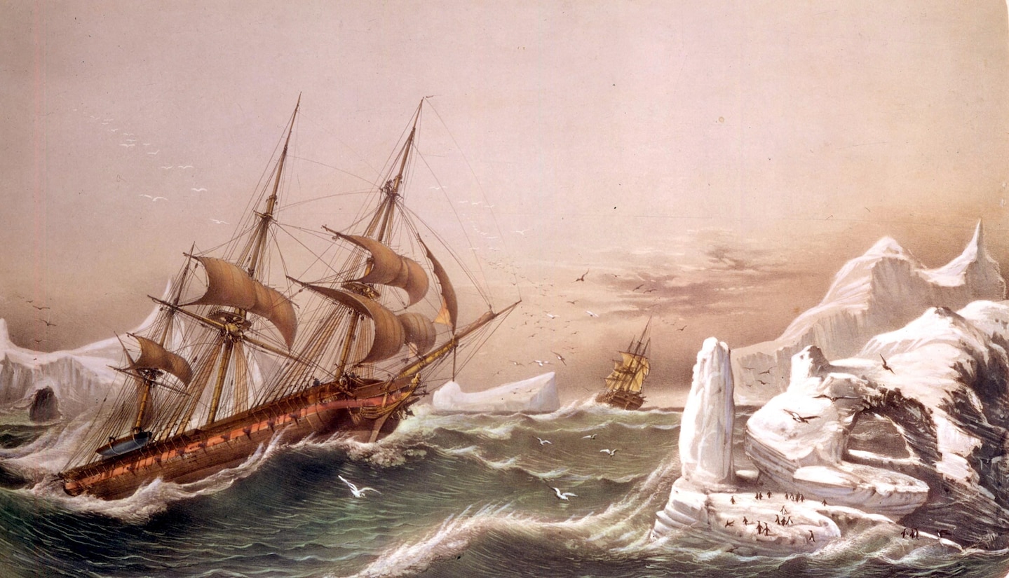
Enormous container ships ferry goods all over the world, but when one of them gets into trouble – as happened with the Ever Given and Ever Forward recently – how can they be saved?


Rain lashed the windows.
A violent sea pounded the steel hull of the ship and the wind roared with primeval power.
It was the middle of the night in the summer of 2010.
The Kota Kado, a 230m-long container ship, had run aground outside the port of Hong Kong.
Her crew had evacuated but standing on the bridge in his life jacket, prepared for the worst, was salvage master Captain Nick Sloane.
He beheld the force of the typhoon that now, in the darkness, raged over the stricken vessel.

Sloane was holed up with just five other members of the salvage team.
Days earlier, they had arrived to the South China Sea with the aim of saving the Kota Kado.
When typhoons were forecast to batter the grounded ship, Sloane made the decision to stay on board overnight with a skeleton crew.
He wanted to feel how the vessel flexed in the storm, to understand where it hit her hardest, knowing that this would inform whatever measures they took next.
But it was a very close call.

"We nearly lost her that night," he says.

The world's cargo ships, which transport around 90% of global trade, do not always make it to their destination without incident.
According to the Safety and Shipping Review by insurance company Allianz, 27 cargo vessels were lost in major incidents during 2021, and 357 during the past decade.
They catch fire.
They hit rocks, reefs and sand bars.
They malfunction.
But they don't always sink.
Whenever there's a chance to rescue a large ship, their owners almost always take it because these vessels can be worth hundreds of millions of dollars.

The people that shipping firms call on in such situations are called salvors.
And they have seen some extraordinary things at sea.
Salvors came to the aid of the huge Ever Given container ship after she ran aground, blocked the Suez Canal, and triggered global supply chain issues last year, for example.
But when a ship weighing tens or hundreds of thousands of tonnes gets stuck somewhere, how do you free it?

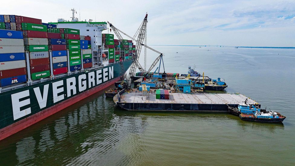
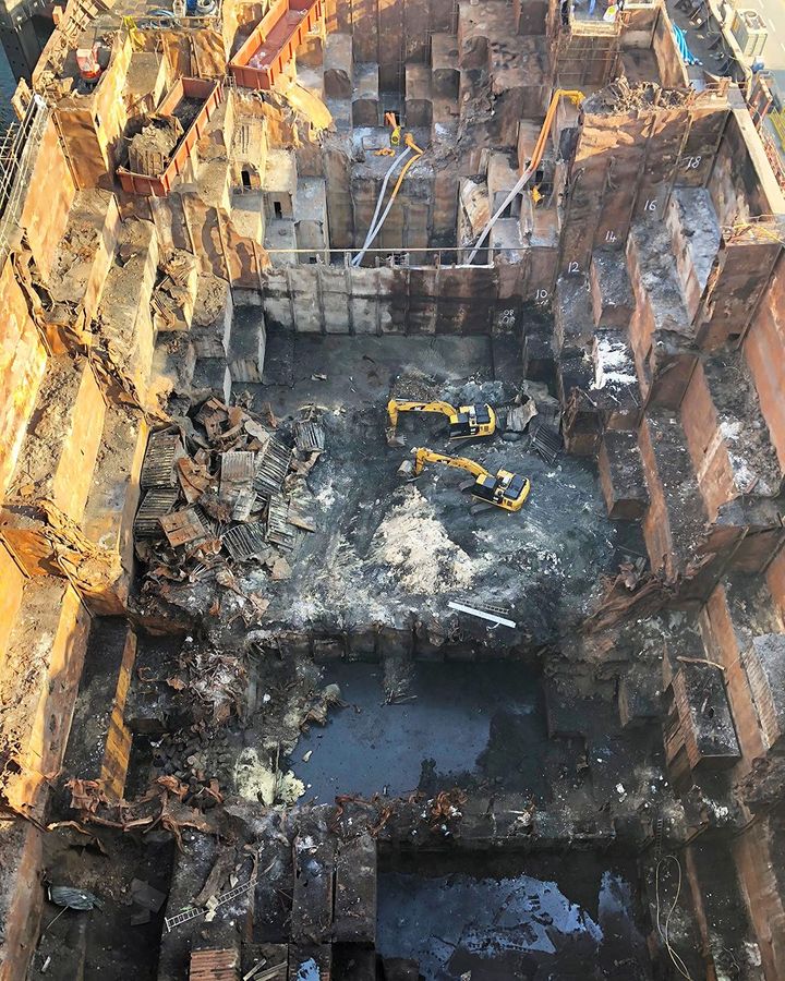
Removing containers from stricken vessels like the Ever Forward – which ran aground in Chesapeake Bay near Baltimore – is a delicate process
(Credit: Jim Watson/AFP/Getty Images)

Sloane, now a director at Resolve Marine Group, was on his way home from a World Cup match in South Africa when his phone rang and he first heard that the Kota Kado had got into trouble.
He flew to Hong Kong the next day.

The ship had struck a reef on its way to port, which sliced a hole in her side.
Two cargo holds began filling with water and she subsided until she eventually ran into a sediment bank about 25 nautical miles (46km) southwest of her destination.
Her bow ploughed into the seabed, trapping her.
And as more water flooded on board, the heavily laden ship began to sink.

Many were sceptical that she could be rescued at all, remembers Sloane: "A lot of the surveyors said, 'OK, the ship's completely lost, get ready for a wreck removal contract'." But he thought she still had a chance.
"She kept on sinking and the bow, literally every day, sank another half-a-metre to a metre (1.6-3.2ft)," he says.
"It was touch-and-go."

Sloane and his colleagues came up with a plan to reduce the mass of the vessel and pump as much water out of her as possible.
This required lighters – barges, which, in Hong Kong, come equipped with large cranes.
Luckily, this is often how cargo is unloaded in Hong Kong anyway, so lots of these barges were available and their operators were already well-accustomed to heaving containers off vessels for transport to shore.

Sloane wanted as much cargo removed as possible.
In the end, the lighters extricated more than 1,200 individual containers.
This sort of operation is time-consuming and difficult, especially given that the Kota Kado was sitting with her bow under water.
Plus, the lightest containers tend to be stacked at the top since this helps to lower a ship's centre of gravity and keep her stable – but that means it takes even longer to reach the heavy containers whose removal really makes a difference.


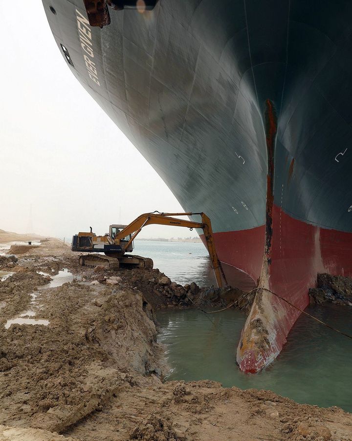
Huge amounts of clay, mud and sand had to be removed to refloat the Ever Given when it became stuck for six days the Suez Canal
(Credit: ALP Maritime Services)

Then there were the giant snorkels.
To get water out of the vessel, Sloane and his team deposited large pumps under water at the bottom of one of the cargo holds.
They also removed hatches on the deck above and welded huge rectangular tubes, or snorkels, onto them before putting them back in place.
The snorkels now dangled down into the belly of the ship.
Finally, a team of divers connected the pumps below to two sets of hoses that extended vertically up through the snorkels.

The pumps ran flat out, remembers Sloane, to stop water filling the engine room, which contains the most expensive and sensitive machinery.

Eventually, having removed huge volumes of water from the hold, the salvage team was able to fill some of the ship's ballast tanks with air in order to refloat her.
Had they tried to do this earlier, the tanks could have ruptured, explains Sloane: "When you get below 10m (33ft), you've got to be very careful about how much pressure you introduce."

Through all of this complicated work, and in spite of not one but two typhoons, the second of which was particularly bad, the Kota Kado was saved and eventually towed to a shipyard for repairs.
She is still sailing today, though under a different name.

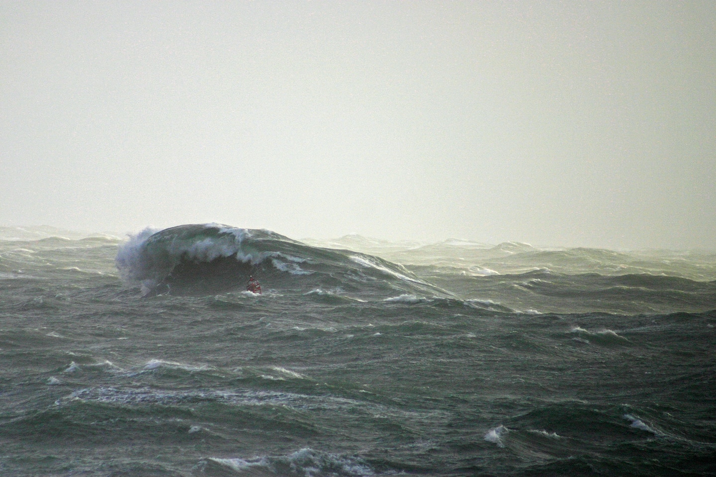
When ships end up in places they were not really designed for, such as stuck fast in mud or pinned against rocks, the forces of nature can tear them apart.
That's why heavy storms presented such a great threat to the Kota Kado.

"Like a paperclip, the more times you bend it, eventually it snaps," says Rosalind Blazejczyk, managing partner and naval architect at Solis Marine Consultants.
She explains how problematic it is when a grounded ship is lifted or twisted by successive waves.
They can crash into it for hours in a swell or high tide, pushing one end of the vessel up and throwing it down again.
Suddenly, steel doesn't seem so strong in those situations.
Sloane mentions how his team sometimes weld huge girders to the deck of a ship simply to hold it together.

We try to bring order to chaos – Richard Janssen

Blazejczyk says that salvage experts such as herself generally use three dimensional computer models of the ship they are trying to save, in order to better judge the effects of forces acting upon it.
"Some ship companies have emergency response services where a model of the ship has been created and is ready to go," she adds.

Salvage teams will place sensors all over the hull to track how it moves and flexes during the operation.
Data from those sensors feed into the model automatically, which in turn highlights when a particular part of the ship might be at risk of cracking.
Salvors might also use lasers, trained on a stricken ship, to monitor its movement in fine detail.

Tugs that attempt to pull ships free also exert significant forces – but, generally, this alone is nowhere near sufficient to liberate a grounded vessel, says Blazejczyk.
This is because the tugs are faced with fighting against what's called the ground reaction force.
Blazejczyk recalls one grounding were she calculated that the salvors would have needed 200 tugs to pull the vessel free – an impossible prospect.
Instead, teams must often lighten ships somehow or clear away the sediment that has trapped them before they'll budge.

Sometimes there is huge pressure to do this work as quickly as possible.
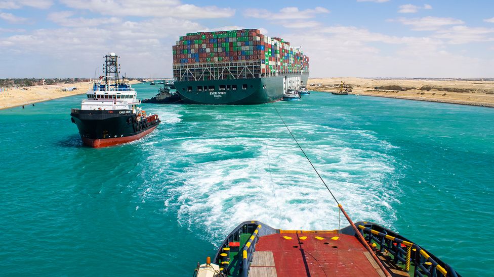
When the Ever Given, one of the largest container ships in the world, got stuck in the Suez Canal on 23 March last year, the ship lay diagonally across the waterway, blocking all traffic.
It took six days for her to be freed, during which time more than 200 other vessels were prevented from passing through, leading to a queue of ships more than 60 miles (100km) long as they waited to get through.

A grounding that becomes a blockage tends to be much more high profile.
Leendert Muller, managing director of Multraship, recalls the grounding of the container ship the CSCL Jupiter outside the port of Antwerp in 2017.
Antwerp is the second-largest port in Europe, after Rotterdam.


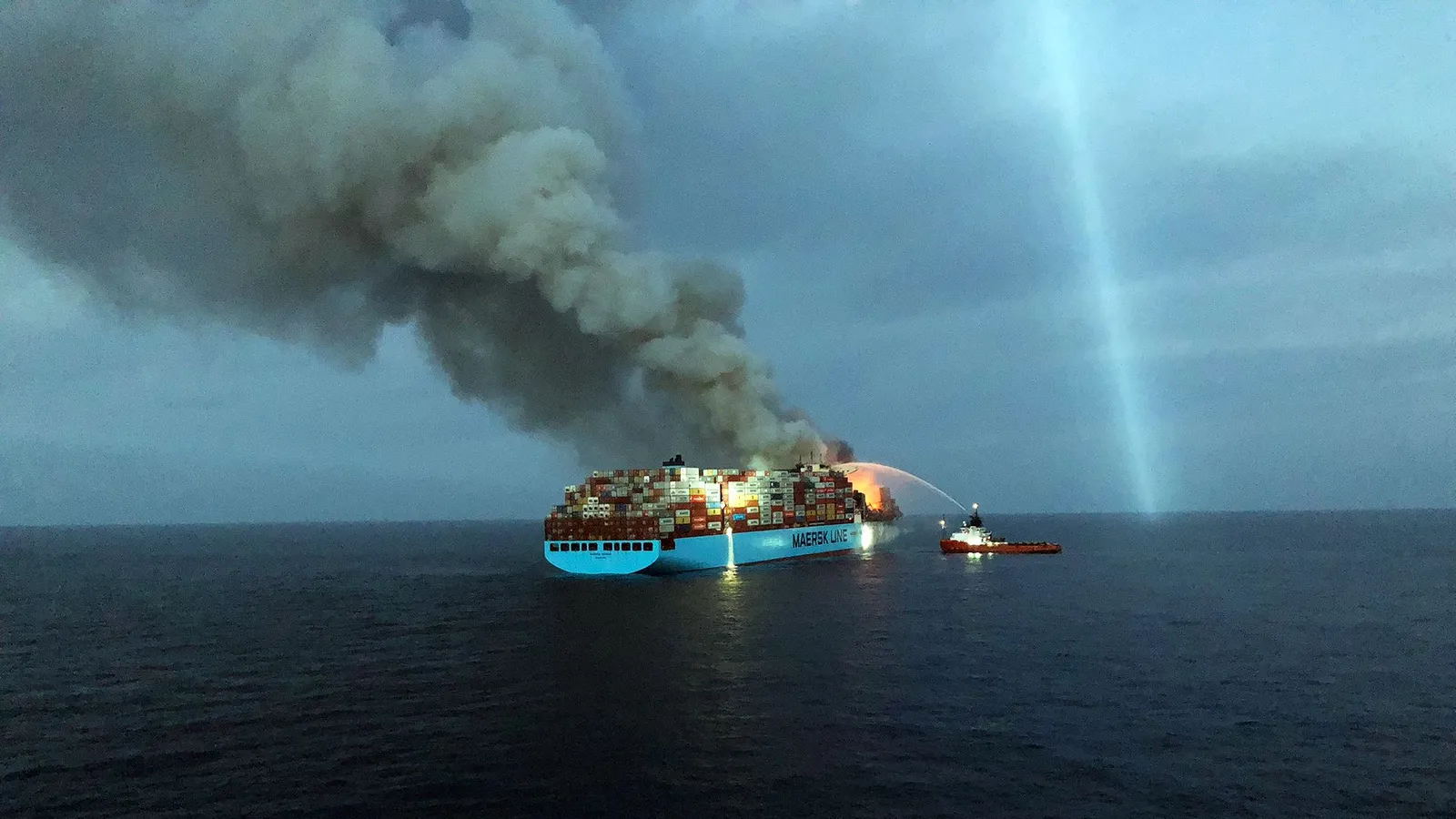
Fires on board container ships are a continual hazard on cargo ships, especially when hazardous material not accurately declared
(Credit: Indian Coast Guard/GODL India)

"When the trade comes to a stop there, it stops the trade at other ports in Europe because it's a whole chain of trade," explains Muller.

The salvors that came to the aid of the Ever Given, from Boskalis and its subsidiary SMIT Salvage, were well aware of the high stakes.
"We try to bring order to chaos," says Richard Janssen, managing director of SMIT.
In this case, the Suez Canal Authority used a dredger and excavators to remove a huge volume of mud and sand from below the ship – 30,000 cubic metres (1.06 million cubic feet) in total.

Such was the intensity of public interest in the incident that people starting sharing jokes and memes about the Ever Given on social media.
Many poked fun at the seemingly diminutive digger that was pictured heaving sand away from around the massive ship's bow.
The vehicle belonged to the Suez Canal authority, not Boskalis or SMIT.

"The digger looks funny because it's relatively small given the size of the vessel but it did actually do a relatively good job," says Janssen, explaining that removing some of the clay from this area helped ensure the Ever Given had enough space to swing free during the refloating operation.

Dredging is a tricky business, too.
It's easier to displace sand says Janssen, whereas mud can be more stubborn.


Images of excavators working to clear the silt and mud around the bow of the Ever Given emphasised the enormous scale of the stuck vessel
(Credit: UPI/Alamy)

In March, another ship owned by the company Evergreen grounded in mud in Chesapeake Bay, an estuary off the northeast coast of the US.
SMIT was again called upon to rescue the Ever Forward, along with local firm Donjon Marine.
Initial efforts to tow the vessel free proved unsuccessful so the salvors turned to removing containers one by one.
A total of 510 12m (40ft) containers were taken off – though, notably, that's just a fraction of the cargo on a ship that can carry several thousand such containers.

A combination of this cargo removal, dredging and lowering of ballast water levels inside the ship, among other techniques, eventually succeeded in freeing the Ever Forward one month after she ran aground.

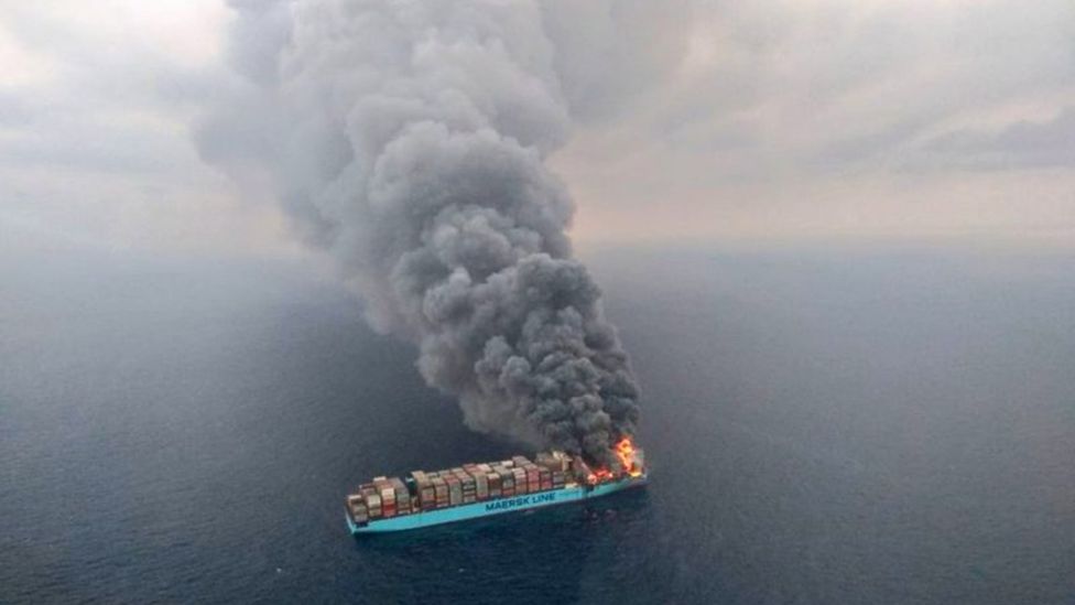
Groundings are nightmare scenarios for floating vessels but fires are among the greatest dangers at sea.
Despite all of the water that is typically nearby, it can be very hard to put out a blaze in the middle of the ocean.
On ships packed with fuel and sometimes highly flammable or explosive cargo, the risks are immense.
In recent years, ships carrying cars have been particularly vulnerable to fires as malfunctions or short circuits have sparked onboard blazes.
Lithium-ion batteries – especially those in electric vehicles – are now considered a growing risk for cargo ships, according to insurers.

In recent years, ships carrying cars have been particularly vulnerable to fires as malfunctions or short circuits have sparked onboard blazes

In 2018, the Maersk Honam, an ultra large container ship 353m (1,158ft) long, caught fire in the Arabian Sea on its way to the Suez Canal.
Tragically, five seafarers lost their lives in the incident.
But 22 crew members survived – and the ship did too, thanks to the efforts of SMIT Salvage.

"It was a very intense fire in the forward section of the vessel and of course you're assessing, 'How is this fire going to develop over time?'," explains Janssen.
Keeping the blaze contained to the front of the ship avoided damage to the engine room and accommodation to the rear.
It was the biggest fire SMIT has ever tackled at sea, says Janssen.
It burned on board for a month but salvors brought it under control and eventually extinguished it after towing the ship to a port in Dubai.


After the fire was extinguished on board the Maersk Honam, the debris was removed by diggers and eventually the entire bow section was cut off and replaced
(Credit: Boskalis)

Later, at a repair yard, the entire bow section of the Honam was cut off and a new one installed so that she could return to service under a new name, Maersk Halifax, a little over a year after the fire.

Blazejczyk notes that one of the difficulties of putting out a fire on a ship is that, while water is essential to tackle the blaze, you don't want to fill the ship's holds up completely, otherwise the vessel will become unstable or simply sink.
Plus, fires can damage fuel containers on board, cause explosions, and send huge volumes of contaminants into the sea.

Fuel oil and polluted water left in the sea after ship fires must be recovered and treated, says Captain John Simpson, Blazejczyk's colleague at Solis.
"The sums can rise into the millions," he adds.

Navigational technology has improved in recent years, says Muller, which means ship collisions and groundings ought to become less common, on average, with time.
But the flipside is that container ships have gotten significantly bigger and more unwieldy in the last decade or two.
The container-carrying capacity of the world's largest ships are today 15 times what they were in the late 1960s.
The world's largest container ship – the Ever ACE – has a capacity of 23,992 TEUs (20ft equivalent units) and is 399m (1,309ft) long compared to 1,578 TEUs capable of being carried by the 227m (745ft) long Encounter Bay when it entered service in 1969.

With increasing size, the impact of groundings is also getting bigger, says Muller.
Sloane adds that it is getting harder to save the largest ships when fires break out or when they do hit sand bars and mud banks.

The worry is that salvors will increasingly face obstacles that are just too great to overcome.
And who knows how that could ricochet through global supply chains, if ships keeping getting into trouble along busy canals or outside major ports.

"Off Hong Kong, you could get these barges around it, Chesapeake Bay, they could get barges around it," Sloane adds, referring to the Kota Kado and the Ever Forward.
But, he warns, there is a risk that eventually, one of the larger container ships could run aground in a location where it's much harder to access in such a way during any recovery operation.

"That's going to be challenging," he says.
"I think it is going to happen."

Monday, June 6, 2022

A moment that changed me: water flowed into our boat – and my parents were at a total loss

 
‘I remember wet summer days, and grey, misty Easters, the sea somewhere between granite and slate.’ Photograph: Tim Merrick/Alamy

From The Guardian by Nick Blackburn

On an ordinary trip out in my father’s boat, we began taking in water.
For once my mother could not comfort me and it felt as if life’s invisible chaos had become clear


It wasn’t something you would think of as particularly grand – a white boat, the shape of an iron with a stripe down it, maybe a foot or two larger than an estate car.
Named after my mother, it lived in a sort of car park for boats, where it rested high up on a trailer and a tractor would come to take it to the shore.
A couple of checks were performed – the battery, maybe; something around the engine; a rubber bung that went in the drain in the back of the boat to stop water coming in.
My parents didn’t often go out on the water together; perhaps the day I’m remembering was why.

The boat was my father’s thing, really.
He came from a family who built planes, raced motorcycles and sailed ships.
At one point, before a fast house move consigned them to a yellow skip, our garage had the kinds of tools to maintain a yacht with: clonky wooden planes and sharp-angled items for working metal.
Honestly, I don’t know what these things were for: they seemed ageless to me when I was a child, and full of purpose – the implements that carved Stonehenge.

I remember being on the boat as one of the only times in my life when I spent significant amounts of time alone with my father – wet summers mostly, or grey, misty Easters when it was flat enough to go out, the sea somewhere between granite and slate.
Now that he’s dead, it’s those afternoons I suppose I imagine replaying with my father until we arrived at a form of connection; sifting them for a closeness I know is wishful thinking.

Usually, my father read the paper, or one of his car magazines, while I fished with a lead weight and a line with feathered hooks: there were electric moments where a shoal of mackerel passed and we would land them by the half-dozen – all wasted.
My mother distrusted things that had come straight out of the sea in that bay; I suppose she was thinking of storm surges and sewage outlet pipes.

The three of us would not have done anything out of the ordinary that day: a trip out to the two small islands, their lighthouse and seal colony.
I remember it being overcast and the water fairly calm, no signs of anything sinister.
But in the centre of the boat near the front there was an oblong, carpeted hatch covering a storage space maybe a foot deep.
When we lifted it up, the space beneath was full of seawater.

Floating boatless in water of that temperature is not deadly: all of us could have swum if we had needed to.
There were lifejackets and ample time to radio for help.
The only sharks of any size you find visiting that bay are basking sharks – vast placid cruisers occasionally sighted round the headland in summer.
The worst risk might have been jellyfish stings, but – horrifying as they were to me as a child – these posed no real threat to our safety.
In fact, as a therapist now, there is a sort of flexibility in this image that I might want to encourage in my patients: yes, floating; why not give in to it, be held up by something bigger than yourself.

The horror for me at the time, though, was twofold.
I don’t remember the specifics, but there must have been a point at which I witnessed my parents at a total loss.
Then, too, the awful realisation that the outside was now on the inside – the water flowing slowly but surely into the boat; that there would come a point at which there was no firm surface any more; there would be new rules.
After my father died, I think I started watching videos of the Chernobyl nuclear disaster for similar reasons: the boundaries of the world suddenly reordering themselves, the invisible chaos of things made dreadfully clear.

The other frightening thing about this moment for me as a child was that I was used to my mother being the one who brought order to my world.
My father was what at that time was called a manic depressive; though good at his job, he rarely spoke and did not excel at parenting.
My mother was now out of her comfort zone: here we were in his territory, the restless sea.
My father turned the key in the engine, which responded.
He slammed on the accelerator, forcing the water out through the hole where the bung ought to have been, and we made it to shore.

You still will not catch me swimming in deep water, and, for many years I stayed away from anything smaller than a ferry.
So it took me by surprise, a few years ago, how much I enjoyed going out on a similar boat as part of a birthday present.
Old enough now to be my younger self’s father, I want to go back to the sea.

Sunday, June 5, 2022

A turf war on the water in "anchored out"


The documentary, directed by Katie Bernstein and Clara Mokri, follows San Francisco's vibrant liveaboards as their boats are targeted by a wealthy community who want them gone—revealing the dark underbelly of class conflict in California.
 
From The New Yorker by Douglas Watson

“It’s all about money, guns, and lawyers,” Joe Tate, who lives on a houseboat docked in Sausalito, near the entrance to the bay, says of the feud.

Katie Bernstein and Clara Mokri’s new documentary, “Anchored Out,” centers on a community of dozens of people who live on boats anchored in Richardson Bay, a shallow estuary rimmed by the well-to-do Marin County, just across the Golden Gate Bridge from San Francisco.
The “anchor-outs,” as they are known, are a motley crew—free spirits, artists, literal drifters, refugees from the high cost of living on land.
Richardson Bay has long been a hub for the Bay Area’s bohemian and arts scenes; it was here that Otis Redding, during a stay on a friend’s houseboat, wrote the first verse of “(Sittin’ On) The Dock of the Bay.” Today, the anchor-outs’ existence on the water faces a threat.
Under pressure from the state, the Richardson Bay Regional Agency (R.B.R.A.), which serves parts of Marin County, has hired a series of harbormasters to enforce a long-ignored rule defining the bay as a seventy-two-hour anchorage.
The anchor-outs must leave the bay or risk having their boats towed and, in some cases, destroyed.

“Money doesn’t talk, it swears,” Bob Dylan once sang, but in this tale of haves and have-nots it’s the latter who do most of the swearing.
In the film, the harbormaster Curtis Havel comes in for a fair bit of verbal abuse as he makes his rounds on the water to inform boaters of the seventy-two-hour rule.
“Don’t ever touch my shit again! Ever!” one irate anchor-out yells at him, bitterly complaining that Havel “stole” one of his boats.
“You’re a lousy person, man! .

I will have your ass in a sling!” Another anchor-out observes, of the harbormaster, “He does get screamed at quite a bit.”
This remark draws a chuckle from a third anchor-out, the sixtysomething Joe (Einstein) Bernstein, who features prominently in the film.
Einstein has a weathered face, a gap-toothed smile, and a tremendous head of omnidirectional white hair, which is perhaps the reason for his nickname.
He also has a philosophical bent.
“There are righteous people out here,” he says, of his community.
“They shouldn’t have to lose what they own.” At one point, Einstein sheds his usual genial, somewhat bemused demeanor to fire up his boat’s engine and chase after Havel, shouting, “Why don’t you take a hike, asshole? Who’re you gonna go bother next, some poor woman? Or how ’bout an old man?”

“I was actually surprised by how much conflict we witnessed first hand during our filming,” Katie Bernstein, who is not related to the anchor-out, told me over e-mail.
But society’s problems don’t stop at the water’s edge.
Mokri, Bernstein’s colleague, wrote, “The conflict in Richardson Bay IS the affordable housing crisis in the Bay Area.
The NIMBY-ism and way in which society treats people who are struggling just to keep a roof over their heads is an issue across the entire country.” Bernstein added, 
“The story brings up a lot of tensions and questions about who is allowed to exist where, and what a wealthy society like ours should provide for its citizens.
Is it access to clean water? Bathrooms? Safe housing? Or nothing if you can’t afford to pay for it? And what if a self-directed choice is dangerous to the person who chooses it?”
(Havel, the harbormaster, asserts in the film that “the large majority” of the anchor-outs’ boats “are inoperable and therefore unsafe vessels,” and that this is why they must be removed.
He quit his job shortly after the film was finished.)

“It’s all about money, guns, and lawyers,” Joe Tate, who lives on a houseboat docked in Sausalito, near the entrance to the bay, says in the film.
Tate, the son of a Mississippi River tugboat pilot, first came to Richardson Bay in 1967, and is a veteran of an earlier conflict there that in many ways foreshadowed the one playing out today: in the seventies, the R.B.R.A.
sought to remove some of the houseboats that had been set up in the area, and Tate and others pushed back, with some success.
Tate is sympathetic to the anchor-outs but not optimistic about their prospects.
“It’s just a matter of getting the pesky anchor-outs out of the way,” he tells the camera.
“You watch and see. They’re gonna get rid of all of them. They’re gonna put mooring balls out there.
And they’re gonna have millionaire boats tied up to ’em. That’s what’s coming.”
And that is how money swears.