Saturday, November 20, 2010

How Cousteau inspired my love of the oceans


From BBC

Jacques Cousteau co-invented the aqua-lung, which brought diving to the masses, he pioneered underwater camera techniques, and he was the godfather of the modern conservation movement. But 100 years since his birth, Cousteau remains somewhat of an enigma.

Growing up, I remember Saturday mornings vividly. As soon as we heard that distinctive epic theme music trill out, my brother and I knew there was three seconds to don our red caps (pulled down at a jaunty French angle) and jump in front of the TV for the next instalment of Cousteau's underwater adventures.

Who didn't want to be a member of Jacques Cousteau's Calypso crew? The Calypso, as it set sail into the next conservation adventure, was the most exciting place to be on the planet.

So in his anniversary year, I set out to find the man behind the French accent. What drove him to his impossible challenges and, when he died in 1997, who took on the Cousteau cap?

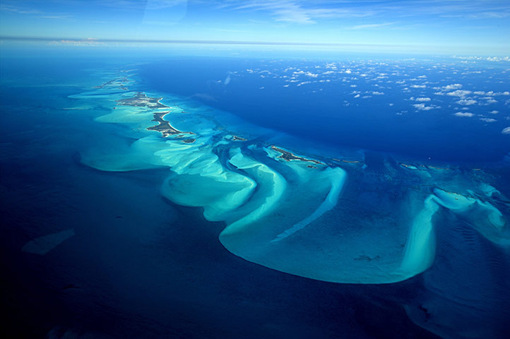
As ocean conservation becomes one of the biggest challenges of our time, what can we learn from Cousteau to take forward in communicating the intrinsic value of the oceans today - and to help a whole new generation fall in love with the sea?

As Cousteau said: "People protect what they love. A lot of people attack the sea, I make love to it."

But Cousteau was not always a conservationist.

He was born in an era when blowing things up (including habitats and other species) for the sake of science and exploration were far more the norm.

Yet as the world became more and more connected with modern technologies and with the birth of TV, he soon began to realise the devastating effects of human impact on our planet.

Turning this new media to his advantage, Cousteau realised the red cap could be his iconic symbol and TV his powerful international communication tool.

Soon, Cousteau became the most important spokesperson for the world's health.

Motivating generations to protect the oceans, from Sylvia Earle, the famous diver, to Wes Anderson the director of the film The Life Aquatic with Steve Zissou (a film inspired by Cousteau), his work has touched many people.

But his legacy is more complicated.

'Exhilarating'

Whilst his family, including his sons Jean-Michel and Philippe and his grandchildren (Fabien and CĂ©line, Philippe Jr and Alexandra), have all devoted their lives to the ocean, the mantel of the Calypso or red cap seems more illusive.

The crew members of the Calypso have carried on with Cousteau's work and I was eager to meet them and get a sense of what life was like onboard the great ship.

So on a sunny September day, I found myself standing at the Harbour Key in Marseille with Albert Falco, former captain of the Calypso, and Denis Martin-Laval, former ship's doctor.

These were men well into their 80s whose lives on the ocean had left them far younger in every way than many half their age. (Readers take note.)

To meet them was an exhilarating experience, especially when I was invited to go back to Denis' house for lunch and to take a tour of his handmade model of the Calypso. Denis talked me through his experience on the ship, as he peeled back layer after layer of the exact replica.

You could see not only how important this boat had been to the conservation movement, but also how it has been a giant chapter in these men's lives - Albert Falco was captain for 40 years.

A feeling of excitement and camaraderie of long days at sea and a sense of purpose also overwhelmed me. I could almost smell the salt air.

Back at the quay side in Marseille, I thought about the anticipation there must have been as the Calypso prepared to set sail on its next high seas adventure.

It was these people coming together to do great things, seemingly impossible things, that created a conservation legacy worth remembering. It was certainly this magic that we need to hold onto to encourage new conservationists into the world.

As Cousteau said: "The sea, the great unifier, is man's only hope. Now, as never before, the old phrase has a literal meaning: we are all in the same boat."

Links :

Friday, November 19, 2010

Klondike shipwreck brought to life with 3D scans


From CBC

A
Gold Rush-era shipwreck at the bottom of a Yukon lake is coming to life with the help of cutting-edge digital 3D scan images.

The images were produced in June by researchers working on the wreck of the A.J. Goddard, a 19th-century sternwheeler that vanished in Lake Laberge in 1901.

Researchers from the Institute of Nautical Archaeology captured images of the sternwheeler with underwater sonar scanners supplied by the U.S. firms BlueView Technologies and Oceangate.

Millions of captured images were then assembled into a 3D model, similar to a recent map of the wreck of the Titanic off the east coast of Newfoundland.

Last year, an archeological team that included the Texas-based institute and the Yukon Transportation Museum announced that it had discovered the shipwreck, mostly intact, at the bottom of Lake Laberge.

Shipped north in pieces

"To get that vessel to the North, it's an amazing story," Lindsey Thomas, a post-graduate student from Texas who is studying the A.J. Goddard, told CBC News.

Thomas said the sternwheeler was built in Seattle, then shipped in pieces over the Chilkoot Pass in the spring of 1898 to Bennett Lake, where it was reassembled.

Thomas said the new digital scans show how exactly the sternwheeler parts were put together at Bennett Lake.

"The people who built the vessel on the shores of Lake Bennett, where they [could] cut corners, they did," she said.

"It's kind of like the way that we build furniture from Ikea: follow the directions for the most part but where you need to, it's not done exactly the same way they might have done it in the factory."

The A.J. Goddard became the first sternwheeler in Dawson City, transporting miners and supplies along the Yukon River until Oct. 22, 1901, when it disappeared in Lake Laberge during a storm. Three of the A.J. Goddard's crew members drowned in the storm, while two survived.

Phonograph, records found

Divers retrieved artifacts from the shipwreck this past summer, including a phonograph player and some perfectly intact records.

"It's just a really unusual item to think of with a vessel that we know was really an industrial kind of workhorse," said Val Monahan, the Yukon government's heritage conservator.

"You don't think of something like music on board."

Monahan and Doug Davidge, president of the Yukon Transportation Museum, both said they hope some of the records can be restored to a playable condition.

"It does paint a quite a unique picture of how people would have enjoyed their time on the river," Davidge said.

"Hopefully there'll be something there that they can actually pull off the vinyl — in terms of a music track or sound or what have you — that might have been on that record, and hopefully in time we'll find out what type of music they were listening to."

Links :
  • Wired : 3-D scanner takes on the Goddard shipwreck
  • CBC : Gold Rush shipwreck named historic site

Thursday, November 18, 2010

Bahamas, a new chart layer in the Marine GeoGarage


The Marine GeoGarage is glad to announce a first license agreement with some private nautical map publisher Wavey Line Publishing to display nautical charts for :
  • Bahamas,
  • Turks & Caicos Islands,
  • Hispaniola
  • and Caribbean.
Today 260 charts are available in a new chart layer accessible publicly.
(some iPhone/iPad application will be available soon).
Note : for ordering any of these maps seen in the viewer, please go to the American Nautical Services website.

An aerial view of Exuma, part of the chain of 365 islands that form the Bahamas
Photograph: Onne van der Wal/Bluegreen/Rex Features

Explorers and Surveyors (extract from Wavey Line Publishing website)
The Dark Ages!
Wavey Line charts have origins way back in the days before GPS completely revolutionized navigation and marine surveying.
After his first Atlantic crossing in the late 1970's, Bob Gascoine started cruising the Antilles and Bahamas Chain.
Bob found great inadequacy in the government chart publications as did many cruisers of that period, and he started to compile his own sketch charts and pilotage notes.
These were first published in 1983 as a Yachtsman's Guide for the Turks & Caicos Islands.
Escape from City Life
Bob's background includes experience in the London printing and graphic arts industry.
This knowledge was bolstered when Jane Minty teamed up with him in the early 1990's and contributed artistic and computer graphic skills.
Soon after, they began exploring and surveying using a sophisticated GPS receiver as their main tool.
Milt the Mentor
Milt Baker, founder of the well-known
Blue Water Books & Charts store, encouraged Bob and Jane to publish their data and TC001, their first chart, was printed in December 1993.
It had the distinction of being the first navigation sea chart designed primarily for use with GPS and featured new innovations such as '
one mile grid' (note : removed in the Marine GeoGarage as the map is georeferenced) and 'waypoint list'.
This first edition sold out in six months, so Bob and Jane quit their day job - which had been sailing and scuba diving charters - and took up hydrography as a full time occupation.


Socially Acceptable to Nature
In addition to work on private publications, Bob and Jane have been engaged by the
Turks & Caicos Islands National Parks Service and Harbour Authority to conduct various marine projects.
They have also checked and advised the UK Hydrographic Office on new British Admiralty publications for the region.
Being conservation activists, Bob and Jane include advice on environmental issues and local etiquette in their publications in the hope that visiting cruisers will respect local ways and go easy on the environment - this should help reduce the need for restrictive legislation in the future.
Out Islands 'R' Us
Bob and Jane are now finishing surveys for two new Bahamas charts and will be updating and re-surveying areas of the Turks & Caicos Islands so that all chart publications have up-to-date information and '
WAAS' accuracy.
But don't expect to see them giving presentations or 'Volleyball Beach' talks, for they prefer to keep a low profile and moor away from the crowd.
Still, if you notice their catamaran 'Mage Magic' (yes, the one with the barking "potcake") and decide to stop by and visit, you'll be warmly received.

USA NOAA update in the Marine GeoGarage

18453 : TACOMA HARBOR

38 charts
have been updated in the Marine GeoGarage (NOAA update 10/10/2010)

  • 1115A : LEASE BLOCK FOR CAPE ST. GEORGE TO MISSISSIPPI PASSES
  • 11313 : MATAGORDA LIGHT TO ARANSAS PASS
  • 11360 : CAPE ST. GEORGE TO MISSISSIPPI PASSES
  • 11429 : FOWEY ROCKS; HILLSBORO INLET TO BIMINI ISLANDS
  • 11505 : SAVANNAH RIVER APPROACH
  • 11520 : CAPE HATTERAS TO CHARLESTON
  • 12375 : CONNECTICUT RIVER LONG ISLAND SOUND TO DEEP RIVER
  • 13246 : CAPE COD BAY MA
  • 13281 : GLOUCESTER HARBOR AND ANNISQUAM RIVER
  • 18428 : OAK AND CRESCENT HARBORS
  • 18440 : PUGET SOUND
  • 19013 : HAWAIIAN ISLANDS NORTHERN PART
  • 11373 : MISSISSIPPI SND and APPROACHES DAUPHIN ISL TO CAT ISL
  • 11539 : NEW RIVER INLET TO CAPE FEAR NORTH CAROLINA
  • 12354 : LONG ISLAND SOUND-EASTERN PART CONN-NY
  • 13009 : GULF OF MAINE AND GEORGES BANK
  • 13229 : SOUTH COAST OF CAPE COD TO BUZZARDS BAY MA
  • 14826 : MOSS POINT TO VERMILION OHIO
  • 11536 : APPROACHES TO CAPE FEAR RIVER
  • 13230 : BUZZARDS BAY
  • 13309 : PENOBSCOT RIVER ME
  • 18656 : SUISUN BAY
  • 18744 : SANTA MONICA BAY
  • 25649 : ST THOMAS HARBOR
  • 11358 : BARATARIA BAY AND APPROACHES
  • 11425 : CHARLOTTE HARBOR TO TAMPA BAY
  • 11478 : PORT CANAVERAL
  • 11485 : TOLOMATO RIVER TO PALM SHORES FLORIDA FF-GG
  • 12277 : CHESAPEAKE and DELAWARE CANAL SALEM RIVER EXTENSION
  • 12347 : HUDSON RIVER-WAPPINGER CREEK TO HUDSON-RIGHT PANEL
  • 13253 : HARBORS OF PLYMOUTH KINGSTON AND DUXBURY MA
  • 13288 : MONHEGAN ISLAND TO CAPE ELIZABETH
  • 13290 : CASCO BAY
  • 13292 : PORTLAND HARBOR AND VICINITY ME
  • 16645 : GORE PT. TO ANCHOR PT.
  • 16713 : NAKED ISLAND TO COLUMBIA BAY
  • 18430 : ROSARIO STRAIT NORTH PART
  • 18453 : TACOMA HARBOR
Today 1019 NOAA raster charts (2932 including sub-charts) are included in the Marine GeoGarage viewer.

Note : NOAA updates their nautical charts with corrections published in:
  1. U.S. Coast Guard Local Notices to Mariners (LNMs),
  2. National Geospatial-Intelligence Agency Notices to Mariners (NMs), and
  3. Canadian Coast Guard Notices to Mariners (CNMs)
While information provided by this Web site is intended to provide updated nautical charts, it must not be used as a substitute for the United States Coast Guard, National Geospatial-Intelligence Agency, or Canadian Coast Guard Notice to Mariner publications

Please visit the
NOAA's chart update service for more info.

Canada CHS update in the Marine GeoGarage

4460 : CHARLOTTETOWN HARBOUR

96 charts have been updated for Canada (CHS update published September 29, 2010) :

  • 1234 :CAP DE LA TETE AU CHIEN TO CAP AUX OIES
  • 1235 : POINTE AU BOISVERT TO CAP DE LA TETE AU CHIEN
  • 1236 : POINTE DES MONTS TO ESCOUMINS
  • 1311 : SOREL-TRACY TO VARENNES
  • 1317 : SAULT-AU-COCHON TO QUEBEC
  • 1350A : SOREL - TRACY TO RUISSEAU LAHAISE
  • 1350B : RUISSEAU LAHAISE TO SAINT-ANTOINE-SUR-RICHELIEU
  • 1350C : SAINT-ANTOINE-SUR-RICHELIEU TO ILE AUX CERFS
  • 1350D : ILE AUX CERFS TO OTTERBURN PARK
  • 1351A : BASSIN DE CHAMBLY TO ILE SAINTE-THERESE
  • 1351B : ILE SAINTE-THERESE TO POINTE LA MEULE
  • 1351C : POINTE LA MEULE TO POINTE NAYLOR
  • 1351D : POINTE NAYLOR TO LAKE CHAMPLAIN
  • 1435 : CARDINAL TO WHALEBACK SHOAL
  • 1514A : CARILLON TO L'ORIGNAL
  • 1514B : L'ORIGNAL TO PAPINEAUVILLE
  • 1551 : CHATS FALLS TO CHENAUX
  • 2123 : PELEE PASSAGE TO LA DETROIT RIVER
  • 2242 : GIANTS TOMB ISLAND TO FRANKLIN ISLAND
  • 3001 : VANCOUVER ISLAND ILE DE VANCOUVER JUAN DE FUCA STRAIT TO QUEEN CHARLOTTE SOUND
  • 3419 : ESQUIMALT HARBOUR
  • 3441 : HARO STRAIT BOUNDARY PASS AND SATELLITE CHANNEL
  • 3475 : PLANS - STUART CHANNEL
  • 3477 : BEDWELL HARBOUR TO GEORGESON PASSAGE
  • 3539 : DISCOVERY PASSAGE
  • 3543 : CORDERO CHANNEL
  • 3547 : QUEEN CHARLOTTE STRAIT EASTERN PORTION PARTIE EST
  • 3602 : APPROACHES TO JUAN DE FUCA STRAIT
  • 3606 : JUAN DE FUCA STRAIT
  • 3960 : APPROACHES TO PORTLAND INLET
  • 4002 : GOLFE DU SAINT-LAURENT GULF OF ST. LAWRENCE
  • 4003 : CAPE BRETON TO CAPE COD
  • 4013 : HALIFAX TO SYDNEY
  • 4015 : SYDNEY TO SAINT-PIERRE
  • 4022 : CABOT STRAIT AND APPROACHES DETROIT DE CABOT ET LES APPROCHES
  • 4026 HARVE-SAINT-PIERRE AND CAP DES ROSIERS TO POINTE DES MONTS
  • 4375 : GUYON ISLAND TO FLINT ISLAND
  • 4377 : MAIN-DIEU PASSAGE
  • 4381 : MAHONE BAY
  • 4432 : ARCHIPEL DE MINGAN
  • 4529 : FOGO HARBOUR SEAL COVE AND APPORACHES LES APPROCHES
  • 4617 : RED ISLAND TO PINCHGUT POINT
  • 4820 : CAPE FREELS TO EXPLOITS ISLANDS
  • 4839 : HEAD OFFOND DE PLACENTIA BAY
  • 4862 : CARMANVILLE TO BACALHAO ISLAND AND FOGO
  • 4911 : ENTREE ENTRANCE TO MIRAMICHI RIVER
  • 4912 : MIRAMICHI
  • 4913 : CARAQUET HARBOUR BAIE DE SHIPPEGAN AND MISCOU HARBOUR
  • 4921 : HAVRE DE BEAUBASSIN
  • 4950 : ILES DE LA MADELEINE
  • 5024 : NUNAKSALUK ISLAND TO CAPE KIGLAPAIT
  • 5048 : CAPE HARRIGAN TO AUX KITLIT ISLANDS
  • 5049 : DAVIS INLET TOUX SENIARTLIT ISLANDS
  • 7565 : CLYDE INLET TO CAPE JAMESON
  • 1220 : BAIE DES SEPT ILES
  • 1233 : CAP AUX OIES TO SAULT-AU-COCHON
  • 1234 : CAP DE LA TETE AU CHIEN TO CAP AUX OIES
  • 1313 : BATISCAN TO LAC SAINT-PIERRE
  • 1429 : CANAL DE LA RIVE SUD
  • 1430 : LAC SAINT-LOUIS
  • 1550 : BRITANNIA BAY TO CHATS FALLS
  • 2042 : WELLAND CANAL ST.CATHERINES TO PORT COLBORNE
  • 2205 : KILLARNEY TO LITTLE CURRENT
  • 3461 : JUAN DE FUCA STRAIT EASTERN PORTION
  • 3462 : JUAN DE FUCA STRAIT TO STRAIT OF GEORGIA
  • 3493 : VANCOUVER HARBOUR WESTERN PORTION
  • 3515 : KNIGHT INLET
  • 3545 : JOHNSTONE STRAIT PORT NEVILLE TO ROBSON BIGHT
  • 3912 : PLANS VICINITY OF DE BANKS ISLAND
  • 3945 : APPROACHES TO DOUGLAS CHANNEL
  • 3947 : GRENVILLE CHANNEL TO CHATHAM SOUND
  • 3984 : PRINCIPE CHANNEL - SOUTHERN PORTION
  • 3985 : PRINCIPE CHANNEL - CENTRAL PORTION AND PETREL CHANNEL
  • 3986 : BROWNING ENTRANCE
  • 3987 : KITKATLA CHANNEL AND PORCHER INLET
  • 4002 : GULF OF ST. LAWRENCE
  • 4021 : POINTE AMOUR TO CAPE WHITTLE AND CAPE GEORGE
  • 4307 : CANSO HARBOUR TO STRAIT OF CANSO
  • 4308 : ST. PETERS BAY TO STRAIT OF CANSO
  • 4335 : STRAIT OF CANSO AND APPROACHES
  • 4342 : GRAND MANAN (HARBOURS HAVRES)
  • 4381 : MAHONE BAY
  • 4406 : TRYON SHOALS TO CAPE EGMONT
  • 4416 : HAVRE DE GASPE
  • 4420 : MURRAY HARBOUR
  • 4432 : ARCHIPEL DE MINGAN
  • 4460 : CHARLOTTETOWN HARBOUR
  • 4466 : HILLSBOROUGH BAY
  • 4498 : PUGWASH HARBOUR AND APPROACHES
  • 4529 : FOGO HARBOUR SEAL COVE AND APPORACHES
  • 4530 : HAMILTON SOUND EASTERN
  • 4653 : BAY OF ISLANDS
  • 4661 : BEAR HEAD TO COW HEAD
  • 4820 : CAPE FREELS TO EXPLOITS ISLANDS
  • 4830 : GREAT BAY DE L'EAU AND APPROACHES
  • 4832 : FORTUNE BAY - SOUTHERN PORTION
  • 4841 : CAPE ST. MARY'S TO ARGENTIA
  • 4862 : CARMANVILLE TO BACALHAO ISLAND AND FOGO
  • 4909 : BUCTOUCHE HARBOUR
  • 4913 : CARAQUET HARBOUR BAIE DE SHIPPEGAN AND MISCOU HARBOUR
  • 5032 : APPROACHES TO APPROCHES WHITE BEAR ARM
  • 5138 : SANDWICH BAY
  • 7777 : CORONATION GULF WESTERN PORTION
Note : don't forget to visit 'Notices to Mariners' published monthly and available from the Canadian Coast Guard both online or through a free hardcopy subscription service.
This essential publication provides the latest information on changes to the aids to navigation system, as well as updates from CHS regarding CHS charts and publications.

Scientists question widely used indicator of ocean health

If humans were fishing down the marine food web then catches of top predators, at trophic levels 3.5 and above, would be decreasing.
But catches at those levels have generally increased according to newly compiled information. Named next to each trophic level is the species most often caught, for example bigeye tuna is the most often caught fish at level 4.5.
The wider the line, the more fish are being caught at that trophic level.
(Credit: Trevor Branch/U of Washington)

From NewsWise

Scientists question widely adopted indicator of fisheries health and evidence for ‘fishing down marine food webs’

The most widely adopted measure for assessing the state of the world’s oceans and fisheries led to inaccurate conclusions in nearly half the ecosystems where it was applied according to new analysis by an international team led by a University of Washington fisheries scientist.

“Applied to individual ecosystems it’s like flipping a coin, half the time you get the right answer and half the time you get the wrong answer,” said
Trevor Branch, a UW assistant professor of aquatic and fishery sciences.

In 1998, the journal Science published a groundbreaking paper that was the first to use trends in the trophic levels of fish that were caught to measure the health of world fisheries.
The trophic level of an organism shows where it fits in food webs, with microscopic algae at a trophic level of one and large predators such as sharks, halibut and tuna at a trophic level of around four.

The 1998 paper relied on four decades of catch data and averaged the trophic levels of what was caught.
The authors determined those averages were declining over time and warned we were “fishing down the food web” by overharvesting fish at the highest trophic levels and then sequentially going after fish farther down the food web.


The gray line represents the average trophic level of what was caught worldwide starting in 1950 according to a 1998 Science paper about fishing down the marine food web.
Newly revised and updated information, the black line, shows that the average trophic level of what is being caught has, instead, been generally going up since the mid 1980s.

(Credit: Trevor Branch/U of Washington)

Twelve years later, newly compiled data has emerged that considers such things as the numbers and types of fish that actually live in these ecosystems, as well as catch data.
An analysis in the Nov. 18 issue of
Nature reveals weaknesses in assessing ecosystem health from changes in the trophic levels of what is being caught.

“This is important because that measure is the most widely adopted indicator by which to determine the overall health of marine ecosystems,” said Branch, lead author of the new analysis in Nature.
Those involved with the
U.N.’s Convention on Biological Diversity, for instance, chose to use the average trophic level of fish being caught as the main measure of global marine diversity.

An example of the problem with the measure is in the Gulf of Thailand, where the average trophic level of what is being caught is rising, which should indicate improving ecosystem health according to proponents of that measure.
Instead, it turns out fish at all levels have declined tenfold since the 1950s because of overharvesting.

“The measure only declines if fisheries aimed for top predators first, but for the Gulf of Thailand the measure fails because fisheries first targeted mussels and shrimps near the bottom of the food web, before shifting to predators higher up in the food web,” Branch said.

Including the Gulf of Thailand, Branch found that changes in the average trophic levels of what was being caught and what was found when fish populations were surveyed differed in 13 of the 29 trawl surveys from 14 ecosystems.
Trawl surveys, generally done from research vessels, count the kinds and abundance of fish and are repeated over time to reveal trends.

Branch and his co-authors are the first to combine so many trawl surveys for analysis – no one had combined more than a handful before.
The trawl survey data came from efforts started three years ago by fisheries scientists and ecologists gathered at the
National Center for Ecological Analysis and Synthesis in Santa Barbara, Calif.
They brought together worldwide catch data, stock assessments, scientific trawl surveys, small-scale fishery data and modeling results.
What emerged is the most comprehensive set of data yet for fisheries researchers and managers.
It paints a different picture from previous catch data and has revealed another major new finding: on a global scale humans don’t appear to be fishing down the food web, Branch said.

The new catch data reveal that, following declines during the 1970s in the average trophic levels of fish being caught, catches of fish at all trophic levels have generally gone up since the mid-80s.
Included are high-trophic predators such as bigeye tuna, skipjack tuna and blue whiting.

“Globally we’re catching more of just about everything,” Branch said.
“Therefore relying on changes in the average trophic level of fish being caught won’t tell us when fishing is sustainable or if it is leading to collapse.”
That’s because when harvests of everything increase about equally, the average trophic level of what is caught remains steady.
The same is true if everything is overfished to collapse.
Both scenarios were modeled as part of the Nature analysis.

“The 1998 paper was tremendously influential in gathering together global data on catches and trophic levels and it warned about fishing impacts on ecosystems,” Branch says.
“Our new data from trawl surveys and fisheries assessments now tell us that catches weren’t enough. In the future we will need to focus our limited resources on tracking trends in species that are especially vulnerable to fishing and developing indicators that reflect fish abundance, biodiversity and marine ecosystem health. Only through such efforts can we reliably assess human impacts on marine ecosystems.”

“In this paper we conducted the first large-scale test of whether changes in the average trophic levels of what is caught are a good indicator of ecosystem status,” says
Beth Fulton, a co-author and ecosystem modeler with the Commonwealth Scientific and Industrial Research Organisation, Australia.
“Catch data might be easiest to get, but that doesn’t help if what it tells us is wrong. Instead we really need to look directly at what the ecosystems are doing.”

Other co-authors are
Reg Watson and Grace Pablico, University of British Columbia; Simon Jennings, Centre for Environment, Fisheries and Aquaculture Science and University of East Anglia, England; Carey McGilliard, University of Washington; Daniel Ricard, Dalhousie University in Halifax, Nova Scotia; and Sean Tracey, University of Tasmania, Australia.

The work was supported by the
National Science Foundation, Gordon and Betty Moore Foundation and the UW School of Aquatic and Fishery Sciences.
It used data from the
National Center for Ecological Analysis and Synthesis working group, used the stock assessment database funded by the Canadian Natural Sciences and Engineering Research Council and the Canadian Foundation for Innovation and used data from the Sea Around Us project funded by Pew Charitable Trust.

Sources willing to comment, who are not co-authors:
  • Henry Gholz, program director National Science Foundation's Division of Environmental Biology : "Monitoring all the fish in the sea would be an enormous, and impossible, task. But this study makes clear that the most common indicator, average catch trophic level, is a woefully inadequate measure of the status of marine fisheries."
  • Phillip Taylor, section head, National Science Foundation's Division of Ocean Sciences : "The research shows the importance of synthesis to furthering an understanding of fisheries impacts and management strategies. For complex ecosystem interactions, answers can only come from repeated scrutiny of data, and comparisons of different scientific methods and systems. This synthesis points to a path forward to evaluate fisheries influences on ocean ecosystems."
  • Stephanie Hampton, deputy director National Center for Ecological Analysis & Synthesis, University of California, Santa Barbara : "Refining scientific concepts is a process of iterative testing. This group accelerated the call-and-response dialog that normally occurs among scientists, by doing what we do here at NCEAS - assembling experts with different perspectives under the same roof, with all the data they can find, and using some really sharp analytical tools to challenge important concepts."
Links :
  • USAToday : Widely-used measure of ocean health flawed
  • NSF : Inaccurate conclusions may have been reached in many ecosystems
  • NewScientist : row erupts over number of big fish in the sea
  • TheVancouverSun : new study questions work of celebrated B.C. scientist
The analysis being published in Nature was based on:
Fishing down marine food webs
Other research led by UW in recent years concerning marine food web:

Wednesday, November 17, 2010

Perpetually sinking boat


From Julien Berthier

Love love’ is perhaps one of Julien Berthier’s more unusual sculptural installations.
The floating sculpture is made from a large sailboat that has been modified to appear as if it is capsizing.
Despite its battered appearance the boat is fully functional and able to move around thanks to a built-in motor.
To create the piece a 6.5 meter yacht was cut in half and a new keel was added to allow the boat to remain upright in the sinking position.
Since its construction Julien has taken the boat out on numerous trips inside harbours like canary wharf in London and in Normandy, France.

For this piece he adapted an abandoned 6.5 meter yacht so that it appears to be perpetually sinking.
To create this, the vessel was split and a new keel was constructed allowing it to be sailed by Julien at a 45 degree angle off the coast of Normandy.
Love-Love, like much of his oeuvre, is impressive, poetic and humorous.

In this project, the artist invests his energies and resources into creating an art of fiasco, aiming in his words to “fix an object at the moment of its deregulation.”
The image, and metaphor of the sinking ship is an iconic one – it signifies death, lost hope and sinking dreams.
Berthier’s Love-Love freezes those sentiments permanently both celebrating and overturning them.
On display in the gallery will be the boat itself as well as a series of accompanying photographs and documentary video showing the performance in Normandy.

The boat now belongs to some wealthy London Banker to whom he sold it for £50,000.

Julien Berthier is an artist with great sense of humor.
We recommend spending some time on his website, exploring his methods of work.

Tuesday, November 16, 2010

Max Hardberger: repo man of the high seas


Max Hardberger makes his living by stealing back stolen cargo ships,
beating pirates at their own game from Haiti to Russia.

From TheGuardian

May 1987. The day after the Naruda had finished offloading its rice cargo in Haiti, armed guards boarded the freighter.
Moments later the captain,
Max Hardberger, had a grubby, badly photocopied piece of paper placed in his hands. "Pour les dettes," the guard said.

"What debts?" Hardberger asked.

The guard shrugged and said: "It's a matter for the courts. In the meantime my men will remain on board."

There were no debts, but that was beside the point. Haiti was a law unto itself; a place where court officials could be bought. And one clearly had been. The Naruda was about to be stolen from under Hardberger's nose.

He played for time. He pumped the guards with booze and waited for dark before ordering his engineer to lock them into their cabin. It was a toss-up whether they would try to shoot their way out, but they were either too drunk or not being paid enough to bother. Hardberger started the engines, switched off all the lights and sneaked out of harbor. If they were spotted, the Naruda would be seized, and he'd be slung in jail. Only when he was in international waters could he relax. Hardberger called down to the guards. He offered to set them loose in a lifeboat or take them to Venezuela; the choice was theirs. They chose the lifeboat.

This event was the making of the man who looks a bit like a salty Hulk Hogan, whose life could be a Hollywood film and whose name is a scriptwriter's dream. And the man with one of the world's wildest jobs. As far as he knows, Hardberger is the only man who makes a living by stealing back stolen cargo boats. When you think of modern-day piracy you probably imagine Somali gunmen holding men and boats for ransom. Yet there are many easier ways to steal a ship than making a mid-ocean boarding raid and hijacking a tanker. Throughout the more lawless ports of the world, piracy is a great deal more frequent than you might imagine. In fact, it's almost an institution in some places.

"The shipping business can be worse than the Wild West," says Hardberger in his southern drawl. "The normal rule of law just doesn't apply in some places; if you can bribe an official to say you have a claim against the boat or its owners, then you can have the boat impounded in that port indefinitely. Possession really is nine-tenths of the law."

Here's how semi-legalized piracy works: you wait until the cargo has been offloaded – the cargo's owner and the boat's owner are rarely one and the same, and you don't want to confuse the issue legally – and then bribe a local court official to validate your claim. And there's nothing the owner can do about it because the boat is subject to the court's jurisdiction.

"One of two things usually then happen," says Hardberger. "The owner either pays out on the bogus claim just to get his ship back, or the claimant uses his court order to sell it." It sounds absurd, but it's true. A chancer can't take the ship out of port, as once it is in international waters it would no longer be under local law and the claim would instantly be recognized as invalid elsewhere; but he can sell it at auction. Under International Maritime Law, all auction sales are deemed to be final; even if the claim against you is subsequently proven to be invalid, there is no means of redress, either against the new owner or the one who stole it off you. Once it's sold and renamed, it's out of reach . . . And it's financially rewarding; a 20-year old, 4,000-tonne freighter can fetch $500,000.

There is actually a third thing that can happen. You can get Hardberger to get your boat back. Word got round after he saved the Naruda, and since then Hardberger has retrieved "about 15" – he's not saying precisely how many – from ports in the Caribbean, South America and Russia. Though not Somalia. "That really is dangerous." It will cost you, mind; simple extraction starts at about $100,000, and the price rises sharpish the more complicated it gets. Even so, he reckons he's worth every cent.

"I've never actually failed to get a boat back," he says. This is less a boast; more a statement of the obvious. If he had failed, he'd probably be still stuck in a hellhole of a jail. "And I've got some basic rules. I never use violence and I don't accept jobs where there's a chance of someone getting killed."

Apart from that, pretty much anything goes. Over the years, he's distracted crews with prostitutes and witch doctors, bribed officials to look the other way, conned Russian mobsters and hidden from naval radar by riding out thunderstorms at sea; he's even taken a 10,000-tonne freighter out of Haiti while the 2004 revolution was going on around him. "It's basically a matter of planning," he says. "To get a boat out of port, you need a chief engineer and a one or two crewmen in your team, so everyone has to know exactly what they are doing.

"I make sure we all arrive in port separately. The aim is to draw as little attention to ourselves as possible, so none of us fly in; rather we come in by ferry or cargo ship. I always stay in lowlife hotels in the seediest part of town, as it fits with my usual cover story of a sea captain looking for work. During the daytime I will scope out the port, working out the easiest way to get the boat out of port; it's always best to have a plan where you can board it brazenly, rather than creep on surreptitiously. In the evenings I act the stereotypical drunk captain, tipping my whiskey down the sink while no one is looking. And when it's time, we move in."

Is it really that simple? "I guess not," he concedes. "I get scared each time I go in. Who wouldn't? You're in places where the normal rule of law doesn't apply. The secret is to be able to keep thinking straight under pressure and not panic. There have been times when I haven't been sure that everyone was on my side, and times when I've been fairly sure the local guys knew something was up. You just have to stay on your guard and try and stay ahead of the game."

And you can't help feeling it is the challenge of the game that is the main attraction for Hardberger. The job has already cost him his marriage – his wife couldn't stand the strain of not knowing if he was going to end up in jail each time he went away – but he keeps going back for more. He even lives for part of the year – "I'm not saying exactly where" – in one of the most lawless parts of Haiti.

"There's no real legal structure there," he laughs, "but it's surprisingly peaceful. Sure, you can have someone killed for $50, but the murder rate is very low. Apart from the passion killings. There's a lot of pilfering, but people leave me alone. I guess it's because I drive a white SUV with blacked-out windows and people aren't sure I'm not the local police chief . . . "

With most people, the longer you spend talking to them, the more normal they appear. With Hardberger, the reverse applies. Just when you think you've heard it all, he comes up with something wilder. He could just as easily have made a career in academia. He's got an English degree from the University of New Orleans, an MA in poetry and fiction from the Writers' Workshop at the University of Iowa (one of the best creative-writing programmes in the US), has a law degree from the University of Northern California, and has taught English and history at high school.

It's just that his seemingly hotwired need for an adrenaline rush kept tempting him away. First, to light aircraft, where he made a living flying dead bodies round the country, towing banners and cropdusting. "It wasn't the danger that stopped me," he says. "I had no worries flying so close to the ground; I just thought I was getting exposed to too many toxic chemicals." His piece de resistance was organizing a squadron of young pilots to help him spirit 47 light aircraft out of East Germany shortly after the fall of the Berlin Wall, by flying them under radar to Rostock on the Baltic.

He eventually settled on a career at sea in his late 30s. "Like most kids from New Orleans, I'd been messing about in boats since I was 15, getting work on the oil-rig supply boats to pay my way through college," he says. "And while I was at a loose end, I kept noticing cargo freighters being sold at super-cheap prices; so I thought I might get one. Within a couple of days I was a captain . . . "

For a long while he made a living by plying a junk route between Miami and Haiti, transporting buckets, bicycles and cooking oil, until one day someone tried to steal his boat. It was a defining moment. Hardberger made his choice, and has gone on to carve out one of the more unusual careers on offer, and is still going strong at 62. But for how long? "Who knows?" he says, though he's in no mood to quit any time soon. And what next? "There's talk of a Hollywood movie and a videogame of my life." Silly me. I should have guessed.

Links :

Monday, November 15, 2010

Transcendent underwater sculpture acting as artificial reefs


The Silent Evolution : new installation currently in progress by Jason deCaires Taylor, installed in The national marine park of Cancun/ Isla Mujeres, Mexico. 250 of the 400 life size Statues casted from local members of the community to form an artificial reef.

From ArtistADay

Jason de Caires Taylor was born in 1974 and divided the earlier part of his life in Europe, Asia and the Caribbean.
Much of his childhood was spent on the coral reefs of Malaysia where he developed a profound love of the sea and a fascination with the natural world.
This would later lead him to spend several years working as a scuba diving instructor in various parts of the globe, developing a strong interest in conservation, underwater naturalism and photography.

In 1998, Taylor received a BA Honours in Sculpture and Ceramics from Camberwell College of Arts, but his scuba diving qualification would prove equally important to his art career—in May 2006 he created the world’s first underwater sculpture park in Grenada, West Indies, furnished with underwater sculptures of his design.
These sculptures create a unique, absorbing and expansive visual seascape, highlighting natural ecological processes while offering the viewer privileged temporal encounters.

His underwater sculptures, designed to create artificial reefs for marine life to colonise and inhabit, embrace the transformations wrought by ecological processes.
The sculptures are made from porous materials that will encourage coral to grow.
The works engage with a vision of the possibilities of a sustainable future, portraying human intervention as positive and affirmative.
Drawing on the tradition of figurative imagery, the aim of Jason de Caires Taylor’s work is to address a wide-ranging audience crucial for highlighting environmental issues beyond the confines of the art world.
However, fundamental to understanding his work is that it embodies the hope and optimism of a regenerative, transformative Nature.

The sculptures are sited in clear shallow waters to afford easy access by divers, snorkellers and those in glass-bottomed boats.
It is hoped the installation will provide a habitat for marine life, and relieve pressure on natural reefs from over half a million water-going tourists who visit the region every year.
Viewers are invited to discover the beauty of our underwater planet and to appreciate the processes of reef evolution.


Links :

Sunday, November 14, 2010

Route du Rhum IMOCA 60 : Bilou makes history


From SailWorld


The familiar megawatt smile lit up the darkness on a still Caribbean night as Roland Jourdain and his Veolia Environnement finally ghosted to a halt in Pointe Ă  Pitre, Guadeloupe as the charismatic skipper wrote himself further into the history of the
Route du Rhum as the first sailor to win the monoholl division twice in consecutive editions.

Over an ocean racing career already spanning 25 years Jourdain has felt the depths of disappointment – having to abandon in two successive VendĂ©e Globe races and the last Barcelona World Race – but the Finistèrian skipper who grew up sailing with and against Michel Desjoyeaux, Jean Le Cam, and raced with Eric Tabarly in 1985 in the Whitbread Round the World Race - matched his greatest solo success to date with a hard earned win in a race which had many meteorological twists and turns from start to finish.

He confirmed that he had a message of warm congratulations from long time sparring partner and close friend Desjoyeaux, who lies seventh with more than 350 miles to the finish.

Other than starting on the back foot in Saint Malo after making a late sail selection he was never out of the top three throughout the 3539 miles course and took the lead on Wednesday 3rd November when he punched further north and gained as the leading pack went around the north of the Azores high.

Four different skippers lead in the early stages of the race, but Jourdain's strategy underlined his vast experience and this time, as the charismatic skipper noted on the dockside this morning, he proved to be consistently in phase with the meteo, with his boat, with his strategy and fleet management tactics.

2006 was a very different race, when he beat Le Cam by just 28 minutes at the end of a gruelling, high octane race.
Jourdain sailed smartly through the transition areas and pushed hardest when he knew he could gain valuable miles.
His routing through the final four days of light, unstable winds, down to Guadeloupe was an object lesson, while both of his main rivals suffered more either side of his.

Jourdain paid tribute to the winning boat, the three year old Farr designed VĂ©olia Environnement 2, formerly Seb Josse's BT, which has consistently proven quick in previous but never yet delivered a major race victory.
Their relationship – matching a skipper whose recent big races have been ill fated, with a boat which has been badly damaged and retired from last year's Transat Jacques Vabre and the 2008-9 VendĂ©e Globe – may have seemed like an odd couple, but it is one which clearly bore fruit.

As Veolia Environnement crossed the finish line second placed Armel Le Cléac'h was at the NW corner of the island on Brit Air and expected this morning.

Roland Jourdan (FRA) (Veolia Environnement) broke the finish line off Pointe-Ă -Pitre, Guadeloupe at 06hrs 12mins 56secs today (Sunday, CET/Paris) (Sunday 05 hrs 12mins 56secs GMT/ Sunday 01hrs 12 mins 56secs local time (CET -4hrs))
Roland Jourdain on the IMOCA 60 Veolia Environnement took first place in the IMOCA Class overall in the ninth Route du Rhum-La Banque Postale solo Transatlantic race which started from Saint-Malo, France at 1302hrs (CET) Sunday 31st October.

The elapsed time for Veolia Environnement is 13 days, 17 hours, 10 minutes and 56 seconds.

His average speed is 12.02kts for the distance he sailed of 3957miles. Over the theoretical course distance of 3539 miles Roland Jourdain's average speed is 10.75 knots

Roland Jourdain: 'It is beautiful, it's amazing and I'm really happy.
I won't say it was easy but it went well on balance. There was definitely a kind of winning aura with me.
The little advance I had on Armel and the others helped me finish the race really nicely.
It was different from four years ago as Jean [le Cam] was not hot on my heels.
All the time I was telling myself, this one I need it, I take it ; I'll let the next ones to the others.
I should not have talked badly about the boat, I believe that the boat and I, we did understand each other. We tamed each other.
I gained confidence in her at the start, after a bad start I was sailing behind and caught the fleet back. I realised I was at ease with the boat.

I gave it all for 15 days of racing. When you are in a three month race you manage yourself for three months. At 45 years old you do not have the physical strength that you have at 25 so you are dealing with things differently.
You are trying to be smarter in your efforts. What I still do not understand is how I could manage to do so many things in the race that are so painful when I am training. Sometimes you feel like you're Hulk.
Our careers as sailors are different from other sports. We do not have a match every Saturday. As ocean racer we have an important race a year, our projects are big and our careers fragile. We're less paid that a football player but our careers last longer !

I really think we all did a good job. The boat is in a very good state, nothing broke and that is because she was well prepared by the team. That's beautiful to be able to take all this to the first place.
My best memory is a sum of things. At the end what stays is when you're in phase with the elements.
I don't get this feeling all the time but on this race I reached this state when you understand how the small air molecules and the small water molecules work and that's what made me win.'

Roland Jourdain (Veolia Environnement)'s race

In what has amounted to a very intense, tactical ninth edition of the Route du Rhum-La Banque Postale, with very many transitions and changes to negotiate Roland Jourdain sailed an impeccable race, consistently choosing a routing for best wind pressure rather than taking unnecessary risks to cut miles.
When he had the opportunity he consolidated to manage the fleet, keeping them directly behind him.

In some respects it was a leaders' race and Jourdain was never out of the top three, at the front for ten of 13 days.
As they worked west after Ushant he chose to tack north later than Armel Le Cléac'h (Brit Air).
The key move was on the afternoon of Tuesday second when he tacked north in better wind pressure, and by the following afternoon, while both Armel Le Cléac'h erred a little too far south and snared himself in light winds as did Jean-Pierre Dick (Virbac 3) Jourdain was ahead, turning a deficit of 3 miles to a lead of 6 miles over that late afternoon.

After that Bilou was never overtaken. He was first to break through the front during Friday fifth and was able to emerge into the fast NE'ly conditions, his reward being a jump out to a 40 miles lead.

Le Cléac'h was first to gybe south on Saturday sixth, Jourdain held on and gained again as lined up to deal with Tomas, the tropical low.
Le Cléach's early move took him south into less wind.

From here Jourdain has a lead of 55 miles on Thursday 11th when he has some 300 miles to Guadeloupe, and again his routing is spot-on.
Le Cléach's easterly position leaves him in lighter winds.

The leader's benefit comes when he is into the light SW'ly headwinds, all the time with the fleet now in V formation behind him.
And as Veolia Environnement reached the top of Guadeloupe he still had some 74 miles of margin over Brit Air.

Links :