From ImrayImray Laurie Norie & Wilson Ltd (Imray), a leading publisher
of nautical information for recreational sailors, and Austrian
cartographic specialist freytag & berndt (FB) have signed a letter
of intent to form a joint venture.
This collaboration will ensure the
continued availability and development of Imray’s renowned nautical
charts and books, maintaining its trusted legacy for sailors worldwide.
The new joint venture, FB Imray Laurie Norie & Wilson GmbH (FB Imray), will be headquartered in Vienna.
Bookharbour (Stanfords) Ltd will continue as the main UK-based distributor of Imray charts and books.
Combining Imray’s proven maritime expertise with freytag & berndt’s extensive cartographic knowledge, will strengthen and expand the Imray portfolio.
The evolved organisation is set to launch in the summer, with further details to be announced in due course.
The focus will remain on producing high-quality nautical charts and publications under the established Imray brand, while also developing new products tailored to the needs of sailors and advancing digital navigation solutions.
Lucy Wilson, Managing Director of Imray, commented: "By combining our deep-rooted maritime knowledge with freytag & berndt’s cartographic abilities, we are securing the future of Imray’s nautical charts and publications while opening the door to new opportunities for development and growth. Our commitment to providing sailors with trusted, high-quality navigation resources remains at the heart of everything we do."
Carl Rauch, Managing Director of freytag & berndt, added: "With this joint venture, we are taking a big step towards becoming a global cartographic publisher. Until now, we have only been involved in predominantly land-based cartography so with this partnership we are literally filling a large blank spot in our maps. By continuing and further developing the Imray portfolio and tapping into digital opportunities, we are creating innovative solutions for navigators."
There will be no interruption in service— paper and digital charts and books will continue to be available as always, ensuring loyal customers can navigate with confidence.
" The plan is to continue to support Imray Digital raster chart delivery", Lucy Wilson
The transition to the new joint venture will be seamless, with the same trusted products and commitment to quality that sailors rely on.
Further updates on the development of this venture will be shared in coming months, including details on product developments, operational plans, and key milestones as the business progresses.
Both Imray and freytag & berndt are committed to ensuring a seamless transition and customers can rest assured that their dedication to serving the maritime community remains unchanged.
 1935 Norie et al Folding Map and Chart of River Thames Docks, London
About Imray
Operating in its current guise since 1904 and still owned and run by descendants of the original founders, Imray, Laurie, Norie and Wilson Ltd is a cornerstone of nautical navigation, setting industry standards and providing sailors and maritime enthusiasts with expertly designed charts, books and guides since the mid-eighteenth century.
With an emphasis on quality and tradition, Imray’s products have helped mariners navigate seas across the globe.
Today, Imray continues to celebrate its storied past while adapting to the evolving needs of the maritime world.
About freytag & berndt : www.freytagberndt.comfreytag & berndt is Austria's market leader in cartography.
Headquartered in Vienna, the traditional publishing house can look back on over 250 years of experience.
The extensive range now includes around 1,500 maps and atlases, specialising in hiking and cycling maps, international road and leisure maps as well as city maps from Austria and abroad.
A team of 30 cartographers ensures that all maps are up-to-date and of high quality.
In recent years, the publishing house has also specialised in digital outdoor geodata for apps and hiking maps.
In addition to the publishing house, the company also owns a distribution centre and a travel bookshop in Vienna and the well-known Rother Bergverlag from Germany.
Links :

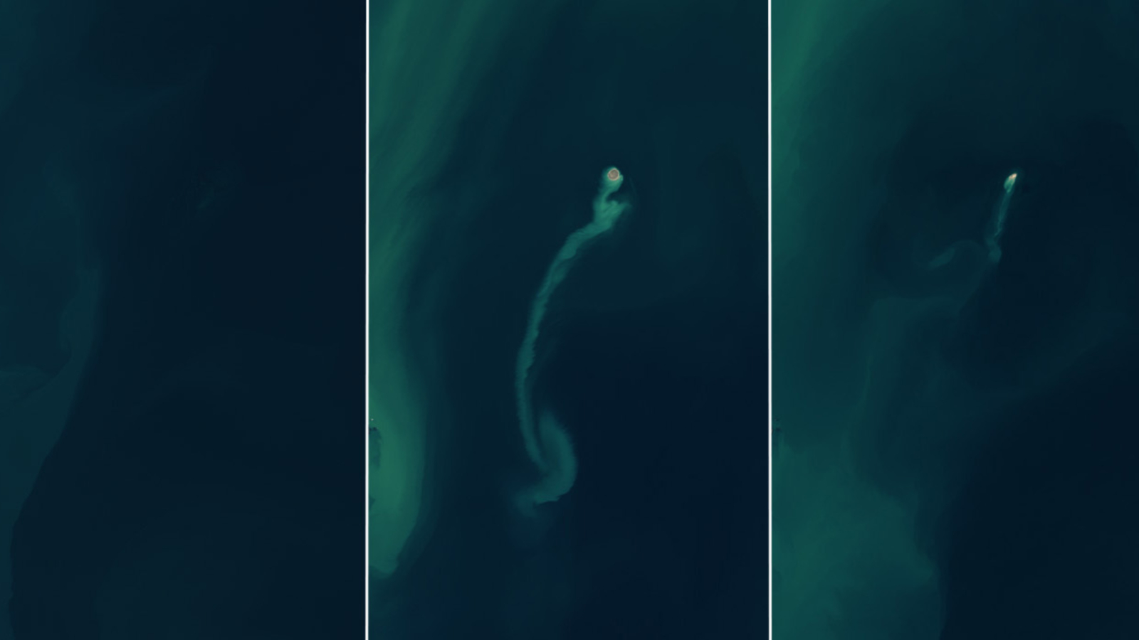

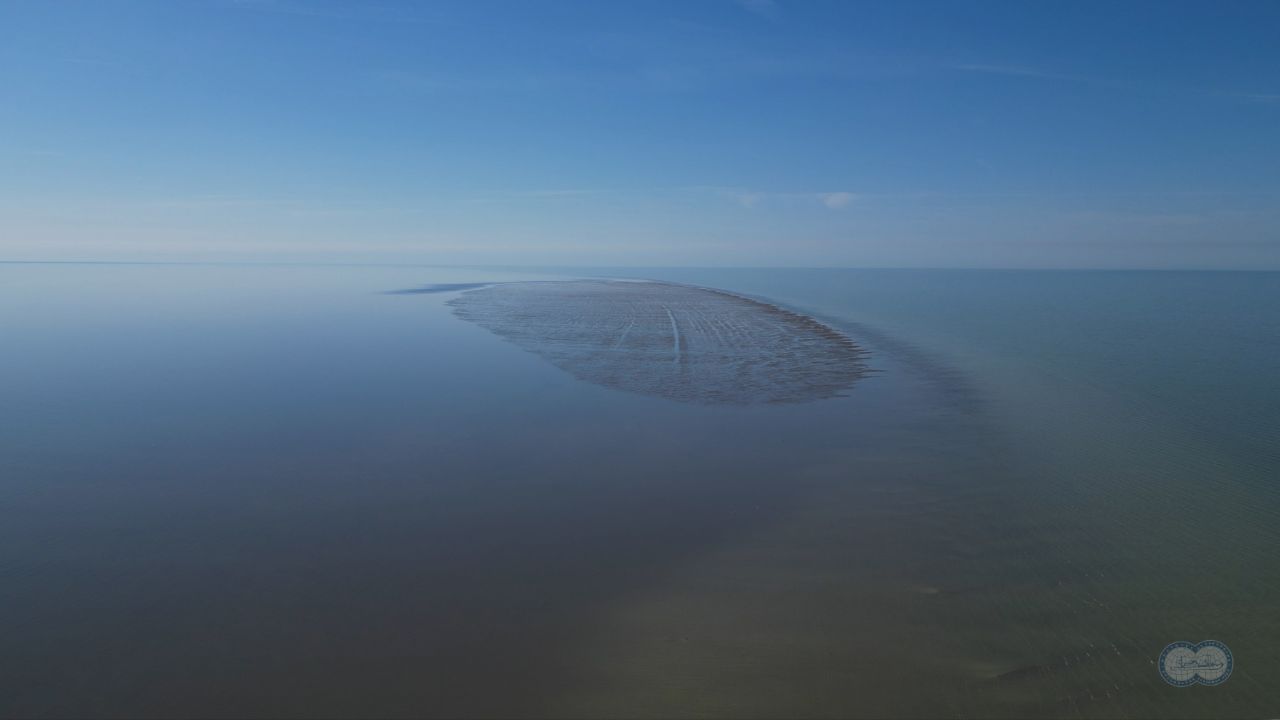 Russian scientists discover a new island in the Caspian Sea — the world's largest inland body of water
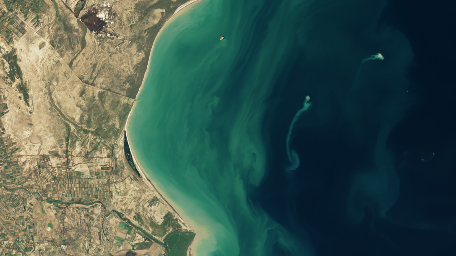 Azerbaijan is home to more than 300 mud volcanoes, including dozens that are hidden beneath the waves of the Caspian Sea.


.jpeg)


